
Scan the QR code and open PeakVisor on your phone
The Roosevelt National Forest is located in the north-central part of the U.S. state of Colorado. It encompasses a large part of the Northern Front Range of the Rocky Mountains of North America. It extends east from the Continental Divide almost to the eastern foothills of the Rockies. From the Wyoming state line, it extends approximately 80 miles to the south. There are 143 named mountains in Roosevelt National Forest, many directly on the Continental Divide, with the highest point being North Arapaho Peak. The most prominent mountain is South Bald Mountain.
The Roosevelt National Forest features some of the finest mountain scenery in the Front Range of the Rockies, including much or all of six wilderness areas - Rawah, Neota, Comanche Peak, Cache-la-Poudre, Indian Peaks and James Peak. This means lots of opportunities for recreation - camping, fishing, hiking, climbing, river rafting - just to name a few. The most dominant and impressive mountains are the long chain of the Indian Peaks which start at the southern boundary of Rocky Mountain National Park and extend south to include the James Peak Group. Being close to major Front Range population centers, especially greater Denver and Boulder, these are the primary target areas in the Roosevelt National Forest for recreation, although there are a number of fine destinations north of the national park that attract visitors from more northerly population centers such as Fort Collins.
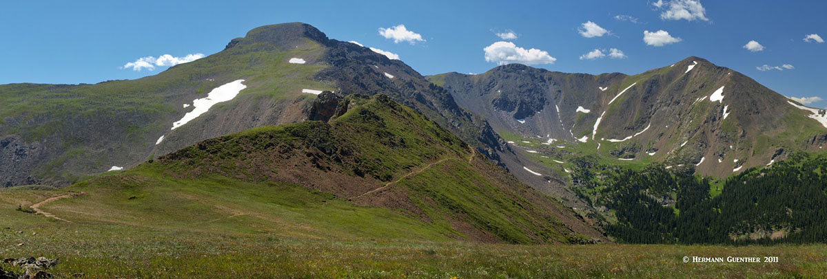
For casual hikers there are countless opportunities to get deep into mountainous terrain without necessarily climbing to any summits. The scenery in the many mountain valleys, on trails leading to pristine alpine lakes, is enough to satisfy most hikers' demands. Yet, while there are no fourteeners anywhere in this national forest, there are plenty of thirteeners to satisfy most serious mountaineers. In fact, there are even plenty of mountains less that 13,000 feet in elevation that will challenge even hardy climbers - mountains that are best left off-limits to casual hikers. Yet such high peaks as Mount Audubon are a moderate walk-up for anyone in reasonably good condition - provided they follow the designated trails.
The major access points for hiking in the Roosevelt National Forest can be found along two significant highways - State Highway 14 and the so-called Peak-to-Peak Highway (consisting of parts of State Highways 119, 72 and 7). SH-14 is the main highway from Fort Collins to the west. In fact it is the northernmost highway in Colorado that crosses the Continental Divide. The Peak-to-Peak Highway is a north-south corridor that extends from the town of Black Hawk to Estes Park at the eastern edge of Rocky Mountain National Park. It basically defines the boundary between the Front Range foothills and the high mountains of the Continental Divide.
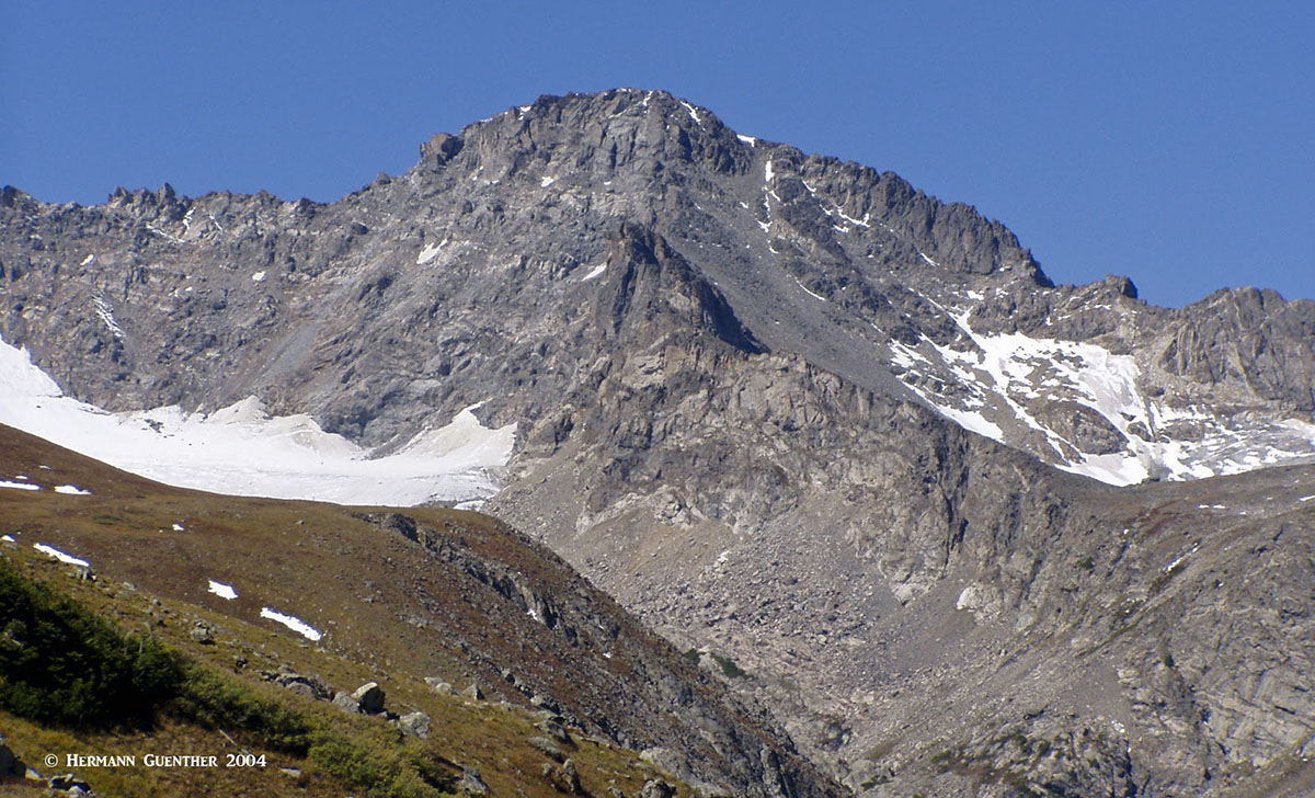
The Continental Divide - Indian Peaks Wilderness
State Highway 14 Area
This scenic highway follows, almost for its entire length, the Cache-la-Poudre River from Fort Collins to the Continental Divide at Cameron Pass. There are several major trailheads right off the highway itself starting in the foothills just to the northwest of Fort Collins. Anyone wanting to hike in this vast area of northern Colorado must necessarily use SH-14 to get to a number of trailheads, many of which can only be reached by branching off onto a network of county roads and even Forest Service roads. They are almost all gravel roads but in most cases passable for most passenger cars.
Stormy Peaks Trailhead - This popular trailhead is reached from SH-14 via the Pingree Road (County Road 63E). It is near the Colorado State University's mountain campus. This is where the Emmaline Lake Trail (and the branching Mummy Pass Trail) leads far into the Comanche Peak Wilderness and the Mummy Range, with trail connections into Rocky Mountain National Park.
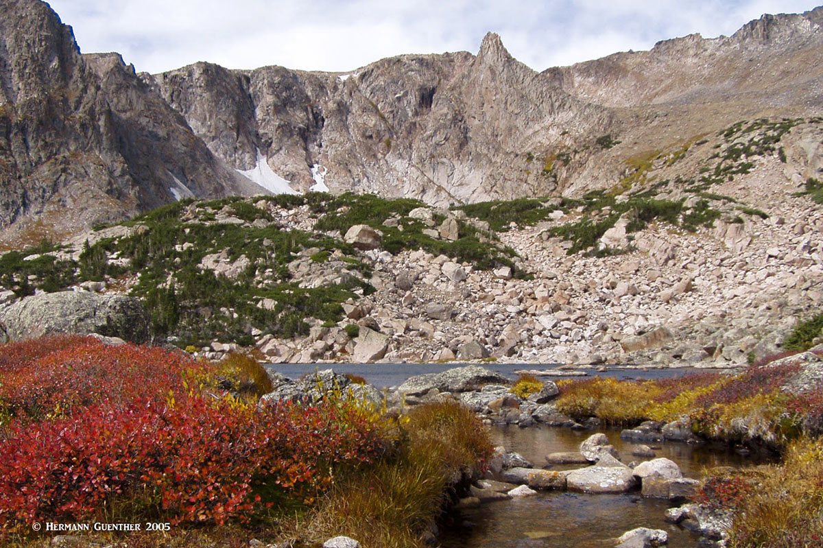
Emmaline Lake - Comanche Peak Wilderness
West Branch Trailhead - This very popular trailhead is about six miles north of SH-14 along Forest Service Road 190. It provides hiking access into the Rawah Wilderness, at the heart of which is what is called the Lakes District. To visit many of these lakes in one hike would take several days following a network of different trails. These lakes, including the four Rawah Lakes, number at least 20 and most of them can be reached via one of several looping or spur trails. Others can be reached just by deviating short distances from the trails. Most of these lakes are situated at elevations between 10,000 and 11,000 feet. The North and South Rawah Peaks and Sheep Mountain are possible climbing targets in this vast area.
Rawah Wilderness
Long Draw Road Area - This road, also known as Forest Service Road 156, is across SH-14 from the Blue Lake Trailhead. It services two trailheads, at Trap Lake and Peterson Lake, that provide hiking access into both the Neota Wilderness and the Comanche Peak Wilderness. Meanwhile, back at SH-14 is the Blue Lake Trailhead which provides access to Blue Lake in the Rawah Wilderness and continues as an alternative access into the Lakes District (above).
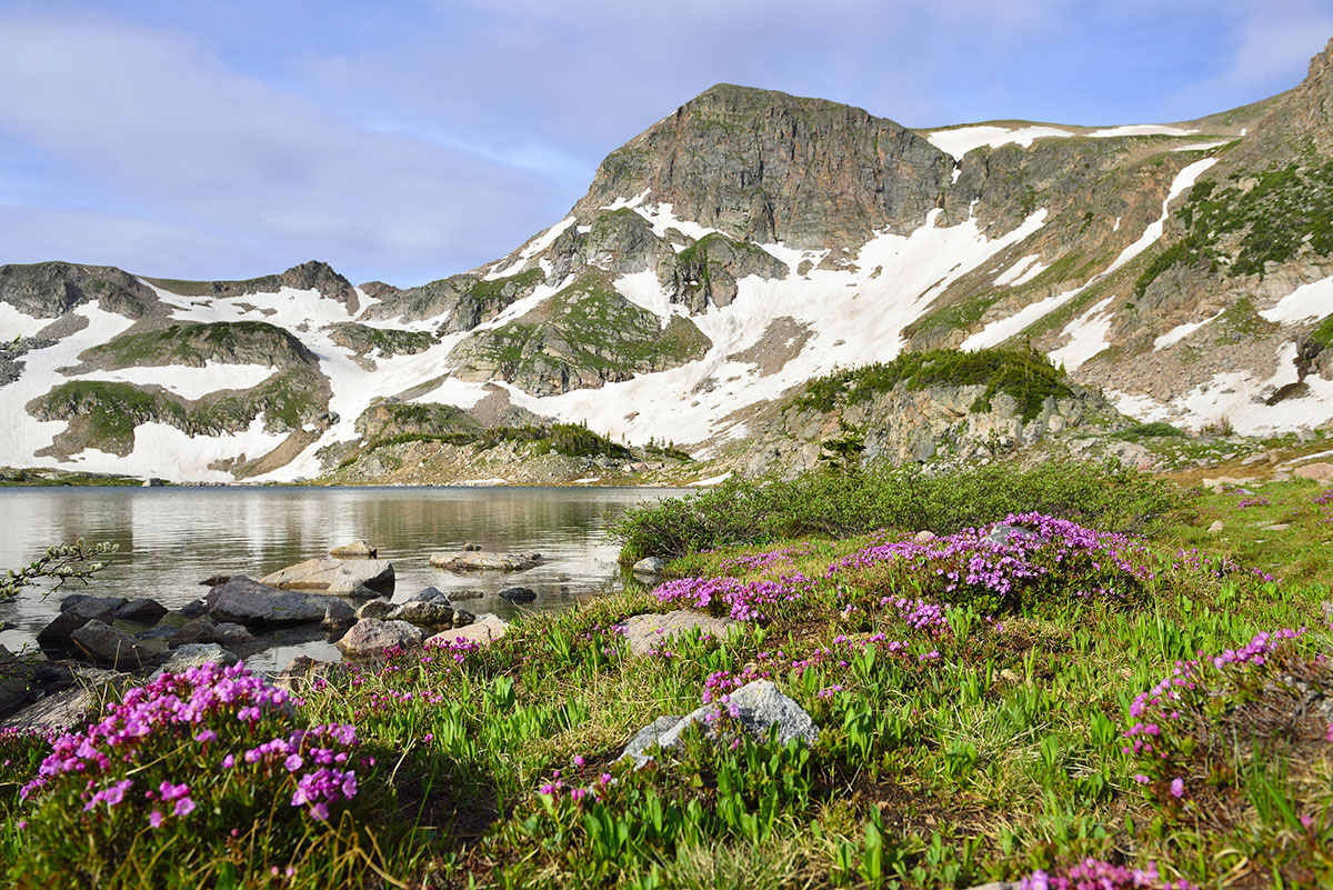
Rogers Pass Lake, Haystack Mountain - James Peak Wilderness
Not only is the Peak-to-Peak Highway a real pleasure to drive because of the countless vistas into the James Peak and Indian Peaks wildernesses, it affords access to several highly popular trailheads and other recreation areas. The fact that these are so handy to the Front Range urban corridor means that they attract lots of visitors, especially on summer weekends when finding parking spaces can be quite difficult. Some of these can be reached in an hour's drive from the western suburbs of Denver and especially from Boulder. But crowded or not, there are so many trails here that visitors become well-dispersed as trails branch off into other trails. One does not necessarily feel crowded when hiking here.
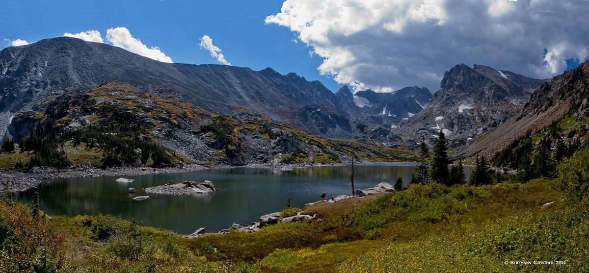
Lake Isabelle - Indian Peaks Wilderness
East Portal Trailhead - This popular trailhead on the east side is so named because it is right by the east portal of the Moffat Railroad Tunnel which extends six miles under the Continental Divide toward Winter Park. This area is easily reached by driving the Peak-to-Peak Highway to the town of Rollinsville, from where it is only eight miles via an excellent gravel road that any passenger car can pass - virtually year-round. The South Boulder Creek Trail begins here and branches off into two other trails in the wilderness. All of them lead to spectacular mountain terrain and a number of pristine alpine lakes. The trail continues up to the Continental Divide at Rogers Pass where it intersects the Continental Divide National Scenic Trail (CDNST), which, as the name implies, follows for miles along the Divide. From this trail it is then possible to drop down into the Fraser Valley where the town of Winter Park is located. But that is no longer within the Roosevelt National Forest.
James Peak - Continental Divide National Scenic Trail
Eldora Trailheads - At the town of Nederland, along the Peak-to-Peak Highway, begins the road to the Eldora Ski Area and the historic town of Eldora. The pavement ends after passing through the town but passenger cars can continue another ¾ mile to a road junction (see below). The left branch continues several hundred yards further but is only advisable for high-clearance vehicles, since for most of this stretch you will be driving in a creek bed with boulders that you cannot see. This is the Hessie Trailhead. From here, hikers have many options to explore this magnificent wilderness which contains numerous scenic alpine lakes, miles of trails and access to and across the Continental Divide. A popular but very strenuous hike is a 16-mile loop that includes about three miles of the Continental Divide. Depending on the exact route taken, it is possible to see eight lakes on this tough hike.
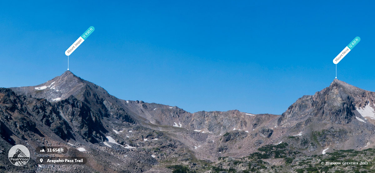
Back at the road junction, passenger cars can take the right branch and continue another four miles to the Fourth-of-July Trailhead, on a somewhat rough road. Here, hikers can access the popular Diamond Lake, Arapaho Pass, Lake Dorothy.
Mounts Jasper and Neva from Arapaho Pass Trail
A side trip from this trail will afford a delightful climb of South Arapaho and North Arapaho Peaks (13,397 and 13,502 respectively). The latter is the highest elevation anywhere in Roosevelt National Forest. The Class 3-4 traverse between these peaks should only be undertaken by experienced climbers due to considerable exposure. Because of the extreme popularity of this hiking area, there is now a free shuttle service to the Hessie Trailhead on summer weekends and holidays that picks up hikers at a park-and-ride facility in the nearby town of Nederland (parking also free).
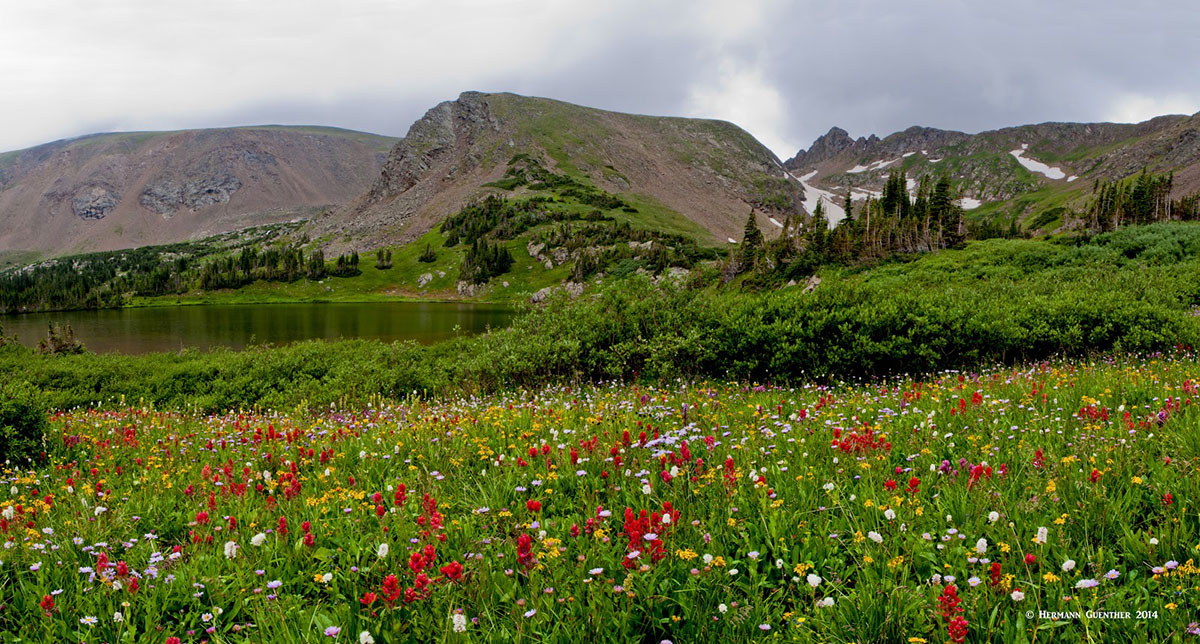
Brainard Lake Recreation Area - About 12 miles north of Nederland, near the town of Ward on the Peak-to-Peak Highway, is the turnoff to the ever popular Brainard Lake Recreation Area. This area experiences heavy visitation and for good reason. There is a large Forest Service campground here as well as several major trailheads, which lead into the spectacular high country. It may be difficult to find a parking space after early morning, especially on weekends, despite the fact that a fee has to be paid here during the summer months. But it is well worth it - there are trails here for all abilities, even just casual hikers. While there are plenty of high summits (over 13,000 feet), the most popular hikes are to two beautiful lakes - Lake Isabelle and Blue Lake (one of many so-named lakes in Colorado). The view across Blue Lake (only a six-mile round trip hike) toward Mount Toll is impressive indeed. A popular thirteener, Mount Audubon, elevation 13,229, can be climbed on a four-mile long trail beginning at the Blue Lake/Mitchell Lake Trailhead. It is the sixth tallest peak in the Indian Peaks Wilderness and is best viewed from the east shore of Brainard Lake.
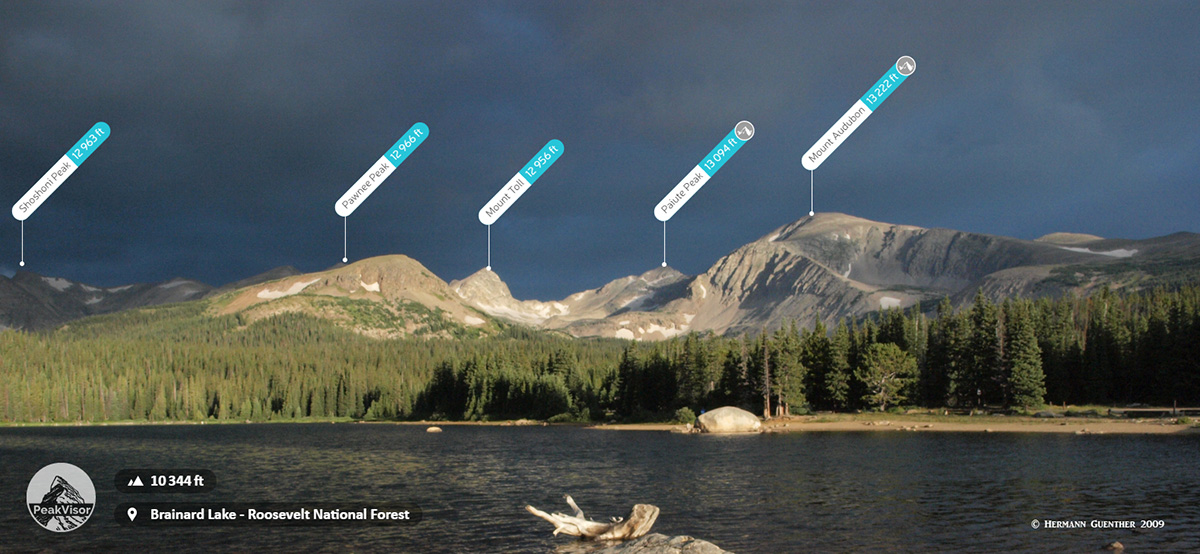
Brainard Lake
Peaceful Valley - About six miles north of Ward along the Peak-to-Peak Highway is a turnoff to Peaceful Valley where there are two campgrounds. One must drive through both of them to get to the Middle Saint Vrain Trailhead. This long trail is quite level and is used for snowmobiling in the winter. After several miles, this trail branches off into a number of trails leading to three lakes (Gibraltar, Coney and Red Deer). The hike to Lake Gibraltar is a long day hike for sure - about nine miles one way. Also leaving the main trail to the north is a trail to Saint Vrain Mountain from where there are views into Rocky Mountain National Park, the boundary of which is just yards away.
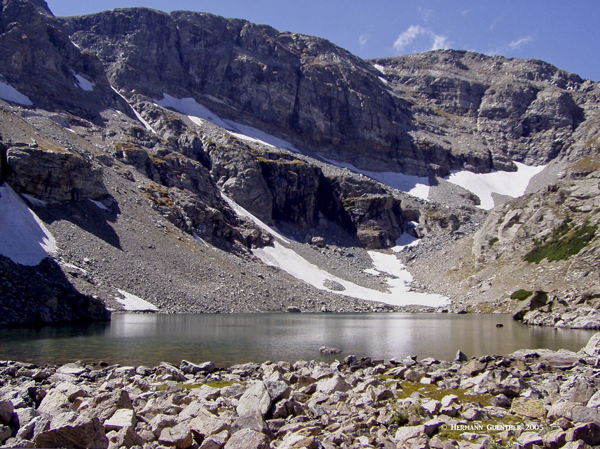
Lake Gibraltar - Indian Peaks Wilderness
There are several major towns or cities that are close enough to the Roosevelt National Forest to be considered handy for staging excursions into many parts of the forest. Many of the hikes described herein can easily be made as day-hikes from Boulder or Estes Park, and to a lesser extent from Loveland. Some of the hikes can even be made as day-hikes from Denver and some of its suburbs. Fort Collins, further north in the Front Range urban corridor, is far less handy as a staging point for most of the hiking areas mentioned, except for those that have trailheads along or off State Highway 14. Even then, reaching some of the best areas will entail a relatively long drive. To compensate, there are many campgrounds, cabins and other lodging facilities along that highway. While Denver, Loveland and Fort Collins are major cities with virtually all of the tourist infrastructure to support a significant influx of visitors, it is beyond the scope of this article to go into details about what they can offer. Instead, the focus is on two major towns that are virtually right at the doorstep of the Roosevelt National Forest.
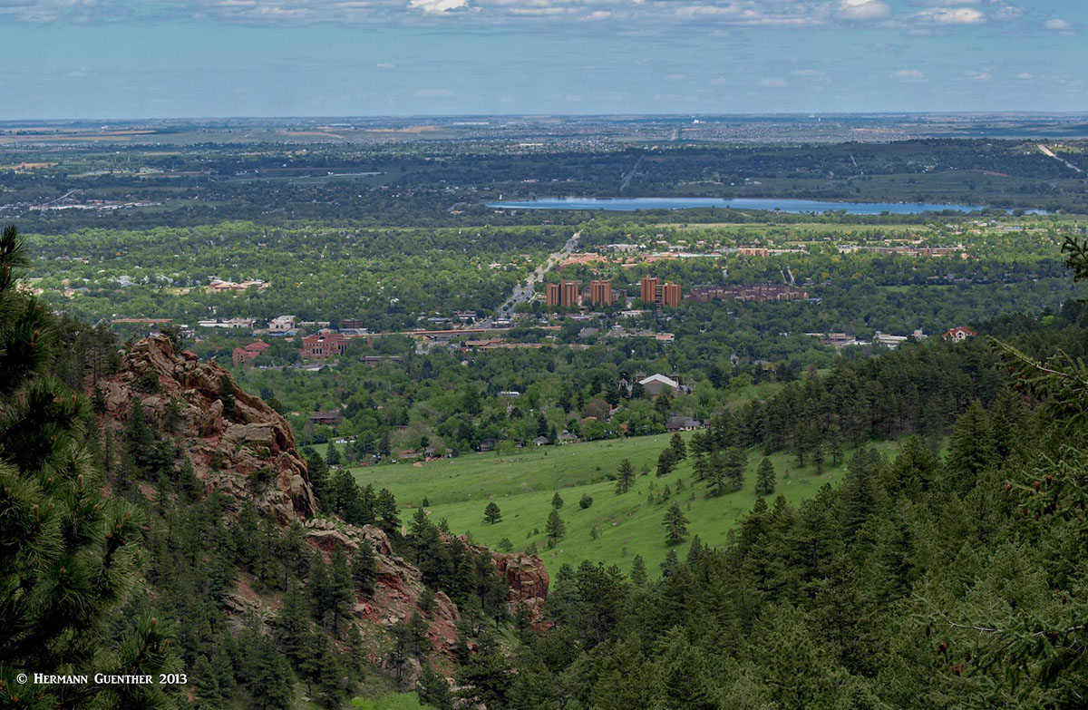
Boulder, Colorado
Boulder - This beautiful city about 25 miles northwest of Denver is a mountain-lover's paradise. Many famous climbers and mountain explorers call (or have called) Boulder home. Nestled right at the base of the foothills of the Rocky Mountains, Boulder is so well positioned as to make it the perfect base from which to explore most of Roosevelt National Forest. It is near Boulder where the Continental Divide meanders to its easternmost location in the United States, less than 20 miles west of the center of town. Even the high foothills looming over the city afford some impressive hiking and climbing opportunities - right within city limits. But these are not actually in the national forest. The main campus of the University of Colorado commands a large presence in Boulder, as well as providing a youthful population that takes advantage of this spectacular location. The major trailheads previously discussed are but a short drive from the city, such that long day hikes can be easily undertaken without having to go away overnight. However, exploring the areas to the north that are served by State Highway 14, would be a challenge for a day trip from Boulder. But it is without question that Boulder offers a wide array of accommodations, restaurants, shopping, cultural venues and scenery.
Estes Park - This wonderful resort town is best known as the gateway to Rocky Mountain National Park. With a wide range of accommodations (from simple cabins to luxury hotels - think The Stanley), a food-lover's delight, and a shopping mecca, this charming town is worth visiting just of its own accord. It simply has a beautiful and stunning setting. But for mountain lovers, Estes, as the locals call it, is an excellent setting for staging countless mountain adventures in the Roosevelt National Forest. It is a year-round resort, although it experiences significantly reduced visitor numbers in winter. In summer months, it is advisable to book ahead for accommodations. The town can be reached in about 90 minutes from Denver by the shortest highway route, but the slightly longer route via the city of Golden and the Peak-to-Peak Highway is far more scenic and has relatively little traffic. Many of the most famous hiking areas in the Roosevelt National Forest are easily reached from Estes Park via the Peak-to-Peak Highway, thus rendering this town an excellent place settle down for a few days - even if visiting Rocky Mountain National Park is not part of the agenda. But access to the northern part of the Roosevelt National Forest is not easily achieved, requiring a roundabout way to get there, generally heading east to Loveland, then north to Fort Collins, ultimately ending up on SH-14. There is no convenient way to drive from Estes Park to the main attractions discussed previously.
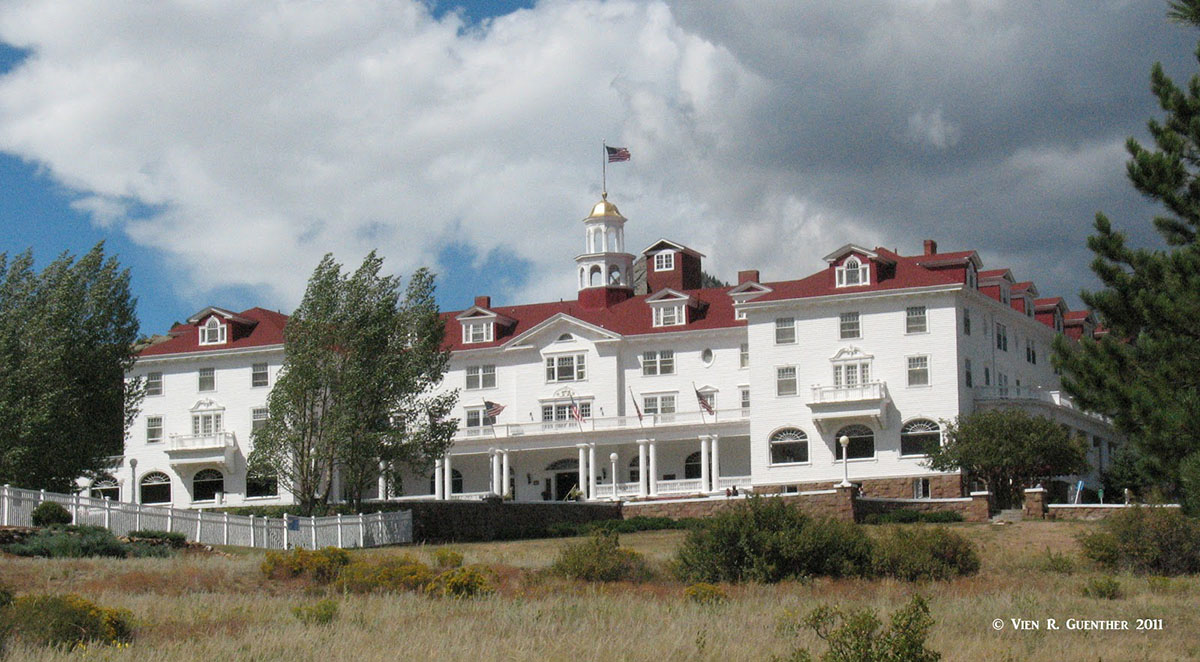
The Stanley Hotel - Estes Park, Colorado
Nederland - Situated right on the Peak-to-Peak Highway is the cute little town of Nederland. It is certainly not what one would consider a “major” town or resort, but it is a charming place to stop for a while, maybe have a snack or lunch, before continuing onward. With a population of less than 1,500, Nederland does not have much to offer in the way of tourist infrastructure, but it does have its share of events and celebrations in commemoration of its early mining days. In recent years the town has done much to improve its appeal to visitors. It is truly worth stopping off here for a while.


