
Scan the QR code and open PeakVisor on your phone
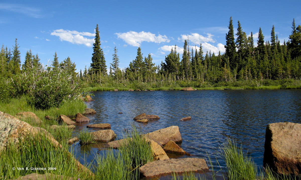
The Indian Peaks Wilderness is located in the central part of Colorado's Front Range and occupies parts of Arapaho and Roosevelt National Forests, administered by the United States Forest Service. It straddles the Continental Divide from north to south which also defines the boundary of Grand and Boulder Counties. There are 37 named mountains in the Indian Peaks Wilderness with the highest and most prominent being North Arapaho Peak. There are no fourteeners in the Indian Peaks but that does not discourage hikers and climbers in this heavily used area. There are a number of formidable thirteeners as well as other craggy mountains a bit lower but just as imposing. The wilderness stretches from the south boundary of Rocky Mountain National Park south to the adjacent and much smaller James Peak Wilderness. It is in the Indian Peaks where the Continental Divide reaches it easternmost point in the United States, only about 20 miles northwest of Boulder.
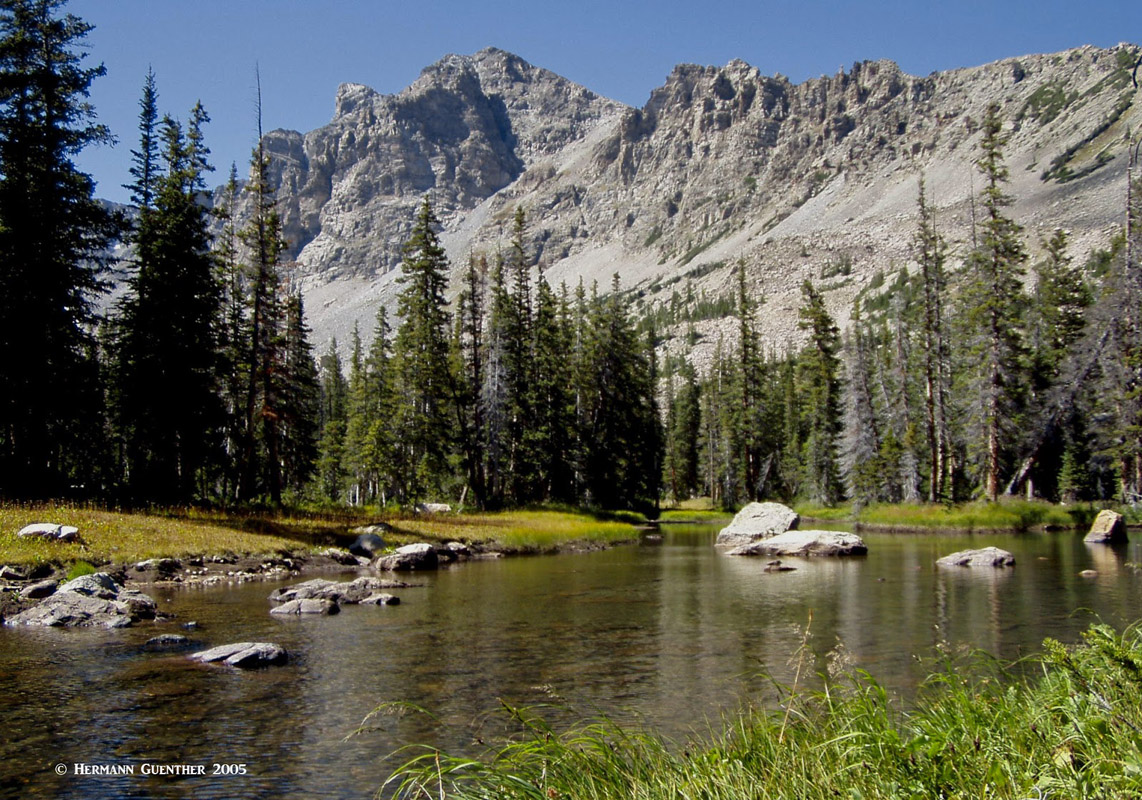
Shoshoni Peak, Indian Peaks Wilderness
The area received its wilderness designation in 1978 pursuant to the Wilderness Act of 1964. Wilderness is best defined by the author of the Wilderness Act, Howard Zahnister: "A wilderness, in contrast with those areas where man and his own works dominate the landscape, is hereby recognized as an area where the earth and its community of life are untrammeled by man, where man himself is a visitor who does not remain." There are several government agencies that administer the 765 wilderness areas in the United States - U.S. Forest Service, U.S. National Park Service, U.S. Fish and Wildlife Service and the U.S Bureau of Land Management. As of 2016, this encompassed a total of 109,129,657 acres, or an area larger than the state of California.
Due to its proximity to the greater Denver metropolitan area, which includes the city of Boulder, a hiking and climbing mecca, this wilderness gets its share of visitors to be sure, especially on summer weekends. Of course most of this visitation takes place in the areas of the wilderness east of the Continental Divide, due to easy access from the crowded urban corridor. Because of its popularity and fragile alpine landscape, visitors hiking in the Indian Peaks face more restrictions than in other wilderness areas in Colorado. For example, backcountry camping requires a permit between June 1 and September 15. This applies to the entire wilderness, including the parts west of the Continental Divide, although there are additional restrictions in specific zones. But despite this popularity, the Indian Peaks offer a rugged wilderness experience that may seem crowded for some of the locals, but visitors from places both near and far will marvel at the scenery to be found here. Yet in the off-season, it is entirely possible to have big parts of the wilderness all to oneself, especially on weekdays.
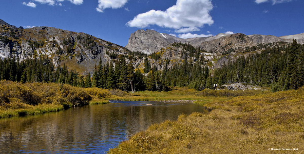
Pawnee Peak, Mount Toll and Mount Audubon - Indian Peaks
The Indian Peaks Wilderness has 110 miles of hiking trails, which can be accessed from a number of major trailheads, mostly on the east side. As with all wilderness areas, there are restrictions that prohibit motorized vehicles as well as mechanized equipment. This means no bicycles, hang gliders, chain saws or drones. Dogs must be kept on a short leash at all times, and groups have size limitations. Camping is allowed in most areas, but only with a permit from June 1 to September 15, with some areas restricted to designated sites only. Camp fires are prohibited east of the Continental Divide and in some areas of the west. The major trailheads on the east side are all reached from the Peak-to-Peak Highway, which is comprised of stretches of three state highways - SH-119, SH-72 and Sh-7. They can all be reached with regular passenger cars. The west side trailheads are a bit more remote, yet can still be reached by ordinary cars from U.S. Highways 40 and 34.
Beginning on the east side and going from south to north you will reach the nice little town of Nederland. Just about a mile before the center of town is a turnoff to the Eldora Mountain Resort and to the historic town of Eldora. Just past the town is the first of two major trailheads. On busy summer weekends or holidays don't even try to drive to the first trailhead - Hessie. You will not find a place to park. But there is salvation. A free shuttle bus from the Nederland High School, right on Eldora Avenue, will take you there. And you can park at the school - no charge. But that is not every day, just on those busy ones. If you want the second trailhead, you will have to drive your car since the shuttle does not go there. More on that later.
Hessie Trailhead - This is a very busy trailhead and it serves miles of trails into the spectacular backcountry. No less than eight pristine alpine lakes can be reached from this trailhead on various trails of different lengths. It is possible to see all of them in a long - I mean very long - day hike. You want to know what they are? Here goes. Lost Lake (oh, that name comes up all over Colorado), Woodland Lake, Skyscraper Reservoir, Betty and Bob Lakes, King Lake (this one is really worth going to, but it's a long hike), Jasper Lake and Devil's Thumb Lake (named after a prominent rock spire nearby). There is a popular loop hike here which, although it does not visit all the lakes, involves taking the King Lake trail to and past the lake up to the Continental Divide, which it follows for almost three miles until it meets the Devils Thumb Trail at the pass of the same name. The section following the Divide is alternatively known as the High Lonesome Trail. Descending from the pass, the Devils Thumb Trail passes Devils Thumb and Jasper Lakes on its way back to the bottom. This hike is long (at least 15 miles depending on where you start) and strenuous. I have done it twice but have attempted it several times more, only to get chased down by thunderstorms. So beware!
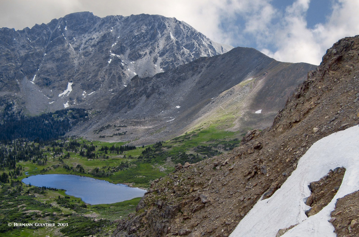
Continental Divide, King Lake
Fourth-of-July Trailhead - This is another popular trailhead that affords a number of different hikes of variable degrees of difficulty. The trailhead is about four miles beyond the Hessie Trailhead on a rough but negotiable road (even for passenger cars). Parking is somewhat limited at the trailhead but there are a number of places along the road where it is possible to park. The shuttle does not go here so you must drive. From here starts the Arapaho Pass Trail which ultimately ends 13.5 miles to the north at Monarch Lake. The most popular hikes here are to Diamond Lake, about three miles and to Lake Dorothy, about 3.5 miles and just above Arapaho Pass. The view of Navajo and Apache Peaks from here is stunning. Also accessed from the Arapaho Pass Trail is the Arapaho Glacier Trail which provides the most direct means to climb South and North Arapaho Peaks. This is without doubt a very pleasant climb for anyone in good condition - at least as far as the South peak. The traverse to the North peak, which is the highest in the Indian Peaks Wilderness, is best left to more experienced climbers.
Arapaho Pass, Lake Dorothy, Apache (ctr.) and Navajo (rt.) Peaks
Rainbow Lakes Trailhead - Only about seven miles north of Nederland is the road to the Rainbow Lakes Campground and Trailhead. While there is a short hiking trail to the quaint Rainbow Lakes, what makes this a significant trailhead is the fact the this marks the east end of the Arapaho Glacier Trail, which is eight miles from its other end at the Arapaho Pass Trail. This is a pleasant trail that crosses a large tract of tundra until it reaches the spectacular Arapaho Glacier overlook. At this point, the ascent of the South and North Arapaho Peaks is the same as it would be coming from the Fourth-of-July Trailhead, although the overall hiking distance is longer with more elevation gain.
Rainbow Lakes
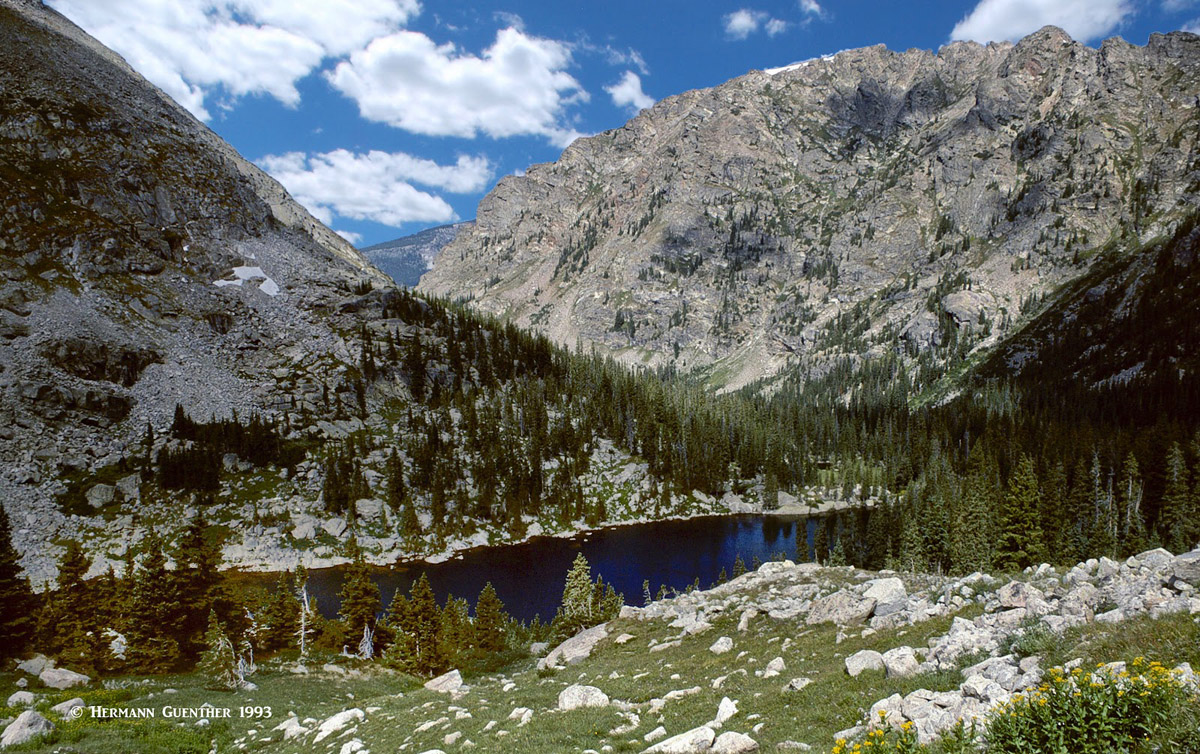
This fee area is the most popular destination on the east side of the Indian Peaks. The Brainard Lake Road intersection on the Peak-to-Peak Highway is 12 miles north of Nederland near the town of Ward. It is only five miles to the lake. There is a major campground here as well as several picnic areas scattered around the scenic Brainard Lake. There is a fee station about two miles before the lake, but fees need only be paid during the summer months (typically late June through mid-October). The rest of the year, the gate here is closed, but visitors can park here and walk into the area without paying. Brainard Lake and the surrounding facilities are not within the wilderness boundary, but the trails that start at the two major trailheads do of course enter the wilderness after short distances. There is a paved road around Brainard Lake, with two spur roadways to the two trailhead parking lots - Mitchell Lake Trailhead and Long Lake Trailhead. They both fill up early in the day - even on summer weekdays - and parking along the roadways is not permitted. So come prepared (meaning early). The eastern shore of Brainard Lake provides an excellent viewpoint of some of the major peaks in the Indian Peaks Wilderness.
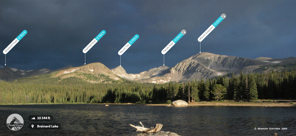
Brainard Lake
Mitchell Lake Trailhead - Most visitors to this trailhead will take the short hike to Mitchell Lake, and many will continue on to the beautiful Blue Lake (yes, there is one of these here, as well as in many other locations around Colorado) with its stunning setting at the base of Mount Toll. Even to this point, the round-trip hike is only six miles, although there are many opportunities for additional exploration. This trailhead also serves the Beaver Creek Trail, which, after about two miles, reaches the junction with the Mount Audubon Trail, which leads to this gentle thirteener, and onward to Paiute Peak.
Blue Lake, Mount Toll
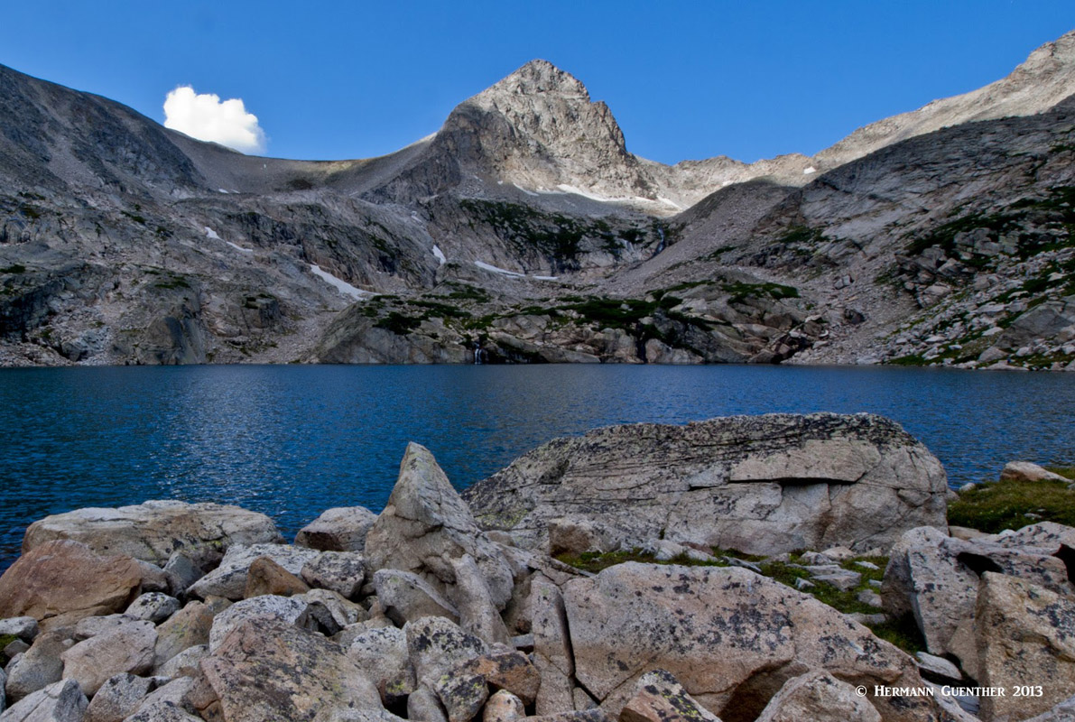
Long Lake Trailhead - Only a half mile from Mitchell Lake Trailhead is the one for Long Lake. The Long Lake Trailhead provides some very easy family hiking, especially the two-mile loop around the lake. But there is more delightful hiking to be enjoyed here. Not far past Long Lake is Lake Isabelle, another popular destination. Though this is a natural lake, there are grandfathered water rights to certain users out on the plains of eastern Colorado. As a result, at certain times the water level can be very low here since it is drained away via a water valve under the lake that releases the water through a tunnel. While there is no dam here, the view of the lake is sometimes less than charming, even with the fantastic mountain background. There is still more to be enjoyed here. The trail continues past the lake to the Isabelle Glacier, resulting in a round-trip hike of 8.5 miles. Back at the lake, there is a major trail junction - and the famous Pawnee Pass Trail. Here the hiking gets serious and the stragglers are left behind. This is for real hikers, since the steep climb to Pawnee Pass on the Continental Divide is considered difficult. From the pass it is possible to take the summit route to Pawnee Peak at 12,966 feet. Continuing at the pass, the trail rapidly descends in a series of steep switchbacks from its 12,541-foot elevation down to Pawnee Lake, which lies in the Colorado River watershed, hence the Pacific watershed. This segment is an impressive piece of trail construction.
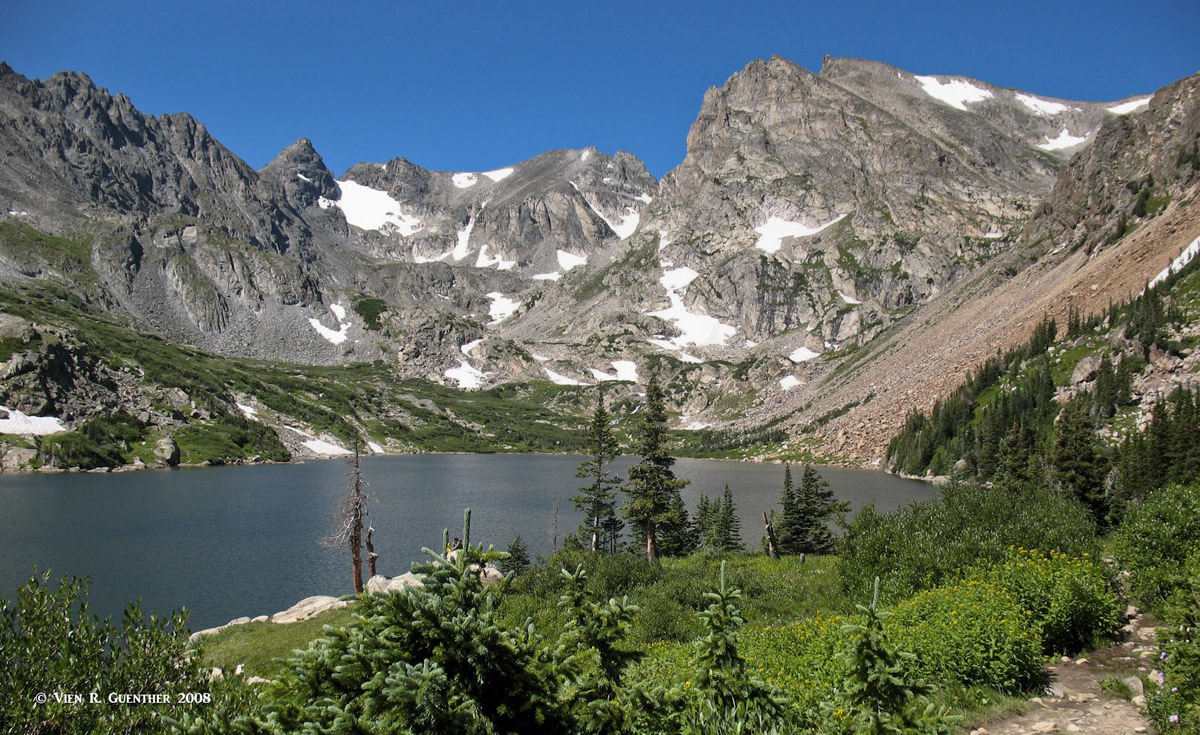
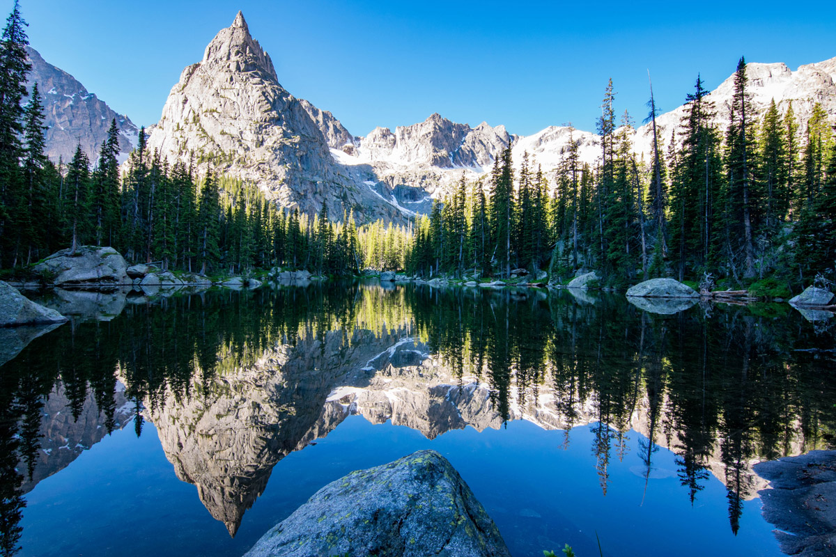
Lake Isabelle, Navajo, Apache and Shoshoni Peaks
Peaceful Valley Trailhead - Another six miles north of Ward, at a very sharp switchback on the Peak-to-Peak Highway, is the access road into two campgrounds - first is Peaceful Valley and about a mile further in is Camp Dick. Just past this campground is the trailhead parking area. This is where the Buchanan Pass Trail begins - it ends at the Cascade Creek Trail near Monarch Lake at the western end of the Indian Peaks Wilderness. The first four miles of the trail are not within the wilderness, but the rest is. At about five miles from the trailhead, it reaches the junction of the Saint Vrain Glacier Trail, which continues another three miles to a deep glacial basin that contains Lake Gibraltar. Throughout much of the hike going west up the Middle Saint Vrain Valley your view will be dominated by the jagged Elk Tooth Mountain.
Elk Tooth Mountain, Saint Vrain Glacier Trail
Meanwhile, the Buchanan Pass Trail makes a sharp u-turn at the junction and crosses to the other side of the valley which it follows downstream for a mile where it meets the Red Deer Lake Trail. From here it continues another three miles before crossing the Continental Divide and then another eight miles, joining the Cascade Creek Trail on its way to Monarch Lake at the end of the Indian Peaks Wilderness. Near where the Buchanan Pass Trail enters the wilderness, about four miles from the trailhead, is the junction with the Saint Vrain Mountain Trail, which climbs steeply up the side of the valley where it ultimately reaches Saint Vrain Mountain in three miles, the summit of which is right on the boundary between Rocky Mountain National Park and the Indian Peaks Wilderness.
Access into the Indian Peaks Wilderness from the west side is a bit more difficult than on the east. The only reasonable way to get there from the Front Range urban corridor is to drive west on Interstate Highway 70 and then take U.S. Highway 40 over Berthoud Pass and the Continental Divide to the resort town of Winter Park. U.S. 40 continues north 20 miles from here to the town of Granby, from where it then heads west and U.S. Highway 34 branches off to the northeast. It is from these two highways that we find access to the major trailheads west of the wilderness. There are really only three significant trailheads on this western side of the Indian Peaks, and some are a bit far from any major roads. But even so, people do use them though not to the extent that the eastern trailheads are used.
Junco Lake Trailhead - Just eight miles north from Winter Park, just before the town of Tabernash, is the junction with Forest Road 129, which, if followed for about 11 miles, reaches the Junco Lake Trailhead. This is a gravel road but good enough for ordinary cars. It will bypass the Meadow Creek Reservoir, part of the Denver water supply network and a popular recreation site, just before the trailhead. This is where the Caribou Pass Trail begins; this is also the route to the popular Columbine Lake. About two miles from the trailhead is the junction where the right branch becomes the Columbine Lake Trail, which reaches the lake in another 1.5 miles. This is a moderately easy hike, even for backpacking, since the total elevation gain to the lake is only 1,100 feet. Back at the trail junction, the Caribou Pass Trail continues only a little over a mile to the pass of the same name. From here there is a short continuation across a very steep slope to Arapaho Pass. There is some exposure that may intimidate some hikers with a fear of heights. The view toward North Arapaho, Navajo and Apache Peaks is stunning.
South Arapaho Peak, Caribou Lake, Arapaho Pass from Caribou Pass
Back down at the trailhead, it is possible to access the Continental Divide Trail (also known as the High Lonesome Trail) which begins at Monarch Lake, about six miles to the north. This trail eventually reaches the Continental Divide at the Devils Thumb Trail. However, most of this trail is not in the wilderness area, though it is within the Arapaho National Recreation Area, as is Meadow Creek Reservoir and the first two miles (more or less) of the Caribou Pass Trail. Therefore, even for those wanting to hike into the Indian Peaks Wilderness, a user fee must be paid.
Monarch Lake Trailhead - This trailhead is perhaps the most popular on the west side of the wilderness. It can be reached by driving six miles north of Granby, and then following County Road 6 (also known as Forest Road 125) for ten miles, much of it following the south shore of Lake Granby, the third-largest body of water in Colorado. This lake is a reservoir that was created by the construction of the Granby Dam and serves as a source of water supply as well as hydropower for the Front Range urban corridor. Being on the west side of the Continental Divide, this water gets delivered to the east side by a tunnel that passes directly under Rocky Mountain National Park and the divide. There are several major trails that are serviced by this trailhead at the west end of Monarch Lake, including the High Lonesome Trail (see above).
The Arapaho Pass Trail, which has its other end at the Fourth-of-July Trailhead near Eldora 13.5 miles away (see above), begins here. For most of the way west of the pass it follows Arapaho Creek. It then climbs to Caribou Lake after which it climbs more steeply over a number of switchbacks to Arapaho Pass, nine miles from its start. From here it then descends to it eastern terminus.
Arapaho Pass Trail
The Cascade Creek Trail is very popular and sees plenty of foot traffic during peak periods. It is the most heavily used trail on the west side of the Indian Peaks. In its eight-mile one-way length it reaches a very special spot - one of the most iconic views of Colorado mountains. While the main destination here is Crater Lake (yes, one of many so-named lakes in Colorado), it is a small tarn called Mirror Lake, just before Crater Lake, that lures photographers who want to snap that perfect reflection of Lone Eagle Peak. This pointed spire is not actually a summit, but rather the end of a long, jagged ridge that rises much higher to the south at the summit of Mount George. Due to the length of the hike to this place, many prefer to backpack here for at least two nights, although a long day-hike is of course possible. But the chances of witnessing the dramatic reflection is somewhat diminished when the mid-day breezes disturb the surface of the water.
The Pawnee Pass Trail (discussed above) has its western end at a junction on the Cascade Creek Trail, though it technically begins at the Monarch Lake Trailhead, running concurrently with the Cascade Creek Trail for the first seven miles. Once it leaves the latter trail, it begins its long climb of more than three miles to the Continental Divide at Pawnee Pass. Along the way, about two miles from the junction, it enters a deep glacial cirque that will open your eyes to a remarkable landscape. Dead ahead looms the summit cone of Mount Toll. This is where you will find the spectacular Pawnee Lake at an elevation of 10,877 feet. For this hike (as well as the one to Crater Lake) you will really need a camera with a wide-angle lens. There is no other way to capture the scenery here in a way that truly conveys the grandeur of this place. After the lake, the trail rapidly ascends the 1,660 feet to Pawnee Pass, in about 1.5 miles. The last half mile to the summit is a series of steep switchbacks built on terrain that must surely approach the limit of steepness and ruggedness for trail construction. It has to be experienced to be believed. Horses are not permitted on this trail.
Pawnee Lake
The Buchanan Pass Trail runs concurrently with the Cascade Creek Trail for the first 3.5 miles before it branches to the left at a junction and then heads in a northeasterly direction following Buchanan Creek for much of the way to the pass. At over nine miles from the trailhead, it reaches Buchanan Pass, from where it then begins its long descent to its eastern trailhead at Peaceful Valley. At this point, the easy half-mile Class 1 hike south to the summit of Sawtooth Mountain beckons and should by all means be taken - but only if weather permits. This peak represents the easternmost point on the Continental Divide in the United States, only 20 miles northwest of Boulder. Anyone who has driven the Peak-to-Peak Highway along the east side of the range cannot miss seeing its striking profile resembling a shark's fin - or a sawtooth. The south face of this mountain is not a recommended climbing route due to poor rock conditions.
Buchanan Creek
Roaring Fork Trailhead - This trailhead is found by following the same route as for the Monarch Lake Trailhead, but before reaching that, turn left at the Arapaho Bay Campground and follow the road for about two miles to the trailhead. The Roaring Fork Trail to the Stone Lakes is an out-and-back hike of about 13 miles. Except for the first few hundred meters or so, this trail is entirely within the Indian Peaks Wilderness. As an alternative to the Stone Lakes, there is a trail split at about 2.5 miles, the left branch continuing to Wantanga Lake. This hike is shorter and easier than the Stone Lakes hike - only about eight miles round-trip.
The Indian Peaks Wilderness is easily explored from several major towns as well as smaller but equally important ones that would make excellent staging points for exploration into this wonderful wilderness. The largest and most significant is the city of Boulder which is itself a worthy destination simply because of its academic atmosphere (University of Colorado campus is here) and stunning setting right at the base of the Rocky Mountains. The following descriptions are by no means the only options, but only provide an overview of what accommodations and amenities are available to the visitor to this wonderful mountain paradise.
This beautiful city (population 107,353, per 2018 estimate) about 25 miles northwest of Denver is a mountain-lover's nirvana. Many famous climbers and mountain explorers call (or have called) Boulder home. Nestled right at the base of the foothills of the Rocky Mountains, Boulder is so well positioned as to make it the perfect base from which to explore the Indian Peaks Wilderness, especially the eastern part of it. Even the high foothills looming over the city afford some impressive hiking and climbing opportunities - right within city limits. Of course, the highly outdoor-oriented population of this town contributes significantly to the hordes of people that often use this part of the Front Range as their playground. But irrespective of that, Boulder is a fun and vibrant town and should be considered an important base for staging exploration into the wilderness. Visitors to the Front Range urban corridor should not pass up a visit to Boulder.
Boulder
This wonderful resort town is best known as the gateway to Rocky Mountain National Park. With a wide range of accommodations (from simple cabins to luxury hotels), a food-lover's delight, and a shopping mecca, this charming town is worth visiting just on its own accord. It simply has a beautiful and stunning setting. But for mountain lovers, Estes, as the locals call it, is an excellent setting for staging countless mountain adventures in the northern Front Range, with easy access into the Indian Peaks Wilderness, especially the eastern trailheads. It is a year-round resort, although it experiences significantly reduced visitor numbers in winter. In summer months, it is advisable to book ahead for accommodations. The town can be reached in about 90 minutes from Denver by the shortest highway route, but the slightly longer route via the city of Golden and the Peak-to-Peak Highway is far more scenic and has relatively little traffic.
Estes Park
This town is best known as a major ski resort, located in the Fraser Valley near the southwestern extremity of the Indian Peaks. A world-class resort, Winter Park is ideally situated for staging expeditions, or simply day hikes, into the high mountains of the Indian Peaks Wilderness. The town is easily reached in little over an hour from Denver via U.S. Highway 40, which crosses the Continental Divide at Berthoud Pass, elevation 11,307 feet. One distinction that other resorts in Colorado don't share is that Winter Park is served by Amtrak's California Zephyr train on a daily basis, thus providing an alternative method of getting there from Denver. There is no shortage of accommodations and restaurants in this mountain getaway. Given its location, Winter Park is obviously more convenient to the western approaches into the Indian Peaks than it is to the eastern, more heavily visited sections.
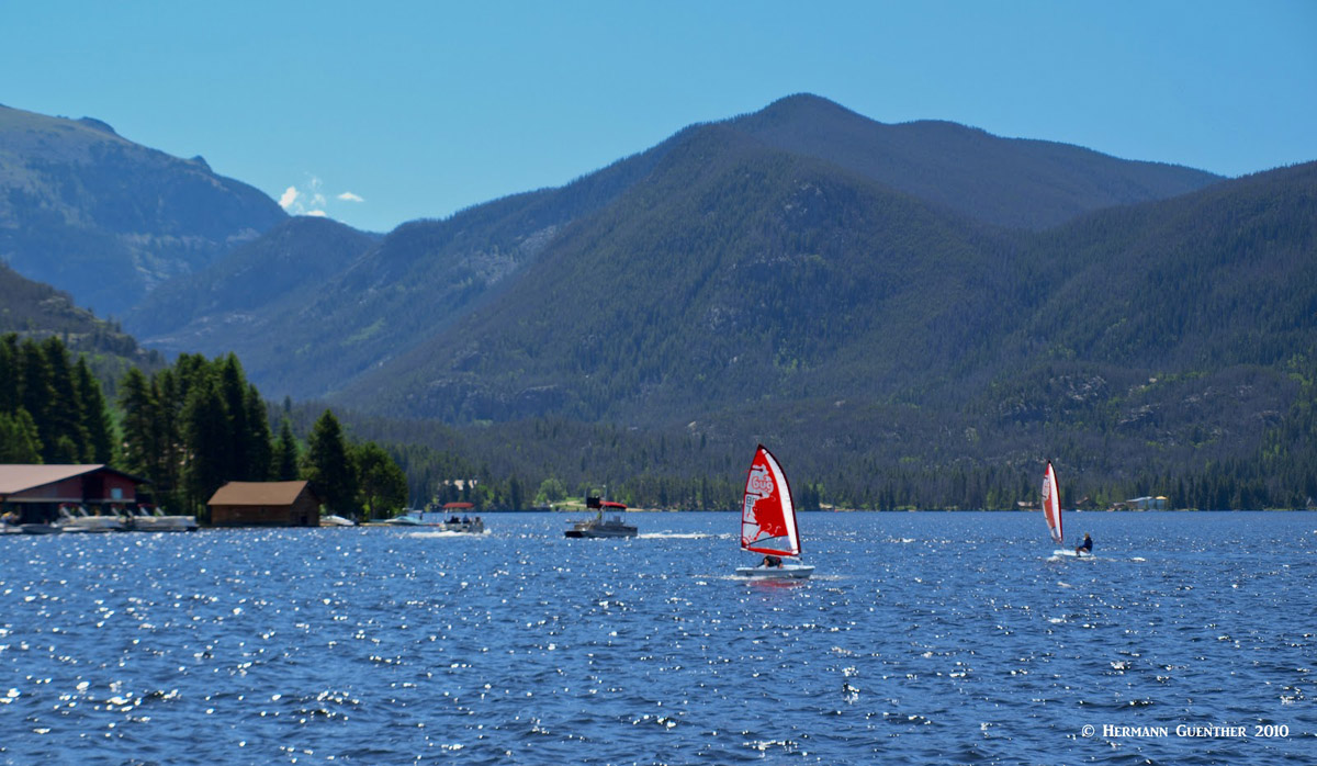
About 35 miles north of Winter Park along U.S. Highways 40 and 34, is a wonderful getaway called Grand Lake, positioned on the shore of the beautiful lake of the same name, Colorado's largest natural lake. It lies near the western entrance to Rocky Mountain National Park, but is less than 20 miles from the most popular trailhead for access into the Indian Peaks Wilderness at Monarch Lake. Compared to the other major towns described here, Grand Lake is a very small town with a permanent population of less than 500. But lest the visitor be fooled by such small numbers, it is known that this charming town can handle its share of visitors, although on a much smaller and more intimate scale than the others. For those who want to settle down in a more low-key locale, Grand Lake just might be the place. This town offers year-round recreation, and, especially in the winter, it is known as the "Snowmobiling Capital of Colorado". Grand Lake has an assortment of accommodations, restaurants, bars, shops and galleries. Nearby lodgings can be found that are more rustic in nature, which may be just what many visitors might be looking for when they choose to stay here. If Grand Lake (the lake) is not big enough for boating and fishing, there are two much larger lakes right next door - Shadow Mountain Lake and the even larger Lake Granby. The views across these lakes to the high peaks on the other side are simply amazing.
Grand Lake
Located at the junction of highways U.S. 40 and U.S. 34 in the Fraser Valley, 20 miles north of Winter Park, Granby may not be a large town but it is perhaps the most convenient place to stage excursions into the western Indian Peaks Wilderness. Less than 25 miles from any of the three trailheads (15 miles from two of them), visitors who choose to stay here will not have to get up too early in the morning to still get an early enough start on the trail. Though the town only has a population of 1,916 (2016 estimate), it offers an adequate selection of accommodations and restaurants, with nearby camping and RV facilities. For those inclined to try their luck at fishing, the nearby rivers and lakes will keep most anglers happy for days.


