
Scan the QR code and open PeakVisor on your phone
There are ten named mountains in the James Peak Wilderness area and the highest, and most prominent, is Parry Peak. The James Peak Wilderness is one of the newest of the 44 wilderness areas in Colorado, and at 14,000 acres in size, it is one of the smallest. The area received its wilderness designation in 2002 pursuant to the Wilderness Act of 1964. Wilderness is best defined by the author of the Wilderness Act, Howard Zahnister: "A wilderness, in contrast with those areas where man and his own works dominate the landscape, is hereby recognized as an area where the earth and its community of life are untrammeled by man, where man himself is a visitor who does not remain." There are several government agencies that administer the 765 wilderness areas in the United States - U.S. Forest Service, U.S. National Park Service, U.S. Fish and Wildlife Service and the U.S Bureau of Land Management. As of 2016, this encompassed a total of 109,129,657 acres, or an area larger than the state of California.
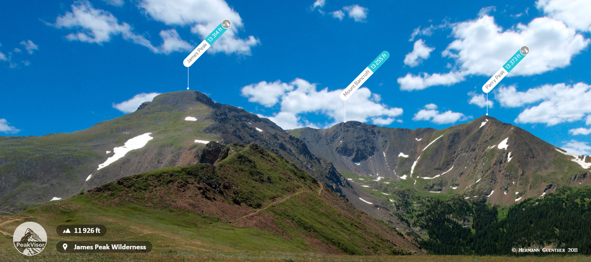
James Peak, Continental Divide Trail, Parry Peak from Rogers Pass
The James Peak Wilderness in the central part of Colorado’s Front Range is an alpine wonderland with panoramic views, majestic mountains and many sparkling alpine lakes. It occupies parts of Arapaho and Roosevelt National Forests. Most of the wilderness is located in Gilpin and Clear Creek Counties although small parts of it encroach slightly into Grand and Boulder Counties. Although it just barely straddles the Continental Divide (according to one website, but it is more likely that the Continental Divide is the actual boundary, in which case the wilderness does not actually straddle the divide), most of it is on the east (or Atlantic watershed) side. Likewise, most trail access, with the exception of the Continental Divide National Scenic Trail (CDNST), is from the east side. In fact, there is really only one major trailhead and just a handful of trails. But what might seem like a dearth of trails is made up for by the fact that hiking in this wilderness is a true pleasure. Aside from all the varieties of forest and animals that can be found here, this place has some incredible displays of wildflowers in the summer months.
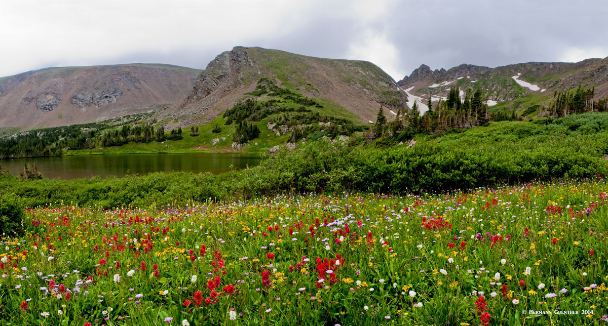
Wildflowers - James Peak Wilderness
Due to its proximity to the greater Denver metropolitan area, which includes the city of Boulder, a hiking and climbing mecca, this wilderness gets its share of visitors to be sure, especially on summer weekends. Of course most of this visitation takes place east of the Continental Divide due to easy access from the crowded urban corridor. But despite this popularity, the James Peak Wilderness offers a rugged wilderness experience that may seem crowded for some of the locals, but visitors from places both near and far will marvel at the scenery to be found here. Yet in the off-season, it is entirely possible to have big parts of the wilderness all to oneself, especially on weekdays, as we often experience. My wife and I have hiked here many times, and return several times each year, because it is so wonderful and only takes a 75-minute drive from our house to the trailhead. Having hiked here for many years and countless miles, I have never felt overwhelmed by crowds of hikers - even before I retired and could only go on weekends.
Continental Divide - James Peak Wilderness
With the relatively small area encompassing the James Peak Wilderness, it is hardly surprising that there is a relative scarcity of trails. There appear to be no details that we have been able to find about how many miles of trails are to be found here, but it seems apparent that a good percentage of the total trail miles is taken up by just one trail - the CDNST, which runs along the entire length of the western boundary of the wilderness. East Portal Trailhead - Alternatively known as the Heart Lake Trailhead, this is easily reached from the Peak-to-Peak Highway on an excellent gravel road that is always in good condition - year-round. Just eight miles from the turnoff from the highway at Rollinsville, the visitor will find a large parking area. It is right by the east portal of the Moffat Railroad Tunnel. This six-mile tunnel finds its other (western) portal right adjacent to the Winter Park Ski Area after passing under the Continental Divide. In fact, many people will take the early train from Denver to ski for a day, and then take it back home at the end of the day. But we come here to go hiking. This is the beginning of the South Boulder Creek Trail. The is the main trail in the area - it end 5.5 miles away on top of the Continental Divide. Along the way, there are several trail junctions from which branching trails can be taken to some wonderful alpine lakes.
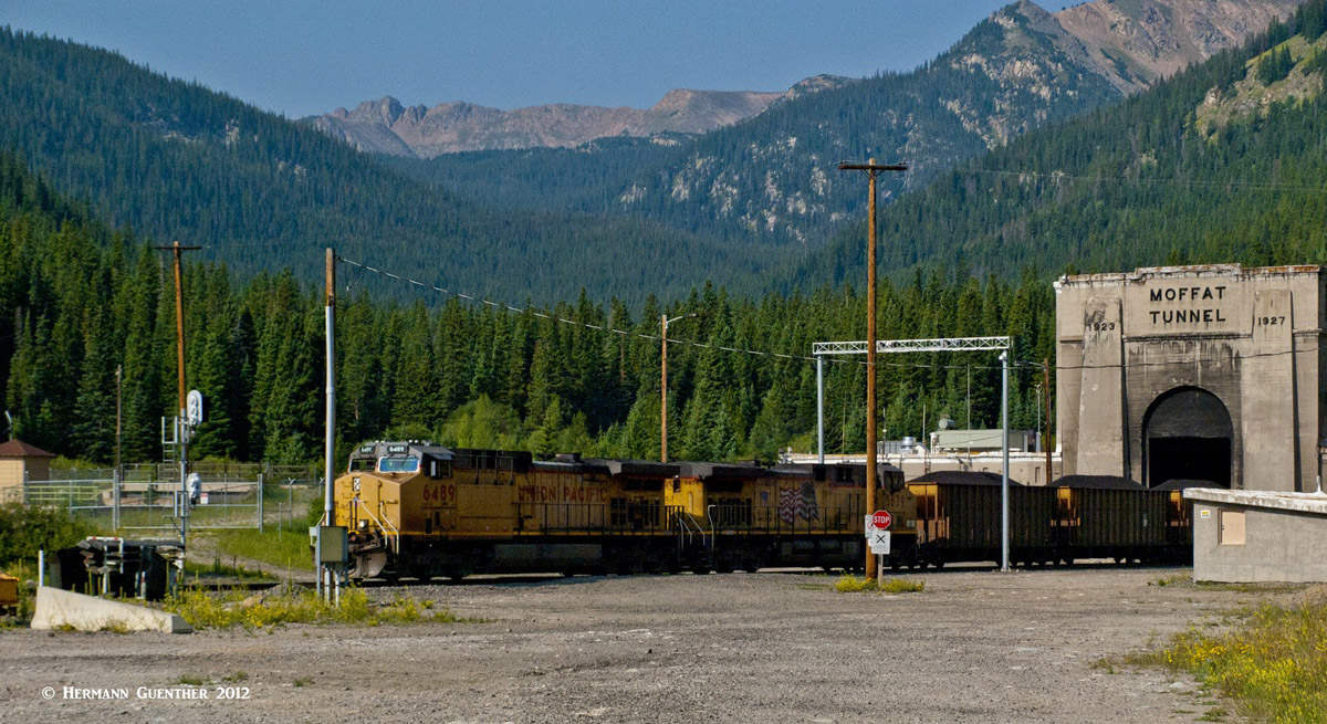
East Portal Trailhead - Moffat Tunnel - Continental Divide
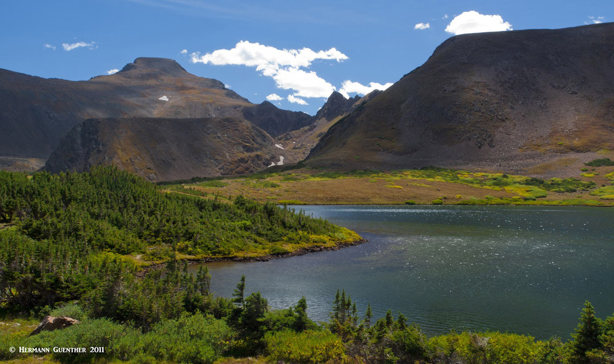
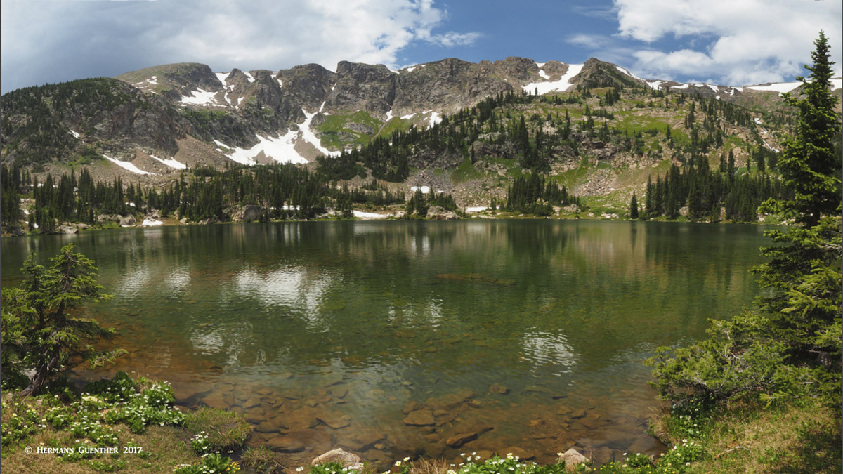
The main trail reaches two fine lakes just before it makes the steep ascent to the Divide at Rogers Pass. First, you will arrive at Rogers Pass Lake (incorrectly labeled Rogers Peak Lake on Google Earth and Maps). There are a number of fine camping spots here for those who want to stay longer than a day. I speak from experience - it is worth doing, especially if you plan to climb the wilderness's namesake mountain, James Peak. On the way, if you know your way around this lovely alpine basin, you can find some incredible wildflowers in the summer here. A short distance and only a little higher, is the aptly named Heart Lake. You have to climb up to the Continental Divide to appreciate why it is so named. By all means, walk completely around this gem - you will get a great view of James Peak from here. If you go up to the Continental Divide on the steep switchbacks (about 500 feet additional elevation gain), you can follow the divide to the south to the summit of James Peak, or to the north for however many miles you want.
Heart Lake, James Peak(l), Haystack Mountain just below James Peak
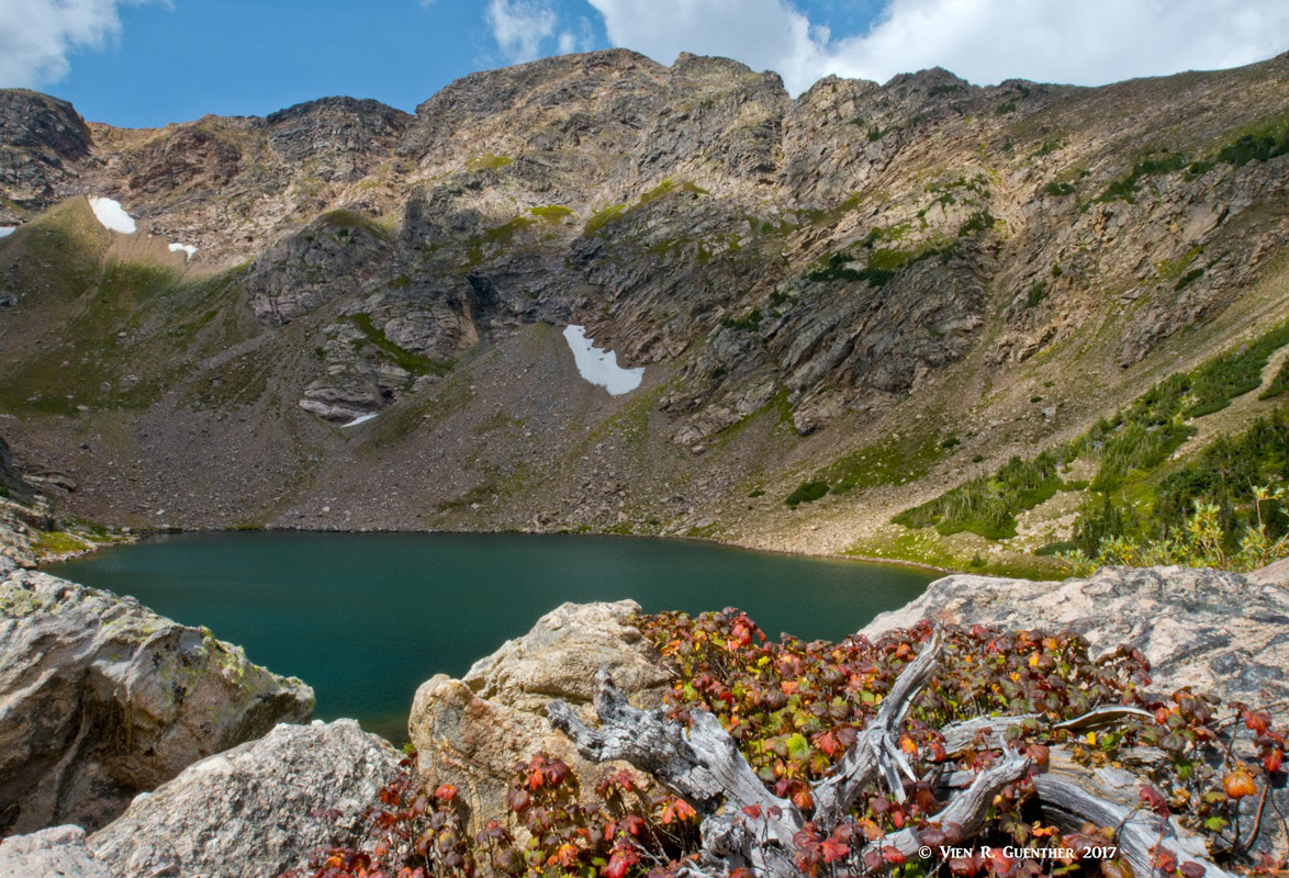
Back at the first trail junction, you can take the trail to the two Forest Lakes. It is an easy hike of about nine miles round-trip from the trailhead. Be sure not to turn around at the lower lake - the best is yet to come. The upper lake is what you want to see - and even walk clear around it, which is quite easy compared to some alpine lakes. At the right time of year, the wildflowers around this lake will impress. If you choose to skip the Forest Lakes, a second trail junction appears about one mile farther up the South Boulder Creek Trail. From here you can take the short but steep trail to the two Crater Lakes (I would like to know how many lakes in Colorado have that name - I have been to a number of them). The round trip distance to the two lakes is only about six miles - a fairly easy day hike. But wait - there is more: another Crater Lake, the upper one. I strongly advise visiting this one, but it makes your day hike a bit more strenuous. For one thing, there is no official maintained trail and whichever route you take, it is steep. Definitely not advisable when winter avalanche conditions exist. But it is rewarding.
Upper Crater Lake
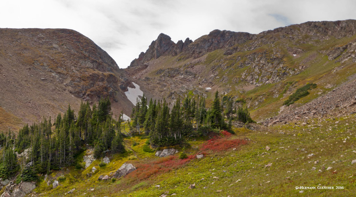
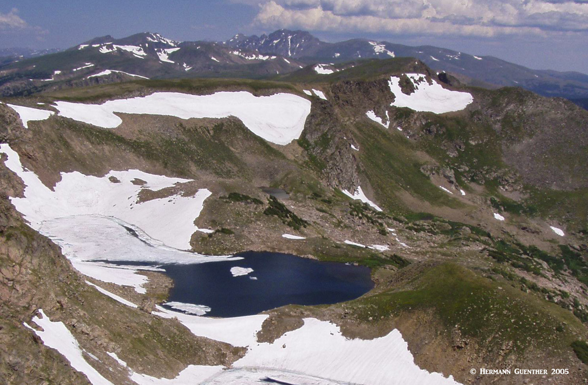
Also, back on the South Boulder Creek Trail, it is possible to reach other high lakes, but there are no official trails to them. I speak of the Iceberg Lakes and the Arapaho Lakes. I have been to the latter lakes, but that was before the U.S. Forest Service eliminated the trail sign to them - because people were getting lost up there. I must admit, even with trail descriptions, I found it challenging to find those lakes. As for the Iceberg Lakes, I have only seen them from the Continental Divide - not many people go there and, although I have been tempted to bushwhack my way up there, doing that alone is not advisable. So I don't advise it.
Iceberg Lakes from the Continental Divide
Saint Mary's Glacier Trailhead - OK, let's be up front about the facts here before disappointment sets in. Saint Mary's is not a glacier - it is merely a semi-permanent snowfield. But it is impressive, steep and people ski on it much of the summer. The trailhead is easily reached along a good road via the Fall River exit from I-70 just west of Idaho Springs. It is about 14 miles to the two parking areas. Yes, you have to pay a fee to park here, and don't even think about parking along the road when the lots are full. You will be fined. The easy half-mile hike to the glacier will bring you to the lovely Saint Mary's Lake perched near the base of the glacier. An easy family hike. But do you really want to come all this way just to see the lake - or even just to climb up to the top of the glacier? If you made it to the top, why not continue all the way to the summit of James Peak. There is an unofficial but well-marked route to the CDNST which will then take you to the top. This was the route I used the first time I climbed the peak - a long time ago. It’s an eight-mile round-trip hike. The lake and the glacier are not themselves within the wilderness, but the trail continuing from the top of the glacier will take you into it.
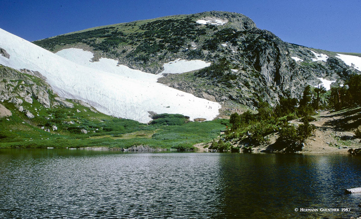
Saint Mary’s Lake and Glacier
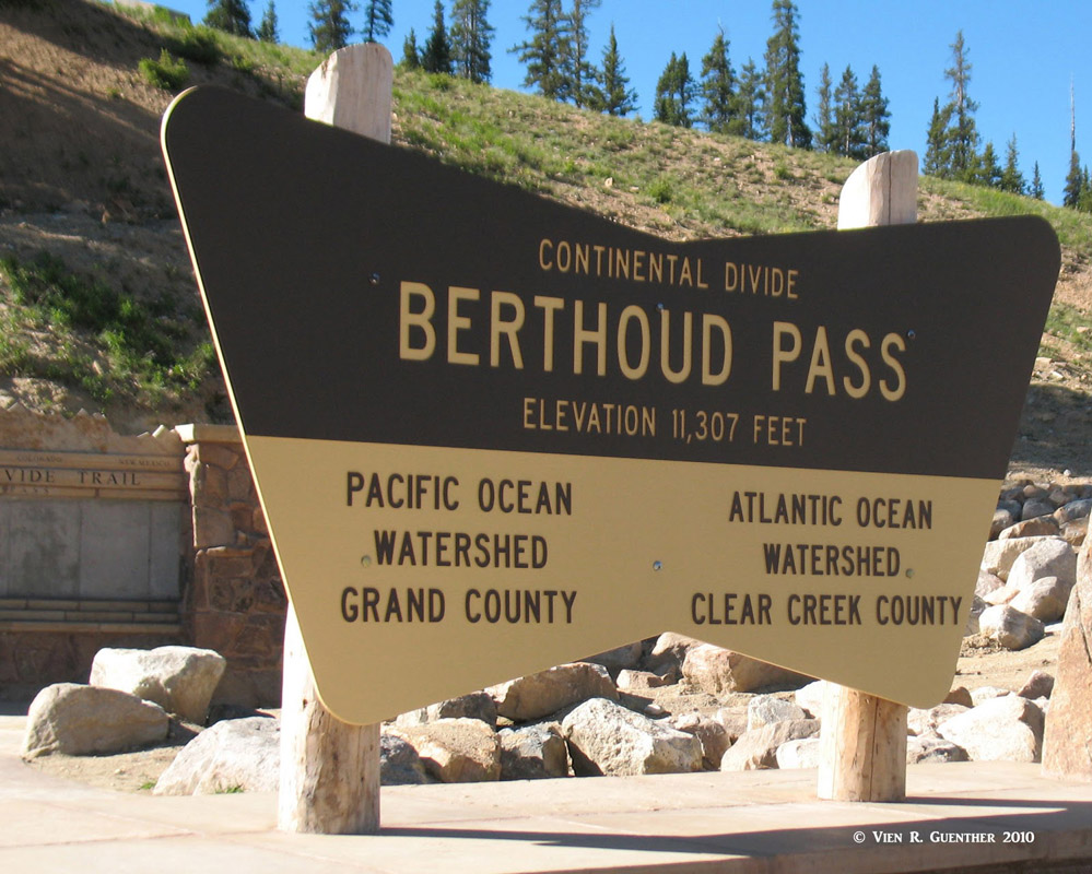
Berthoud Pass - This high pass (elevation 11,307) is where the Continental Divide crosses U.S. Highway 40 on its way from Denver to the resort of Winter Park. The CDNST crosses the highway here, thus effectively making Berthoud Pass a trailhead for accessing the James Peak Wilderness. In fact, those who desire to climb Parry Peak, the highest in the wilderness, might consider using this as the shortest and most direct means to climb this peak by following a maintained trail.
Rollins Pass - Now this is really interesting - this is the pass that isn't. What used to be a continuous road following an old railroad grade from Winter Park east across the Continental Divide and then down to Rollinsville is no longer continuous. You can drive up to (or close to) the actual pass (elevation 11,677 feet) from each side, but to get back down you just have to turn around and go back the way you came. That is because there are three tunnels near the top of the route that have mostly caved in. But people do drive up to the top for the excitement of the ride, the scenery and for its historical value. Therefore, this pass could be considered a sort of trailhead into the wilderness since the CDNST passes through here. Also, from the east spur of the road, there is a short trail that connects to the upper Forest Lake, resulting in a very short hike to that scenic spot.
Upper Forest Lake, Rollins Pass (r)
There are a few other access points into the wilderness, but these are not what I would consider major trailheads. They involve driving on roads that are not suitable for ordinary cars in some cases and require some local knowledge to find.
The James Peak Wilderness is essentially a southern extension of the much larger Indian Peaks Wilderness. There is no significant change in the characteristics of the topography or the ecosystem from one wilderness to the other. But with the James Peak Wilderness being so much further south, some of the towns that provide a handy base for exploration are correspondingly further south as well. Charming towns such as Grand Lake or Estes Park are less likely to be chosen by visitors as a place to stage their visits. In fact the greater Denver area is easily the major contributor of visitors to this wonderful wilderness. Plus the fact that the trails here are so close to where people live, it is so easy to undertake all of the hikes mentioned herein as simple day hikes, after which people just go home again upon completion of their hike.
But backpacking is of course very common here, and I speak from experience. It is a wonderful place to spend a night or two in the many fine camping sites that can be found, especially around the many alpine lakes. One note of caution though. You will not be guaranteed total silence typical of a wilderness. The main trailhead is at the Moffat Tunnel portal where the big ventilation fans are also located. After each passage of a train, these fans are turned on and will run until all the air inside the tunnel is cleared to safe levels. If you are camped anywhere up in the mountains east of the Continental Divide, you will hear the whine of the fans. But it is not very disturbing - unless somebody wants to camp very close to the trailhead, which is very unlikely.
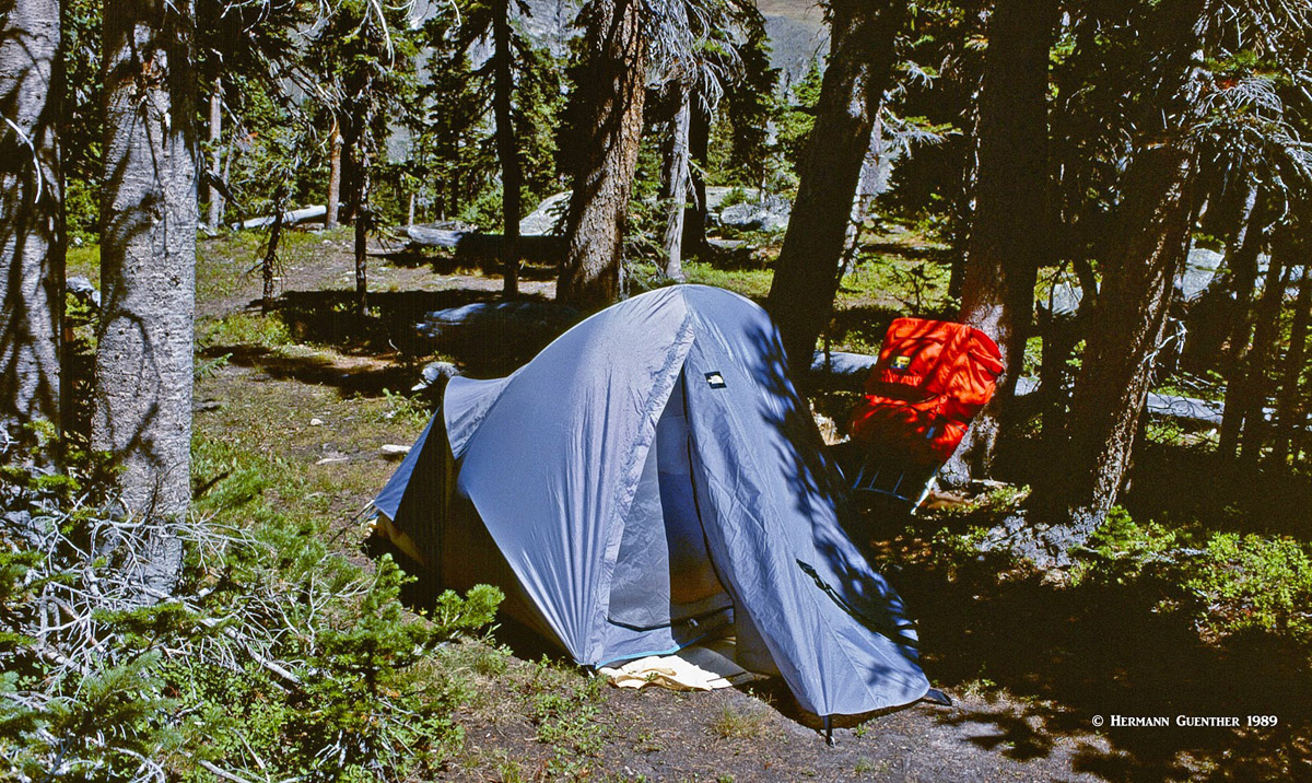
Backpacking in the Front Range
Having a metropolitan area population of over 2 million, it goes without saying that Denver, the Mile High City, offers anything and everything that a visitor needs or wants. With a world-class international airport, world-wide access to Denver is easy. Non-stop flights from as far away as Asia and Europe are routine. And while all amenities one could want in a big city are readily available, it is the proximity to the mountains which is one of the biggest attractions Denver provides. The James Peak Wilderness is so close to the city that it obviously attracts a large proportion of its visitors from all over the metropolitan area. The western suburbs are of course so handy to the wilderness that one can have a leisurely (well, early and quick) breakfast at home, then make the relatively short drive to the main trailheads, undertake a satisfying day hike, and then be back home in time for a hearty and well-deserved dinner. My wife and I do this often.
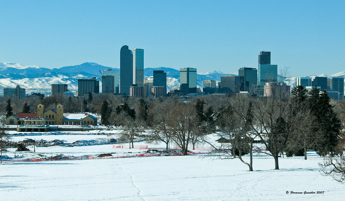
Denver - Mountains of the James Peak Group can be seen at far right
This beautiful city (population 107,353, per 2018 estimate) about 25 miles northwest of Denver is a mountain-lover's nirvana. Many famous climbers and mountain explorers call (or have called) Boulder home. Nestled right at the base of the foothills of the Rocky Mountains, Boulder is so well positioned as to make it the perfect base from which to explore the James Peak Wilderness. Even the high foothills looming over the city afford some impressive hiking and climbing opportunities. Just above Chautauqua Park are the famous Flatirons - not too many cities have this kind of climbing venue right within city limits. Of course, the highly outdoor-oriented population of this town contributes significantly to the hordes of people that often use this part of the Front Range as their playground. But irrespective of that, Boulder is a fun and vibrant town and should be considered an important base for staging explorations into the wilderness. Visitors to the Front Range urban corridor should not pass up a visit to Boulder.
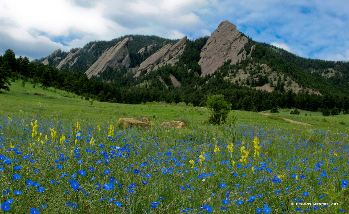
The Flatirons, Chautauqua Park - Boulder
This town is best known as a major ski resort, located in the Fraser Valley immediately to the west of the James Peak Wilderness. A world-class resort, Winter Park is ideally situated for staging expeditions, or simply day hikes, into the high mountains of the wilderness. But the availability of trailheads on this western side is much more limited such that most visitors staying in Winter Park might be more likely to be attracted to the Indian Peaks further north. The town is easily reached in little over an hour from Denver via U.S. Highway 40, which crosses the Continental Divide at Berthoud Pass, elevation 11,307 feet. One distinction that other resorts in Colorado don't share is that Winter Park is served by Amtrak's California Zephyr train on a daily basis, thus providing an alternative method of getting there from Denver. There is no shortage of accommodations and restaurants in this mountain getaway. The CDNST is easily reached from the town just to the south at the summit of Berthoud Pass.
Berthoud Pass - Winter Park


