Scan the QR code and open PeakVisor on your phone
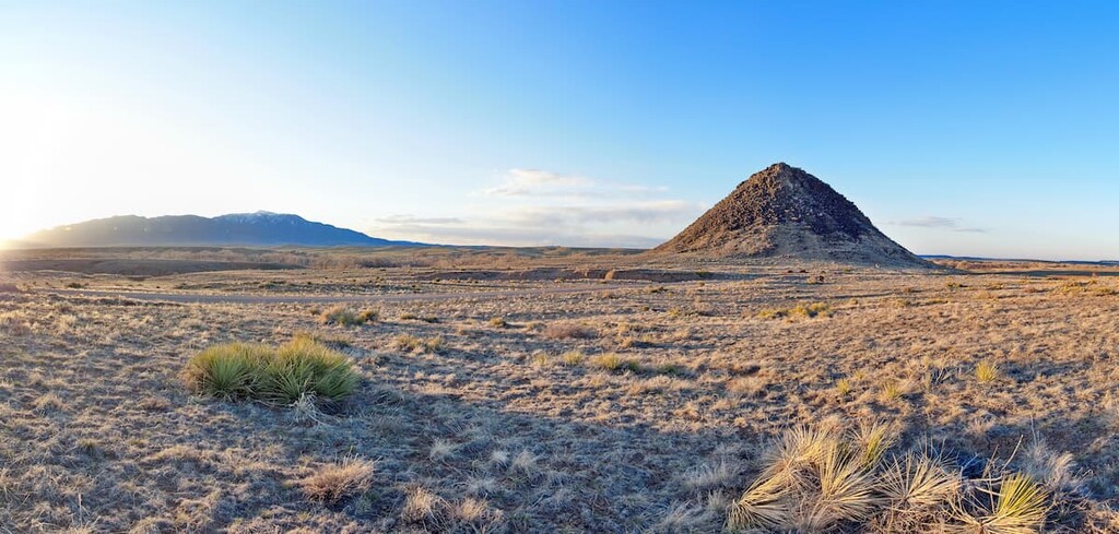
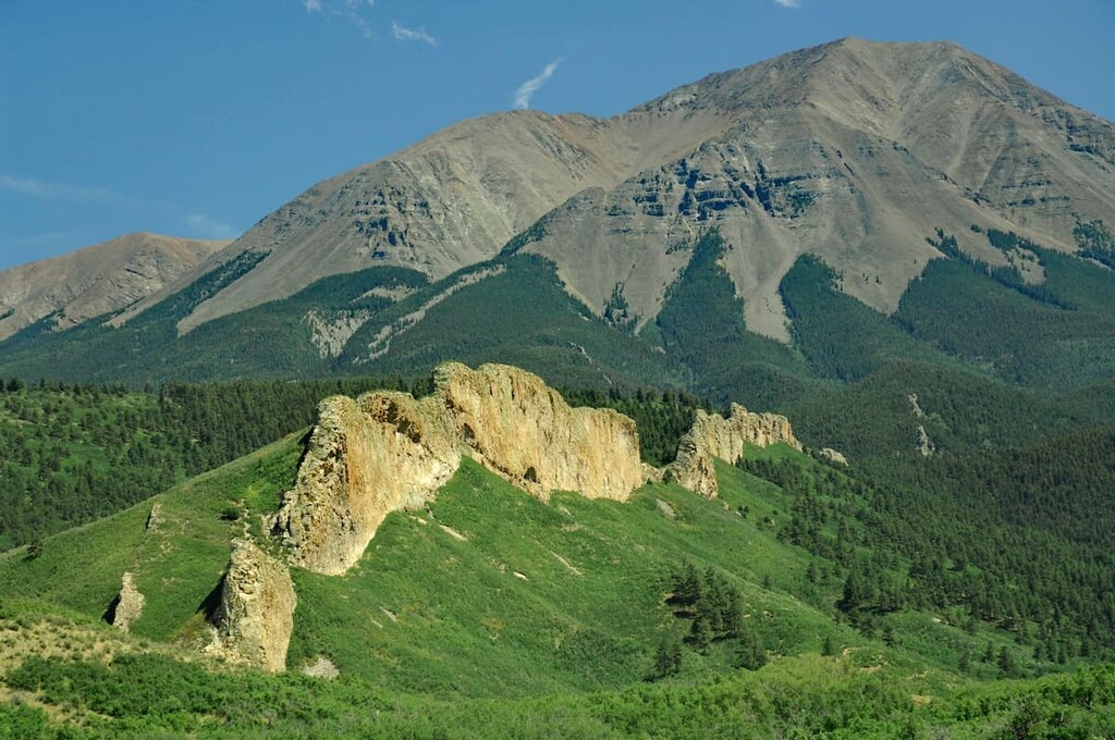
Located in south-central Colorado, Huerfano County is one of 64 counties in the state – back when it was created by the Territory of Colorado on November 1, 1861, it was one of only 17 original counties, considerably larger in area than it is today. Its population as of 2019 was 6,897, down significantly since its peak in 1930 when it reached 17,062, from which it has generally declined to the present day, with a brief spike in 2000 after which the decline continued. The county seat and largest municipality is the City of Walsenburg with a population of 3,029. There are two other towns in the county, LaVeta and unincorporated Gardner with populations of only 811 and 536 respectively. The county’s name is derived from “huérfano”, Spanish for “orphan”, which refers to a popular regional landmark named Huerfano Butte. It is a volcanic plug that rises 200 feet above the south bank of the Huerfano River floodplain.
Geographically, Huerfano County varies from flat prairie to some of the highest peaks in the Rocky Mountains. There are 68 named mountains in the county, the highest and most prominent of which is Blanca Peak, which is also the fourth-highest summit in the Rocky Mountains of North America. Interestingly, this ultra-prominent mountain sits on a “tri-point”, where three governmental entities (Huerfano, Alamosa and Costilla Counties) meet at a single point; there are many “tri-points” in the state,but here is one that happens to be a mountaintop. The mean elevation of the county is 7,474 feet. Its total area is 1,593 square miles of which 2.2 square miles is water. It shares common borders with six other counties. Two major cross-country highways cross the county – I-25 from north to south and US-160 from east to west. There are also three Colorado State Highways – SH-10, SH-12 and SH-69.
Though a relatively small county, Huerfano is rich in natural recreational resources and is home to parts of the San Isabel National Forest as well as parts of three designated wilderness areas – Greenhorn Mountain, Sangre de Cristo and Spanish Peaks. In fact, the county’s tourism board brands it as “Southern Colorado’s Spanish Peaks Country”. These wilderness areas are easily the most popular places in the county for hiking and climbing. Well-positioned near Walsenburg is the Lathrop State Park which offers hiking, camping, picnicking and fishing. It became the first state park in Colorado in 1962 and has two lakes (Martin Lake and Horseshoe Lake) which hold a variety of sport fish; the park also offers swimming, boating, water skiing, windsurfing, jet skiing and a nine-hole golf course.
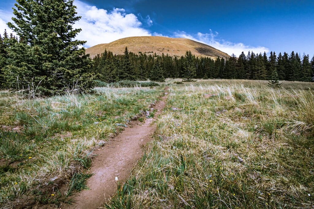
Despite the county’s relatively small size, it offers a healthy variety of places to go hiking. Notably, the Sangre de Cristo Range, especially the towering Blanca Massif in the middle part of the range will attract many serious climbers, as these mountains present some of the state’s most challenging climbing routes. But not to be ignored are the beautiful Spanish Peaks, with the higher West Spanish Peak at 13,631 feet the fourth most prominent mountain in the county. While not as challenging as the Blancas, a climb of this lofty sentinel will reward you with some of the best views in southern Colorado.
Go to the northernmost part of Huerfano County and you will find yourself at the southern end of the Greenhorn Mountain Wilderness, which is itself part of a sub-range of the Sangre de Cristo Range, called the Wet Mountains. The namesake mountain of the wilderness, Greenhorn Mountain, may only reach 12,352 feet, but it is the second most prominent mountain in the county. It can be climbed via designated routes, but some trailheads are outside of Huerfano County. We include it here since the mountain and the wilderness are important features of the county.
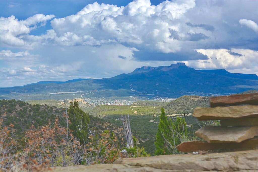
The southernmost segment of the San Isabel National Forest is dominated by the mighty Spanish Peaks, two prominent mountains that can be seen from as far away as Colorado Springs 102 miles to the north, Alamosa 85 miles to the west, and Raton, New Mexico 65 miles to the south. If you are driving north- or southbound on I-25 in the southern half of Colorado, you simply cannot miss seeing these impressive mountains. These peaks are east of and separate from the main Sangre de Cristo Range though they are considered part of the Culebra Range which is a sub-range Cristos.
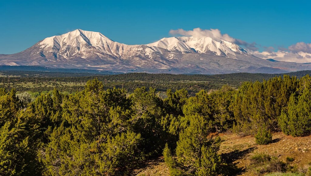
West Spanish Peak, the higher of the two, has 13,583 feet of elevation with a prominence of 3,648 feet. It is the easternmost mountain over 13,000 feet in the United States. Because of their unique geology, the Spanish Peaks were made a National Natural Landmark in 1976 and designated a Wilderness Area in 2000. The designation as a Natural Landmark is due to their unique (at least for Colorado) geologic characteristics. They were formed by two separate igneous intrusions, the evolved evidence of which is now visible as some of the best-known examples of igneous dikes.

Although it is higher, West Spanish Peak is the more commonly climbed of the two, since it is actually easier and more accessible. The major trailhead is a few miles off State Highway 12 via Forest Road 46 which starts at Cucharas Pass. This is a good gravel road that will take you to 11,005-foot Cordova Pass where there is a campground and trailhead parking (you will have to pay a modest fee to park here). The total distance to the summit is only four miles with an elevation gain of about 2,600 feet. That’s the good news. The bad news is that you will gain the final 1,600 feet in the last mile along a very rocky route to the summit. It is strenuous but totally worthwhile, as the 360-degree views are stunning. Two important things to consider before undertaking this epic hike – bring plenty of water as there is none along the trail, and keep an eye on the weather. Lightning is a real threat on this isolated and exposed peak. You should plan on leaving the summit no later than noon.
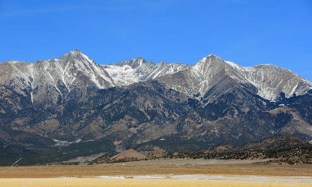
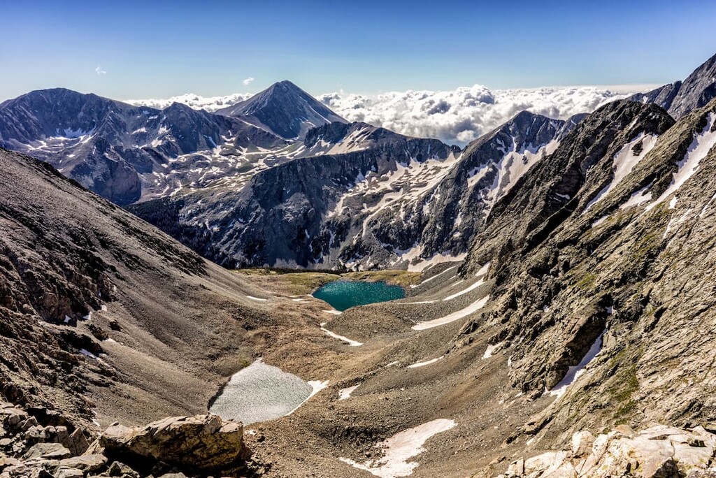
The more serious climbers who want to test their abilities and endurance will most likely gravitate to the high peaks of the Blanca Massif, which includes four lofty fourteeners, two of which are technically in Huerfano County since their summits straddle the boundaries of adjacent counties – Alamosa and Costilla. However, two of these peaks – Ellingwood Point and Blanca Peak – are typically not climbed from trailheads within county limits. In fact, there are only really two trailheads from which climbers usually approach these peaks, and they are on the west side of the range in Alamosa County (see https://peakvisor.com/park/san-isabel-national-forest.html). But occasionally, some will attempt to climb them from the east, in Huerfano County.
A third fourteener in this group is Mount Lindsey. It is not in Huerfano County, but the only legal approach to it starts at a trailhead in this county. This trailhead in the Huerfano Basin provides an alternative access to climbing Blanca Peak and Ellingwood Point, especially the north faces of the two. But this is also the only public access for climbing Mount Lindsey. A four-wheel drive vehicle is advisable since the final two miles of the road to the trailhead are quite rough. This magnificent cirque has all the hallmarks of wilderness except for the mining claims around Lily Lake. But don’t let that discourage you from coming here. If you want to avoid climbing the peak, the four-mile one-way hike to Lily Lake makes a fine day hike.
This wilderness area was designated in 1993 and is one of the most remote and lightly used wilderness areas in Colorado. It is named after Greenhorn Mountain, the second most prominent mountain in Huerfano County. Most of this wilderness lies in the county and ranges in elevation from 7,600 to 12,349 feet. It lacks jagged peaks and contains not even one lake. It is a dry area extending right down to the prairie of eastern Colorado. It is not an ideal hiking area and probably was never intended to be – the entire southern half of the wilderness is devoid of trails, but there are a few farther north with one trailhead actually in Huerfano County and two others in adjacent Pueblo and Custer counties. The Bartlett Trailhead on the east side provides access to the Apache Falls, a tough ten-mile out and back hike with several ups and downs involving some 3,000 feet of elevation gain. From this trailhead it is possible to climb Greenhorn Mountain via the Bartlett Trail. This trail skirts around the south end of the mountain and continues west to the Greenhorn Trailhead at the end of Forest Road 369 (Greenhorn Mountain Road). This trail is over eight miles long one way – it can be done as a point-to-point hike that would require a very lengthy car shuttle. The Greenhorn Trail likewise also has two trailheads – the one at Greenhorn Mountain Road and another west of the town of Rye at the northeastern corner of the wilderness.
In a mostly rural county with a very low population density and not too many tourist attractions that would draw large crowds, it is no surprise that you won’t find any major resorts here. That is indeed the case – for that, visitors will have to go to other nearby counties, although the large city of Colorado Springs is not too far away – 93 miles (or 1½ hours) north of Walsenburg. There, visitors can definitely find anything they could possibly want, including the 5-star Broadmoor Resort. But closer to the main recreation areas in Huerfano County, there is not much to be found, even in Walsenburg, the county seat centrally positioned in the county. So we will have to look for accommodations, restaurants and shopping a bit outside Huerfano County. That leads us to two cities conveniently located right on Interstate Highway 25 – one to the north and one to the south – and both less than one hour away.
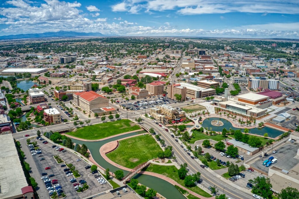
Pueblo, less than 50 miles north of Walsenburg, is the ninth largest city in Colorado with a population of 112,361 as of 2019. It is one of the largest steel-producing cities in the United States, the main industry which has been a fixture of Pueblo for most of its history. It has a high desert climate, with summer days often very hot, although anomalies have happened periodically with bouts of extreme cold in winter months. Pueblo has the distinction of being the hometown of four Medal Of Honor recipients, the highest military decoration that can be awarded to American soldiers. The City Council has adopted the tagline “Home of Heroes” due to the fact it can claim more recipients of the medal than any other municipality in the United States. The city has plenty of tourist infrastructure such that visitors can find a variety of accommodations, restaurants and shopping. Colorado’s largest single annual event, the Colorado State Fair, is held in Pueblo in late summer. The mighty Arkansas River flows through the center of town; a mile-long channel, diverted from the river, is the centerpiece of the Pueblo Riverwalk in the heart of downtown.
Less than 40 miles south of Walsenburg is the small city of Trinidad with a population of only 9,096 inhabitants as of the 2010 census. Close to the New Mexico border, this is a historic town that lies on the old Santa Fe Trail, which was first explored by Spanish and Mexican traders. With the discovery of coal deposits in the mid-19th century, it follows that the town was founded shortly thereafter in 1862. While all the mines are now closed, companies have started to drill gas wells since the 1980s. Today, Trinidad benefits from the tourist trade – I-25 bisects the town. This highway is the most highly traveled route between Colorado and New Mexico. Because of this, Trinidad has a fairly good selection of accommodations and restaurants, especially for such a small town. The town is currently experiencing an economic boom as a result of the legalization of marijuana in Colorado. And another interesting factoid: Trinidad was once dubbed the “Sex Change Capital of the World”. It came about because a veteran surgeon, having returned from Korea, learned that the town needed a surgeon. After he got a good reputation for performing “sex reassignment surgery” on a few parients, his reputation in that specialty put his name on the map. The rest is history...Just outside of town is the state’s newest state park - Fisher’s Peak State Park. Just opened in 2021, much of the park is still under development, but it promises to provide some extreme backcountry hiking challenges once fully developed.