Scan the QR code and open PeakVisor on your phone
Raggeds Wilderness is a protected region and outdoor recreation destination located within the Gunnison and White River national forests of western Colorado in the US. The tallest and most prominent point in the region is Treasure Mountain at 13,530 ft (4,124 m) in elevation and with 2,812 ft (857 m) of prominence.
Raggeds Wilderness encompasses 65,443 acres (264 sq. km) of land within the Southern Rocky Mountains of western Colorado. Many other wilderness areas and national forests surround the Raggeds Wilderness.
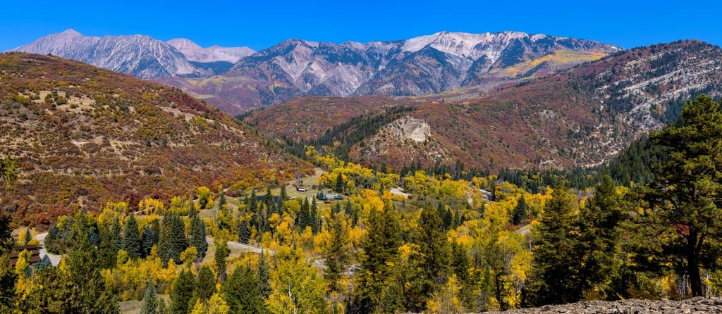
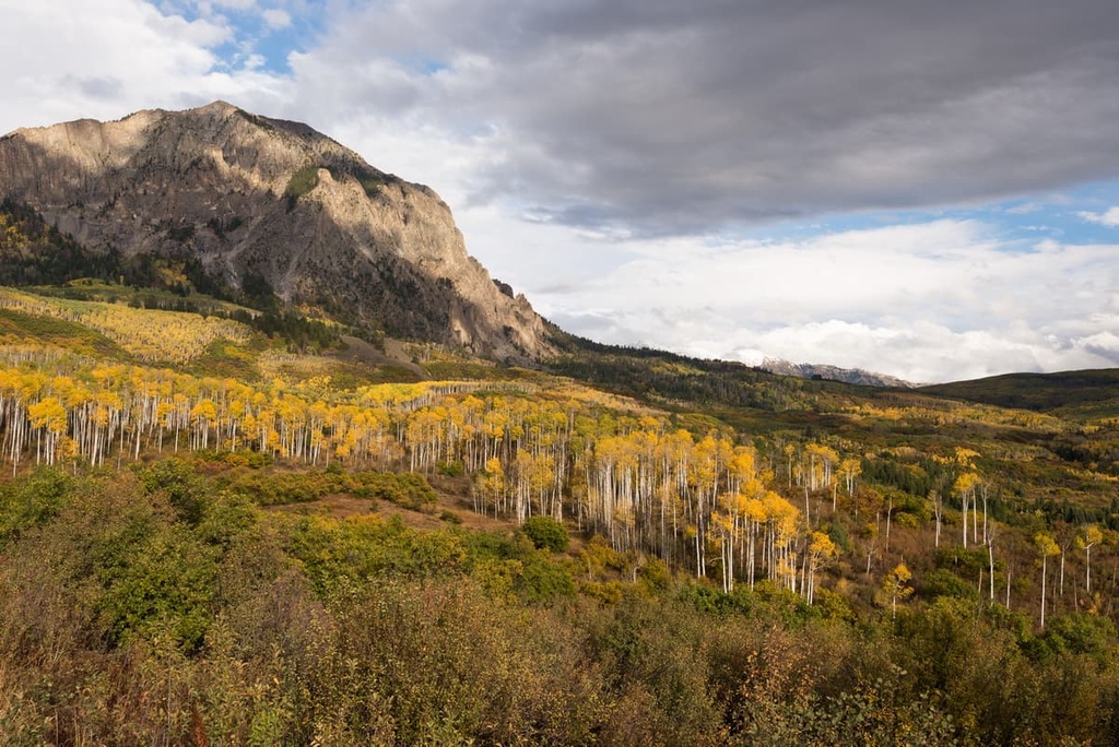
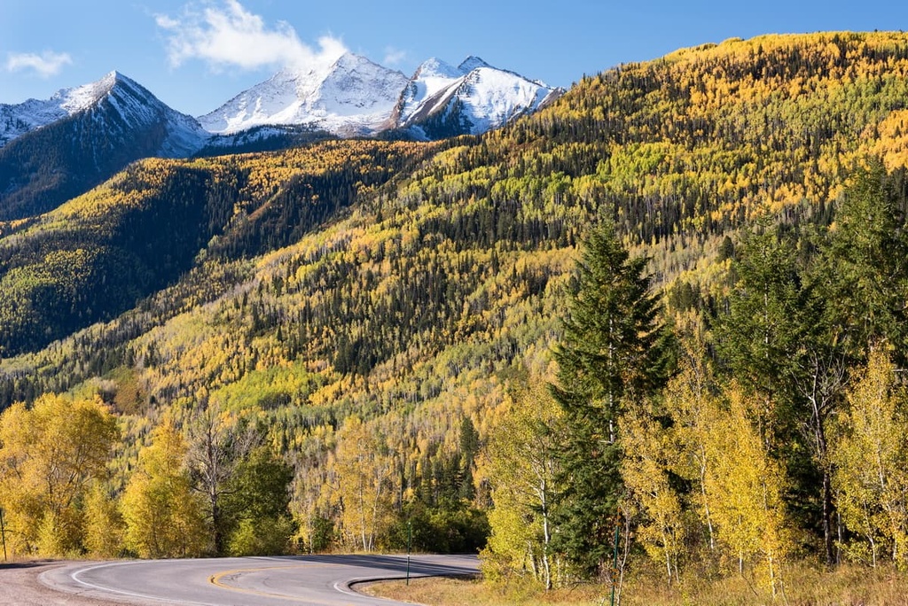
Elevations throughout the wilderness range from around 7,000 feet (2,134 m) up to the summit of Treasure Mountain. Alternating rugged peaks and valleys define the wilderness areas’ remote terrain.
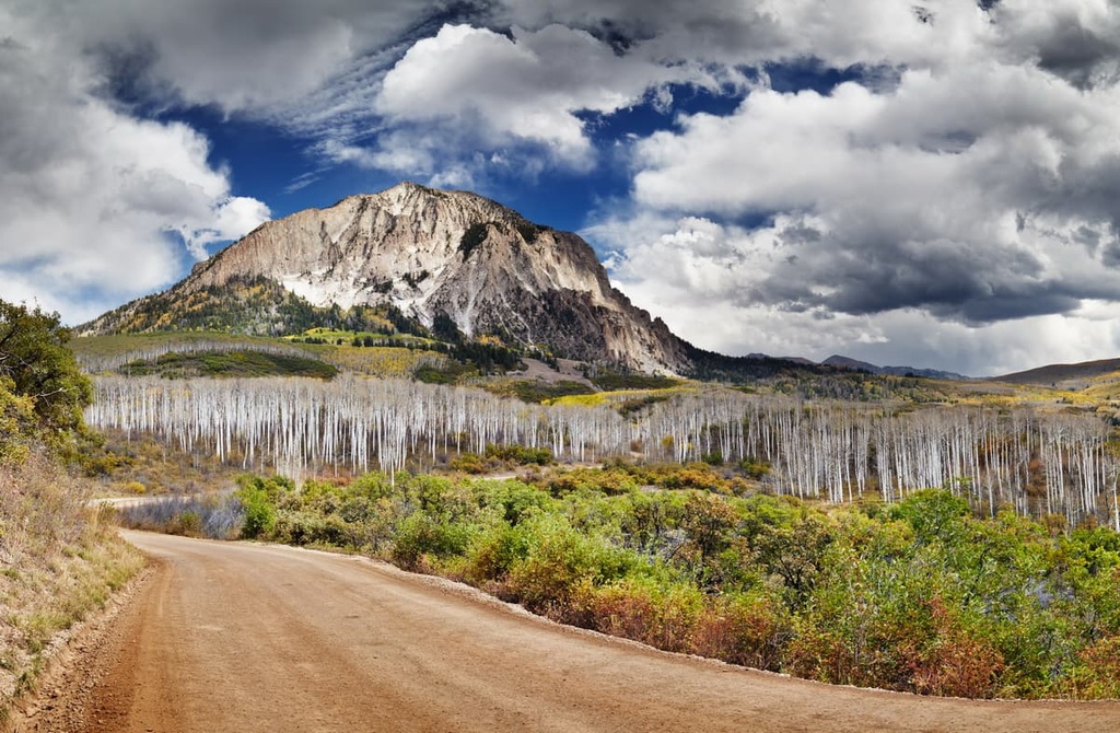
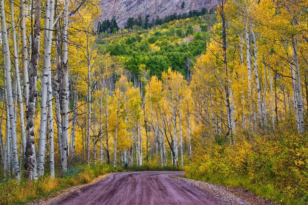
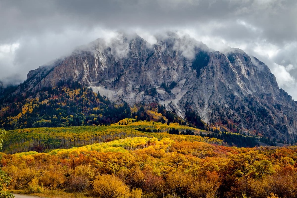
Rocky slopes dominate much of the landscape in the Raggeds Wilderness with jagged ridgelines forming the tallest peaks. Amidst the many peaks in the region lie the deep Dark Canyon and the Anthracite Creek that runs through it.
Prominent features within the Raggeds Wilderness include Oh-Be-Joyful Pass along with the Oh-Be-Joyful Creek Valley. The Slate River cuts through the wilderness separating the Oh-Be-Joyful Pass from the rest of the landscape.
Alpine lakes are scattered throughout the wilderness, often surrounded by grassy meadows, small patches of trees, and steep scree fields. Dense patches of forest can be found along the valley bottoms, too, near the many creeks of the region.
The Raggeds Wilderness lies within the Gunnison and White River National Forests. Nearby wilderness areas and national forests include Maroon Bells-Snowmass Wilderness Area, West Elk Wilderness, and Collegiate Peaks Wilderness Areas, and Grand Mesa National Forest.
The peaks within Raggeds Wilderness are part San Juan Mountains, a subrange of the Southern Rocky Mountains. The Rocky Mountains, which the Southern Rocky Mountains are a part of, extend from southern Wyoming to central New Mexico.
Rock formations throughout the wilderness date back to the Precambrian. These rocks are often found in the core sections of the mountains while the outer layers of rock are from the Cenozoic era.
The mountains within the wilderness are part of the San Juan Mountains that dominate the southwestern section of Colorado. Volcanic history in the region dates back 30 million years and it was responsible for forming many of the peaks that are visible in the region today.
During this time, magma was thrust upward from beneath the Earth’s crust as continual folding resulted in immense pressure. This pressure, mixed with the subsequent volcanic activity, resulted in the rugged peaks of the San Juan Mountains.
A vast majority of the San Juan Mountains were heavily glaciated during the last glacial maximum. As the glaciers began to retreat from melting, they further carved out the deep valleys seen in the Raggeds Wilderness.
This glacial retreating also formed the alpine lakes, steep slopes, and expansive box canyons. During the mid 1800s, the region was heavily mined, primarily for silver and gold. Many of the small mountain towns found throughout the region were originally established as mining villages.
Major peaks within Raggeds Wilderness Area include Treasure Mountain, Marcellina Mountain, Chair Mountain, Mount Owen, and Ragged Peak.
The drastic changes in elevation throughout the wilderness allow for numerous ecoregions to prosper.
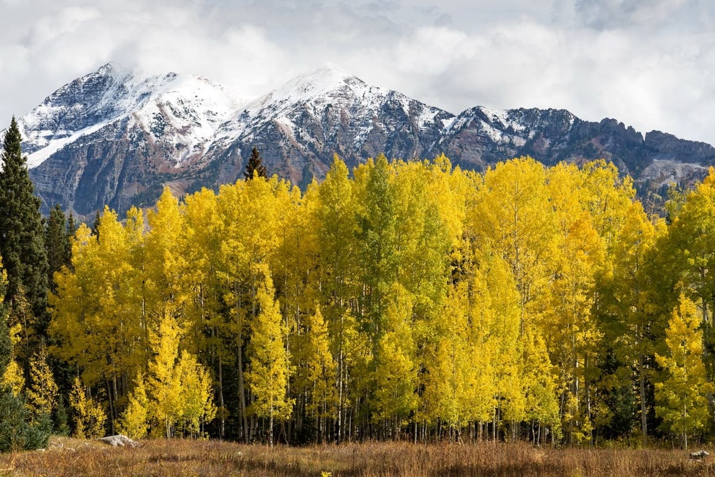
The lower elevations in the wilderness are home to dense patches of forest, with the numerous streams acting as their water supply. As the elevation increases, the forest begins to thin, giving way to alpine meadows, scree fields, and various species of wildflowers.
Minimal vegetation grows on the peaks and ridgelines within the wilderness. At the highest elevations, there are small grass patches and low-growing shrubs. The ;lack of vegetation at these higher elevations lets hikers experience panoramic views of the wilderness and surrounding national forests.
The forested hillsides within the wilderness provide an ideal habitat for a majority of the fauna that inhabit the region. Mule deer, moose, elk, and bighorn sheep can be spotted within the forest and along the scree fields in the area.
Populations of mountain lions and black bears have also been spotted within Raggeds Wilderness. While beavers inhabit land near the many creeks and streams, marmots can often be spotted in the vast rock slides throughout the landscape. Additionally, the region’s skies are home to various species of songbirds, falcons, and eagles.
Human history within the Raggeds Wilderness area dates back thousands of years, long before the arrival of settlers from Europe.
The land within the wilderness is part of the ancestral homelands of the Ute people. The homeland of the Ute spans throughout southwestern Colorado and the San Juan Mountains. Prior to the arrival of Europeans, the Ute traditionally lived at higher elevations during the summer months and traveled down to the valleys during the winters.
Many of the seasonal walking paths that were originally created by the Ute would later be used by both American and Spanish settlers. The first Spanish settlers arrived in the San Juan Mountains during the eighteenth century. These settlers initially hoped to mine the surrounding mountains for silver.
By the 1820s, Americans of European descent arrived in the region, many of whom were fur trappers. The discovery of gold during the 1860s soon led to a massive influx of settlers. This gold was discovered by the Charles Baker Expedition in the western portion of the San Juan Mountains.
Many of the settlers that flocked to the region during this gold rush disregarded the Ute people’s claim to their ancestral lands. Disputes frequently broke out between the groups over the course of the next few decades.
In 1873, the Brunot Agreement was negotiated, providing the Ute people with 3.5 million acres (1.4 million ha) of land. However, although both parties agreed to this agreement, the American settlers continued to disregard the Ute’s claim to their ancestral lands in the region. Eventually, many Ute were forced from their homelands and onto reservations.
Many of the small mining settlements in the region continued to grow throughout the nineteenth and twentieth centuries, eventually transforming into the quaint mountain towns that can be found throughout the San Juan Mountains today.
The White River National Forest was established in 1902, followed shortly after by Gunnison National Forest which was established in 1905. The Raggeds Wilderness was established in 1980 and later expanded in 1993 to its current size.
Raggeds Wilderness is home to numerous hiking trails. Here are some of the most popular hiking areas in the region:
The Three Lakes Trail takes hikers to one of the most scenic spots within the wilderness. This route is 3.4 miles (5.5 km) long with 515 feet (157 m) of elevation gain.
Along this loop trail, hikers pass by three pristine alpine lakes, waterfalls, numerous creeks, and barren peaks covered with patches of wildflowers during the summer months. Hikers also have the option of camping at Lost Lake Campground along the trail.
The Dark Canyon Trail runs through the wilderness and the Dark Canyon. This point-to-point trail is 13.2 miles (21.2 km) long with 3,408 feet (1,039 m) of elevation gain. The route can be completed in one day or backpacked over the course of multiple days.
Throughout the trail hikers have panoramic views of the wilderness and surrounding San Juan Mountains. Waterfalls, creeks, and rugged ridgelines can be spotted throughout this trail. The route can also be used for snowshoeing during the winter and early spring.
The route to Green Lake follows along the Carbon Trail, just off Highway 12. This trail is 5 miles (8 km) long round trip with 1,433 ft (437 m) of elevation gain.
The beginning of the trail climbs steeply through the forest before the trees begin to clear and open up to the lake. On the far side of the lake lies a steep scree field along with views of other peaks within the wilderness.
Looking for a place to stay near Raggeds Wilderness? Here are some of the best cities and villages to check out in the region:
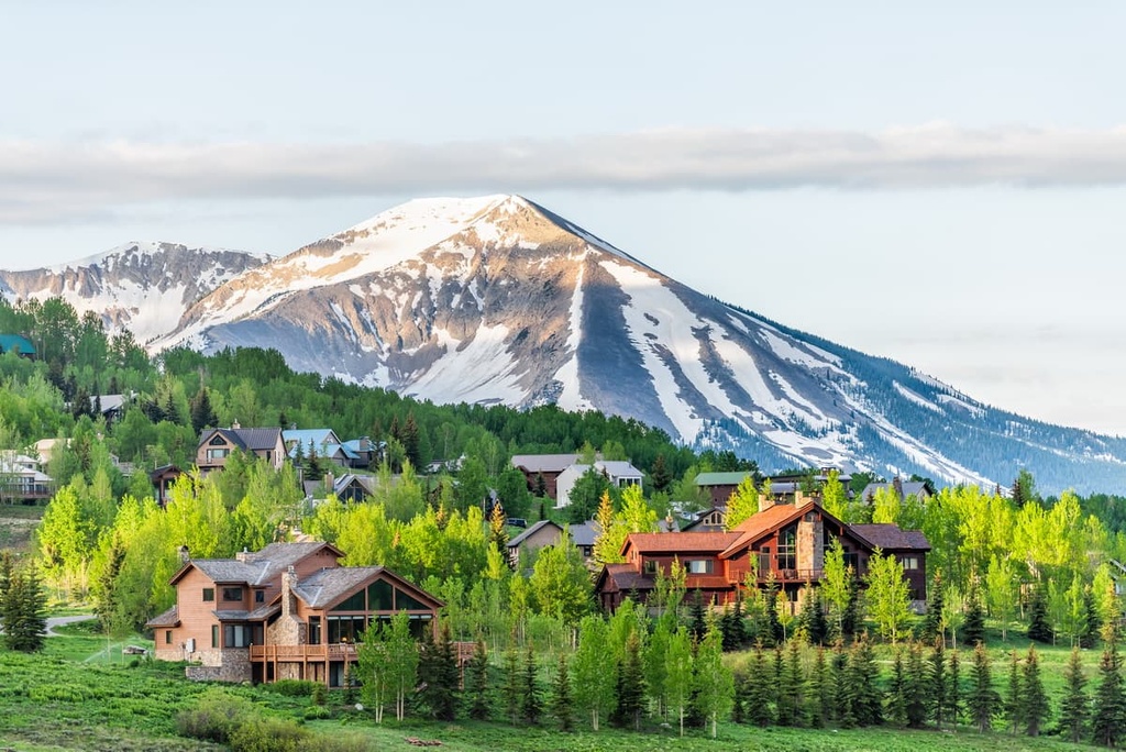
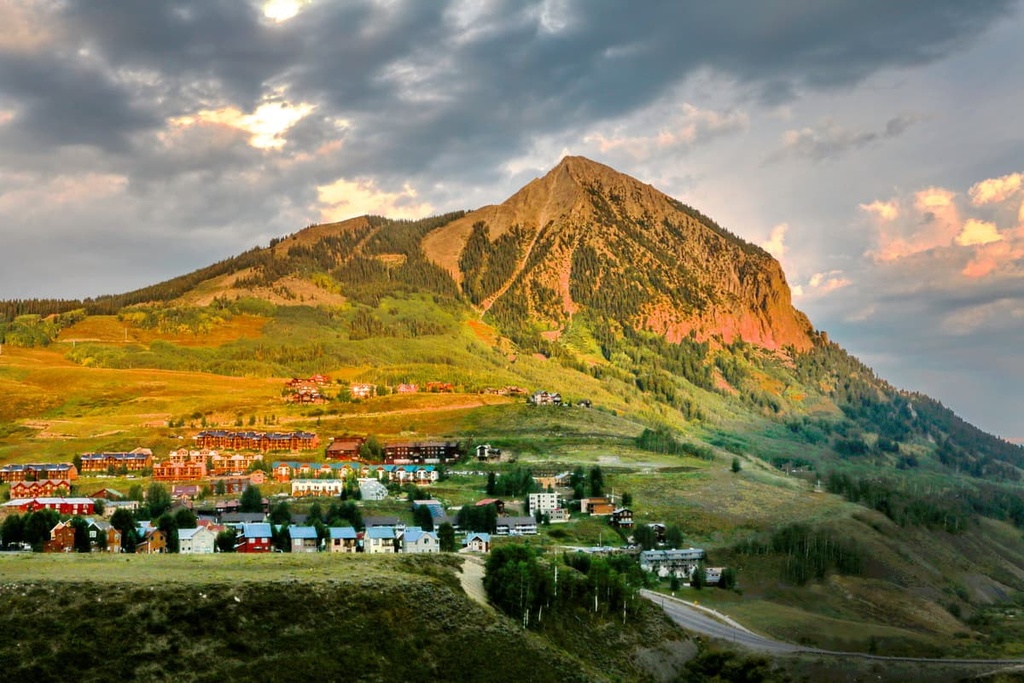
Crested Butte lies just to the southeast of the Raggeds Wilderness. The small town is home to under 2,000 people and has been given the nickname of “the last great Colorado ski town”.
During the winter months, the town comes alive due to its close proximity to Crested Butte Mountain Resort. The area also has an ice skating rink and numerous groomed cross country skiing trails for visitors to enjoy.
During the summer, the city transforms into a hub for mountain biking, hiking, rock climbing, trail running, and whitewater rafting. Each year, the city hosts numerous festivals and parades. Some of the most popular include the Crested butte Bike Week, Crested Butte International Film Festival, and Crested Butte Musical Festival.
Just to the south of Crested Butte lies the city of Gunnison, which is located near the center Gunnison National Forest. Gunnison is slightly larger than many small towns in the area, and it is home to around 6,500 people.
Gunnison is a popular destination for outdoor recreation throughout the year. Thousands of miles of nearby trails make it a great stop for hiking, backpacking, trail running, and mountain biking adventures. The city is also in close proximity to many ski resorts for winter activities. The central location of the city within Gunnison National Forest allows it to be a great home base for outdoor exploration.
Additionally, just to the west of Gunnison lies the Blue Mesa Reservoir, Colorado’s largest body of water. During the summer months, the reservoir provides even more opportunities for people to explore the outdoors. Rock climbers in the region can climb in both the Black Canyon and the Harmans Rocks Recreation Area, which are located near the city.