Scan the QR code and open PeakVisor on your phone
Grand Mesa National Forest is a large and rugged area of public land located to the east of Grand Junction in the US state of Colorado. The forest is named after the Grand Mesa (11,000 ft/3,350 m), which is one of the world’s largest mesas. It contains 45 named summits, the tallest of which is Crater Peak (11,339 ft/3,456 m) and the most prominent of which is Piñon Mesa (9,692 ft/2,954 m) with a prominence of 2,684 feet (818 m).
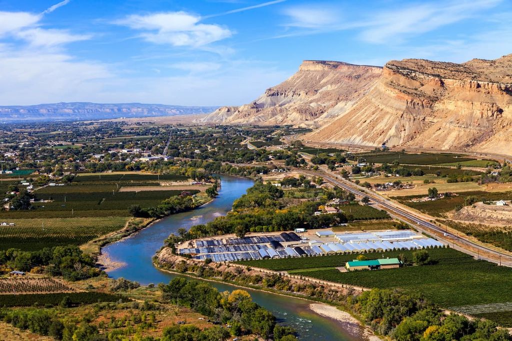
Grand Mesa National Forest spans 346,240 acres (140,118 ha) of land to the east of the city of Grand Junction in Colorado. It is also located to the north of Delta and to the west of the Roaring Fork Valley. The national forest is bordered by the White River National Forest to the north and the Gunnison National Forest to the east.
Grand Mesa National Forest is commonly lumped into a collective administration region with two other National Forests, Uncompahgre and Gunnison. Collectively the three account for over 3 million acres (1,214,057 ha) of public land.
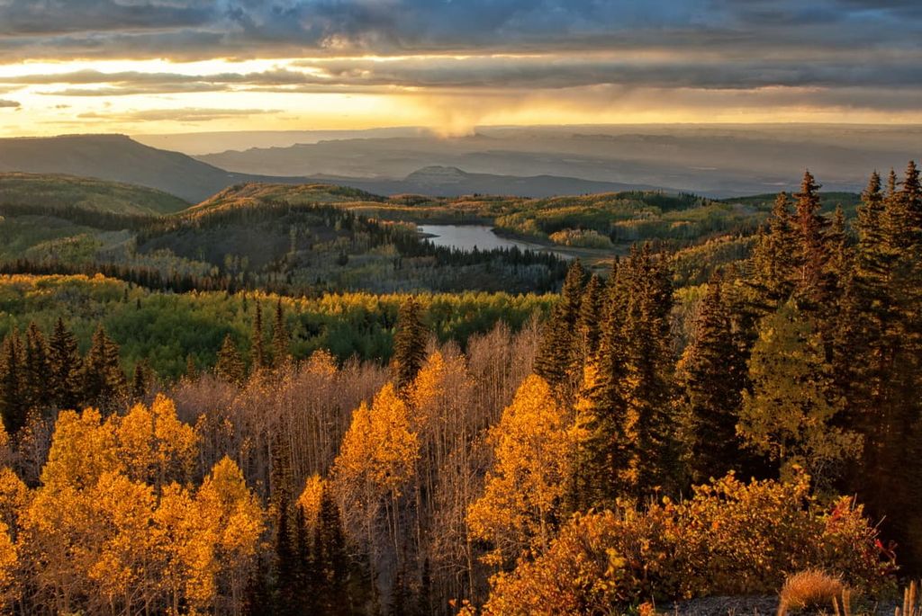
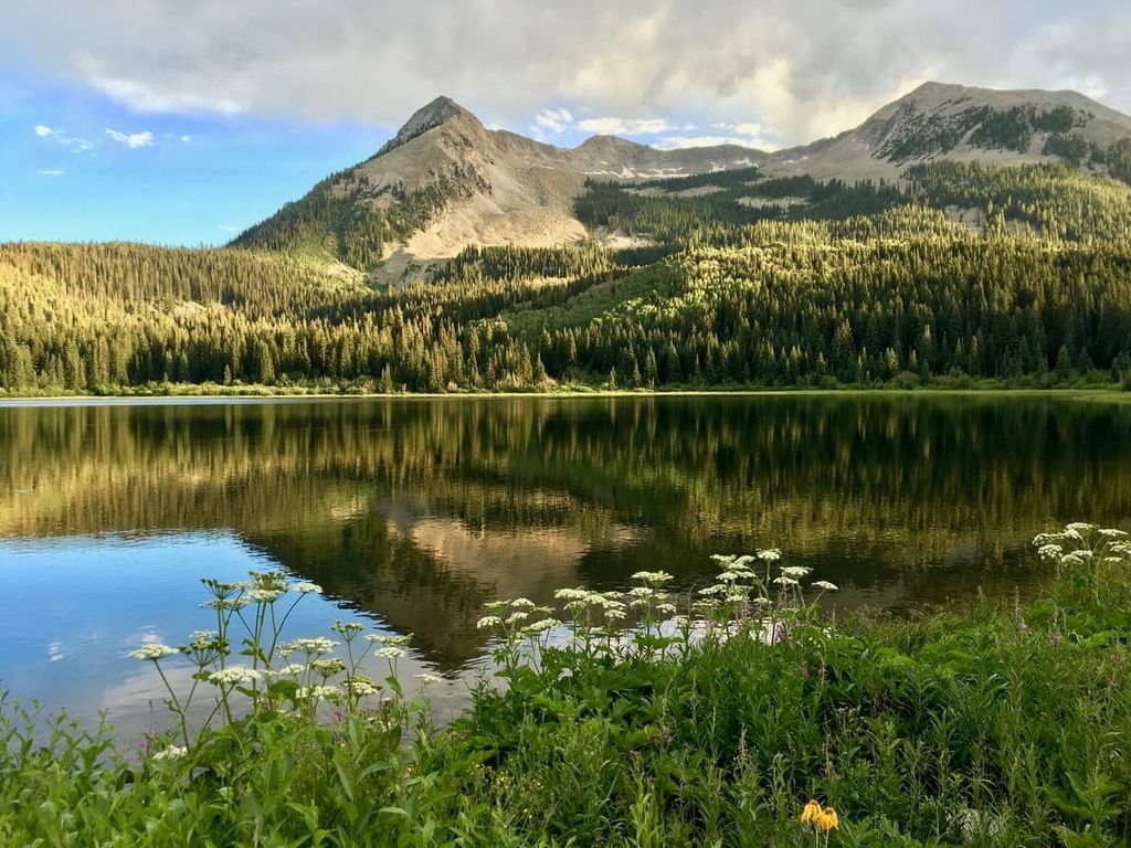
The eponymous Grand Mesa (11,000 ft/3,350 m at its highest point) is the most recognizable landmark in the national forest. The entirety of the mesa is above 10,000 feet (3,048 m) in elevation, and it stretches for over 43 miles (70 km) from east to west.
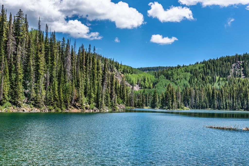
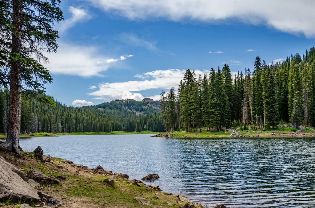
It is known worldwide as the largest mesa on Earth. The mesa houses over 350 lakes, and it is bounded by the Colorado River in the north and the Gunnison River to the south. The Battlement Mesa, a smaller mesa to the north of Grand Mesa and to the south of I-70, is also located inside Grand Mesa National Forest boundaries.
Unlike most alpine lakes in Colorado, Grand Mesa’s lakes are not due to glaciation. Rather, they formed as a result of landslides that occurred hundreds of thousands of years ago.
According to Andres Aslan, professor of geology at Colorado Mesa University , the lakes formed as large pieces of the basalt rock found in the Grand Mesa calved off. These large blocks started to fall downhill, creating large depressions on the mesa in the process. These depressions eventually filled up with water, giving us the lakes we see today.
Grand Mesa isn’t just the largest flat-top mountain in the world, it’s actually an extinct volcano that formed 10 million years ago. It’s estimated that the lava flows from the Grand Mesa volcanic field originally stretched for some 320,000 acres (129,499 ha). However, erosion has since shrunk these flows to a mere 40,960 acres (16,576 ha).
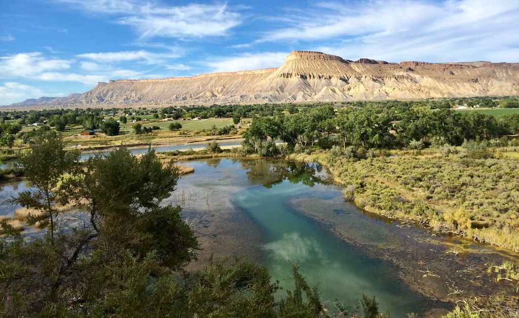
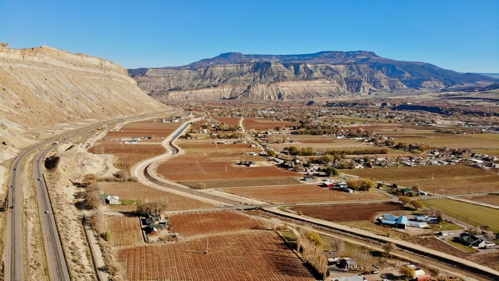
Grand Mesa is topped by a hard layer of volcanic basalt that’s up to 310 feet (94 m) thick in some places. Below this basalt shelf are multiple layers of sandstone and shale hailing from the Paleogene Period. The lowest layer of rock, made of Mancos Shale, hails from the Late Cretaceous Period.
These softer sedimentary rock layers below the basalt were eroded over time by the Colorado and Gunnison Rivers, forming the classic “mesa” shape. The lowest layers of shale in the formation also spread out into the valleys surrounding Grand Mesa, creating an extremely fertile soil base that has made the region ripe for agricultural production.
Grand Mesa National Forest receives a fair amount of precipitation for western Colorado. According to the National Weather Service, the mesa receives 18 feet (5.5 m) of snowfall and about 33 inches (84 cm) of rainfall annually. This has allowed the national forest to become a home to a variety of flora and fauna.
Trees in the forest include subalpine fir, douglas fir, aspen, lodgepole pine, bristlecone pine, Engelmann spruce, ponderosa pine, juniper, and pinyon pine. The national forest is also home to the aptly-named Wildflower Garden, which is located at the Grand Mesa Visitor Center. Here, visitors can see over 50 species of native wildflowers, including yarrow, beardtongue, wild rose, and asters.
Native fauna in the national forest includes mammals like mule deer, elk, black bears, Canadian lynx, marmots, cougars, bighorn sheep, and pine marten. Snowshoe hares, pine squirrels, chipmunks, red foxes, and pocket gophers are also in the area. The Grand Mesa area is also home to a large population of moose.
Many birds call Grand Mesa home as well, such as boreal owls, Mexican spotted owls, bald and golden eagles, peregrine falcons, jays and hummingbirds, blue grouse, chickadees, robins, common ravens, wild turkeys.
The area that is now Grand Mesa National Forest has been home to humans since time immemorial. The people of the Fremont culture inhabited the Grand Mesa region between 250 and 1300 CE. Much of the rock art found in the region dates back to the people of the Fremont culture.
Additionally, the region is ancestral homelands of the Ute Indian Tribe. However, the discovery of gold and silver in the 1880s brought a swarm of settlers and prospectors to the region, and many towns (including Grand Junction) sprung up as a result. The Ute were later forced off their homelands and moved west into Utah where many members of the Ute Indian Tribe live on the Uintah and Ouray Reservation.
By 1887, the primary line of the Denver and Rio Grande Railroads came through the area. The arrival of the railroad helped Grand Junction thrive economically. Additionally, major irrigation initiatives in the region brought agricultural growth to the Grand Valley. Before long, the valley became a major fruit-growing region, something that it remains to this day.
Despite development in the valleys around the mesa, the wilderness of Grand Mesa itself was so remote and rough that it was one of the last places in the contiguous United States to be settled. A reserve called Battlement Mesa (after the prominent mesa to the north of Grand Mesa) was established in 1892. This reserve became the Grand Mesa National Forest in 1924.
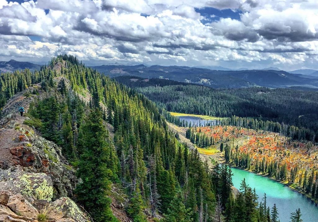
There are over two dozen trails in Grand Mesa National Forest ranging in lengths up to 16 miles (26 km). The Crag Crest Trail loop is overwhelmingly the most popular and takes hikers to the high points of the Grand Mesa. The much shorter Lost Lake Trail is another excellent option, while the informational Discovery Trail is a great option for those looking for a more casual, kid-friendly stroll.
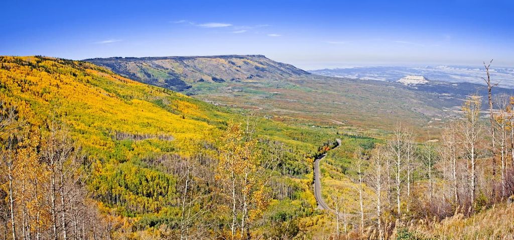
Grand Mesa National Forest and the mesa itself are split north to south down the middle by the 63-mile (101 km) Grand Mesa Scenic and Historic Byway (State Highway 65), which takes visitors by a plethora of scenic overlooks. This route is the main way to experience all Grand Mesa National Forest has to offer.
The 10.3-mile (17 km) Crag Crest Trail (#711) is Grand Mesa’s most popular hike, and one of its most strenuous. The loop trail entails an elevation gain of 1,548 ft (472 m) and takes hikers up above 11,000 feet (3,350 m) on the crest of the mesa.
As a loop trail, Crag Crest Trail can be accessed from one of two trailheads. On the west end, hikers can begin across from Island Lake, near the Grand Mesa Visitor Center. Hikers coming from the east can begin from the Crag Crest Campground on the shores of Eggleston Lake, which is the low point of the trail. Given the large elevation gain along this hike, an early start is recommended.
The short, steep Lost Lake Trail (#502) ascends from Mesa Lake to the sublime Lost Lake, a pristine alpine lake that’s nestled just below the rim of Grand Mesa. The trail is 2.2 miles (3.5 km) long in total and includes around 400 feet (122 m) of elevation gain. Hikers begin the Lost Lake Trail from Glacier Springs Campground, near the Mesa Lakes Resort.
The Discovery Trail (#745) is a 0.4 mile (0.6 km) gravel trail located behind the Grand Mesa Visitor Center. The trail follows a variety of informative plaques and signs, and nature guides are available at the Visitor Center. The Discovery Trail is a mellow, brief, and informative hike, so it’s an excellent way for children and the elderly to experience Grand Mesa, in particular.
Looking for a place to stay near Grand Mesa National Forest? Here are a couple of the best cities and towns to check out in the region:
Grand Junction is the closest major city to Grand Mesa National Forest, sitting about an hour’s drive to the west. The city houses a population of 63,000 people and sits at 4,593 ft (1,397 m) in elevation.
Grand Junction has become increasingly popular as a mountain biking destination in recent years. In fact, it has several single-track trails that are famous among mountain bikers nationwide. Two of the most well-known mountain biking trails are Tabeguache and Kokopelli.
The city is the focal point of Colorado’s wine country, and there are a number of wineries outside of town in the surrounding Grand Valley region. The Museum of the West is another classic tourist stop, with a variety of exhibits spanning Colorado's history, including an extensive collection of nineteenth-century firearms, adobe pottery, and a uranium mine exhibit.
The local James M. Robb Colorado River State Park offers mellow walking and biking trails. Meanwhile, visitors looking for something a bit more grand can head to Colorado National Monument, which is located just outside of town to the west.
The National Monument features a number of sheer canyons and rocky towers and covers 20,500 acres (8,296 ha) of land and it features a variety of hiking, biking, and other outdoor activities.
The small town of Cedaredge, home to 2,300 people, sits on the southern slopes of Grand Mesa. The famous Powderhorn Ski Resort, a heavily trafficked winter destination, is located approximately 30 miles (48 km) north of town.
The town is primarily agricultural, with the production of apples, peaches, wine, and beef cattle as the main source of income in the region. Notable tourist sites in town include the Historic Pioneer Town and Cedaredge Golf Club.

Cedaredge is also home to the Grand Mesa Visitor Center. Here, visitors can embark on guided nature hikes, listen to presentations on wildflowers, mushrooms, birds, and other wildlife, visit the Wildflower Garden, or browse a gift shop. The Discovery Trail (see above) also begins at the Visitor Center, and the Crag Crest is nearby.
On the annual “Moose Day,” which takes place on the last Saturday in July, visitors can take part in a variety of moose activities. These include presentations on moose biology and moose re-introductions to the wild. Moose Day draws in over 1,000 visitors each year and is arguably the biggest event of the year in Cedaredge.
There are several established campgrounds within the National Forest, such as Little Bear Campground and Ward Lake Campground, both of which are within the vicinity of the Grand Mesa Visitor Center.
Cobbett Lake Campground is the only campground in the park that accepts reservations. All others operate on a first-come, first-serve basis.
Dispersed primitive camping is also allowed within the Grand Mesa National Forest, however, it is prohibited along the access road to Big Creek Campground and the access road to the Lake Island boat launch.
According to the Forest Service, you can set up your campsite within 300 feet (91 m) of any designated road or trail, providing no resource damage occurs. Camping is limited to a maximum of 28 days in any 60-day period. After 14 consecutive days at a campsite, you must move your campsite at least 3 miles (4.8 km) away.