
Scan the QR code and open PeakVisor on your phone
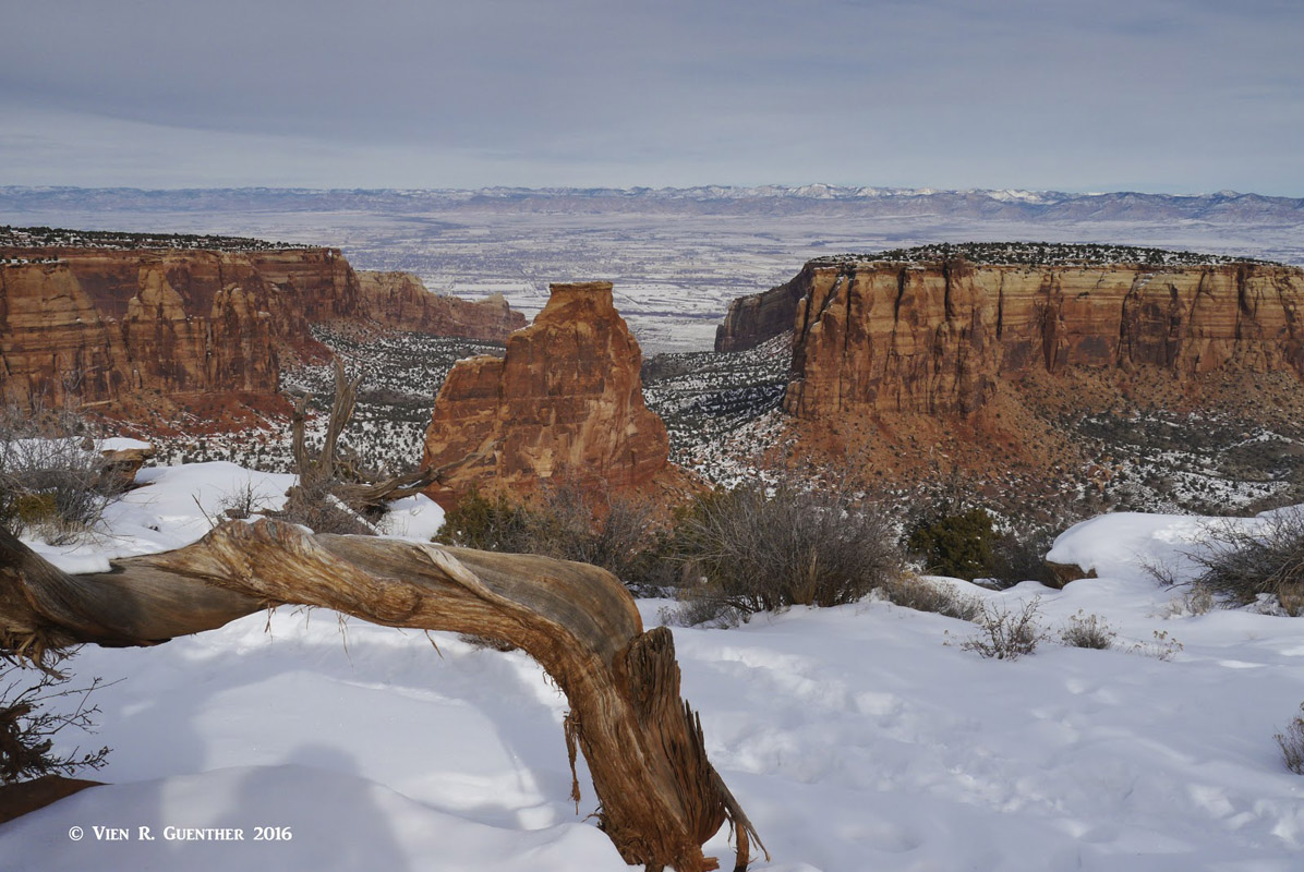
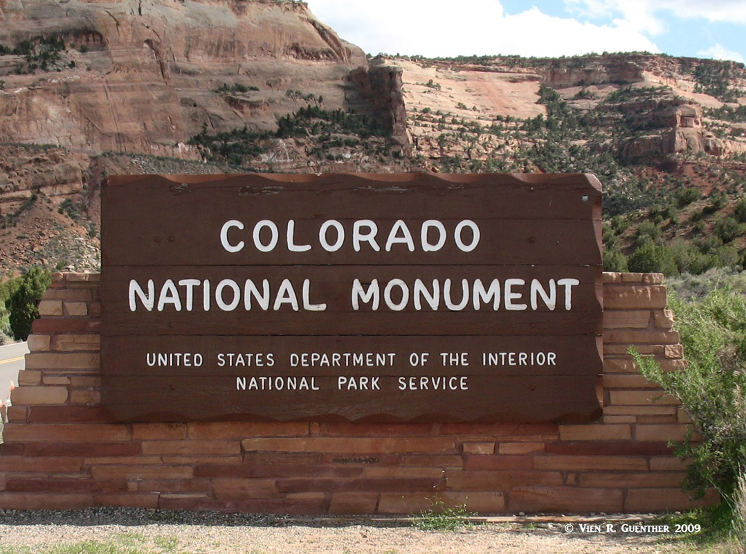
The Colorado National Monument in the western part of the State of Colorado is one of five national monuments located in the state. Just as with the National Parks, of which there are four in Colorado, it is administered by the National Park Service of the U.S. Department of the Interior. Situated at the eastern edge of the Uncompahgre Uplift, the park is part of the greater Colorado Plateau. Its 32 square miles of breathtaking landscapes include sheer-walled canyons, towering monoliths and colorful formations that harbor a variety of wildlife and flora.
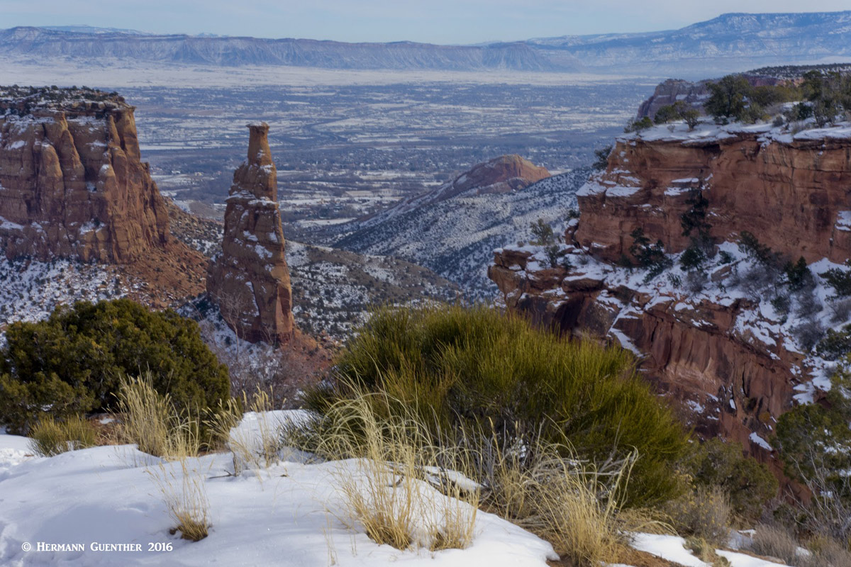
Colorado National Monument - Independence Monument (c), the Monolith Spire (r), Grand Valley
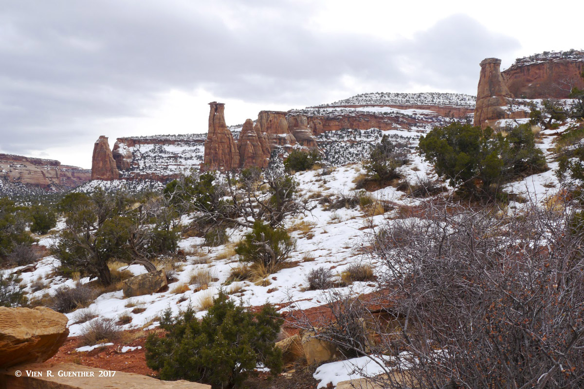
The Monument has 28 named “mountains” with Monument Mesa as the highest and Monolith Spire the most prominent. These are not mountains in the usual sense in that almost none of them can be climbed by traditional trails. Rock climbing is how to get up onto these formations, which is permitted and is a very popular activity in the park. But hikers, fear not! There are wonderful hikes with many miles of trails to be experienced here, some of which are primitive and unmaintained so that backcountry experience is advisable.
The Monument is located about ten miles west of the city of Grand Junction, or 260 miles from Denver, along Interstate Highway 70. The Monument is open year-round and there really is not a bad time to visit it. Summer can be quite hot at times, especially at the lower elevations and on the trails that meander into the canyons. Winter can be especially scenic when snow blankets the red-rock formations and highlights wonderful contrasts in color and texture. Meanwhile, spring and autumn offer perhaps the best times to visit in terms of comfortable temperatures and reliable weather. There is a campground within the park that is open year-round.
Monument Canyon - Kissing Couple (c) and Grand View Spire (r)
There are two entrances into the park – one in the north near the town of Fruita and one in the south about five miles from the center of Grand Junction. For the majority of visitors, one of these entrances will be where they start their visit. There is one road connecting these two entrances – the Rim Rock Drive. It is appropriately named since it follows the rim of canyons for 23 miles along the edge of the plateau offering many spectacular overlooks with views of all the major features down below. Most people will drive from one end to the other, stopping along the way to enjoy the fine views – both into the canyons below as well as into the far distance towards Grand Junction, the Bookcliffs and the Grand Mesa to the east.
The Colorado National Monument came into being as a result of one man’s enduring love and commitment. John Otto arrived in this wilderness in 1906 and immediately knew that this collection of monuments and canyons had to become a national park at some time. He spent five years promoting this place through newspapers and countless letters to politicians in Washington. By conducting tours to reporters, photographers, and the public, he managed to drum up enough support to get President Taft, in 1911, to proclaim this special place what it is today.
During that time, he personally lived in the Monument and used a pick and shovel to carve out the trails. In the process, he named many of the unique rock formations, some of which still bear the names he gave them, such as Independence Monument and Liberty Cap. For the first 16 years of the monument, he served as its custodian, after which he retired to California, where he died in poverty in 1952. But his legacy lives on – and we are the beneficiaries of his devotion. I hope that you enjoy exploring this splendid place as much as I do.
There are quite a few hiking trails in the Monument, some of which are quite short (0.25 miles) and suitable for anyone, while others are long (up to 8.5 miles one way) and strenuous. Some of the trails start at designated overlooks by the Rim Rock Drive, descend into the canyons below, and end at the eastern park boundary. While I have done all of the short overlook spur trails, I have not done much hiking down in the canyons. I still plan to do some of them, though it is a long drive to get there from home, with many other hiking opportunities in between. Following are some of the more popular trails to be experienced.
Canyon Rim and Window Rock Trails – These two level and easy trails provide a great introduction to the wonders of the Colorado National Monument. Starting right at the visitor center, they are best done together in a simple one-mile half-hour hike following the cliff edge to some fine viewpoints of formations such as Independence Monument, Praying Hands and the Pipe Organ. This is a good hike from which to observe the unique lifezone found throughout the Colorado Plateau at elevations from 4,500 to 6,500 feet.

Wedding Canyon - Pipe Organ and Praying Hands
Coke Ovens Trail – This one-mile round trip hike starts at the same location as the upper Monument Canyon Trail (see below), about four miles east of the visitor center on the Rim Rock Drive. It is a popular and easy hike to one of the most famous overlooks – the view toward the Coke Ovens. It should not be missed.
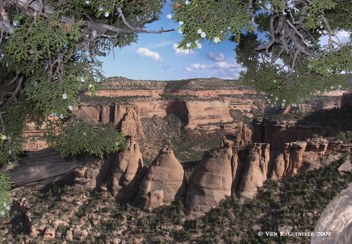
Coke Ovens
Serpents Trail – This 3.5-mile round-trip hike starts near the east entrance into the Monument. It follows what used to be part of the main road through the Monument before the Rim Rock Drive was completed in 1950. It has 16 switchbacks to its upper end at the Rim Rock Drive, 700 vertical feet higher. It is very popular with the local residents, many of whom make this an early morning workout before getting started with the rest of their daily activities.
Black Ridge Trail – This is the highest trail in the park, having three access points along the Rim Rock Drive. It has a total one-way length of 5.5 miles and affords far-reaching views west toward the Utah Canyonlands country and east across the Grand Valley towards the Grand Mesa, as well as south all the way to the San Juan Mountains. There is considerable up-and-down terrain such that a one-way hike can encompass some significant elevation gain. Parts of the trail meander outside of the Monument’s west boundary.
View across Grand Valley - Independence Monument, Bookcliffs (l and c), Grand Mesa (r)
Monument Canyon Trail – This is a magnificent trail that takes the hiker right into the midst of some of the park’s most significant rock formations including Independence Monument, the Kissing Couple, and the Coke Ovens. It has its upper trailhead at the same location as the Coke Ovens Trail (above), and its lower trailhead at the east park boundary near some housing developments. The trail is six miles long and has an elevation difference of 1,440 feet. My wife and I have hiked this trail one winter as far as the Independence Monument and enjoyed this hike immensely despite the fact that it was a very cold day.
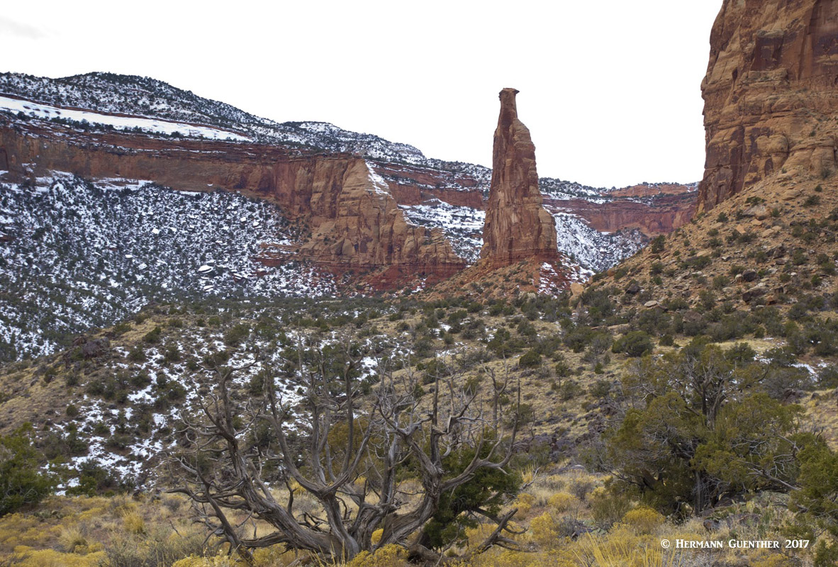
Monument Canyon Trail - Independence Monument
Liberty Cap Trail – This 7-mile one-way trail also starts in a residential area at the east park boundary and ascends to the canyon rim 1,550 vertical feet later, ending at a small parking area on the Rim Rock Drive. Along the way, the trail crosses the gently sloping Monument Mesa, the highest summit in the Colorado National Monument. A car shuttle would be beneficial unless you want to turn this into a 14-mile round-trip hike.
Ute Canyon Trail – This unmaintained 7-mile one-way trail penetrates deep into the Monument, beginning at the east park boundary and ending 1,640 vertical feet later at the Rim Rock Drive. This one is not for casual hikers since it is a primitive trail requiring some skills in route finding. It shares the first couple of miles with the Liberty Cap Trail.
Ute Canyon
Unlike so many parks and other natural attractions in the American West, the Colorado National Monument is not as isolated in terms of its proximity to a major city. Some of the National Parks and Monuments are truly “off the beaten path” such that the availability of tourist infrastructure is sparse indeed. But sitting at the doorstep of Grand Junction makes the Colorado National Monument very accessible for visitors arriving from distant places. The availability of good transportation and accommodations is not likely to deter visitors coming to this place.
The largest city in Colorado west of the Continental Divide could not be more handy for visitors to the Colorado National Monument. First of all, Grand Junction has a major regional airport that is served by most major U.S.-based airlines as well as regional operators. Train service via Amtrak is also readily available, and the city, as well as the Monument, are served by Interstate Highway 70, which passes within about three miles of the west entrance to the Monument. With a population of around 63,000 inhabitants (147,000 metro area), Grand Junction offers virtually all amenities visitors could need, including a wide range of accommodations and restaurants. There is no shortage of shopping venues either, and the city has excellent health care facilities. And, although it can get quite hot in the summer, this place has an excellent climate, making it conducive to all kinds of recreational activities. For example, the nearby Grand Mesa, the largest flat-topped mountain on the planet, is a fine place for hiking as well as cross-country skiing. Nearby Mount Garfield is a challenging climb with great vistas at the top. One would do well to spend a few days here.
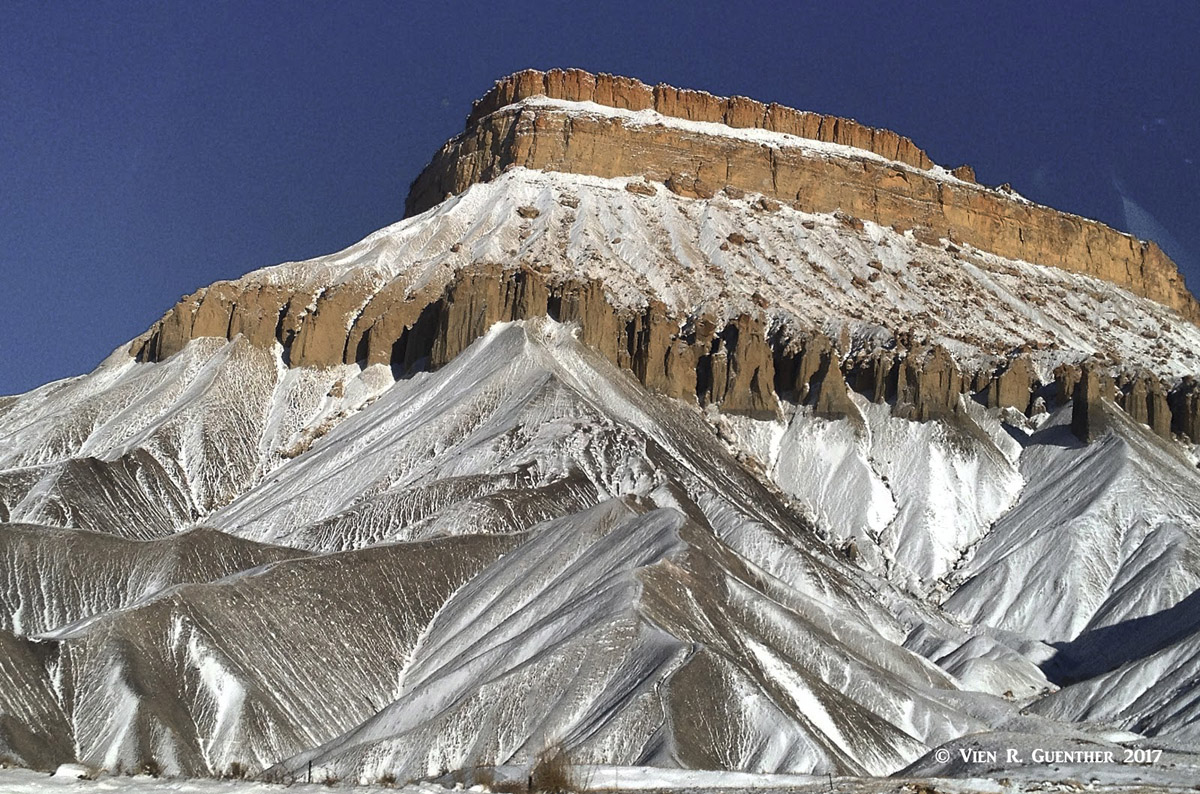
Grand Junction - Mount Garfield
This city of about 20,000 people is only 60 miles south of Grand Junction (and therefore the Colorado National Monument) and is a wonderful alternative place to use as a base for visitors to the area that want to take in a range of other attractions nearby. For one thing, the Black Canyon of the Gunnison National Park is only 15 miles away. Then there are the northern segments of the spectacular San Juan Mountains – only a 45-minute drive to a gem of a town called Ouray. Plenty of tourist amenities are available in this pleasant town. At one time a number of years ago I had actually contemplated moving to Montrose after retirement, but other more important life-changing events overruled that dream.
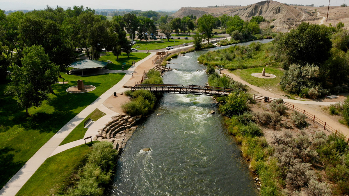
Public Park in Montrose
This small town of only around 5,000 inhabitants is 100 miles from the north entrance of the Colorado National Monument, and takes around two hours to reach, depending on which route you take. This is the shorter way to get there and takes a little more time than the longer way – but it is far more scenic. If you were impressed with the Monument, then you will be astounded with what there is to find in and near Moab – even just on the way there. This small but busy town sits at the doorstep of two of Utah’s National Parks – Arches and Canyonlands. There you will see more of what you have already seen in Colorado National Monument, but on an even grander scale. There is no shortage of places to stay and to eat in this desert town. Of course the parks there will be more crowded and less intimate than the Monument. So you have a choice. Or better yet, go and see both.
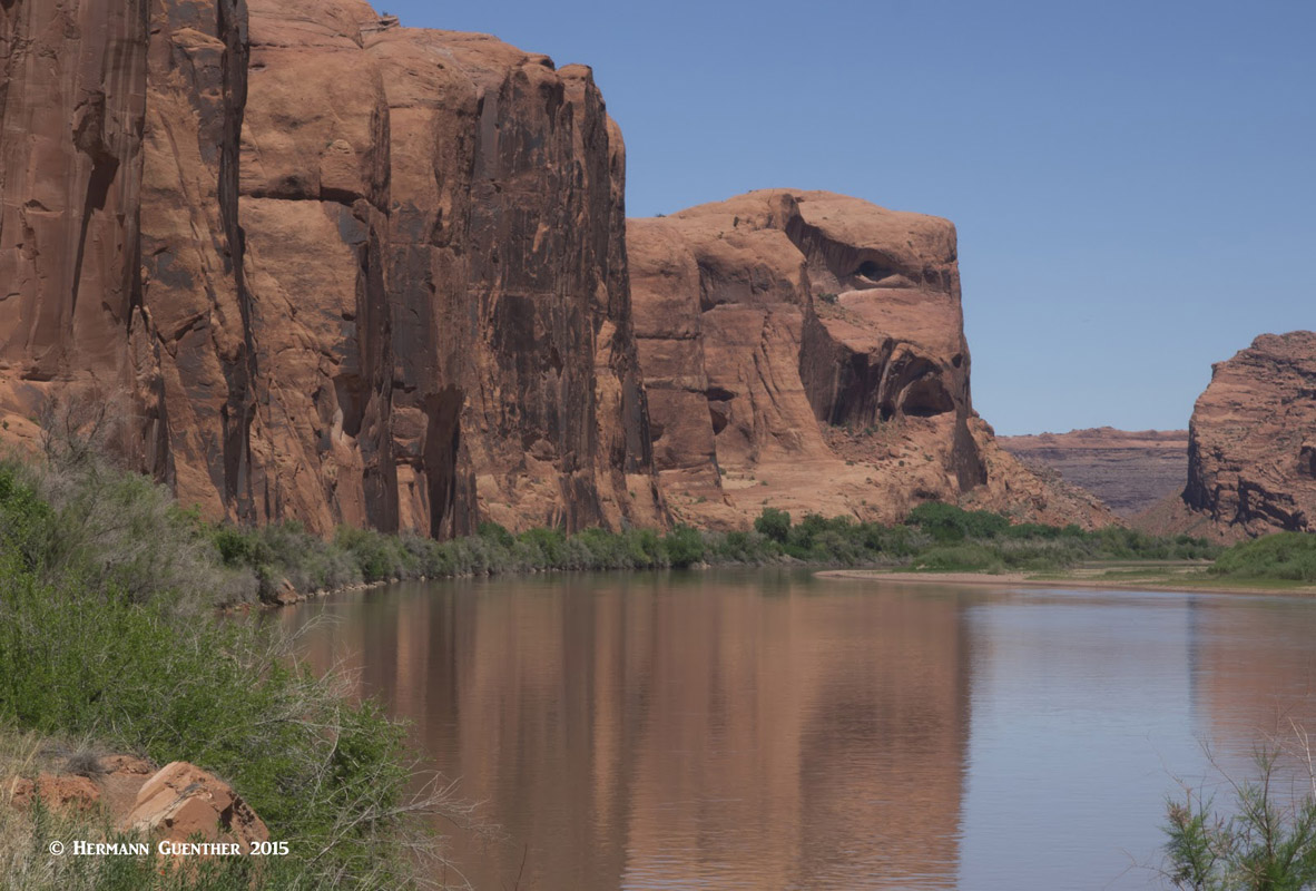
Moab, Utah - Colorado River


