
Scan the QR code and open PeakVisor on your phone
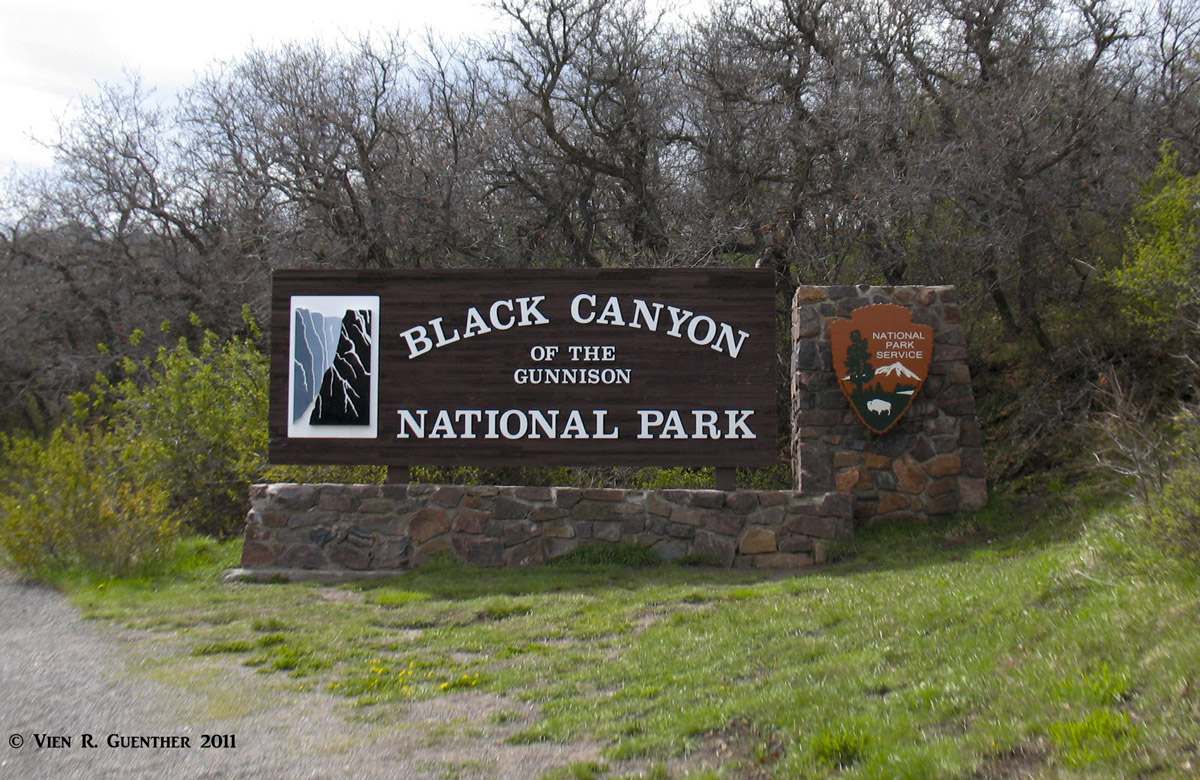
The Black Canyon of the Gunnison River is a 48-mile-long gorge in western Colorado that has a combination of attributes which make it unique among canyons of North America. A 12-mile stretch of this canyon is contained within the Black Canyon of the Gunnison National Park. This is of course the deepest and most dramatic section of the canyon. Originally established as a National Monument in 1933, it was elevated to National Park status in 1999.
While most of the terrain above the rim of the canyon are an upland plateau, there are 12 named mountains within the park boundaries, the highest and most prominent being Poison Spring Hill at an elevation of 9,042 feet. While all summits here are within the Elk Range of west-central Colorado, they are no match for the rugged high peaks with which the Elks are usually associated. The average elevation of the terrain adjacent to the north and south rims is just under 8,000 feet which means that any hikes to these summits involve minor elevation gains.
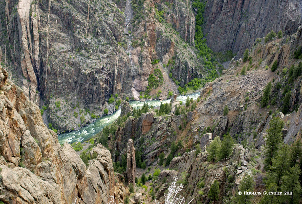
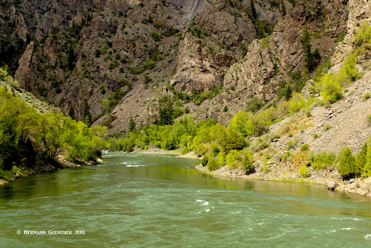
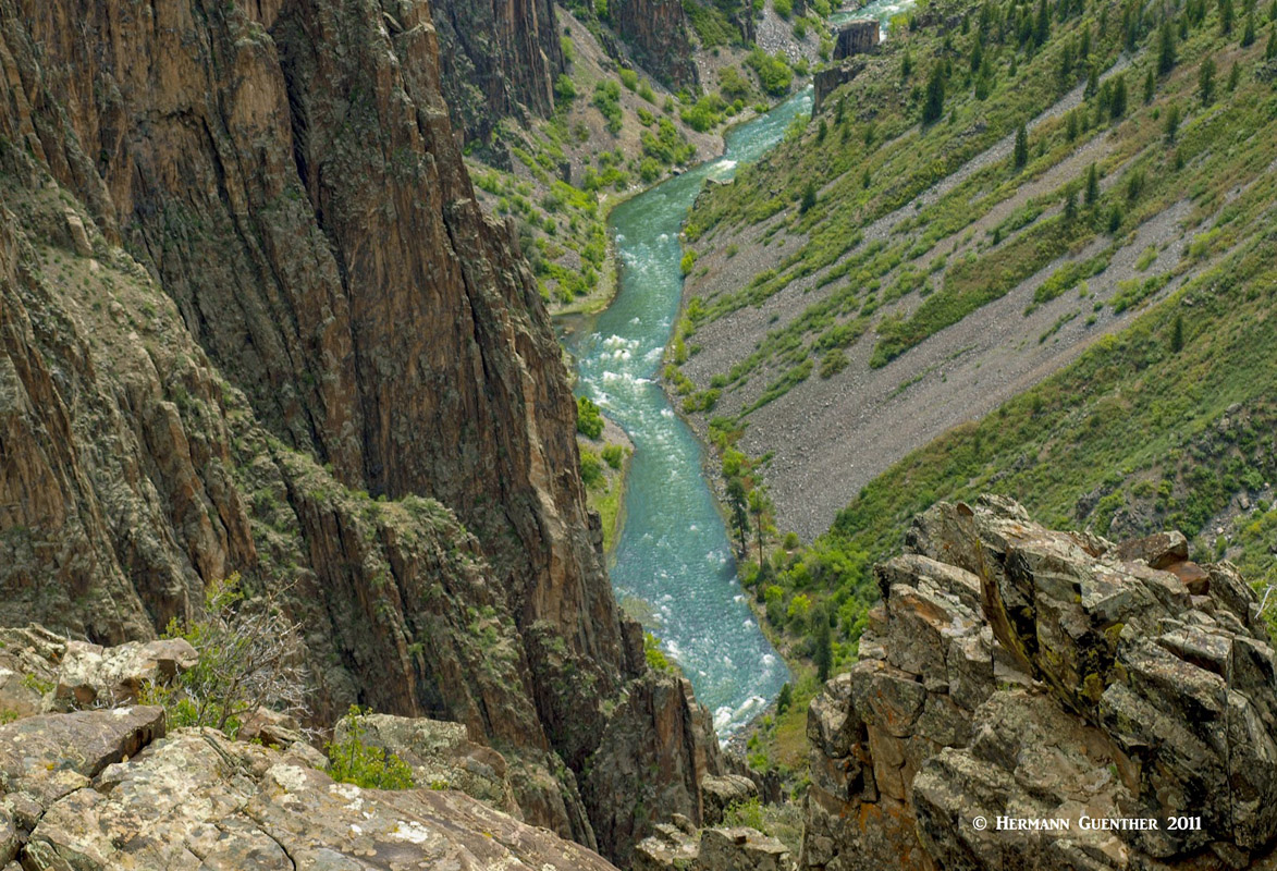
The canyon (and therefore the park) owes its name to the incredibly steep walls and the overall narrow configuration of the space between these walls. In places, the distance from rim to rim is less than one-fourth of a mile, and the width at its narrowest point is only 40 feet at the river. At Warner Point, the gorge is almost 2,800 feet deep, while the overall average depth is almost 2,000 feet. Given that the gorge is deeper than it is wide at the rims in many places, this means that there are places where it receives only 33 minutes of direct sunlight a day. Thus, with the deep shadows and darkness of the rock down there, the canyon got its name.
The Gunnison River is considered one of the steepest mountain descents in North America, averaging 34 feet per mile and a stunning 240 feet per mile within the park at Chasm View. This means that large volumes of water running at high velocities, especially before several dams were built, made the Gunnison River the primary creator of the canyon, carving its way downward over the eons of its geologic life, at rates of one inch every 100 years. That, combined with the extreme hardness of the metamorphic rock, is what resulted in such steep walls. This place must be seen to be believed.
The park is accessible from two entrances – the south entrance is about 15 miles east of the town of Montrose via U.S. Highway 50, while the north entrance can be reached via a gravel road, which is closed in winter, about 11 miles south of the town of Crawford. While both sides of the canyon can be explored from a rim road, it is the south side that is most commonly visited. Yet both sides have a campground, several overlooks and trailheads. Both rim roads are closed in the winter (the south road is open as far as the visitor center at Gunnison Point however). This provides for excellent cross-country skiing.
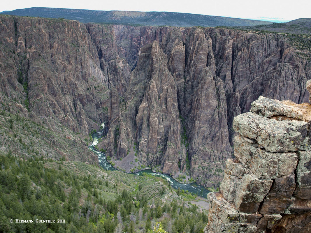
Black Canyon is the least visited National Park in Colorado and also one of the least visited of the entire National Park system. The south rim of the canyon is where most visitors will come to experience this amazing place. It is easily accessible from a major cross-state east-west highway (U.S. 50). The seven-mile rim drive features no less than a dozen overlooks, all of which afford impressive views into the depths of the canyon. Though they all have safety railings at the most prominent points, some can be vertigo-inducing for people who are afraid of heights. And then there are many places along the rim where you are on your own. It is wise to keep away from the edge at all times, it can be crumbly and give way underfoot. No second chance here.
There are a number of mesa-top trails on both sides of the canyon which can be enjoyed by almost anyone. Some of them just go to the overlooks and others loop around in the vicinity of the visitor center. Some are nature trails with interpretive signs along the way. Vegetation is sparse and fragile in this arid environment. Then there are trails (actually just routes) that can take hikers down to the river from both rims. These are extremely steep, unmarked and very strenuous. They are only for highly experienced hikers. Climbing the walls of the canyon is obviously best left to expert climbers. The walls in this canyon are dangerous, and rescue (or recovery) is difficult and even impossible in certain situations.
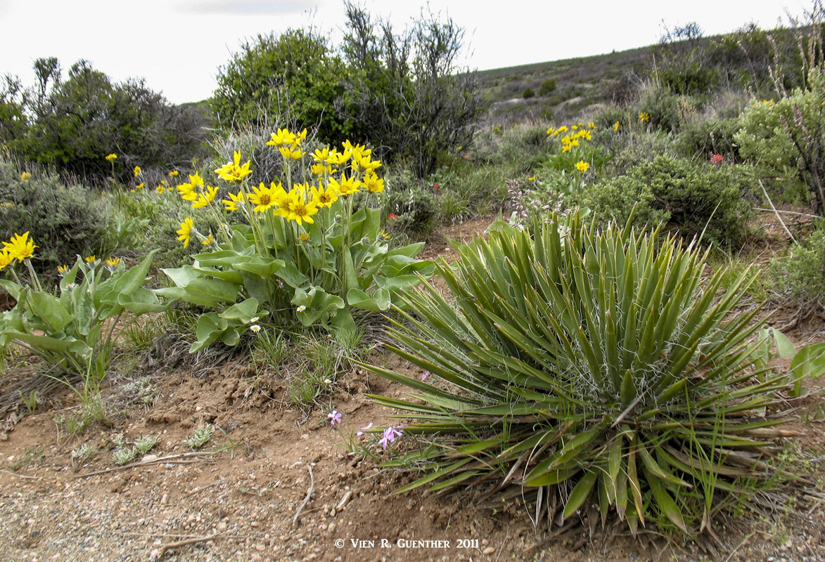
Flora on the Canyon Rim
It is possible for park visitors to get close to the river as well. Near the south entrance to the park is what is called the East Portal Road. This road is very steep (16% grades) and full of twists and sharp turns, so it is restricted to vehicles less than 22 feet long. There is a campground at the bottom, but don’t even think about hauling your 35-foot RV down there. This one is for tent camping only. This is a good place to go fishing, but here the river is designated as Gold Medal Water and Wild Trout Water, such that special regulations apply. Needless to say, this road is closed in the winter.
For those wanting an adrenaline rush, kayaking through the canyon in the park is possible but only for the most experienced and well-equipped kayakers. The rapids within the park are considered Class V and some sections are unrunnable, thus requiring long, difficult and dangerous portages. Even some of the most experienced and respected kayakers have lost their lives in this river, where hydraulics can make self-rescue or rescue by other means impossible. Rafting is not possible in the canyon. A word to the wise should be sufficient.
The many overlooks in Black Canyon of the Gunnison National Park are truly worth stopping to see if you are driving the north or south rim road. I have stopped at all of them (on the south rim) and none of them involve hiking more than a few hundred feet from the car. One of these is truly remarkable – the Painted Wall Overlook, which can also be reached from the 2/3-mile round trip Cedar Point Nature Trail. The Painted Wall is the tallest sheer cliff in Colorado, rising 2,250 feet from the river. It ranks as the third tallest wall in the lower 48 states after El Capitan in Yosemite National Park and Notch Peak in remote western Utah. It can be climbed…
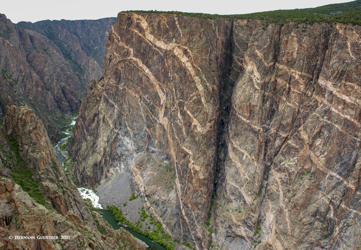
Painted Wall
There are more benign adventures to be had in this magnificent park. Following are some fine trails to be found, which are for the most part easily done by most reasonably fit hikers. Exceptions are the routes down to the Gunnison River. Keep in mind that, should you be at the visitor center and decide to do a hike on the north rim, you will have a long drive to just get to the trailhead – at least two hours. There is no bridge across the canyon.
Oak Flat Loop Trail - The two-mile Oak Flat Loop offers variety to the hiker who would like to explore below the rim without taking on the challenge of hiking to the river. The trail is narrow in places and traverses some steep slopes. It begins near the visitor center and follows for a short distance the Gunnison River access route before it branches left into the actual loop. The trail meanders through a thicket of oak scrub passing near a rock outcrop, a pleasant location where you can relax and enjoy the view. The trail then heads west where it begins its ascent back up to the rim. On the return leg one finds another unmarked overlook offering spectacular views downstream. Despite being only two miles long, the trail is considered moderately difficult.
Warner Point Nature Trail – This 1.5-mile out-and-back trail leads west from the end of the south rim road. This easy trail affords some fine views of the San Juan Mountains as well as the West Elk Mountains. The difficult Warner Route to the Gunnison River branches off this trail just before it reaches Warner Point. That one is not for casual hikers.
Warner Route – This 4.2-mile roundtrip primitive trail down to the river follows the Warner Point Nature Trail for the first seven tenths of a mile before it dives steeply downhill. Total elevation gain, including some ups and downs along the top portion, is over 3,000 feet. This strenuous hike should only be attempted by highly experienced hikers that have basic route-finding skills and are prepared for self-rescue. As with all routes below the rim, it is strongly advised that hikers come prepared with long sleeves and pants as well as hiking boots. Poison Ivy is endemic here and can almost not be avoided.
As has already been pointed out, the north rim of the canyon is not as easily accessible as the south. There are no major amenities or a visitor center here. This is where most of the highest elevations in the park can be found. It is noted here that the highest point in the park, Poison Spring Hill, while within the park boundaries, is located on private property. There is no official trail to this summit.
Dead Horse Trail – This moderate 5.3-mile out-and-back trail begins near the east end of the north rim road. It offers some good views of Deadhorse Gulch and of the East Portal area on the Gunnison River. It’s a great place to observe birds. Total combined elevation gain is only about 700 feet.
North Vista Trail – This moderately difficult trail begins at the North Rim Ranger Station and offers a shorter hike that only takes in the three-mile round trip to Exclamation Point, which affords some of the best inner-canyon views. But it is the longer seven-mile round trip to Green Mountain, the second most prominent and fourth highest peak in the park, that rewards the hiker with some fantastic panoramic vistas. In addition to unobstructed views of the San Juan Mountains, the West Elks, the Grand Mesa and the Uncompahgre Plateau, you will get an aerial perspective of the Black Canyon. This one is really worth seeking out if you can take the extra time to get to the trailhead.
Black Canyon of the Gunnison National Park is about 250 miles southwest of Denver, thus ruling out this metropolis as a viable place from which to explore this wonderful park. But there are some major towns within striking distance of the park that can offer visitors the necessary amenities they might be looking for, some to a greater extent than others. Good year-round highways are here to offer easy access to at least the south rim of the canyon, while more limited roads can provide at least seasonal access to the north rim. Let’s have a look at some of the options.
With a population of just under 20,000 and located just 15 miles from the south entrance into Black Canyon National Park, Montrose is the obvious choice for visitors who want to stage themselves for a day or more just a short drive from the park. This town is ideally positioned for adventure throughout much of western Colorado. Here visitors will have a wide assortment of accommodations for a range of budgets, though not much in the way of high-end lodgings or resorts. Plenty of shopping and eating establishments are not a problem here, and the city even has a regional airport with scheduled airline service, though it is not a major hub. An added benefit of Montrose is that it is equally handy for exploring the northern ranges of the San Juan Mountains.
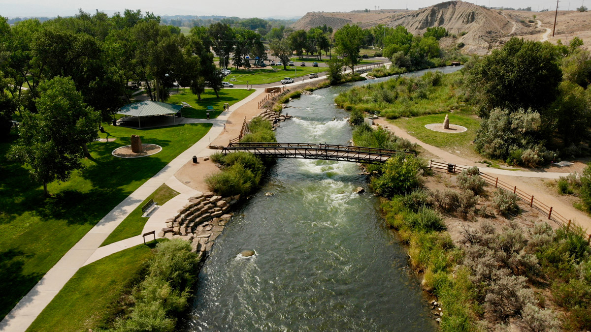
Public Park in Montrose
This very pleasant high-country city, with a population of around 6,500, is only about sixty miles east of the south entrance of Black Canyon National Park. And it is a very scenic drive of just over one hour, as long as you don’t make countless photo stops along the way. The town is conveniently situated at the south edge of the Elk Range, thus making it ideal for exploring much of south central Colorado. In addition to a regional airport with scheduled airline service, Gunnison has a full range of accommodations, restaurants and shopping venues. I have been in Gunnison many times and find it a very livable town – except in winter when it is often the coldest place in the state. But if you want to explore more than just the Black Canyon, you would be well advised to consider making this town your base.
Here is the biggest city west of the Front Range. Located at the confluence of the Gunnison River and the Colorado River, Grand Junction is only 72 miles northwest of the south entrance to Black Canyon National Park, less than a 90-minute drive. It may not be quite where a visitor would base himself or herself for visiting the park, but the fact that it has a major airport makes Grand Junction a very good alternative to Denver for visitors flying in from distant places. Of course, this city of 63,000 inhabitants (147,000 metro area) affords all kinds of amenities, so visitors will not be left wanting. It affords plenty of handy recreational opportunities itself, such as the Grand Mesa – the largest flat-topped mountain on the planet, with an average elevation of about 11,000 feet. The famous Bookcliffs right at the edge of town, anchored by the impressive Mount Garfield, present an iconic view in this city. One could do worse than staying here for a few days.
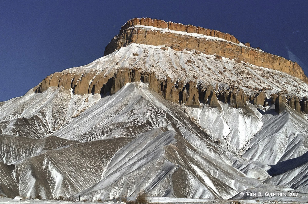
Grand Junction - Mount Garfield
If you want a little more glitz and glamour, head to the lovely town of Ouray, 48 miles south of the south entrance to Black Canyon National Park. This pretty town and its surroundings are affectionately called the "Switzerland of America" - and for good reason. The scenery from and of the town is simply stunning. Despite its population of just over 1,000 permanent residents, Ouray offers a considerable selection of accommodations and dining options. Aside from being a hiking and climbing mecca, Ouray is famous for its many hot springs, five of which are developed for the tourist trade. On the opposite end of the spectrum, there is an ice climbing park right within the town limits. So there is simply no excuse for not finding something exciting to do in this awesome little gem in the San Juan Mountains.
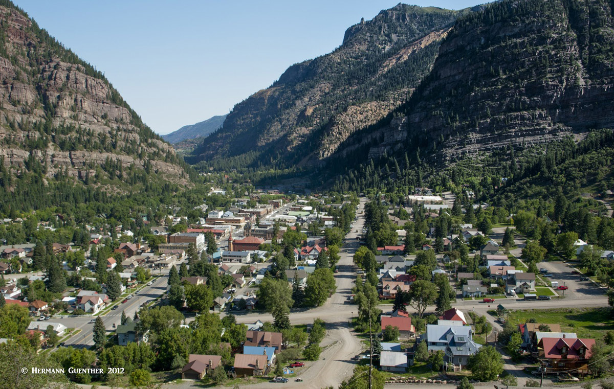
Ouray


