Scan the QR code and open PeakVisor on your phone
The Uncompahgre National Forest (UNF) in southwestern Colorado is generally recognized as having two distinct divisions. There is the Mountain Division comprising the eastern half, and the Plateau Division at the western side, which extends northwesterly almost to Grand Junction. These two divisions are highly representative of the type of terrain that makes up each division. The Mountain Division obviously encompasses plenty of mountains – the northern half of the immense San Juan Mountains. Meanwhile, the Plateau Division encompasses the arid Uncompahgre Plateau. Together, these segments cover 955,229 acres or 1,493 square miles. The forest contains all or parts of three alpine wilderness areas – Uncompahgre, Mount Sneffels and Lizard Head. There are no wilderness areas in the Plateau Division of the UNF.
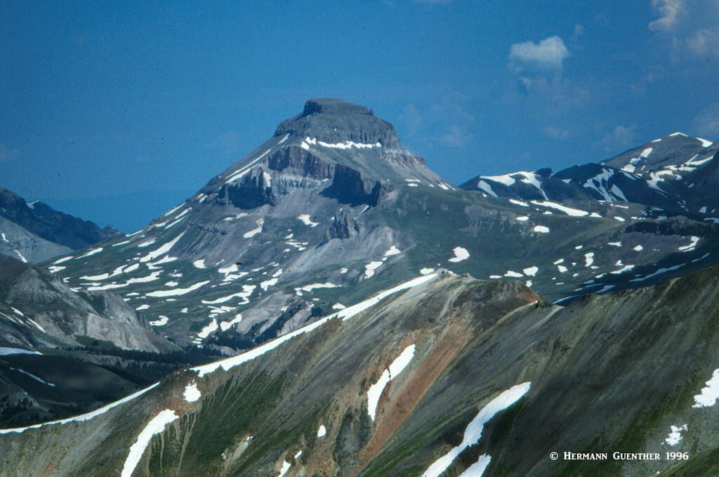
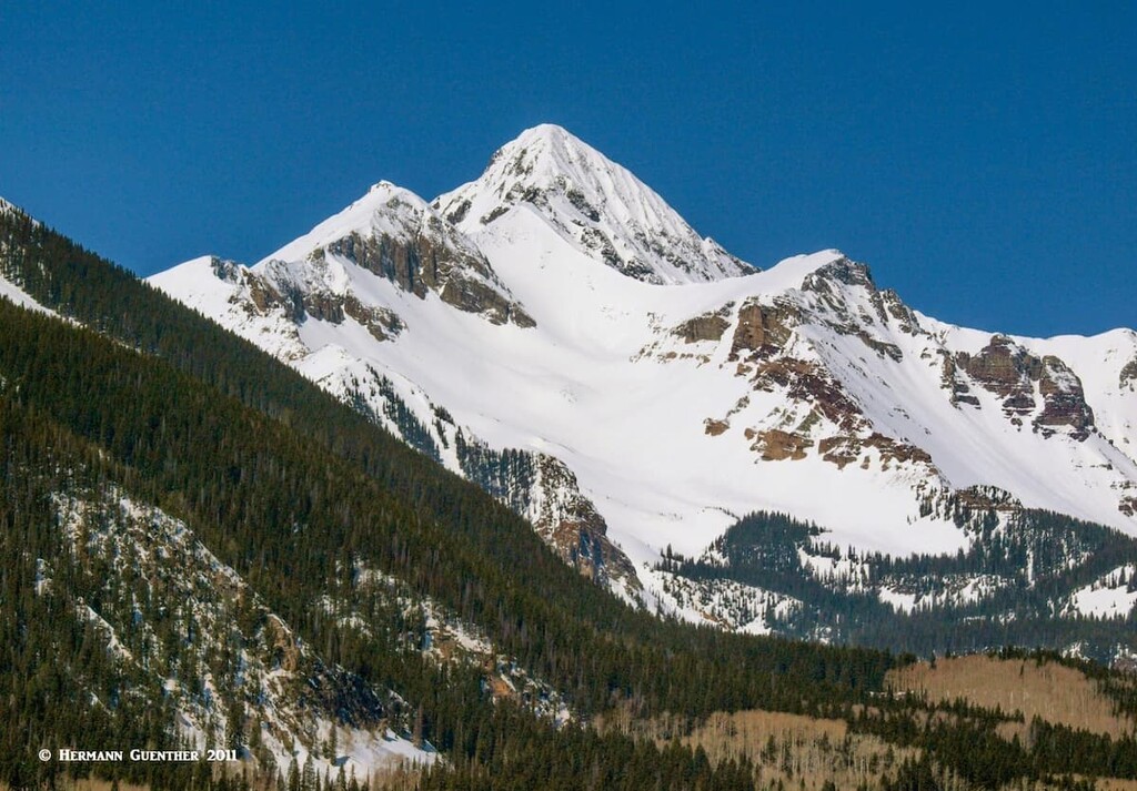
There are 133 named mountains in the Uncompahgre National Forest, the highest and most prominent being Uncompahgre Peak, the fifth-highest mountain in Colorado as well as in the entire Rocky Mountains of North America. The UNF also includes three additional fourteeners – Wetterhorn Peak, Mount Sneffels and Wilson Peak – each of which is located in one of the three wilderness areas. While there are a number of named mountains in the Plateau Division of the forest, all of them are at elevations below 10,000 feet – still high by some standards, but not of the magnitude of those mountains in the Mountain Division of the forest. Since we at PeakVisor are a hiking website and app, we will concentrate here on the peaks and trails of the Mountain Division.
The Uncompahgre National Forest was established on June 14, 1905. While a separate national forest, it is jointly administered with the Grand Mesa and Gunnison National Forests from the supervisor’s office in the town of Delta. The combined forests are further managed from five ranger district offices. The UNF lies in parts of eight counties of western Colorado – Montrose, Mesa, San Miguel, Ouray, Gunnison, Hinsdale, San Juan and Delta. Much of the area within and around this forest is sparsely inhabited, it enjoys a varied climate depending on which division, and it is crossed by only a couple of highways.
Thanks to the imposing San Juan Mountains with their wilderness areas, the UNF does not go unnoticed by visitors and locals alike. While the Plateau Division is more likely to attract jeepers and off-road vehicle enthusiasts, the Mountain Division is where hikers, bikers, fishermen and tourists simply driving the scenic roads will congregate. There are two scenic byways (parts of the Colorado Scenic and Historic Byway System) crossing parts of the forest – the San Juan Skyway as well as the Alpine Loop. While the Skyway is a 233-mile loop all on paved highways, the Alpine Loop is almost entirely on gravel roads and driving the entire loop requires a high-clearance 4-wheel drive vehicle. The latter takes the visitor over high mountain passes and tundra, and encounters several ghost towns along the way.
The only U.S. highway is US-550, which is part of the San Juan Skyway. The 82-mile stretch from Ridgway in the north to Durango in the south is unquestionably one of the finest drives in Colorado, much of it within UNF boundaries. A 25-mile segment of this road from Ouray to Silverton is known as the Million Dollar Highway. This travels through the deep Uncompahgre Gorge to the summit of Red Mountain Pass. This is a challenging and potentially dangerous road to drive, with many hairpin curves, narrow lanes and serious drop-offs into the gorge. A lack of guardrails adds to the excitement, especially for those drivers going south, since they are always perched on the outside edge of the road. White-knuckle drivers might want to avoid this road; winter snowstorms, which often cause the road to be closed, may further induce some visitors to find someplace else to drive.
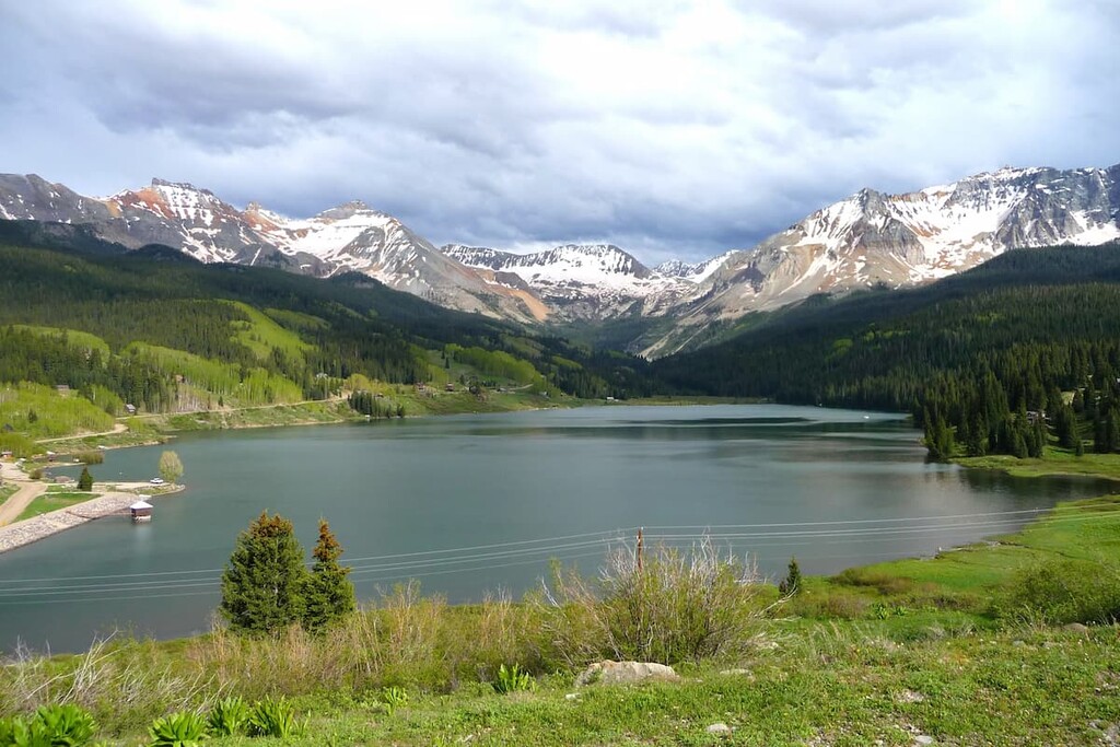
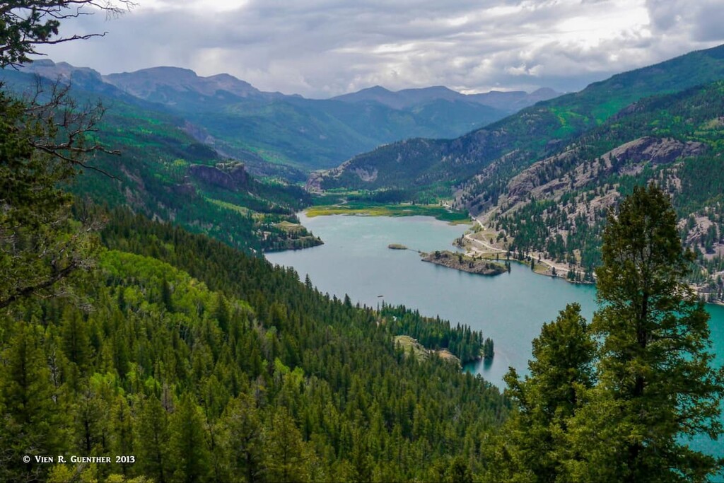
If water sports are what you are looking for, you can find those in the forest as well. There are several streams and rivers that provide fine fly fishing. The San Miguel River near Telluride and the Dolores River south of Lizard Head Pass provide anglers with plenty to keep them occupied. There are many small lakes and ponds, many that can only be reached on foot or horseback. Larger lakes include Trout Lake near the summit of Lizard Head Pass, about 30 minutes from Telluride. This is a natural lake that was increased in size by the construction of a dam in 1894 for the purpose of generating hydro-electric power. It has become a venue for fishing and boating. The Silver Jack Reservoir on the East Fork of the Cimarron River is the center of a recreation area that offers camping, picnic areas, boating (manually-powered craft only), fishing and hiking trails. This one is open year-round but cannot be reached by car in the winter - snowmobiles, cross-country skis or snowshoes only.
Finally, if you are here in the winter and skiing is your favorite activity – why not ski at one of Colorado’s most loved ski resorts. Telluride leaves nothing to be desired. With plenty of lifts and challenging terrain, surrounded by spectacular terrain, Telluride maintains an “old west” flavor and is far removed from the more glitzy resorts in the central mountains of Colorado. You can even fly here in your own plane. Don’t have your own plane? Telluride has the highest airport in the United States offering scheduled passenger flights.
Since the Uncompahgre National Forest has three magnificent wilderness areas (one shared with another national forest), that fact alone leads to some extraordinary hiking and climbing possibilities. But there are also other areas in the forest that deserve at least some recognition if not close attention. We’ll visit a few of these now, but be prepared to deal with a daunting task – making up your mind where to begin.
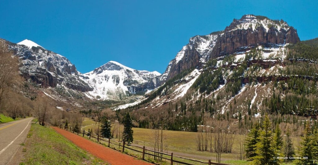
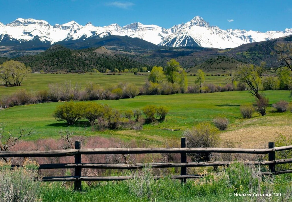
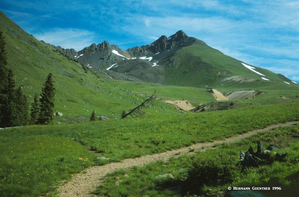
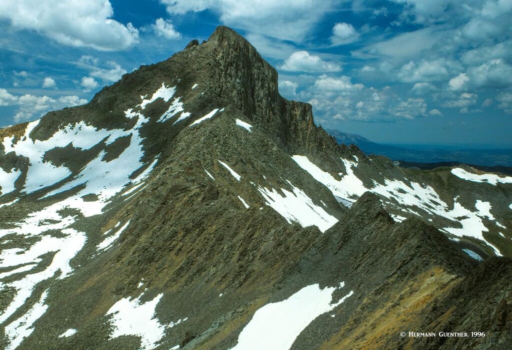
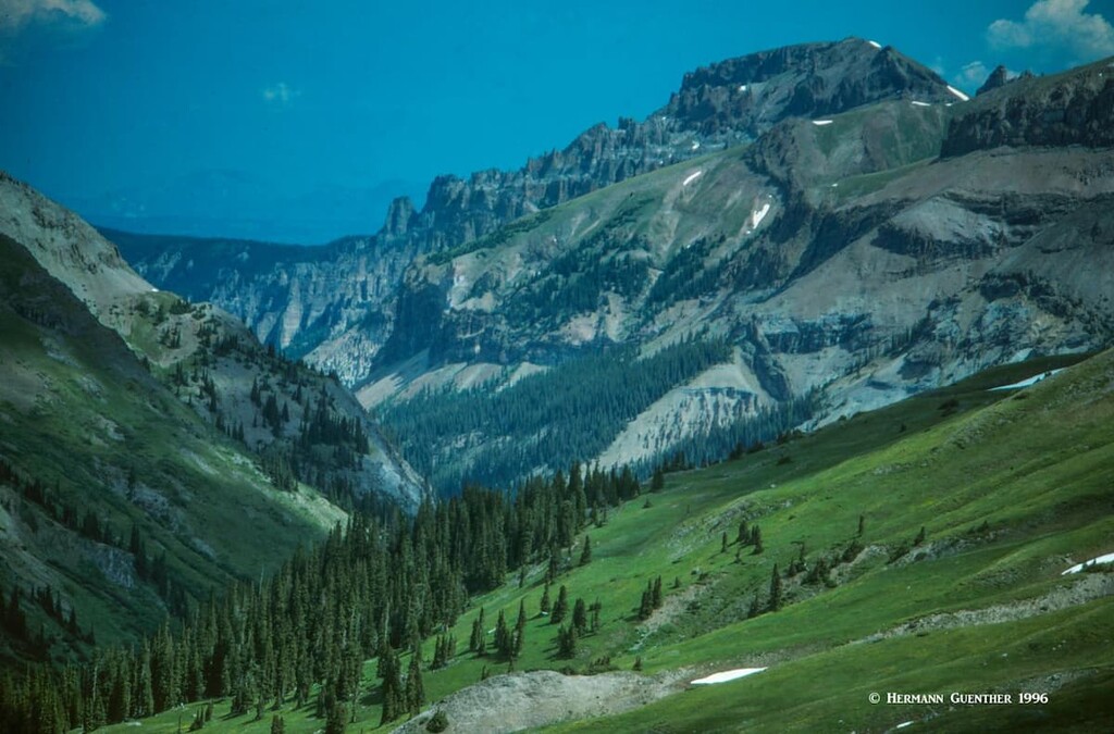
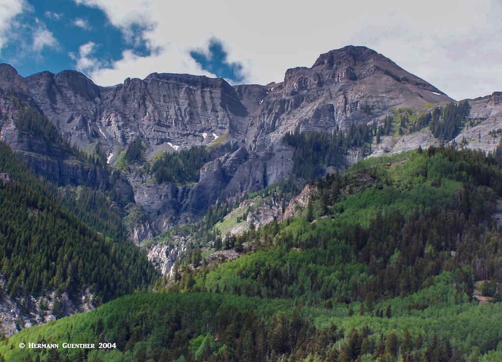
This rugged and beautiful wilderness at the northern end of the San Juan Mountains might be small but it is massive in terms of the kind of terrain it presents to the visitor and hiker alike. When driving on State Highway 62 along its northern fringe you will immediately understand why it is so special. This place along the highway is known as the Dallas Divide and the views toward the seemingly impenetrable wall of rock and ice is stunning – as well as one of the most photographed scenes in Colorado, especially in autumn. With the exception of Mount Sneffels, most of the mountains in this wilderness are rarely climbed – they are difficult, there are no maintained trails and they can be dangerous. Let’s have a look at some hiking places you can find there.
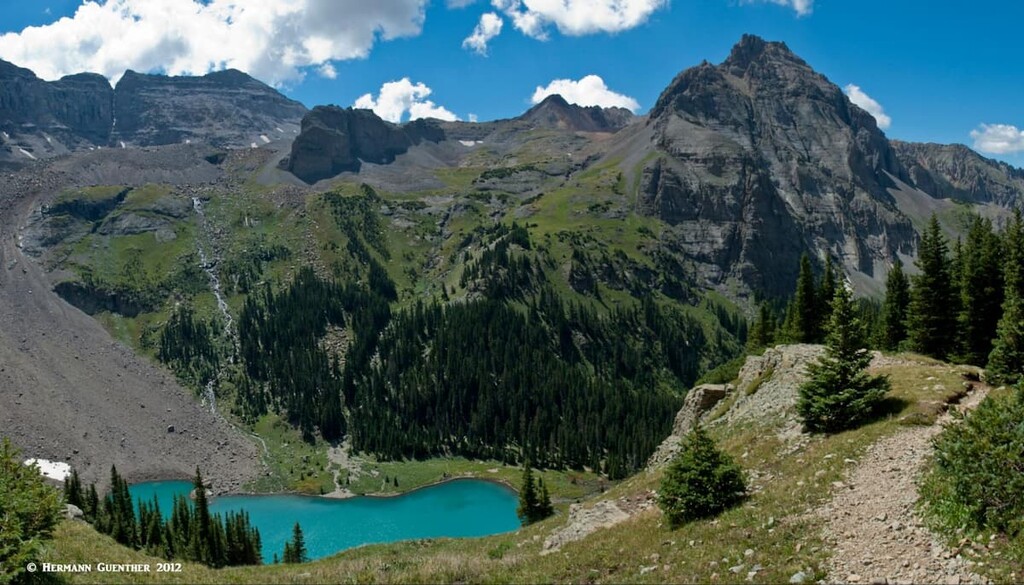
Blue Lakes Trailhead – Let’s start by pointing out that there are many lakes called “Blue” in Colorado – how many, I have no idea, since even I have been to many and I know there are many more. But the trail that starts here will take you to what I think is the single most beautiful place to go hiking in this state. This trailhead is about nine miles south of SH-62 along County Road 7, which can be driven in most passenger cars during the summer months. This trail takes you to three lakes – Lower, Middle and Upper Blue Lakes. Most hikers just go to the first lake, which is itself already a magic spot. But going to the other two makes this hike truly special – the views just get progressively better. The total round-trip hike is about nine miles. Many hikers camp at the lower lake and use that as a base for climbing Mount Sneffels.
Dallas Creek Trailhead – From the same parking area on CR-7 you can find the Dallas Trailhead. Though this trail will not take you into the wilderness, it will take you into the immense Blaine Basin on the north and east slopes of Mount Sneffels. This place sees few hikers, especially as compared to the Blue Lakes basin which can obviously get quite crowded. I don’t recall seeing any other hikers when I went there. Most likely, the only people you will see here are those who want to take a different approach to climbing Mount Sneffels. This might not be designated wilderness, but you may find it a lot more wild than the Blue Lakes basin. This is really worth doing if you want to see some amazingly rugged terrain first-hand.
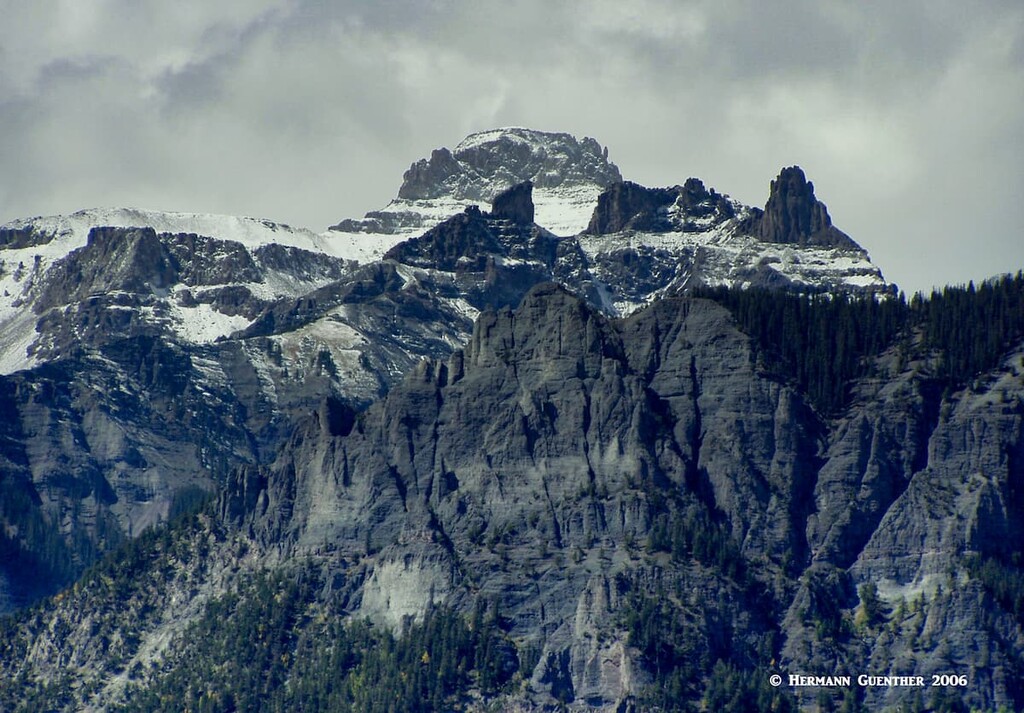
The Uncompahgre Wilderness encompasses the northernmost reaches of the San Juan Mountains. It is also home to the highest mountain in the range and the fifth-highest in Colorado and the entire Rocky Mountains of North America. Uncompahgre Peak, along with its nearby neighbor, Wetterhorn Peak (named after a mountain in Switzerland) are prime targets for hikers and climbers. While the southern part of the wilderness, where the most popular hikes are to be found, is easily reached from Lake City, the northern part is far more remote and involves much longer approaches to the popular hiking areas.
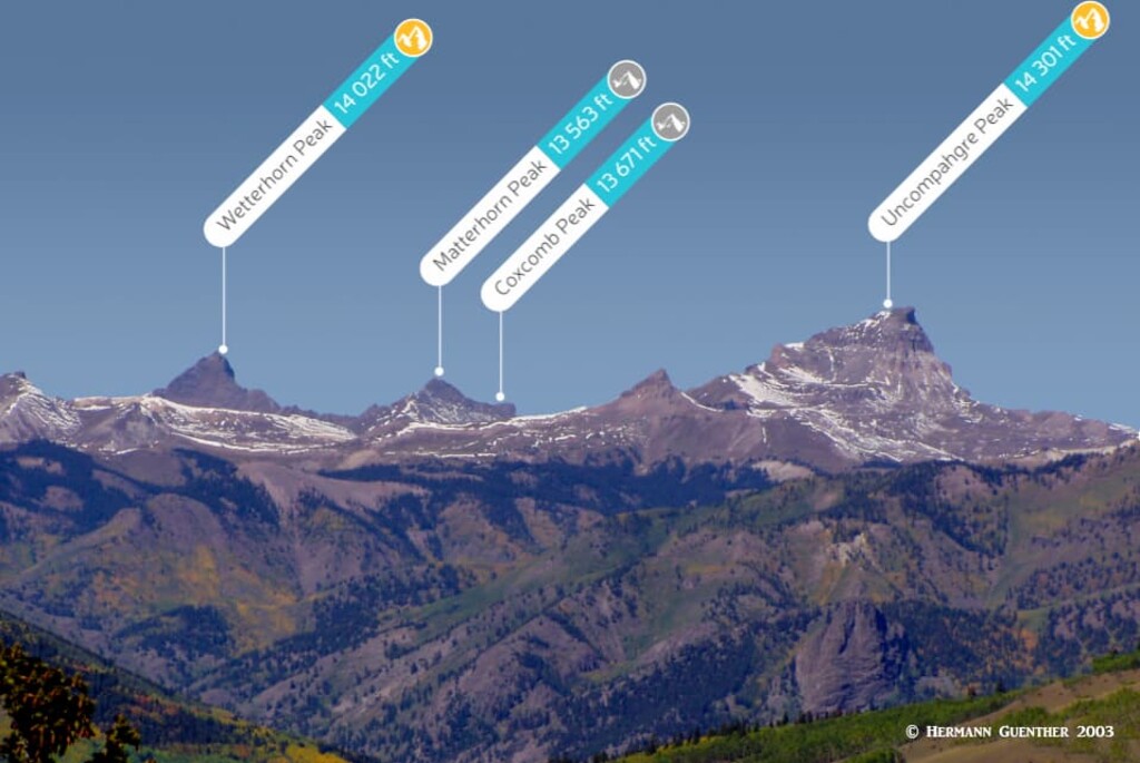
Nellie Creek Trailhead - If you are going to climb Uncompahgre Peak, this is most likely where you will begin your hike. The trailhead is nine miles from the center of Lake City, but the last four miles along the Nellie Creek Road are only suitable for 4WD vehicles. So if you rely only on a normal passenger car, you will have a long 15.4-mile round trip hike. From the actual trailhead, the total hike to the summit and back is 7.6 miles. This is the easiest route to the top and involves only 2,900 feet of elevation gain. From here it is also possible to combine your hike with Wetterhorn Peak, but be prepared for a very long 16-mile day.
Matterhorn Creek Trailhead - OK, let’s make something very clear – this is not the Matterhorn that you see on the packaging of certain Swiss chocolates. But this trailhead does give you climbing access to both fourteeners in the wilderness as well as to the less-than-formidable Matterhorn Peak of the Colorado “alps”. From here you will find the easiest route to Wetterhorn Peak, about seven to eight miles round trip via the southeast ridge. It is considered a Class 3 climb, with some exposure in the upper reaches.
This trailhead also offers the option to climb Uncompahgre Peak by its southwest slopes, but that involves a round trip of 13 to 14 miles with an elevation gain of up to 4,300 feet. And, as long as you are here, you can also take in a quick ascent of 13,563-foot Matterhorn Peak – after which you can impress your friends with your accomplishment. When you get to the open meadows at the pass between Uncompahgre and Matterhorn, the ascent of the latter is a short hike across a steep meadow followed by a Class 3 scramble to the summit. That was the extent of my “Matterhorn” experience, although I have hiked on the lower slopes of the real one (which is only a thousand feet higher but significantly more complex).
East/Middle Fork Cimarron River Trailheads – If you prefer to explore the more remote and less trafficked northern segment of this fine wilderness, you will be faced with much longer hikes but perhaps more of a wilderness feeling. Here you will find two trailheads that are involved in a long 14-mile loop – if you do a car shuttle between the two trailheads. If not, you will have to walk an additional five miles between the trailheads along a gravel forest road. The hike will take you into the headwaters of the Cimarron River as well as to the bases of both Wetterhorn and Uncompahgre Peaks. If you have plenty of time, this is clearly an alternative approach to both peaks, either of which can then be reached via the traditional trails from the pass below Matterhorn Peak (the same trails that start at the Matterhorn Creek Trailhead). Needless to say, if you choose to climb one or both, you will add a lot more miles to the original 14 miles.
A note about winter excursions in the wilderness: This wilderness is not considered suitable for skiing, although the temptation to do a traverse of the long northern valleys might be strong. The steepness of the terrain and remote access in the winter make the potential for avalanches severe, and rescue can be far away both in terms of time and distance.
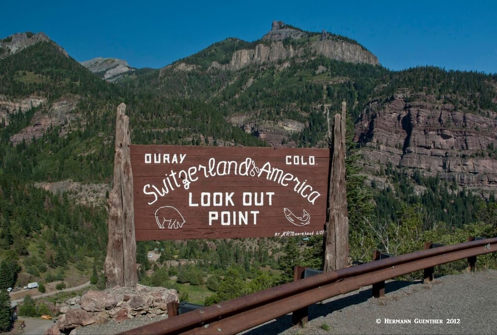
The area around the charming little town of Ouray has for years been affectionately called “The Switzerland of America”. This is obviously because of the grandeur of the mountains and not the man-made environment. The town is laid out on a rectangular grid pattern so typical of much of the western United States, something that is much less common in the Alps. But just like Switzerland, this place offers some stunning hiking opportunities, with the exception that here you cannot get on a cable car to take you up. You have to rely on your legs for that.
Portland Amphitheater Trailhead – I simply love hiking in Ouray – plain and simple. This trailhead is located near the Amphitheater Campground at the eastern edge of the town and offers you a choice of interesting hikes varying from five to eight miles in length. I particularly like the 8-mile round-trip hike to the Chief Ouray Mine high above the town. It takes the visitor through a spectacular basin involving 2,600 feet of elevation gain.
From the upper parts of the trail there are stunning views down to the town of Ouray and across to the high, craggy peaks of the Sneffels Range. This can be done as an out-and-back hike by going up the Portland Trail and continuing on the Chief Ouray Mine Trail. The latter has some pretty amazing switchbacks over very steep terrain. If you go to the mine, be mindful of some serious drop-offs. On the return, you can cut out about two miles by following the Cascade Falls Trail back to the trailhead. If you choose to skip the mine, you can just do a very pleasant 5-mile loop by just combining the Portland and Cascade Falls Trails.
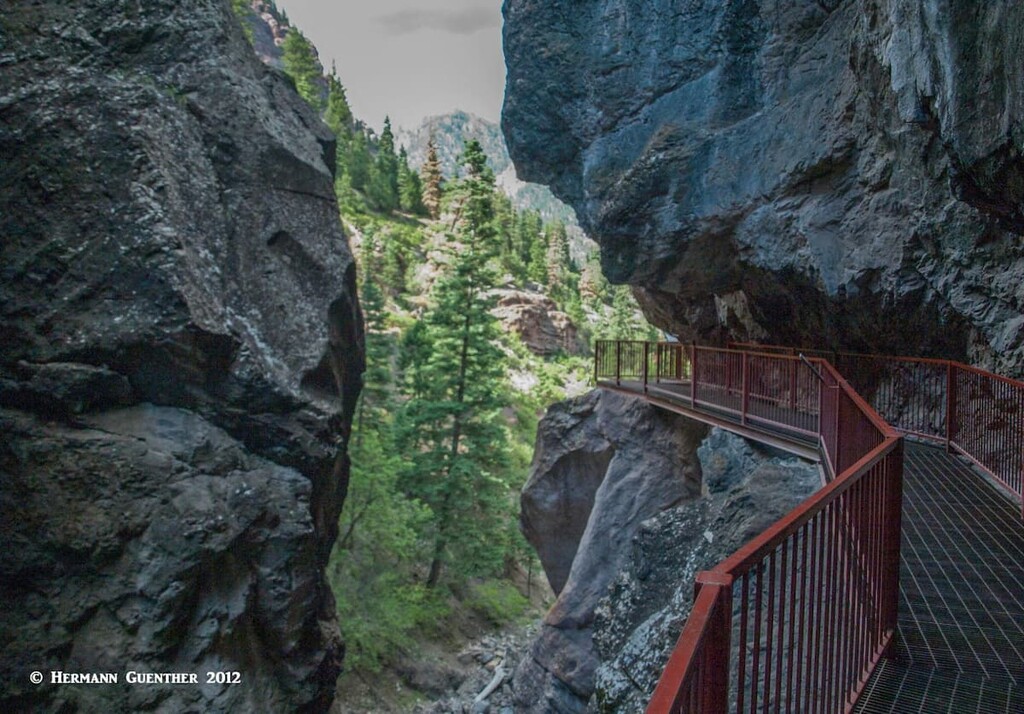
Ouray Perimeter Trail - This six-mile loop leading completely around the town of Ouray can be started at any number of locations either in or just outside the main part of the town. The visitor center at the north end of town might be a logical place to start. The entire trail involves a total elevation gain of about 1,500 feet along a series of ups and downs. The trail’s maximum elevation is 8,500 feet near where it crosses US-550. The scenery changes continuously on this hike, which makes it a pleasant way to get a feel for the town as well as the surroundings. An added benefit is that the trail provides access to the public Ice Park (and ice-climbing venue) as well as the Box Canyon Park, for entrance to which you will have to pay an admission fee. It is well worth doing. In the winter months, you would be well advised to take hiking sticks and/or spikes, since there will be lots of icy spots along the trail.
Dallas Trailhead - Just two miles north of Ouray, beside the west bank of the Uncompahgre River, is a trailhead that gives access into some little visited wild country. While the Dallas Trail continues west to another trailhead (coinciding with the Blue Lakes Trailhead) and even further west, it is possible to do a fine six-mile loop hike here by combining this trail with the Corbett Creek Trail, a hike that I did several years ago. When my friend and I did this, we saw no other hikers all day, although we saw evidence of bears. Near the upper end where the two trails join is a wonderful viewpoint from which you can get just about the best view possible of Whitehouse Mountain.
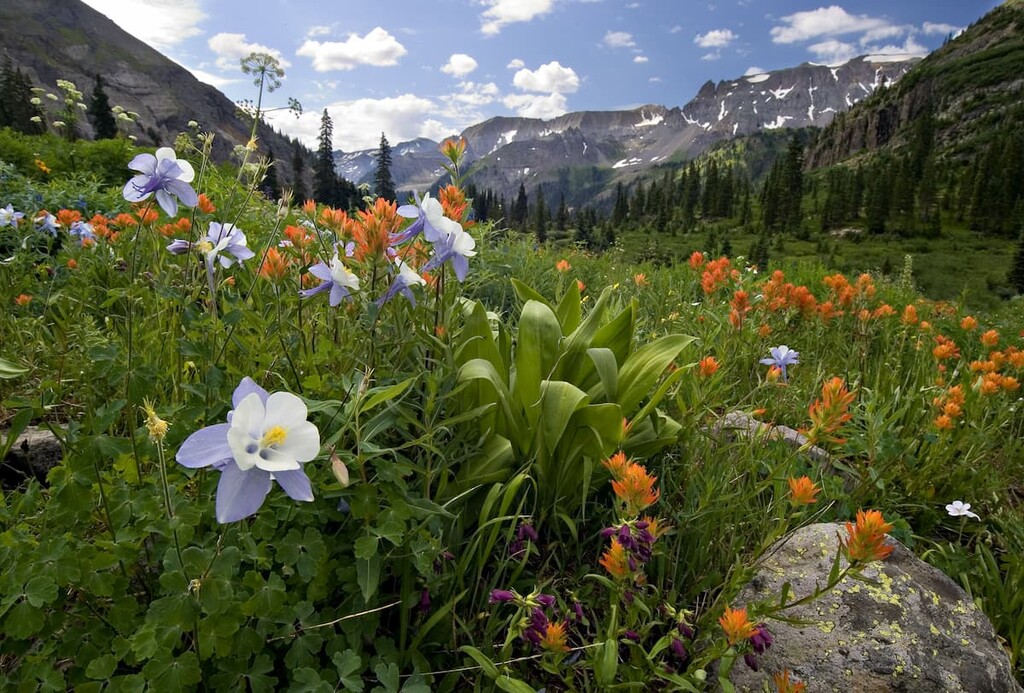
Yankee Boy Basin Trailheads - About eight miles from Ouray is Yankee Boy Basin – a wonderland of wildflowers and killer views. To get there, you need a high-clearance and 4WD vehicle. There are a number of places to park here – how far you drive depends on your vehicle and how brave you are. If you go at the right time of summer, you will not be alone since this is a popular place – both for hiking and viewing some of the most stunning wildflowers in Colorado. Here is where many will attempt to climb Mount Sneffels, the only fourteener easily accessible from Ouray County. If you drive to the highest parking area, it is only a two-mile hike to the top and back, but it is steep. But you don’t have to climb Sneffels to enjoy this area as there is a network of trails here, some of which will take you to Wrights Lake at about 12,200 feet elevation. Of course you can also go to Blue Lakes Pass and then down to the three so-named lakes. But there is a better way to get to these stunning lakes (see above).
Just to the southwest of Telluride you will find a small sub-range of the San Juan Mountains – these are the San Miguel Mountains. These mountains contain the westernmost fourteeners in Colorado, one of which is in Uncompahgre National Forest – the majestic Wilson Peak. This small chain of mountains form the backbone of the Lizard Head Wilderness, part of which is in the adjacent San Juan National Forest. Wilson Peak resides in the part of the wilderness that is in UNF. The boundary delineating the two forests also coincides with the boundary between San Miguel County in the north and Dolores County in the south. This means that the major hiking areas are reached from trailheads in either forest and county. We will only talk about those trailheads in UNF; for the others, we refer you to these links: San Juan National Forest, Lizard Head Wilderness Area, San Miguel County Mountains and San Juan Mountains.
Silver Pick Basin Trailhead - Wilson Peak is one of three fourteeners that make up the Wilson Group, which are the dominant features of the San Miguel Mountains. All three are often climbed together resulting in a tough hike to be sure. This trailhead is for those who would like to climb Wilson Peak by itself from the north side. The Rock of Ages Trail that starts here is the easiest approach to this marvelous mountain – nine miles and about 3,500 feet of elevation gain. It is considered a Class 3 ascent due to some significant exposure and some rock scrambling near the top. The trailhead can be reached via the Silver Pick Road which intersects SH-145 about six miles west of the main intersection in Telluride. The road is about eight miles long, and marginally passable for passenger cars. High-clearance vehicles would be a good idea. Wilson Peak sits at the edge of the Lizard Head Wilderness.
Sunshine Mountain East Ridge – If you are looking for solitude, great views and a little bit of adventure, look for this hike just outside of the tiny settlement of Ames about 12 miles south of Telluride on SH-145. At Ames is a very historic generating station which claims to be the world’s first to produce and transmit alternating current. Park here and then look for the Galloping Goose trail sign. From there, you are on your own and good navigating skills will greatly benefit you until you reach the ridge from where the route should become obvious. Poor markings at the lower end are sure to cause confusion, but the reward will be the views. This hike is between six and seven miles and entails an elevation gain of almost 4,000 feet. So make sure that you are adequately conditioned.
San Miguel River Trailhead – There are many hiking opportunities right from within the town of Telluride. Some, such as the San Miguel River Tail which starts from below town and goes three miles or more upstream to above the town. On the way it passes through Town Park which offers lots of other recreation activities. The upper part of the trail is definitely more scenic but all of it can be enjoyed by just about anyone, including families with children.
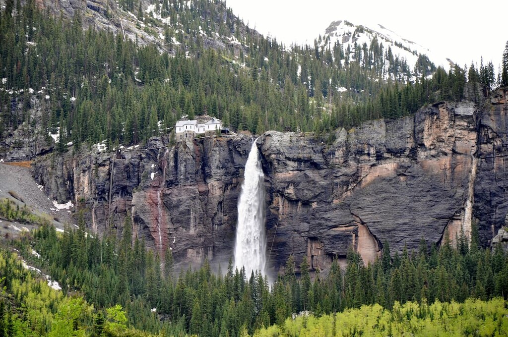
The Bridal Veil Falls Trailhead – This trail starts from near the end of the road in the community of Pandora east of town. Rated as a moderate hike of five miles round-trip with about 1,400 feet of elevation gain, this one is good any time of the year, even winter when the falls are frozen – spikes or snowshoes are needed then. Views of the town are great from up here. Just to the west of town are several trailheads that provide access into the rugged backcountry on the south side of the Sneffels Range in the Mount Sneffels Wilderness. The Deep Creek Trailhead is one way for climbers to get to Mears Peak which is virtually unclimbable from the north side. The Mill Creek Trailhead is right at the edge of town and is one place from which climbers can begin their ascent of Dallas Peak. This is rugged and remote terrain and is not frequently used except for hardy climbers who want to conquer these difficult peaks.
Lake City lies just outside the eastern boundary of the Uncompahgre National Forest. Contrary to what its name implies, this is anything but a city. It is a small town, and the seat of Hinsdale County (the smallest in Colorado, with a population of about 400). It is so named because of its proximity to nearby Lake San Cristobal, the second largest natural lake in Colorado. As with many mountain towns in the San Juans, Lake City's economic driver shifted from mining to tourism in the early years of the 20th century. Now the town attracts visitors that love to recreate in the mountains and pursue interests such as fly fishing, hiking, jeeping, nordic skiing, climbing and camping. While the town does have a few motels and restaurants, there are a number of cabin and cottage developments as well as campgrounds, which appear to be the preference of visitors planning to stay more than a few days. This wonderful town is not about luxury - it is for people who come here to truly enjoy the pleasures that the mountain environment has to offer. The main trailheads for the two dominant fourteeners (Uncompahgre and Wetterhorn Peaks) in the Uncompahgre National Forest are just minutes from the center of town.
With a population of just under 20,000, Montrose is the largest town in southwest Colorado. While it is not in the Uncompahgre National Forest, it is handy to much of it, especially to the Plateau Division of the forest. It is also a convenient place to make a base for exploring the northern part of the Mountain Division of the UNF, specifically the northern remote parts of the Uncompahgre Wilderness. This town is ideally positioned for adventure throughout much of western Colorado. Here visitors will have a wide assortment of accommodations for a range of budgets, though not much in the way of high-end lodgings or resorts. Plenty of shopping and eating establishments are not a problem here, and the city even has a regional airport with scheduled airline service, though it is not a major hub. But for those visitors who might prefer a larger town than the others mentioned here, Montrose is a great choice.
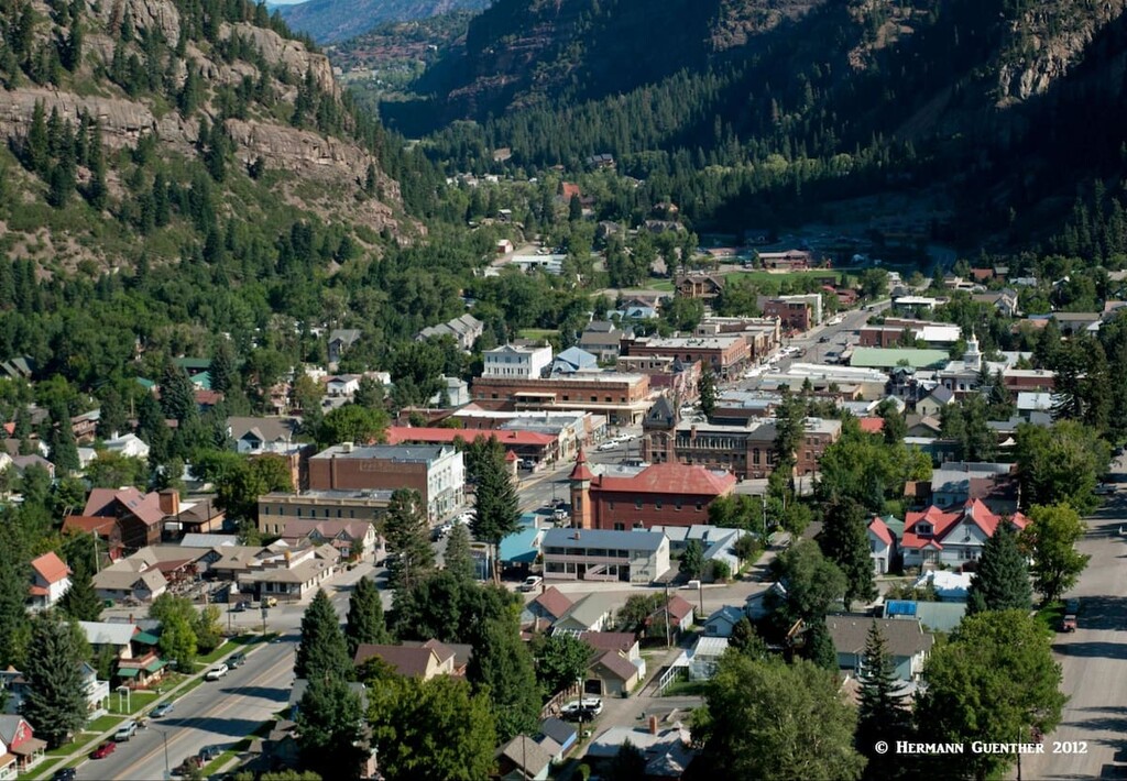
The charming town of Ouray (named after a famous Indian Chief) is tucked into a pretty valley between two of the great wilderness areas in the UNF. This makes it a handy place from which to explore some of the great hiking country this forest has to offer. The scenery from and of the town is simply stunning. Despite its population of just over 1,000 permanent residents, Ouray offers a considerable selection of accommodations and dining options. Aside from being a hiking and climbing mecca, Ouray is famous for its many hot springs, five of which were developed for the tourist trade. For hikers, there are so many options from which to choose. The nearby Yankee Boy Basin is world-renowned for its annual display of wildflowers. There are several trailheads near the town that provide access into the Uncompahgre Wilderness to the east, and the Mount Sneffels Wilderness is not far away to the northwest.
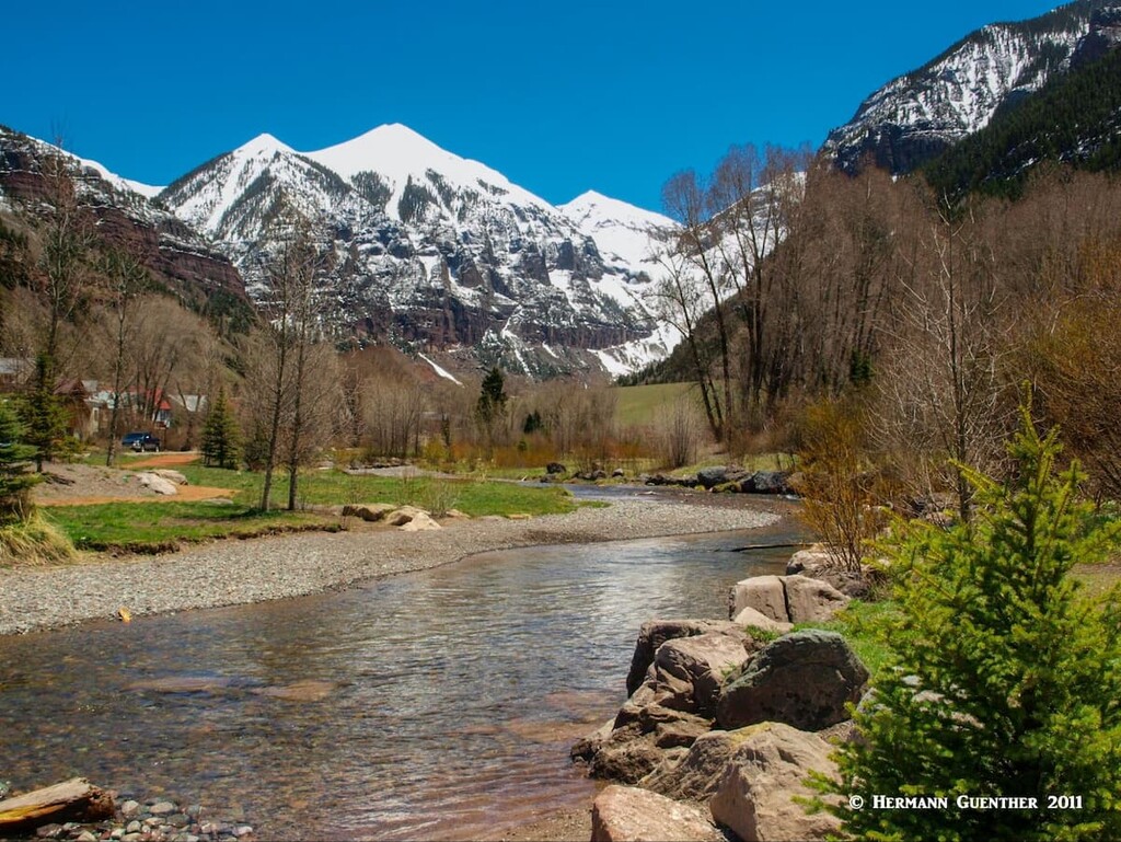
The wonderful town of Telluride is conveniently positioned for those wanting to recreate in the western parts of the Uncompahgre National Forest. Squeezed into a box canyon of sorts adjacent to the Mount Sneffels Wilderness Area, you can’t find a much more dramatic setting to call home for a few days. It is also the only major town close to the San Miguel Mountains and the Lizard Head Wilderness. This makes it a fine base from which to do some serious climbing of peaks such as Wilson Peak. As a ski town, Telluride is somewhat unique as compared to the more famous glitzy resorts (not to be named here) elsewhere in Colorado. Though it has 5-star accommodations (after all, people fly there in their private jets), Telluride is unpretentious and prefers to maintain its "old west" style. It is simply an old western mining town that grew into one of America's most loved ski towns. Celebrities who prefer to avoid the limelight and attention come here, and even own property. With a permanent population of less than 2,500, the town is not likely to get much bigger - its geology prevents growth and urban sprawl more effectively than does legislation. When not catering to skiing, Telluride offers all kinds of recreational activities - jeeping, golf, fishing, mountain biking, and of course hiking and climbing. This town is also known for its summer music festivals.