Scan the QR code and open PeakVisor on your phone
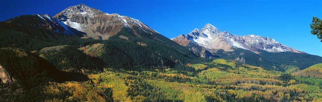
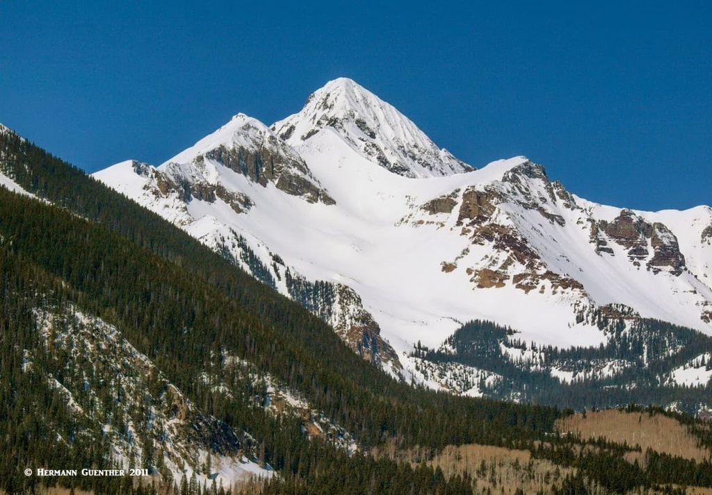
The Lizard Head Wilderness in southwestern Colorado is the westernmost wilderness area in the state administered by the United States Forest Service. It has 15 named mountains, the highest and most prominent being Mount Wilson, one of the three fourteeners in this wilderness (one of which - El Diente Peak - is not an “official” fourteener because it fails to satisfy the required prominence criterion). Nevertheless, El Diente Peak is the westernmost fourteener in Colorado. The wilderness encompasses 41,193 acres, which are roughly shared equally between the Uncompahgre and San Juan National Forests as well as between San Miguel and Dolores Counties.
The Lizard Head Wilderness was designated in 1980 pursuant to the Wilderness Act of 1964, and ranges in elevation from 9,000 feet to 14,252 feet. Wilderness is best defined by the author of the Wilderness Act, Howard Zahnister: "A wilderness, in contrast with those areas where man and his own works dominate the landscape, is hereby recognized as an area where the earth and its community of life are untrammeled by man, where man himself is a visitor who does not remain." There are several government agencies that administer the 803 wilderness areas in the United States - U.S. Forest Service, U.S. National Park Service, U.S. Fish and Wildlife Service and the U.S. Bureau of Land Management. As of 2019, this encompasses a total of 111,368,221 protected acres, or an area larger than the state of California.
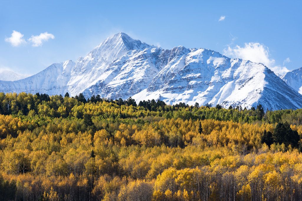
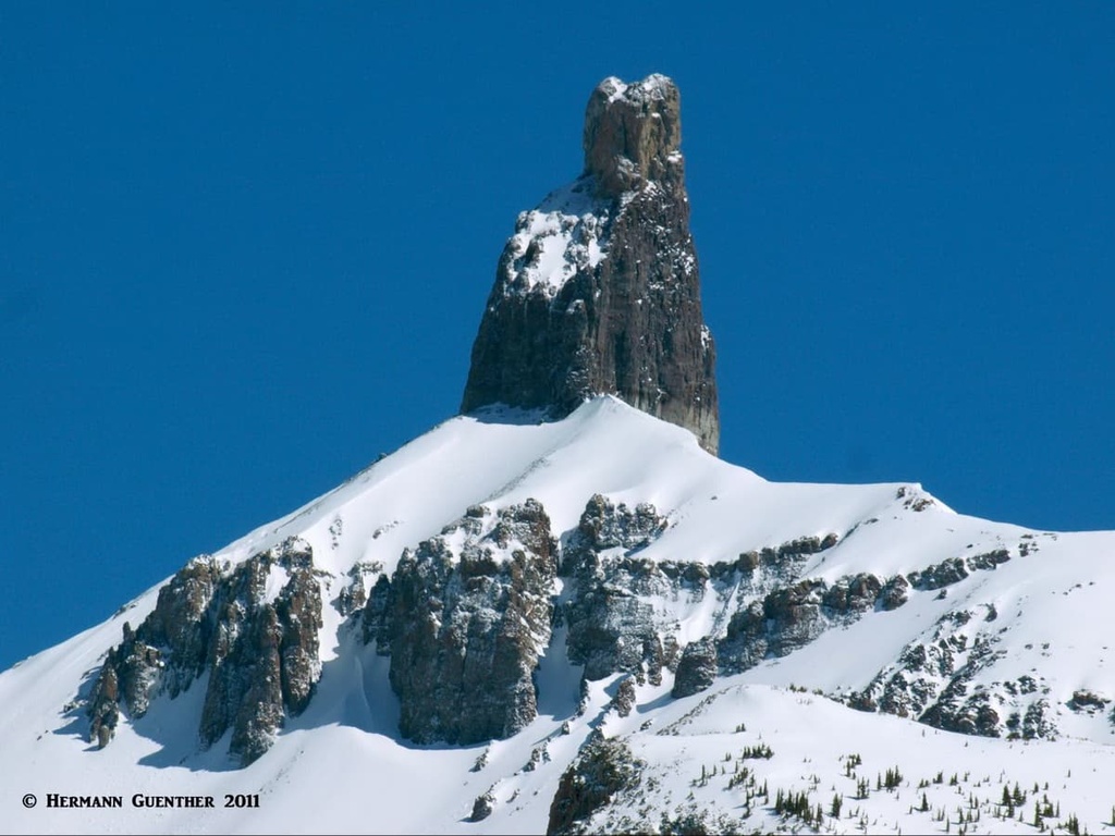
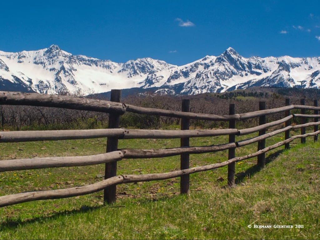
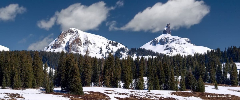
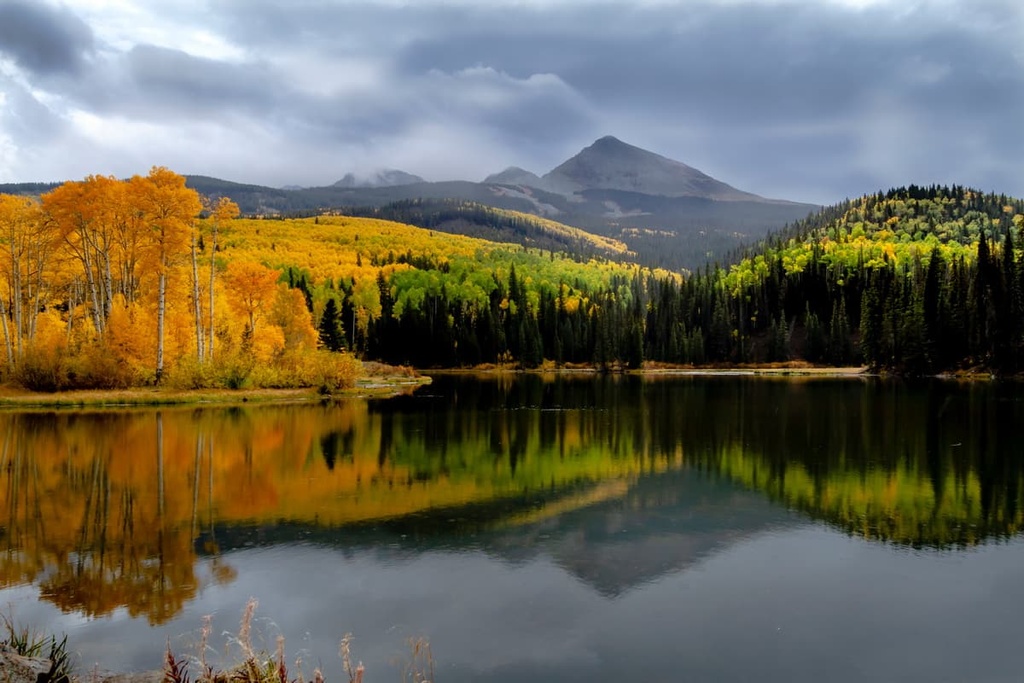
The wilderness is named for the prominent spire near Lizard Head Pass and represents a land of ragged mountain splendor including cirque lakes, swift mountain streams, waterfalls and 37 miles of hiking trails. Human use is relatively light given that the trails are predominantly strenuous. The landscape is characterized by blankets of golden aspen trees dominating the lower slopes, above which you will find spruce/fir forests broken up by large expanses of alpine vegetation. Much of the recreational allure is provided by the fourteeners, which host some of the most difficult climbs in the state; exposed knife-edge ridges connecting the peaks will challenge and frighten even the most experienced climbers if they suffer at all from acrophobia. And then there is Lizard Head itself, considered the most difficult summit in Colorado.
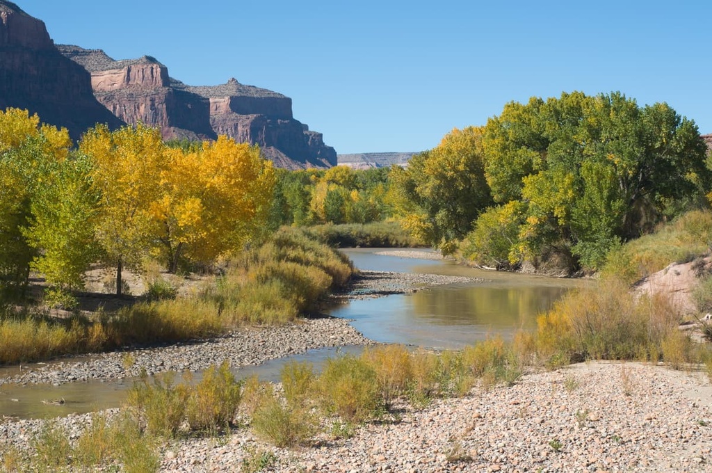
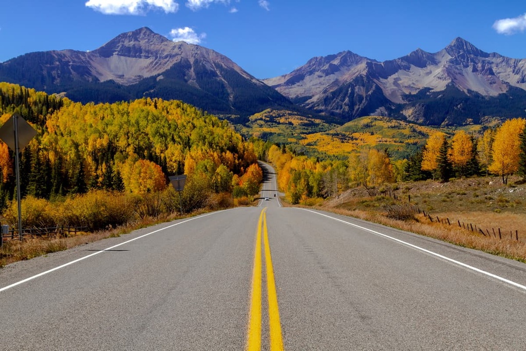
Tourism in the Lizard Head Wilderness is relatively light, consisting mostly of travelers driving from the Four Corners area (the only point in the United States where four states meet at one point) to the resort of Telluride along State Highway 145, one of Colorado’s (and America’s) Scenic Byways also known as the San Juan Skyway. This is a 236-mile loop passing through some of the most stunning landscapes in the entire country. If you have never been here, just drive the segment of this Byway adjacent to the wilderness. This will surely entice you to put on your hiking boots.
But aside from the scenic drive, there are other options for recreation not too far away. For example, the world-famous Mesa Verde National Park with its more than 5,000 historic sites and 600 cliff dwellings, is just over an hour away. This, the largest archaeological preserve in the United States, is a UNESCO World Heritage Site and absolutely should be on a visitor’s itinerary.
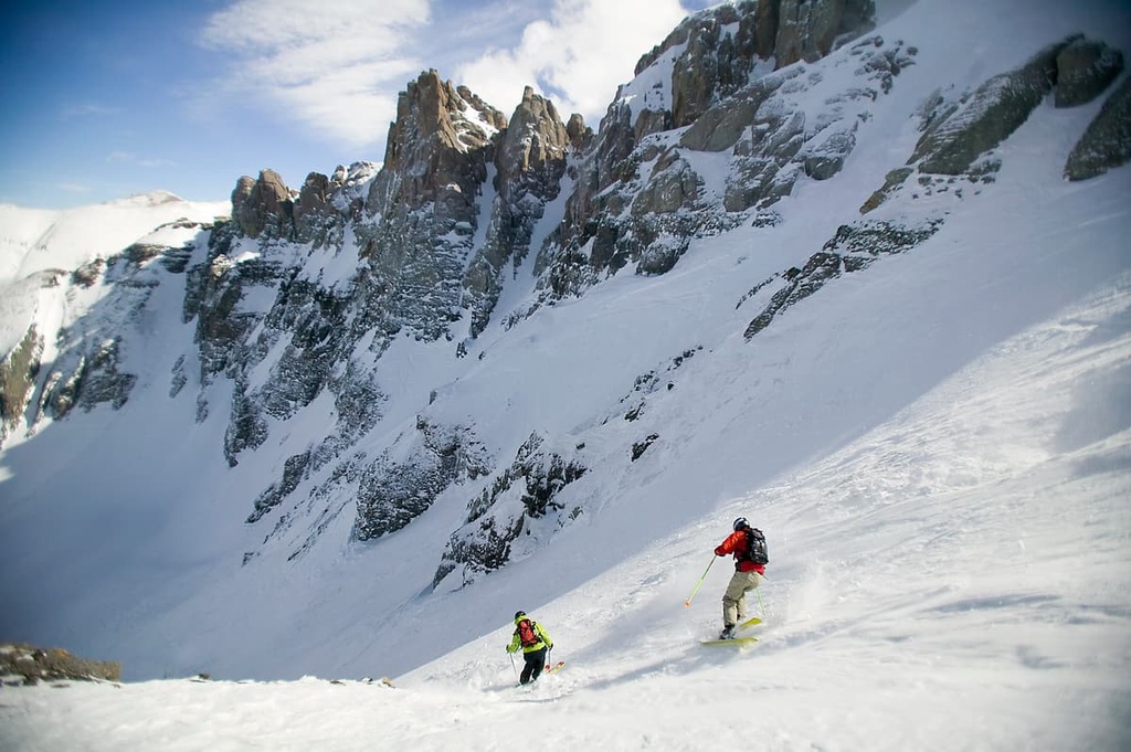
Certain trails in the wilderness afford some spectacular cross-country skiing. Also, only about one hour away to the southwest in adjacent Montezuma County near the town of Dolores is the McPhee Reservoir, the second-largest lake in Colorado with a shoreline of 50 miles. It is a favorite retreat for boating, fishing, camping and picnicking. This manmade lake was completed in 1985 and was named after the town of McPhee, which was submerged after construction of the dam across the Dolores River. The river is also famous for trophy trout fishing.
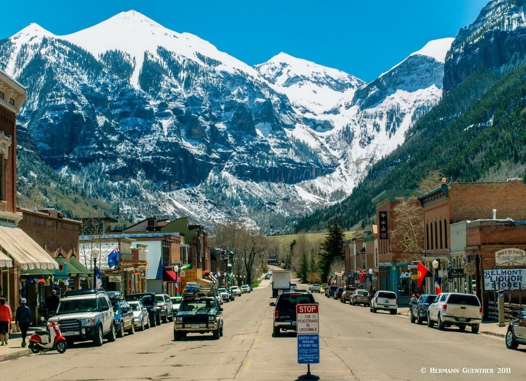
Finally, there is the resort of Telluride itself. Its primary allure is the fact that it is a spectacular ski resort, offering some amazing terrain to test your ability to challenge gravity. Whether hiking or skiing – after a day of either activity your legs will tell you that everything around here is steep. You can even fly here to the highest airport in the United States with scheduled passenger service. I have not flown here (except with a flight simulator) but it must be one of the most spectacular airport approaches anywhere. The airport is less than six miles from the town center and is perched on a high mesa with precipitous drop-offs on three sides. If you fly here, you can always rent a car and drive to the trails of the Lizard Head Wilderness.
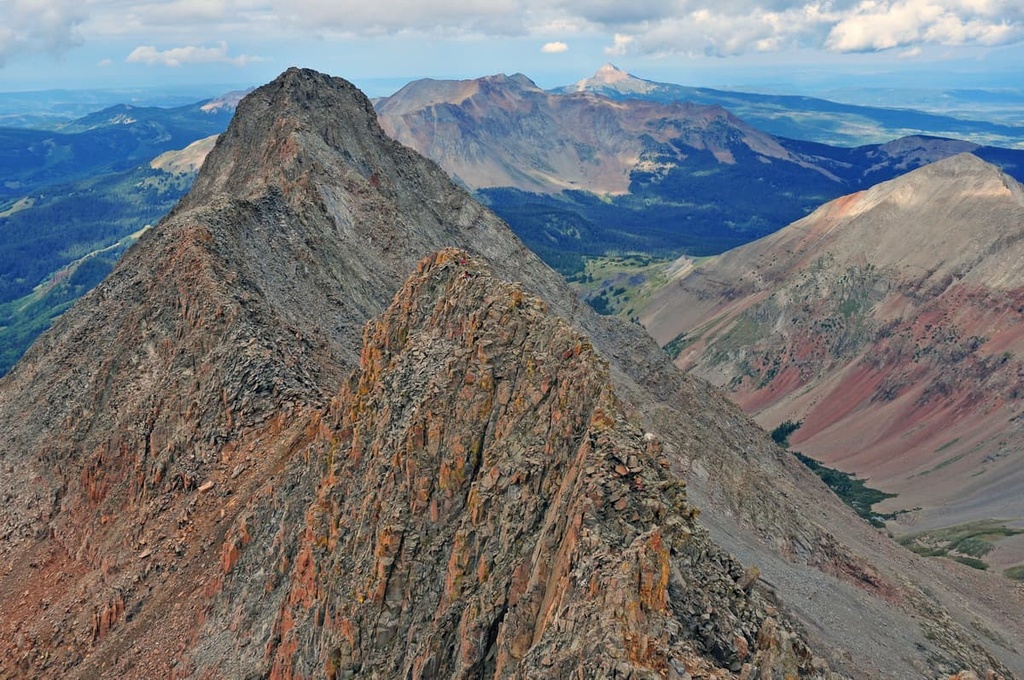
The Lizard Head Wilderness may only have 37 miles of trail, but with no less than ten different access points/trailheads spread around the perimeter of the wilderness, there are a number of different hikes that can be accomplished here. There are possible combinations of loops, out-and-back trails and point-to-point routes. The latter will, of course, require a car shuttle. Some of these hikes will be difficult if not extreme. For example, the traverse between Mount Wilson and El Diente Peak can be dangerous and requires special mountaineering skills and equipment. It is considered one of Colorado’s four finest fourteener traverses. Don’t even think of doing this one without a helmet or if a thunderstorm threatens! There is no realistic way to bail off this one.
While it is likely that a great number of hikers in this wilderness will be climbers (“peak baggers”) attempting to knock off one, two or all three fourteeners in one outing, one need not be a climber to take in the beauty of this fine place in the Rockies. There are some beautiful day hikes of various lengths and levels of difficulty that can be made by most fit hikers, while others require a bit more conditioning but without having to reach the higher zones. Even family-friendly hikes can be found here. Combinations of trails can be turned into multi-day backpack trips requiring car shuttles or variations turned into loops. The choices are there even if you are not looking to climb any summits. Let’s look at some great hikes.
Silver Pick Basin Trailhead – Wilson Peak is one of three peaks (the other two are Mount Wilson and El Diente Peak) that make up the Wilson Group, which are the dominant features of the San Miguel Mountains. All three are often climbed together resulting in a tough hike to be sure. This trailhead is for those who would like to climb Wilson Peak by itself from the north side. The Rock of Ages Trail that starts here is the easiest approach to this marvelous mountain – nine miles round trip and about 3,500 feet of elevation gain. It is considered a Class 3 ascent due to some significant exposure and some rock scrambling near the top. The trailhead can be reached via the Silver Pick Road which intersects SH-145 about six miles west of the main intersection in Telluride. The road is about eight miles long, and marginally passable for passenger cars. High-clearance vehicles would be a good idea. Wilson Peak sits at the edge of the wilderness.
Lizard Head Trailhead – This trailhead is located at the summit of Lizard Head Pass, the high point of State Highway 145. From here it is possible to do a magnificent hike one-way across the wilderness. For this, you will need to do a vehicle shuttle so that you can do this moderately strenuous 9-mile hike to the other end which is at the Wilson Mesa Trailhead (also known as the Sunshine Mesa Trailhead). This hike will take you to the foot of the incredible Lizard Head. But you don’t have to climb it – just enjoy the immensity of it. It is considered one of the most difficult summits to climb in Colorado. Just past Lizard Head, the trail crosses a 12,000-foot pass from where it gradually descends through Bilk Basin past a series of wonderful waterfalls. If you don’t have two cars, you can always go to the pass at Lizard Head and return to where you started. And another option is to leave Lizard Head by the Cross Mountain Trail which returns you to a different trailhead just two miles south of the Lizard Head Trailhead on SH-145. You can get back to your starting point from there by hiking along SH-145, making this a ten-mile loop. To make the one-way hike to Bilk Basin a lot easier and shorter, start at the Cross Mountain Trailhead (see below).
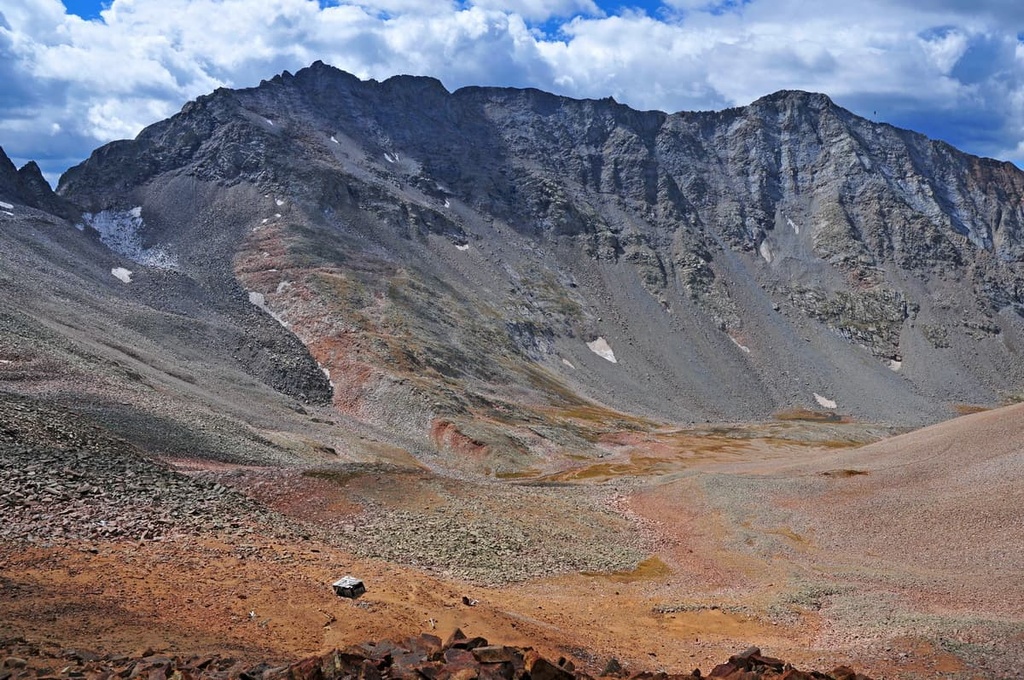
Kilpacker Trailhead - This trailhead can be reached along the seasonal Dunton Road, just a short distance north of State Highway 145, can be used to access the south and southwest slopes of Mount Wilson and its western partner El Diente (“The Tooth”) Peak. While the Kilpacker Trail also connects to the Navajo Lake Trail (see below), it bears northeasterly towards Kilpacker Basin, from where these summits are climbed. The connection to the Navajo Lake Trail is about two miles in from the trailhead. After this junction, the climbing gets serious and is not recommended for casual hikers. The view from the summit of Mount Wilson toward the northeast should be enough to intimidate anyone thinking about scrambling around up here.
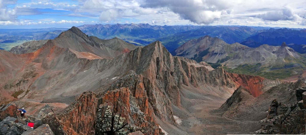
Navajo Lake Trailhead – The Navajo Lake Trail is the busiest trail in the Lizard Head Wilderness and starts about two miles further up the Dunton Road beyond the Kilpacker Trailhead (above). It basically follows the West Dolores River easterly until it enters the Navajo Basin and reaches the namesake lake at just under five miles. The trail then continues past the lake and up the basin which trends towards the east, flanked by two immense high ridges. This basin and the Navajo Lake are popular places for staging climbs of any or all three of the fourteeners here. This configuration of high peaks offers the serious and experienced climbers plenty of opportunities to do some serious mountaineering. When you are in this basin and looking east toward Gladstone Peak, you will appreciate the intimidating slopes plunging down off the ridge on the right upon which sits the incredible El Diente Peak. The latter is not an “official” fourteener since its prominence is only 266 feet, thus not satisfying the criteria for these mountains. Never mind! This is a monster of a mountain and deserves real recognition and respect.
Woods Lake Trailhead – This begins near the northwestern end of the wilderness at the Woods Lake State Wildlife area. If you want to make a day hike (or an overnight backpack trip) to Navajo Lake and basin, this might be a more pleasant alternative to the Navajo Lake Trail beginning at the south side of the wilderness. The same length as the more popular southern approach, this one is more challenging due to greater elevation gain. But you are very likely to encounter far fewer hikers on this route – at least until it intersects the latter trail just a half mile from Navajo Lake. The scenery, of course, is just as spectacular irrespective of how many people are on the trail. If you just want to make a short hike suitable for most families, you can just make a loop around Woods Lake and enjoy the splendid scenery this area affords. Though this would be entirely just outside of the wilderness, you will see most of the great mountains inside the wilderness, including the Dolores Group of peaks.
Cross Mountain Trailhead - This trailhead right beside State Highway 145 provides fine hiking access deep into the wilderness. If you just want to go to the Lizard Head itself and no further, the Cross Mountain trail would entail the shortest hike to that magnificent natural monument. But from here it is also possible to make a 9-mile loop hike, passing the Lizard Head and then taking the Lizard Head Trail down to its trailhead at the scenic overlook on SH-145. To get back to your car from here, you will have to walk along the road for a couple of miles, but at least you will have different scenery on the way back. Alternatively, you can do a one-way hike going past Lizard Head and on into the Uncompahgre National Forest; this becomes a 9-mile hike requiring a car shuttle (see above). This is considered one of the classic hikes in this remote part of the San Juan National Forest.
Sunshine Mountain - East Ridge – If you are looking for solitude, great views and a little bit of adventure, look for this hike just outside of the tiny settlement of Ames about 12 miles south of Telluride on SH-145. At Ames is a very historic generating station which claims to be the world’s first to produce and transmit alternating current. Park here and then look for the Galloping Goose trail sign. From there, you are on your own and good navigating skills will greatly benefit you until you reach the ridge from where the route should become obvious. Poor markings at the lower end are sure to cause confusion, but the reward will be the views. This hike is between six and seven miles round trip and entails an elevation gain of almost 4,000 feet. So make sure that you are adequately conditioned.
Fish Creek Trailhead - If you like solitude, want to get some peak climbing (other than fourteeners) and possess a degree of navigation skills, Dolores Peak, Middle Peak and Dunn Peak can be combined into a loop encompassing three peaks ranging in elevation from 12,582 to 13,294 feet. These mountains, all lying within the Lizard Head Wilderness, are just about at the western end of Colorado’s San Juan Mountains. You are sure to find yourself far from the buzzing crowds in the Wilsons, of which you will get great views from these summits. It is said that the scenery here is even better than from the nearby fourteeners. An added bonus is that you will also get a glimpse of desert country just to the west. No official trails reach these peaks, but they can be easily navigated from the Fish Creek Trailhead on Forest Road 611. This is no more difficult than a Class 2 hike, although if you choose to combine all three peaks, it will be strenuous.
Let’s recognize that we are at the far western end of Colorado and that the two counties in which the Lizard Head Wilderness lies have a combined population of just over 10,000; and most of that is in San Miguel County which is home to the major resort of Telluride. So we don’t have a large base of local visitors to the mountains here, meaning that many visitors to this fine wilderness are coming from afar. And most of those don’t come here for just a day-hike, which means that they will need a place to stay and eat. Other than Telluride, the nearest major towns with some choices in tourist amenities are Cortez (75 miles away) and Montrose (65 miles away). If you opt to stay in one of those towns, you will have to get a very early start to get to the trails. This means that Telluride is the most likely place to find your accommodations, but that will cost you. If you are a camper, there will be additional (and cheaper) options.
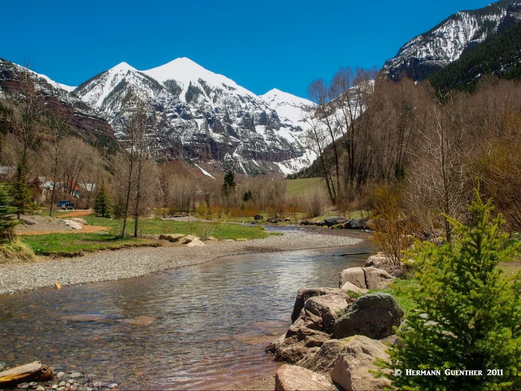
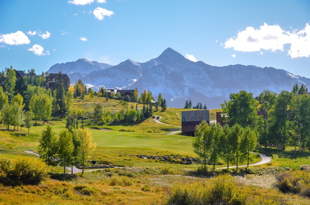
Telluride is situated at an elevation of 8,750 feet. You could do worse than stay in this delightful western town. First of all, this town has a spectacular mountain setting which is enough to get one’s hiking juices flowing. With a permanent population of less than 2,500, Telluride is not likely to get much bigger - its geology prevents growth and urban sprawl more effectively than does legislation. Though it has 5-star accommodations (after all, people fly there in their private jets), Telluride is unpretentious and prefers to maintain its "old west" style. It is simply an old western mining town that grew into one of America's most loved ski towns. Celebrities who prefer to avoid the limelight and attention come here, and even own property. That includes people like Tom Cruise, Oprah Winfrey and Ralph Lauren. Accommodations and eating venues are plentiful, though the former are bound to be pricey, especially during ski season and at times when the Telluride Jazz Festival or the Telluride Balloon Festival takes place in the summer. A free bus service called the Galloping Goose is provided that loops around the town and runs every 20 minutes.
One might be tempted to regard Mountain Village as a suburb of Telluride. It is more of a residential development although a few lodges and rental condominiums can be found here. Mountain Village varies in elevation from about 9,000 feet to over 10,000 feet, thus it offers some fine views that are not available down in Telluride. The ski area has lift access from here as well as from down in Telluride itself. It is connected with Telluride by a three-stage gondola – it is free and runs from 6:30 in the morning until midnight during both summer and winter seasons. The gondola cabins, which seat eight passengers each, feature bike racks as well as ski racks depending on the season. This gondola is the only one of its kind in North America. It takes you between the two towns in 13 minutes versus a 20-minute drive by road. During months when the gondola is closed (usually less than three months in shoulder seasons), free bus service is provided between the two towns.