Scan the QR code and open PeakVisor on your phone
The Mount Sneffels Wilderness is one of the smallest wilderness areas in Colorado and is home to only 10 named mountains with Mount Sneffels the highest and most prominent peak. The mountain sits right on the wilderness boundary and is also the easternmost point of the wilderness, which occupies 16,565 acres of the northern San Juan Mountains. It is unlike many other wilderness areas in the state in that it is not studded with countless alpine lakes, has very few hiking trails and offers very little in the way of biological diversity. This is all due to the fact that the vast majority of the wilderness consists of mainly vertical rock and ice slopes. And this is partly what makes it one of the most spectacular wilderness areas in Colorado.
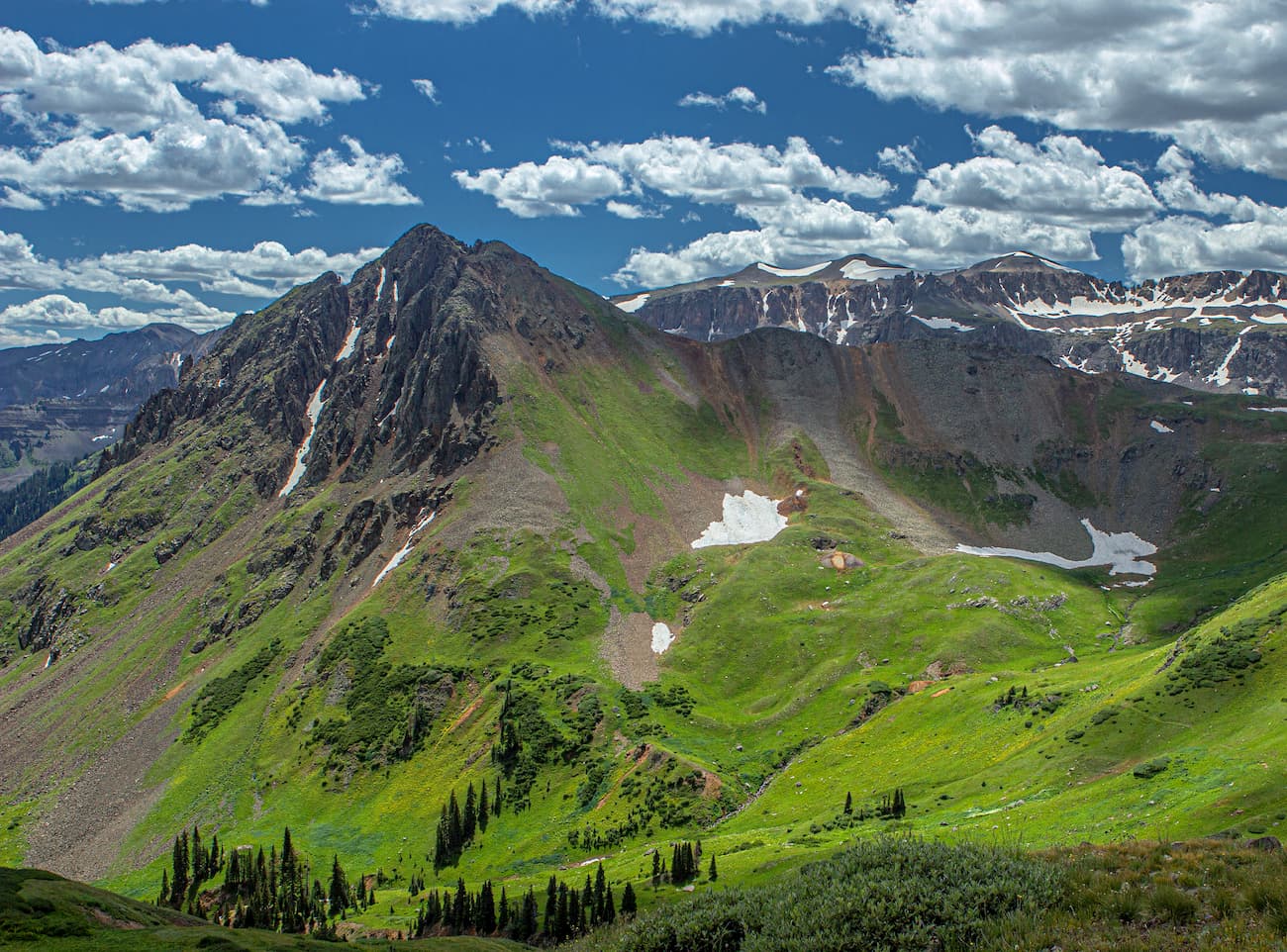
The forbidding central region of the area is rugged beyond words and is relatively seldom explored. There are few maintained trails (only 15 miles) and the various peaks, with their loose-vertical rocks, offer challenging climbs that are downright dangerous. Climbers should be highly experienced and be well prepared with helmets and technical climbing equipment. Self rescue capability is a great idea. In the 1920’s and1930’s these peaks sparked a long and glorious era of mountaineering. Nowadays, most climbing in the wilderness is confined to Mount Sneffels itself, which is not a difficult fourteener, and can be approached from two sides.
The Mount Sneffels Wilderness received its designation in 1980 pursuant to the Wilderness Act of 1964. Wilderness is best defined by the author of the Wilderness Act, Howard Zahnister: "A wilderness, in contrast with those areas where man and his own works dominate the landscape, is hereby recognized as an area where the earth and its community of life are untrammeled by man, where man himself is a visitor who does not remain." There are several government agencies that administer the 765 wilderness areas in the United States - U.S. Forest Service, U.S. National Park Service, U.S. Fish and Wildlife Service and the U.S. Bureau of Land Management. As of 2016, this encompassed a total of 109,129,657 acres, or an area larger than the state of California.
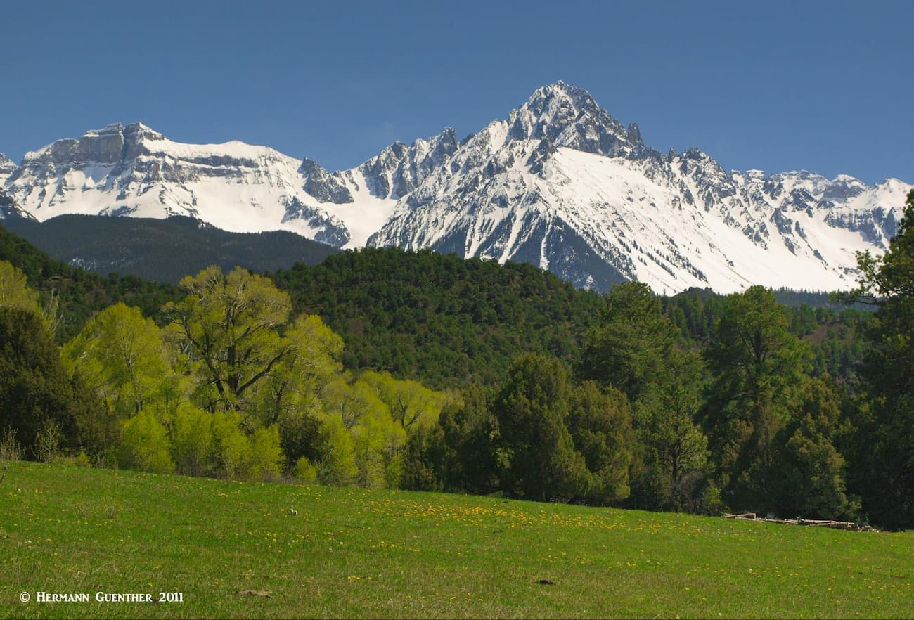
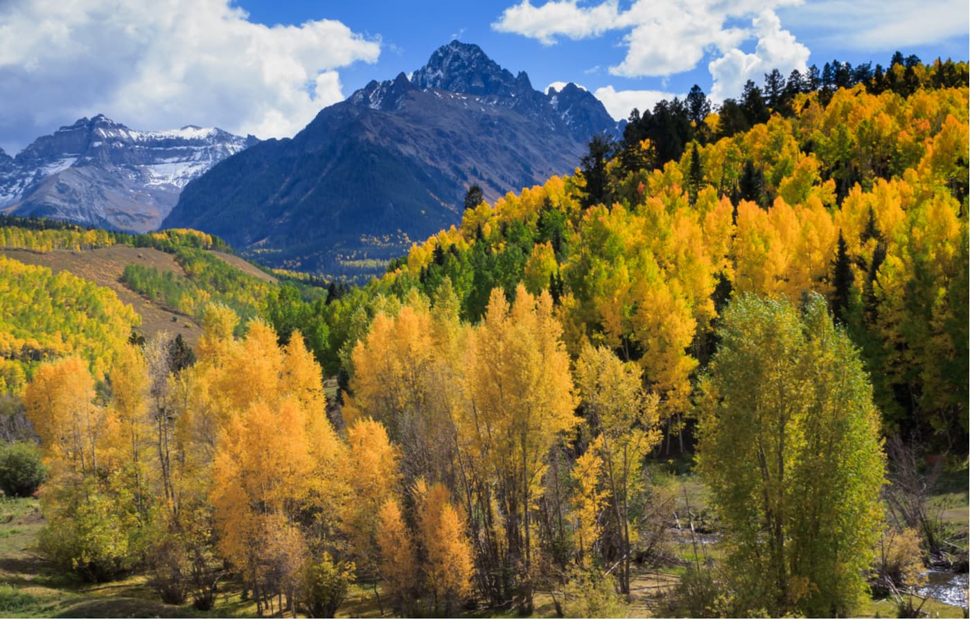
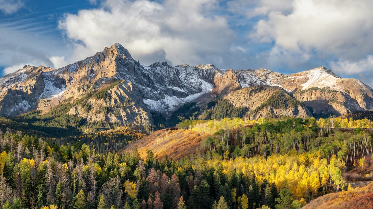
While most tourists to Colorado will flock toward the many scenic byways, they may not always know what they are looking at. But those who travel to the northern San Juan Mountains will likely visit places like Ouray and Telluride, and if they make the drive connecting the two towns, they cannot miss one of the most iconic views in the state. The view from the Dallas Divide on State Highway 62 is what postcards and calendars are made for – especially in the autumn when the aspen trees change into their fall colors – gold and more gold. Viewed against the white snow-covered mountains and a blue sky, they will always remember what they saw, and may even know what they were looking at.
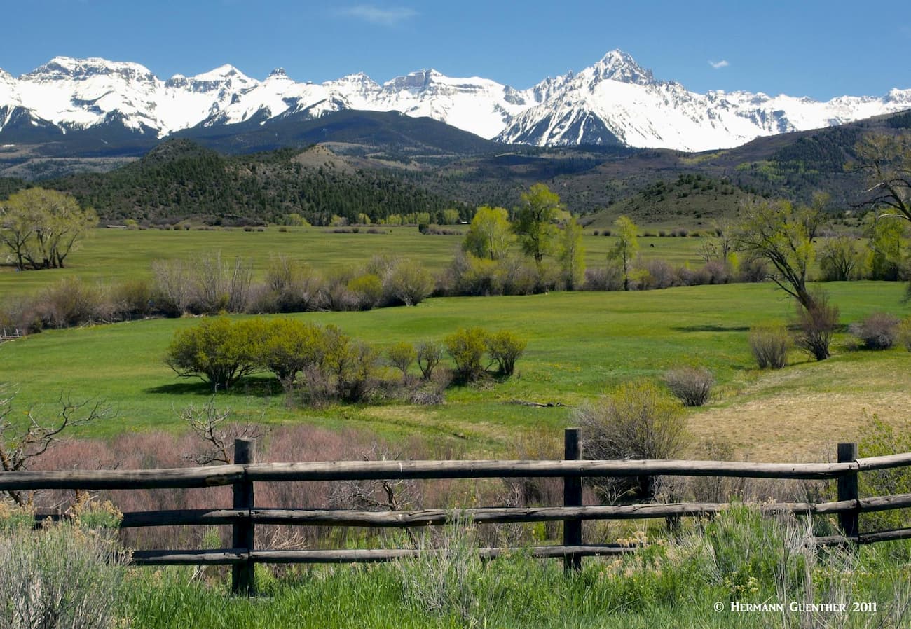
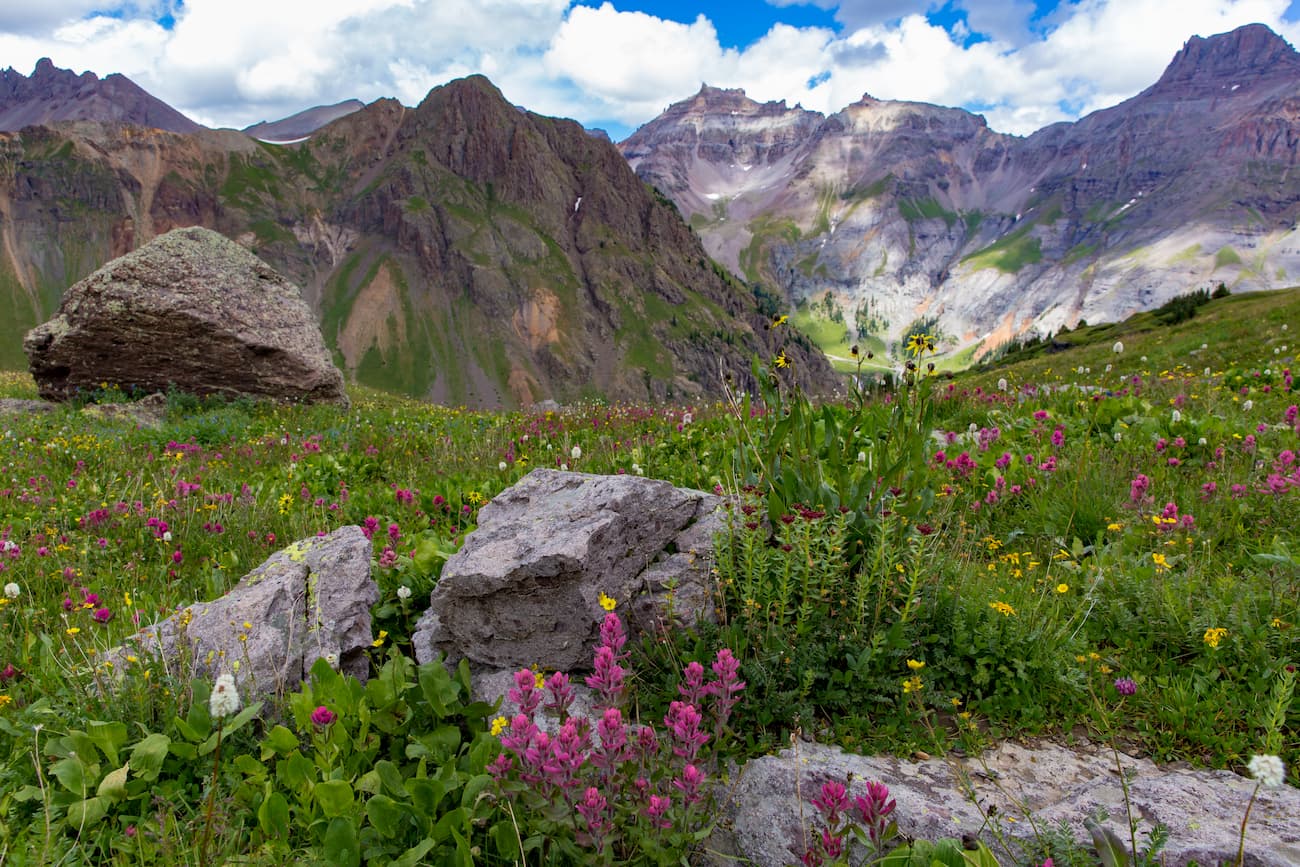
Virtually the entire wilderness encompassing the mountains in the range can be viewed from the highway, with Mount Sneffels reigning supremely over all the rest. You can’t miss it – unless you picked a bad day when everything is hidden in the clouds. But fear not. Such days are rare here, especially at that time of year. Another scenic bonanza can be found at the mountain’s back side, a place known as Yankee Boy Basin. While this is not within the wilderness itself (there are jeep trails running through this area, which disqualifies it for wilderness status), Yankee Boy Basin is renowned for its incredible displays of wildflowers of every imaginable color. This kaleidoscope of color unleashes a shutter-clicking frenzy as both amateur as well as professional photographers prowl the area for the best shots. It is possible to drive a passenger car to the fringes of the basin, although high-clearance or 4WD vehicles are preferable. Part of the approach into the basin follows a spectacular shelf road that may intimidate some drivers. I remember riding up there with a friend who, when we got to the shelf road segment, got spooked by the drop-offs and asked me to drive that part – both going up and coming back down.
As earlier stated, there really is no abundance of hiking areas in the Mount Sneffels Wilderness. In fact, there is only one area and it probably draws all but a small handful of hikers or climbers to the wilderness. That is the area dominated by Mount Sneffels itself. And there are only two trailheads from which to access the mountain and its surrounding terrain, neither of which are even within the wilderness boundary. But these two major trailheads provide access into what is unquestionably one of the most spectacular mountain domains in the entire state of Colorado, if not the entire country. I have been to and hiked from both of these trailheads, so I can speak confidently about the beauty of the Mount Sneffels Wilderness.
There are actually two trailheads in Yankee Boy Basin for those who want to climb Mount Sneffels or make the trek over Blue Lakes Pass for a delightful descent into what I think is one of the most beautiful places in Colorado. But let’s talk about the trailheads. The first one is just over eight miles from the center of the town of Ouray. This is the one where they recommend that it is best to park your passenger car. Well, I have driven to this spot in a 4WD and decided I did not want to drive further. Never would I drive our “passenger car” to this trailhead, even though it has AWD. To go to the second and much higher trailhead, it is another 1.7 miles, and you really need a true 4WD with a short wheelbase to get to this upper part of the basin. They say that you can walk this additional distance as fast as you can drive it.
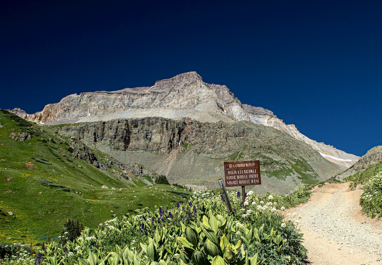
Now, the entirety of Yankee Boy Basin is outside of the wilderness boundary, but it certainly should be on the itinerary of those who want to experience the wonder of this magnificent wilderness. Certainly this is the most direct way to climb Sneffels. From the uppermost trailhead in the basin, it is less than two miles to the summit, with an elevation gain of only 1,700 feet. It is the shortest and easiest route to the mountain, barely above a typical Class 2 climb. It is a good route for those who have climbed all the easy fourteeners and want a taste of what a slightly more challenging route is like. There is a bit of exposure near the summit that might intimidate some hikers.
This is also a fine trailhead from which to make a trek to the Blue Lakes by going over Blue Lakes Pass. The trail distance to the lower Blue Lake is only three miles from the upper Yankee Boy Trailhead with an elevation gain to the pass of just over 500 feet. The challenge would be to return the same way – that involves a gain of 1,800 feet back up to the pass. But the view from the switchbacks on the pass is epic. Alternatively, those who want to experience the Blue Lakes without taking in the pass, have another option at their disposal – and you don’t need a 4WD vehicle. Your ordinary passenger car will easily take you to that trailhead.
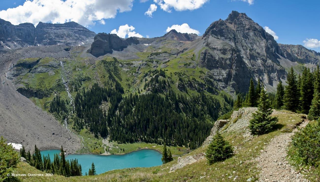
This very popular trailhead is a 45-minute drive (24 miles) from the town of Ouray on good roads, including the last nine miles on a gravel road that is plenty good enough for any passenger car. The trail is mainly used for hiking to the three Blue Lakes, the only real alpine lakes in the entire Mount Sneffels Wilderness. But those three lakes are true alpine gems. Many day hikers just go to the first (lowest) of the three lakes, a seven-mile round trip hike with an elevation gain of about 1,800 feet. If you want to go to the upper lake, which I strongly advise, you will add about two miles to the total hike and at least an additional 600 feet of elevation.
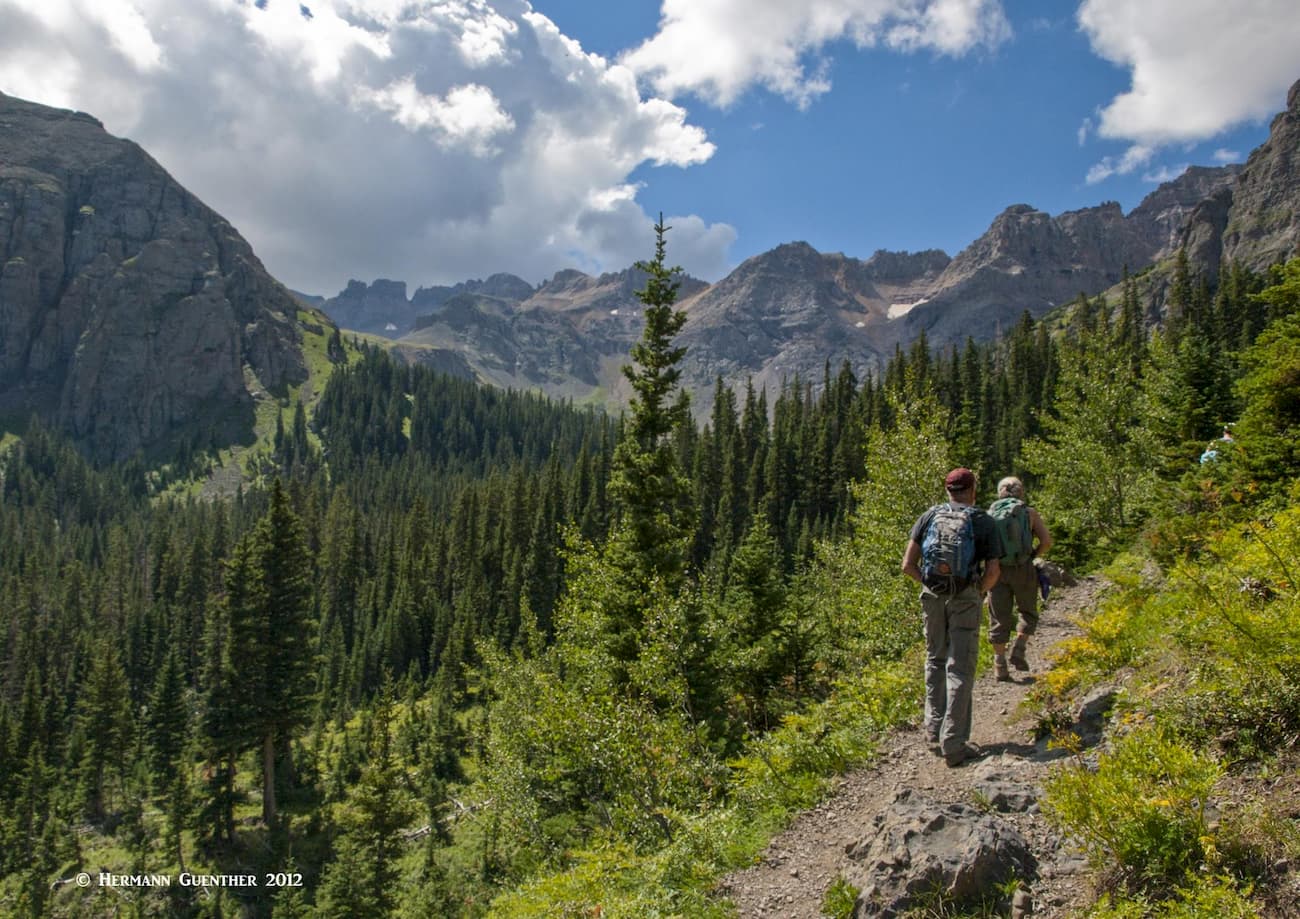
Many people will backpack to the first lake and spend at least one night there. A great place for fishing for fat trout. But many will use this as a base camp for climbing Mount Sneffels. That entails a round-trip hike of five miles and about 2,000 feet of elevation gain. So not really all that difficult. So if you have three days to devote to this adventure, that is the way to bag a moderate fourteener and experience some of the best that the mountains have to offer.
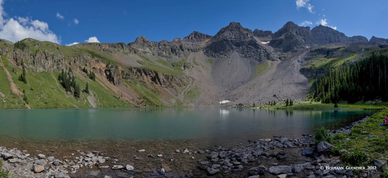
Well, if you only have enough time to hike to the lower of the three lakes, you will of course be very amply rewarded. The crystal-clear lake is surrounded by magnificent, and in places unforgiving, terrain. But if you have the time and energy, the additional effort to go to the upper lake is totally worth expending. The trail does not actually go to the middle lake, but rather bypasses it by following a minor ridge that reaches to the upper lake. In fact the best view of the middle lake is from the slopes just below the upper lake. Please do this if you can. The view down to the lowest lake will convince you of why these lakes are so named. I have been to many similarly named lakes in Colorado, but none of them are as blue as these.
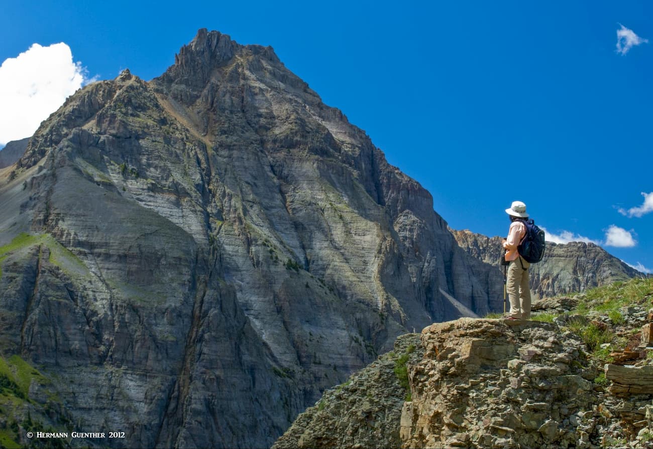
While hiking between the lakes, the views will get progressively more stunning. You are exposed up here, so there are few trees to block the views. You will want fine weather in order to get the most from your effort. It is so worth it on a day like we had - the views to the high peaks in the interior of the wilderness are epic. The view across the basin to Wolcott Mountain and its impressive northeast face will take your breath away. Be glad you have a digital camera with you, because you will be taking more pictures than you will know what to do with. In the days of film, we couldn’t afford to take that many photos!
The Blue Lakes Trailhead also doubles as the Blaine Basin Trailhead. This trail does not enter the wilderness area but offers an alternative approach to climbing Mount Sneffels. I decided once to hike high into the upper part of the basin from where the north and east faces of the mountain look formidable, especially the north buttress which is best left to experienced rock climbers.
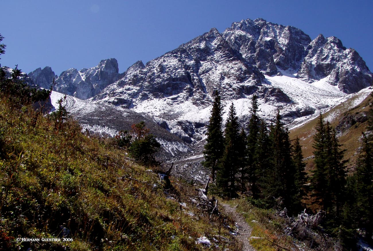
The entire basin is one rugged and imposing geological feature that was not designed by nature for human intrusion. But of course, this presents a challenge that many cannot resist. I hiked well up into the basin, from where the only things you can do is climb or retreat. I did the latter. As opposed to the Blue Lakes basin, I saw no other people on this hike.
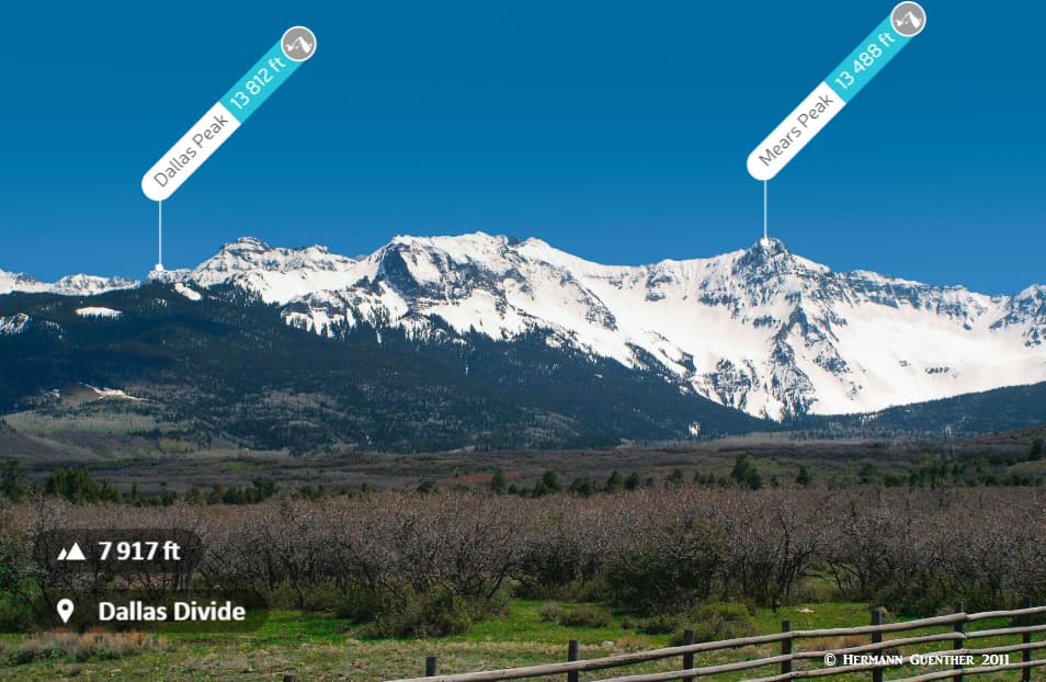
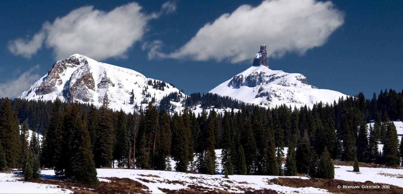
This trailhead just at the edge of the delightful resort town of Telluride provides access into the southern part of the Mount Sneffels Wilderness. This is not where most visitors go hiking into the wilderness, but it affords the hard-core climbing types a way to conquer the second-highest mountain in the wilderness. Dallas Peak (elevation 13,812 feet) is considered the most difficult ranked peak above 13,113 feet in Colorado to climb. Why 13,113 feet? Because that is the elevation of Lizard Head also near Telluride (see photo below), which is apparently even more difficult.
The Sneffels Highline Trail, in combination with the Deep Creek Trail, will get you to the south slopes and the base of the mountain, after some difficult route-finding. And then it gets interesting. After climbing through several cliff bands of solid rock and numerous gullies of loose rock, you will eventually get closer to the summit – and be faced with the summit tower - a Class 5.3 technical climb. And this is the standard and easiest route up Dallas Peak. Needless to say, not many people attempt this.
About six miles west of Telluride, on the Last Dollar Road (there surely must be a story behind that name) near the airport, is the Deep Creek Trailhead. This is the point of departure for climbing Mears Peak, which is just about at the geographical center of the Mount Sneffels Wilderness. For the few people that climb this mountain (among the 300 highest in Colorado), it is this southern approach that is most likely used. While the mountain is prominently visible from State Highway 62 and the Dallas Divide, it is difficult to reach from the north, not to mention almost impossible to climb from the north except in the month of May, and only if the spring snow conditions are just right. Therefore, only the southern approach is suitable, yet very uninviting due to tons of scree and rubble on the slopes. This is the easiest route on the mountain and offers plenty of excitement. A word of caution, Mears is not for casual hikers.
There are other, more accessible high peaks in the eastern part of the Sneffels Range, but they are not in the wilderness area, so we may discuss those at another time. Also, there are a few other trails around the periphery of the area that occasionally meander into and out of the wilderness. These trails probably see more visitors on horseback than in hiking boots.
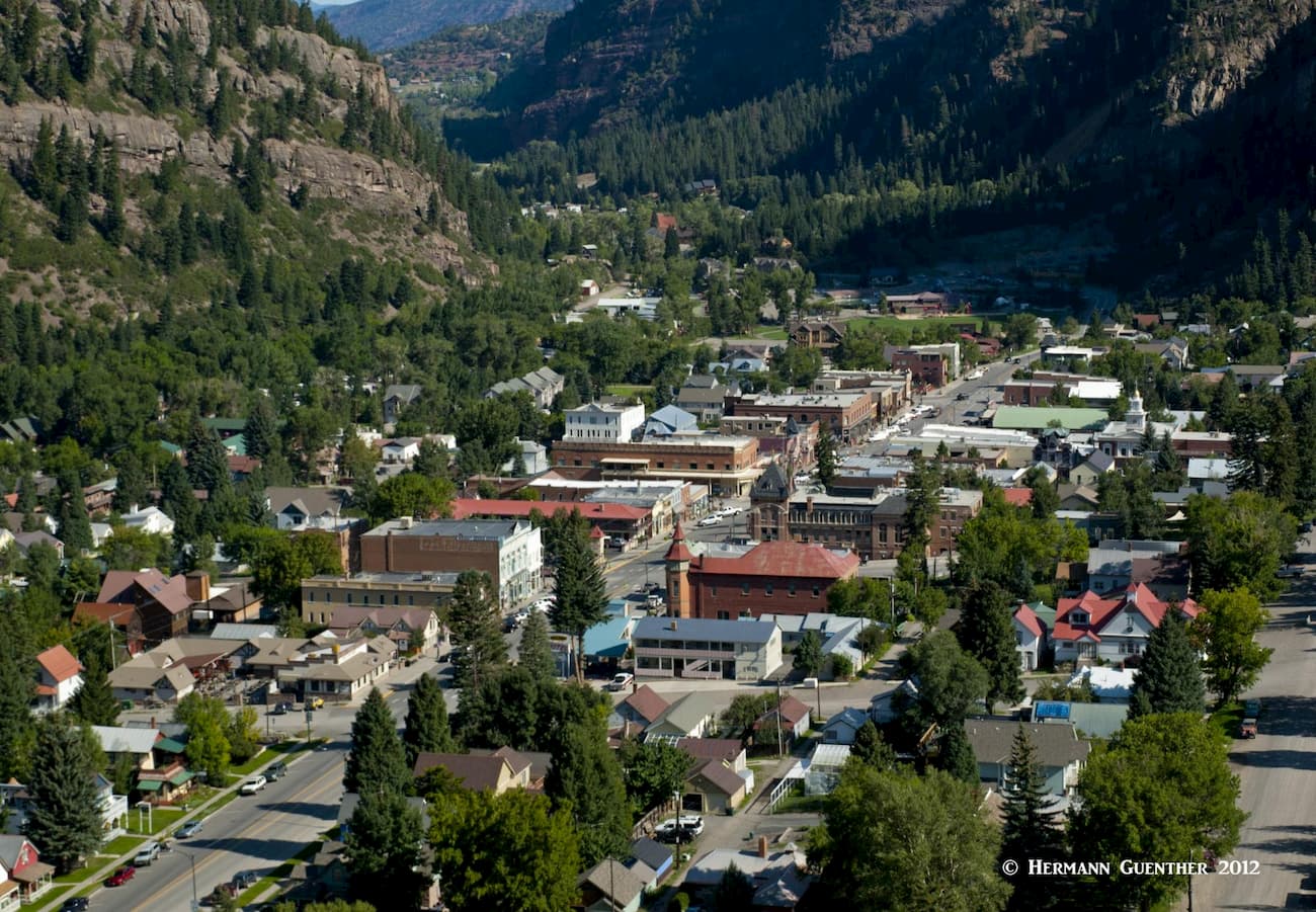
The pretty town of Ouray (named after a famous Indian Chief) is only 35 miles south of Montrose or 95 miles south of Grand Junction, the largest towns anywhere near the wilderness. Ouray and its surroundings are affectionately called the "Switzerland of America" - and for good reason. The scenery from and of the town is simply stunning. Despite its population of just over 1,000 permanent residents, Ouray offers a considerable selection of accommodations and dining options. Aside from being a hiking and climbing mecca, Ouray is famous for its many hot springs, five of which were developed for the tourist trade. For hikers, there are so many options from which to choose. The nearby Yankee Boy Basin is world-renowned for its annual display of wildflowers. The basin provides plenty of opportunities for hiking, including into the Mount Sneffels Wilderness as well as climbing the great mountain itself.
The famous Blue Lakes Trail is only a 24-mile drive north of town. That is the premier trail in the wilderness and the one most visitors are likely to want to experience. There are also other places close to town that offer some pretty rugged hikes. So there is simply no excuse for not finding something exciting to do in this awesome little gem in the San Juan Mountains. For more information and photos about hiking in and around Ouray, please follow this link.
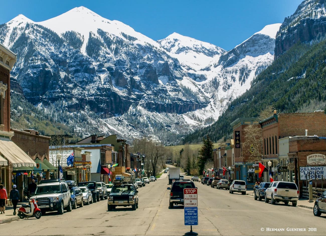
As a ski town, Telluride is somewhat unique as compared to the more famous glitzy resorts (not to be named here) elsewhere in Colorado. Though it has 5-star accommodations (after all, people fly there in their private jets), Telluride is unpretentious and prefers to maintain its "old west" style. It is simply an old western mining town that grew into one of America's most loved ski towns. Celebrities who prefer to avoid the limelight and attention come here, and even own property here. That includes people like Tom Cruise, Oprah Winfrey and Ralph Lauren. But people love it for its amazing setting in the most rugged terrain in the San Juan Mountains. No wonder visitors come here as well for reasons other than skiing. With a permanent population of less than 2,500, the town is not likely to get much bigger - its geology prevents growth and urban sprawl more effectively than does legislation. When not catering to skiing, Telluride offers all kinds of recreational activities - jeeping, golf, fishing, mountain biking, and of course hiking and climbing. For the truly adventurous hikers and climbers, access into the rugged interior of the Mount Sneffels Wilderness and its forbidding mountains is extremely handy from this town. Telluride is also known for its summer music festivals.