Scan the QR code and open PeakVisor on your phone
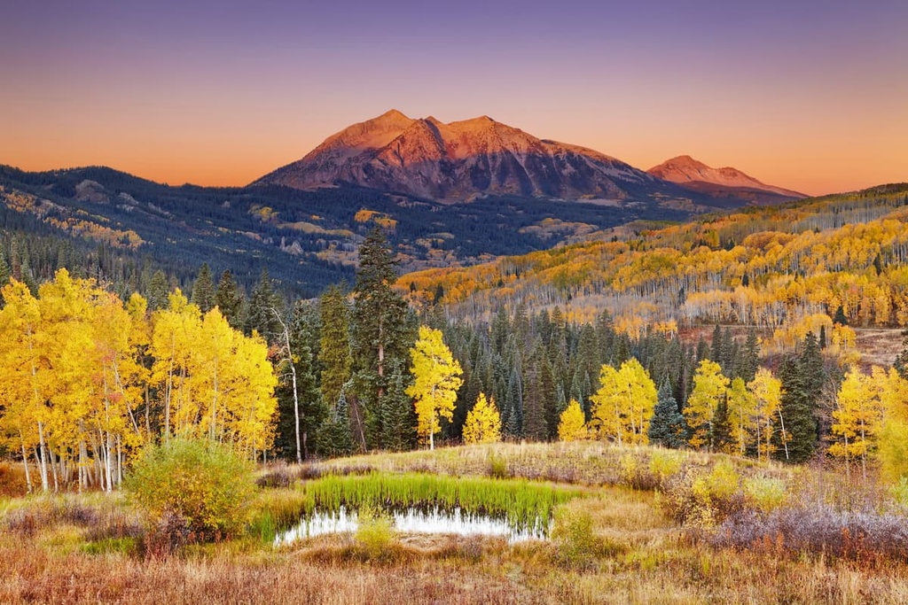
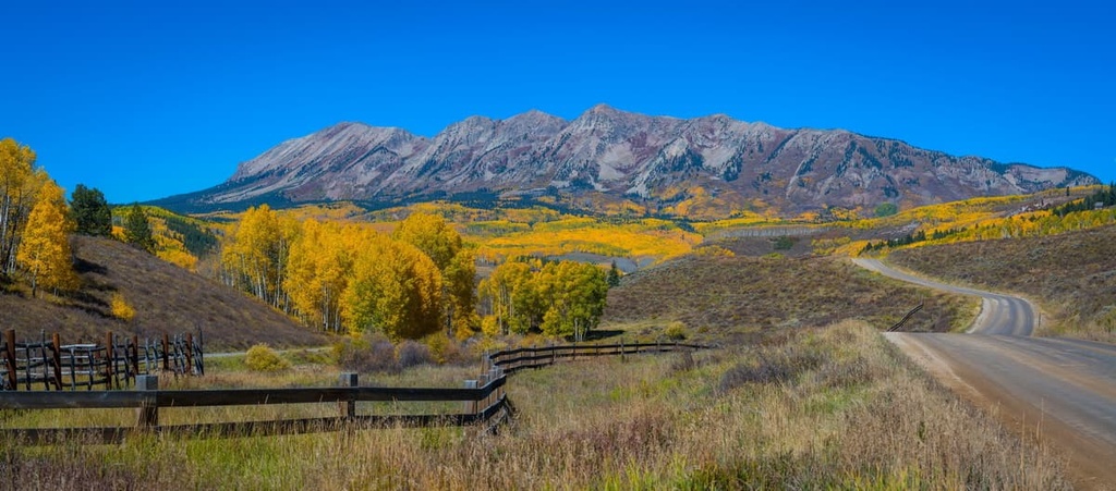
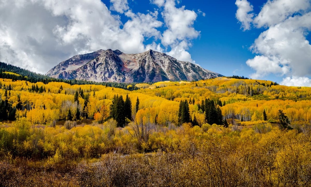
Located within Gunnison National Forest of central Colorado in the southwestern US, the West Elk Wilderness is the fifth largest wilderness area in the state, and it contains 29 named mountains. The highest peak in the wilderness is West Elk Peak at 13,042 ft (3,975 m) in elevation and the most prominent peak is Mount Gunnison with a prominence of 3,514 ft (1,071 m).
The West Elk Wilderness is located in Gunnison National Forest in central Colorado, and it falls within the Upper Gunnison Basin, which is part of the Rocky Mountain watershed. Designated a wilderness area in 1964, the West Elk Wilderness stretches across 176,412 acres (71,391 ha) of stunning mountains, forests, and rivers.
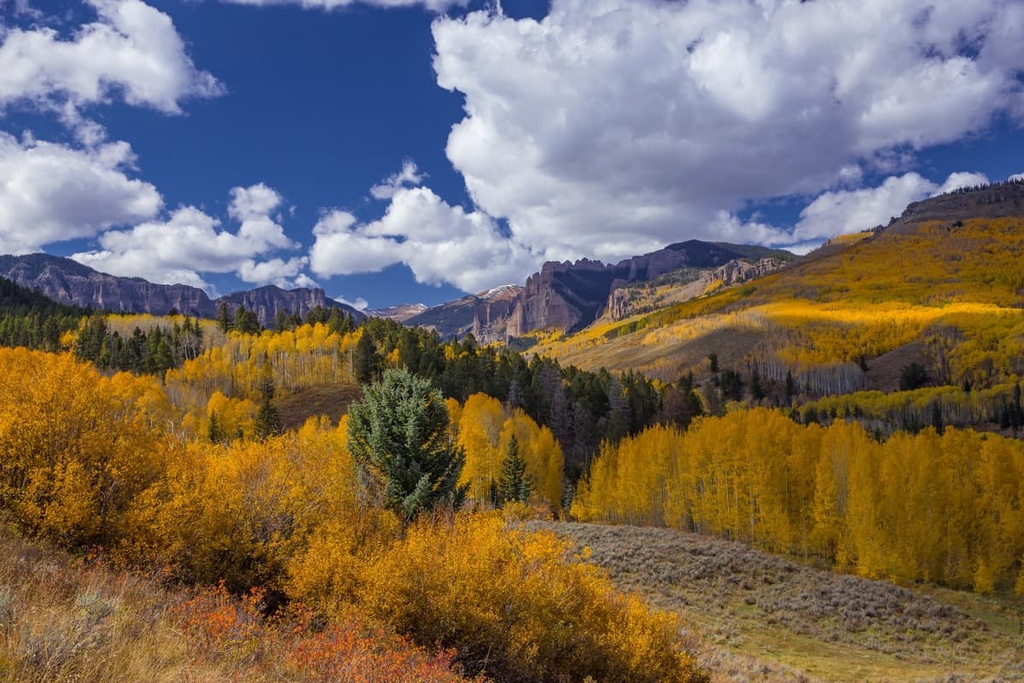
Often overlooked for 14ers in the neighboring San Juan Mountains, Sawatch Range, and the Elk Range, this rugged wilderness remains remote and exciting for those looking to escape the crowds.
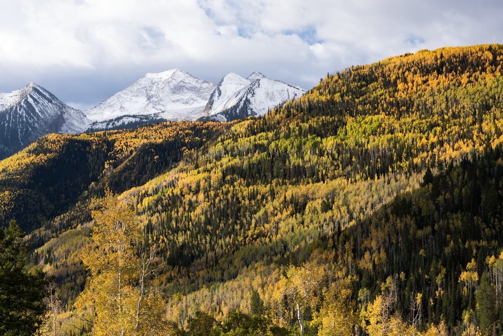
Peaks in the area rise between 7,000 ft (2,134 m) and 13,000 ft (3,962 m) in elevation. The area only sees significant numbers of visitors in the fall during hunting season. For the rest of the year, hikers, backpackers, and horseback riders exploring the 200 miles (322 km) of trails in the wilderness will encounter few other people.
Note that those looking to reach the remote interior of the West Elk Wilderness should be comfortable using topographic maps and self-reliant in the backcountry due to the remote nature of the terrain.
Thanks to the mountainous terrain in this part of Colorado, the West Elk Wilderness is surrounded by other areas of public land. This includes the Raggeds and Maroon Bells–Snowmass wilderness areas to the north, the Collegiate Peaks and Fossil Ridge wilderness areas to the west, Black Canyon of the Gunnison National Park to the south, and the Gunnison Gorge Wilderness Area to the west.
The volcanic activity that occurred approximately 35 to 30 million years ago shaped and influenced the topography of the Gunnison National Forest and the West Elk Wilderness. In particular, this volcanic activity created calderas and remnant lava flows that are still seen in the region to this day.
West Elk Breccia is the predominant rock type in the region. This mismatched amalgamation of sediments mostly likely formed as explosive eruptions tore apart the region’s bedrock. These fragments then melded with hot ash to create a rock of mixed composition.
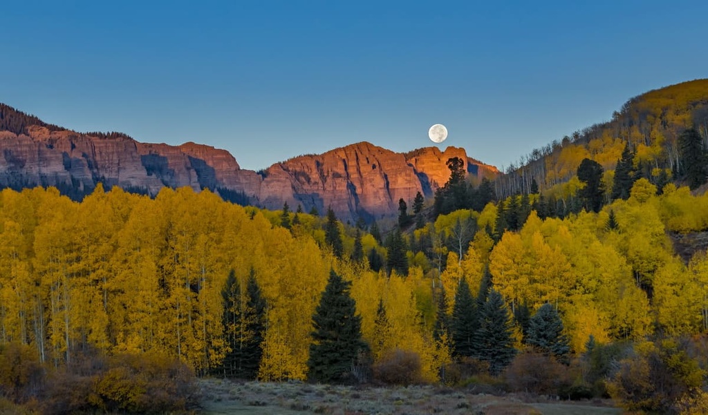
Wind and water have carved and eroded these ancient lava flows and breccia over the course of millions of years, leaving behind an impressive array of pinnacles, spires, and turrets that inspired the names of local attractions such as Castle Creek, Castle Pass, and Castle View, to name a few.
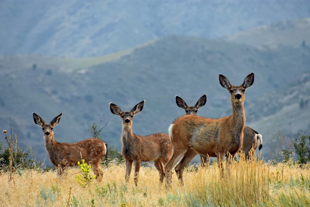
As it receives little human traffic, the expansive West Elk Wilderness provides a relatively undisturbed habitat for many species of wildlife. As its name suggests, elk and deer populations thrive here and draw lots of hunters in the autumn months.
Other species that call the place home include black bears, bobcats, mountain lions, coyotes, and golden eagles. Cutthroat, rainbow, brook, and brown trout live in the streams and rivers that flow through the wilderness area.
Increasingly widespread across the American West, parts of the West Elk Wilderness show signs of infestations of the destructive pine and spruce beetles. These native beetles attack and kill lodgepole and ponderosa pine as well as Engelmann and blue spruce, respectively.
Multiple vegetation zones exist in different elevation areas of the wilderness area. The most abundant vegetation zones in the wilderness are ponderosa pine forests, pinyon-juniper forests, aspen forests, montane shrublands, and grasslands. The average precipitation in the wilderness ranges from 25 in (63.5 cm) to 40 in (101.6 cm) per year and the area is typically free of snow from mid-July through September.
Gunnison County is the traditional territory of two bands of Ute—the Parianuches (meaning ‘elk people’) who traditionally resided north of the Gunnison River and the Tabeguaches (subsequently called the Uncompahgre) who moved throughout Gunnison Valley and the nearby mountains. The rich environment of the valley provided abundant game for hunting and ample roots and berries to harvest.
The first Europeans to arrive in the valley were French trappers. Gunnison Valley gets its English language name from Captain John W. Gunnison who passed through the valley in 1853 in search of a rail route to the Pacific. Although gold was found a decade prior, mining began with vigor in 1872 when silver ore was discovered in the Elk Mountains. Silver mining in the area dwindled in popularity by 1893.
Today tourism drives the county’s economy as visitors flock to enjoy the area’s rivers, forests, and mountains. Ranching remains popular in the region. Ranchers and the Forest Service collaborate to maintain ecological balance while allowing cattle to graze on public lands. Hikers in the West Elk Wilderness can expect to encounter ranging cattle or signs of them.
The West Elk Wilderness was formally designated in 1964 as part of the original 1964 Wilderness Act, which established the National Wilderness Preservation System. This makes the West Elk Wilderness one of the five oldest wilderness areas in Colorado. It was later expanded under the Colorado National Forest Wilderness Act of 1980 (PL 96-560).
With 200 miles (322 km) of trails to choose from, the hikes below are simply a starting point for journeys into the West Elk Wilderness.
The West Elk Wilderness is known for its incredible beauty and solitude. Those planning to venture into the wilderness to summit some of the peaks or embark on longer hikes should be aware that some junctions and trails are unmarked or that they have markers that are easy to miss.
Visitors to the area should also note that the dirt access roads can be very muddy in the spring. Ranging cattle can mean an occasional encounter with cows and bulls while hiking through the wilderness.
Trail maps detailing the 200 miles (322 km) of trails can be found online at the Forest Service website. With that in mind, here are some of the best hikes in the West Elk Wilderness to check out during your next trip to the region.
This 25 mi (40 km) out-and-back trail is lauded as one of the most scenic hikes in the area. The trailhead for the Mill Castle Trail lies just to the north of the West Elk Wilderness boundary at the end of Mill Creek Road. Those looking for an easier hike can do just the first few miles.
The Mill Castle Trail crosses Storm Pass to ultimately reach Castle Creek. It wanders through spruce and aspen groves, among wildflowers in the summer, and offers incredible views of the area’s quintessential rock spires and pinnacles.
One can cut off at Storm Pass in order to summit West Elk Peak. West Elk Peak alone is not too difficult to summit, but it is considered a more challenging 13er to hike due to its distance from the trailhead (about 11 mi/18 km).
At 4 miles (6.4 km) one way, the Rainbow Creek Trail is a moderate hike that traverses timber groves and meadows before making a brief climb to a ridge and a descent into West Elk Creek.
In addition to being pretty in its own right, this hike connects to the West Elk Rim Trail and can be used to reach North Baldy, Middle Baldy, or South Baldy mountains. The trailhead is accessible by following Rainbow Lake Road for 12 mi (19.3 km).
To reach the Hoodoo Gap Trail on the western side of the West Elk Wilderness, one must begin at the Curecanti Trail and proceed for 6 mi (9.6 km). Once on the Hoodoo Gap Trail, you’ll hike approximately 3 mi (4.8 km) to reach Hoodoo Gap.
This trail can be used to access Mount Gunnison (12,719 ft/3,877 m). Trails in this section of the West Elk Wilderness are sometimes hard to follow so it is best to be prepared with maps and a GPS device.
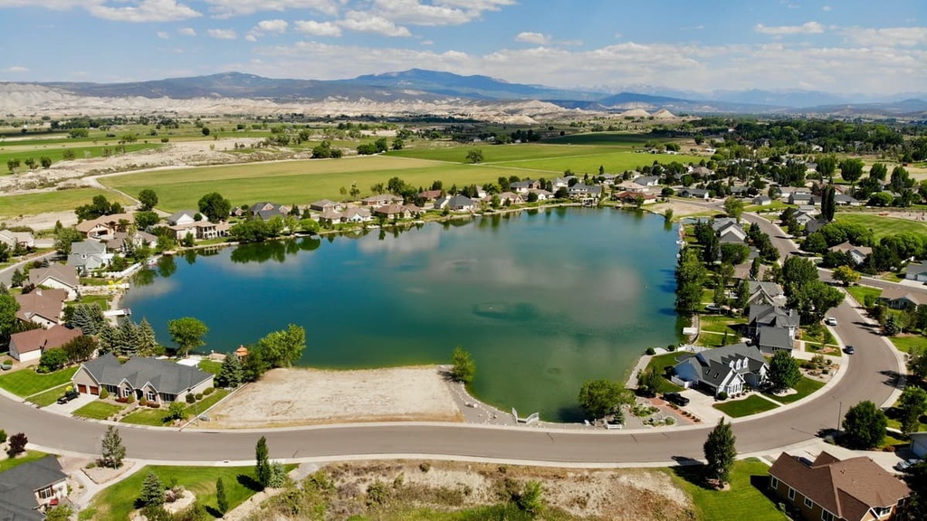
Gunnison and Crested Butte are two of the most popular towns near the West Elk Wilderness. Other small towns like Montrose, Hotchkiss, and Cimmaron lie to the west and are also good jumping-off points for visiting the many hikes and rivers in the area.
Here are some of the best places to stay during your next trip to the West Elk Wilderness.
There is plenty of charm in Gunnison, a small town of 6,500 people that features a decent selection of restaurants, boutiques, and accommodation.
In the winter, Gunnison is just a short drive away from Monarch Mountain and Crested Butte for skiing and snowboarding. Ample opportunities exist for cross country skiing and snowshoeing in the surrounding valley, hills, and forests, too.
During the summer months, the rivers and creeks around Gunnison are prime destinations for fishing enthusiasts while there are hiking trails located minutes from town for the more adventurous among us.
Curecanti National Recreation Area and Blue Mesa Reservoir (one of Colorado’s largest bodies of water) are both situated about 15 mi (24 km) from town, and they offer a refreshing escape from summer heat to swim, fish, and boat. Elk Creek Campground is a developed campsite along the reservoir that’s worth checking out if you need accommodation during your visit.
Also located nearby is Black Canyon of the Gunnison National Park and the Gunnison Valley Observatory. The observatory is an International Dark Sky Park where visitors can enjoy spectacular night sky viewing with little light pollution.
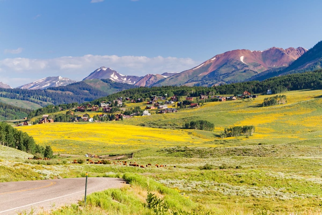
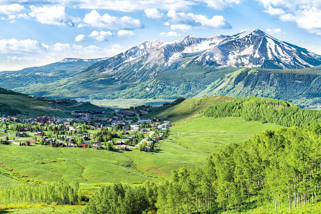
Despite being a small town with only about 1,500 inhabitants, the town of Crested Butte and the surrounding nature both draw many visitors to the region. Thanks to its plethora of skiing opportunities, the town is often called ‘the last great ski town of Colorado,’ an acknowledgment of both its incredible slopes and the authentic feel of the Crested Butte.
In the summer, mountain bikers can take the chairlift up Crested Butte to take advantage of an incredible selection of downhill trails. Along the base of the mountain and in the surrounding forests, there are a handful of cool mountain rivers that are ideal for fishing.
Crested Butte is also known for its wildflowers in the summer months. Hikers in the area are treated to the rich colors of lupine, columbine, paintbrush, and more as they walk in the surrounding meadows and mountains. Summer also means festivals almost every week, all of which invite people to come together to experience and celebrate everything from the wildflowers to music and food.
Another spot worth mentioning is the town of Montrose, which provides easy access to the western side of the Black Canyon of the Gunnison. The population of Montrose is just under 20,000 people, so it’s a large community for the area.
All amenities that you can think of, including hotels, restaurants, and gear shops, can be found in Montrose. Many visitors to the area appreciate the old West feel of the town and the spectacular vistas of the surrounding mountains that you can enjoy from downtown Montrose.