Scan the QR code and open PeakVisor on your phone
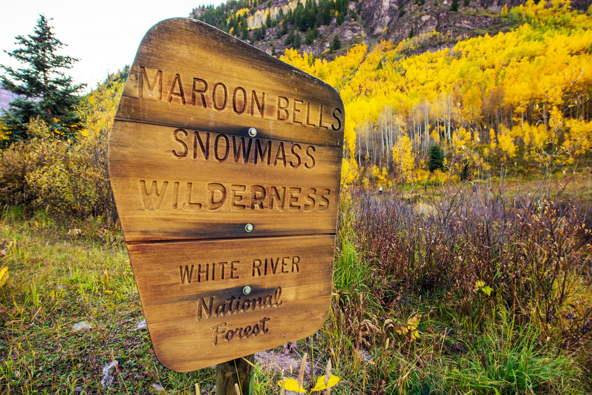
The Maroon Bells-Snowmass wilderness area encompasses a significant part of the Elk Range of west-central Colorado. Spanning parts of the White River and Gunnison National Forests, and occupying parts of two counties (Pitkin and Gunnison), this wilderness was one of five such areas in Colorado designated in the original Wilderness Act of 1964. At 181,117 acres in area, this is one of the largest in the state – only four are larger. Yet it has only 38 named mountains – but what mountains they are! The highest and most prominent is Castle Peak. Contained within the wilderness are six fourteeners, five of which qualify as “official” based on prominence criteria. They are Castle Peak, Pyramid Peak, Maroon Peak, Snowmass Mountain and Capitol Peak.
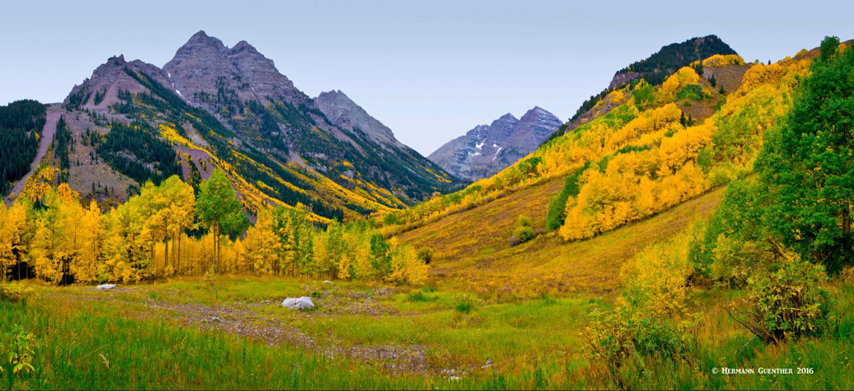
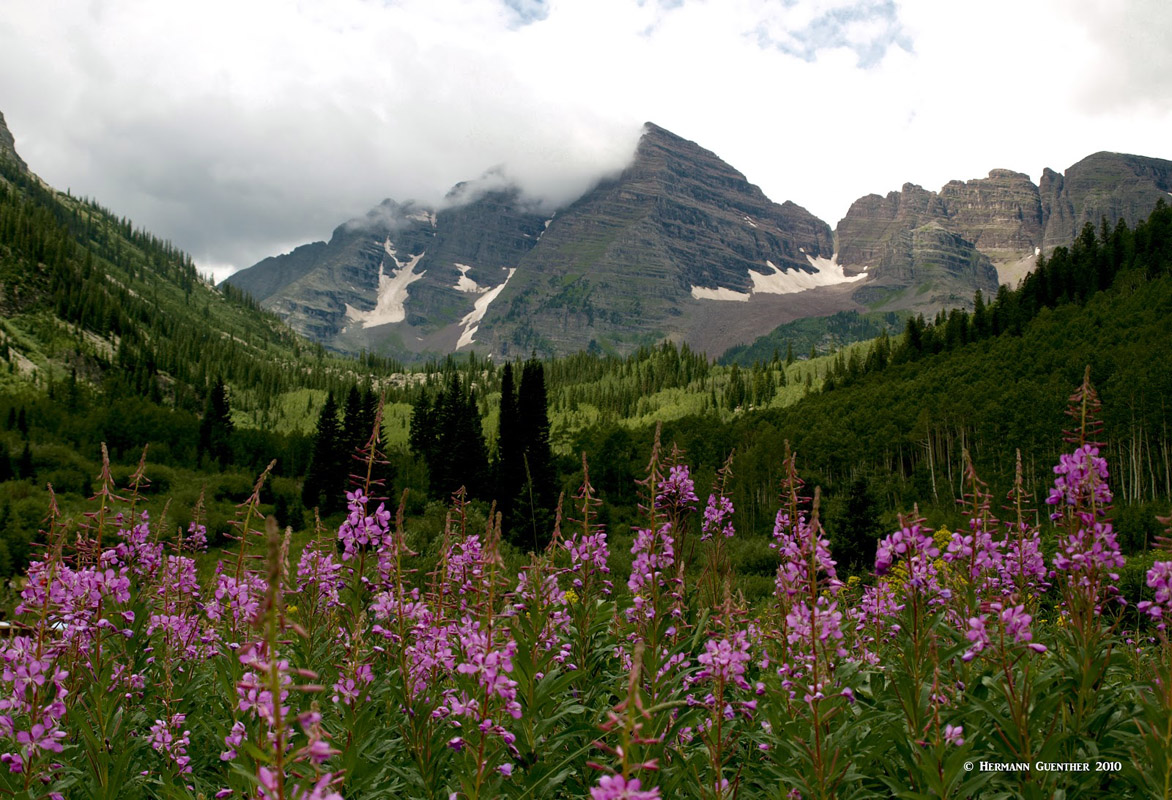
Pyramid Peak (l) and Maroon Bells (c)
Wilderness is best defined by the author of the Wilderness Act, Howard Zahnister: "A wilderness, in contrast with those areas where man and his own works dominate the landscape, is hereby recognized as an area where the earth and its community of life are untrammeled by man, where man himself is a visitor who does not remain." There are several government agencies that administer the 765 wilderness areas in the United States - U.S. Forest Service, U.S. National Park Service, U.S. Fish and Wildlife Service and the U.S Bureau of Land Management. As of 2016, this encompassed a total of 109,129,657 acres, or an area larger than the state of California.
The Maroon Bells-Snowmass Wilderness is one of the most spectacular areas in Colorado and in fact in the entire United States. The stunning beauty of its namesake mountains – the Maroon Bells – is truly second to none. And that is why it is so popular. During the summer and autumn months it is actually overrun by visitors, many of whom go there simply to take in the view across Maroon Lake to the “Bells” and then leave after having taken countless photos and selfies. But others also go beyond the viewpoint and take a short hike (or even longer excursions deep into the wilderness). Regardless, this place is popular and well worth visiting, despite the crowds. The fact that this wilderness lies at the doorstep of the world-renowned playground of the rich and famous, the swank resort of Aspen, clearly adds to the popularity of this area. But one need not come here to hobnob with celebrities – more down-to-earth people are equally welcome to play here.
North Maroon Peak (c) below Crater Lake
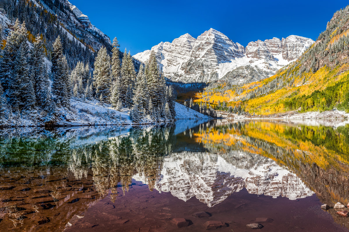
Perhaps one of the features of the this wilderness that surpasses all others in terms of popular appeal is the Maroon Bells. These two summits over 14,000 feet in elevation, Maroon Peak and North Maroon Peak (not an “official” fourteener), are easily the most photographed mountains in Colorado and possibly even among the best-known mountains in the entire country (some even claim that they are the most photographed mountains in all of North America). A paved road goes all the way to the popular viewing site at Maroon Lake, although it is closed in the winter. Due to the popularity of these mountains, the road is often closed to private vehicles, so that when the parking lots fill up, often by 8:00 in the morning, visitors are limited to taking a bus. The actual wilderness boundary is just a short trail hike away from this hotspot.
Most of the mountains here, and especially the Maroon Bells and other nearby mountains, consist of highly weathered and very loose sandstone. This crumbly terrain is difficult even for the experienced mountaineer, and visitors are strongly advised to avoid any attempts to venture beyond maintained hiking trails. Because of the many deaths that have occurred here, the Maroon Bells have been given the dubious unofficial name of the "Deadly Bells". Even some experts tend to shy away from these mountains. But there is more to this wilderness than just the Maroon Bells – lots more.
Photography at the Maroon Bells – A special note about photography at Maroon Lake is appropriate here. While thousands of visitors to this place come here of course to capture those memorable photos of this magnificent place, the great majority simply snap a load of photos (selfies included naturally), walk part way around the lake, and then leave. But at certain times of the year, you can encounter countless more serious photographers who stake out their desired positions by the lake early in the morning and stay put for as long as it takes to get that perfect shot. You will see them with their mighty tripods mounted with super-expensive cameras and accessories. Every available space along the shore of the lake will be taken, with some even positioning their tripods in the water. The trick is to get these shots without other people in them, which can be a challenge at times. But the results of their patience can be seen in various media – and there is not shortage of super-stunning photos of this spot. The iconic “Bells”, framed within the almost perfect “U”-shaped valley will not fail to impress anyone with an eye for natural beauty. Yet, there are opportunities just nearby for taking less iconic photos, thus affording a very different perspective, such as the following photo.
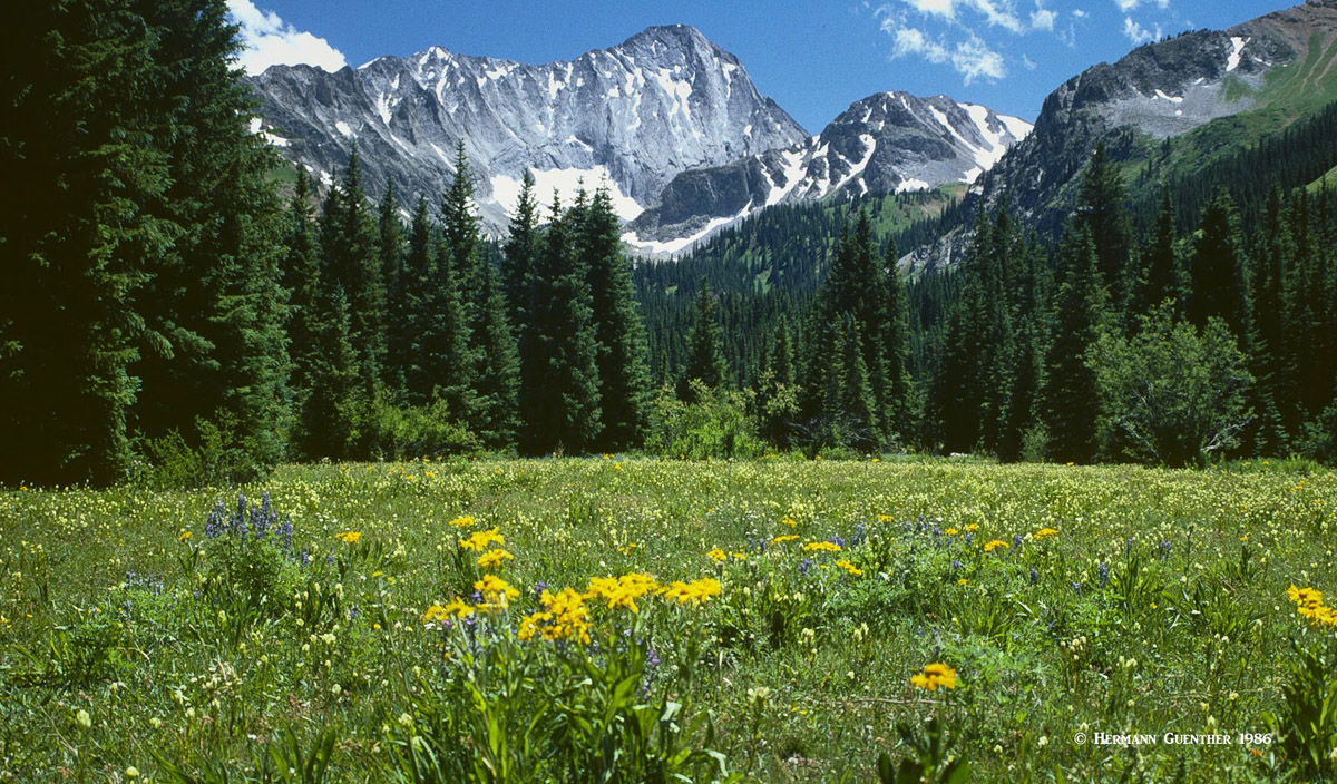
While the high peaks of the Maroon Bells-Snowmass Wilderness may be intimidating, that is not to say that exploring these mountains is limited to only seasoned climbers and hikers. There are many places where even casual hikers can enjoy stunning vistas, wildlife and wildflower displays. Within the boundaries of the wilderness are 100 miles (160 km) of trails and nine passes over 12,000 feet (3,000 m). Simple hikes of only a few miles, to much longer ones requiring overnight bivouacs, can be negotiated on well-built and maintained trails by anyone with a reasonable level of conditioning. Altitude, however, can be a problem for some visitors that are not acclimated.

Mountain Goats beside the Trail to Crater Lake
I have done many day-hikes and multi-day excursions here over a number of years and can speak from experience, yet I have only climbed one of the fourteeners, the others being far too risky for my comfort level. I prefer the view of the mountains rather than the view from their summits. The following discussion is based mostly on my personal experience, supplemented as necessary with facts that I have researched from various sources.
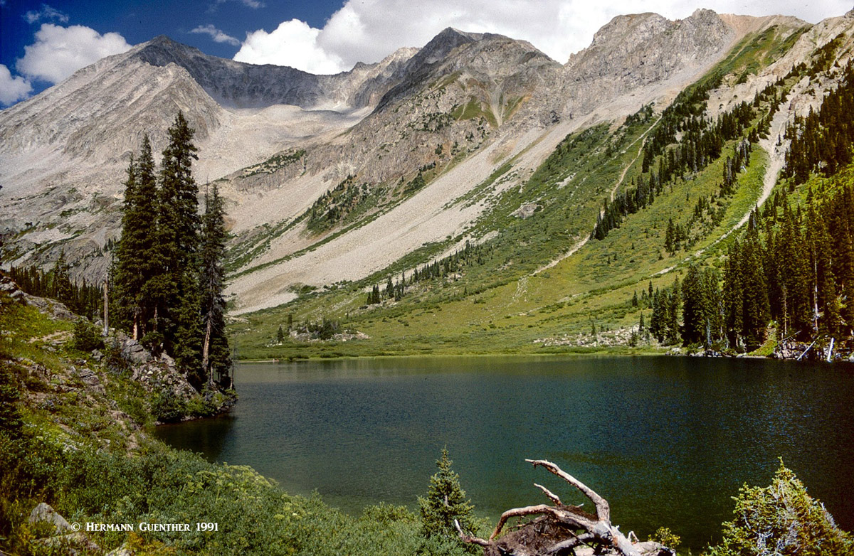
Maroon-Snowmass Trail to Crater Lake - This major trail encompassing a round-trip hike of about six miles is likely the most popular in the entire wilderness. Due to its easy access from the end of the Maroon Lake Road, visitors of all abilities give this trail plenty of use. In fact, so much use that it can hardly be called a wilderness experience. However, there is no other place in this area that will provide the hiker with so much spectacular scenery for such little effort. Upon reaching Crater Lake, the casual hiker is not likely to proceed further, but for those who are experienced and properly equipped, continuation on the trails to West Maroon Pass or to Buckskin Pass can take the hiker miles into the Maroon Bells-Snowmass Wilderness. The only limitations then are time and preparedness. This is also the place where climbers will start their ascent of the Maroon Bells.
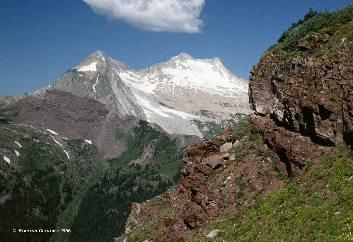
Hagerman Peak (l) and Snowmass Mountain (c) from Buckskin Pass
Snowmass Lake Trail - Near Snowmass Village, about eight miles from Aspen, is the beginning of the trail to Snowmass Lake, which involves a one-way hike of 8.5 miles. This would be a difficult one-day hike for most people so that backpacking is the order of the day here. But, given the stunning scenery and view of the Snowmass Mountain massif (which includes Hagerman Peak and Snowmass Peak) above the lake, one would not want to immediately turn around and go back down. This view rivals that of the more popular Maroon Bells, and the opportunities of further exploration in the wilderness area make a multi-day excursion a very memorable experience. With numerous campsites at or near the lake, this is a perfect staging area for an assault on Snowmass Mountain, one of my memorable climbs. Of course the interconnectivity of so many trails makes even longer excursions possible in this area. This trail is very popular, but of course not on the scale of the Maroon Bells. During my four-day expedition into this area I was blessed with absolutely perfect weather, something that is not always guaranteed.
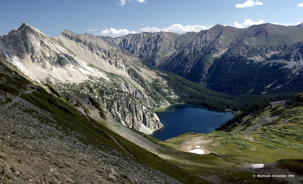
Snowmass Lake from Trail Rider Pass
Mount Sopris - One cannot fail to see one of the most stunning mountain views in Colorado when one is driving on State Highway 82 from Glenwood Springs toward Carbondale or Aspen. Mount Sopris simply dominates this view. This mountain is notable for having two summits of equal elevations of 12,965 which are about one-half mile apart. Because of the elevation of the surrounding terrain, this mountain, which is at the northern end of the Elk Range, has the appearance of being much higher than its southern neighbors. For years I have wanted to climb that mountain – and I finally did in 1994. The Mount Sopris Trail begins at Dinkle Lake near Carbondale and ascends East Sopris via the east ridge after passing between the two Thomas Lakes at about timberline. The ascent involves 4,300 feet of vertical gain in a round trip of 12 miles (an additional mile plus another 600 feet of elevation if a round trip to West Sopris is desired). The total hike is very strenuous and can be made easier if an overnight stop at Thomas Lakes is included in the overall tour. Exposure to lightning can be an issue here.
Capitol Creek Trailhead - Getting to this trailhead involves driving on a rough forest road from the town of Snowmass (not Snowmass Village, which is the ski area) that may or may not require four-wheel drive, depending conditions from year to year. Certainly high clearance is preferred here. The view of Capitol Peak from the trailhead is classic. The Capitol Creek Trail extends all the way to Capitol Lake which sits at the base of the north face of the imposing Capitol Peak. This is also the trail for those who want to go for the summit, a climb that is not to be taken lightly. The standard Knife Edge route can be intimidating, and there are no easy routes on which to bail off in case of bad weather. The north face of Capitol Peak is one of the highest mountain walls in Colorado. The knife edge route is considered "relatively easy" even though it reaches Class 4 in places. The hike up the mountain beyond the lake is not for the casual hiker. This mountain offers perhaps the best technical climbs in the Maroon Bells-Snowmass Wilderness, if not in the entire Elk Range.
North Face Capitol Peak
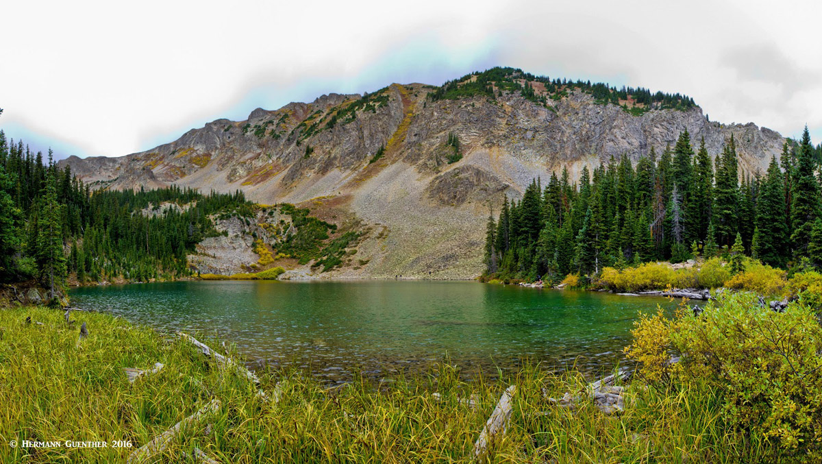
Lead King Basin/Geneva Creek Trail - If one drives from Glenwood Springs to Carbondale, and then continues south toward McClure Pass, there is a pleasant approach to the central high peaks of the Maroon Bells-Snowmass Wilderness, especially to Snowmass Mountain. It requires a four-wheel drive vehicle to get from the historic town of Marble to the Geneva Lake Trailhead in Lead King Basin. This trail affords access to three high alpine lakes (Geneva, Little Gem and Siberia Lakes) and affords pleasant camping spots, especially at Geneva Lake. From the north end of this lake is the junction of another trail that leads over Trail Rider Pass to Snowmass Lake and a very pleasant route (Class 3 in places) to the top of Snowmass Mountain. This can be done in a long day hike from your campsite. While this is a fairly popular trail, it is still not very crowded because of the effort required just to drive to the trailhead. Parts of the road can be intimidating for some drivers. Forget about trying to drive to this trailhead in the winter.
Geneva Lake, Snowmass Mountain (l)
Castle Creek Road Trailheads
If you want to get a bit further away from the crowds at Maroon Lake, yet still not far at all from Aspen, this is the place for you. The Castle Creek Road starts in Aspen and follows the Castle Creek Valley for 11 miles to the old ghost town of Ashcroft, which is really worth a visit. This beautiful valley heads south while staying mostly east of the far more popular Maroon Creek Valley. Along the way to Ashcroft are two trailheads, just off the paved road, from which trails lead to two of the most beautiful alpine lakes. And while everybody else is at Maroon Lake, here you will find very few people.
American Lake Trail - The first trailhead you will find along the Castle Creek Road is the American Lake trailhead. We hiked here one day after hiking to Crater Lake at the Maroon Bells, where we were never out of sight or earshot of other hikers. Yet when we arrived at this trailhead, there were no other cars in the parking lot. For the entire seven-mile round trip to and from the lake, we saw just a handful of other hikers. This was a true wilderness experience.
American Lake
Cathedral Lake Trail - The hike to Cathedral Lake is a good intermediate-level alternative to fighting the crowds at Maroon Lake. Just a few miles further along the Castle Creek Road is the trailhead for this 6-mile round trip hike encompassing about 2,000 feet of elevation gain. This moderately strenuous hike ends in a stunning rocky basin containing this very beautiful lake. Cathedral Lake is an alpine jewel surrounded by jagged peaks and crags. For those who have the time and energy and want a more challenging hike, the steep trail to Electric Pass offers a spectacular viewpoint. It is recommended that those who wish to do this go to the pass before visiting the lake. Electric Pass (elevation 13,485) is the highest named pass accessible by trail in Colorado and is a magnet for lightning (do you suppose that’s how it got its name?), so hikers are advised to be off the pass by noon to avoid the inevitable afternoon thunderstorms.
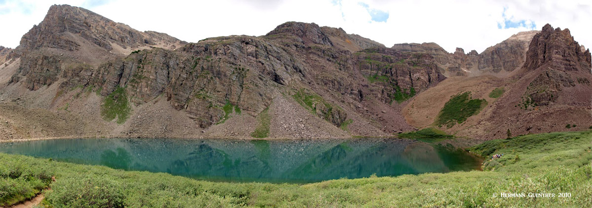
Cathedral Lake
Who has not heard of Aspen, Colorado? It started as a silver mining town in the late 1800's and was highly successful until 1893 when the silver market collapsed. The town was so named because it is surrounded by forests of Aspen trees, which in the autumn exhibit an impressive display of gold color. Aspen is known for high-end lodging, restaurants, boutiques and many celebrities (who fly into Aspen in their private jets). The Aspen area boasts four major ski areas - Aspen Mountain, Buttermilk, Aspen Highlands and Snowmass, the latter being a separate resort development about ten miles from Aspen. This is a year-round town that offers unlimited recreational opportunities. For those of us who don’t want to spend the generous amounts of dollars to stay in this upscale town, fear not. The nearby towns of Basalt, Carbondale and Glenwood Springs have plenty of affordable accommodations and restaurants.
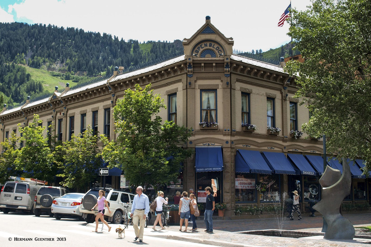
Aspen
About forty miles north of Aspen is the historic town of Glenwood Springs which is best known for its hot springs and vapor caves. It has grown into a vibrant destination of its own, affording many dining, lodging and recreational opportunities. It serves as an easy gateway, via excellent highways, to the most visited parts of the Maroon Bells-Snowmass Wilderness. As with many towns in the Rocky Mountain West, Glenwood Springs started in the late 1800's as a camp of tents, saloons and brothels. This of course attracted hordes of gamblers, gunslingers and prostitutes. It has changed significantly since those days. It is an elegant town in a dramatic setting at the confluence of the Colorado River and the Roaring Fork River. Its proximity to Aspen and the main attractions in the mountains of this wilderness make this town an ideal base of operations for those wanting to explore this spectacular region.
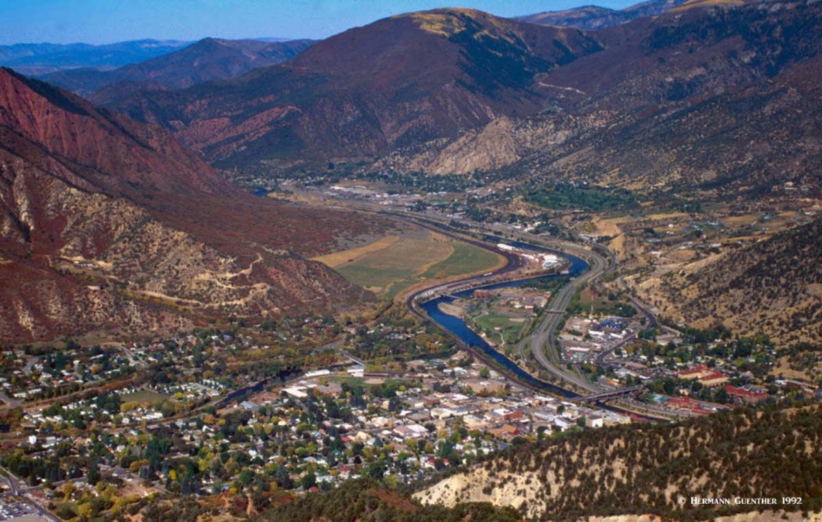
Above Glenwood Springs
These two nice towns with populations of 3,857 and 6,427 respectively are only about 12 miles apart on State Highway 82 between Glenwood Springs and Aspen. Just like Aspen and Glenwood Springs, they are very conveniently located for exploring the Maroon Bells-Snowmass Wilderness. In terms of accommodations and other tourist amenities, they are an affordable alternative to high-end Aspen. Each town has it charms and recreational appeal. Carbondale is located at the confluence of the Roaring Fork and Crystal Rivers - thus great fishing. Also several miles up the beautiful Crystal River Valley is the historic resort town of Redstone, founded in the late 19th century as part of the coal mining industry. Basalt, located at the confluence of the Roaring Fork and Frying Pan Rivers, is well known as a haven for Gold Medal fly fishing on the latter river. The nearby Ruedi Reservoir is a popular regional water sports and camping destination.
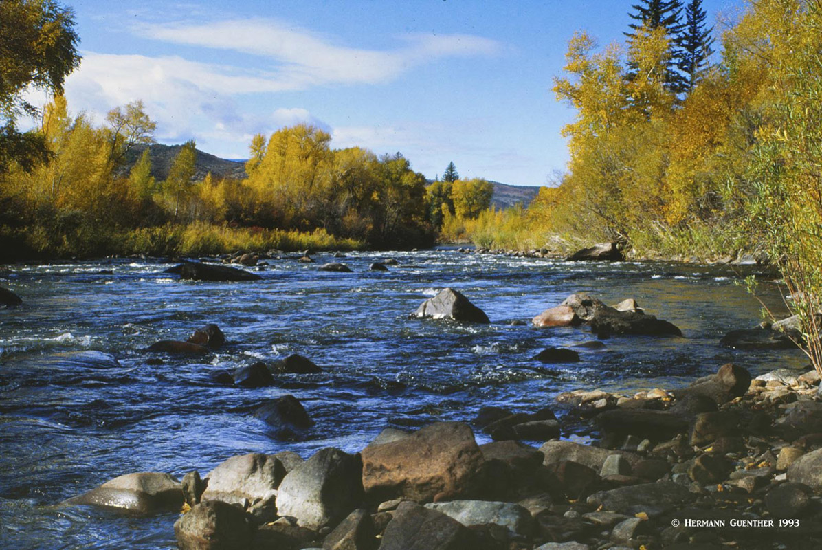
Roaring Fork River, Basalt
In addition to these towns and resorts, there are other ways to spend nights in or near this wilderness. One thing you will not find in these mountains (or other wilderness areas around the country) is what European hikers are so familiar with – fully staffed and stocked mountain huts, oftentimes re-supplied by cable lifts. But there are campgrounds nearby, though not within wilderness boundaries, for those who want a more rustic experience. Even more rustic is the wilderness itself – where you can camp almost anywhere as long as you carry everything on your back. In some popular locations, such as Snowmass, Geneva and Crater Lakes, you may only camp in designated sites. Due to recent bear activity, all backpackers must now carry bear-proof canisters for their food, something that was not required in the days when I backpacked there.