Scan the QR code and open PeakVisor on your phone
Chaffee County, one of 64 counties in Colorado, is strategically positioned right in the center of the state. It is widely known as the “Heart of the Rockies” and for good reason. It straddles the beautiful Arkansas Valley and encompasses more fourteeners than any other county in the state – twelve to be exact. In addition, it is home to four of the highest thirteeners in Colorado. All of these are part of the mighty Sawatch Range, which continues north into adjacent Lake County. These are impressive statistics by anybody’s yardstick. Of the 99 named mountains in the county, the highest is Mount Harvard (also the third highest in the Rocky Mountains of North America) and the most prominent is Mount Ouray. The Continental Divide forms the entire western boundary of Chaffee County. Park and Fremont Counties share the eastern boundary. The lowest elevation in the county is about 6,900 feet on the Arkansas River.
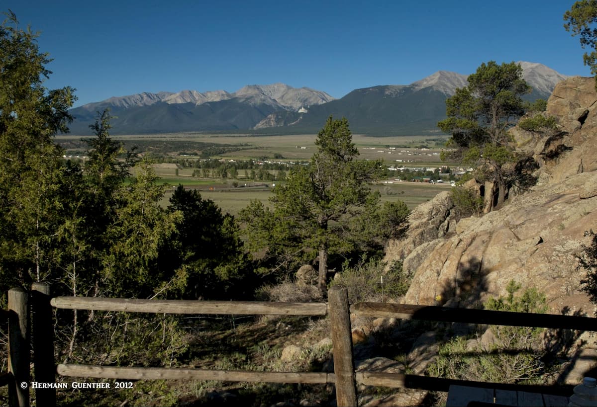
Named after Jerome Chaffee, Colorado’s first United States Senator, the county encompasses a total area of 1,015 square miles and has a population of 17,809 (2010 census) which results in a density of 18 inhabitants per square mile. Most of these people are concentrated along the Arkansas River and mainly in the three major towns – Salida (the county seat), Buena Vista and Poncha Springs – and several smaller communities. No matter where you are in this county, you will be treated to stunning views in all directions. But if you are not into scenery or recreation, you might not find much else of interest here.
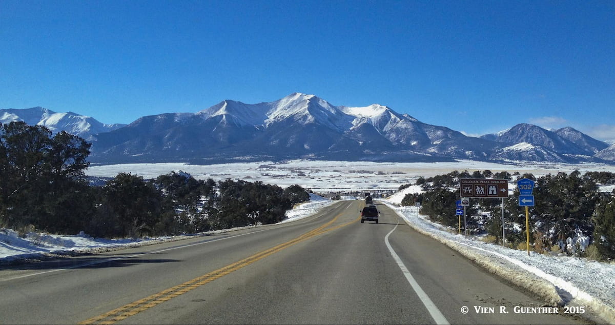
There are three major U.S. highways crossing the county – US-285, US-24 and US-50 – plus two State Highways, SH-291 and SH-306 entirely within the county. The latter crosses the Continental Divide at Cottonwood Pass and is closed during winter in its upper reaches. There are also a number of county roads, some paved at least in parts, which provide access to the many properties in the valley, as well as many forest roads that service parts of the San Isabel National Forest and the two wilderness areas, Collegiate Peaks and Buffalo Peaks, that are partly in the county. Finally, there is the relatively new Browns Canyon National Monument on the eastern side of the valley. With all of this infrastructure and natural beauty in the county, it is no wonder that this is one of Colorado’s finest recreation areas. The approach into the county from the east along US-285 is one of the finest mountain views in the state.
Before we get to the subject of mountains, let’s examine some of the other recreation options in the county that visitors can avail themselves of. Let’s talk about water first. In 2014, the Colorado Division of Parks and Wildlife designated 102 miles of the Arkansas River as the state’s newest and longest stretch of Gold Medal waters. That includes the entire stretch of the river within Chaffee County. That’s a lot of water for catching trophy trout! And it attracts fly-fishermen from all over – year round, since much of Colorado does not have a designated fishing season as do other states.
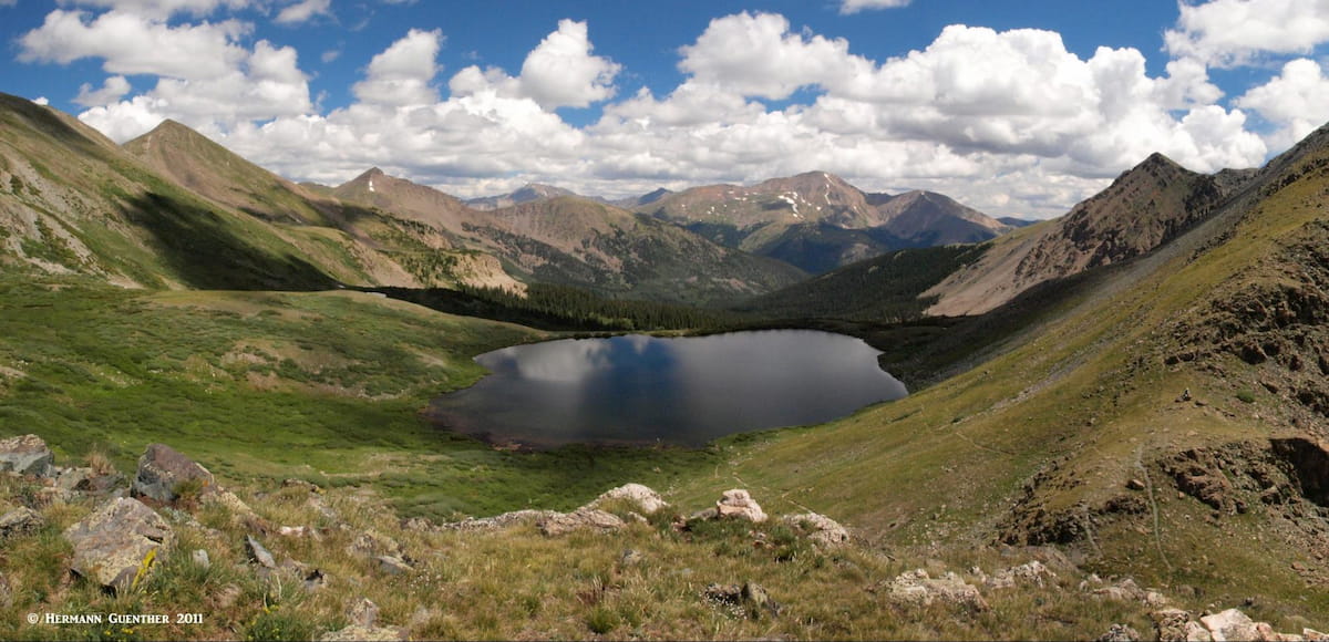
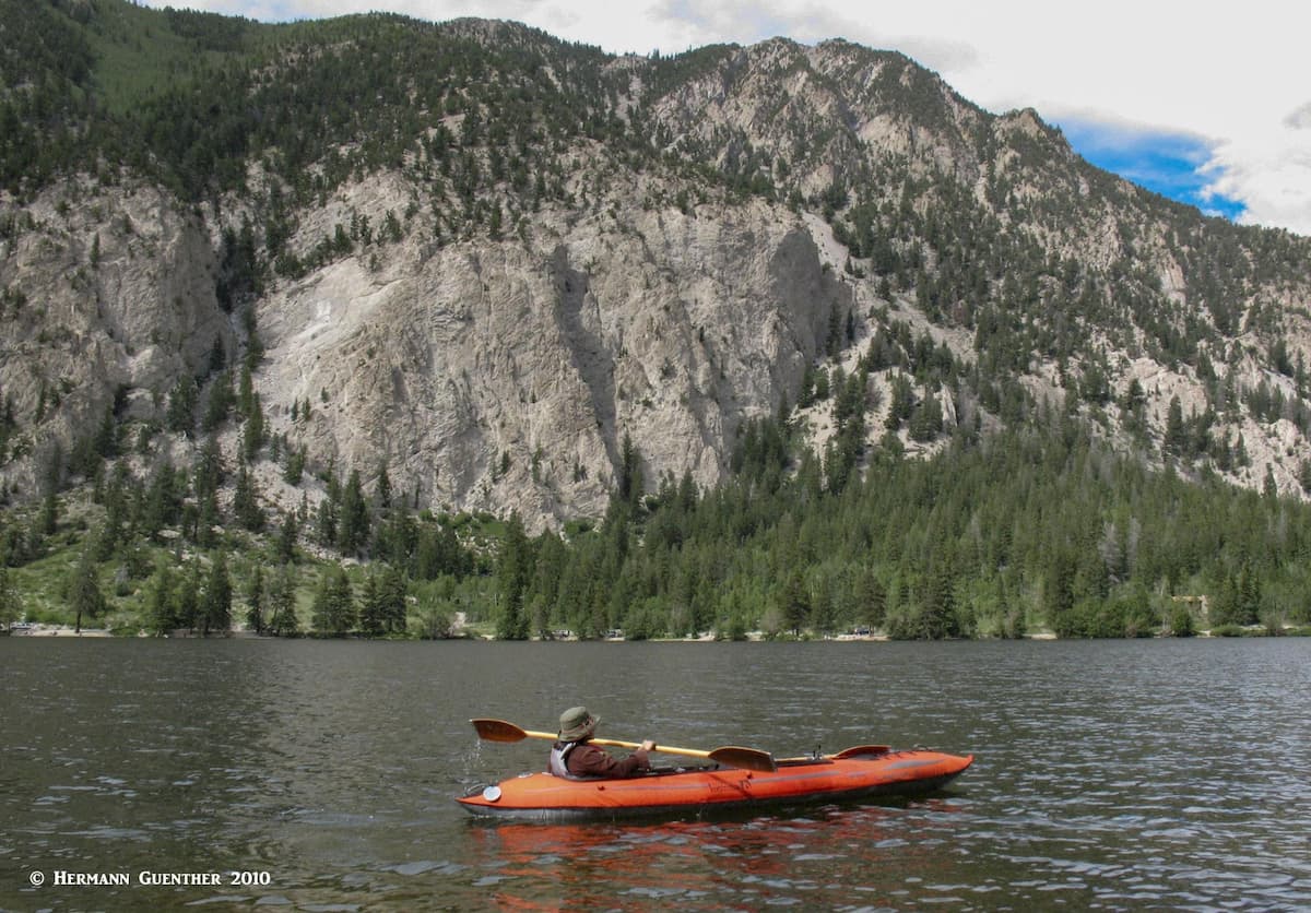
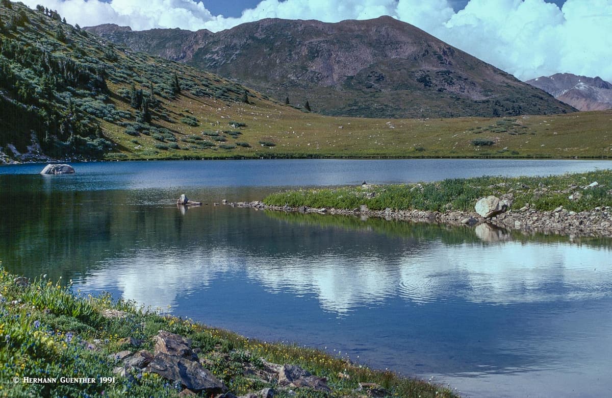
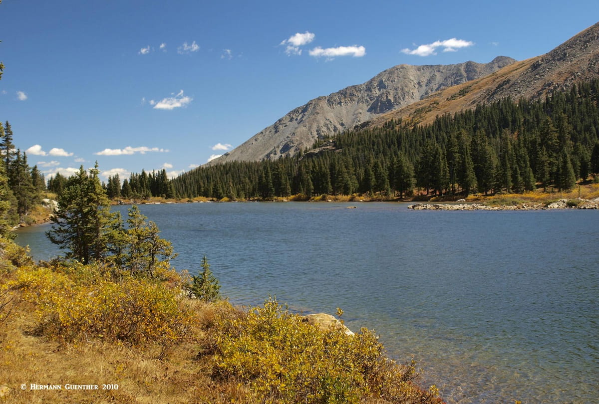
But wait – there’s more. There are several fine lakes for recreation, the largest being Clear Creek Reservoir near the community of Granite at the north end of the county. There is a campground by the lake and motorized boating is permitted. A few miles west of Buena Vista is the pristine Cottonwood Lake which also has a nearby Forest Service campground less than a half mile beyond. Fishing on this lake can be really fine, and non-motorized boats are permitted on the lake. We take our two-person kayak when we go there and have had good luck catching our dinner. The views from the water to the steep cliffs of Sheep Mountain dropping almost into the lake are first rate. There are also many smaller alpine lakes in the Collegiate Peaks Wilderness Area that afford some fine fishing for wild trout, but of course you will have to hike to these.
If alpine skiing is your cup of tea, there is always the Monarch Mountain Ski Resort just east of where U.S. Highway 50 crosses the Continental Divide at Monarch Pass (11,312 feet). This is a relatively low-key resort compared to many others in Colorado. It has no snow-making facilities and only five chairlifts, and only one of those is for four persons while the others are just doubles. The resort caters to mostly locals – the international set tends to gravitate to the better-known resorts in the state.
But it is the hiking that is the biggest attraction in this mountainous county. Given that bagging fourteeners is one of the great obsessions in Colorado, Chaffee County will satisfy hikers and climbers alike. I have climbed several of the fourteeners myself, in some cases as part of overnight backpack trips. Though fourteeners have a certain fascination for me, I am not obsessed with climbing them and would rather hike to other destinations where I can look at the views of the mountains rather than the views from their summits. Accordingly, I will provide you with some fine hikes that my wife and I have made over the years, as well as some that I made years ago before we met.
Most of the great hikes in the county are easily reached as day-hikes from Buena Vista. But there are some approaches to the high peaks that straddle the Continental Divide which are best reached from the west, either from Aspen via State Highway 82 (such as Grizzly Peak or La Plata Peak) or from the Taylor Park area (such as the Three Apostles, though this is not a common approach). We will concentrate on the eastern approaches which are not as remote and offer more maintained trails.
This adequate gravel road starts at US-24 right by the Clear Creek Reservoir about 15 miles north of Buena Vista. The first 12 miles of the road are easily negotiated by ordinary passenger cars, though continuing to some of the popular trailheads beyond will require a high-clearance vehicle at minimum, four-wheel drive preferable. At least five fourteeners can be easily accessed from this road.
Missouri Gulch Trailhead – Only eight miles from the highway is this popular starting point for three of the fourteeners in the Collegiate Peaks Wilderness – Mounts Oxford and Belford as well as Missouri Mountain. Well-conditioned hikers could combine all three into one long and strenuous day hike (14.5 miles and 7,400 feet of accumulated elevation gain). I just did the first two and it was enough for me – a combined elevation gain of almost 6,000 feet in a total distance of 10 miles round trip. The trailhead is at the site of an old mining camp known as Vicksburg. The hike up Missouri Gulch during the height of summer wildflower season is most rewarding when parts of the route are completely enveloped in beautiful stands of Colorado Columbines. While this is a good trail, don’t underestimate this climb – it is relentlessly steep all the way to the top of Belford, from where the connecting ridge to Oxford gives somewhat of a reprieve, though you still have to drop 700 feet to the saddle, which you have to regain on your way to Oxford. Since you have to return the way you came, you get to do this again, before you return to the trailhead.
West Winfield Trailhead – This trailhead is about a half mile west of the old Winfield townsite – driving here is no longer advisable for passenger cars. This spot provides the easiest ascent of La Plata Peak, the fifth-highest mountain in Colorado and therefore the entire Rocky Mountains of North America. A moderate hike via the southwest ridge of 9.5 miles and 4,000 feet elevation gain. Certainly easier than Mount Belford, not to mention the combination with Oxford (described above). The group of high summits anchored by La Plata on its west end and extending easterly to Mount Hope is best viewed from Lake Ann to the south (see below).
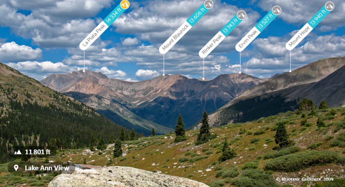
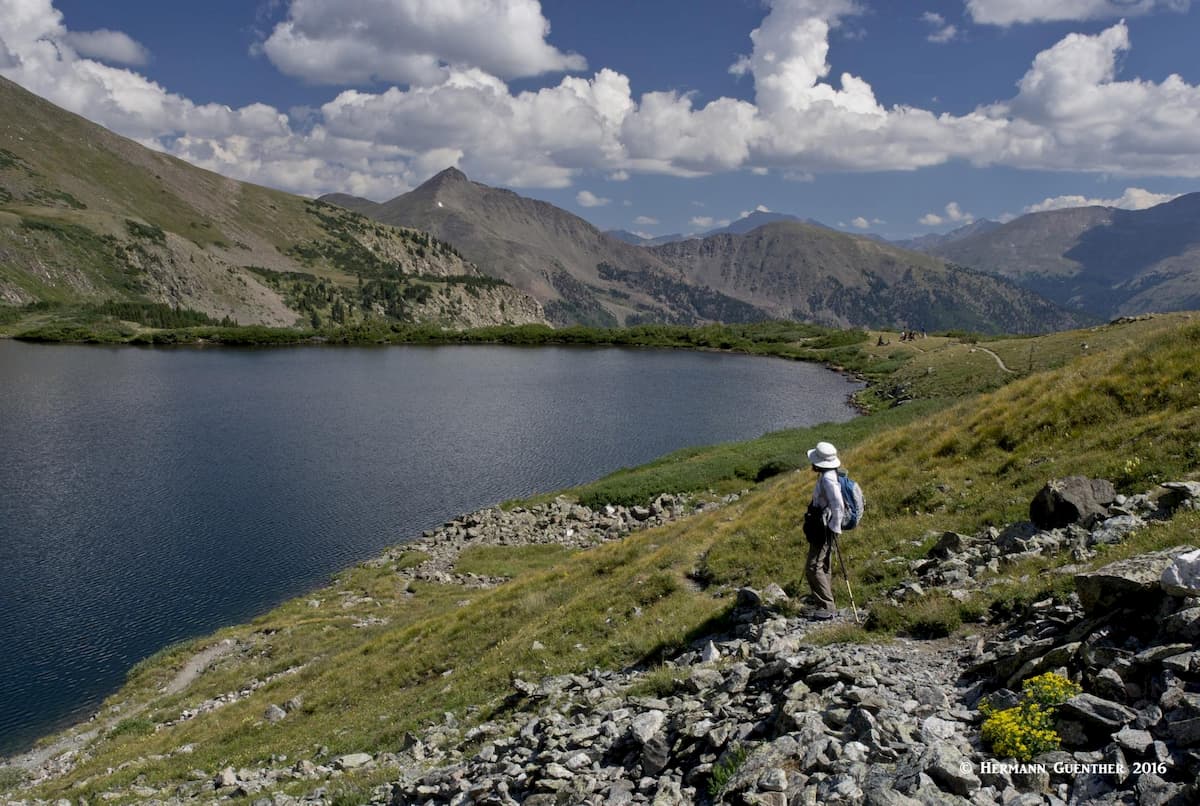
Lake Ann Trailhead – About two miles south of Winfield, this is where you want to start your hike to the beautiful high basin containing the pristine Lake Ann as well as two other unnamed ponds in a plateau called Harrison Flat. The trail offers stunning views of the Three Apostles, high thirteeners that can match many fourteeners in terms of challenge. They are typically climbed from here. Between this trailhead and Winfield is the South Winfield Trailhead, where the standard route to the summit of Huron Peak begins. It is the second-lowest of Colorado’s fourteeners, and it is not a difficult climb, involving only 3,750 feet of elevation gain in a round-trip distance of a little over eight miles. From Lake Ann, the view toward the north encompasses several high peaks including La Plata Peak, the fifth-highest in the Rocky Mountains.
North Cottonwood Trailhead – This trailhead, only about eight miles from Buena Vista, can be reached by a variety of county and Forest Service roads, depending on where your drive originates. This is the most common place to start your climb of Mounts Harvard and Columbia and also affords an alternative approach to Mount Yale. I have climbed both of these fine mountains from this point, in each case involving an overnight backpack trip to fine alpine lakes. If you have three or more days, you could set up camp somewhere in between and perhaps bag all three of these in one outing. The main trail diverges into the Horn Fork Trail to Bear Lake, which provides the most common approach to Harvard and Columbia, and the Kroenke Lake Trail from where you have a great hike to Mount Yale. But you don’t have to climb fourteeners to enjoy these two wonderful basins. Just a couple of days exploring this area, and maybe trying your luck fishing in these fine alpine lakes can be enough fun. I caught my dinner there.
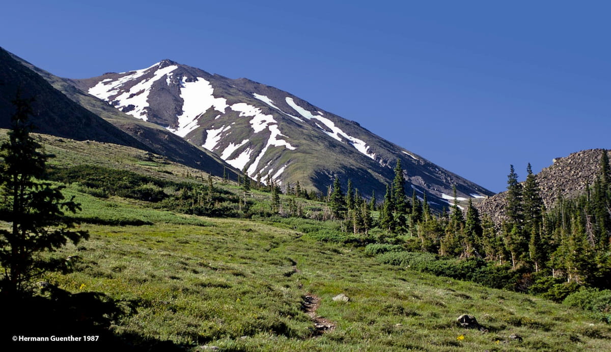
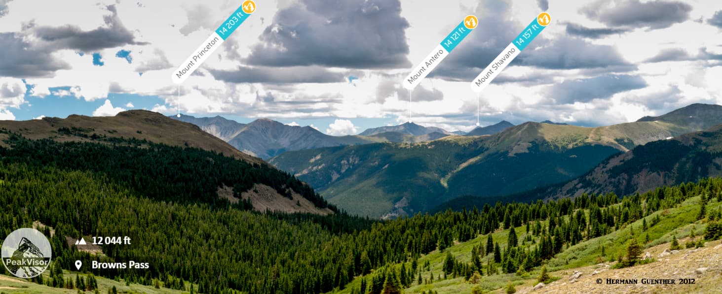
Denny Creek Trailhead – One of my favorite places to hike in Chaffee County is from this trailhead, just a few miles outside of Buena Vista. While peak-baggers would most likely start their ascent of Mount Yale from here, there are a couple of fine alternative hikes for the non-climber. A favorite of ours is to hike to the relatively little-visited Hartenstein Lake, across which you will get a fine of Mount Yale to the east. If you want a different view, don’t take the side trail to the lake but continue the main trail all the way to Browns Pass. From this 12,020-foot perch the views to the north and south are epic. From here you can continue deep into parts of the Collegiate Peaks Wilderness that are not commonly visited by casual hikers since the distances are so long that overnight backpacking is necessary. I particularly enjoy the view north toward the Three Apostles, although looking south you can see three of the southern fourteeners on the horizon.
Going south from Buena Vista is not the end of what Chaffee County has to offer in terms of hiking. There are four more fourteeners to be explored here, but they are not in the Collegiate Peaks Wilderness. These mountains are studded with mining claims and old mine roads that disqualify this area for wilderness status. But that does not mean that these are any less spectacular places to go hiking.
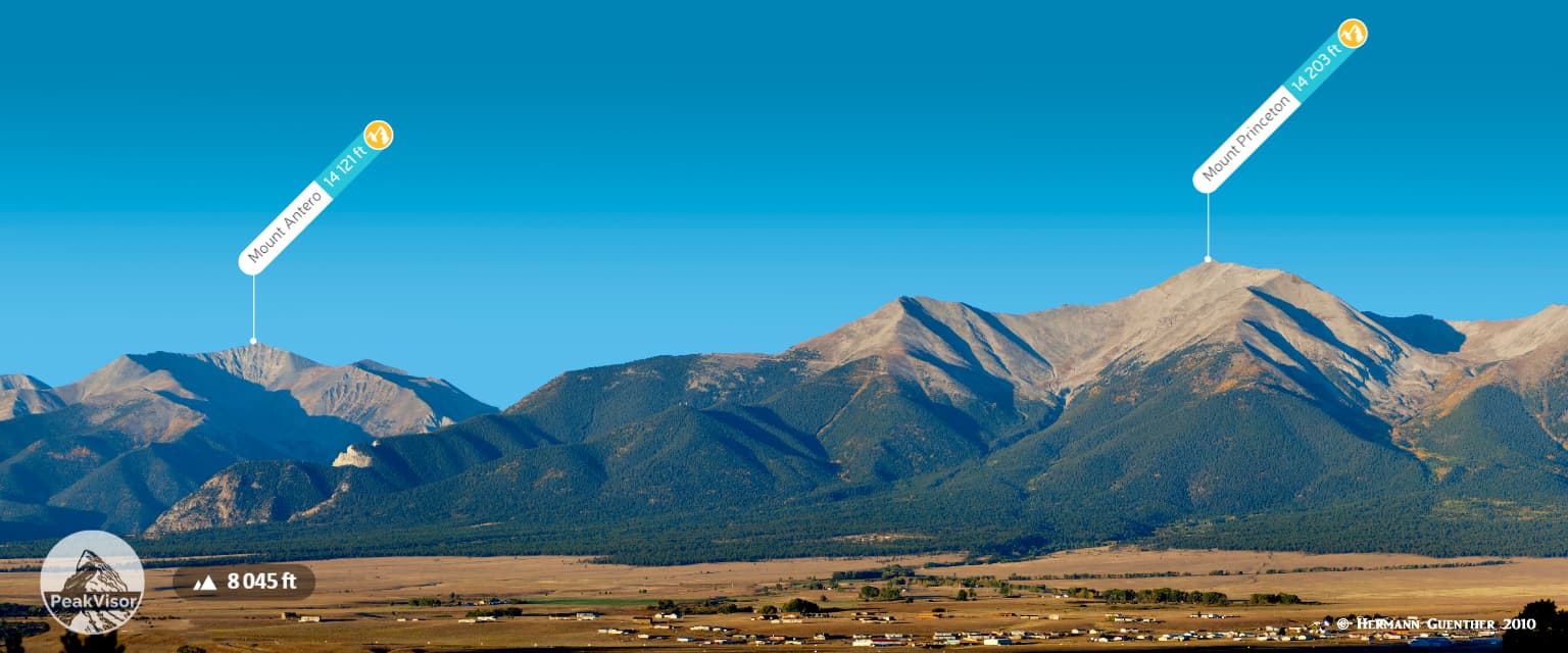
Chalk Creek Drive – Also known as St. Elmo Road and County Road 162, this mostly paved road leads to the St. Elmo ghost town, a popular and still inhabited tourist attraction. The road also provides access points for climbing both Mount Princeton and Mount Antero - both popular fourteeners. The "official" trailhead for Mount Princeton is on a side road, called the Mount Princeton Road, at an elevation of 8,900 feet. This is where most passenger cars will park in a large lot. But the road continues up until reaching 11,000 feet, though driving to that point is not advisable for people who value their cars. Further up Chalk Creek Drive are two trailheads for those wishing to climb Mount Antero. The first is at the Cascade Campground which is the trailhead for the north slopes of the mountain. A couple of miles further up is the Baldwin Gulch Road junction which is used as a staging point for those wanting to climb Antero's west slopes. Without a four-wheel drive vehicle it is not possible to drive up Baldwin Gulch Road.
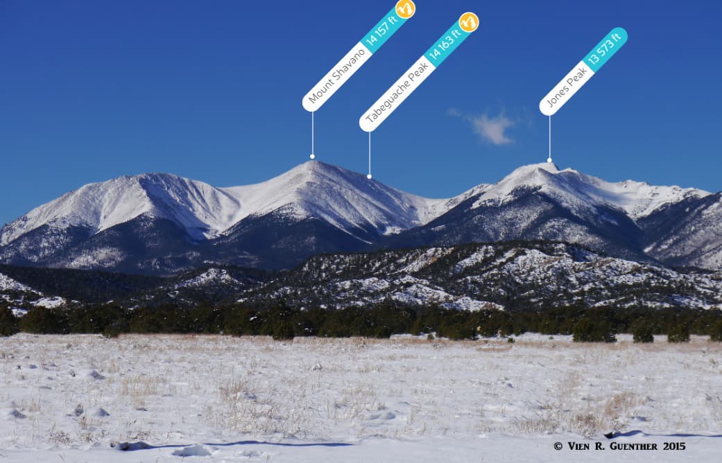
County Road 240/Jennings Creek Road - This road is commonly used to access the two southernmost fourteeners in the Sawatch Range - Mount Shavano and Tabeguache Peak. These two mountains are often climbed together, but there are two trailheads along this road depending on your climbing preferences. One is the Angel of Shavano Trailhead and the other is the Jennings Creek Trailhead. They can both be reached by passenger cars, although the road gets considerably rougher after the first trailhead.
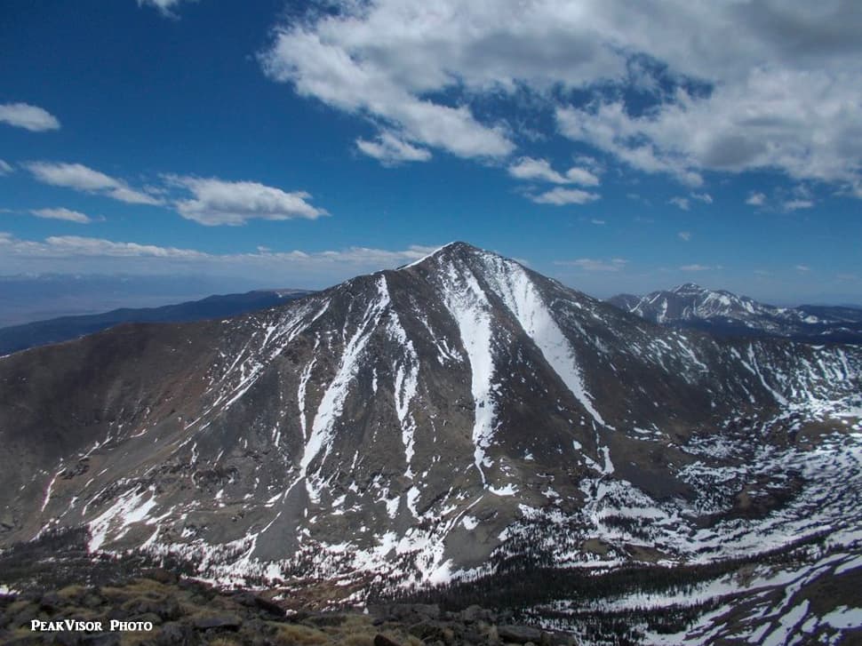
Marshall Pass Trailhead – If you want to climb the most prominent mountain in Chaffee County, Mount Ouray might be for you. It is one of the highest thirteeners in Colorado, as well as the southernmost mountain in the Sawatch Range and Chaffee County. It is just a short ridge walk from the Continental Divide. It is not often climbed, though if it were just a few feet higher, it would be a fourteener and everybody would be trying to bag it. The trail begins at the pass and follows the Continental Divide to a ridge which is then followed east to the summit, from where some of the best views in south-central Colorado can be appreciated. The round-trip hike is about seven miles and has an elevation gain of 3,200 feet. The road to the trailhead can be driven in a regular passenger car.
While Chaffee County is only a two-hour drive from the two major population centers of Colorado – Denver and Colorado Springs – these two urban areas are not close enough to really constitute a significant base from which to explore the county’s many charms. Certainly, there are people who make day trips from these places to hike in the mountains and then return home again the same day. I have done that on many occasions myself, especially back when I could not afford to stay overnight in a hotel, or had to be back to work the next day. In retirement, that is now a different story and we would more likely want to spend several days at a time, which is what we do now, and only on weekdays of course.
When recreating in this county, all bets are that this nice little town is the place of choice to stay for a few nights, at least for us. We sometimes camp in the back of our pickup truck at one of the many Forest Service campgrounds. That is fun, but not nearly as comfortable as staying in a cabin, which is what we usually do, and there are plenty of selections in the Arkansas Valley. We usually stay in the local KOA, which is one of a chain of similar facilities throughout North America. These have simple cabins as well as sites for tent campers or powered sites with all necessary connections for those who haul their massive land yachts equipped with all the amenities of their homes. There are several such RV parks in Buena Vista as well as in other areas of the county. This town has plenty of other amenities including motels, a wide selection of restaurants and shopping. But it is not a high-end town with five-star resorts. For that you would have to go elsewhere. For us, this is just fine.
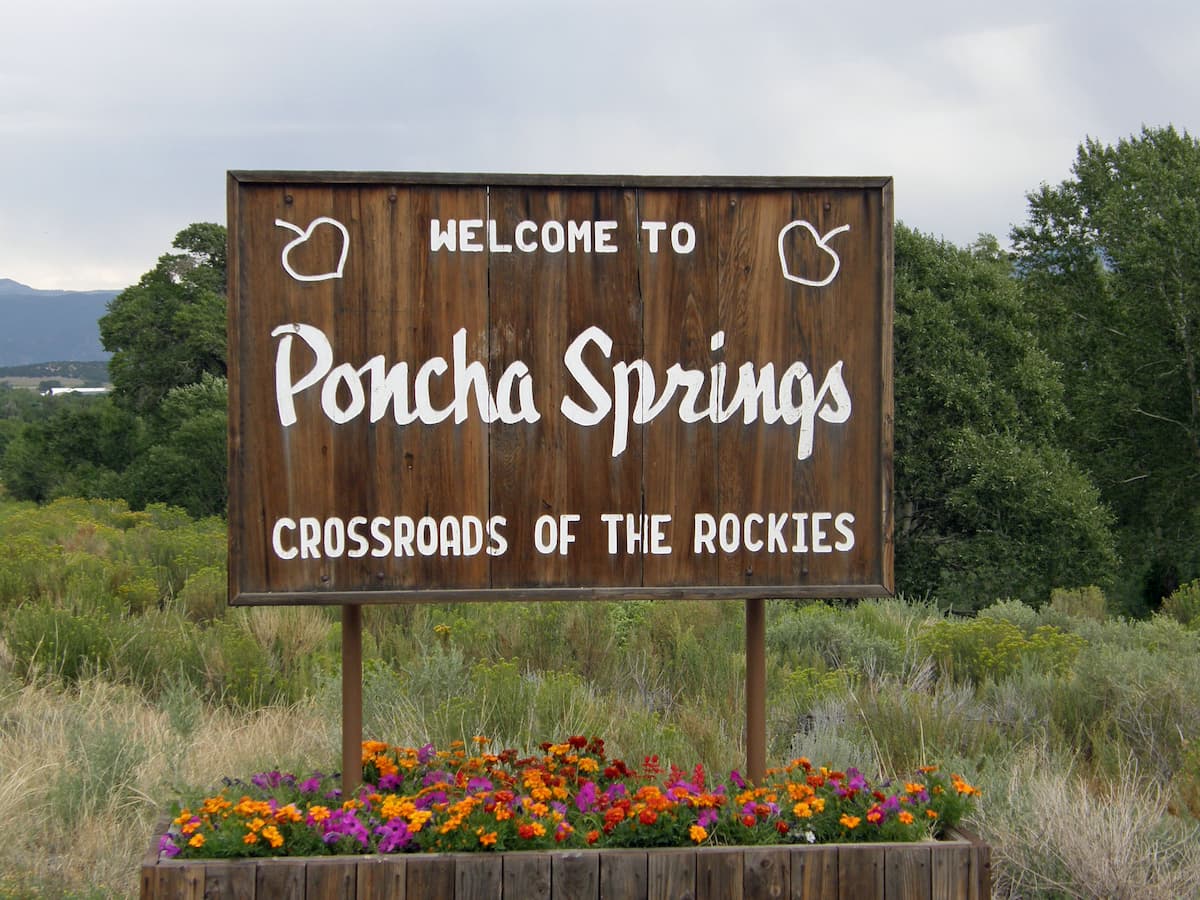
This is definitely a small town! With a population of less than 1,000 inhabitants, the visitor cannot expect to find an expansive tourist infrastructure here. But what makes Poncha Springs significant is its location in that it sits right at the crossroads of two major highways - US-285 and US-50. One crosses Colorado from east to west and the other from north to south. This town is situated near the southern end of Chaffee County and while it comes up short on amenities, it is only five miles from the much larger town of Salida to the east on US-50. For those wishing to climb Mount Ouray, Poncha Springs is by far the closest town to the Marshall Pass Trailhead.
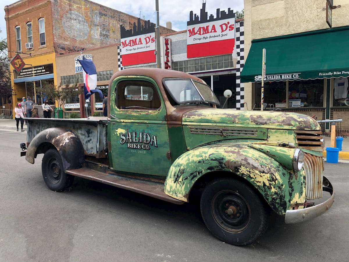
While not as centrally located in Chaffee County as Buena Vista, Salida is the largest and only city in the county, thus giving it a meaningful role in supporting the tourist trade in the Arkansas Valley. It also happens to be the county seat. With a population of almost 6,000 inhabitants, there are plenty of accommodations, restaurants and other establishments that can cater to most tourist needs. Being adjacent to the Arkansas River, there are many businesses here and nearby that provide the recreational activities that this area is famous for - some of the best whitewater rafting in the country. This river provides all the thrills a rafter could want and more, and in the summer visitors arrive here in droves just to have an opportunity to get thrown off a raft into the cold, clear waters of this world-class whitewater venue. It should be noted, however, that parts of this river are not for amateurs. For those who want to go hiking and climbing in the southernmost mountains of Chaffee County, Salida would be a good bet for accommodations and restaurants.