Scan the QR code and open PeakVisor on your phone
Ouray County is one of 64 counties in the state of Colorado, located in the southwestern part of the state. It lies at the northern edge of the mighty San Juan Mountains. The town of the same name is the county seat. It is named for Chief Ouray, a distinguished Ute Indian chief. The founding and evolution of this county is somewhat convoluted to say the least. It was first carved out of the much larger San Juan County on January 18, 1877. Then on February 19, 1881, Dolores County was carved out of Ouray County. Two years later, on February 27, 1883, the county was further split into San Miguel County and what remains as the present Ouray County. But that’s not all. The Colorado General Assembly then renamed Ouray County as Uncompahgre County – but four days later, on March 3, 1883, they changed their minds and changed the name back to Ouray County. Did you get all that?
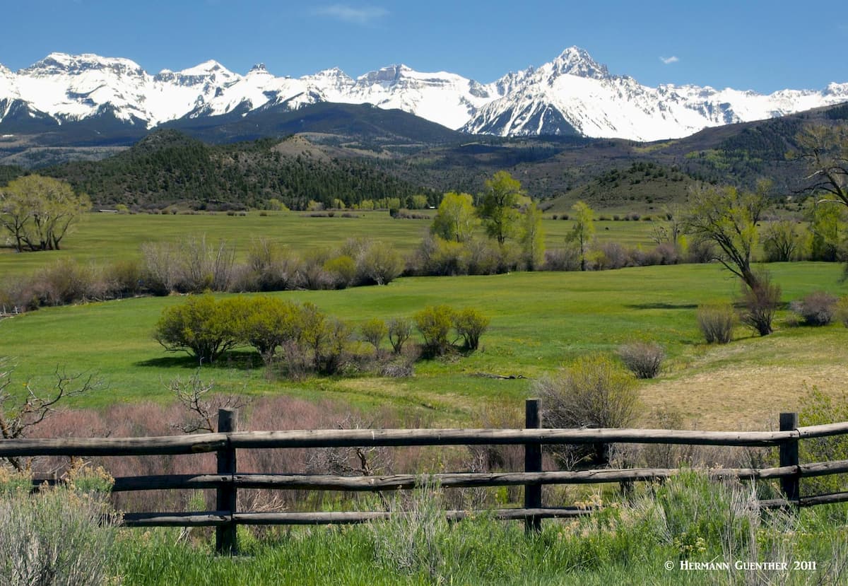
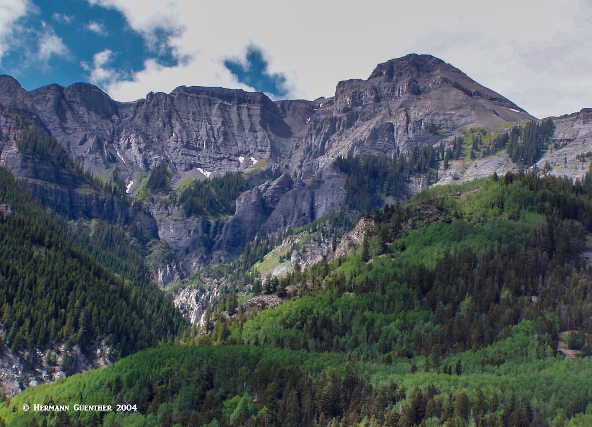
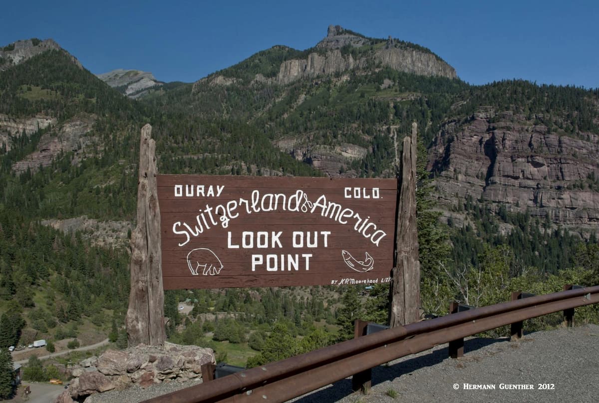
OK, there is more to this beautiful place than 19th century politics. Nature has blessed this county with some of the most spectacular mountain scenery in the country – which is why it has been known as the “Switzerland of America''. Now, I have hiked quite a bit in Switzerland as well as in Ouray County and have to tell you that some imagination is necessary to make that comparison. (Geologically, these mountains are quite different from the Swiss Alps and the man-made fabric of the surroundings is substantially different.) But don’t get me wrong, this place has some of the best mountain scenery I have seen anywhere. This small county is home to 46 named mountains of which the highest and most prominent is Mount Sneffels – one of only two fourteeners in the county, though the other one, Wetterhorn Peak, is shared with adjacent Hinsdale County.
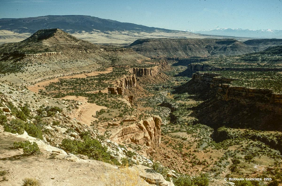
This is a small county with a 2019-estimated population of less than 5,000 souls. Its population density is about 9 persons per square mile. Contrary to what some believe, the county is not all composed of high mountains – its mean elevation is only 8,951 feet. Most of the northern half of the county is part of the Uncompahgre Plateau, with an average elevation of around 8,000 feet and lacking any pronounced mountains, though there are many prominent points here that rise above the terrain. In fact, as soon as you go north from Ouray town toward the town of Ridgway the mountains abruptly transition into low hills. After Ridgway, the plateau takes over the terrain. There is plenty to do here with scattering of minor hiking trails and off-road tracks. The Dominguez Canyon Wilderness Area on the plateau is a fine place to go backpacking, as I have done once. The photo below was not taken within Ouray County but demonstrates the geologic character of much of the plateau.
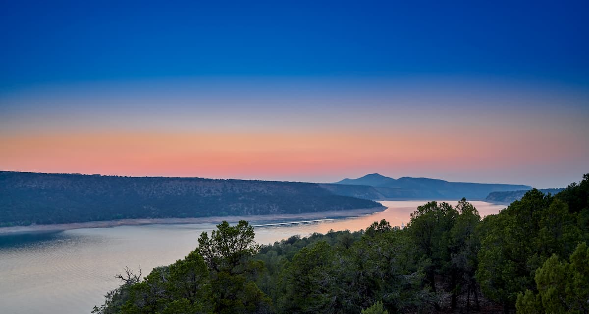
Right at the southeastern end of the plateau is the amazing Ridgway State Park, just north of the town of Ridgway. This gem surrounding a magnificent reservoir offers a myriad of recreation possibilities, including 14 miles of hiking trails. This park is a year-round destination offering fishing, boating, camping, biking, Nordic skiing (when snow conditions permit), windsurfing and many others. Of course, the terrain is such that visitors wanting challenging outings might be better advised to look elsewhere. That’s where the mountains come in.
Despite the relatively small area of the county occupied by high mountains, there are some very fine hikes that can be made within short drives from the center of the town of Ouray. In fact, a number of challenging hikes can be started right from within the town’s limits or just outside of town. I have done a few of those and I can assure you that they are so worthwhile and will certainly test your conditioning and stamina. And then, a bit further from town are some hikes that will take you into spectacular places that, once you have been there, you will never forget. Let’s take a look at some of these.
Portland Amphitheater Trailhead – Located near the Amphitheater Campground at the eastern edge of town is a trailhead from which some interesting hikes can be undertaken. For the really ambitious hiker, the 8-mile round-trip hike to the Chief Ouray Mine is a respectable trek into a spectacular basin involving 2,600 feet of elevation gain. From the upper parts of the trail there are stunning views down to the town of Ouray and across to the high, craggy peaks of the Sneffels Range. This can be done as an out-and-back hike by going up the Portland Trail and continuing on the Chief Ouray Mine Trail. The latter has some pretty amazing switchbacks over very steep terrain. If you go to the mine, be mindful of some serious drop-offs. On the return, you can cut out about two miles by following the Cascade Falls Trail back to the trailhead. If you choose to skip the mine, you can just do a very pleasant 5-mile loop by just combining the Portland and Cascade Falls Trails.
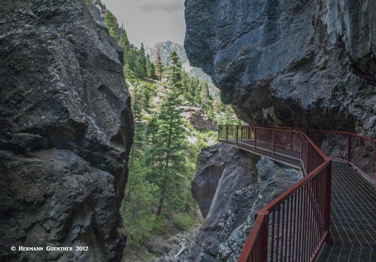
Ouray Perimeter Trail – This six-mile loop leading completely around the town of Ouray can be started at any number of locations either in or just outside the main part of the town. The visitor center at the north end of town might be a logical place to start. The entire trail involves a total elevation gain of about 1,500 feet along a series of ups and downs. The trail’s maximum elevation is 8,500 feet near where it crosses US-550. The scenery changes continuously on this hike, which makes it a pleasant way to get a feel for the town as well as the surroundings. An added benefit is that the trail provides access to the public Ice Park (and ice-climbing venue) as well as the Box Canyon Park, for entrance to which you will have to pay an admission fee. It is well worth doing. In the winter months, you would be well advised to take hiking sticks and/or spikes, since there will be lots of icy spots along the trail.
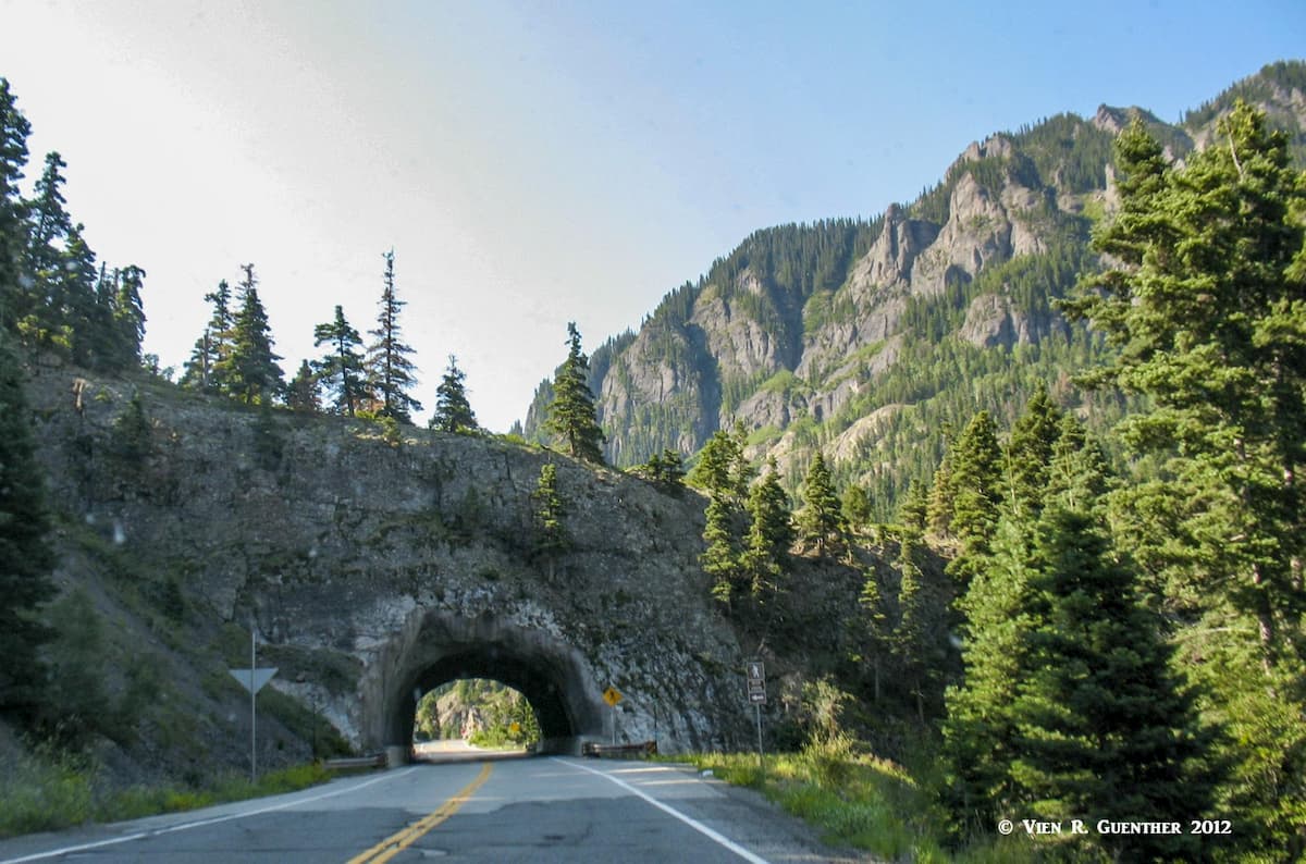
Horsethief Trail/Bear Creek Trail Combination – Just 2.5 miles from the south end of Ouray along US-550 is a short tunnel through which you drive to get to the Bear Creek Trailhead. There is some limited parking beside the road on the south side of the tunnel. The famous Bear Creek Trail starts here and actually crosses over the top of the tunnel. This six-mile trail to American Flat can be combined with the Horsethief Trail at that location to return to a trailhead north of Ouray at the end of the Dexter Creek Road (Forest Road 871). While a car shuttle is required to do this, since the trailheads are about seven miles apart, this hike is one of the finest trail combinations in the Ouray area. At 13 miles long, this is a strenuous hike but affords some amazing views in all directions at its upper reaches. A segment of the Bear Creek Trail hangs on the side of steep cliffs with spine-tingling drop-offs, which makes it inadvisable for hikers with a fear of heights. This long hike will take you into the wonderful Uncompahgre Wilderness.
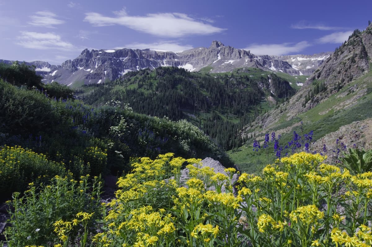
Yankee Boy Basin Trailheads – About eight miles from Ouray is Yankee Boy Basin – a wonderland of wildflowers and killer views. To get there, you need a high-clearance and 4WD vehicle. There are a number of places to park here – how far you drive depends on your vehicle and how brave you are. If you go at the right time of summer, you will not be alone since this is a popular place – both for hiking and viewing some of the most stunning wildflowers in Colorado. Here is where many will attempt to climb Mount Sneffels, the only fourteener easily accessible from Ouray County. If you drive to the highest parking area, it is only a two-mile hike to the top and back, but it is steep. A slightly longer route is to hike to Blue Lakes Pass and follow the southwest ridge to the top. But you don’t have to climb Sneffels to enjoy this area as there is a network of trails here, some of which will take you to Wrights Lake at about 12,200 feet elevation. Of course you can also go to Blue Lakes Pass and then down to the three so-named lakes. But there is a better way to get to these stunning lakes (see below).
Dallas Trailhead – Just two miles north of Ouray, beside the west back of the Uncompahgre River, is a trailhead that gives access into some little visited wild country. While the Dallas Trail continues west to another trailhead (coinciding with the Blue Lakes Trailhead) and even further west, it is possible to do a fine six-mile loop hike here by combining this trail with the Corbett Creek Trail, a hike that I did several years ago. When my friend and I did this, we saw no other hikers all day. Near the upper end where the two trails join is a wonderful viewpoint from which you can get just about the best view of Whitehouse Mountain.
If you drive north of Ouray on US-550 as far as Ridgway and then head west on State Highway 62 for about five miles, you will see a turnoff to County Road 7. Take this good gravel road, suitable for most cars much of the year, south about nine miles to its end. This is where you will find two trailheads very close together. Be warned, one of these is extremely popular – they both share a common parking area that will at times be crowded.
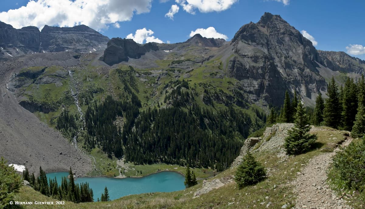
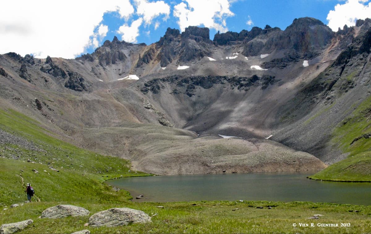
Blue Lakes Trailhead – The trail that begins here is without doubt one of my all-time favorites – and that of countless other hikers. In 3.5 miles, it will take you to the lowest of the three Blue Lakes, which is itself a fantastic destination. Many people don’t go beyond this lake, and many others will camp here to get more time in this mountain wonderland. The times that I made this hike I did not camp here, but I have definitely gone beyond this aptly named lake. Lower Blue Lake is unlike any other lakes I (and my wife) I have ever been to. The scenery is so stunning that I didn't even make the effort to catch fish in this lake, even though it is said to be a fine fishing hole with large trout.
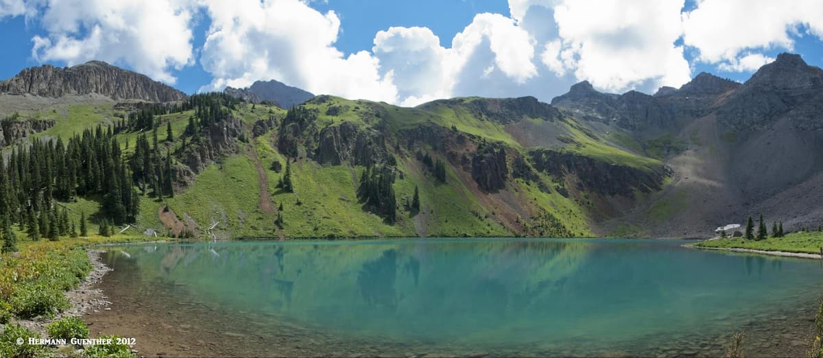
But with so much scenery to explore here, I thought I could fish in lots of other lakes, but I won’t find scenery like this just anywhere. The thing to do here is to go to the two upper Blue Lakes – it’s only an additional mile each way but some considerable additional elevation gain. Believe me, it’s worth going to the extra effort to see what is up there. The trail is constructed in such a location that you will not actually see the middle lake until you are already above it and just before you reach the upper lake. But don’t worry – you really don’t need to go to the middle lake. The views of it from above are more than adequate. And the views from the upper lake across this awesome alpine basin are just mind-blowing. Let the photos speak for themselves.
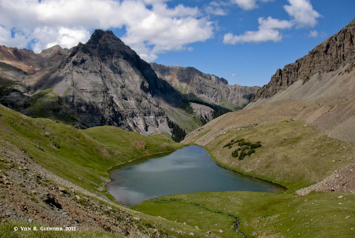
Many hikers intent on climbing Mount Sneffels will do it from here. They will most likely camp at the lower Blue Lake and then make the climb the next morning. Getting to the upper Blue Lakes is then the easy part. But at the upper end of the last lake is where it gets serious – many switchbacks up the steep slope to Blue Lakes Pass (on the other side of which is Yankee Boy Basin), after which it is a steep ridge walk to the top. While not much more than a Class 2 hike, there is some exposure near the summit, so that care is advisable. If the weather is fine, as it was when we were here, you will get an eyeful of magnificent scenery. Be sure to have a camera and extra batteries with you.
Dallas Trailhead – This is an intermediate access point to the Dallas Trail, which continues for some additional miles to the west. Taking this trail to the east about three miles will take you to a junction with a spur trail of about one mile in length. That takes you into Blaine Basin, an incredible alpine bowl on the northeast side of Mount Sneffels. You will not find many people here as this basin is generally only visited by climbers attempting the north routes of Sneffels. Some of the other high peaks in the Sneffels Range are also accessible from this basin, especially Cirque Mountain and Mount Ridgway.
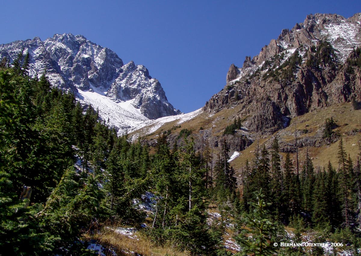
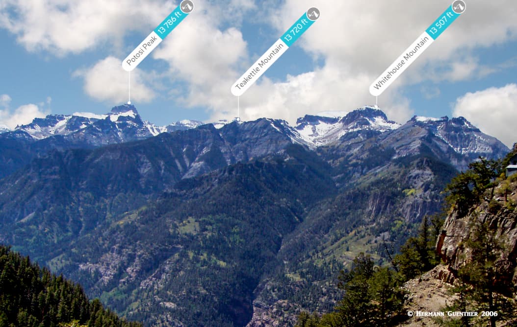
Other Mountains in the Mount Sneffels Wilderness – There are a few significant high mountains in the eastern segment Sneffels Range including Cirque Mountain, Teakettle Mountain, Potosi Peak, Mount Ridgway and Whitehouse Mountain. They are all mostly climbed from Yankee Boy Basin and generally using unmaintained trails or even recognized routes known only to experienced climbers who are familiar with these mountains. There is one “official” trailhead on the Yankee Boy Basin Road (also known as Camp Bird Road) that can be reached in passenger cars. It is called the Weehawken Trailhead and is generally used for climbing Mount Ridgway and Whitehouse Mountain. But don’t expect a maintained or well-marked trail to their summits. None of the mountains in this area are frequently climbed, and certainly not by casual hikers.
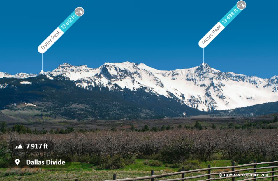
South and west of Mount Sneffels are several other prominent high peaks that are rarely climbed. Access to them is generally from outside of Ouray County though they sit right on the southwestern county boundary. These impressive peaks, including Gilpin Peak, Dallas Peak and Mears Peak, along with their high connecting ridges, are easily viewed when driving along SH-62 and over the Dallas Divide. This is one of the most iconic views in Colorado, especially during autumn when the aspen trees change colors. Some of these peaks, especially Mears Peak, are almost impossible to climb from the north – instead, when they are climbed it is from the area around the resort of Telluride to the south. We will not discuss them here since they are not of universal interest to visitors of Ouray County.
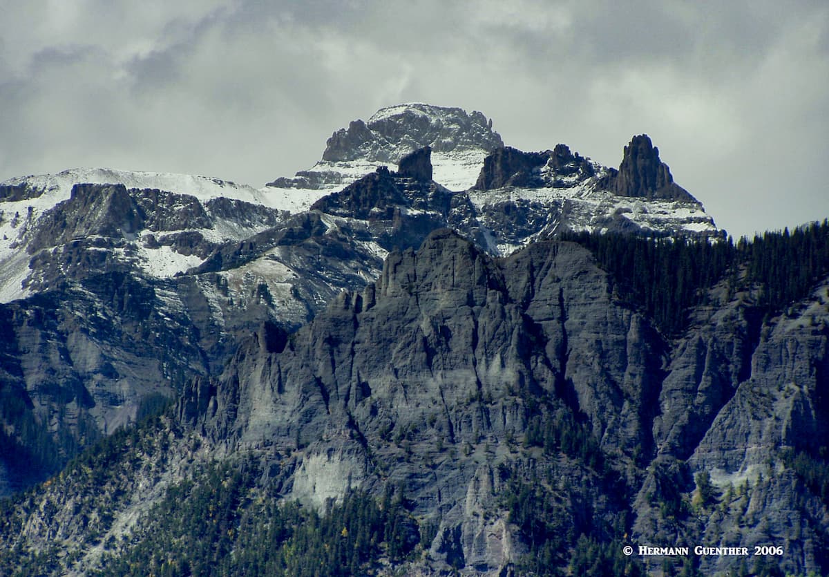
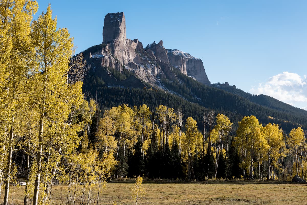
Part of this impressive wilderness lies within Ouray County, so it would be remiss to not mention its mountains here. After all, the only other fourteener in the county, Wetterhorn Peak, is in this wilderness area though it does lie on the boundary with Hinsdale County. Other important mountains on this common boundary include Coxcomb Peak and Courthouse Mountain. Though these mountains and their surrounding terrain are more likely to be explored from adjacent Hinsdale and Gunnison Counties, the northern parts of this wilderness are accessible, at least in the summer months, from Ouray County. There is one road that starts near Ridgway called the Owl Creek Pass Road (also County Road 8) that can take visitors to this beautiful place. This well-maintained gravel road is only open in the summer months, closing for good after the first significant snowfall in autumn. This road, combined with other similar roads in Gunnison County, will lead to several remote trailheads from which Courthouse Mountain and Coxcomb Peak, for example, can be climbed. Chimney Rock (one of many so-named formations in the west) is a popular destination, though only climbers would attempt reaching its top.
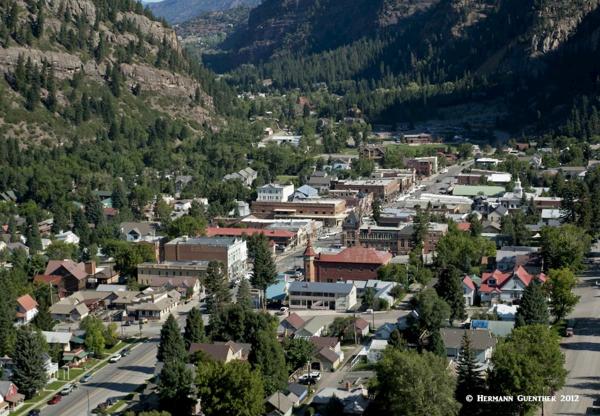
Ouray County is far from major cities, being tucked away in a sparsely populated area of Colorado. The town of Ouray is the only designated city in the county, while Ridgway is the only town. There are a few small communities, three of which are “census-designated places” which are defined for statistical purposes only. So needless to say, Ouray County is small and as such does not support much in the way of tourist infrastructure. Yet the county attracts its fair share of visitors, many of which do find decent as well as upscale accommodations. If camping is your way of enjoying the great outdoors, there are plenty of places in the county to do that.
The pretty City of Ouray (named after a famous Indian Chief) is only 35 miles south of Montrose or 95 miles south of Grand Junction, the largest towns anywhere near Ouray County. Ouray and its surroundings are affectionately called the "Switzerland of America" - and for good reason. The scenery from and of the town is simply stunning. Despite its population of just over 1,000 permanent residents (one would hardly expect something so small being called a city), Ouray offers a considerable selection of accommodations and dining options. Aside from being a hiking and climbing mecca, Ouray is famous for its many hot springs, five of which were developed for the tourist trade. For hikers, there are so many options from which to choose. The nearby Yankee Boy Basin is world-renowned for its annual display of wildflowers. The basin provides plenty of opportunities for hiking.
The famous Blue Lakes Trail is only a 24-mile drive north of town. That is the premier trail in the wilderness and the one most visitors are likely to want to experience. There are also other places close to town that offer some pretty rugged hikes. Some of these mountains, though not very frequently climbed, are a short drive from the town. So there is simply no excuse for not finding something exciting to do in this awesome little gem in the San Juan Mountains. For more information and photos about hiking in and around Ouray, please follow some of the links in this article. If simply relaxing in a pristine setting and not doing anything but enjoying the scenery and mountain air, you can’t do much better than Ouray. If you are not into hiking or climbing, but need an adrenaline rush, you can always rent a Jeep and try your skills on one of the many nearby trails. Try Black Bear Pass from the top of Red Mountain Pass to Telluride. It will give you white knuckles.
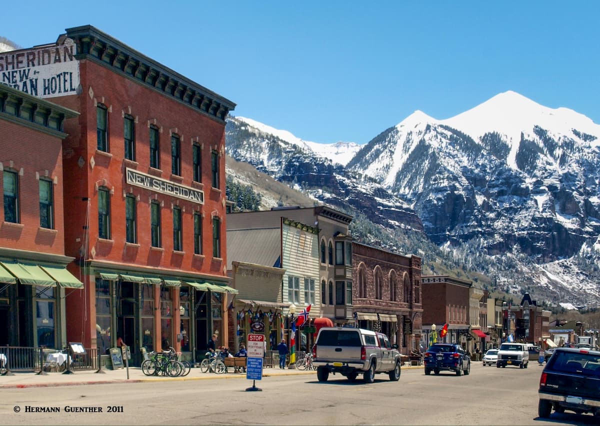
No, this spectacular mountain resort is not in Ouray County, but it is close. Though only ten miles from Ouray, you do have to drive 50 miles to get there by road. But if you are craving a high-end resort experience in a town that prides itself as having a laid-back old west atmosphere, this might be a fine place to base yourself. Some of the highest mountains in Ouray County can be attacked from just outside of town. Likewise, if the Blue Lakes hike described above appeals to you, you can get there in a little over an hour, so that a good day hike can be completed in time to return to your accommodations for late-afternoon happy hour.