Scan the QR code and open PeakVisor on your phone
The Dominguez Canyon Wilderness is located in the western portion of the US state of Colorado. The wilderness is part of the larger Dominguez-Escalante National Conservation Area. There are 8 named mountains in the wilderness area, the tallest of which is Steamboat Mesa at 7,726 ft (2,355 m) of elevation. The most prominent peak in the wilderness is Star Mesa with 535 ft (163 m) of prominence.
The Dominguez Canyon Wilderness is situated in western Colorado, just to the west of the Southern Rocky Mountains.
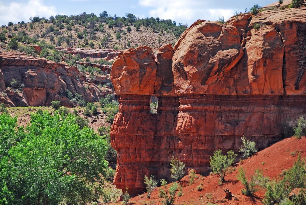
While the Southern Rocky Mountains dominate much of western Colorado, the landscape within the wilderness has a high desert landscape. The wilderness is home to two major canyon systems, which are known as Big Dominguez and Little Dominguez, respectively.
The Uncompahgre Plateau drains to the northeast through these canyons. Tall walls of red rock along with outcroppings and buttes tower above the canyon floor. Despite being called Little Dominguez, this canyon is the longer of the two canyons named Dominguez in the area, with a total length of 12 miles.
Additionally, large mesas dominate the wilderness, which encompasses 66,280 acres (26,822 ha) of land in western Colorado. Within the wide canyons, there are often rolling hills covered in red rock, grasses, and low growing shrubs.
Though seemingly remote, the Dominguez Canyon Wilderness is located close to a number of other protected areas within the region. Nearby areas include Black Ridge Canyons Wilderness, Grand Mesa National Forest, Gunnison Gorge National Conservation Area, Gunnison National Forest, and Uncompahgre Wilderness Area.
The Dominguez Canyon Wilderness is part of the Uncompahgre Plateau, a subregion of the Colorado Plateau.
The Colorado Plateau is known for being a massive, yet stable geological region. Minimal folding of rock layers over the past 600 million years has given way to the formations within the wilderness that we see to this day.
While the nearby Southern Rocky Mountains were formed by drastic movements in the Earth’s crust, the canyon landscape was slowly uplifted to its current height. The canyons within the high desert plateau showcase the region’s many layers of rock, providing geologists with great access to the region’s geologic history.
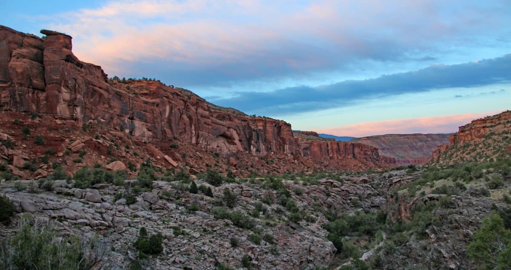
As elevations rose across the Uncompahgre Plateau, the various rivers and streams steepened. This change in grade resulted in more powerful rivers which then carved out the many canyons that are visible throughout the wilderness today.
The primary rivers still present today in the region that are further shaping the landscape include the San Miguel and Dolores rivers in the west. Other major rivers include the Gunnison and Uncompahgre rivers to the east, and the Colorado River to the north.
Major peaks within the Dominguez Canyon Wilderness include Steamboat Mesa, Star Mesa, Triangle Mesa, Horse Mesa, and Flat Iron.
There are multiple ecosystems found throughout the Dominguez Canyon Wilderness.
A majority of the wilderness is dominated by piñon-juniper desert. Other vegetation in this region includes desert sagebrush, buckwheat and mountain mahoganies.
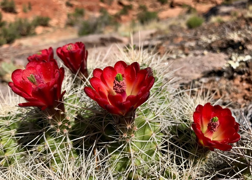
The highest mesas in the wilderness are home to ponderosa pine and aspen trees. Low-growing grasses can be found throughout the wilderness as can seasonal wildflowers and succulents.
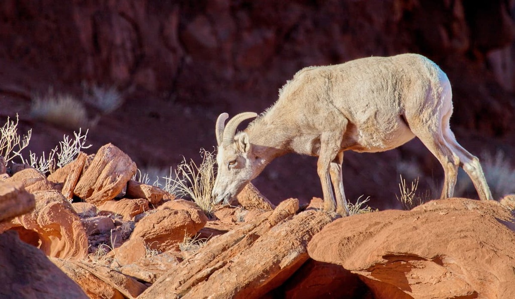
The vast landscape in the wilderness provides the ideal habitat for a variety of fauna. Desert bighorn sheep can often be spotted roaming throughout the canyons and forested regions
Other common mammals found in the wilderness include deer, mountain lion, and elk. Populations of both wild turkey and chukar are common throughout the region.
What is now part of western Colorado has been inhabited by humans for thousands of years, long before the arrival of European Americans. The land surrounding Dominguez Canyon Wilderness is part of the ancestral homelands of the Ute people, more specifically the Pahdteeahnooch band.
The Ute traditionally lived near the confluence of the Colorado and Gunnison Rivers in what is present day Grand Junction, just to the north of the wilderness. The land within the wilderness was often used for hunting and gathering.
The Ute historically traveled throughout the region to gather food and materials. Over the course of many generations, the Ute created footpaths throughout much of the region. These paths would later be used by the Spanish explorers and American settlers of the region.
Spanish explorers arrived in the region during the eighteenth century, though many of their expeditions took them eastward into the Southern Rocky Mountains. By the mid 1800s, Americans of European descent began arriving in the region in hopes of mining precious metals, often disregarding the Ute people’s claim to the land in the process.
Regular fights broke out between the Ute and the settlers, who were often backed by the United States military. In September of 1881, the Ute were forced from their homelands and onto reservations by the US government. These actions were taken by the government so that US settlers could begin developing and mining the region.
In 1882, George Crawford purchased land just north of the wilderness, to establish the city of Grand Junction and plant Colorado’s first vineyard. Both the Dominguez-Escalante National Conservation Area and Dominguez Canyon Wilderness were established in 2009.
The Dominguez Canyon Wilderness is home to relatively few hiking trails. Here are some of the most popular hiking areas in the wilderness:
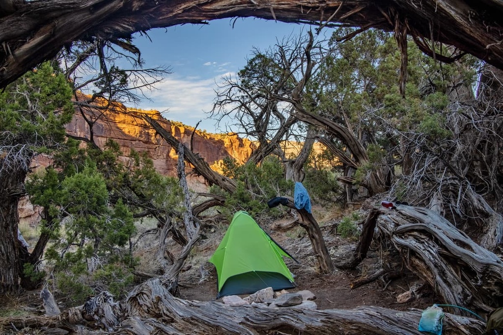
The Big Dominguez Canyon Trail is the most popular route in the wilderness. It takes hikers on a walk through the region’s main canyon. The trail is 12.3 miles (19.8 km) long with 1,112 ft (339 m) of elevation gain.
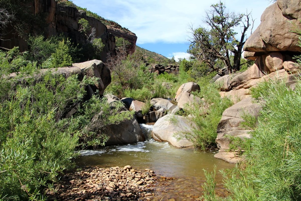
This route offers stunning views from start to finish. The rolling trail follows along the banks of Big Dominguez Creek before it joins with the Gunnison River.
Low growing shrubs line the sides of the creek while red rock buttes and outcroppings tower overhead. Small waterfalls can be spotted along the trail after heavy rain, feeding into the gentle flowing creek. Hikers can also backpack the route to spend a night within the breathtaking canyon.
The Big Dominguez and Little Dominguez Loop takes hikers through the two main canyon systems found within the wilderness. The backpacking loop is 40 miles (64 km) long with 4,504 ft (1,373 m) of elevation gain.
The trail features views of the canyons throughout while the rugged canyon walls towering above on either side. Despite being a longer backpacking route, elevation gain along the trail is gradual and the path offers sweeping views of the surrounding region.
The loop allows hikers to explore the major sites in the wilderness while avoiding large crowds that can be found in nearby national parks and forests. Horseback riding and trail running are also allowed along the trail.
Looking for a place to stay near the Dominguez Canyon Wilderness? Here are some of the best cities and villages to check out in the region:
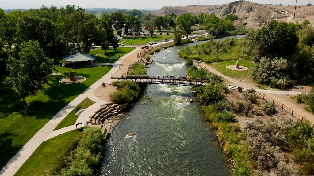
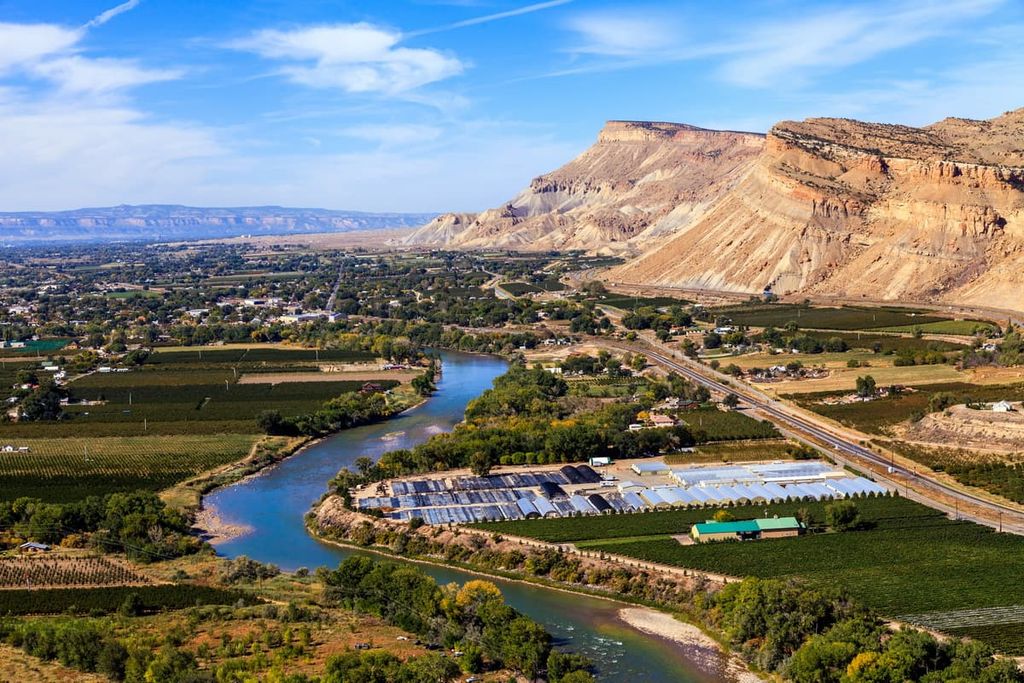
The city of Grand Junction lies just to the north of the wilderness. It has a population of 65,000 people, making it the most populated city in western Colorado. Red Rock scenery surrounds the city, which is situated at the confluence of the Gunnison and Colorado rivers.
Throughout the year, Grand Junction is full of opportunities for outdoor recreation. The plethora of waterways surrounding the city allow for rafting, kayaking, and fishing. Meanwhile, the surrounding mesa is full of hundreds of miles of trails for hiking, backpacking, mountain biking, horseback riding, and running.
Downtown Grand Junction is home to local farm-to-table restaurants, breweries, distilleries, and cultural sites. Visitors to the region should check out the Colorado National Monument, Grand Mesa, and Museum of the West to learn more about the region’s history.
The community of Montrose, Colorado is located just to the southeast of the wilderness, and it is home to around 20,000 people. The city is nestled between the red rock landscapes of the desert and the rugged Southern Rocky Mountains, providing seemingly endless opportunities for outdoor activities.
Montrose serves as the gateway to nearby Black Canyon of the Gunnison National Park, the Uncompahgre Plateau, and the San Juan Mountains. During the summer, the city comes alive with hikers, bikers, rafters, and rock climbers. Meanwhile, the winter months provide the perfect amount of snowfall for snowshoeing and cross country skiing.
Cultural sites to visit in the city include Montrose County Historical Museum, Ute Indian Museum, and Museum of the Mountain West. Local shops and restaurants line downtown Montrose, too, providing the ideal place to relax after a long day of adventure.