Scan the QR code and open PeakVisor on your phone
Of the 64 counties in the state of Colorado, Pitkin County easily ranks as one of the most popular for Colorado residents and visitors alike. It was named after Frederick Walker Pitkin who served as the second governor of Colorado from 1879 to 1883. The county seat is the high-end city of Aspen, a playground for the rich and famous. But you don’t have to be wealthy to play in this beautiful county – you just may not be able to afford to stay here.
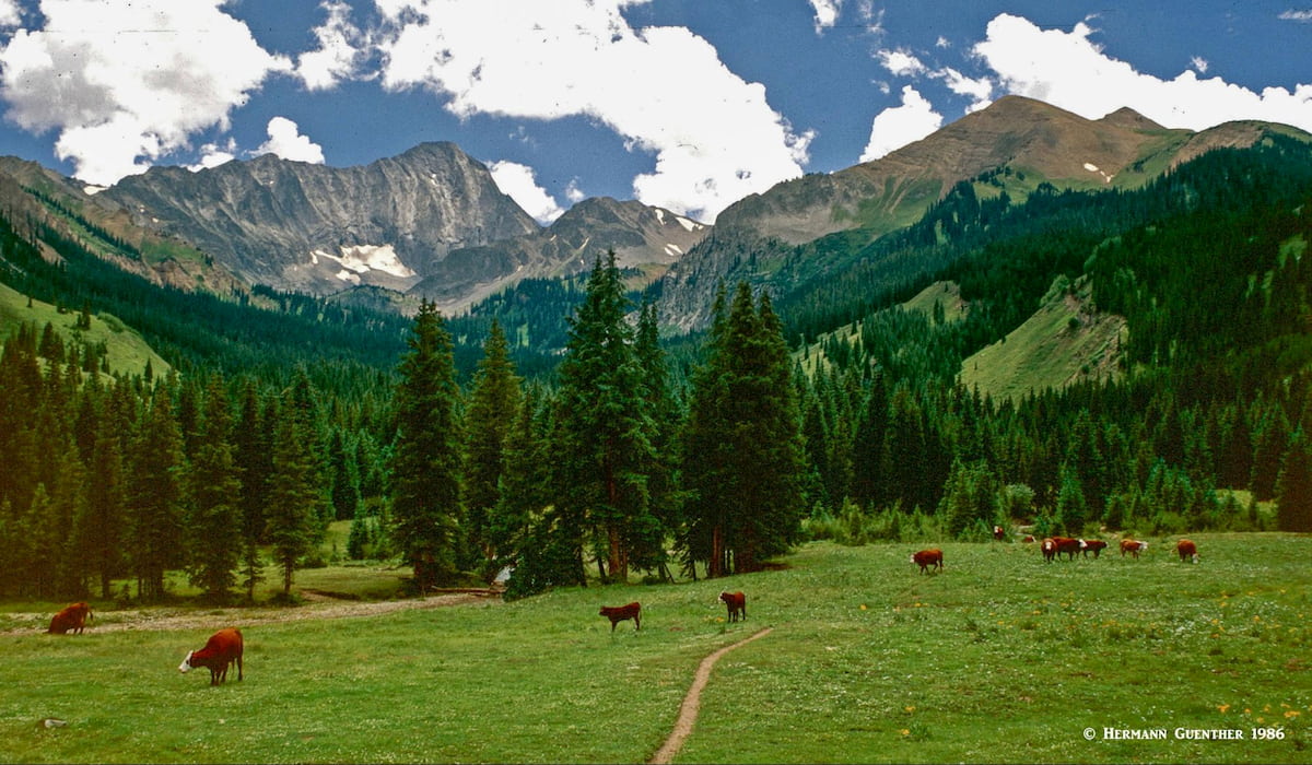
While the county is not the highest in the state in terms of average elevation (9,940 feet), it is mostly mountainous and is home to 76 named mountains of which no less than six reach over 14,000 feet (a total of 51 exceed 12,000 feet). The highest is Castle Peak and the most prominent is Huntsman Mountain, part of a long ridge quite remote from the much more well-known mountains further south and east. The lowest elevation is only about 6,275 feet where the Crystal River crosses the Garfield County line.
Pitkin County has a population of almost 18,000 as of a 2019 estimate and a density of 18 per square mile, over an area of 973 square miles. It is one of the wealthiest counties in the United States based on per capita income, and, when measured by the average income of the top 5% of wage earners, it is indeed the wealthiest in the nation. It also has some of the most expensive real estate in the country. The county has the second-longest life expectancy of all counties in the U.S., surpassed only by nearby Summit County. This is due to a high level of education, high income, access to first-rate health care and overall fitness of the population, with one of the lowest obesity rates anywhere. No wonder – there is so much opportunity for outdoor recreation at just about every doorstep.
Pitkin County has boundaries with six other counties – Eagle on the northeast, Lake on the east, Chaffee on the southeast, Gunnison on the south, Mesa on the west and Garfield on the northwest. The eastern boundaries coincide with the Continental Divide. The southern boundary separates the drainage basins of the Gunnison and the Colorado Rivers. Much of the county is in the White River National Forest (the most visited of all U.S. national forests) and all or parts of four wilderness areas are located in the county – Collegiate Peaks, Holy Cross, Hunter-Fryingpan and Maroon Bells-Snowmass. This amounts to lots of protected land which in turn provides an abundance of recreational opportunities.
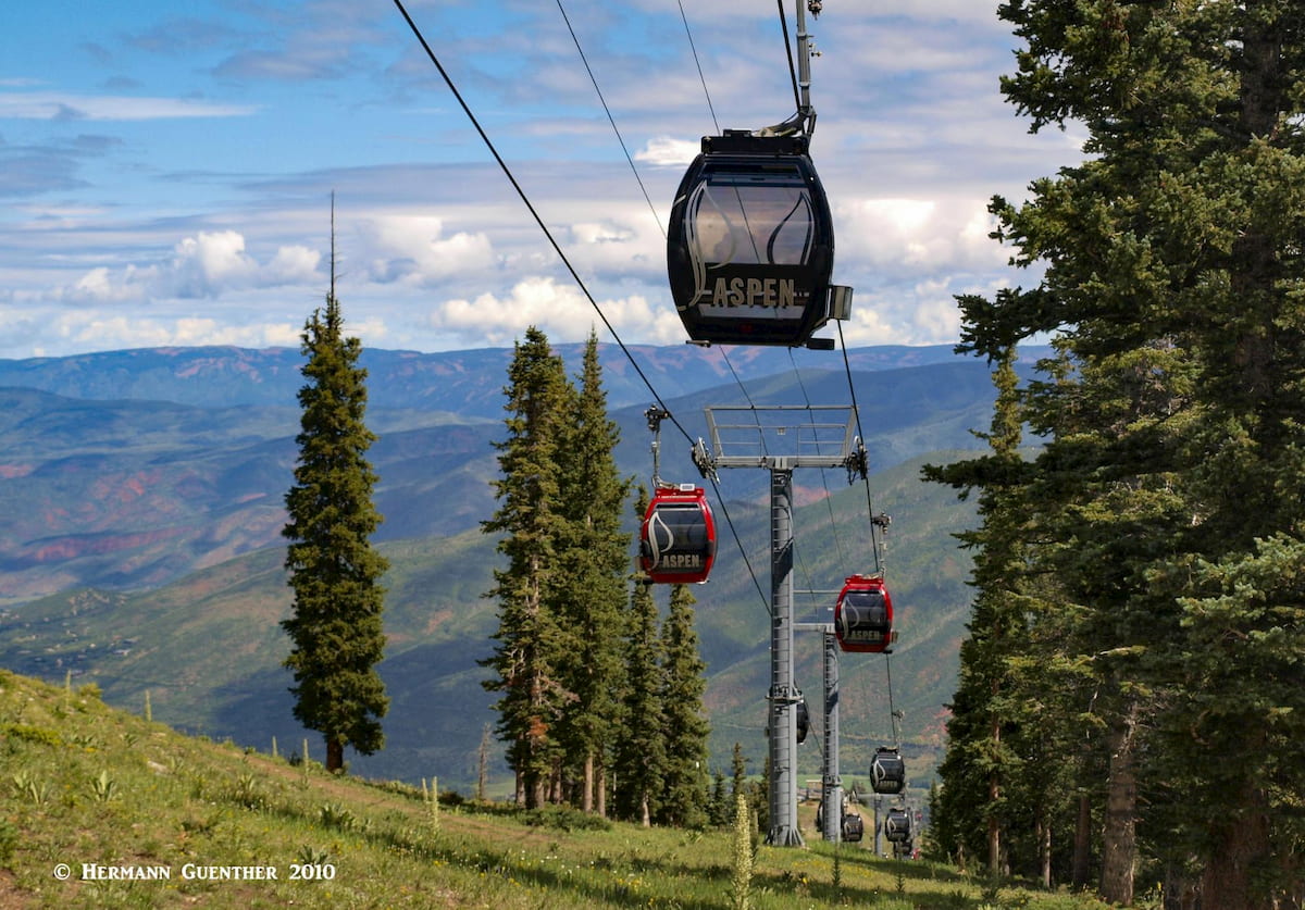
It is simply amazing that an old silver-mining town such as Aspen can become a world-renowned destination for sliding down a mountain on a pair of boards. But Pitkin County (meaning Aspen) boasts four ski areas – Snowmass, Aspen Mountain, Aspen Highlands and Buttermilk. Highlands is especially popular with die-hard locals, perhaps due to some of its extreme terrain. The view from one of the upper lifts is staggering. Nowhere else have I ever been on a chairlift so high above the ground.
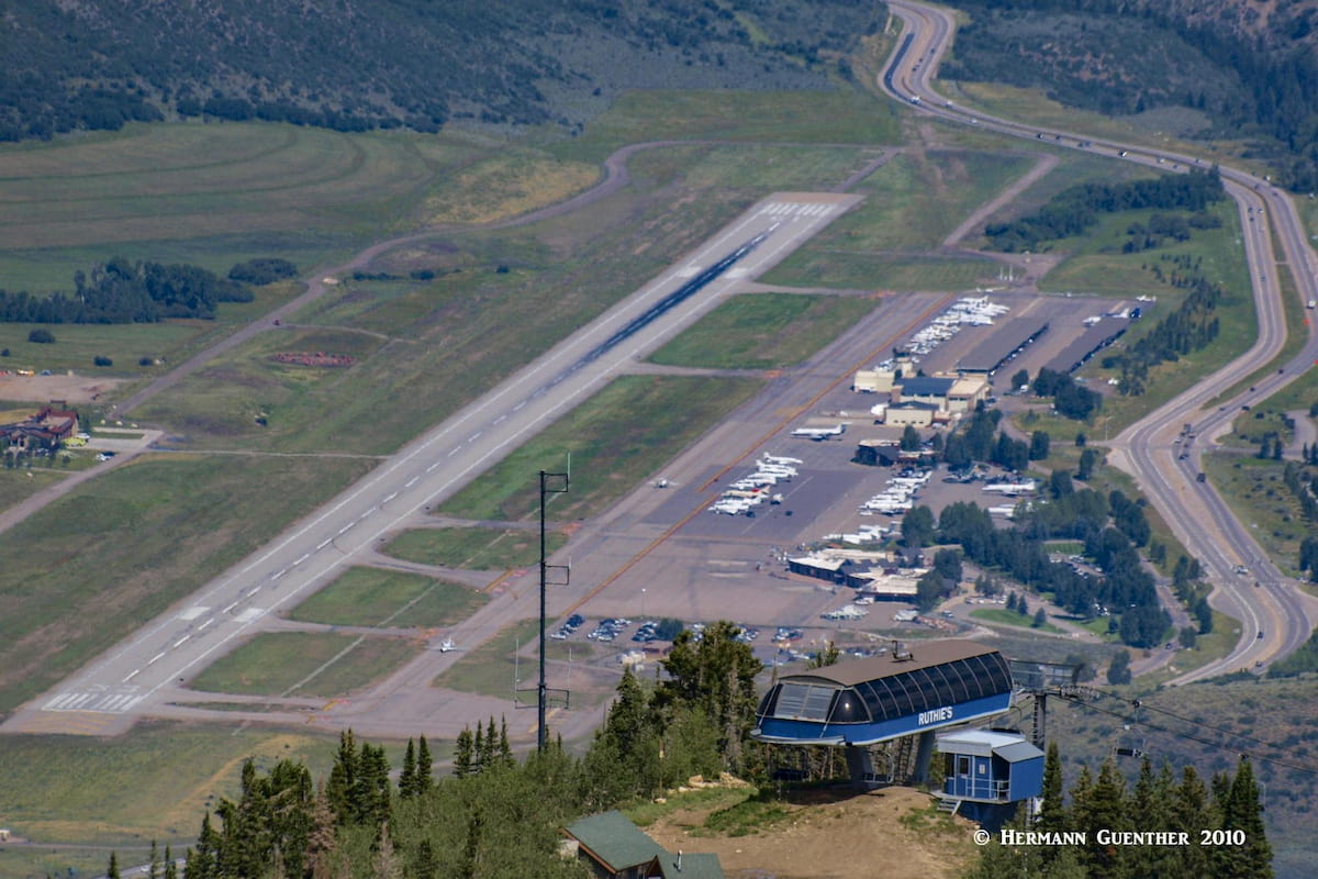
And the people come from all over the world – after all, Aspen has a very busy airport which has scheduled airline service. But many of the wealthy don’t need to fly commercially – they fly in on their private jets. At any one time, it is not unusual to see 40 or more of them parked on the tarmac of the airport, which is small, tucked between the mountains and can only be approached from one direction. Departures can only be in the opposite direction – one end of the runway is too close to a mountain. These visitors don’t stay in the kinds of places most of us hikers stay. They have their private mansions scattered amongst the mountains of the Roaring Fork Valley. The famous singer John Denver had a home here before his tragic death. Of course, there are some very swanky hotels in town as well. This makes Aspen a great place for celebrity-spotting.
But while most people from out-of-state – or overseas – may come here for world-class skiing, there is a lot more to Pitkin County than that. For example, the county offers not one, but two, Gold Medal rivers where trophy trout can be caught by those having the right skills – and luck. The Roaring Fork River and the Frying Pan River converge at the town of Basalt less than 20 miles north of Aspen along State Highway 82 – the only road to and from Aspen. Upstream of Basalt is the beautifully positioned Ruedi Reservoir (partly in adjacent Eagle County) where more fishing as well as boating can be pursued.
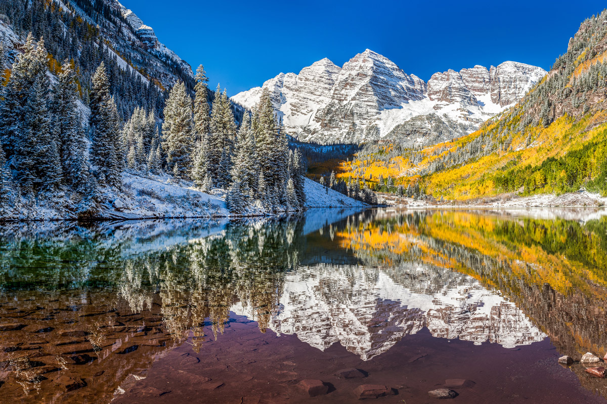
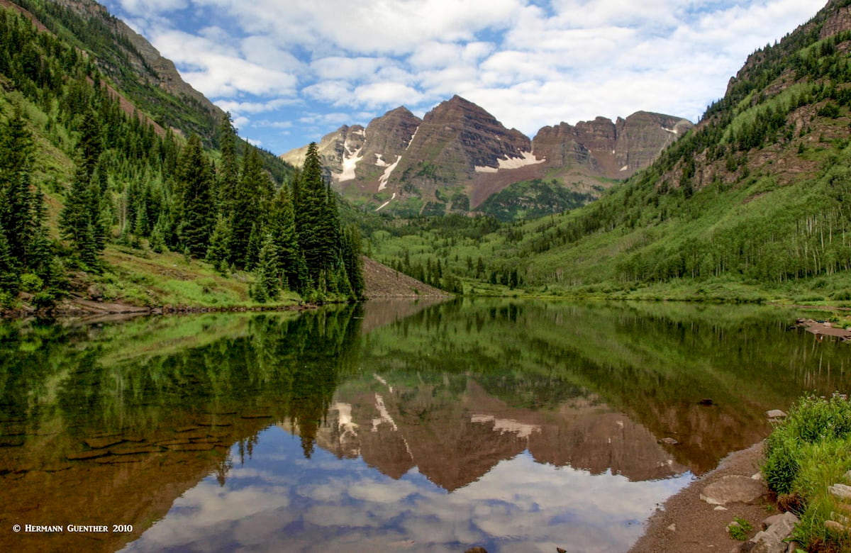
As anywhere in stunning mountain environments, sightseeing is an activity that will attract visitors, and for good reason. Pitkin County is no exception. The number one attraction here is without question the famous Maroon Bells – among the most photographed mountains in North America. The first view one gets of these mountains when driving up the Maroon Creek Road is unforgettable. But because of that view, it is often no longer possible to drive there – it has become so popular that visitors now must take a bus from Aspen due to the limited parking at the site. And those who are early enough to drive up have to pay a fee. I still remember the days when driving up there was no problem at all – and it was free. Regardless, the view of the “Bells” is stunning and well worth the time and cost. Just don’t expect a wilderness experience.
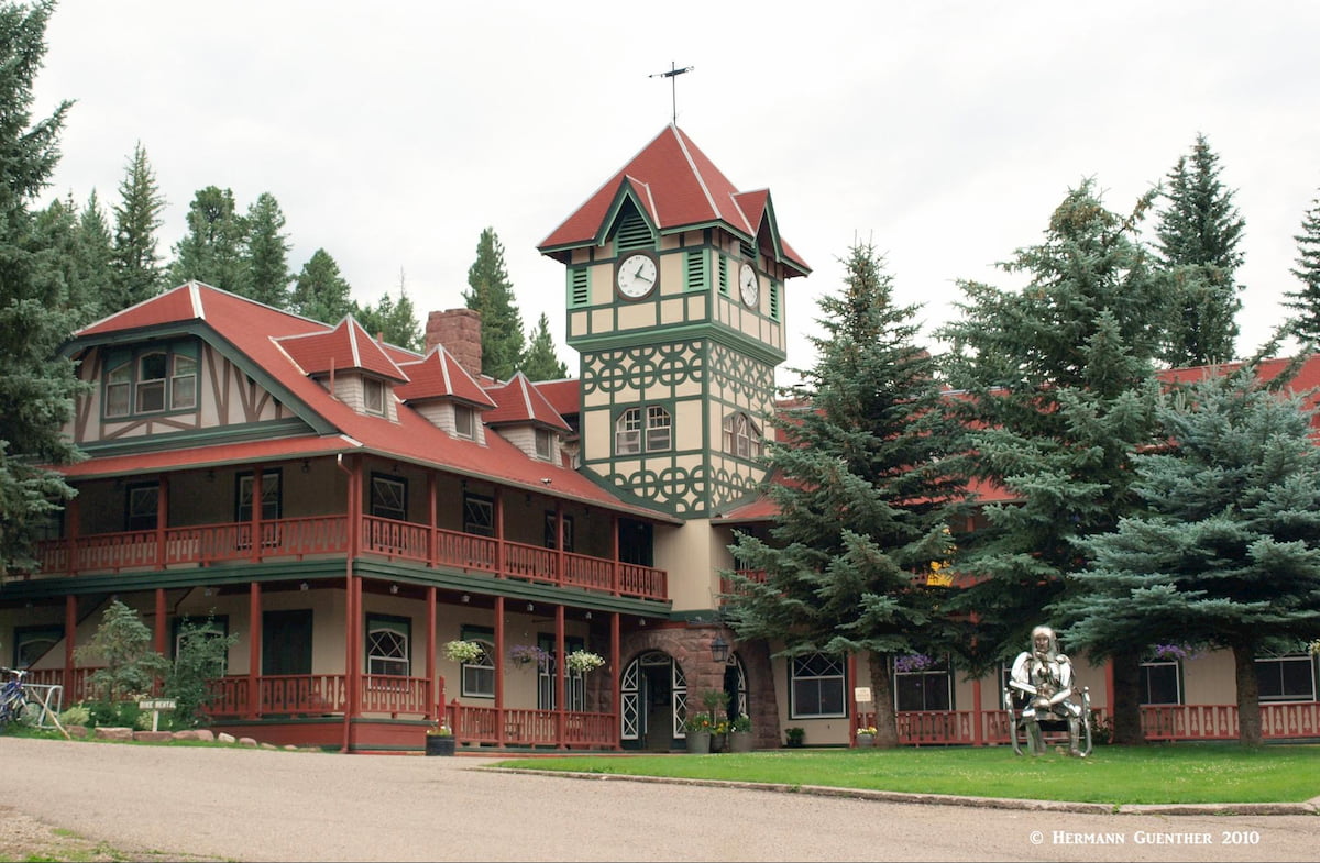
The city of Aspen is a pleasure to explore on foot. Visitors will be amazed at the Victorian architecture not to mention the countless high end shops and boutiques and galleries. There is no shortage of ways to part with your money in Aspen. In the summer, a pleasant ride to the top of Aspen Mountain on the Silver Queen Gondola yields an impressive view of the surrounding mountain landscape.
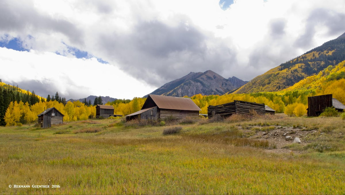
But there are more attractions to visit in Pitkin County. One of my favorites is the Crystal River Valley, which I think is the most beautiful in Colorado. Beginning in nearby Carbondale (in adjacent Garfield County), this lovely valley trends toward the south, passing the impressive Mount Sopris with its twin summits, a sight to behold from a distance. A real gem of an attraction is the historic coal-mining town of Redstone (you will understand why it is called that when you drive the highway through the valley). Be sure to stop and see the historic coke ovens at the side of State Highway 133 and walk around the town a bit. But the ultimate attraction in the county, at least for us hiking aficionados, is the mountains – and what mountains they are!

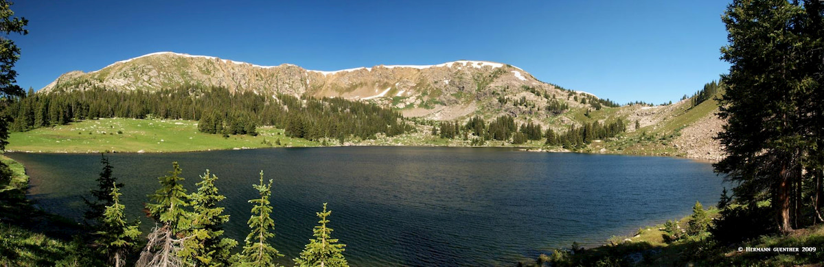
Wilderness areas naturally attract hikers due to their complete absence of motorized or mechanized travel. The only travel permitted in these areas is on foot or horseback, thus affording the visitor a sense of tranquility and as pristine an environment as can be found. There are four of these nationally protected areas in Pitkin County – some in part and one, the Hunter-Fryingpan Wilderness, fully contained within county boundaries. This wilderness, located to the north of State Highway 82 and Independence Pass, maintains a low profile, largely forgotten between the lofty heights of its neighbors, the Collegiate Peaks and the Maroon Bells-Snowmass Wilderness areas. It is dominated by rugged and unnamed peaks of the Williams Mountains and is not frequently visited. This wilderness is for those seeking solitude, gurgling trout streams and wildflower-studded alpine tundra.
The nearby Holy Cross Wilderness is mostly located in the adjacent Eagle and Lake Counties, which is where most of its attractions are accessed from. But there are several nice places to go hiking and backpacking in the Pitkin County segment of this fine wilderness. Getting to them involves driving on a combination of county and forest roads, mostly passable for ordinary passenger cars. I have done several backpack trips in this area. The following is one of my favorites.
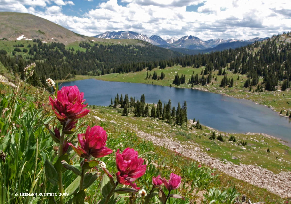
Lyle Lake Trailhead - This trailhead is at the west end of the Hagerman Pass Road, just where it merges with the Fryingpan Road. This spot can be easily reached from the town of Basalt via a paved road that then changes to a steep and twisting gravel road easily passable in the summer months. Though it is only a 42-mile drive, it will take the better part of two hours to reach the trailhead (which is actually much closer to Leadville by going over the pass, but that requires a high-clearance vehicle at minimum). The pleasant hike to Lyle Lake is one of the easiest backpack trips I have ever made. Each time I have gone to this lake, I saw few people, and never any others at night as I camped. This is even though the lake is only a little over one mile from the trailhead.
From this fine alpine lake, there are other great destinations to visit, including a nice ridge-walk above the lake. And a short day-hike from Lyle Lake will take you to the even more remote Mormon Lake. Each time I was there, I set up our tent on the eastern shore of Lyle Lake, where early morning or late afternoon fishing can be quite productive. If you take the short hike to Mormon Lake, be sure to bring your fishing gear as well. This place is pretty exposed above the tree line so also come prepared with proper clothing. And please don’t tell too many people about this little “secret”.
The Collegiate Peaks Wilderness, the best and most popular hiking areas of which are east of the Continental Divide in adjacent Chaffee County, does reach as far west as the outskirts of Aspen. This part of the wilderness is most accessible from the south side of State Highway 82 between Aspen and Independence Pass. But with the nearby Maroon Bells-Snowmass Wilderness dominating the recreation scene in Pitkin County, this area is not very heavily visited except perhaps by locals who want to get away from the tourist crowds.
Grizzly Reservoir Trailhead – This trailhead is about 17 miles east of Aspen on State Highway 82 and the Lincoln Creek Road (Forest Road 106). The 6.5-mile segment on the latter requires a high-clearance or 4WD vehicle as it is extremely rocky and rough. The trailhead is located beside a campground. The fine hike to Grizzly Lake is about eight miles round trip and chances are you will find few other hikers there. But that is not the only reason to use this trailhead. Here you can climb the highest ranked thirteener in the United States – Grizzly Peak (13,995 feet). If you reach the summit and are over five feet tall, part of you will be above 14,000 feet. If you are ambitious, you can do the relatively easy Class 2+ scramble along the Continental Divide south to the slightly lower Garfield Peak.
Now if you want to undertake some truly memorable hikes on your visit to Colorado, you have come to the right place. Pitkin County can keep you occupied for much longer than the time you have at your disposal – unless you live nearby. And it is the wonderful Maroon Bells-Snowmass Wilderness that will capture your imagination and challenge your body. You will certainly want to be well acclimated to the altitude when exploring these magnificent mountains, especially if you plan on climbing the five ranked fourteeners that are at home here. There are so many places to go hiking and climbing here that the only dilemma you will encounter is deciding where to go. That’s where I can help you.
While the high peaks of the Maroon Bells-Snowmass Wilderness may be intimidating, that is not to say that exploring these mountains is limited to only seasoned climbers and hikers. There are many places where even casual hikers can enjoy stunning vistas, wildlife and wildflower displays. Within the boundaries of the wilderness are 100 miles of trails and nine passes over 12,000 feet. Simple hikes of only a few miles, to much longer ones requiring overnight bivouacs, can be negotiated on well-built and maintained trails by anyone with a reasonable level of conditioning.
I have done many day-hikes and multi-day excursions here over a number of years and can speak from experience, yet I have only climbed one of the fourteeners, the others being far too risky for my comfort level. I prefer the view of the mountains rather than the view from their summits. The following discussion is based mostly on my personal experience (including that of my wife, though many of those hikes were done before we met), supplemented as necessary with facts that I have researched from various sources.
Maroon-Snowmass Trailhead – The first part of this major trail encompassing a round-trip hike of about six miles is likely the most popular in the entire wilderness. Due to its easy access from the end of the Maroon Lake Road, visitors of all abilities give this trail plenty of use. In fact, so much use that it can hardly be called a wilderness experience. However, there is no other place in this area that will provide the hiker with so much spectacular scenery for such little effort. Upon reaching Crater Lake, the casual hiker is not likely to proceed further, but for those who are experienced and properly equipped, continuation of this and other trails to West Maroon Pass or to Buckskin Pass can take the hiker miles into the Maroon Bells-Snowmass Wilderness. The only limitations then are time and preparedness. This is also the place where climbers will start their ascent of the Maroon Bells.
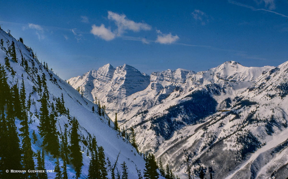
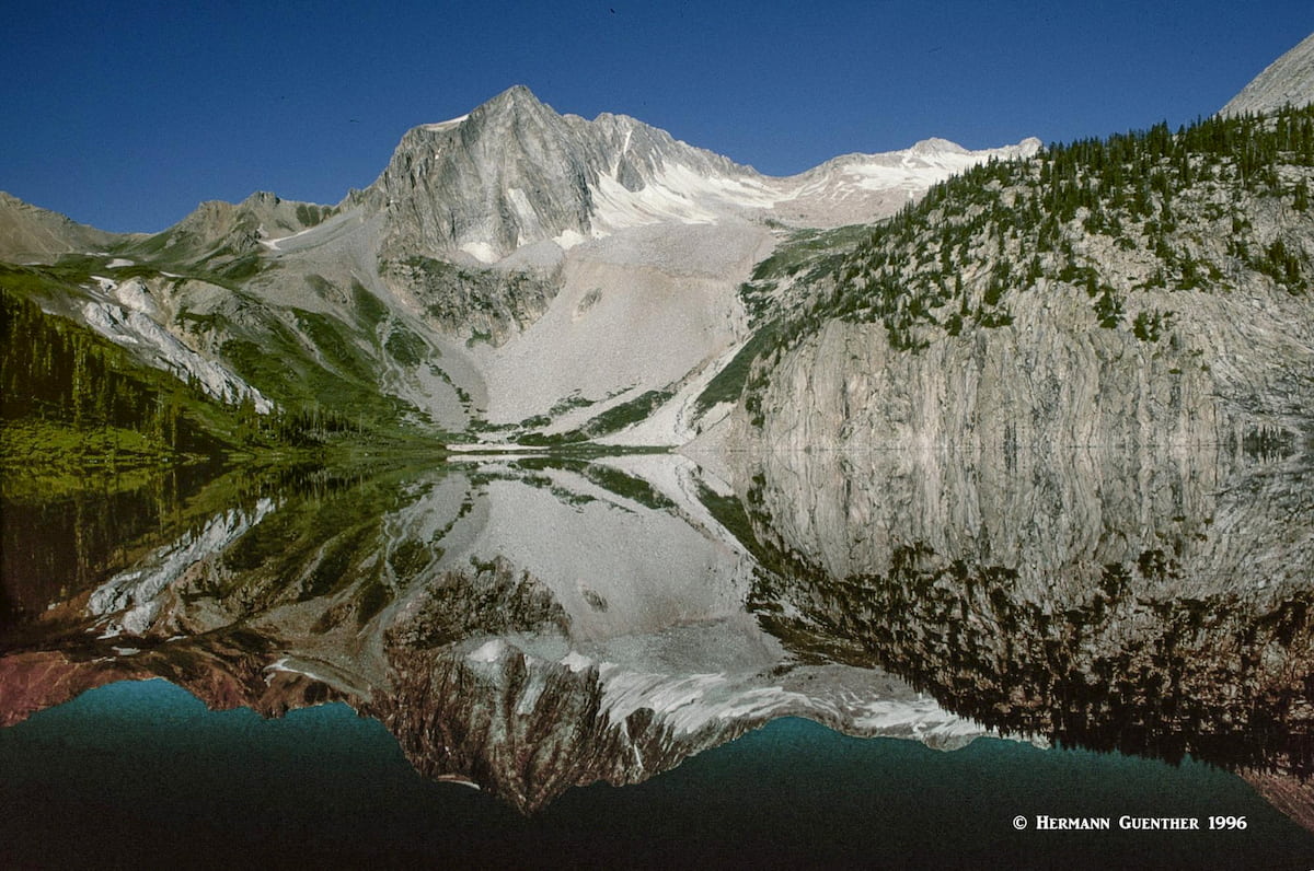
Snowmass Lake Trailhead - Near Snowmass Village, about eight miles from Aspen, is the northern end of the Maroon-Snowmass Trail. This trailhead provides the shortest access to Snowmass Lake, which involves a one-way hike of 8.5 miles. This would be a difficult one-day round trip hike for most people so that backpacking is the order of the day here. Given the stunning scenery and view of the Snowmass Mountain massif (which includes Hagerman Peak and Snowmass Peak) reflected in the lake, one would not want to immediately turn around and go back down. This view rivals that of the more popular Maroon Bells, and the opportunities of further exploration in the wilderness area make a multi-day excursion a very memorable experience. With numerous campsites at or near the lake, this is a perfect staging area for an assault on Snowmass Mountain, one of my memorable climbs. Of course the interconnectivity of so many trails makes even longer excursions possible in this area. This trail is very popular, but not on the scale of the segment near the Maroon Bells. During my four-day expedition into this area I was blessed with absolutely perfect weather, something that is not always guaranteed.
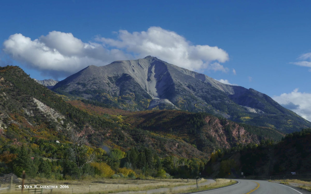
Mount Sopris Trailhead – If you have ever driven, or plan to drive, on State Highway 82 from Glenwood Springs to Carbondale or Aspen, you cannot fail to see what I think is one of the most stunning mountain views in Colorado. The 12,965-foot Mount Sopris, notable for two summits of equal elevation, dominates the view. Because of the elevation of the surrounding terrain, this mountain at the northern end of the Elk Range appears to be much higher than its southern neighbors. For years I had wanted to climb that mountain, and I finally did it in 1994 – fourteen years after I moved to Colorado. The trail begins at Dinkle Lake near Carbondale and ascends East Sopris after passing between the two Thomas Lakes at timberline where it enters the wilderness. The ascent involves 4,300 feet of elevation gain in a round trip of 12 miles (an additional mile plus another 600 feet of elevation if a round trip to West Sopris is desired).The total hike is strenuous and can be made easier if an overnight stop at Thomas Lakes is included in the tour (as I did it). Exposure to lightning can be an issue here.
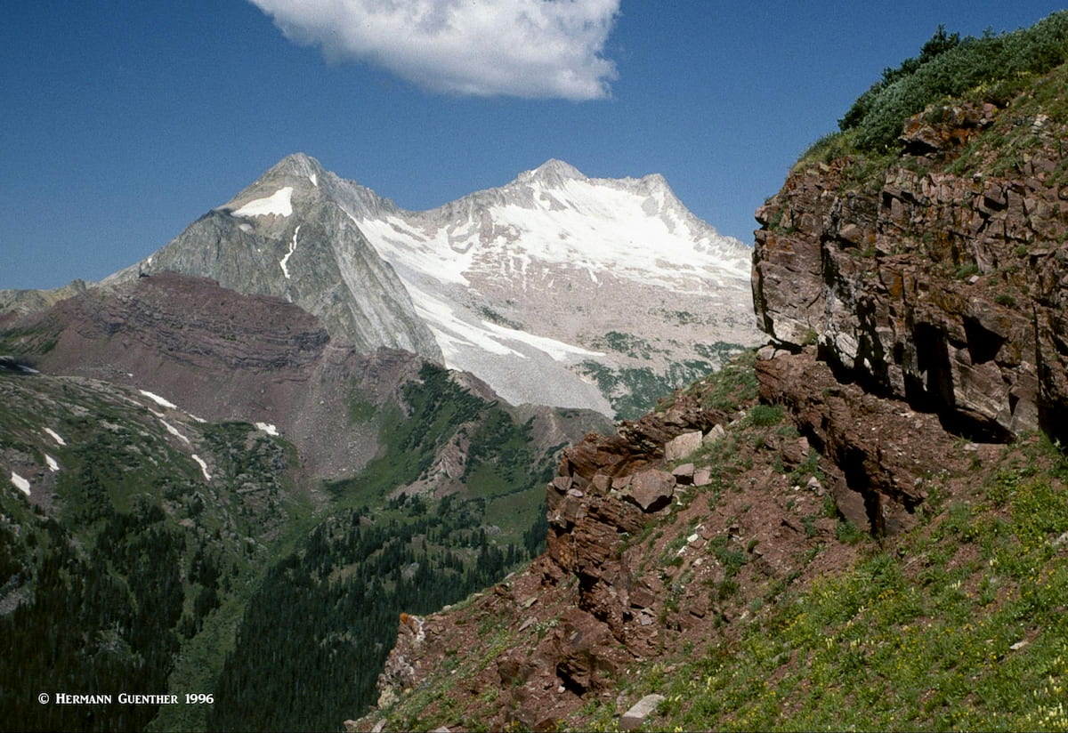
Capitol Creek Trailhead - Getting to this trailhead involves driving on a rough forest road from the town of Snowmass (not Snowmass Village, which is the ski area) that may or may not require four-wheel drive, depending on conditions from year to year. Certainly high clearance is preferred here. The view of Capitol Peak from the trailhead is classic. The Capitol Creek Trail extends all the way to Capitol Lake which sits at the base of the north face of the imposing Capitol Peak. This is also the trail for those who want to go for the summit, a climb that is not to be taken lightly. The standard knife edge route can be intimidating, and there are no easy routes on which to bail off in case of bad weather. The north face of Capitol Peak is one of the highest mountain walls in Colorado. The knife edge route is considered "relatively easy" even though it reaches Class 4 in places. The hike up the mountain beyond the lake is not for the casual hiker. This mountain offers perhaps the best technical climbs in the Maroon Bells-Snowmass Wilderness, if not in the entire Elk Range.
I did this trail as a 3-day backpack trip, camping partway up the Capitol Creek Valley and doing a day-hike to Capitol Lake the second day. If you do this hike, be sure to go past the lake and up to the unnamed pass. That involves another 500 feet of elevation gain but is truly worth the effort. When hiking along Capitol Creek in the valley, be sure to watch out for cow pies – this area is used for grazing cattle in the summer. You would expect to find this in the Alps, but certainly not in the Rockies. Climbing the peak was not on my agenda though two of my companions on this trip did climb it – from our campsite it took them 14 hours round trip because one of them had little mountaineering experience. That mountain is serious business!
Castle Creek Road Trailheads - If you want to get a bit further away from the crowds at Maroon Lake, yet still not far at all from Aspen, this is the place for you. The Castle Creek Road starts in Aspen and follows the Castle Creek Valley for 11 miles to the old ghost town of Ashcroft, which is really worth a visit. This beautiful valley heads south while staying mostly east of the far more popular Maroon Creek Valley. Along the way to Ashcroft are two trailheads, just off the paved road, from which trails lead to two of the most beautiful alpine lakes. And while everybody else is at Maroon Lake, here you will find very few people. And both of these trails will take you well into the Maroon Bells-Snowmass Wilderness. I consider these two hikes among the finest in Pitkin County.
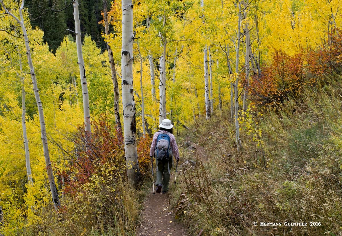
American Lake Trail - The first trailhead you will find along the Castle Creek Road is the American Lake trailhead. We hiked here one day after hiking to Crater Lake at the Maroon Bells, where we were never out of sight or earshot of other hikers. Yet when we arrived at this trailhead, there were no other cars in the parking lot. For the entire seven-mile round trip to and from the lake, we saw just a handful of other hikers. This was a true wilderness experience. This trail does not have much in the way of wildflower meadows since most of it is below timberline, but it does have an abundance of aspen groves, which makes this a particularly fine hike in late September when the autumn colors emerge.
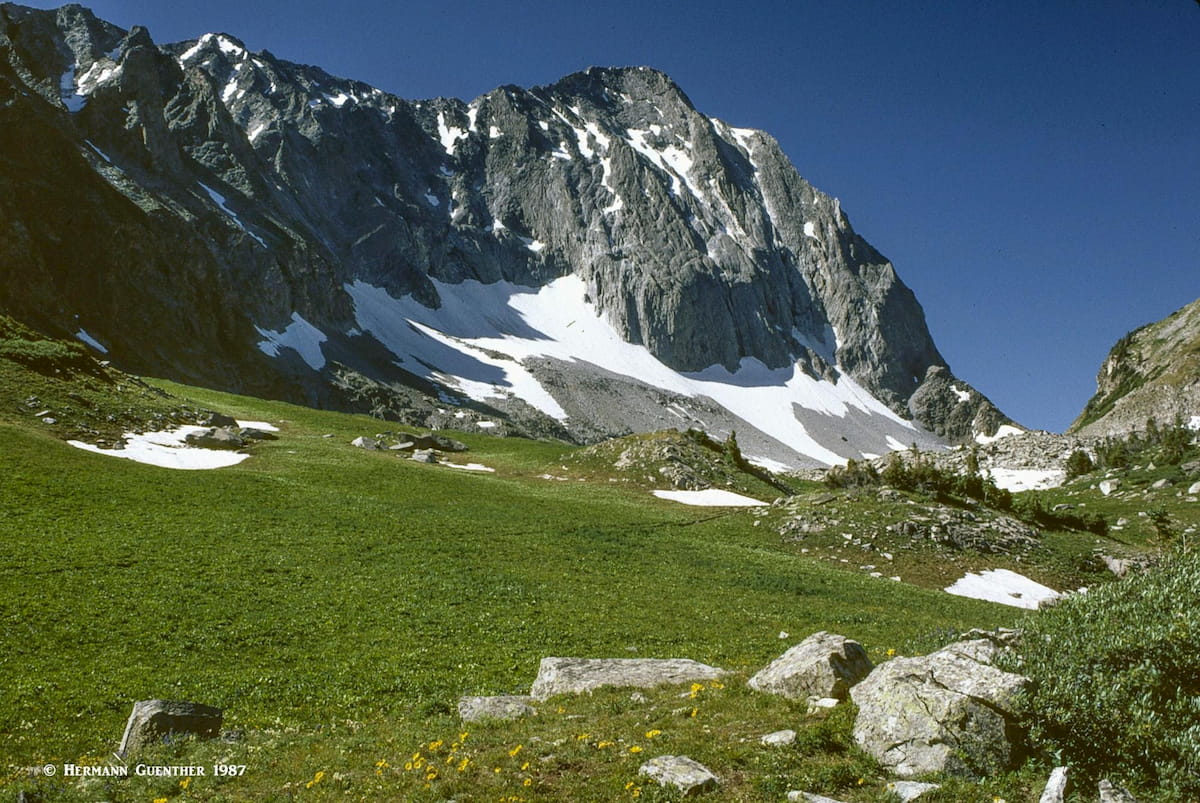
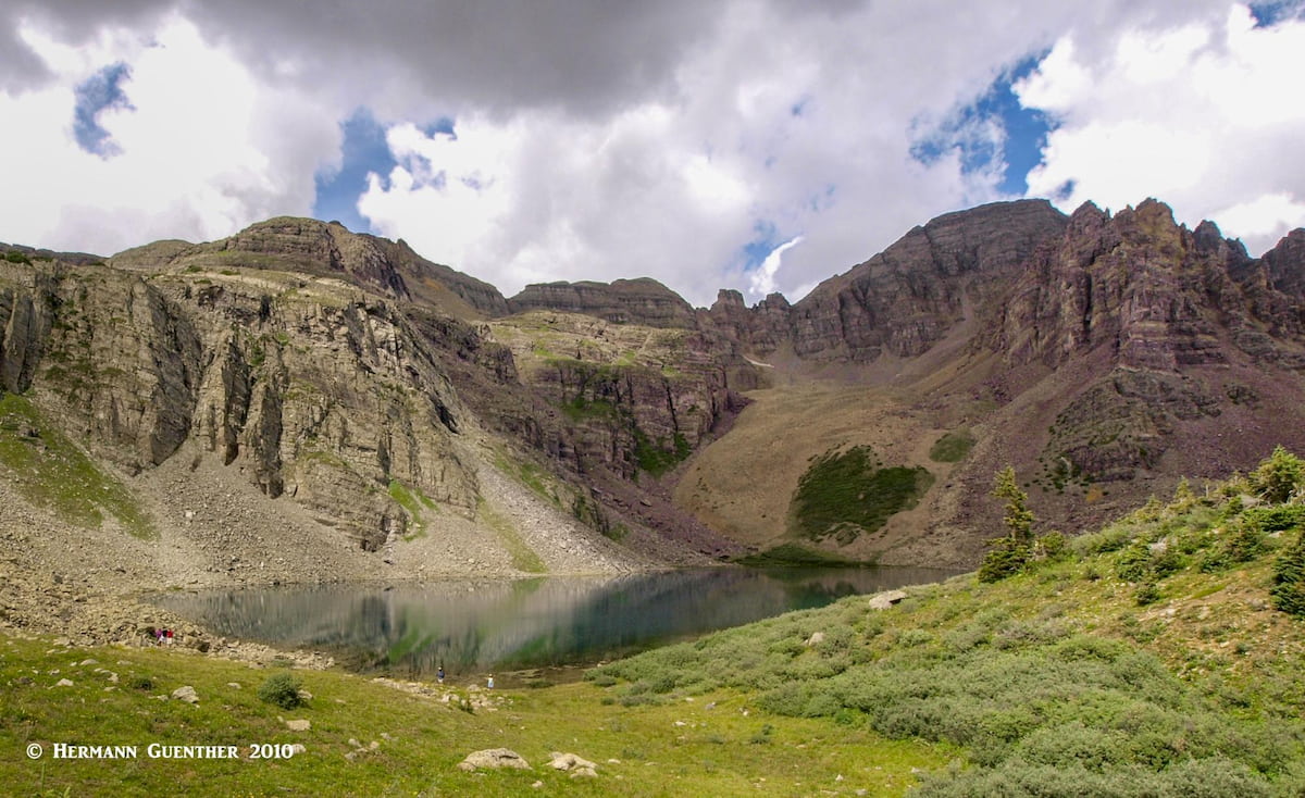
Cathedral Lake Trail - The hike to Cathedral Lake is a good intermediate-level alternative to fighting the crowds at Maroon Lake. Just a few miles further along the Castle Creek Road is the trailhead for this 6-mile round trip hike encompassing about 2,000 feet of elevation gain. This moderately strenuous hike ends in a stunning rocky basin containing this very beautiful lake. Cathedral Lake is an alpine jewel surrounded by jagged peaks and crags. For those who have the time and energy and want a more challenging hike, the steep trail to Electric Pass offers a spectacular viewpoint. It is recommended that those who wish to do this go to the pass before visiting the lake. Electric Pass (elevation 13,485) is the highest named pass accessible by trail in Colorado and is a magnet for lightning (do you suppose that’s how it got its name?), so hikers are advised to be off the pass by noon to avoid the inevitable afternoon thunderstorms.
Who has not heard of Aspen, Colorado? It is the seat of Pitkin County and the only city therein. It started as a silver mining town in the late 1800's and was highly successful until 1893 when the silver market collapsed. The town was so named because it is surrounded by forests of Aspen trees, which in the autumn exhibit an impressive display of gold color. Aspen is known for high-end lodging, restaurants, boutiques and many celebrities (who fly into Aspen in their private jets). The Aspen area boasts four major ski areas - Aspen Mountain, Buttermilk, Aspen Highlands and Snowmass – the only ski areas in the county, the latter being a separate resort development about ten miles from Aspen. This is a year-round town that offers unlimited recreational opportunities. For those of us who don’t want to spend the generous amounts of dollars to stay in this upscale town fear not. The nearby towns of Basalt, Carbondale and Glenwood Springs have plenty of affordable accommodations and restaurants, though they are not in Pitkin County (but interestingly, the southern part of Basalt is).
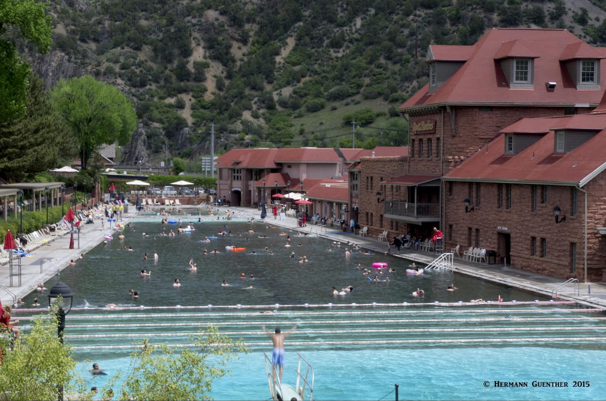
About forty miles north of Aspen is the historic town of Glenwood Springs (the seat of nearby Garfield County) which is best known for its hot springs (the resort has the world’s largest hot springs pool) and vapor caves. It has grown into a vibrant destination of its own, affording many dining, lodging and recreational opportunities. It serves as an easy gateway, via excellent highways, to the most visited parts of Pitkin County. As with many towns in the Rocky Mountain West, Glenwood Springs started in the late 1800's as a camp of tents, saloons and brothels. This of course attracted hordes of gamblers, gunslingers and prostitutes. It has changed significantly since those days. It is an elegant town in a dramatic setting at the confluence of the Colorado River and the Roaring Fork River. Its proximity to Pitkin County and the main attractions in the Roaring Fork and Crystal river valleys make this town an ideal base of operations for those wanting to explore this spectacular region.
These two nice towns with populations of 3,857 and 6,427 respectively are only about 12 miles apart on State Highway 82 between Glenwood Springs and Aspen. Just like Aspen and Glenwood Springs, they are very conveniently located for exploring the scenic and recreational offerings of Pitkin County. In terms of accommodations and other tourist amenities, they are an affordable alternative to high-end Aspen. Each town has its charms and recreational appeal. Carbondale is located at the confluence of the Roaring Fork and Crystal Rivers - thus great fishing. Also several miles up the beautiful Crystal River Valley is the historic resort town of Redstone, founded in the late 19th century as part of the coal mining industry. Basalt, located at the confluence of the Roaring Fork and Frying Pan Rivers, is well known as a haven for Gold Medal fly fishing on these rivers. The nearby Ruedi Reservoir is a popular regional water sports and camping destination.