
Scan the QR code and open PeakVisor on your phone
The Holy Cross Wilderness is located in the northern part of the Sawatch Range in central Colorado. It is one of four wilderness areas in this range of high peaks. There are 15 named mountains in the Holy Cross Wilderness of which the Mount of the Holy Cross is both the highest and most prominent, as well as the only fourteener. The mountain as well as the wilderness got their name as a result of a famous photograph taken by William Henry Jackson in 1873 during one of the Hayden Geographical Surveys of the American west. The shape of the cross was created by large quantities of snow that accumulate in a long steep couloir that is intersected by a more or less horizontal ledge. Given the right snow conditions, a cross-shaped configuration can indeed be seen after most of the surrounding surface snow has melted.
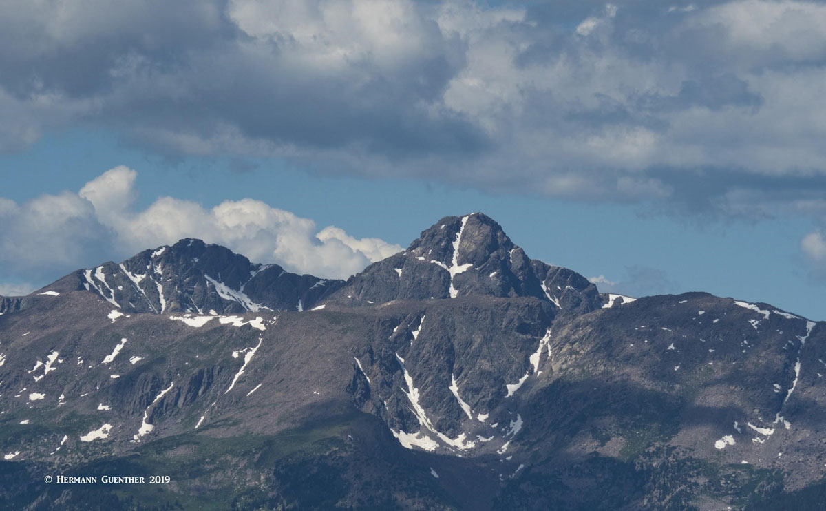
Mount of the Holy Cross (lower part of cross is blocked by Notch Mountain)
The Holy Cross Wilderness is located mainly in Eagle County although it spills over into small parts of Lake and Pitkin Counties. It also shares parts of the White River and Pike-San Isabel National Forests, administered by the United States Forest Service. Wilderness is best defined by the author of the Wilderness Act of 1964, Howard Zahnister: "A wilderness, in contrast with those areas where man and his own works dominate the landscape, is hereby recognized as an area where the earth and its community of life are untrammeled by man, where man himself is a visitor who does not remain." There are several government agencies that administer the 765 wilderness areas in the United States - U.S. Forest Service, U.S. National Park Service, U.S. Fish and Wildlife Service and the U.S Bureau of Land Management. As of 2016, this encompassed a total of 109,129,657 acres, or an area larger than the state of California.
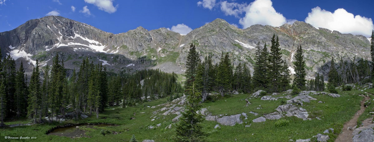
This wilderness is a pristine and beautiful landscape of mountains, lakes, streams and more than 160 miles of hiking trails which makes hiking in the Holy Cross Wilderness a supreme pleasure. While there is only one fourteener, there are 25 peaks over 13,000 feet (although only seven are named thirteeners) that afford some pleasurable non-technical climbs. But it is the scenic alpine basins and valleys that make any excursion into the Holy Cross Wilderness a memorable experience - and for most hikers, multiple repeat visits are normal. The dozens of lakes, stuffed with fat trout, are some of the best backpacking destinations in the entire state. This however, also makes this wilderness area extremely popular, such that solitude is difficult to find in certain areas and during peak periods and weekends. Nevertheless, this is a wonderful place to "get lost" in the mountains. Most of the wilderness is west of the Continental Divide, at least all the best-known recreation areas, but a small southeastern part lies in the Arkansas River, therefore the Atlantic, watershed.
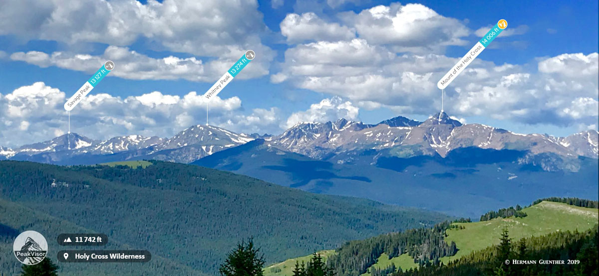
Holy Cross Wilderness from Shrine Mountain
The most popular hiking areas in the Holy Cross Wilderness are generally reached from roads that branch off U.S. Highway 24, between Leadville in the south and the town of Minturn in the north, not far from Vail. The most important of these access roads are the Homestake Reservoir Road and the Forest Road 707, the latter also known interchangeably as the Notch Mountain Road or the Tigiwon Road. Both are usually easily accessible to regular passenger cars. However, there is also access into the wilderness from Interstate Highway 70 (I-70) via the town of Eagle as well as from the west via the town of Basalt along the Frying Pan Road. In addition, those with a high-clearance vehicle can make the drive over Hagerman Pass from Leadville to access some of these western trailheads, although not in winter. Finally, the Holy Cross Wilderness has such a fine network of interconnected trails that it is possible to plan a "super" loop hike of seven or more days that will take in many of the lovely interior lakes of the wilderness, although a car shuttle would be required.
This ten-mile-long road, in combination with the Missouri Creek Road (Forest Road 704) provides access to several major trailheads that serve a number of trails that penetrate deep into this wonderful wilderness and that connect with a number of other trails. This busy road, which also features two campgrounds, follows Homestake Creek from the reservoir to its confluence with the Eagle River. There are many fine spots along the road which allow for free dispersed camping. This, of course, also has its disadvantages in that it encourages even more people to free-camp in the great outdoors. More and more such places are disappearing from the Colorado landscape due to overuse and abuse. It remains to be seen if or how long this practice is allowed to continue here.
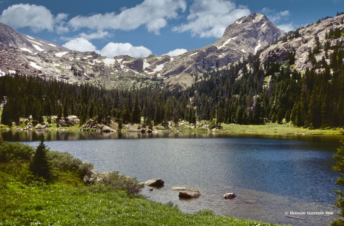
Missouri Lakes Trailhead - This trailhead provides access to almost unlimited back-country pleasure - once you have hiked here, you will come back again and again. The beautiful Missouri Lakes Basin can be explored on a comfortable day hike involving only eight to nine miles total. The problem is, once you are in the middle of this basin, you don't want to leave. Backpacking is the undisputable solution to that dilemma. You see, there are many other wonderful lakes to explore further afield which will demand much more of your time. Treasure Vault and Blodgett Lake come to mind as do many smaller and unnamed ponds and lakes. Then there are nearby mountains to climb - an enjoyable climb to the top of the prominent 13,127-foot Savage Peak beckons here. It is not as fierce as its name implies, but you will huff and puff your way up its northeast ridge - and then comes the even steeper summit cone! This mountain is more admired than climbed. If you only have time for a day hike and want an alternative to the out-and-back trek to Missouri Lakes, it is still possible to see them all (though one is kind of off the trail a bit) and then head over Missouri Pass, down to Treasure Vault Lake, and then return back to the trailhead via Fancy Pass and Fancy Lake. This nine-mile loop hike is very popular, but does involve considerably more elevation gain than merely going to the Missouri Lakes and back.
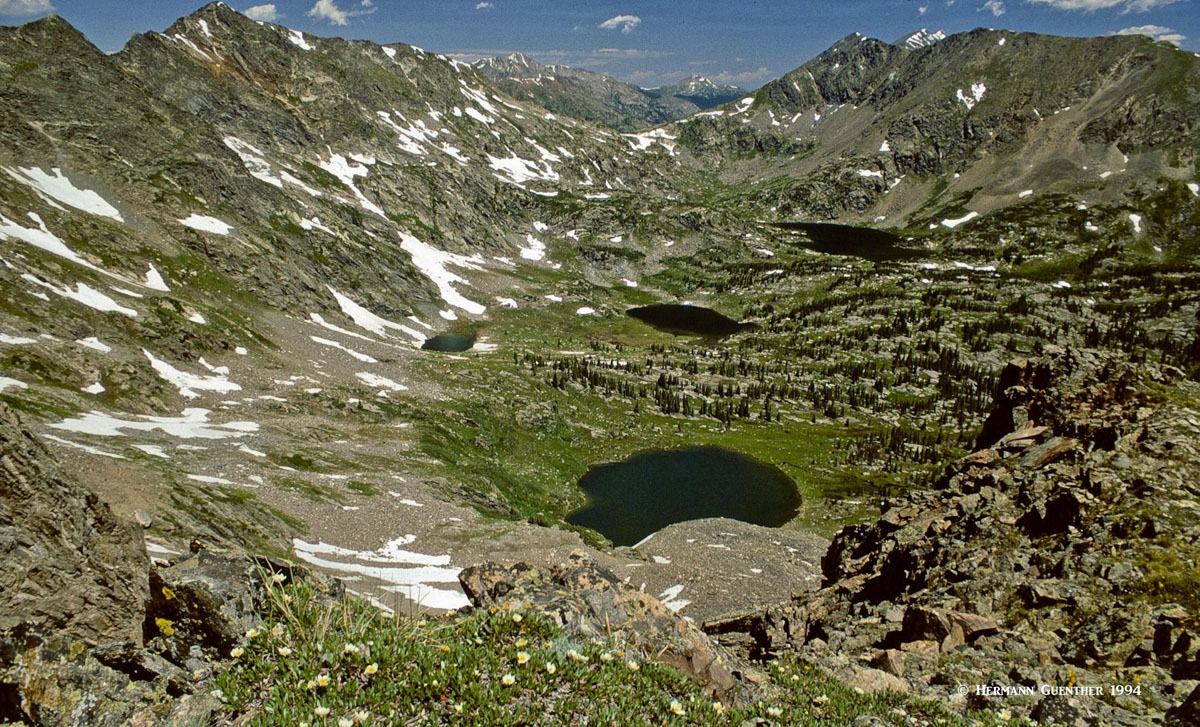
Missouri Lakes from Savage Peak
Lonesome Lake Trailhead - This trailhead is located right at the end of the Homestake Reservoir Road, close by the dam. The southern end of the Holy Cross Wilderness has fewer lakes than the rest of it, and has no nearby significant mountains to attract peak-baggers. This therefore results in far less visitation, which may be just what some hikers want. The five-mile one-way trail to Lonesome Lake makes for a worthy day hike and you will likely see very few hikers here. A longer, much longer, day hike would include taking the spur trail (actually more a route than an official trail) to the lovely Isolation Lakes, aptly named. This could result in up to five miles additional hiking, but is well worth the effort. Obviously, a backpack trip of at least two days would make this a far less strenuous undertaking, three days would be far more preferable. While at Isolation Lakes, one might be tempted to climb the 12,887-foot Galena Mountain. There is an easier way than trying to climb out of the lakes' basin which is defended by some very steep slopes.
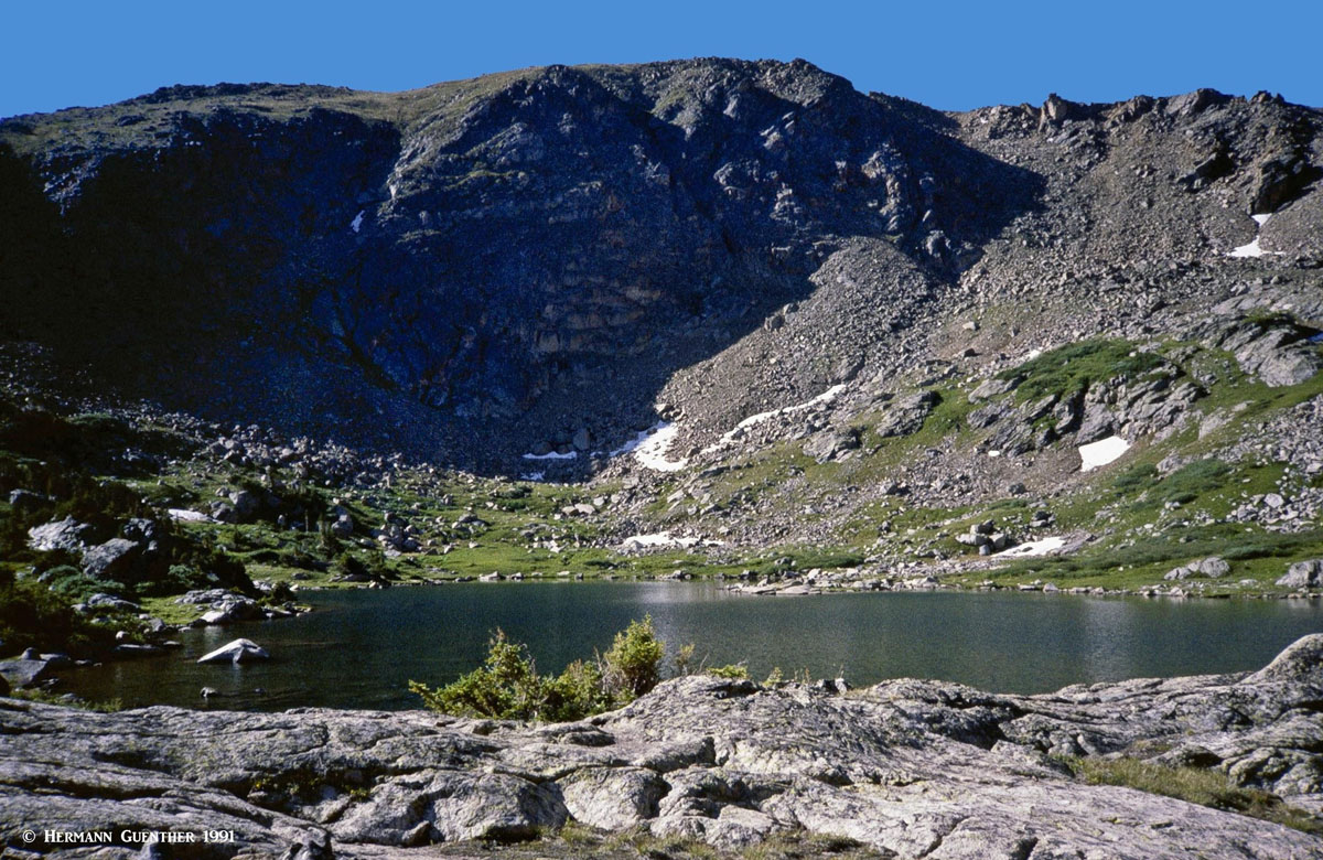
Lonesome Lake
Holy Cross City Trailhead - This trailhead is right beside the Homestake Reservoir Road just north of the Missouri Lakes Road turnoff. This is actually a jeep trail more than a hiking trail. It goes up to the historic mining town of Holy Cross City. The trail and the mining town are not in the wilderness area for the obvious reason that motorized vehicles are prohibited there. But there are other hiking trails from that site into the wilderness. Hiking up the jeep trail is not very pleasant when compared to all the other trails.
Whitney Lake Trailhead - Whitney Lake is the only destination served by this trail which is less than three miles one way. For this reason, and for the fact that this trail does not connect to any other maintained trails, it is a lightly trafficked trail. Whitney Peak (13,274 feet) could be climbed from Whitney Lake, although that would be better accomplished in combination with a backpack trip to one of the many other lakes closer to the interior of the wilderness (see below). Whitney Peak is not often climbed although its gentle northwestern slopes are a delight, and the view from the top is fantastic. Solitude can be virtually assured on its summit.
Half Moon Trailhead - This important trailhead can be found at the end of the eight-mile log Tigiwon Road (also known as Forest Road 707 and Notch Mountain Road). There are two major trails that start here - the Half Moon Pass Trail and the Fall Creek Trail. The Half Moon Pass Trail is the easiest and most common approach to Mount of the Holy Cross - the only fourteener in the Holy Cross Wilderness. Even so, it is a very strenuous hike of 12 miles round trip and an accumulated elevation gain of over 5,600 feet (actual varies slightly depending on the source you believe). Many hikers climb this magnificent peak by backpacking part way in and then climbing the peak the next day.
Mount of the Holy Cross from Notch Mountain
The Fall Creek Trail leads to many fine destinations in its eight-mile one way length. The first is about 2.3 miles from the trail head - the junction from where the trail to Notch Mountain diverts. Notch Mountain provides a breathtaking view of Mount of the Holy Cross - directly across a narrow cirque. This is the best place to see the entire cross from top to bottom. From Notch Mountain it is possible to continue along an undulating ridge to reach Holy Cross on an alternate route. While that would be an 18-mile round trip hike, it involves less overall elevation gain since Half Moon Pass would not have to be crossed twice. Meanwhile, the Fall Creek Trail continues onward to a number of wonderful alpine lakes including Lake Constantine, the two Tuhare Lakes (via a short spur trail), and the Seven Sisters Lakes, which are reached by going over Fall Creek Pass at 12,150 feet. Returning the same way would require crossing the pass a second time, although with a car shuttle arrangement, that can be avoided by taking the Holy Cross City Trail back down to the Homestake Reservoir Road. The climb of Whitney Peak from the top of Fall Creek Pass is simply delightful and not very crowded, if at all. This writer climbed it without seeing anyone else - on a holiday weekend. Admittedly, that was a few years ago and things are likely to have changed since then.
Lake Constantine and Fall Creek Pass
Lake Charles Trailhead - An alternative way to get into the Holy Cross Wilderness is to exit I-70 in the town of Eagle - halfway between Vail and Glenwood Springs - and drive the 16 miles toward the Fulford Cave Campground, following a series of forest roads (it is best to inquire locally for the best way to get there). The trail is a 12-mile (round trip) out-and-back trail to two terrific alpine gems - Lake Charles and Mystic Island Lake. It is a long day hike indeed, but an overnight backpack is ideal, preferably spending two nights. Lake Charles is the more scenic place to set up camp and spend the rest of the first day just enjoying the wonderful surroundings - and perhaps fishing the lake and the segment of East Brush Creek between the two lakes. The second day - more of the same, but spending the better part of the day exploring Mystic Island Lake and its surroundings. The downside of entering the wilderness here is that the trail is a dead end - there are no maintained trail connections into the rest of the wilderness. For those who camp here, who have a little extra time and who want additional adventure, a climb up to Fools Peak (12,887 feet) is not out of the question. That would certainly add some spice to the outing.
Lake Charles and Fools Peak
Savage Lakes Trailhead - While the trail from here to the two Savage Lakes is short and relatively easy, though steep in places, it is far from anywhere. Therefore, this trailhead is suitable mainly for those arriving from the west - from towns like Basalt, Carbondale, Glenwood Springs, and even Aspen. It is not likely that many visitors from the eastern side of the wilderness will go here since that incurs a rather long drive. The trailhead is reached by driving the paved Frying Pan Road from Basalt to the junction of Forest Road 4b and 4c which are gravel surfaced, a total distance of about 35 miles. The trail distance is only about two miles to the second lake. It is also possible to combine this hike with a side trip to nearby Carter Lake, which adds between two to four miles to the length of the hike, depending on how one returns to the trailhead. Climbing Savage Peak is a good option from here via its southeast ridge.
Lyle Lake Trailhead - Like Savage Lakes, this trailhead is also a bit far from anywhere, although a little bit easier to reach from the east side of the wilderness. This requires taking the Hagerman Pass Road from the south shore of Turquoise Lake near Leadville. This road is not open during the winter months, and in summer, it requires a high-clearance vehicle, though not necessarily 4WD, but it helps. From the trailhead it is only 1.5 miles to Lyle Lake with only 700 feet of elevation gain, thus making this pleasant hike one of the easiest backpack trips into pristine high-country wilderness. The trail also continues another 1.5 miles to nearby Mormon Lake - an extension of the hike definitely worth making. While people do this as an easy day hike, extending the adventure to three days is to be recommended as there is much to explore here. Fishing in both lakes is great and hiking the nearby ridges provides awesome views, especially toward Mount Massive, the second highest peak in the Rocky Mountains of North America. In the three times this writer has done this backpack excursion, not once were there any other people camped in this basin, though there were a few day hikers.
Lyle Lake, Mount Massive - July 1995
The entire Holy Cross Wilderness is contained within a roughly rectangular area defined by four major towns - Leadville, Vail, Eagle and Aspen. The extent to which each of these towns can serve as a base to explore the wilderness depends upon which parts of the wilderness visitors want to concentrate on. Without question, Vail and Leadville are best positioned to serve the "best" areas - those that are most popular and therefore most visited. Eagle, though a major town with commercial airline service, is really only convenient for those who want to explore the northwestern part of the wilderness (see Lake Charles Trailhead above). Likewise, visitors making Aspen their base are far more likely to focus their attention on the Elk Mountains as their mountain playground. The trails to the Savage Lakes and Lyle/Mormon Lakes, would likely be of secondary interest, except for those wishing to avoid the crowds. For the latter trails, the towns of Carbondale and Basalt are a good bet - not far from Aspen, but offering a much more low-key experience. Even so, they are only handy to those most remote western parts of the wilderness. There are of course many rustic accommodations such as campgrounds or wilderness lodges available along the roads encircling the wilderness.
Situated at an elevation of 10,152 feet, Leadville is the highest incorporated town in the United States. Lake County Airport just outside of town is the highest airport in North America, at 9,924 feet. A general aviation facility, it does not have scheduled passenger service, which was discontinued a number of years ago. Historically, Leadville was a major silver mining center and in the late 1890's was second in population only to Denver. Today, it retains its historic charm and contains many historic buildings and sites. The two highest peaks in the Rocky Mountains of North America (Mounts Elbert and Massive), and therefore in the Sawatch Range, can be easily seen from most parts of the town. For those who want to recreate in the Holy Cross Wilderness, Leadville makes a very conveniently situated base from which to explore the very popular eastern trailheads, all easily reached via U.S. Highway 24. When the Hagerman Pass Road is open, the western trailheads, especially Lyle Lake, can be reached in under 20 miles, but of course at quite slow speeds for much of that drive. Though not a very big town, Leadville offers a choice of reasonably-price accommodations and restaurants. It is certainly not a swanky resort town; but it offers a hearty dose of "old west" flavor and atmosphere.
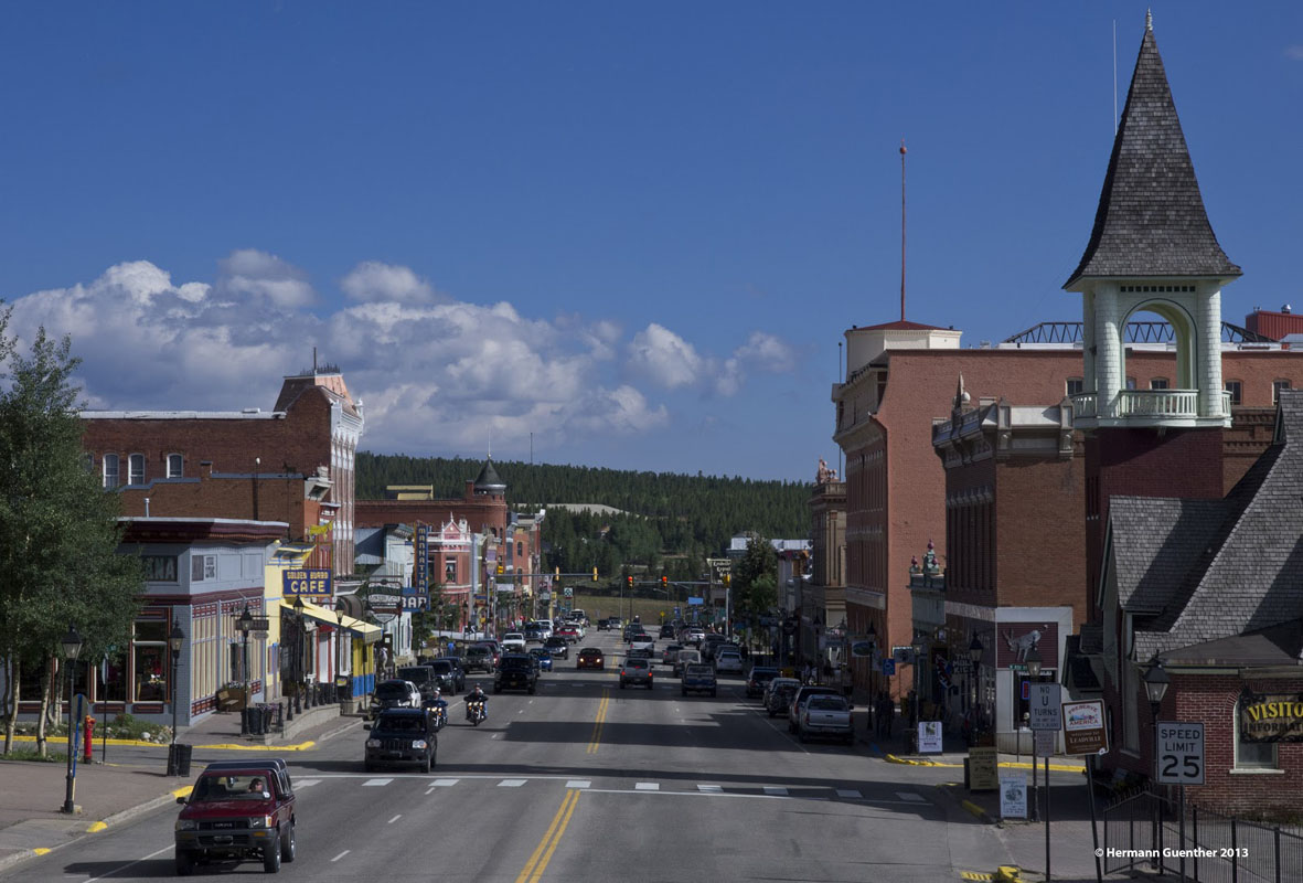
Leadville
What was at one time nothing much more than "a wide spot in the road" has become a charming and fashionable alternative to the big resorts dotting the Colorado landscape. Only a couple of miles south of Interstate Highway 70, Minturn is well positioned to serve as a base from which to explore the northern part the wonderful Holy Cross Wilderness. This town is especially handy to the trails starting at the upper end of the Tigiwon Road. With a population of little more than 1,000 inhabitants, this charming town does have a limited supply of accommodations and eating establishments, but it may be just what some people want in terms of a cozy and quiet place to spend a few nights.
For those with slightly more sophisticated tastes, and matching budgets, Vail simply can't be beat in terms of convenience and its wonderful setting. Everyone with an interest in skiing (or not) has heard of the swanky resort of Vail in the central Colorado Rockies. It started in 1962 as a small ski area and has grown into the largest ski resort in Colorado. It offers everything a visitor could ask for and at prices that are, well, not for everyone, especially during the ski season. Budget accommodations are rare in this resort that was modeled after high-end resorts in the Alps. Vail is very accessible and is only a 90-minute drive from Denver (on good days when the traffic is light, which does not happen on weekends or when the roads are snow-and ice-covered), with Interstate Highway 70 going right through the town. But Vail is more than a ski resort. It offers a wide variety of recreational activities including biking, fishing, golf, rafting, high-adrenaline activities, and more and more. The closest major trailhead in the Holy Cross Wilderness (Half Moon Trailhead) is only 18 miles from the center of Vail, taking less than an hour to reach via the Tigiwon Road. The beginning of the Homestake Reservoir Road is likewise only 18 miles from Vail, taking only 30 minutes to reach - the main trailheads along this road are only minutes away from this intersection on U.S. Highway 24.
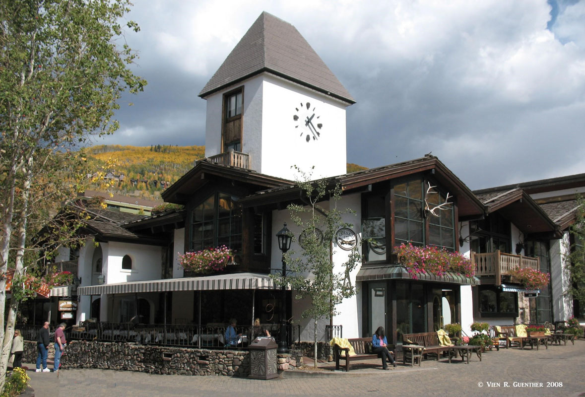
Vail
Basalt and Carbondale - These two nice towns with populations of 3,857 and 6,427 respectively are only about 12 miles apart on State Highway 82 between Glenwood Springs and Aspen. Like Aspen itself, they really don't figure prominently as convenient bases from which to explore the Holy Cross Wilderness. But in terms of accommodations and other tourist amenities, they are an affordable alternative to high-end Aspen. Each town has it charms and recreational appeal. Carbondale is located at the confluence of the Roaring Fork and Crystal Rivers - thus great fishing. Also several miles up the beautiful Crystal River Valley is the historic resort town of Redstone, founded in the late 19th century as part of the coal mining industry. Basalt, located at the confluence of the Roaring Fork and Frying Pan Rivers, is well known as a haven for Gold Medal fly fishing on the latter river. The nearby Ruedi Reservoir is a popular regional water sports and camping destination.
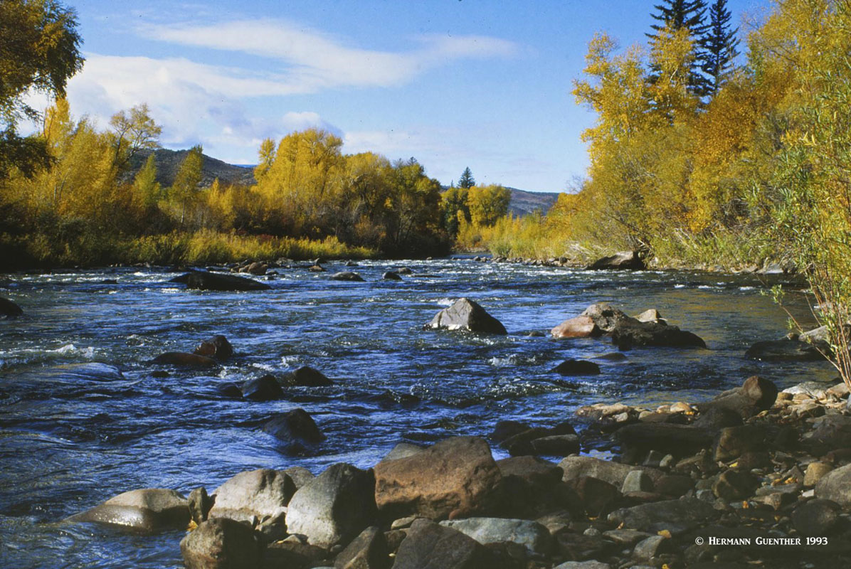
Roaring Fork River - Basalt
Positioned conveniently right on I-70 halfway between Vail and Glenwood Springs, Eagle is a burgeoning town that has grown from a population of 3,032 in 2000 to 6,508 in 2010. By highway it is just over two hours from Denver and about five minutes from the Eagle County Regional Airport, which has scheduled airline service, especially in the winter when it serves as the closest airport to Vail. But its function as a base for exploring the Holy Cross Wilderness is somewhat minor as it directly serves only the most northwesterly reaches of the wilderness - specifically the Lake Charles Trailhead (see above). But it does offer reasonably priced accommodations and eating establishments. The nearby Sylvan Lake State Park is a notable attraction in Eagle. The town is located at the confluence of Brush Creek and the Eagle River. The world-famous hot springs at Glenwood Springs are only a 30-minute drive away.
Holy Cross Wilderness Backcountry


