Scan the QR code and open PeakVisor on your phone
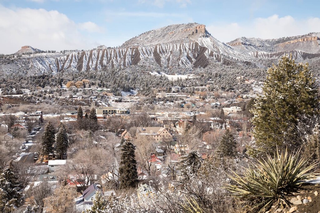
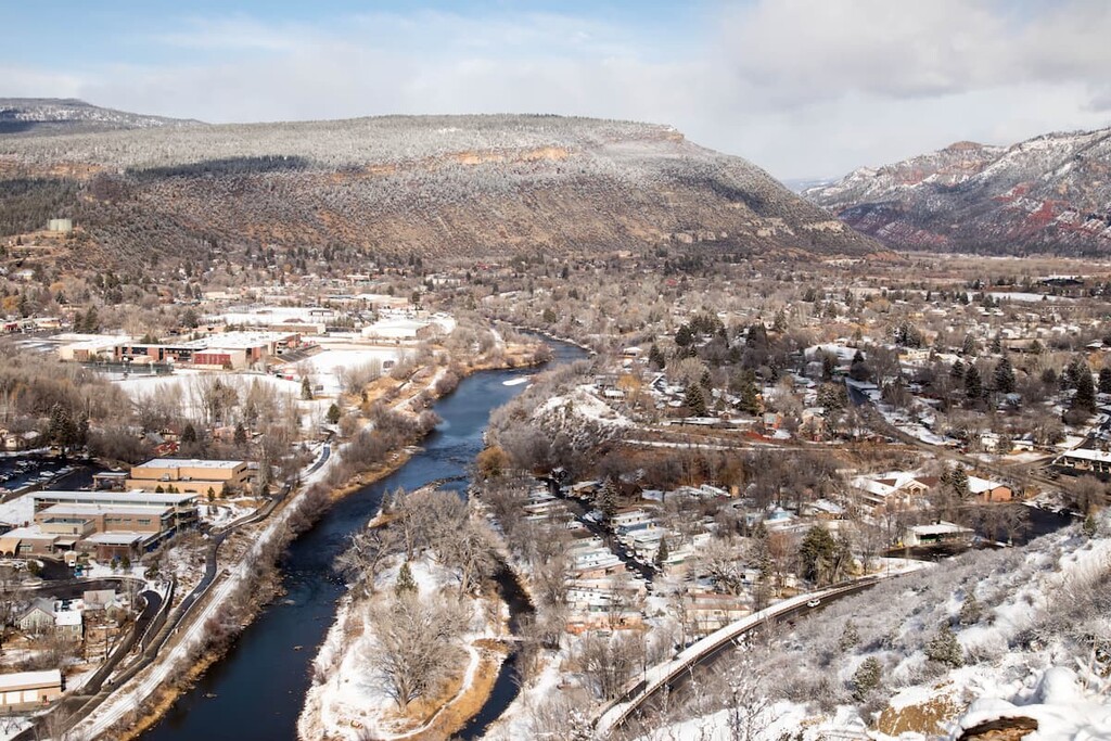
La Plata County is one of 64 counties in the state of Colorado. It is located in the southwest quadrant of the state and encompasses an area of 1,700 square miles, only about 8 of which is water. Its population was 51,334 inhabitants as of the 2010 census, making it the second-most populous county in the mountainous regions of the state after Eagle County. The largest city and the county seat is Durango, which sits at just about the geographical center of the county, at the crossroads of two major highways – the north-south US-550 and the east-west US-160. Durango has a population of 18,973 (2019 estimate); the only other towns in the county are Bayfield and Ignacio with populations of 2,689 and 908 respectively. In addition, there are several small unincorporated communities and three ghost towns. The Southern Ute Indian Reservation is located in the southwestern corner of the county.
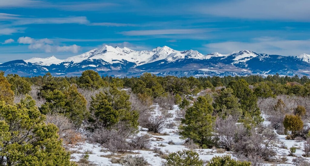
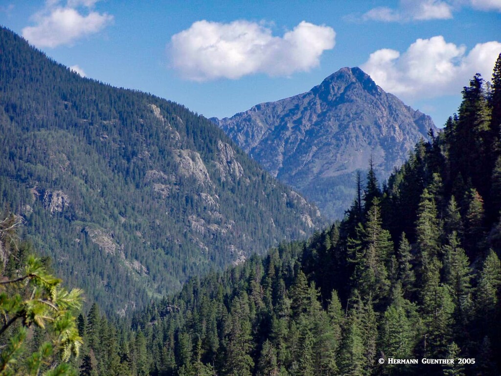
Much of the southern half of the county is not mountainous – it is more like a high plateau interspersed with forested hills. It is mostly the northeastern corner of the county that is characterized by high mountains (known as the Needle Mountains), although midway along the western county boundary is another cluster of high peaks (the La Plata Mountains – several exceeding 13,000 feet in elevation) that might be of interest to hikers and climbers. Nevertheless, there are 118 named mountains in La Plata County, the highest and most prominent of which is Mount Eolus. There are two other fourteeners (Windom Peak and Sunlight Peak) in the county plus another named peak over 14,000 feet (North Eolus) which does not qualify as a ranked fourteener since it does not meet the criterion of 300 feet of topographic prominence.
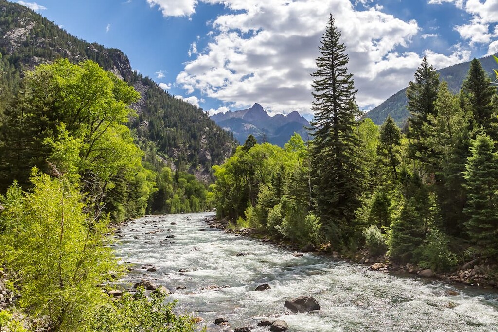
La Plata County is named after the La Plata River, a relatively minor river by Colorado standards, which finds its headwaters in the cluster of high peaks along the county’s western boundary with Montezuma County. “La Plata” is the Spanish word for “The silver”, the mineral for which the county is well known, since it was mined extensively in the nearby San Juan Mountains in the late 19th century. The far better known river is the Animas River, which runs from north to south essentially splitting the county into two equal segments. It has its headwaters in the Uncompahgre Wilderness area to the southeast of Ouray and ends at its confluence with the San Juan River in the city of Farmington in New Mexico. The San Juan winds its way across much of the Colorado Plateau until it joins the mighty Colorado River in south-central Utah.
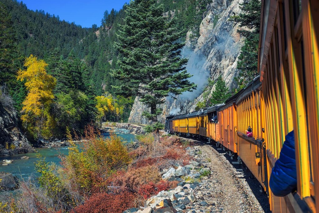
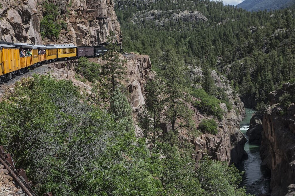
Before we get into the discussion about mountains and hiking and climbing, let’s inform visitors to La Plata County about the many other recreation attractions the county and the surrounding area have to offer. Without doubt, the most popular attraction in the county is the Durango and Silverton Narrow Gauge Railroad, a federally designated National Historic Landmark. Originally opened in 1882 to transport silver and gold ore mined in the San Juan Mountains, it is now a tourist line hauling passengers – thousands of them, and reservations are needed well in advance. For its entire 45-mile length, the line follows the Animas River. The railroad maintains a museum at both ends of the line.
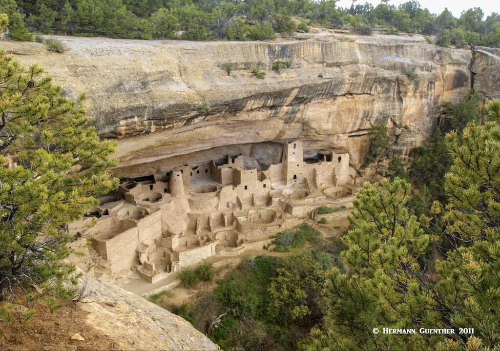
Mesa Verde National Park, while just to the west of La Plata County in Montezuma County, most certainly contributes significantly to tourism in the county. It was established in 1906 by President Theodore Roosevelt in order to protect and preserve over 5,000 historic sites and 600 cliff dwellings built by ancient Native American cultures between 650 and the end of the 13th century. A UNESCO World Heritage Site, Mesa Verde is the largest archaeological preserve in the United States – it is certainly a place that anyone visiting La Plata County must include on their itinerary. The park entrance is only 35 miles from Durango and can be reached in less than 40 minutes. The real time-consuming part is visiting the many sites and cliff dwellings. One whole day is barely enough. While Mesa Verde is not known as a major hiking destination, there are many trails in the park, almost all of them rated as easy, thus making them suitable for families with children.
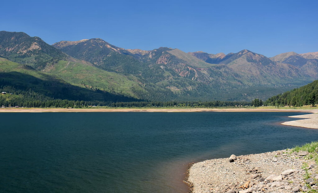
Just southwest of downtown Durango is Lake Nighthorse, a popular recreation park well-known to locals, but not generally known to outsiders. What was once a private lake, first opened to the public in 2018, is a favorite for all kinds of water sports including boating, water skiing, and wakeboarding. If you don’t own your own watercraft, they can be rented from local vendors right on the shore of the lake. Located on sacred tribal land, Lake Nighthorse also offers excellent fishing. Also, about 20 miles east of Durango, nestled in a scenic valley deep in the San Juan Mountains is Vallecito Lake, considered one of the most beautiful bodies of water in Colorado. All kinds of water sports are allowed at this lake, which lies at an elevation of 8,000 feet. It is a great place for year-round fishing (yes, through the ice), camping and hiking.
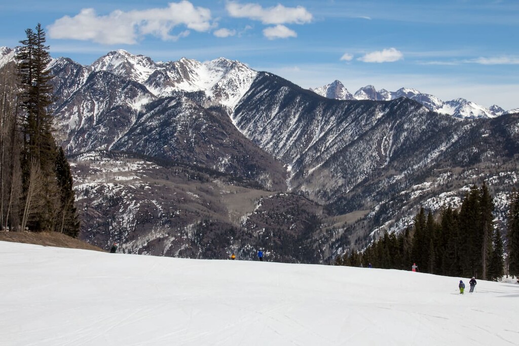
Finally, La Plata County has its own major ski area. Just 25 miles north of Durango is the Purgatory Resort, sometimes referred to as the Durango Mountain Resort. One travel website has called it the Best Value Ski Resort in North America. With nine chairlifts and 1,605 acres of skiable terrain, it is not exactly a small resort, yet it retains the small resort flavor. It is known for great value and short lift lines, if any.
While La Plata County is not as much of a hiking destination as many other counties in the mountains of Colorado, it still has its share of good places to go hiking, including one of the most popular and spectacular sites in the state for bagging fourteeners. But there are actually many trails that offer great hiking some of which start right within Durango city limits. This is because the city sits right at the base of some pretty amazing terrain. We will examine some of these now.
Keeping in mind that most of Durango sits at an elevation of around 6,500 feet, the terrain around here will largely resemble that of the Front Range foothills, which is where we live and do much of our hiking in autumn, winter and spring. We rarely hike at these low elevations in summer because it can get very hot – something many people can handle, but which we find uncomfortable. Now, knowing that Durango is in the southwestern part of the state, summer here can be equally hot, if not more so. People who can hike in the heat will find year-round hiking opportunities around this ideally situated town.
Twin Buttes Trailhead – This trailhead less than two miles from the major highway interchange at the south end of town offers a variety of great hikes ranging in difficulty from easy to hard. The hike to Twin Buttes at elevation 7,609 is only 6.4 miles in overall length and is rated as easy though it has an elevation gain of 1,236 feet. The most difficult rated hike here is to the top of Perins Peak – ten miles out and back and 1,730 feet elevation gain. Other combinations here vary between 9 and 10 miles, with elevation gains generally below 1,500 feet and involving loop options are rated as moderate so that most hikers in reasonably good condition can easily do these. Mountains bikes are permitted on most of these trails
Animas Mountain East Trailhead – Just three blocks west of Main Avenue at the north end of town is this convenient trailhead. It offers several hiking options with none longer than seven miles. The loop trail that includes reaching the summit of Animas City Mountain (8,186 feet) involves an elevation gain of 1,560 feet. A moderate hike of less than four hours, this is a favorite half-day hike for many locals. Fine views from the top cover the city as well as the high peaks just to the west.
La Plata River Valley Trailheads – If you drive 11 miles west on US-160 from the south end of Durango, you will find County Road 124 branching off to the north. It follows the La Plata River up into the high peaks (the La Plata Mountains) where you will find several trailheads and a number of campgrounds. This road ends at the southern boundary of the Hermosa Creek Wilderness, which is entirely within La Plata County and has a few hiking trails that penetrate it. If you want a good workout, try the trail to Deadwood Mountain (12,290 feet) and Silver Mountain (12,470 feet). This lightly trafficked nine-mile out and back trail will certainly challenge you with its total elevation gain of 4,020 feet. The lower part of the hike follows a jeep trail which begins at the La Plata City campground. For the truly adventurous and well-conditioned climbers, the two ranked thirteeners on the west side, straddling the La Plata/Montezuma County line, are Mount Moss and Babcock Peak. No official trailheads for these appear to exist, but that surely does not deter dedicated peak baggers from climbing them.
About 20 miles east of Durango is the beautiful Vallecito Lake where you can find all kinds of recreation including camping and hiking. About three miles past the north end of the lake is a campground as well as the Vallecito Creek Trailhead. The trail rises gently toward the north and it is up to you how far you want to go. If you are really ambitious, you can hike all the way to the Purgatory Resort – this 33-mile trek will take you right through the Needle Mountains and even over Columbine Pass into the fabulous Chicago Basin (see below). I only went up the valley about seven miles before I decided it was time to turn around. I wish I had had more time to explore that beautiful part of the Weminuche Wilderness. On the east side of the lake are several campgrounds and trailheads from which you can hike deep into the wilderness. These trails are very lightly trafficked which means solitude is your reward for hiking here.
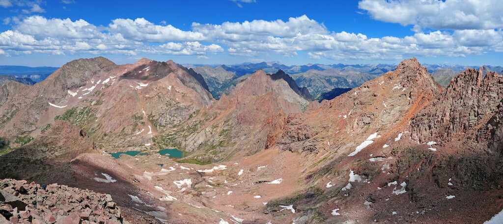
Chicago Basin in the northern part of La Plata County is undoubtedly one of the premier hiking areas in Colorado. It gets crowded due to the three popular fourteeners that can be climbed from here. But to get even as far as the upper basin itself, you have to make an 8-mile hike and overcome an elevation gain of 4,300 feet. And that’s before you start climbing the mountains. That approach alone is more than climbing many fourteeners, but many people do it and virtually all of them will camp at least one night in the basin, the upper part of which contains two alpine lakes called, appropriately, Twin Lakes. But first you have to get to the trailhead and you can’t drive your car there. You only have one option (although, see below) and that is to take the Durango and Silverton Narrow Gauge Railroad, which stops in the gorge of the Animas River at a place called Needleton. You need to get off the train here. Beside the track is a footbridge which marks the beginning of your hike. From there you march about a half mile along the river until you reach Needle Creek, where you turn inland and start climbing.
You can actually hike to this trailhead via the Purgatory Trail and the Animas River Trail which starts at US-550. That way you can drive your car to the trailhead right beside the highway, but you will add nine miles of additional hiking – each way. I doubt too many will choose this way to climb those famous fourteeners in Chicago Basin. But paying to ride the train is preferred by most, though it is expensive, since it adds another element of adventure to the overall outing. But those who have plenty of time and energy have the advantage of following a more flexible schedule by hiking in from the highway – taking the train requires booking far in advance, which means you are committed to a certain day. There is an alternate approach to the basin from the east, but that is a lengthy expedition by itself.
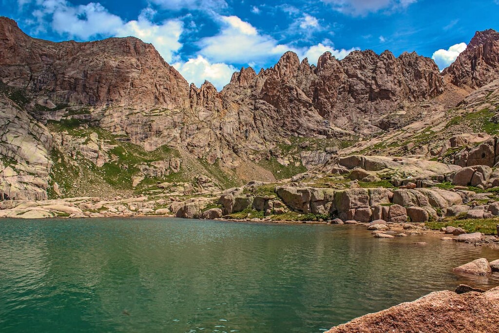
As you hike up through the Needle Creek valley, at around 6.5 miles in, there is a trail junction from which you can take a trail that leads over a high ridge (Columbine Pass) to two high alpine lakes – Columbine Lake and Hazel Lake. They are nestled below and between some high peaks that are probably rarely climbed except by those wanting to bag all the thirteeners in the state. But since you want to stay in Chicago Basin, here is where you should start to look for a campsite. If you stay on the main trail for another mile or more and an additional 1,300 feet of elevation gain you will get to the Twin Lakes. Now you are in the heart of the Needle Mountains in the Weminuche Wilderness. And you will not be alone, since some 100,000 visitors make this hike every year. The presence of so many people stresses the environment and the wildlife – there is a herd of semi-domesticated mountain goats here that have a habit of harassing the hikers for food. It is difficult to comprehend how much longer this stress on nature can be sustained without permanent damage. I suspect that, as has happened in other popular places in Colorado, the United States Forest Service may some day require permits in order to control how many visitors may camp here at any one time.
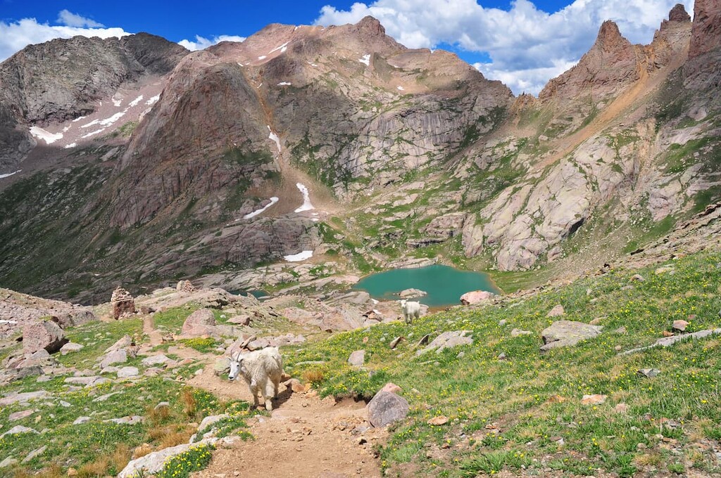
Chicago Basin is one of the most spectacular mountain settings in Colorado and probably in the entire country. In the summer, late July and August, the alpine meadows here are full of blooming wildflowers which, together with the dramatic mountain backdrop, can provide a setting for some great photography. There are no camping spots along the trail until you reach Chicago Basin, and there is a permanent fire ban in the entire Needle Creek drainage basin.
Once you are in the basin, there are several well-used routes to climb the famous fourteeners. Windom and Sunlight Peaks are at the east end of the upper basin and are separated by a jagged ridge of one-half mile. On the west end of the basin is Mount Eolus and its slightly lower brother, North Eolus. Sunlight and Windom are often climbed together due to their proximity to each other. If you just want to climb one summit in the basin, Windom is the easiest. On the other hand, Eolus on the west side is the most difficult, and it is often combined with North Eolus which, though not a ranked fourteener, is one of 58 named mountains in Colorado over 14,000 feet. Some hardy climbers will combine all three of the fourteeners in a single climbing session. The easiest way to do this is to climb Eolus first, then return back down to Twin Lakes, continuing up Sunlight, then traversing (below the connecting ridge) to Windom, from where you can descend back into the basin by its west ridge. A tough day to say the least!
There are not many towns in La Plata County besides the county seat of Durango – only Bayfield and Ignacio. In fact, you would be lucky to find any accommodations in either of those small towns, although you probably won’t go hungry if you happen to be driving through them - there are eating eateries in both towns. So, as a visitor you would most likely make Durango your base for exploring the county and nearby surrounding areas. But keep reading, for you might find that you want to stay outside of town and there are some options available. Inns and cabins are plentiful for those seeking such accommodations, plus there are many campgrounds all over the county.
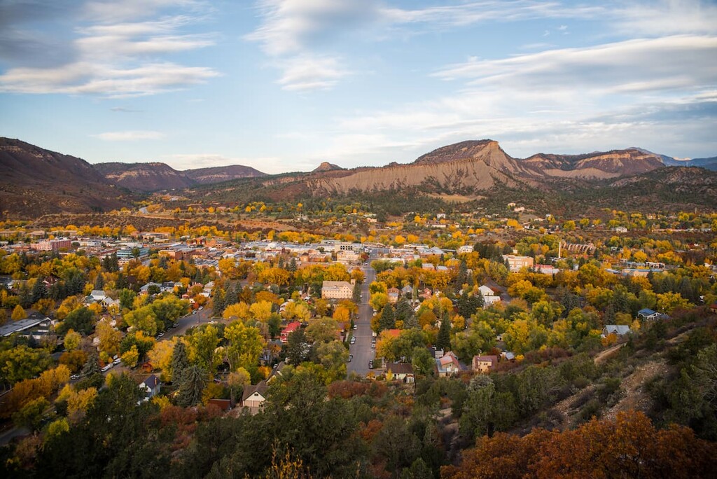
Durango shares its name with two other cities – one in Mexico and one in Spain. Many people find Durango just about the best place to live in Colorado. The town is small enough to give the feeling of living in the mountains, yet large enough to offer its citizens and visitors just about all they can reasonably expect or require. There is no shortage of accommodations, restaurants and shopping venues. Even high-end hotels can be found here. Then you can also find major shopping centers, hospitals, schools and two colleges. The city can be easily reached by good highways and even has a regional airport that provides scheduled airline service to major hub airports such as Dallas, Phoenix and Denver. Durango offers many tourist attractions, not the least of which is the Durango and Silverton Narrow Gauge Railroad – so you can ride the rails to Silverton in the heart of the San Juan Mountains instead of driving your own car. And don’t forget, the Mesa Verde National Park, a UNESCO World Heritage Site, is just 35 miles to the west. It is worth exploring the historic downtown Durango on foot – you will find restaurants with western charm (and tastes) as well as boutiques offering genuine Native American products – not made in “you know where”.
Whether you come here to ski at the only major ski area in La Plata County, or just want to feel the resort atmosphere during the summer, Purgatory Resort is a great place to base yourself if you don’t have the need for city amenities. The Village Plaza at the mountain’s base area features a choice of lodging, retail shops, restaurants and bars. All kinds of family-friendly activities can be found here including the Inferno Mountain Coaster, the area’s only alpine slide. And if you want to go hiking, there are plenty of places just a short drive from the resort. If you are interested in the attractions in and near Durango, that vibrant town is only 25 miles to the south. If venturing deeper into the San Juan Mountains is what you are looking for, the historic mining town of Silverton in adjacent San Juan County is only 22 miles to the north along US-550, one of the most spectacular highways in . Just give yourself plenty of time, since you will find many excuses to stop along the way.