Scan the QR code and open PeakVisor on your phone
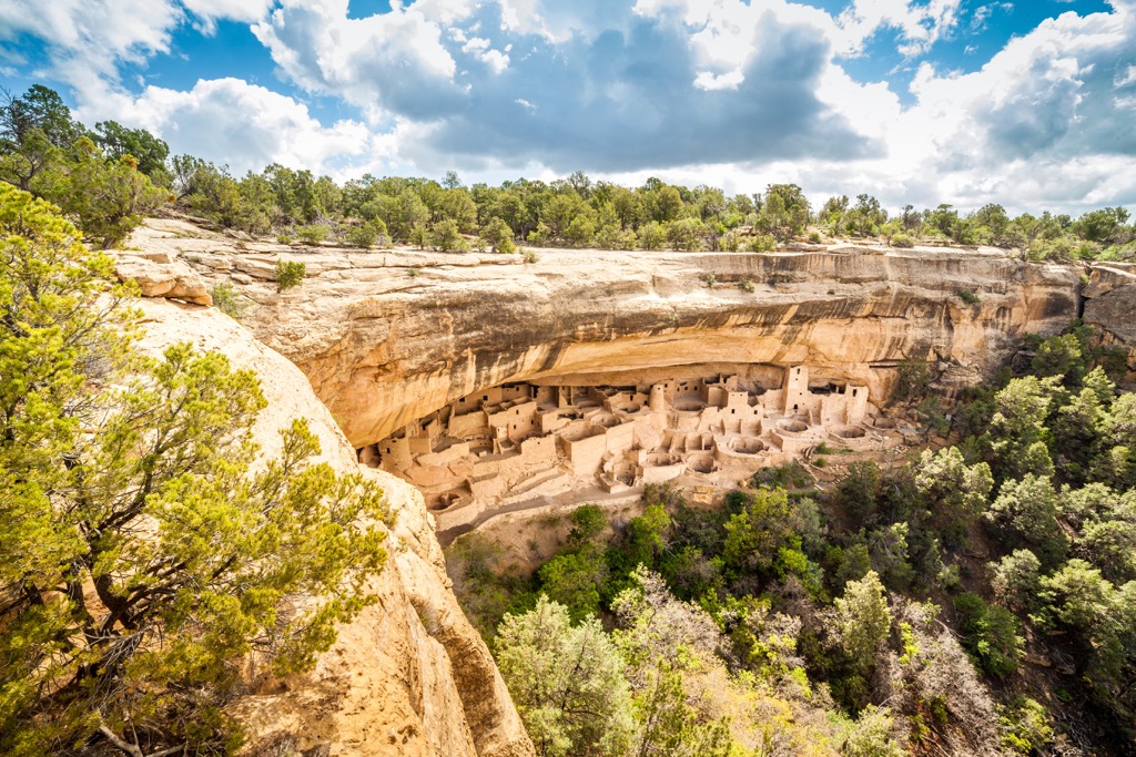
Mesa Verde National Park in southwest Colorado, USA, is one of the nation’s first national parks created to protect archaeological remains left behind by previous cultures. The impressive cliff dwellings of the Ancient Pueblo people were constructed seamlessly within the impressive landscape of mesas and canyons. There are 19 named mountains in the park and the highest and most prominent is Park Point at 8,570 ft (2,612 m) with a prominence of 1,611 ft (491 m).
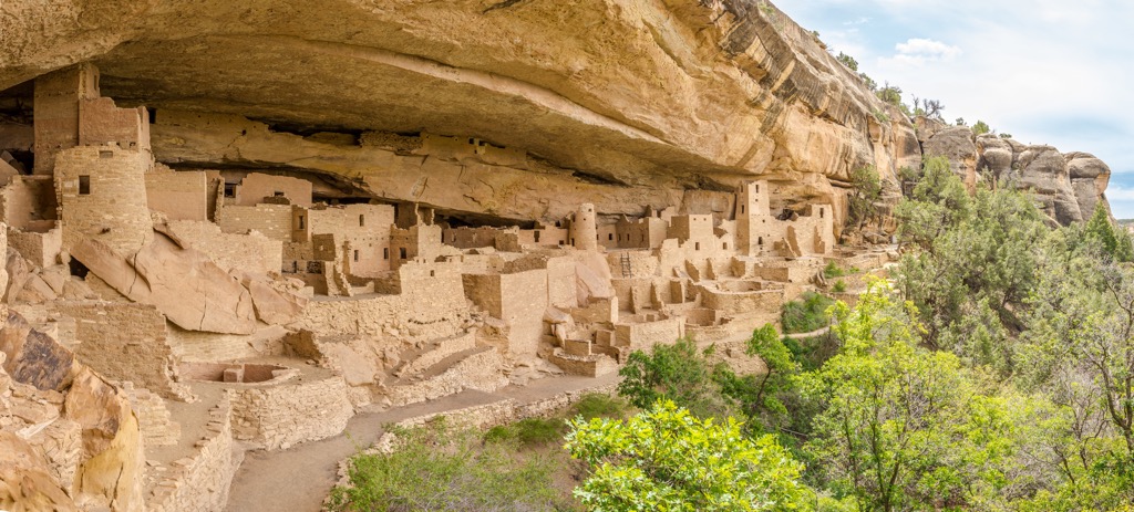
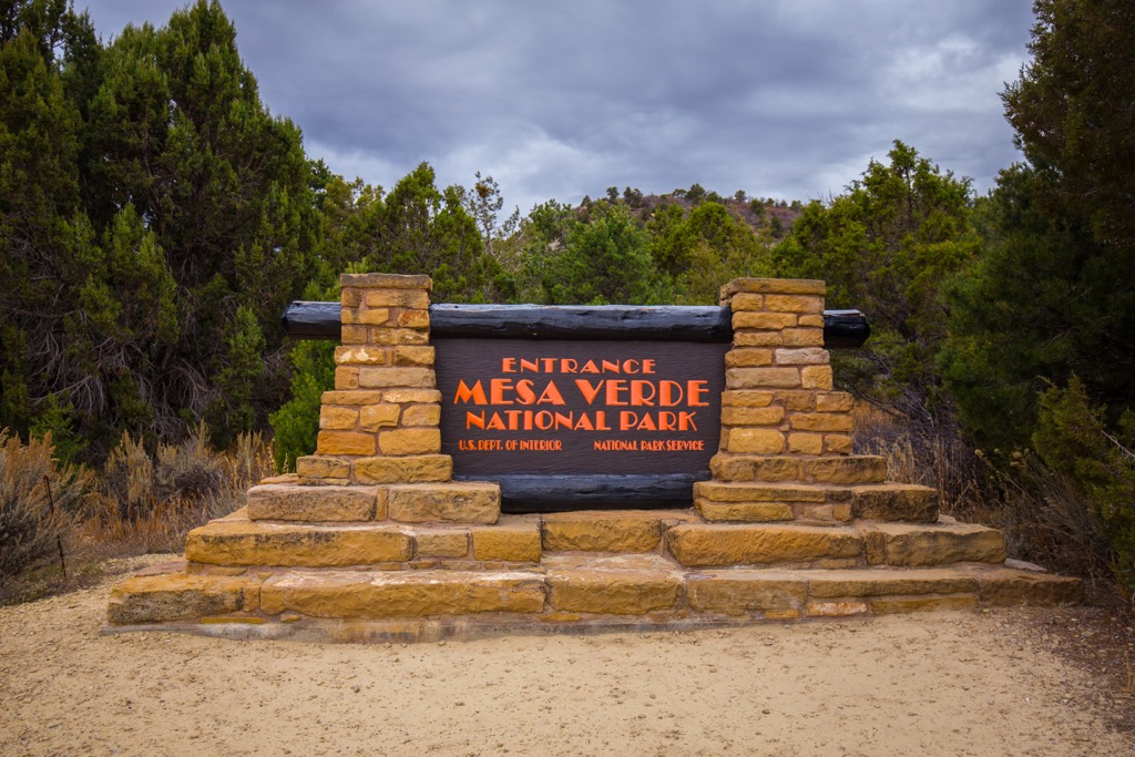
Spanning 52,000 acres (21, 045 ha) of the Colorado Plateau in Colorado, Mesa Verde National Park is also a World Heritage Site and an International Dark Sky Park. The park was established in 1906 by President Theodore Roosevelt in order to “preserve the works of man”. The Ancient Pueblo people occupied the area for 700 years and their remarkably intact structures remain tucked beneath overhangs and built up against canyon walls.
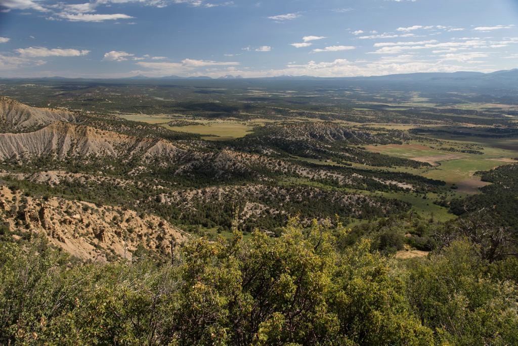
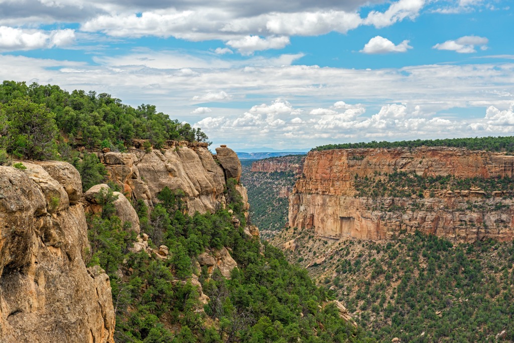
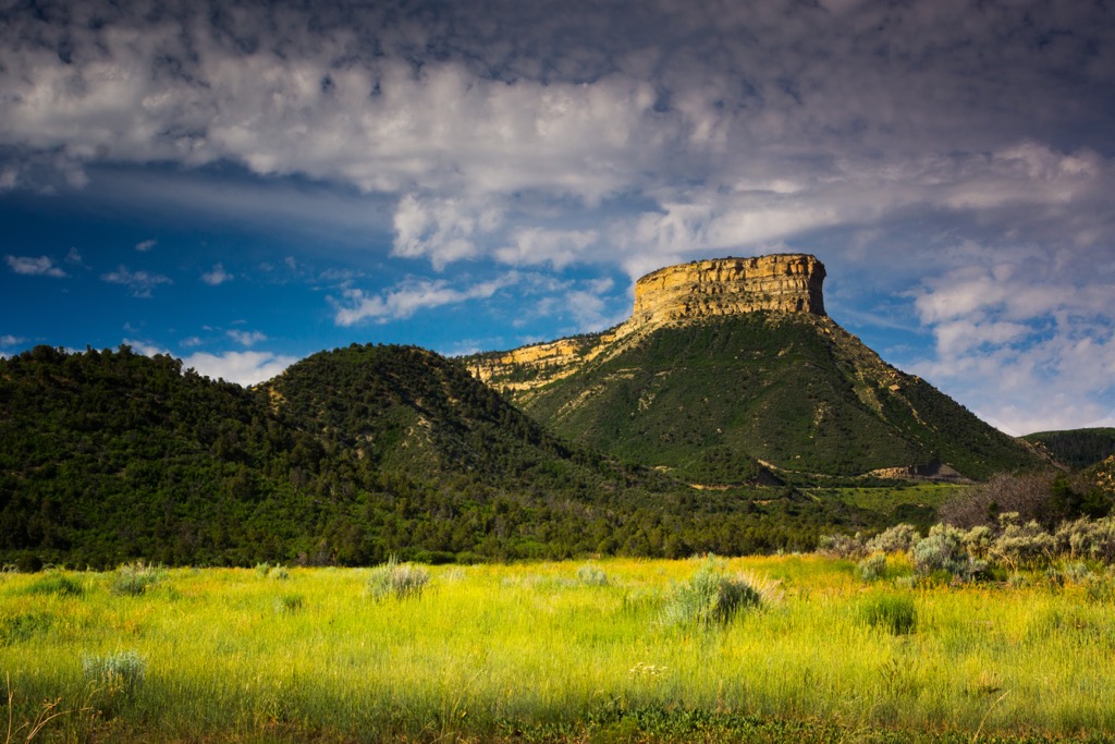
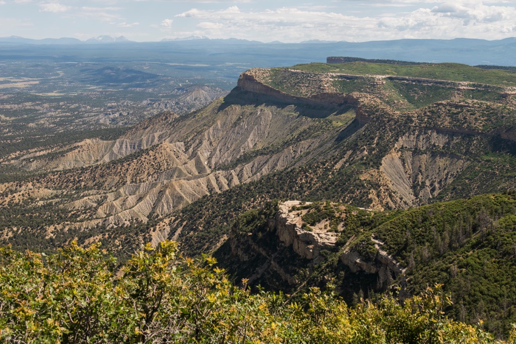
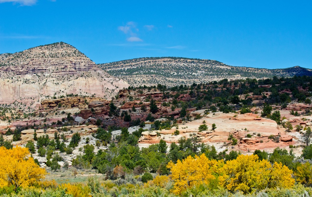
Elevations within the park range from around 6,000 ft (1,830 m) in the southern canyons to 8,570 ft (2,612 m) at Park Point. Although named Mesa Verde (green mesa), the formation is technically a cuesta. While a mesa is flat on top, a cuesta has a gentle slope. Mesa Verde is inclined slightly to the south at about a seven degree angle. Millions of years of erosion from wind and water has sliced and shaped the landscape into a series of mesas and canyons.
Nearby protected areas include the Canyons of the Ancients National Monument to the northwest, Lone Mesa State Park to the north, and Colorado’s extensive San Juan National Forest to the northeast. The highest points in the park are Park Point (8,570 ft/2,612 m), Moccasin Mesa (8,369 ft/2,551 m), Lone Cone (8,297 ft/2,529 m), North Rim (8,274 ft/2,522 m), and The Knife Edge (8,212 ft/2,503 m).
The formations of Mesa Verde took shape as the Western Interior Seaway repeatedly advanced and retreated from the region during the Cretaceous Period, leaving behind distinct deposits. About 100 million years ago, the sea deposited sand that hardened into what is known today as Dakota sandstone. This composes most of the base of Montezuma Valley below the mesa and around the nearby city of Cortez.
Following this episode of sandy deposits, the sea continued to spread west and fine particles and organic matter accumulated, later hardening into Mancos shale. This shale makes up the hills near the base of the mesa in Montezuma Valley. In this rock one can find fossils of oysters, clams, snails, shark teeth, and ammonites (ancestors of mollusks).
Three formations known collectively as the Mesaverde Group overlie the Mancos shale. From oldest to youngest this includes the Point Lookout Formation, Menefee Formation, and Cliff House sandstone.
The Point Lookout Formation is primarily sandstone with occasional patches of shale, and formed as the sea was retreating. The Menefee Formation came into existence as the receding sea left behind flat coastal plains about 80 million years ago. Particles and organic materials amassed from the swamps, eventually compacting and forming darker colored shales. There are a few sandstone and coal seams, as well as a few fossilized plant remains.
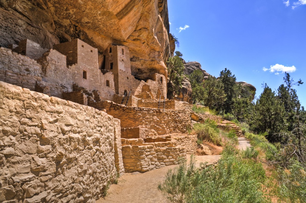
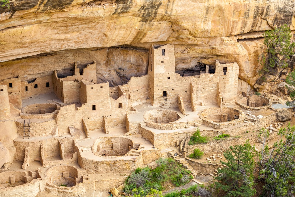
The third formation, the Cliff House sandstone, was a result of the sea advancing yet again over the region and depositing more sand. Wave action from the sea left behind ripples that can be seen in the rock formation today. This layer was used by the Ancestral Pueblo people for their cliff dwellings.
Although 1,500 ft (160 m) more of sandstone and shale were deposited after the Mesaverde formations, these later layers eroded with time. The Western Interior Seaway subsided for the final time about 75 million years ago.
At the end of the Cretaceous around 65 million years ago, the Laramide Orogeny began to uplift the Rocky Mountains. The intense collision of tectonic plates caused laccoliths in some areas. Laccoliths occur as magma travels up through a vent but, rather than exploding, pushes up rock layers into a dome or mushroom shape. Examples of laccoliths are Sleeping Ute and La Plata Mountains.
Igneous dikes are present in Navajo Canyon, Mancos Canyon, and Wetherill Mesa. These dikes extend vertically through surrounding rocks and were formed about 30 million years ago due to volcanism. The final contouring of the region into canyons and mesas occurred due to uplift, erosion, and downcutting.
Mesa Verde National Park sits between dry scrublands to the south and montane forests of the Rocky Mountains to the north. The park receives an average of 18.4 in (46.7 cm) of precipitation annually.
Four major plant communities exist in the park. From lowest elevation to highest, they include shrub-steppe, including sagebrush valleys; pinyon-juniper forests; mountain shrub communities; and Douglas fir and ponderosa pines at the highest elevations.
The range of elevations and the natural springs that arise from cracks in the Cliff House sandstone and Menefee shale created a range of climates and microclimates to support diverse plant life. Within the park one can find prickly pears that thrive in dry, rocky soils, Douglas firs growing in shaded, moist soil, and mosses and ferns growing along springs.
As the national park is protected, it has maintained some species that are otherwise rare in the region such as peregrine falcons and Mexican spotted owls. The same goes for plants, including the Cliff Palace milkvetch which is endemic to Mesa Verde. There are 556 vascular plants, 75 fungi, 21 mosses, and 151 lichens recorded in the park.
In total, the park is home to about 74 mammals, 200 birds, 16 reptiles, 5 amphibians, six fish, and more than 1,000 insects and invertebrates. The park was named a Colorado Important Bird Area by the Audubon Society and has several protected areas for the preservation of the threatened Mexican spotted owl.
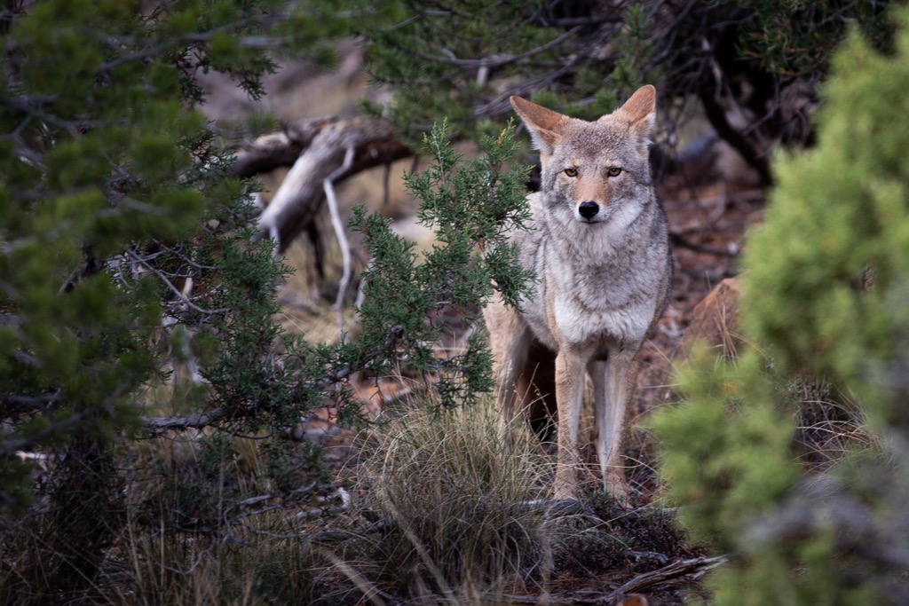
Mammals that live here include bats, shrews, weasels, raccoons, squirrels, mule deer, elk, black bears, coyotes, foxes, and porcupines. A full list of all plant and animal species found within the park can be seen here.
For over 700 years, the Ancestral Pueblo people lived in thriving communities on the mesas and along the cliffs. Today, the park protects the rich cultural heritage left behind by these people.
The earliest people in the area came around 550 AD, settling from their nomadic ways and bringing with them a strong basket weaving culture. These early settlers farmed, lived in pit houses, and began to make pottery and use bows and arrows. Around 750 AD, there was a shift from pit houses to constructing houses above ground.
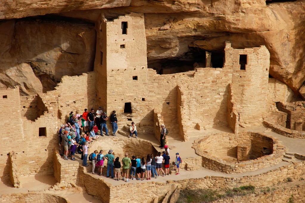
By 1000 AD, house construction had shifted from using poles and adobe to stone masonry, sometimes resulting in buildings two or three stories high. The cliff dwellings are made of rectangular blocks of sandstone held together with mortar made of mud and water.
Dwellings included rooms for storing crops, underground kivas (like pithouses), and open courtyards. The Ancient Pueblo peoples farmed beans, corn, and squash on the mesa tops and supplemented their diet with wild plants and by hunting game.
From 1100 to 1300 AD, the communities peaked and then, within the span of a couple generations, dispersed into surrounding regions. First the population swelled as high as several thousand, a time marked by impressive stone walls and widespread use of pottery.
Around 1200 AD, there was a shift away from stone buildings back to cliff dwellings for reasons that cannot quite be known. By the end of the century, most of the people had moved away, leaving behind the impressive architecture we see today.
There are 26 associated tribes of Mesa Verde today. This includes the 19 pueblos of New Mexico – Taos, PIcuris, Sandia, Isleta, Ohkay Owingeh, Santa Clara, San Ildefonso, Nambe, Tesuque, Jemez, Cochiti, Pojoaque, Santo Domingo, San Felipe, Santa Ana, Zia, Laguna, Acoma, and Zuni. In addition to this, are the Hopi tribe in Arizona, the Ysleta del Sur Pueblo in Texas, the Navajo Nation in Colorado, Arizona, and New Mexico, the Ute Mountain Ute Tribe in Colorado, the Southern Ute in Colorado, the Northern Ute in Utah, and the Jicarilla Apache Nation in New Mexico.
Mesa Verde National Park has almost 30 mi (48 km) of trails which offer scenic vistas and a chance to immerse yourself in history. Hikes leave from three main points in the park – Morefield Trailheads, Chapin Trailheads, and Wetherill Mesa Trailheads.
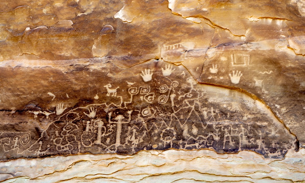
Leaving from Chapin Mesa, the trail runs 2.6 mi (4.1 km) through the Spruce and Navajo Canyons. Before doing this trail, stop by the Visitor’s Center for a guidebook explaining the dozens of markers along the trail that point out plants and archaeological sites. Trail features include petroglyphs, challenging stairs, and incredible views from the top of the mesa.
This trail heads out from Morefield Campground and follows roads first built in 1914. It is named after the formation’s steep overhangs. It is a 2 mi (3.2 km) out and back trail with a sweeping vantage point across Montezuma Valley from the top. There is not much shade on this trail.
The Mesa Verde Point Lookout Trail also leaves from Morefield Campground. It is a 2.1 mi (3.4 km) trail with some steep switchbacks but incredible views from the top.
The Spruce Canyon Trail begins from Chapin Mesa and runs a 3.1 mi (5 km) loop. Although it is a relatively short trail, there is significant elevation gain as the path descends into the canyon and then back out. This trail doesn’t have much by way of archaeological sites but is excellent for enjoying the environment of the region.
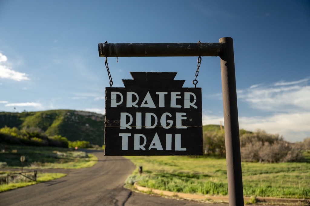
The Prater Ridge Trail is 7.8 mi (12.6 km) round trip. It leaves from Morefield Campground and climbs Prater Ridge. From there it runs the ridge before reconnecting with the access trail and retracing its path back to the campground. A cut-off trail can be used to shorten the loop to 5 mi (8 km).
There is one campground in the park – Morefield Campground. It has 267 sites and is open to tents, trailers, and RVs. Near the campground is a cafe, gas station, RV dumping station, grocery store, laundry, and showers.
Only a 15 minute drive away, Cortez has a population of just under 9,000 people and all accommodations necessary to make it a pleasant stop over. It has a decent selection of restaurants and cuisines, and a selection of hotels, motels, B&Bs, guest ranches, campgrounds, and RV parks.
Nearby attractions include the Four Corners where Colorado, Utah, Arizona, and New Mexico meet, the Canyons of the Ancients National Monument, Hovenweep National Monument, and Totten Reservoir State Park. Learn a bit more about the culture and history of the area at the Cortez Cultural Center.
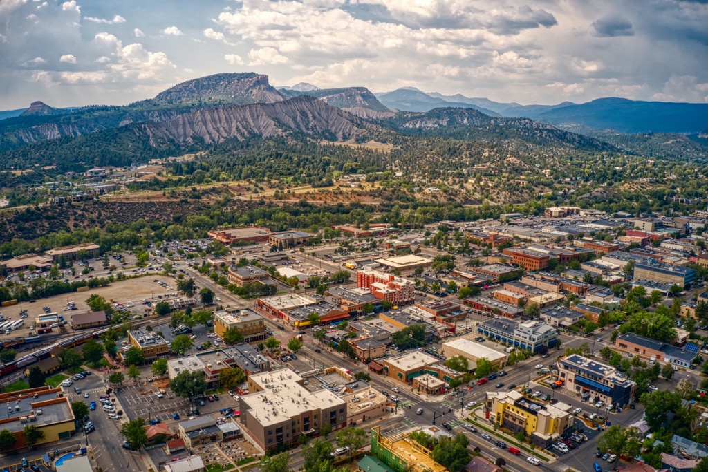
A 40 minute drive away, scenic Durango has a population of 19,500 people. Set against the San Juan National Forest, there are miles of trails to explore by foot, bike, horseback, or vehicle around the town. The Durango and Silverton Narrow Gauge Railroad gives a unique and scenic vantage point of the region. Soak in hot springs or hit the slopes near town in winter.
The downtown is bustling and packed with boutiques, galleries, and handmade crafts. It also boasts a wide selection of restaurants offering New Mexican food, farm-to-table dining, breweries, cafes, and more. Lodging around town includes hotels, B&Bs, cabins, rental properties, camping, and RV parks.
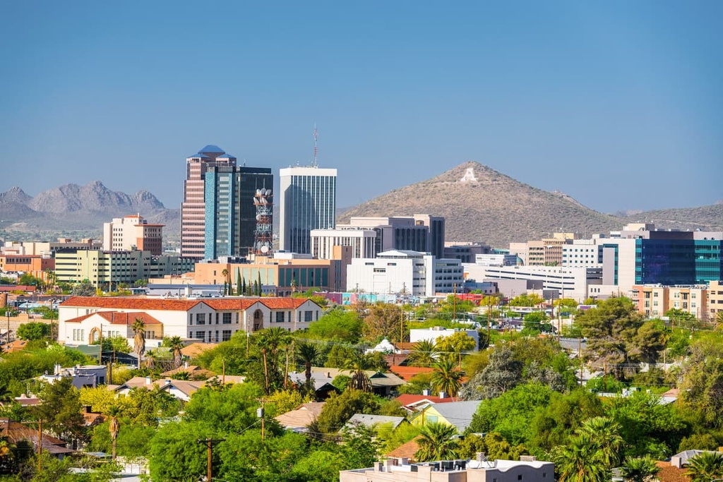
With a population of 560,500 people and four hours away by car, Albuquerque, New Mexico, is the closest big city to Mesa Verde National Park. This high desert city is situated between 5,000 and 6,000 ft (1,525 and 1,830 m) elevation. It has a strong art and artisan scene and the city brims with shops highlighting art, jewelry, and pottery. The Indian Pueblo Cultural Center and National Hispanic Cultural Center educate visitors on the area’s rich cultural heritage.
Popular outdoor activities in the area include exploring the Sandia Mountains and visiting Petroglyph National Monument. The Sandia Peak Aerial Tramway carries visitors to Sandia Peak’s 10,378 ft (3,163 m) summit.
There are plenty of options for dining in the city. Of course there is the classic New Mexican cuisine with chiles featured prominently. But there are also options ranging from Asian flavors to southwestern classics to fine dining. Accommodation in the city can be found in quaint adobe B&Bs, hotels, resorts, campgrounds, and RV parks.