Scan the QR code and open PeakVisor on your phone
Canyons of the Ancients National Monument is a protected archaeological area located in southwestern Colorado in the four corners region of the US. The tallest point in the monument is Mockingbird Mesa at 6,453 ft (1,967 m) while the most prominent point is The Island with 253 ft (77m) of prominence.
Canyons of the Ancients National Monument is a unique archaeological protected landscape. Situated in the southwestern corner of Colorado, the monument encompasses 176,056 acres (71,247 ha) of land near the state’s border with Utah.
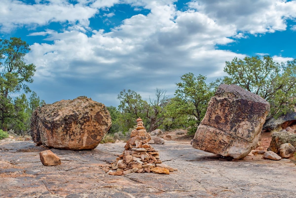
There are more than 8,300 recorded historical and cultural sites throughout the monument, ranging from villages, shrines, and petroglyphs. It is estimated that there are around 30,000 sites throughout the region.
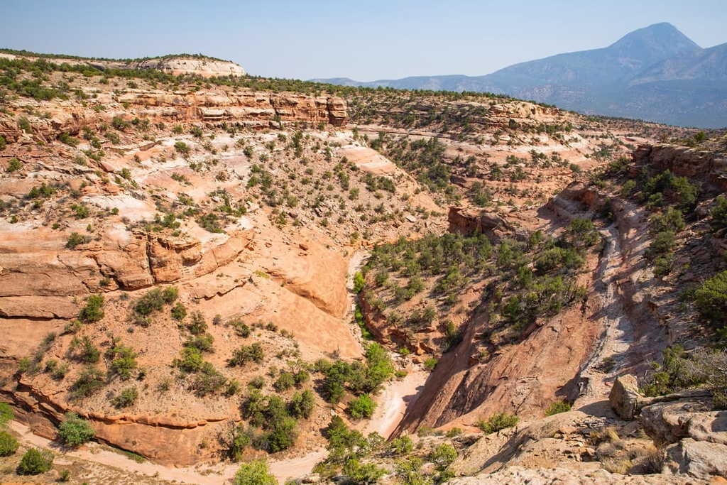
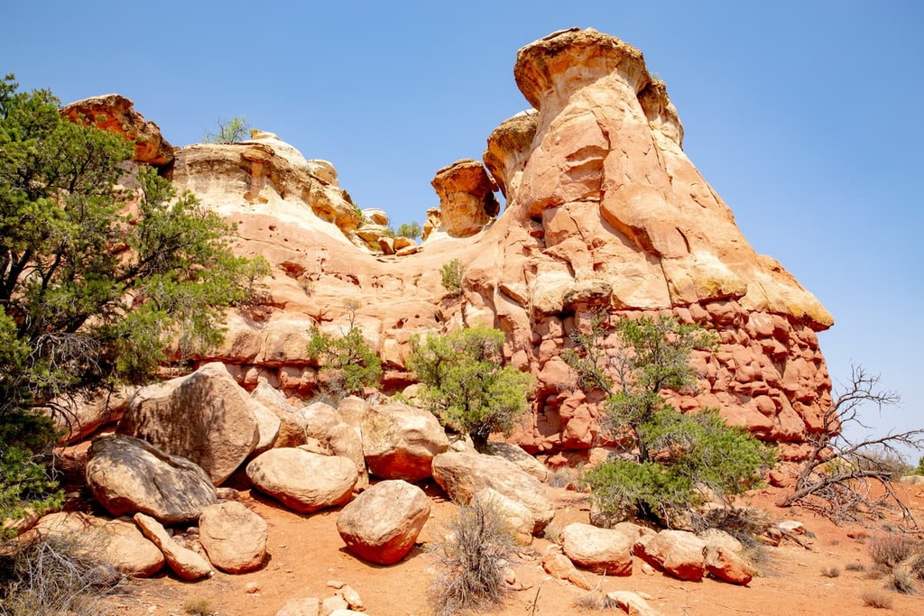
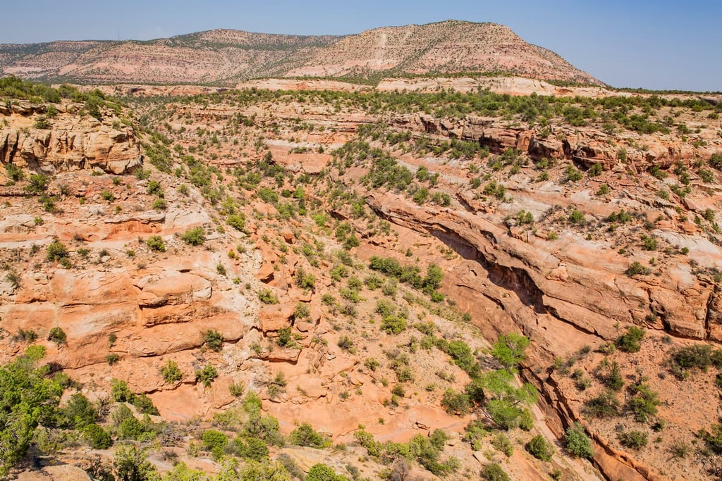
The landscape within the monument consists of dramatic red rock cliffs, valleys, buttes, and plateaus. The rolling hills that separate many of these rock formations are often covered in trees and shrubs.
Dramatic natural arches can be found amidst the archaeological sites in the monument while steep hillsides lead to the bottom of the many canyons. Numerous small creeks, including McElmo Creek, travel through the monument, while some run completely dry during the warmer months of the year.
Canyons of the Ancients National Monument is situated between Bear Ears National Monument to the west and San Juan National Forest to the east. Other nearby forests and parks include Mesa Verde National Park and Road Canyon Wilderness Study Area.
The land within the monument has gradually sloping terrain with higher elevations primarily being found in the eastern half of the region. Elevations in the west of the region range from around 6,000 feet to 5,500 feet (1,800 m to 1,700 m).
The cores of many of the rock formations and deep canyons in the monument date back to the Cretaceous. The visible rock within the monument is much younger as it is composed primarily of layers of sand and gravel that’s only a few million years old.
The oldest rocks within Canyons of the Ancients National Monument can be found in McElmo Canyon. Here the numerous layers of rock date back as far as the Jurassic.
A unique geological feature within the monument is McElmo Dome, where sedimentary rock has been bent due to extreme pressure, forming a dome structure. In this region, you can’t see the Jurassic rocks that normally dominate the landscape. The Ute Mountains lie just to the south of the monument.
The Mississippian rock found within McElmo Dome contains unusually high levels of carbon dioxide. In fact, the dome is home to one of the largest deposits of carbon dioxide in the nation.
By the year 2000, nearly 85 percent of the monument was leased for oil and gas exploration and by ranchers. Environmental groups have pushed back in efforts to reclaim and preserve the land rather than allow it to succumb to further oil explorations.
Major peaks within Canyons of the Ancients National Monument include Mockingbird Mesa, The Island, Cannon Ball Mesa, Mail Trail Mesa, Cajon Mesa, and White Rock.
The flora and fauna within the monument is similar to that of many places in the southwestern US. Indeed, the region is home to minimal flora due to its harsh climate.
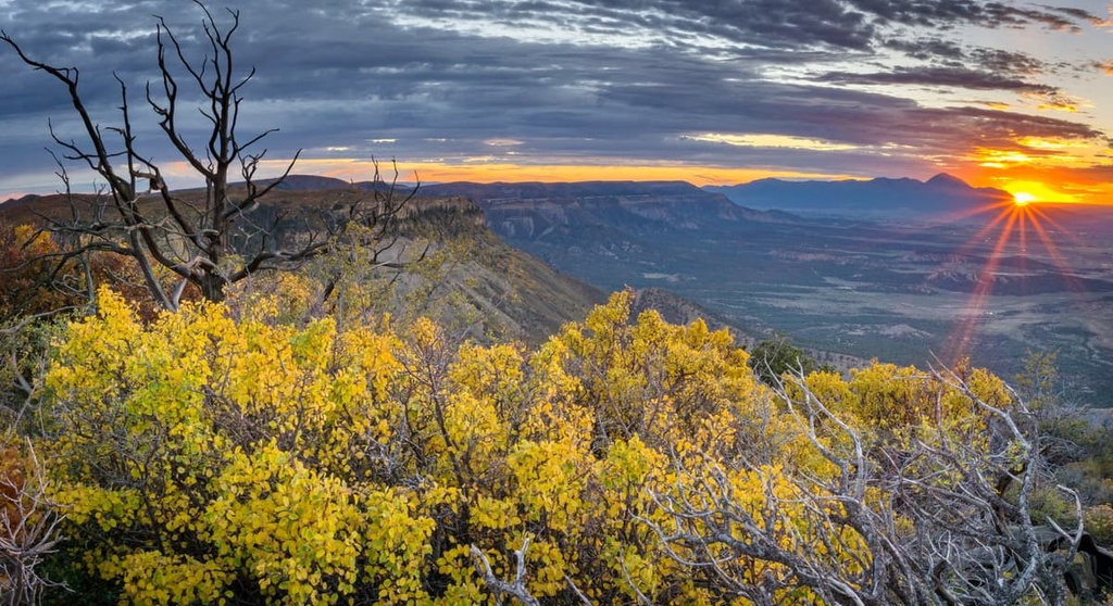
For the most part ,the gentle slopes found within the monument are covered by patches of ponderosa pine and low-growing shrubs. Various grasses are found along the plateaus and steep cliffs, often accompanied by seasonal wildflowers.
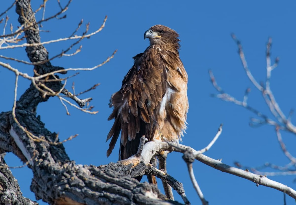
However, a wide variety of fauna inhabit the monument and surrounding region. Common bird species include American kestrels, golden eagles, mourning dove, peregrine falcons, and red-tailed hawks.
Other popular animals include the long-nosed leopard lizard, Mesa Verde night snake, mule deer, bobcat, beaver, jackrabbits, and muskrat.
Both the flora and fauna of the region have been negatively affected by the presence of oil and gas exploration and extraction activities.
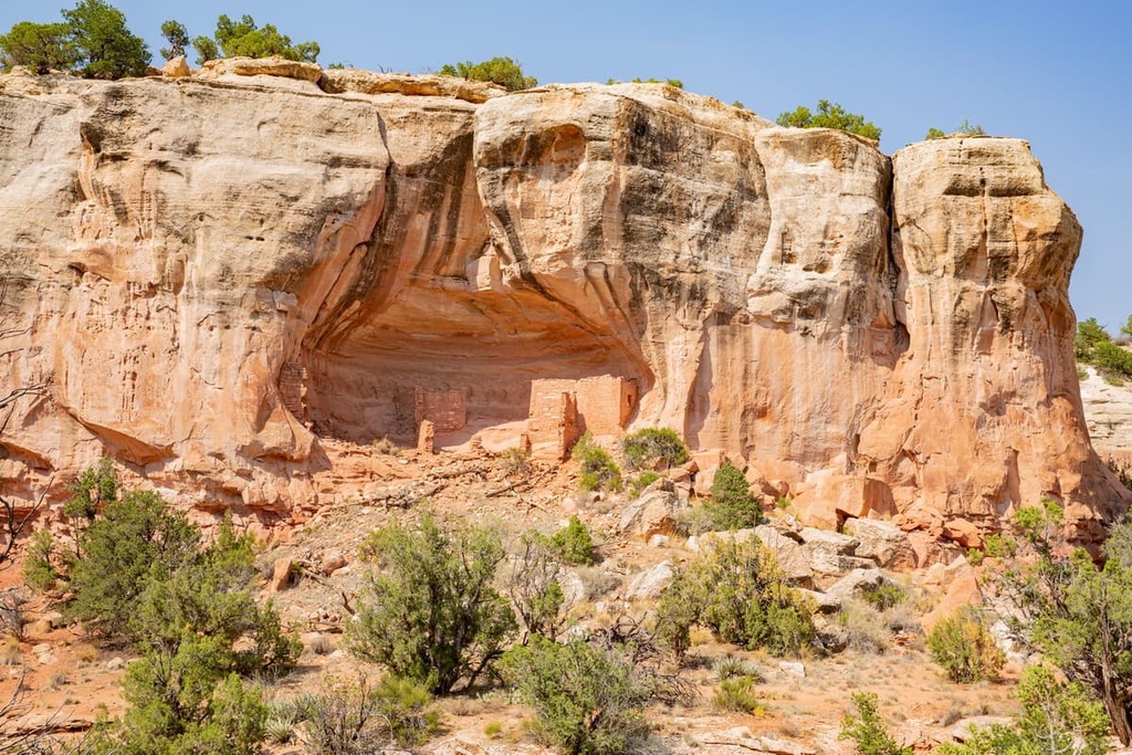
Humans have inhabited the region that is now part of Canyons of the Ancients National Monument for thousands of years, as is clear from the multitude of archaeological sites in the area.
The ancestral Puebloans inhabited the region long before the arrival of European settlers. Throughout this period, the ancestral Puebloans built homes and complexes, many of which were crafted out of adobe mud, stone, and other similar materials. Sometimes, the ancestral Pubeloans also built their homes into cliff sides, as is seen in Bandelier National Monument.
It’s believed that the ancestral Puebloans left the region sometime before the twelfth century. Many of these people then migrated southward into present day New Mexico and Arizona.
During the 1300s, the ancestors of the Ute and Navajo people began inhabiting much of southwestern Colorado. The Spanish began traveling in the region as far north as northern New Mexico during the sixteenth century.
The first settlers of European American descent arrived in the region during the early nineteenth century. Many of the first settlers to arrive were fur trappers. Discovery of precious ores resulted in a large influx of miners into the region.
Shortly after the arrival of miners, both the Ute and Navajo were forcibly removed from their homelands and forced onto reservations.
Canyons of the Ancients National Monument was established in the year 2000 in order to preserve the archeological, cultural, and geological features of the region.
Canyons of Ancients National Monument is home to numerous hiking trails. Here are some of the most popular hiking areas in the range:
The Sand Canyon Trail is the most popular hiking route within the monument. The trail is 12.4 miles (20 km) long round trip with 1,965 ft (599 m) of elevation gain. Along the way, hikers have the opportunity to pass by numerous Puebloan ruins along the route.
The trail has a gradual incline until the final section where it steepens considerably. Many short trails shoot off of the main route, leading to other sites. The trail turns around at the San Canyon Pueblo and heads back to the trailhead.
This loop trail allows hikers to walk through many of the major sites within the monument. The route is 11.4 miles (18.3 km) long with 1,100 ft (335 m) of elevation gain.
Pueblos, caves dwellings, petroglyphs, and unique rock formations line much of the route. Though beautiful, hikers should remember to keep their distance when visiting the archaeological sites out of cultural respect and to ensure that they stay well-preserved for future generations to appreciate.
The East Rock Creek Trail Loop is a shorter route that is full of numerous archeological sites. It is 6.7 miles (10.8 km) long with 521 ft (159 m) of elevation gain.
Though primarily used for hiking, the route can also be used for mountain biking, horseback riding, and trail running. Low growing shrubs throughout the region allow for impeccable views throughout the route.
Looking for a place to stay near Canyons of Ancients National Monument? Here are some of the best cities and villages to check out in the region:
The city of Cortez, Colorado lies east of the monument, near the entrance into Mesa Verde National Park. The small city has around 8,700 residents and is popular for those visiting the multitude of archeological sites in the area.
Within the city lies the Cortez Cultural Center, which offers exhibits on Indigenous history and culture. Cortez lies along the Trail of the Ancients Scenic Byways, and it has a plethora of dining and lodging options for those who are visiting the area.
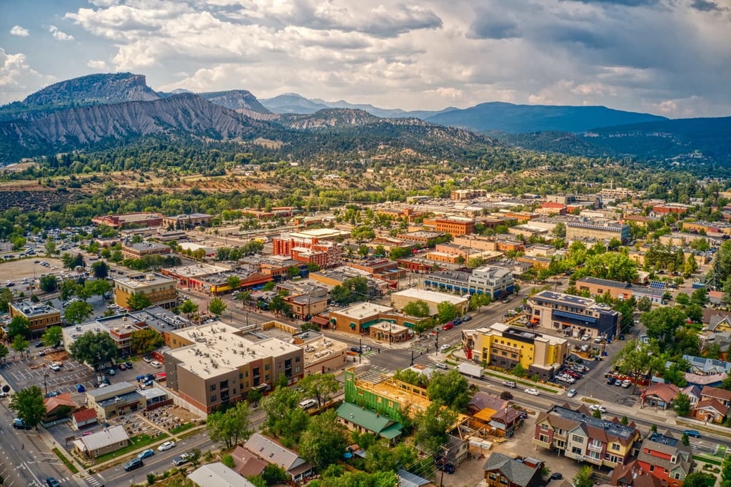
Durango lies further to the east of the monument, situated in the western stretches of the Southern Rocky Mountains. The city has a population of around 19,000 people, which makes it one of the most populated mountain towns in the region.
Situated at the confluence of the Colorado and Gunnison Rivers, Durango is a hub for year-round outdoor recreation. The city is surrounded by thousands of miles of trail used for hiking, trail running, and mountain biking. During the winter the city transforms into the ideal location for skiing and snowshoeing.
Main Avenue of Durango is lined with locally owned restaurants, bars, and businesses. Each year Durango hosts multiple events including Music in the Mountains, Snowdown Festival, and the Durango Ragtime & Early Jazz Festival.