Scan the QR code and open PeakVisor on your phone
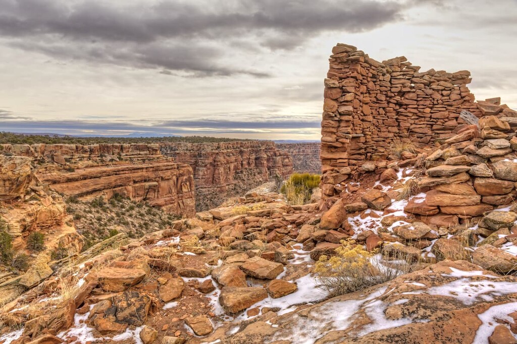
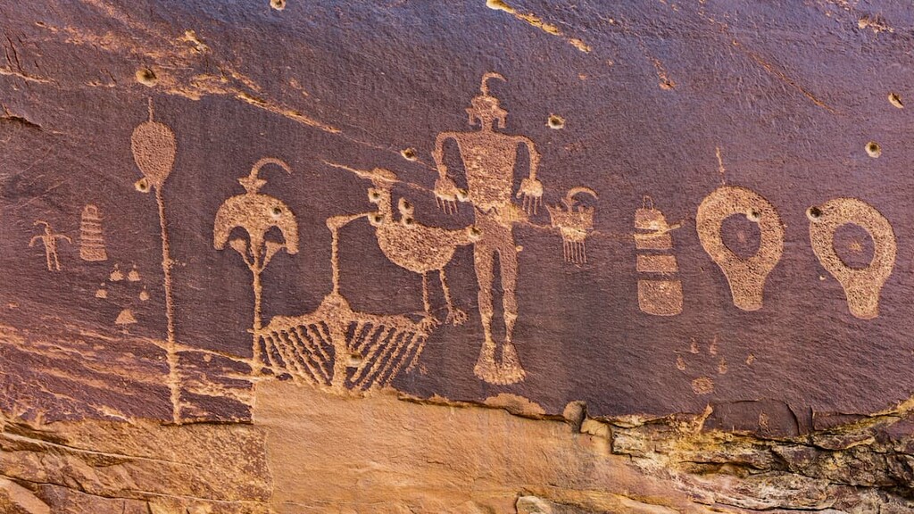
The Bears Ears National Monument is a protected area located in southwestern Utah in the United States. The monument was created in 2016 by President Barack Obama and spans 1,351,849 acres. In 2017 the monument was drastically reduced in size by President Donald Trump but has since been reinstated to its original size by President Joe Biden. The monument was named after a pair of buttes, named Bears Ears. Native Americans named the buttes in their native languages with all translating to Bears Ears. This monument also protects the Indian Creek climbing area near the buttes. Today the monument is managed by numerous groups including the Bureau of Land Management, United States Forest Service, and a group of five local Native American tribes who have ties to this region of land. There has been an immense amount of backlash with the Trump administration trying to deplete this land as it is home to over 100,000 archaeological and cultural sites, 5 Native American tribes, and 18 endangered species.
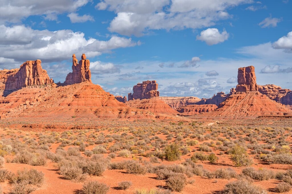
There are 126 named mountains in Bears Ears National Monument. West Mountain is the highest point at 10,981 feet. The most prominent mountain is Shay Mountain with 1,637 feet of prominence. The Bears Ears themselves stand at elevations of 8,900 feet and 9,000 feet. Much of the land within the monument is owned by the federal government with the state of Utah owning about 110,000 acres.
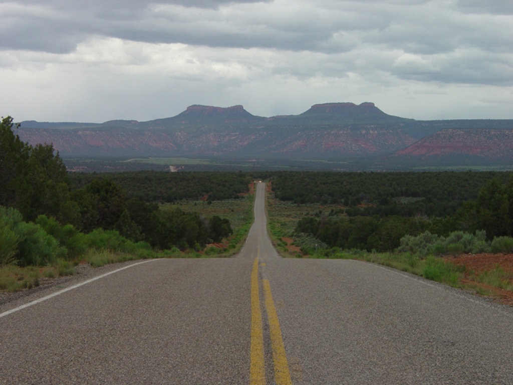
The northern region of the monument shares a border with the Canyonlands National Park. Other regions of the original monument shared borders with both the Glen Canyon National Recreation Area and the Natural Bridges National Monument. Much of the monument is made of sandstone, buttes, mixed with deep canyons and rugged landscapes. Cactus, grasses, and wild flowers and intermixed with juniper, pine, and cottonwood trees. While there are numerous endangered species within the Bears Ears National Monument, it is also home to a variety of mammals; including black bear, bats, elk, bobcats, pronghorns, skunks, foxes, and cougars, among others.
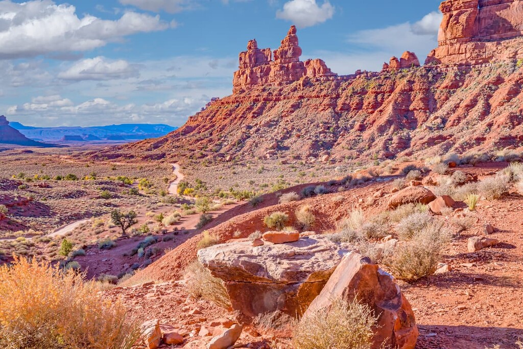
Valley of Gods Road: The Valley of Gods Road is the most popular route in the monument. The route totals 16 miles point to point, traveling from Highway 261 to Highway 163 and can be driven in most vehicles. The road winds through the valley with towering and rugged buttes visible throughout. While the trail is heavily trafficked by car, it can also be hiked or biked to enjoy the views for a bit longer.
Bullet Canyon Trail: This 20 mile hike travels from point to point across the Bears Ears National Monument with 1,720 feet of elevation gain. While some trail runners complete the hike/run in one day, the distance is often covered over the course of 2-3 days. This route takes hikers through the heart of the monument, offering views of the remote canyons and buttes. The trail winds through canyons and past historical sights. While parts of the trail follow the hard rock of the canyon, other sections pass through loose sand. Hikers should be prepared with enough water to travel through the monument and also be alert of flash flood warnings.
Wolfman Panel: This short 1-mile hike has just 90 feet of elevation gain. The trail starts just off of Highway 262 before leading up to the Wolfman panels. Hikers scramble up past small caves to see these cultural and historic pieces of the art along the rock walls.
Monarch Cave: Monarch Cave via the Comb Ridge trail is a short two-mile hike with just 475 feet of elevation gain. The trail takes hikers up to one of the largest ruin sites in the entire Bears Ears National Monument. These ruins are not roped off so hikers have the ability to walk around them without touching the ancient artifacts.

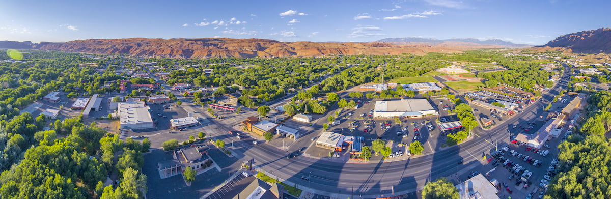
Just northwest of the Bears Ears National Monument lies the iconic city of Moab, Utah. The city has a population of just 5,400 residents but is often full of tourists due to its close proximity to both Arches and Canyonlands National Parks. While hiking trails surround the city, Moab is also a popular destination for mountain bikers with many major trails leading right from the city. The city is known as being an outdoor mecca for these sports as well as whitewater rafting, BASE jumping, and slacklining/highlining. The city sits at 4,025 feet of elevation just south of the famous Colorado River.
Salt Lake City is the most populous city in the state of Utah and it lies just over three and a half hours north of the Bears Ears National Monument. The city’s population is 200,000 while the metropolitan area is estimated to be about 1.2 million. The city is known for being an outdoor adventure paradise. Surrounding the city are seemingly endless places to go hiking, biking, running, and skiing. The city was home to the 2002 Winter Olympics and is closely located to numerous ski resorts. There are 5 national parks near the city, allowing for countless opportunities for hiking. Popular restaurants include Red Iguana, White Horse, The Copper Onion, and Nomad Eatery.