Scan the QR code and open PeakVisor on your phone
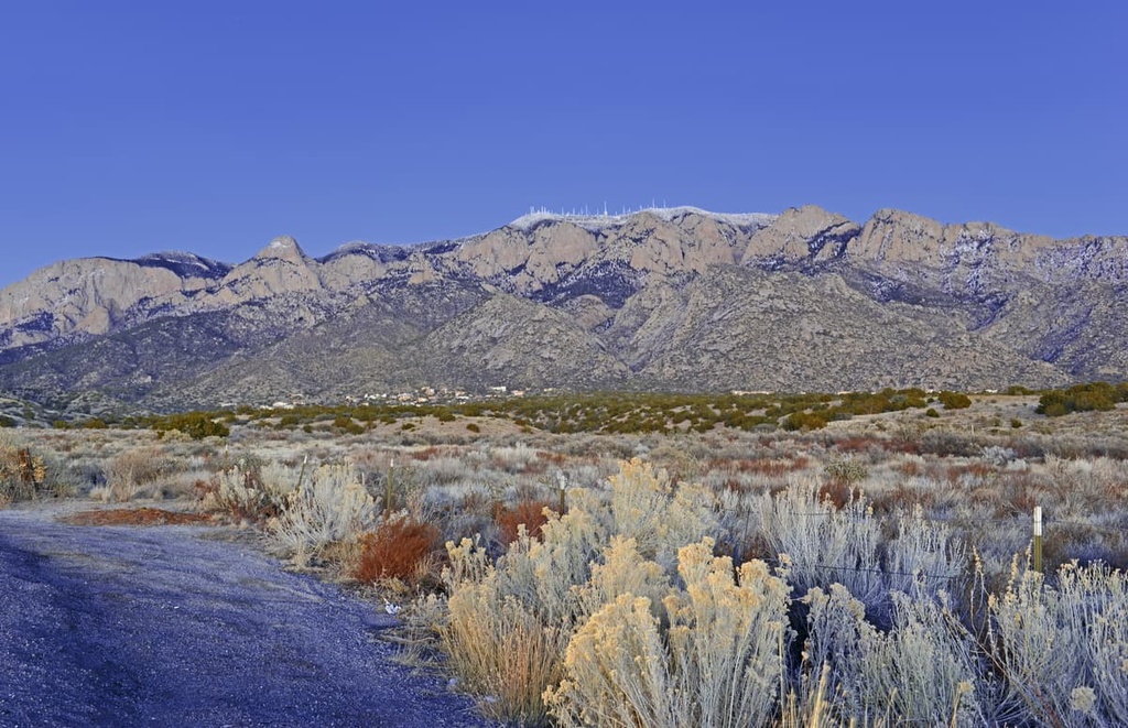
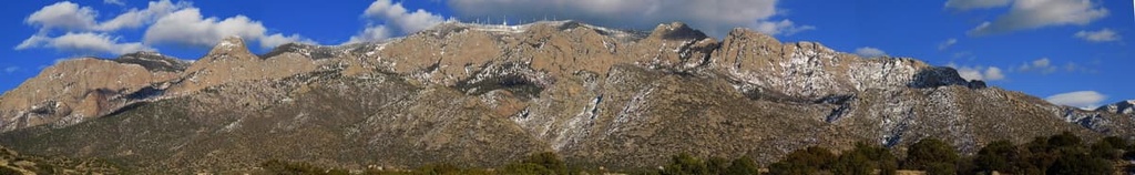
The Sandia Mountains are a mountain range situated in the central part of the US state of New Mexico, just to the northeast of the city of Albuquerque. The tallest and most prominent peak in the range is Sandia Crest at 10,580 ft (3,255 m) in elevation and with 4,117 ft (1,255 m) of prominence.
The Sandia Mountains (Southern Tiwa: Posu gai hoo-oo, Keres: Tsepe, Navajo: Dził Nááyisí; Tewa: O:ku:p’į, Northern Tiwa: Kep’íanenemą; Towa: Kiutawe, Zuni: Chibiya Yalanne) are a mountain range located in central New Mexico.
This range lies to the northeast of Albuquerque, to the south of the southern terminus of the Rocky Mountains. The Sandia Mountains are part of the larger Manzano Mountains (sometimes called the Sandia-Manzano Mountains) range.
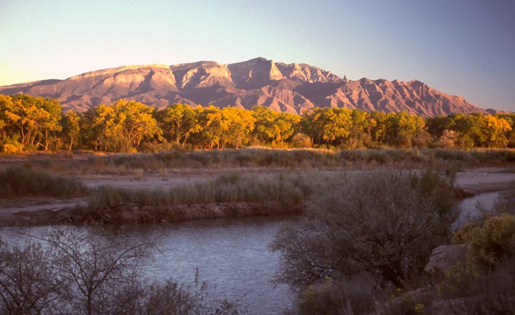
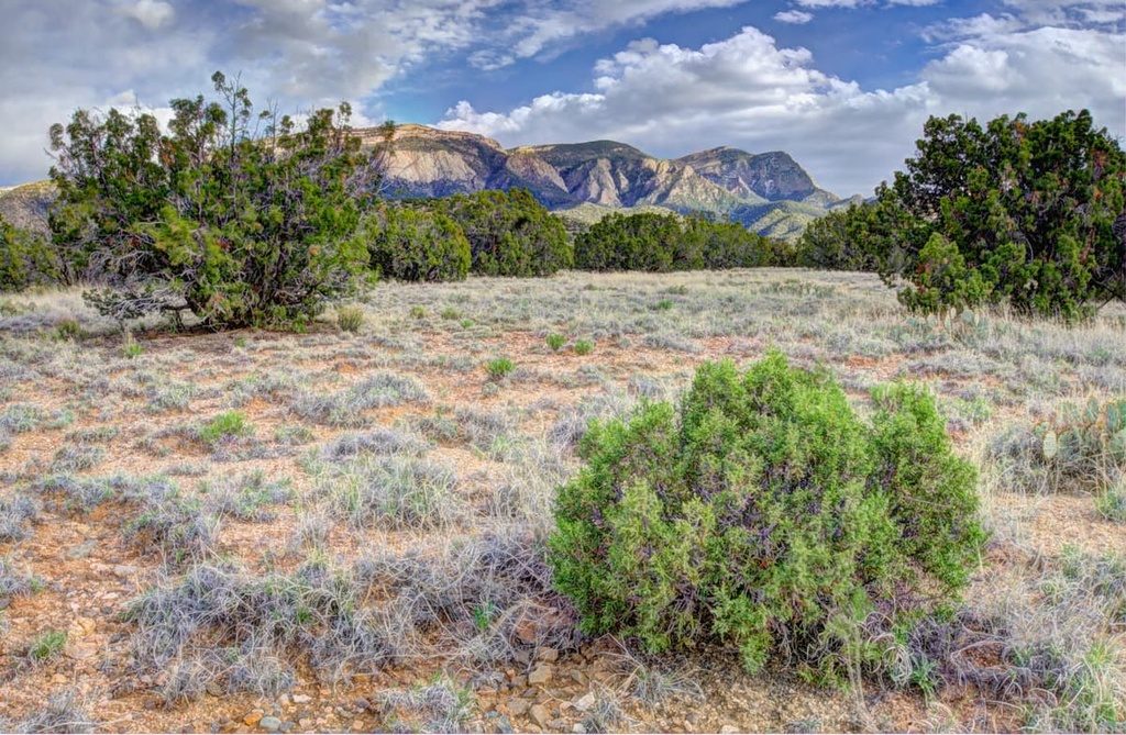
The Sandia Mountains span 17 miles (26 km) from north to south and an average of 6 miles (9 km) from east to west. While the eastern side of the range is characterized by gentle rolling slopes, the western side of the range is marked by abrupt changes in elevation and rugged cliffs.
Due to the arid climate and steep terrain in the range, there are few sections of dense vegetation in the range. Rather, the west side of the range showcases sheer cliffs. However, more flora and fauna can be found on the eastern side of the range’s main crest.
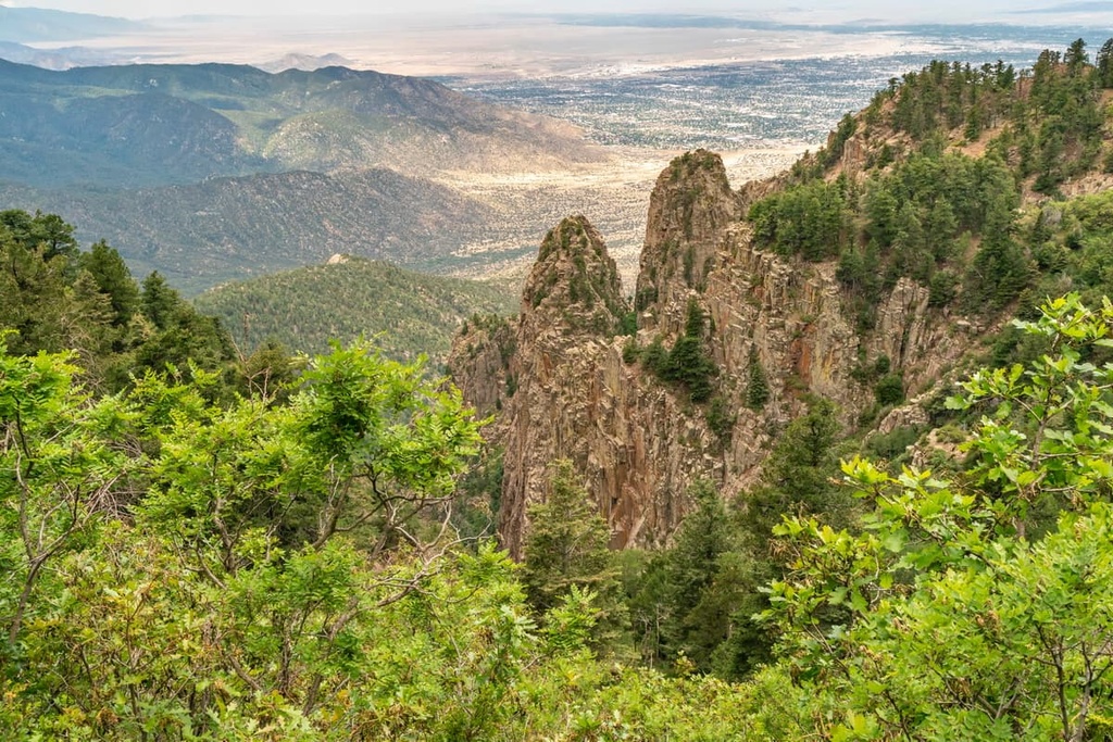
The Sandia Mountains feature a higher prominence than a majority of ranges in the area, allowing for them to stand out amidst the surrounding landscape. Most of the Sandia-Manzano Mountains lie within the Sandia Mountain Wilderness, which is part of Cibola National Forest.
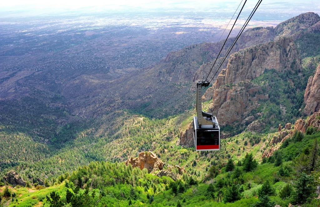
Within the Sandia Mountains lies the Sandia Peak Aerial Tramway. Spanning 2.7 miles (4.3 km) in length, the tramway is one of the longest such tramways in the world. It provides unparalleled views of much of the range.
Although the range lies within the Sandia Mountain Wilderness and the Cibola National Forest, there are numerous other forests and parks in the region. The Santa Fe National Forest and Carson National Forest lie to the north, the Pecos Wilderness to the northeast and the Manzano Mountain Wilderness to the south.
A majority of the Sandia Mountains lie within the Sandia Mountain Wilderness. The range is part of the larger Southwest Basins and Ranges, though the peaks were formed through rifting.
The fault block range lies along the eastern side of the Rio Grande Rift Valley. Rifting occurs when the Earth’s crust is pulled apart, an event that often leaves behind a vast basin with mountain ranges on either side.
Around 10 million years ago, immense rifting resulted in the formation of the Sandia Mountains, which now mark the eastern edge of the Albuquerque Basin.
Sandia granite is the primary rock within the range, making up the core of the mountains. This granite is surrounded by a thin layer of sedimentary rock, which mostly consists of limestone and sandstone.
The outer layer of sedimentary rock in the range dates back 300 million years. This layer also features numerous fossils, though a majority are too small for the human eye to see. The range gets its pink appearance from the potassium-feldspar crystals within the rock.
Major peaks within the Sandia Mountains include Sandia Crest, Crest of Montezuma, South Sandia Peak, and Palomas Peak.
The Sandia Mountains are home to four ecological zones, most of which are defined by their elevation. The Upper Sonoran Zone is home to pine, juniper, and oak trees along with broadleaf evergreen shrub, gray oak, and mountain mahogany.
The desert climate in the region provides an ideal habitat for various species of succulents, yucca, and cacti to thrive throughout the Upper Sonoran Zone. Other plant species in this zone include the desert marigold, Engelman prickly pear, and mariola.
The Transition Zone lies above the Upper Sonoran Zone and is dominated by ponderosa pine and deciduous oaks. At even higher elevations, the Canadian Zone is home to gambel oak while the Hudsonian Zone is home to Engelman spruce and white fir.
A plethora of wildlife also inhabits the mountains throughout its various ecological zones. Common species include mule deer, bobcats, and black bears. There are also many bird species throughout the mountains. Golden eagles and hawks are common amongst the many ravens, canyon wrens, and roadrunners that call the region home.
The Sandia Mountains, and the land surrounding them, have been inhabited by humans for thousands of years
The region around the Sandia Mountains marks the ancestral homelands of numerous Indegenous groups. This includes the Sandia Pueblo (Tuf Shur Tia), Santa Ana Pueblo (Tamaya), San Felipe Pueblo (Katishtya), and Isleta Pueblo (Shiewhibak), among others. Today the Sandia Pueblo community maintains a reservation just to the west of the range.
Within the range lie numerous archeological and cultural sites. One of the most notable is the Sandia Cave, which is also referred to as the Sandia Man Cave. Artifacts found in the cave date back approximately 9,000 to 11,000 years ago.
Within the cave, archaeologists found remnants of mammoths, camels, sloths, and various species that went extinct by the end of the Pleistocene. Today, a trail leads visitors to the mouth of the cave.
During the sixteenth and seventeenth centuries, the Spanish sent many expeditions into the region surrounding the Sandia Mountains. The San Agustín de la Isleta Mission was founded in 1613 and lies just west of present day Albuquerque.
Many of the establishments founded by these colonizers and settlers were aimed at converting Indigenous communities to Christianity.
An outpost called La Villa de Albuquerque was founded in 1706. Although it is now located within the city of Albuquerque, at the time, the outpost was part of the kingdom of Santa Fe de Nuevo México.
The city of Albuquerque began to grow rapidly following the Mexican War of Independence in 1821. Shortly after, in 1848, the land was ceded to the United States after the Mexican-American War.
The Cibola National Forest was later established in 1931. A few decades later, the Wilderness Act of 1964 resulted in the designation of 109 million acres of land as federal wilderness. The Sandia Mountain Wilderness was added shortly after the passage of the Wilderness Act in 1978.
The Sandia Mountains are home to numerous hiking trails. Here are some of the most popular hiking areas in the region:
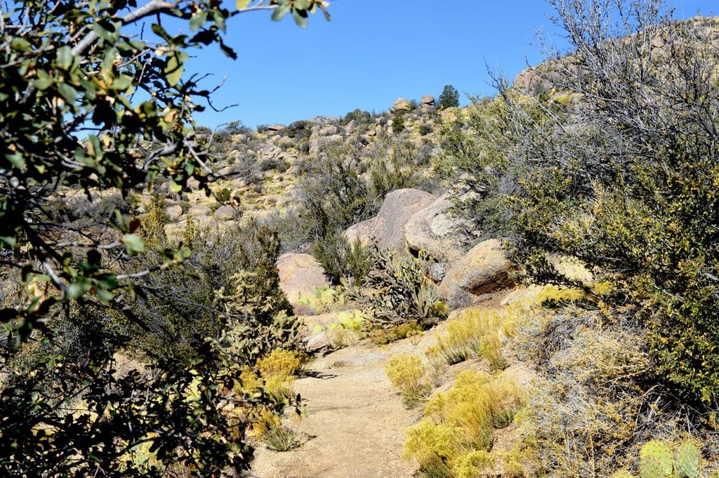
La Luz Trail #137 is the most popular hiking route within the Sandia Mountains. The trail is 13.3 miles (21.4 km) long and has 3,572 feet (1,089 m) of elevation gain. It begins just outside of Albuquerque and then climbs steadily up to the tallest peak in the range.
This trail allows for hikers to see how the range’s vegetation changes as the elevation increases. Here, seemingly barren hills give way to dense patches of forest interspersed with sheer rock faces.
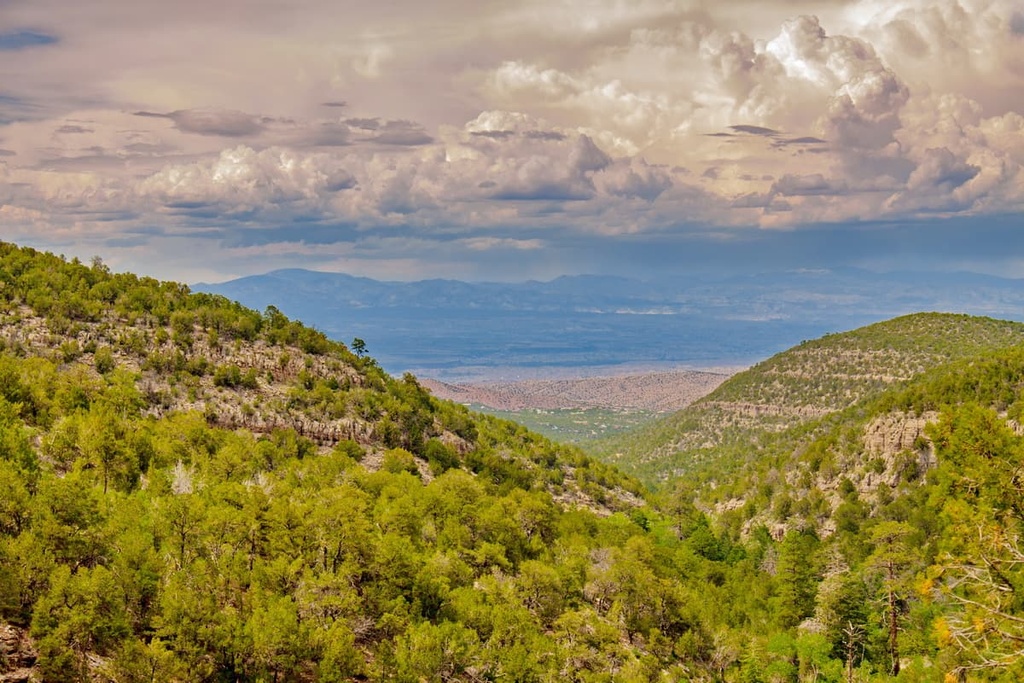
The South Piedra Lisa Trail is 4.4 miles (7 km) long round trip and has 1,309 feet (399 m) of elevation gain. The trail winds its way between shrubs and trees with numerous viewpoints throughout. Hikers can still see impeccable views of the Albuquerque Basin.
The Sandia Cave Trail leads to one of the most important archeological sites in the entire state of New Mexico. The trail is just 1 mile (1.6 km) long round trip with 193 feet (59 m) of elevation gain. Hikers can walk along the cliffside and look into the network of caves within the rock face. Here, archeologists found evidence of human activity dating back nearly 10,000 years.
Looking for a place to stay near the Sandia Mountains? Here are some of the best cities and villages to check out in the region:
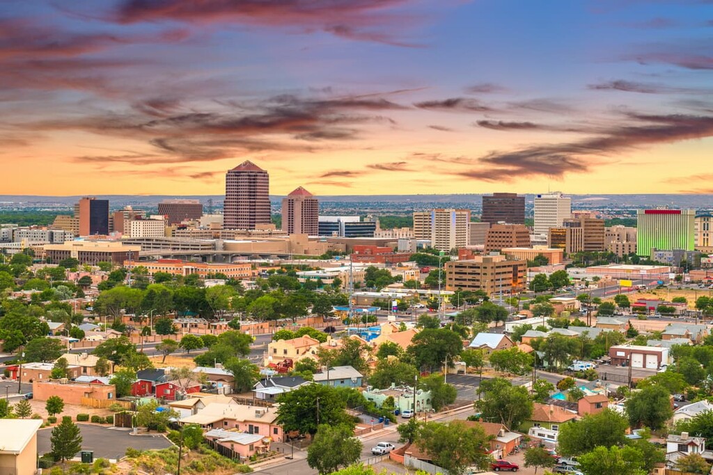
With a population of around 560,000 people, Albuquerque is the most populous city in the entire state of New Mexico. Situated on the high desert, the city is full of diverse cultures, cuisine, and natural beauty. Boasting over 300 days of sunshine each year, Albuquerque is a major city surrounded by outdoor recreation.
Hiking, mountain biking, kayaking, golfing, and even skiing opportunities are all located just outside the city limits. The city is also home to a thriving music scene as well as many of the major museums in the state. This includes the New Mexico Museum of Natural History and Science, Indian Pueblo Cultural Center, Albuquerque Museum of Art and History, and various others.
Situated to the east of Albuquerque lies Tijeras, a mountain town located between two canyons. Here, the Tijeras Canyon and Cedro Canyon come together, giving the city its name, which translates to ‘scissors’ in Spanish.
Today just under 1,000 people live in the small town, which is full of local shops, restaurants, and access to the numerous hiking trails in the region. The city also gained national recognition in 2014 when a section of Route 66 in the town was outfitted with rumble strips that play “America the Beautiful” when you drive over them at about 45 mph (72 km/h).