Scan the QR code and open PeakVisor on your phone
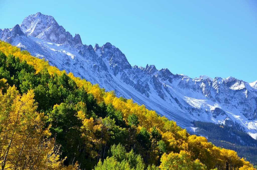
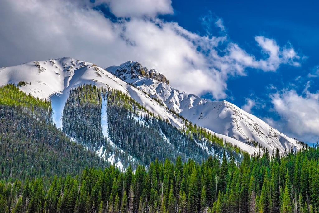
Featuring some of the most beautiful mountain scenery in the US state of New Mexico, Carson National Forest is a stunning outdoor recreation area that’s perfect for any adventure. The forest contains 123 named mountains, the highest and most prominent of which is Wheeler Peak (13,166ft/4,013m) - the tallest mountain in New Mexico.
Located in the north-central part of the state of New Mexico, Carson National Forest is a federally-managed area of land that’s known for its fantastic mountainscapes. The forest is one of 5 national forests in the state, alongside Lincoln National Forest, Gila National Forest, Cibola National Forest, and Santa Fe National Forest.
At around 1.5 million acres (607,000 ha), Carson National Forest is the fourth largest of the state’s federal forests and it encompasses parts of Taos County, Rio Arriba County, Mora County, and Colfax County. It is split up into a number of discontiguous units which are scattered around north-central New Mexico.
The forest is located in a highly mountainous region that connects northern New Mexico and southern Colorado. Indeed, the forest is surrounded by other areas of federal and public land, as well as some large private ranches.
In particular, Carson National Forest is situated to the east of Santa Fe National Forest, Mexican Spotted Owl ACEC, and Laguna Mesa Wildlife Area. It is also located to the west of Philmont Scout Ranch, Colin Neblett State Wildlife Area, Kimberlin Point Ranch, Kiowa National Grassland, Sabinoso Wilderness, and Las Vegas National Wildlife Refuge (of Las Vegas, New Mexico - not Las Vegas, Nevada).
Moreover, Carson National Forest is located to the north of both Pecos National Historical Park and Santa Fe National Forest, as well as to the south of Rio Grande National Forest, San Juan National Forest, South San Juan Wilderness, San Isabel National Forest, Spanish Peaks Wilderness, Rio Grande del Norte National Monument, Cerro del Yuta Wilderness, Great Sand Dunes National Park and Preserve, Baca National Wildlife Refuge, and Rio San Antonio Wilderness.
The forest also contains parts of a number of wilderness areas, including:
For the most part, the mountains in Carson National Forest are part of the Southern Rocky Mountains. In particular, the forest encompasses much of the southernmost extent of the Rockies, which stretch from New Mexico all the way through the United States to Montana, where they cross the international border and cover parts of Alberta and British Columbia in Canada as the Canadian Rockies.
However, a very small part of the westernmost region of Carson National Forest includes peaks that are technically on the Colorado Plateau. That being said, the majority of the forest is dominated by the Rocky Mountains and the Continental Divide actually bisects the forest from south to north before turning westward into the nearby San Juan National Forest.
Carson National Forest is situated to the south of the San Luis Valley, which is a major alluvial basin of the northern stretches of the Rio Grande, much of which is encompassed within the Rio Grande National Forest. The river itself originates as a number of streams in the San Juan Mountains before travelling down the San Luis Valley, which separates the Sangre de Cristo Range and the San Juan Mountains - the 2 primary mountain ranges in Carson National Forest.
Major peaks in Carson National Forest include Wheeler Peak (not to be confused with Wheeler Peak in the Snake Range of Nevada’s Great Basin National Park), Lake Fork Peak, Venado Peak, Cerro Vista, and Picuris Peak.
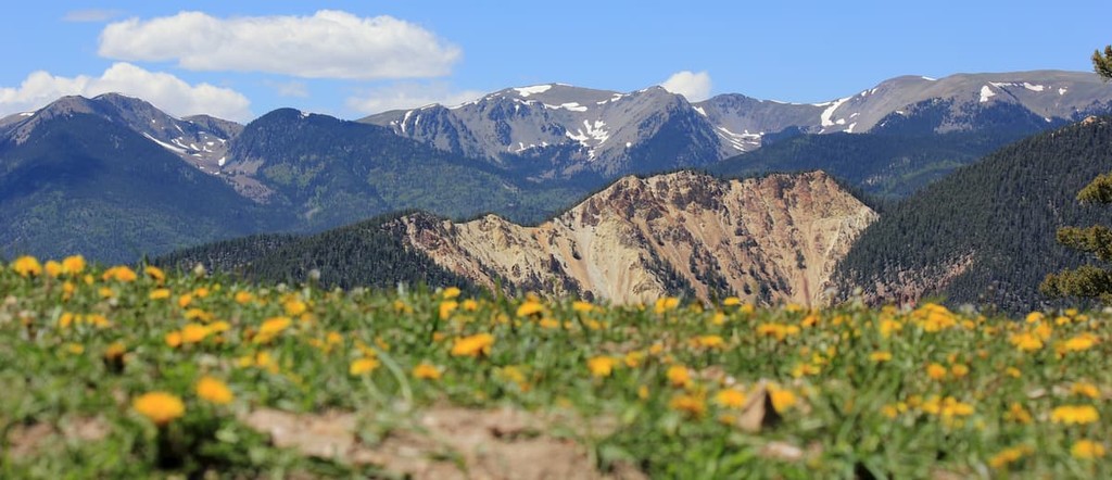
By area, the San Juan Mountains are Colorado’s largest mountain range, though they cover just a small section of northern New Mexico within Carson National Forest. The range is part of the Southern Rocky Mountains and it formed through the collision and uplift of 2 continental plates.
Moreover, the range was heavily glaciated during the last major glaciation. These glaciers helped to carve out the major U-shaped canyons that we can see in the range today.
The range is particularly well known for its rich mineral deposits. In fact, the San Juan Mountains were heavily mined for both gold and silver during the mid- to late-1800s.
Like its neighbor, the San Juan Mountains, the Sangre de Cristo Range is part of the Southern Rocky Mountains. However, the Sangre de Cristos extend much further south into New Mexico, terminating near the city of Las Vegas, New Mexico.
The range is comprised of a mix of different rocks, the oldest of which are Precambrian genesis that date back some 1.8 billion years. These rocks, which can be clearly seen on Blanca Peak in the Rio Grande and San Isabel National Forests to the north, likely formed through the metamorphism of igneous intrusions that occurred during the Precambrian. However, other rocks in the region include substantial layers of Mississippian-age limestones as well as Ordovician and Devonian-age sandstones and dolomites.

That being said, the Sangre de Cristo Range started to form about 320 million years ago during a period of widespread uplift. While these Ancestral Rockies eventually eroded away, much of the eroded sediment from an area to the west of the range eventually collected in a region known as the Colorado tough, which formed a 2 mile thick layer of conglomerate that is now the backbone of the range.
Much more recently, during the Laramide orogeny, about 80 to 40 million years ago, the Sangre de Cristo Range - along with the majority of the modern-day Rocky Mountains in Wyoming, Utah, Idaho, and Montana - experienced a major mountain building event. During the Laramide orogeny, the Sangre de Cristo Range uplifted to form the building blocks of the mountains that we see today.
About 26 million years ago, the range then experienced a massive rifting event known as the Rio Grande Rift. Although it’s believed that the San Luis Valley was actually a closed valley until just half a million years ago, eventually, the Rio Grande was able to cut through the southern part of the valley and chart the course that it follows today.
Meanwhile, during the Pleistocene, the Sangre de Cristos, like much of the rest of the Rocky Mountains, experienced widespread glaciation. These glaciers carved out the many cirques, ridges, and valleys that we see in the range today, giving it its characteristic shape and stunning mountain scenery.
Carson National Forest is located in the southernmost part of the Southern Rockies ecoregion (also known as the Colorado Rockies Forests), which is an ecologically diverse area that’s home to hundreds of plant and animal species.
Within the forest, plant communities are highly dependent on elevation and aspect, as the western-facing slopes tend to receive substantially more rainfall than their eastern-facing neighbors.
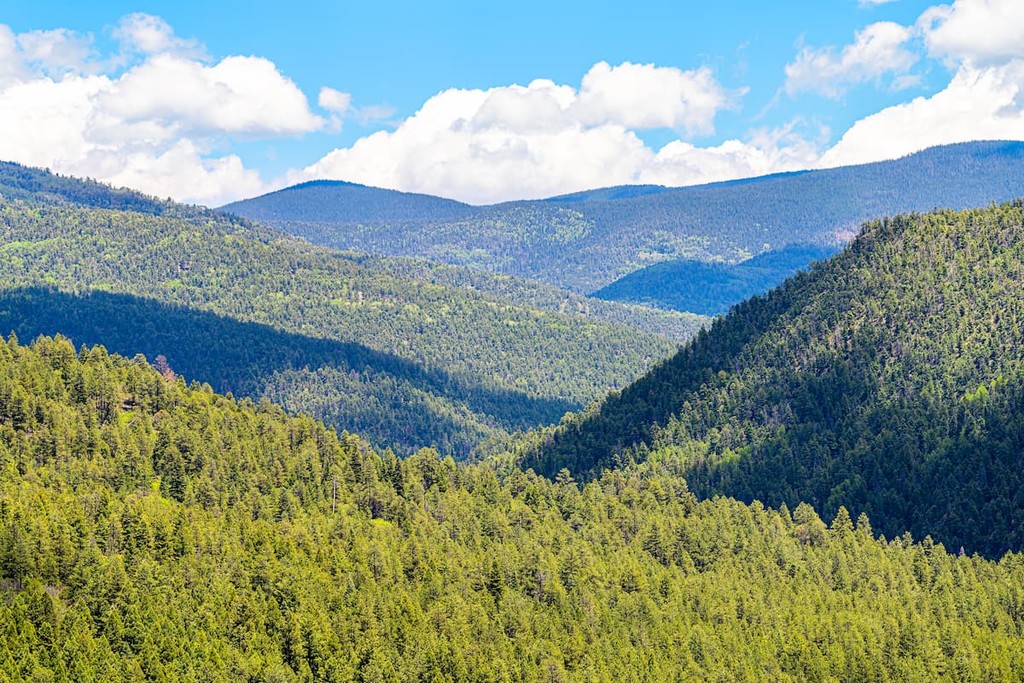
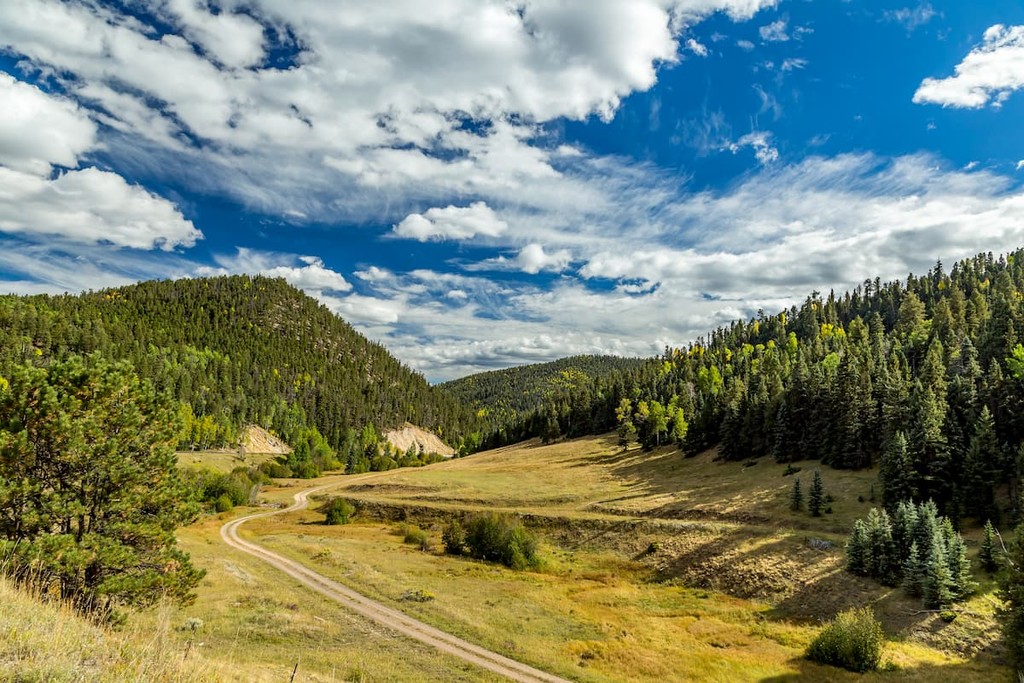
Throughout Carson National Forest, however, the dominant tree cover is coniferous, with species such as ponderosa pine and bristlecone pine forming large stands throughout the region. There are also large areas of grasslands at the lower elevations as well as alpine tundra and alpine meadows in the highest sections of the forest.
As far as wildlife goes, Carson National Forest doesn’t disappoint. The range is home to a number of mammal species, including black bears, mountain lions, elk, bighorn sheep, wolverine, lynx, and martens. It’s also possible that there’s a small section of grizzly bears in the San Juan Mountains, though they have mostly been extirpated from the region.
The rivers and streams in and around Carson National Forest are also home to some great fishing opportunities, since they have stocks of brown trout, rainbow trout, and the native Rio Grande cutthroat trout.
Humans have lived in and around what is now the Carson National Forest, as well as the Rio Grande Valley, the Sangre de Cristo Range, and the San Juan Mountains for thousands of years.
In particular, the region was the home of the Ancestral Puebloans, and it is part of the ancestral homelands and traditional territory of many peoples, including the Ute Mountain Ute Tribe, the Southern Ute Indian Tribe, the Jicarilla Apache Nation, and the Taos Pueblo, among others. Moreover, the Taos Pueblo on the outskirts of the forest has been continuously inhabited for at least a thousand years.
The first settlers in the region of European descent were likely Spanish settlers who arrived in the early 1600s. However, after the Pueblo Revolt in the 1680s, many of the Spanish colonizers left the area, only to return about a decade later. In the late 18th century, the city of Don Fernando de Taos (now called Taos) was established and land was taken from local tribes and nations to give to Spanish settlers.
As a result of Spanish settlement both in what is now New Mexico and other parts of what is now the southern United States, the majority of the region that is now Carson National Forest was ruled by Spain as part of the Spanish Empire until it became part of independent Mexico following the end of the Mexican War of Independence in 1821.
Afterward, it was later ceded to the United States government following the end of the Mexican-American War in 1848 and the signing of the Treaty of Guadalupe Hidalgo, which saw Mexico ceed much of its northerly territory.
During the 1850s, the United States government encouraged settlement of the San Luis Valley to the north of the forest, which allowed for an influx of farmers and ranchers from other parts of the region. Trappers were also active throughout the region’s mountain ranges, particularly in the early part of the 19th century.
By the late 1850s, however, a new event had brought thousands of prospectors to the San Juan Mountains: the discovery of gold. During the Colorado Gold Rush, thousands of prospectors made their way into the San Juans, leading to conflict between the prospectors and the many tribes in the region whose lands were being taken away for mining purposes.
The prospectors eventually established a number of towns in the area, such as Silverton, Durango, and Telluride. Additionally, the construction of the Denver & Rio Grande Railroad (D&RG) in the 1880s also allowed for increased development and the mining industry flourished.
Not long afterward, however, the price of silver plummeted and by the 1890s, the region’s silver mines were in peril. Thankfully, as the mining industry declined, the region’s residents realized that tourism was the perfect industry with which to rebuild their economy.
In 1908, the former Taos and Jemez National Forests were merged to establish Carson National Forest, which was named for Kit Carson, one of the early fur trappers in the region. However, the initial forest boundaries were meant to include land around Blue Lake, which is an important cultural site for the Taos Pueblo.
In 1970, President Richard Nixon signed Public Law 91-550 (often called the “Return of the Blue Lake Act”) to officially return the land around Blue Lake to the Taos Pueblo. Interestingly, this was the first time that a tribal government had their lands restored by the US Government rather than receiving monetary compensation.
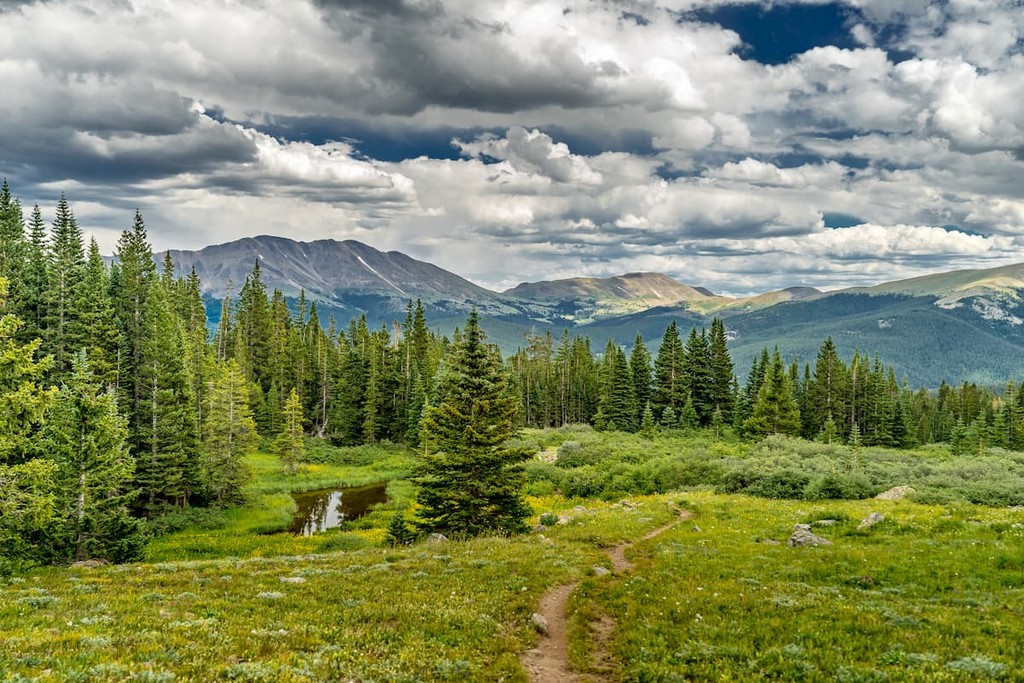
These days, the forest remains a highly popular outdoor recreation destination for residents of both northern New Mexico and southern Colorado, as well as for tourists. Carson National Forest has hundreds of miles of hiking trails, which make for a great adventure for outdoor recreationalists of all experience levels.
Carson National Forest is a fantastic place to hike and adventure if you’re in northern New Mexico. Here are some of the best hiking areas to check out during your visit:
The 14 mile (22.5km) Lost Lake Loop is a popular hiking trail near the town of Red River. Hikers can follow the Red River to the confluence between its East Fork and Middle Fork before heading off on a loop path to Lost Lake.
The lake is nestled on the northwestern slopes of Wheeler Peak, so it offers great views of the surrounding area. Do keep in mind, however, that the trail is a popular mountain biking route, so be mindful of riders who may descend the trail at an astonishingly fast speed.
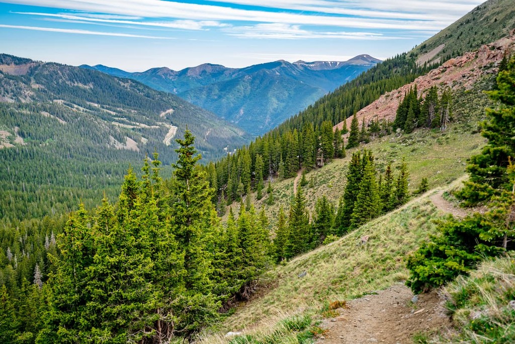
For a bit of an alpine adventure, the Bull of the Woods Trail to Wheeler Peak is a solid choice. This 7.3 mile (11.7km) strenuous trail starts off at the upper parking lot at Taos Ski Valley and makes its way steeply upward to the summit of Wheeler Peak.
The trail itself is well marked, though you can expect a substantial amount of climbing before you earn your 360 degree view of the Sangre de Cristo Mountains. For an added bonus, you can also opt for a small spur trip to Williams Lake, which is located between Lake Fork and Wheeler Peaks.
A 5.3 mile (8.5km) trail that starts at the Columbine Campground, the Columbine Canyon Trail is a stunning hike into a majestic forest of the Columbine-Hondo Wilderness. The trail itself requires quite a bit of climbing beyond the first few miles, though it also allows for plenty of connections to the nearby trail network for anyone planning a longer trip into the mountains.
Looking for a place to stay during your trip to Carson National Forest? Here are some of the best places to check out:
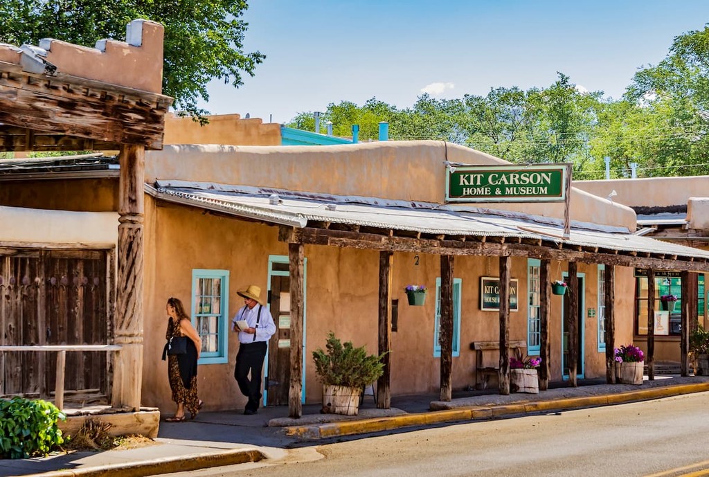
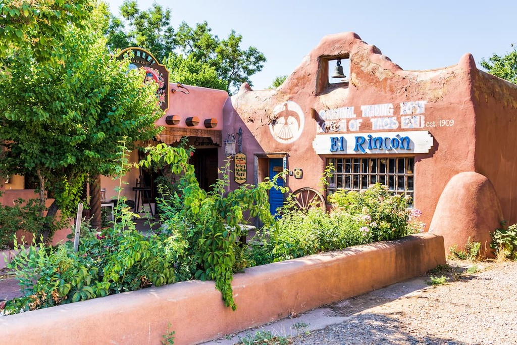
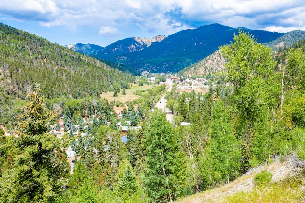
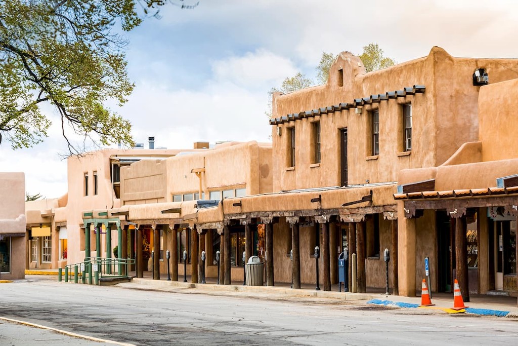
Located in the heart of Carson National Forest, the town of Taos is home to about 6,000 residents and some stunning mountain scenery. Taos is rich in culture and history, so it’s a great place to stay if you’re looking to check out some of the region’s historic sites.
The town also has a popular alpine ski resort, which brings a lot of tourism in the winter months. Taos is accessible by road and by air and the town has a great public transportation network that offers connections to Santa Fe.
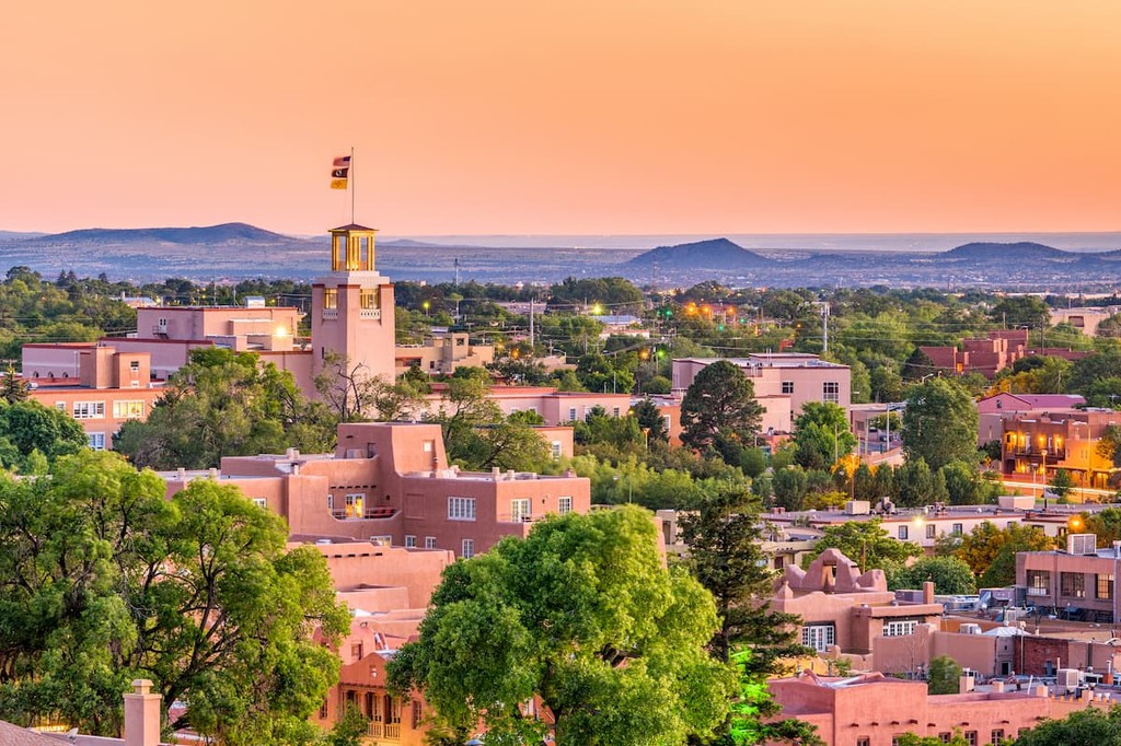
The capital of New Mexico, Santa Fe is home to about 84,000 residents and is located just to the south of Carson National Forest. Interestingly, as Santa Fe was designated the capital of the Spanish territory of Nuevo México in 1610, it is often considered to be the oldest state capital in the country.
Santa Fe is known for its arts scene, thanks to its many great galleries and museums, such as the Georgia O’Keeffe Museum. You can get to Santa Fe by road, air, or train, so it’s a nice place to start your trip into the forest.
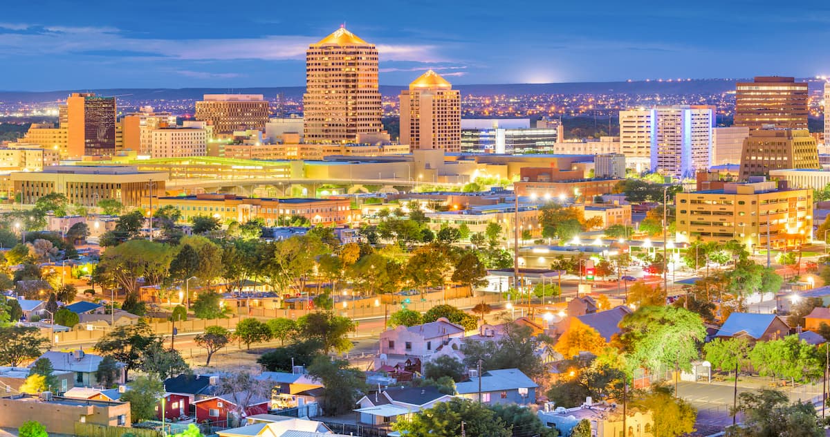
New Mexico’s largest city, Albuquerque is located to the south of Carson National Forest. It is home to about 560,000 people and it has a metropolitan area of around 1 million residents.
The city has a bustling and diversified economy that includes strong science, education, commerce, medicine, and technology sectors. It is also a major tourist hub and a transportation center for the entire state, thanks to its great road, train, and air connections.
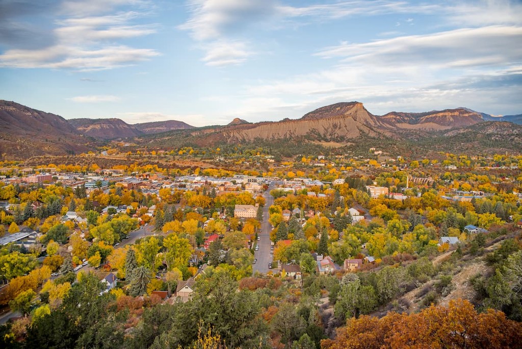
Located to the northwest of Carson National Forest, Durango is the largest city in Colorado’s La Plata County with around 19,000 residents. Durango has a number of historic attractions, thanks to its long history of mining, as well as plenty of outdoor recreation opportunities.
In addition to offering great access to Carson National Forest, Durango is also the southern terminus of the 567 mile (912km) Colorado Trail, which travels through Colorado’s Rocky Mountains to Denver. Durango is accessible by road and air, with good connections to many of the region’s largest airports.