Scan the QR code and open PeakVisor on your phone
The South San Juan Wilderness Area is a protected region and outdoor recreation destination located within the Rio Grande and San Juan National Forest of southwestern Colorado in the US. The tallest and most prominent point in the region is Summit Peak at 13,294 ft (4,052 m) in elevation and with 2,733 ft (833 m) of prominence.
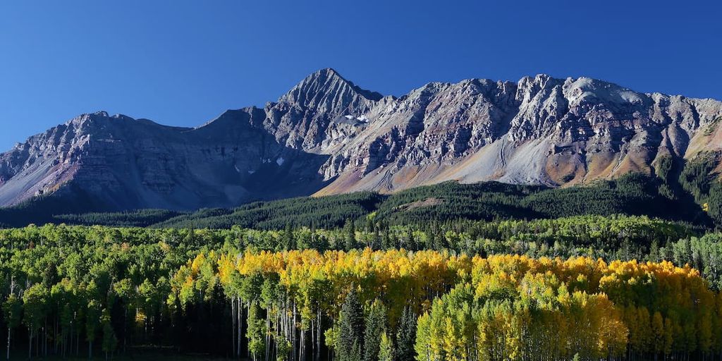
The South San Juan Wilderness is situated in southwestern Colorado within the San Juan National Forest. The San Juan Mountains dominate much of the landscape in the region, and they feature numerous peaks that reach above 12,000 feet (3,658 m).
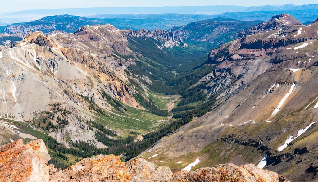
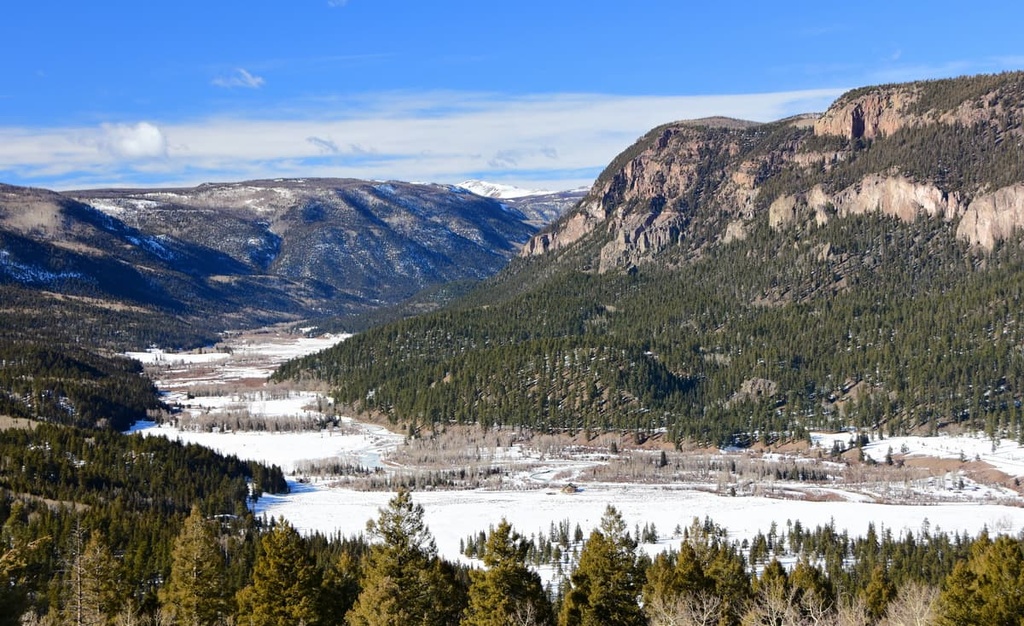
The wilderness spans 158,790 acres (64,260 ha) across the southwestern part of Colorado. Here, steep slopes leading to barren peaks are coupled with wide U-shaped valleys. The prominence of many of the peaks allow hikers to experience panoramic views of the wilderness and surrounding national forest.
Though the wilderness only comprises a small portion of the national forest, it is home to 32 alpine lakes. Three major rivers—the Conejos, San Juan, and Blanco—have headwaters that are located within the South San Juan Wilderness.
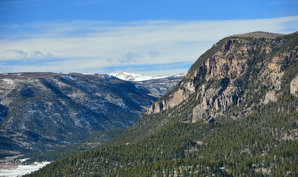
Jagged peaks and ridgelines tower above the rushing creeks and streams that have carved their way through the landscape in the wilderness. Here, dense patches of forest are intermixed with alpine meadows and steep scree fields.
Low growing shrubs and plants are not commonly found within the wilderness due to the minimal sunlight that reaches the forest floor. That said, the rugged ridges and peaks within the wilderness make for often steep and challenging hiking.
There are over 180 miles (290 km) of trails throughout the wilderness, including a portion of the Continental Divide.
South San Juan Wilderness lies within the Rio Grande and San Juan National Forest. It is surrounded by numerous other protected areas. Nearby lie the Weminuche Wilderness Area, La Garita Wilderness Area, Gunnison National Forest, and Carson National Forest.
The peaks within the South San Juan Wilderness are part of the San Juan Mountains. The San Juan Mountains are a subrange of the larger Southern Rocky Mountains, which span from Wyoming to central New Mexico.
The mountains in the wilderness consist of rocks dating back to the Precambrian. This age of rock is often found at the core of the peaks and ranges while the visible layers are from the much more recent Cenozoic era.
The San Juan Mountains, for which the wilderness and national forest are named, cover nearly all of western Colorado. Thirty million years ago, volcanic activity helped shape the range that is visible today.
During this time, immense pressure from the shifting of tectonic plates forced magma through the Earth’s crust. Continual folding of the crust, combined with the volcanic activity, gave rise to the rugged San Juan Mountains.
During the last glacial maximum, a majority of the peaks within the wilderness were heavily glaciated. The distinct wide valleys and ridgelines within the wilderness were formed by the retreating of the once massive glaciers.
Today the melting winter snowpack is what feeds the multitude of creeks, rivers, and lakes found within the wilderness, continuing to carve the landscape that we see today.
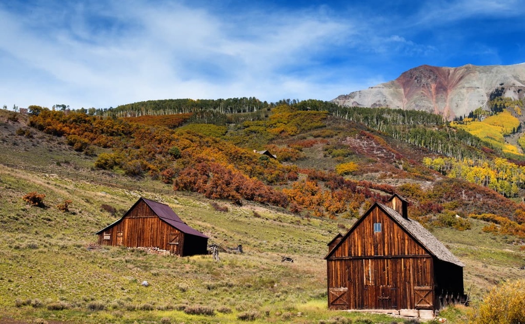
Throughout the 1800s, the region was heavily mined for silver and gold, too. Numerous mining villages were established throughout the range, many of which are now ideal cities for outdoor recreation.
Major peaks within the South San Juan Wilderness Area include Summit Peak, Chalk Mountains, Conejos Peak, Blackhead Peak, and Flattop Mountain.
The steep slopes and changes in elevation throughout the wilderness allow for a variety of flora and fauna to thrive.
Dense sections of forest can be found at the lower elevations, often relying on the many creeks and streams as their main source of water. These forests consist primarily of populations of lodgepole pine and aspen.
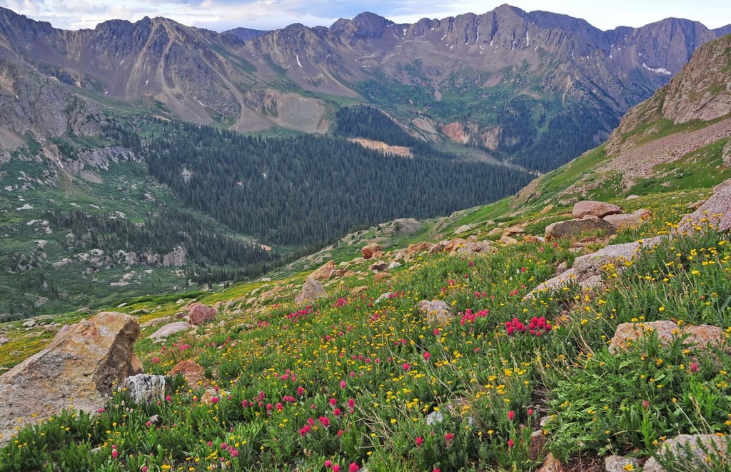
As elevation increases, the forest transforms to feature more Engelmann spruce and subalpine fir. The highest elevations in the wilderness are characterized as an alpine tundra. They are full of grasses, low growing shrubs, and various wildflowers.
This ecological region leaves the highest elevations free of trees, providing hikers with impeccable views of the surrounding peaks, valleys, and alpine lakes.
The forested regions within the wilderness provide the ideal habitat for mule deer, elk, moose, black bears, and mountain lions. The last known grizzly bear in Colorado was killed in the wilderness in 1979, though there are speculations about other grizzly bears existing within the state.
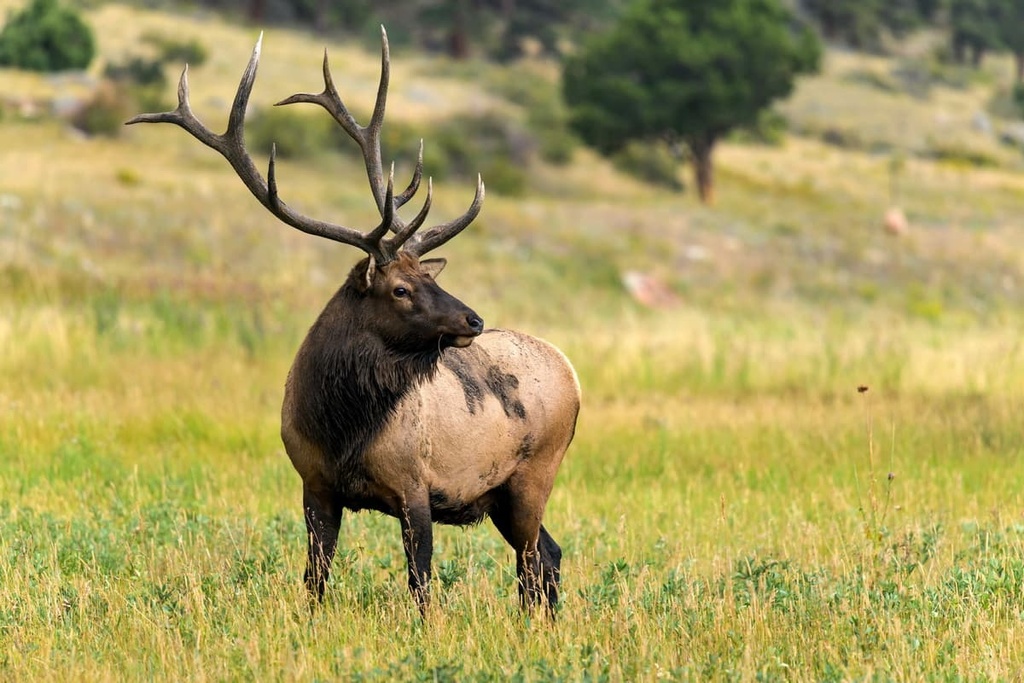
While bighorn sheep and marmots can often be spotted on the rocky hills in the area, populations of beavers inhabit some of the wetlands. Numerous species of falcons, eagles, and songbirds also live throughout the wilderness.
Humans have inhabited the land surrounding the South San Juan Wilderness for thousands of years. Indigenous people utilized the fertile land in the region to grow crops long before the arrival of American settlers.
The wilderness is part of the ancestral homelands of the Ute people. These homelands span throughout the San Juan Mountains, encompassing much of what is now southwestern Colorado and Utah. The Ute would often migrate with the changing of the seasons, living at higher elevations in the summer, and retreating to lower elevations during the winter months.
Over the course of countless generations, the Ute established seasonal walking paths throughout the San Juan Mountains. Many of these trails would later be used by both Spanish explorers and American settlers of the region.
It wasn’t until the eighteenth century that Spanish settlers arrived in the region in hopes of finding silver to mine. During the 1820s, American settlers arrived in the San Juan Mountains. Many of the first settlers were fur trappers who soon learned about the discovery of gold.
Gold was found by settlers during the Charles Baker Expedition in the 1860s. This resulted in a large influx of Americans settling throughout the region.
A majority of the settlers in the region disregard the Ute people’s claim to their ancestral homelands. Numerous battles broke out between the two groups, with the United States government often backing up the settlers.
These battles continued for about a decade until the Brunot Agreement of 1873 was negotiated. This agreement gave the Ute people 3.5 million acres (1.4 million ha) of their ancestral land. Unfortunately, this agreement was not upheld and the settlers forcibly removed the Ute people onto reservations.
Mining communities continued to grow in the region until the gold rush ended. While some of these communities would later transform into cities centered around outdoor recreation, others were completely abandoned, leaving behind ghost towns in their wake.
The San Juan National Forest was established in 1905 followed by the Rio Grande National Forest in 1908. The South San Juan Wilderness was established in 1980.
South San Juan Wilderness is home to numerous hiking trails. Here are some of the most popular hiking areas in the range:
The route to the summit of Alberta Peak follows the Continental Divide National Scenic Trail (CDT). This out and back trail is 5.8 miles (9.3 km) long with 1,187 feet (362 m) of elevation gain. The rocky summit continues in a steep ridgeline that extends throughout the wilderness.
Though not one of the tallest peaks in the wilderness, Alberta Peak offers scenic views of the surrounding mountains and nearby Wolf Creek Ski Resort. The trail begins in the forest before opening up to rolling alpine meadows for the final third.
The Lake Fork Creek Trail is a shorter route in the wilderness, just 3.8 miles (6 km) roundtrip with 1,010 feet (308 m) of elevation gain. The rocky trail passes along steep hillsides covered in various grasses and wildflowers.
The route follows along a creek while crossing over scree fields and forested patches. As elevations increase on the trail, hikers can look to the south for views of the surrounding mountains in the wilderness.
The Red Lake Trail takes hikers to one of the numerous lakes within the wilderness. The trail is 6 miles (9.6 km) long round trip with 660 ft (201 m) of elevation gain. The route climbs steadily through the forest before dipping in elevation to reach Red Lake.
The lake itself is surrounded by small patches of trees and sweeping alpine meadows. During the summer these fields are full of numerous species of wildflowers. Hikers also have the option of camping at the lake.
Looking for a place to stay near the South San Juan Wilderness Area? Here are some of the best cities and villages to check out in the region:
Pagosa Springs is the closest town to the wilderness, with a population of just over 2,000 people. The town is surrounded by San Juan National Forest and the Weminuche Wilderness, Colorado’s largest wilderness area.
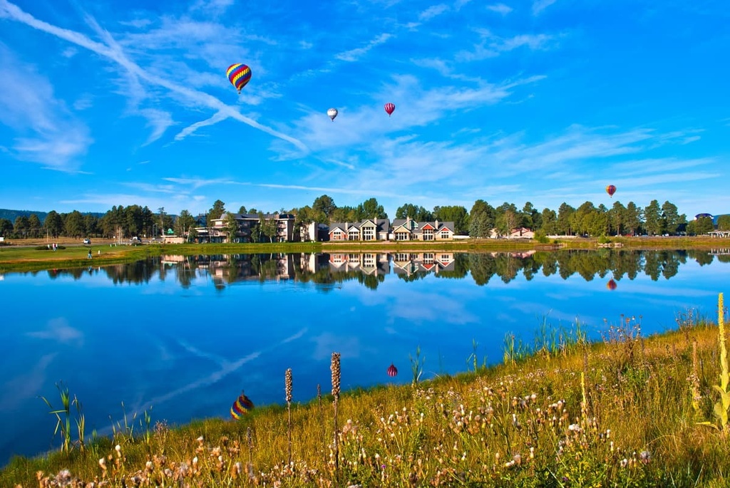
Pagosa Springs is named after the sulfur springs within the town. One of the springs also boasts being the world’s deepest geothermal hot spring. The springs are situated along the San Juan River, which is free and open to the public.
During the summer the town is a hub for hiking, trail running, fishing, and mountain biking. Nearby Wolf Creek Ski Area offers an abundance of winter activities, including miles of cross-country trails.
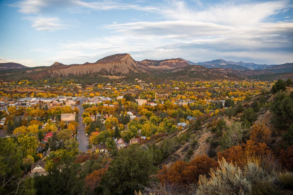
Durango lies west of the wilderness, surrounded by the San Juan National Forest. The city is one of the most populated mountain towns in the San Juan Mountains with over 19,000 residents. Situated at the confluence of the Colorado and Gunnison Rivers, Durango is also home to Fort Lewis College.
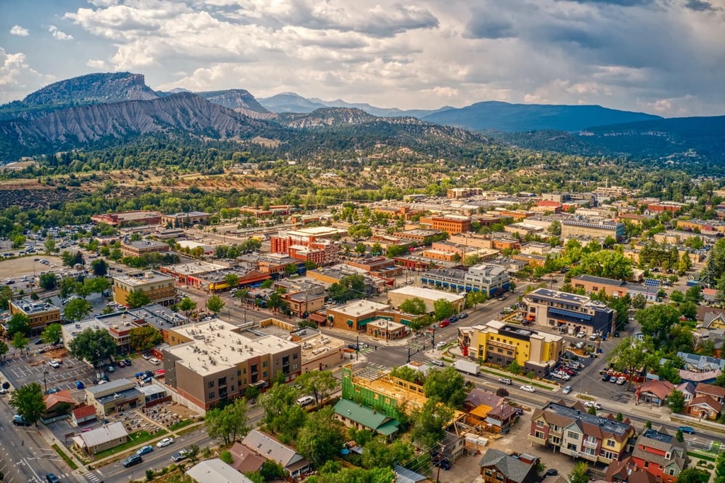
Surrounded by mountains, the city is a mecca for outdoor activities throughout the year. Thousands of miles of trails around Durango provide endless opportunities for hiking, trail running, and mountain biking.
Durango hosts numerous events each year, such as the Durango Ragtime & Early Jazz Festival, Music in the Mountains, and the Snowdown Festival. The small downton area is full of outdoor gear shops along with local restaurants and bars for visitors to check out.