Scan the QR code and open PeakVisor on your phone
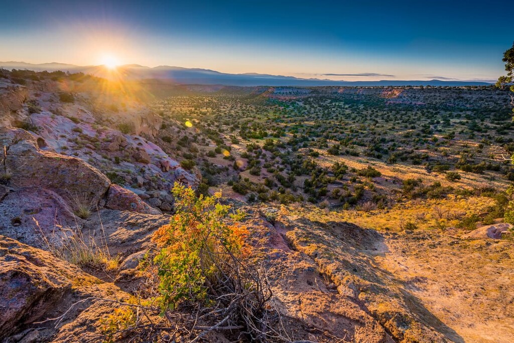
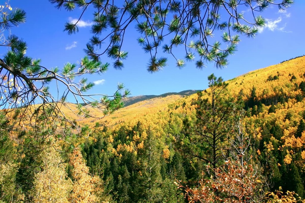
Featuring miles of Wild and Scenic Rivers, sprawling wilderness areas, spectacular hiking opportunities, and some fantastic wintertime adventures, Santa Fe National Forest is a true hiker’s paradise. The national forest is located in the north-central part of the US state of New Mexico. It contains 174 named mountains, the highest of which is Deception Peak (12,336 ft/3,760 m), and the most prominent of which is Chicoma Mountain (11,555 ft/3,522 m).
Santa Fe National Forest is located in the north-central part of the US state of New Mexico. It is situated within Los Alamos, Mora, Santa Fe, Sandova, San Miguel, and Rio Arriba counties.
The forest is approximately 1.5 million acres (607,000 ha) in size. So, it’s the third largest of the national forests contained wholly within the state of New Mexico after the Gila and Cibola national forests. However, it is larger than the Lincoln and Carson national forests.
Santa Fe National Forest is divided up into five ranger districts, each of which features its own unique landscapes. These include:
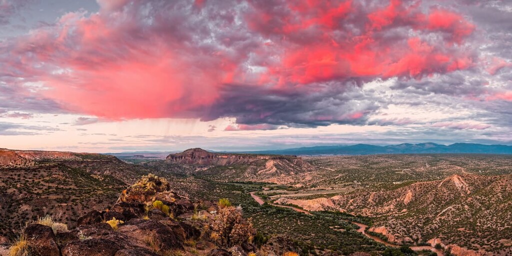
Within the Santa Fe National Forest, there are a number of other special destinations. This includes the Jemez National Recreation Area in the western part of the forest, as well as four federally protected wilderness areas:
The Santa Fe National Forest is within driving distance of many other popular outdoor recreation destinations. This includes the Carson National Forest and the Rio Grande del Norte National Monument to the north. Additionally, the western portion of the Santa Fe National Forest is adjacent to the Valles Caldera National Preserve and the Bandelier National Monument.
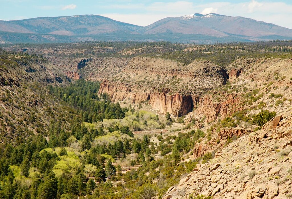
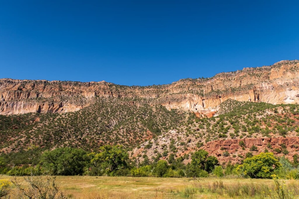
The Santa Fe National Forest straddles both sides of the Continental Divide in New Mexico. Additionally, it includes part of the Sangre de Cristo range of the Southern Rocky Mountains in the east as well as part of the Jemez Mountains of the Colorado Plateau in the west.
The Sangre de Cristo Range is one of the southernmost stretches of the Southern Rocky Mountains. The range actually stretches fairly far north into south-central Colorado, terminating just south of US Route 50 near Cañon City.
It consists of a diversity of different rocks, including Precambrian gneisses that date back approximately 1.8 billion years. There are also much younger sedimentary rocks, such as dolomites, limestones, and sandstones that date to the Mississippian, Ordovician, and Devonian, in the range.
The formation of the Sangre de Cristo Range began approximately 320 million years ago. At this time, the range was undergoing a period of widespread uplifting. Furthermore, this was also a period of widespread erosion, during which point, a large quantity of the eroded sediment made its way to the west of the range and later compacted into sedimentary rocks.
However, the range truly started to form during the Laramide orogeny, alongside much of the rest of the Rocky Mountains. The range was heavily glaciated throughout the height of the Pleistocene. This glaciation helped to carve out many of the topographical features we see in the Sangre de Cristos to this day.
Meanwhile, the Jemez Mountains form the border between the Colorado Plateau to the west and the Southern Rocky Mountains to the north and east. The Jemez Mountains also consist of a mix of rock types, including a handful of Tertiary and Quaternary igneous complexes that lie unconformably over metamorphic, igneous, and sedimentary rocks, some of which date back to the Precambrian.
Although the range doesn’t have any particularly active volcanoes in it today, its past volcanism did form many of the features we see in the range. This includes the Valles Caldera, which is technically located just outside the forest.
Interestingly enough, the Santa Fe National Forest generally allows for the personal mining and collecting of small amounts of common, low-value minerals.
According to forest regulations, the US Forest Service allows visitors to the national forest to collect up to about 10 lbs (4.5 kg) of minerals and rocks like obsidian, quartz, and agate. Visitors can also go gold panning are also allowed in the forest, so long as they do not do so in wilderness areas, along Wild and Scenic Rivers, in the Jemez National Recreation Area, or in any campgrounds.
Additionally, visitors are allowed to go metal detecting in the forest outside of areas with significant historical or archaeological sites. So long as the found items are on the surface of the Earth and so long as they are not protected (e.g., vertebrate fossils, shark teeth, pottery shards, projectile points, and other archaeological resources older than 50 years of age), permits generally aren’t necessary for metal detecting in the forest.
Do note, however, that mining and rock collecting can only be done without a permit for personal purposes—not commercial. If you’re interested in collecting rocks or minerals in the forest for non-personal purposes, contact the forest directly to inquire about permits.
Santa Fe National Forest covers a wide swath of north-central New Mexico. As such, the forest is home to an array of different ecosystems and plant communities. This is particularly true given the great disparity in elevation between different areas of the park, which paves the way for a diversity of ecosystems.
As a general rule, there are four primary ecozones in New Mexico: alpine, subalpine, coniferous forest, transition forest, and desert.
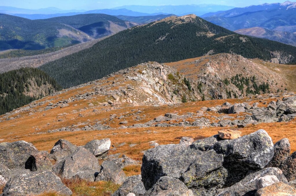
The alpine zone exists at elevations above 11,500 feet (3,505 m), which occurs in very limited spots in the Santa Fe National Forest, such as in the Pecos Wilderness. Here, the plant life is mostly dwarf willows, sedges, grasses, and mat- and cushion-plants. This region is generally called the alpine tundra and it is home to wildlife like the Rocky Mountain bighorn sheep, white-tailed ptarmigan, and pika.
Meanwhile, the subalpine zone exists between approximately 9,500 feet (2,895 m) to 11,500 feet (3,505 m). It is dominated by dense spruce-fir forests and receives large amounts of snowfall in the winter months. Notable animal species include the boreal owl, blue grouse, Mexican spotted owl, Rocky Mountain elk, and Clark’s nutcracker.
Below the subalpine zone is the coniferous forest zone, which exists between 8,500 feet (2,590 m) and 9,500 feet (2,895 m). The zone features aspen groves, white fir, Douglas fir, and some ponderosa pine. Many of the animal species found in the subalpine also live in the coniferous forest zone.
Moving further down in elevation, we have the transition forest, which is located between 7,000 feet (2,133 m) and 8,500 feet (2,590 m). This forest is home predominantly to ponderosa pines and stands of both gambel oak and piñon-juniper. Here, wildlife species include the endangered Jemez Mountain salamander, northern goshawk, Merriam’s turkey, and Albert’s squirrel.
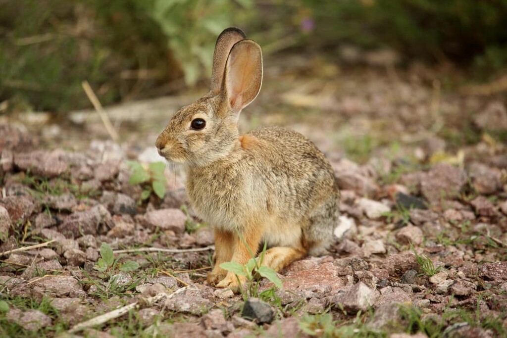
The final ecozone in the region is the desert ecozone, which exists at elevations below the transition forest. This area is home to big sagebrush, grasslands and other similar shrubbery. Common animal species include mule deer, desert cottontail, and western diamondback rattlesnakes.
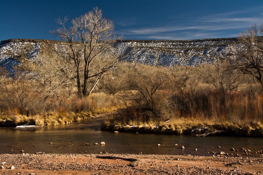
Additionally, there are quite a few fish species found in the rivers of the forest. This includes the Rio Grande chub, Rio Grande cutthroat trout, rainbow trout, and German brown trout, but the latter two species are either hatchery-stocked or introduced to the region.
The land in and around what is now Santa Fe National Forest has been home to humans for thousands of years. It is part of the traditional territory of many Indigenous communities and contemporary tribal nations, including that of the Ohkay Owingeh Pueblo, Nambé Pueblo, San Felipe Pueblo, and the Pueblo of Jemez, among many others.
The first peoples of European descent to visit what is now the Santa Fe National Forest were potentially members of a 1541 Spanish expedition led by Francisco Vázquez de Coronado. The Pueblo of Jemez are believed to have made contact with Coronado during his travels through the region.
Later, in the 1580s, conquistador Juan de Oñate y Salazar was sent to colonize the area, though he was eventually banished from what is now New Mexico as a punishment for his role in the killing of approximately 1,000 members of the Acoma Pueblo in the 1599 Acoma Massacre.
The Spanish later established a mission at San José de los Jemez in 1621. The mission was located near what is now Jemez Springs in the western part of the forest. It was abandoned not long after construction and the region became a mostly agricultural one.
From that point forward, Spain claimed what is now New Mexico and Santa Fe National Forest as part of the Kingdom of Santa Fe de Nuevo México. The territory became part of Mexico after the Mexican War of Independence in 1821. Then, it was ceded to the United States as part of the Treaty of Guadalupe Hidalgo in 1848 after the Mexican-American War.
The land that is now part of the Santa Fe National Forest was first put under federal purview in 1892 with the establishment of the Pecos River Forest Reserve and in 1905 with the establishment of the Jemez Forest Reserve. By 1907, both reserves were redesignated as national forests.
In 1915, the Jemez and Pecos national forests were combined to create the Santa Fe National Forest. Although the forest is now prized as an outdoor recreation area and, in some places, a preserve for culturally important sites, it was actually heavily logged during the 1920s and 1930s.
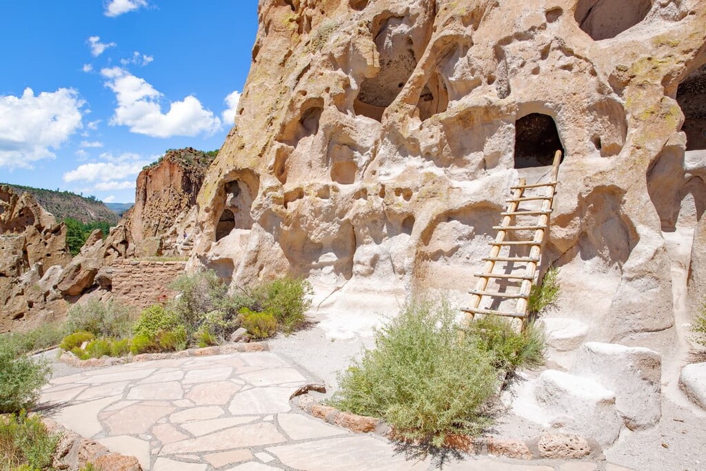
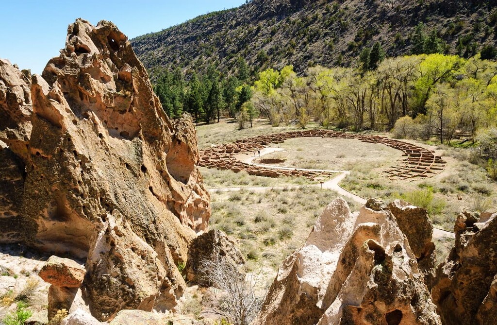
Over the years, parts of the forest have been removed to create national monuments, such as the Bandelier National Monument in 1916. It is now one of the region’s most iconic hiking and backpacking areas, so it’s a must-visit if you’re in northern New Mexico.
There is no shortage of fantastic places to go hiking in the Santa Fe National Forest. Here are some of the best hiking areas in the forest to check out:
The Pecos Wilderness is a large protected area located in the eastern part of the forest. It is situated just northeast of the city of Santa Fe and it contains some of the most rugged terrain in the entire Santa Fe National Forest.
The wilderness is actually partly located in the Carson National Forest, but most of it is situated in Santa Fe. It features many of the highest peaks in the southern part of the Sangre de Cristo Range as well as the Wild and Scenic Pecos River.
Popular hiking options in the forest include the Windsor Trail, the trail to Truchas Peak, and the trail to Pecos Baldy Lake.
Situated in the northwestern edge of the Santa Fe National Forest, the Chama River Canyon Wilderness is a small wilderness area that protects the banks of the wild and Scenic Rio Chama.
The wilderness itself is very small and it contains about 6 miles (9.7 km) of the river. Here, visitors can raft the river and enjoy its scenic beauty. While there are relatively few trails in the Chama River Canyon Wilderness, there is a backpacking trail that follows along portions of the river and leads to campsites within the canyon’s many high-water beaches.
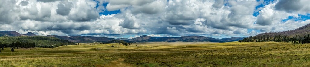
The San Pedro Parks Wilderness is a protected area located in the northwestern part of the Santa Fe National Forest. It contains the bulk of the high-elevation areas in the western portion of the forest including large grassy meadows.
Within the wilderness, visitors can enjoy hiking, horsepacking, fishing, and other outdoor recreation activities. There are approximately 100 miles (160 km) of trails in the wilderness, including the popular Vacas Trail. Additionally, an 8 mile (13 km) section of the Continental Divide Trail traverses the wilderness.
The Dome Wilderness is a small wilderness area located in the southern part of the western portion of the forest. It features vast canyonlands and a plethora of important cultural and historical sites.
In the Dome Wilderness, visitors can check out fantastic viewpoints at places like Saint Peter's Dome. The wilderness also contains a handful of trails, such as the Capulin Trail and the Saint Peter's Dome Trail, which are both worth checking out.
Known for its great hiking, climbing, hunting, and fishing opportunities, the Jemez National Recreation Area protects land of significant ecological and cultural importance. It is located in the Jemez Mountains in the western part of the park and it is managed in collaboration with the Governor of the Pueblo of Jemez.
Jemez National Recreation Area contains a handful of great hiking opportunities, including trips to McCauley Hot Springs and Jemez Falls. If you’re going to visit the recreation area, don’t forget to check out the nearby town of Jemez Springs, too.
Looking for a place to stay during your trip to the Santa Fe National Forest? Here are some of the best places to check out in the region:
Santa Fe National Forest is home to a treasure trove of fantastic camping opportunities.
In fact, you can primitive camp pretty much anywhere in the forest unless explicitly stated otherwise. However, note that you must be at least 100 feet (30 m) from lakes, streams, and other bodies of water while camping in the forest. All other standard Leave No Trace guidelines are also in place.
Additionally, the forest contains dozens of designated campgrounds for visitors to choose from, including some with large group sites. Some campgrounds are available on a first come, first served, but many are available on Recreation.gov for advanced reservation. Campgrounds in the forest vary from developed sites with hook ups and amenities to more rustic campgrounds that offer only a place to stay.
The campgrounds in the Coyote, Cuba, and Espanola ranger districts include:
Meanwhile, the Jemez Ranger District campgrounds include:
Finally, the Pecos–Las Vegas Ranger District contains the following campgrounds:
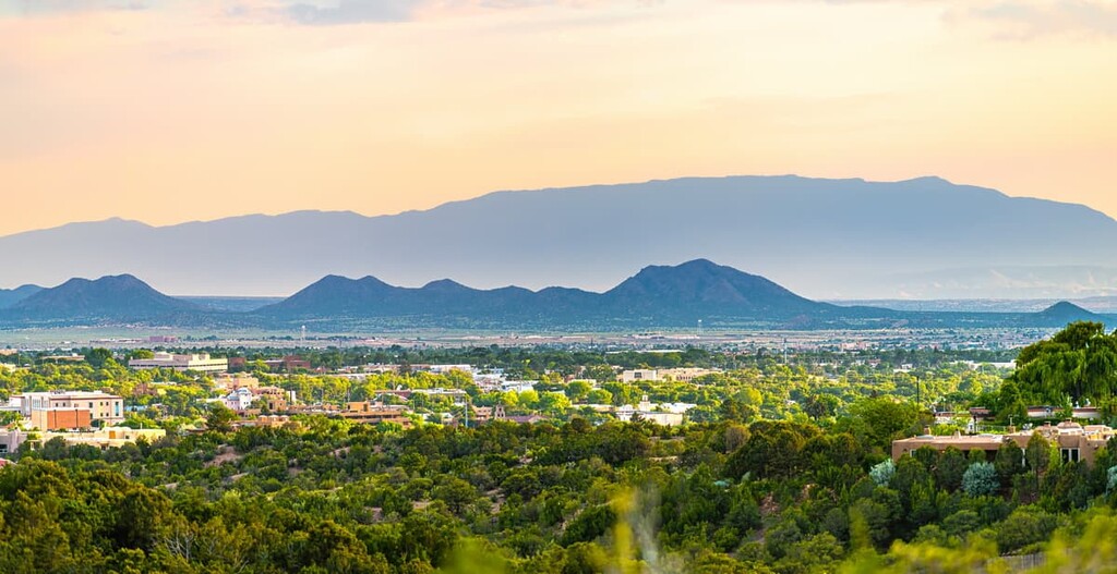
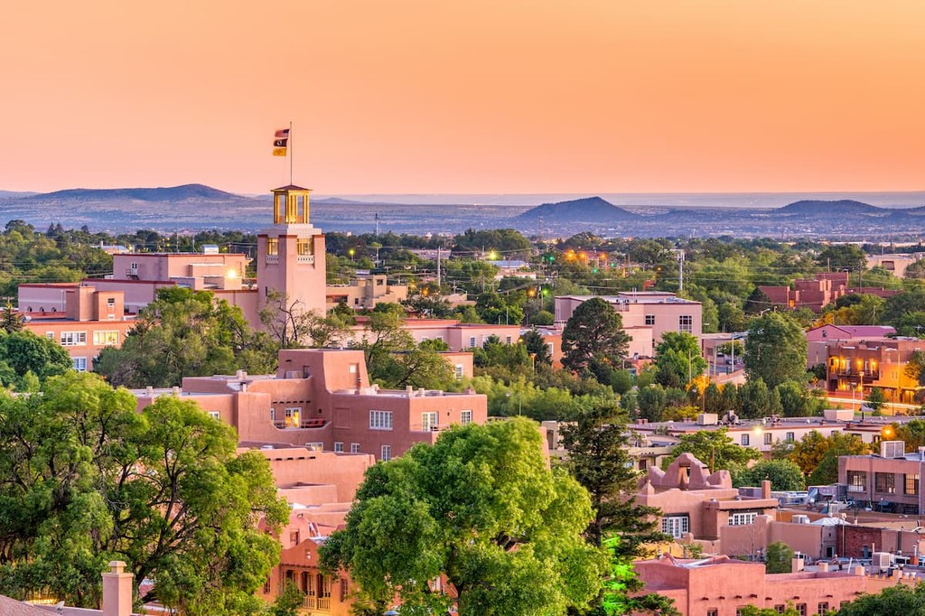
The capital and fourth-largest city in the state of New Mexico, the city of Santa Fe is home to some 85,000 people who live just south of its namesake national forest. Santa Fe is often heralded as one of the world’s best art cities, so it’s a great place to stay if you’re looking to visit museums, galleries, and other cultural sites.
Santa Fe is particularly well known for its fantastic cuisine and live music performances. It is a major center for tourism in the region, least of all for its plethora of historic sites. Plus, Santa Fe is relatively easy to get to by road, train, and air, so it’s a great place to start your adventures in the national forest.
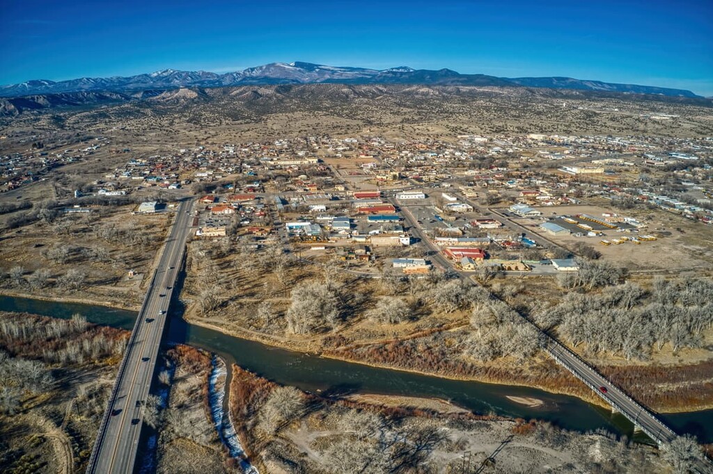
Located between the two major sections of the Santa Fe National Forest, Española is an ideal basecamp for trips in the region. The city is home to approximately 11,000 people and it hosts a number of excellent festivals each year that are popular among tourists.
Española is located within driving distance of much of the forest’s best trails and outdoor recreation activities. It also features a large fountain in its aptly named Plaza de Española that’s a replica of the famous Alhambra in the province of Granada in the autonomous community of Andalusia in Spain.
Arguably best known for being the home of artist Georgia O’Keeffe toward the end of her life, Abiquiú is a small community of approximately 230 people that’s located in the northern part of the Santa Fe National Forest.
Abiquiú was historically part of the Old Spanish Trail, which served as a trade route for much of the seventeenth to mid-nineteenth centuries. The city’s scenic backdrop has also served as the filming location for a number of popular TV shows and movies, including No Country for Old Men, Indiana Jones and the Kingdom of the Crystal Skull, and Breaking Bad.
Although it doesn’t quite have the same reputation as Las Vegas in Nevada, the city of Las Vegas in New Mexico is one of the region’s largest population centers. It’s home to approximately 13,800 people and it’s located on the eastern edge of the Santa Fe National Forest.
Las Vegas features a large number of historic buildings, libraries, and museums. It’s also the home of the New Mexico Highlands University, so it makes for a great starting point for trips into the eastern part of the forest.