Scan the QR code and open PeakVisor on your phone
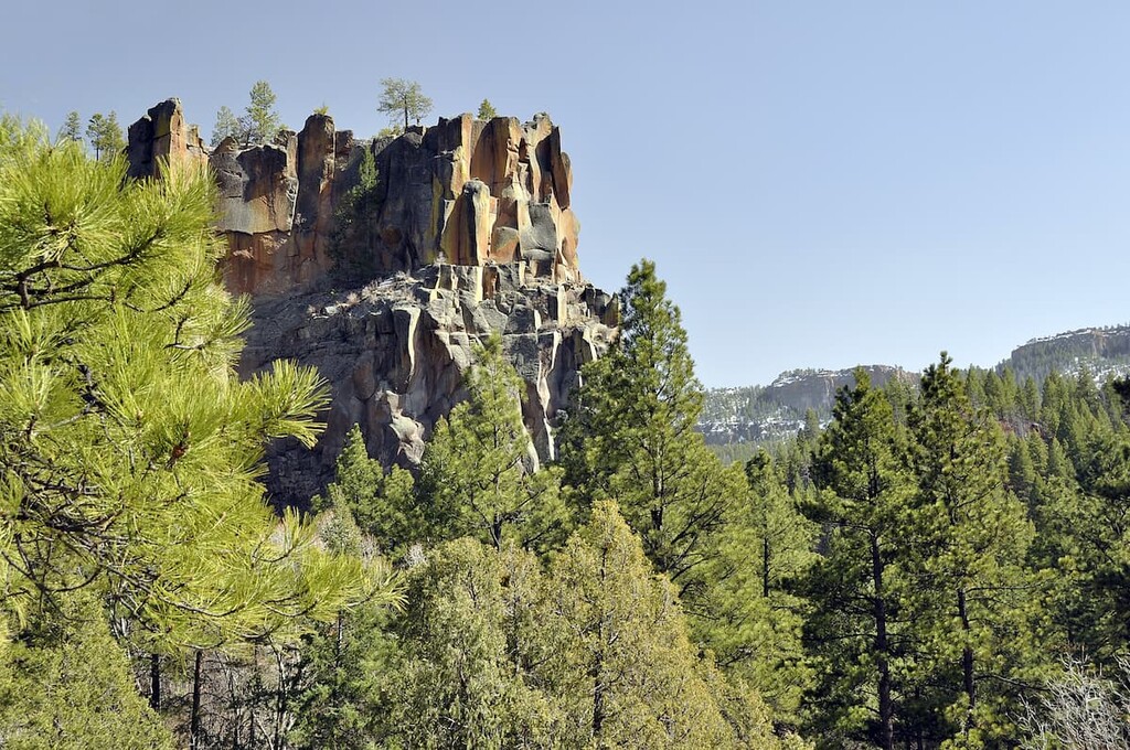
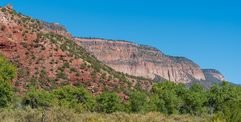
Known for its dramatic rock formations, steep gorges, and towering peaks, the Jemez Mountains (Tewa: Tsąmpiye'ip'įn) is a collection of peaks located in the north-central part of the US state of New Mexico. The Jemez Mountains contain 162 named peaks, the highest and most prominent of which is Chicoma Mountain (11,555 ft/3,522 m).
One of New Mexico’s major mountain ranges, the Jemez Mountains (Tewa: Tsąmpiye'ip'įn) are a collection of peaks located in the north-central part of the state. The range is shaped like a giant dome, a formation that hints at the range’s volcanic origins as part of the Valles Caldera.
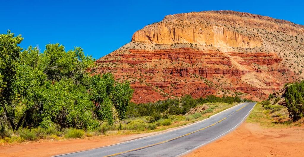
The Jemez Mountains are situated to the north of the city of Santa Fe in Rio Arriba, Sandoval, Los Alamos, and Santa Fe counties. New Mexico State Highway 4 and New Mexico State Road 126 are the primary roads that cross through the range. These roads are both part of a 150 mile (241 km) byway that travels through the range called the Jemez Mountain Trail National Scenic Byway.
There are a number of areas of public land located within the Jemez Mountains. This includes parts of Santa Fe National Forest, as well as Valles Caldera National Preserve, Bandelier National Monument, and the Jemez National Recreation Area. The range also contains a number of wilderness areas, including the San Pedro Parks Wilderness and the Dome Wilderness.
Additionally, the Jemez Mountains are located in one of the most mountainous sections of New Mexico. As such, the Jemez Mountains are located within driving distance of other ranges, including the San Juan Mountains and the Sangre de Cristo Range. The Jemez Mountains are also surrounded by peaks within the greater Colorado Plateau geomorphic province and the peaks of the Southern Rocky Mountains.
The Jemez Mountains are a geologically complex and unique range in New Mexico. The range is part of the greater Valles Caldera, which is considered to be one of the largest volcanic craters in North America.
It is also located along the boundary of a number of major geomorphic regions, including the Colorado Plateau, the Southern Rocky Mountains, and the valley of the Rio Grande.
For the most part, the Jemez Mountains are comprised of a number of complexes of volcanic rock, some of which date back to the Tertiary and Quaternary. However, these rocks overlie unconformably over various sedimentary, metamorphic, and igneous rocks that date as far back as the Precambrian.
It’s believed that volcanic activity in the region began around the Pliocene. This led to the formation of a substantial amount of basalt and, later, various andesites, rhyolites, and dacites. Additionally, this volcanic period led to the formation of the Valles Caldera, which is actually overlaid on top of an older caldera. The highest point on the caldera is Redondo Peak.
Like many areas in the region, the Jemez Mountains were the site of a number of mining attempts in the recent past. There were a number of gold and silver mines in the area, particularly around what is now the ghost town of Bland, in the late nineteenth and early twentieth centuries.
Due to the widespread volcanism in the area, there’s also a decently large amount of interest in the potential geothermal energy options in the Valles Caldera. Doing so is contentious due to the number of sacred cultural sites and outdoor recreation destinations in the region, particularly on land in the Santa Fe National Forest.
As of 2018, the Santa Fe National Forest has rejected proposals for geothermal development in the region. Although this decision could change, the official decision on the matter cited the substantial cultural and spiritual significance of the landscape for many local tribal nations, so the protections will likely be in effect for the foreseeable future.
Major peaks in the Jemez Mountains include Chicoma Mountain, Redondo Peak, Polverada Peak, Cerro Toledo, South Mountain, Cerro de la Garita, and Caballo Mountain.
The Jemez Mountains feature an ecological make up that’s similar to that of the surrounding region.
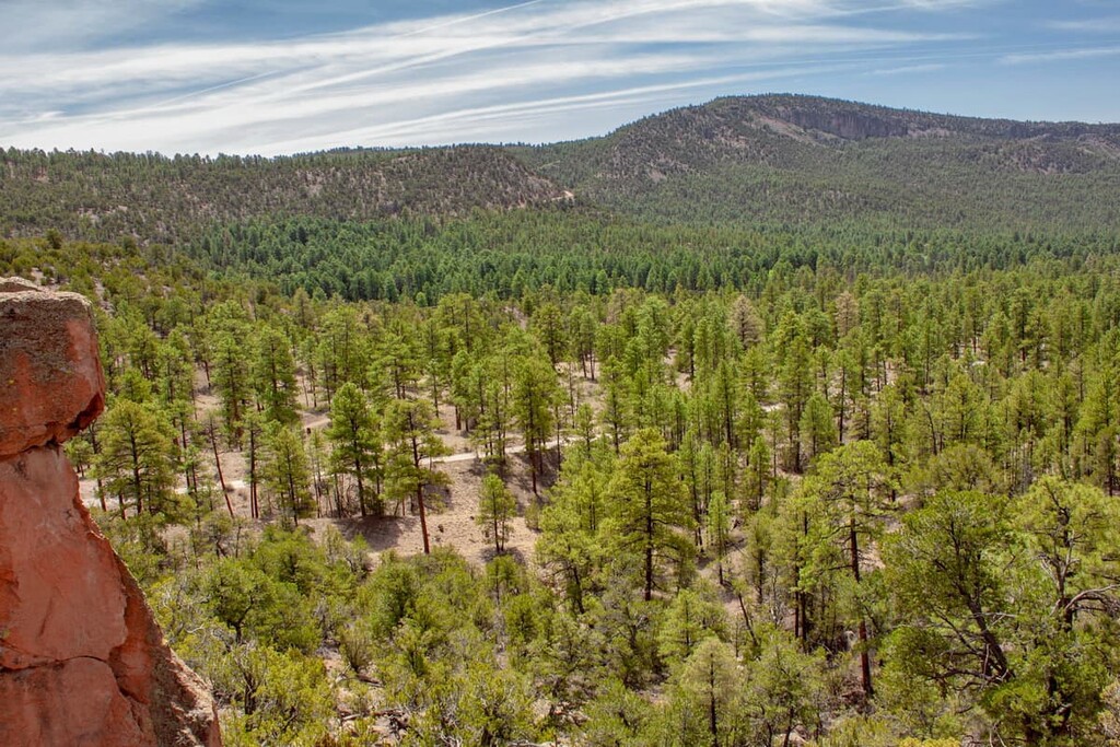
Within the range, much of the lowest elevation landscapes are dominated by a mixture of piñon/juniper woodlands and large open areas of scrub and grasses. The mid-elevations, on the other hand, are often home to aspens and various coniferous trees. Some of the many tree species in the region include Engelmann spruce and Douglas fir.
As far as wildlife is concerned, the Jemez Mountains are home to a diversity of different species. This includes black bears, mountain lions, elk, prairie dogs, beavers, and even the occasional bighorn sheep.
Arguably the most unique species in the range is the Jemez Mountain salamander (Plethodon neomexicanus), which inhabits temperate forests. Jemez Mountain salamanders tend to be quite small and they rarely venture out from their hiding spots except at night to feed. During the winter months, the salamander actually hibernates underground.
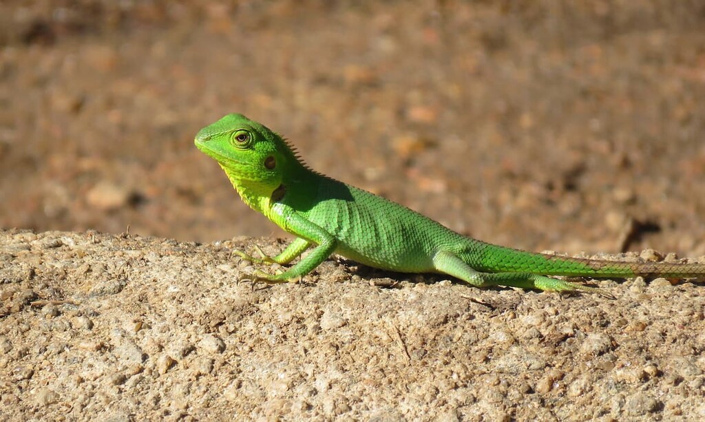
Due to habitat loss, the Jemez Mountain salamander is listed as near threatened by the IUCN and it has been a federally listed endangered species in the US since 2013.
The area in and around the Jemez Mountains has been home to humans since time immemorial. The range is the ancestral homelands of many tribal nations, including the many surrounding Pueblo communities. These include the Santa Ana Pueblo, Zia Pueblo, Kewa Pueblo, San Felipe Pueblo, Nambé Pueblo, Pueblo of Pojoaque, Pueblo of San Ildefonso, Santa Clara Pueblo, Ohkay Owingeh Pueblo, and the Pueblo of Jemez, among others.
Many contemporary Pueblo communities are located outside the main crest of the Jemez Mountains, however, Indigneous communities have lived and traveled through the range for thousands of years. The range contains a number of important spiritual and cultural sites for many tribal nations, particularly within Jemez National Recreation Area, Bandelier National Monument, and Valles Caldera National Preserve.
People of European descent likely first made contact with tribal nations in the region during the mid sixteenth century. Francisco Vázquez de Coronado of Spain led an expedition through the region in the 1540s that came into contact with the Jemez Nation. Later Spanish expeditions, including the Chamuscado and Rodríguez Expedition, as well as the Espejo Expedition, also traveled through the region.
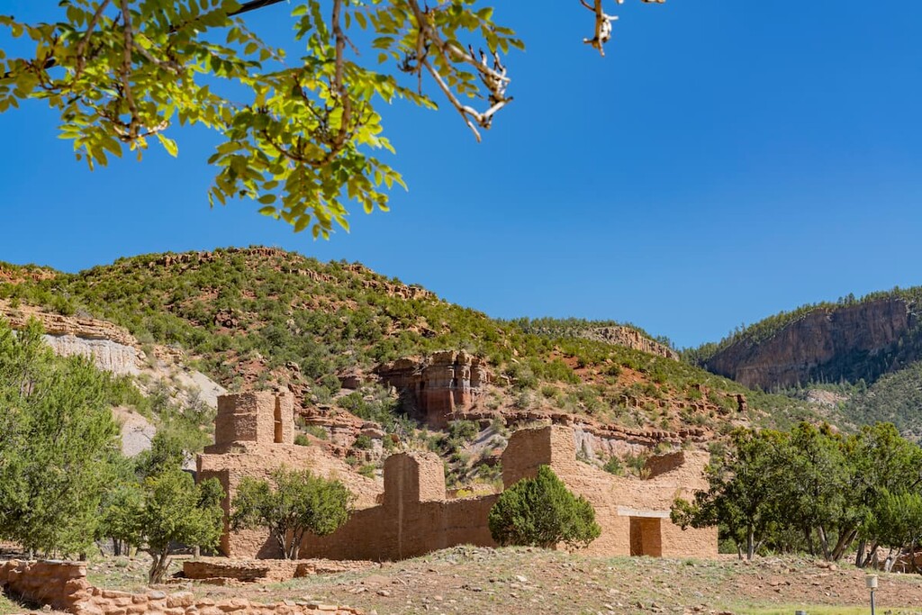
By the 1600s, Franciscan priests had arrived in the area around the Jemez Mountains to establish missions. One of the best-known missions of the era in the region was located at San José de los Jemez in the Jemez Mountains. This mission was abandoned soon after its establishment.
Harsh living conditions and violence at the hand of colonial settlers led to the Pueblo Revolt of 1680. This revolt was one of the relatively few successful Indigenous rebellions during the time period as it drove the bulk of Spanish settlers out of the region. However, this success was short-lived as the Spanish returned in force just a decade later.
From the eighteenth to the early nineteenth century, the region of the Jemez Mountains was controlled by the Spanish as part of the Kingdom of Santa Fe de Nuevo México. The territory was ceded to Mexico in 1821 after the end of the Mexican War of Independence. It was later ceded to the US in 1848 after the end of the Mexican-American War.
The Jemez Mountains were first set aside for conservation purposes with the establishment of the Pecos National Forest in 1898 and the Jemez National Forest in 1905. These two forests were later merged to create the Santa Fe National Forest in 1915.
Part of the range was protected as Bandelier National Monument in 1916. Much later, in 1993, the Jemez National Recreation Area was established to protect the recreational , cultural, and ecological resources of the southern part of the range.
Finally, in 2000, Valles Caldera National Preserve was established with the passage of Valles Caldera Preservation Act. This land in the northern part of the range was originally managed by an external trust, however it has been under the sole management of the US National Park Service since 2015.
When compared to the Sangre de Cristo Range in the east, the Jemez Mountains don’t get nearly as much foot traffic. However, if you’re looking for stunning mountain views and relatively few crowds, the Jemez Mountains are a sure bet for any adventure.
The Jemez Mountains are home to four fantastic areas of federally managed public land: a national forest, national preserve, national monument, and national recreation area. Each of these areas offers unique opportunities for outdoor recreation in this stunning mountain range that contains a rich cultural history. Here’s what you need to know.
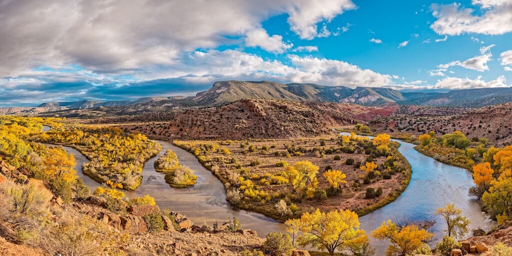
Valles Caldera National Preserve is a unique landscape located in the north-central part of the Jemez Mountains. The preserve contains 23 named mountains, the highest of which in the caldera itself is Redondo Peak.
Aptly named, Valles Caldera is situated around a large caldera. It is a landscape known for its geologic features, which include fumaroles, lava flows, and a massive subterranean geothermal system.
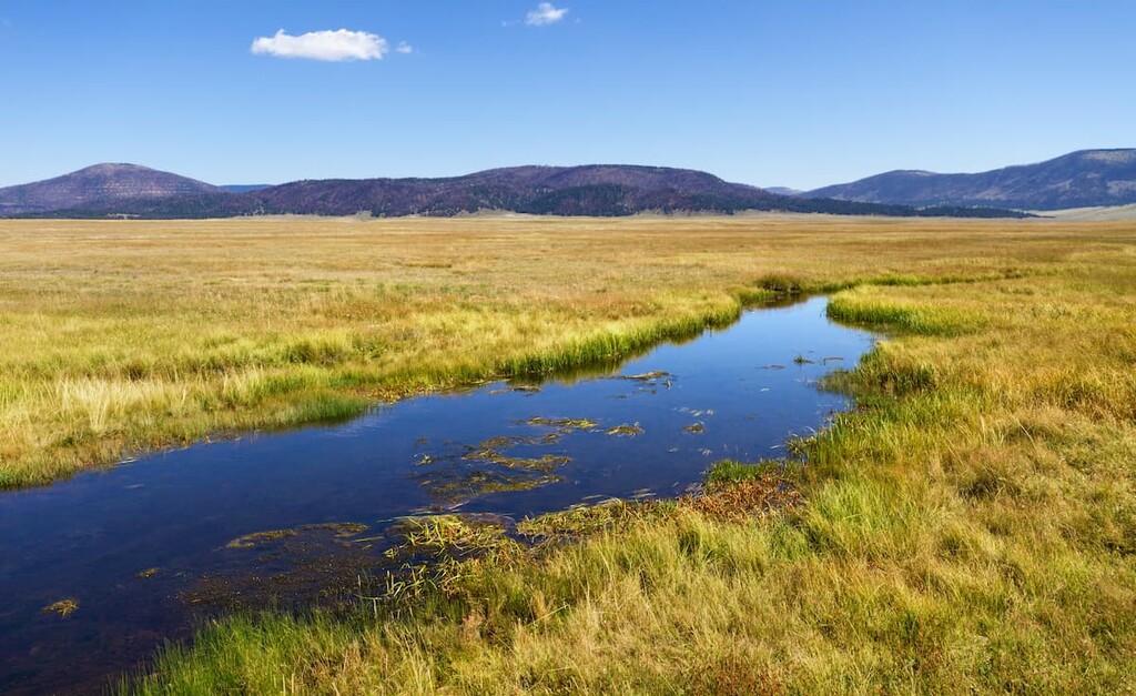
As a national preserve, access to Valles Caldera is a bit different from what you’d expect at a national park or monument. The preserve has a large number of fantastic trails, though many of the longer adventures in Valles Caldera require that you obtain a vehicle permit. There is also no overnight camping in the preserve, but day hiking opportunities are abundant.
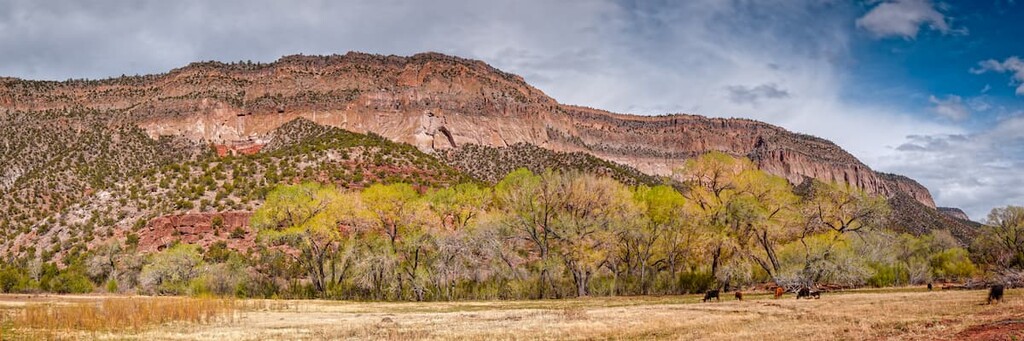
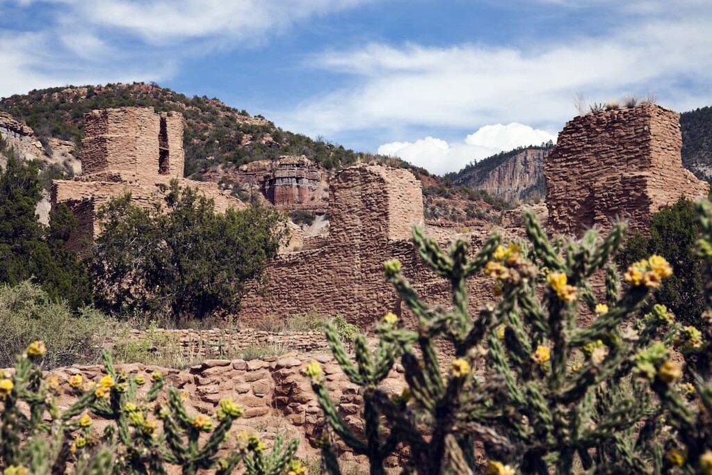
Situated in the eastern part of the Jemez Mountains, the Bandelier National Monument is an area steeped in cultural history. The monument contains 9 named mountains, the highest and most prominent of which is Cerro Grande.
Bandelier National Monument is perhaps best known for being home to a number of important archaeological and cultural sites from Ancestral Puebloans. One site, Tyuonyi, was a large circular pueblo that likely housed hundreds of rooms when it was in use.
Keep in mind that the many, many cultural sites in Bandelier National Monument are all protected areas and they should not be disturbed.
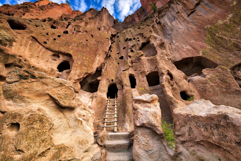
Visitors to Bandelier can hike on one of the monument’s many trails, most of which bring visitors to some of the region’s top cultural sites. This includes the Painted Cave and a number of cliff dwellings.
Jemez National Recreation Area is a federally managed area situated in the southern part of the Jemez Mountains. The recreation area contains 11 named mountains, the highest and most prominent of which is Los Griegos.
As its name suggests, much of Jemez National Recreation Area has been set aside for recreation. There are a number of trails in the area, though some can be difficult to follow.
Additionally, Jemez National Recreation Area is managed in consultation with the Governor of the Pueblo of Jemez, particularly with regards to concerns about the management of religious and cultural sites. Do note that sections of the recreation area can be closed down for traditional and cultural events.
Encompassing much of the land on the edge of Jemez Mountains that’s not located in the national monument, preserve, or recreation area, Santa Fe National Forest is a premier hiking destination in northern New Mexico. It contains 173 named mountains, the highest of which in the Jemez Mountains is Chicoma Mountain.
Santa Fe National Forest covers a vast swath of land that includes more than 1.5 million acres (607,000 ha). It is home to hundreds of miles of hiking trails, many of which traverse some of the most rugged terrain in the range.
Looking for a place to stay near the Jemez Mountains? Here are some of the best nearby cities and towns to check out:
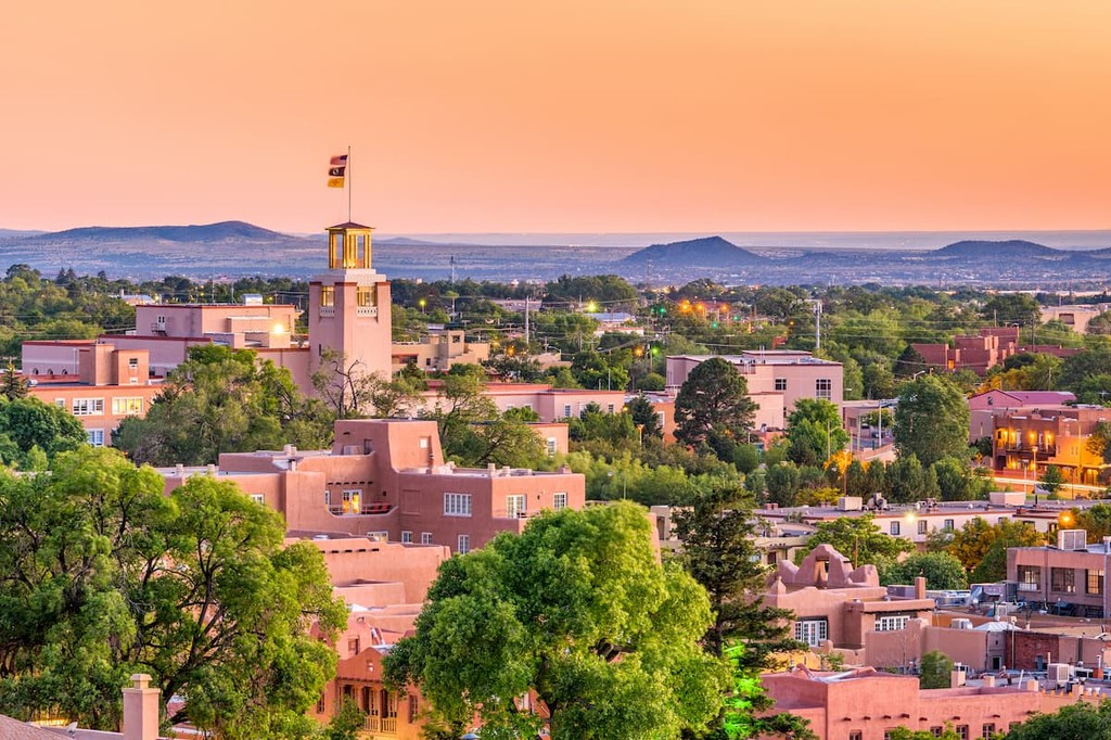
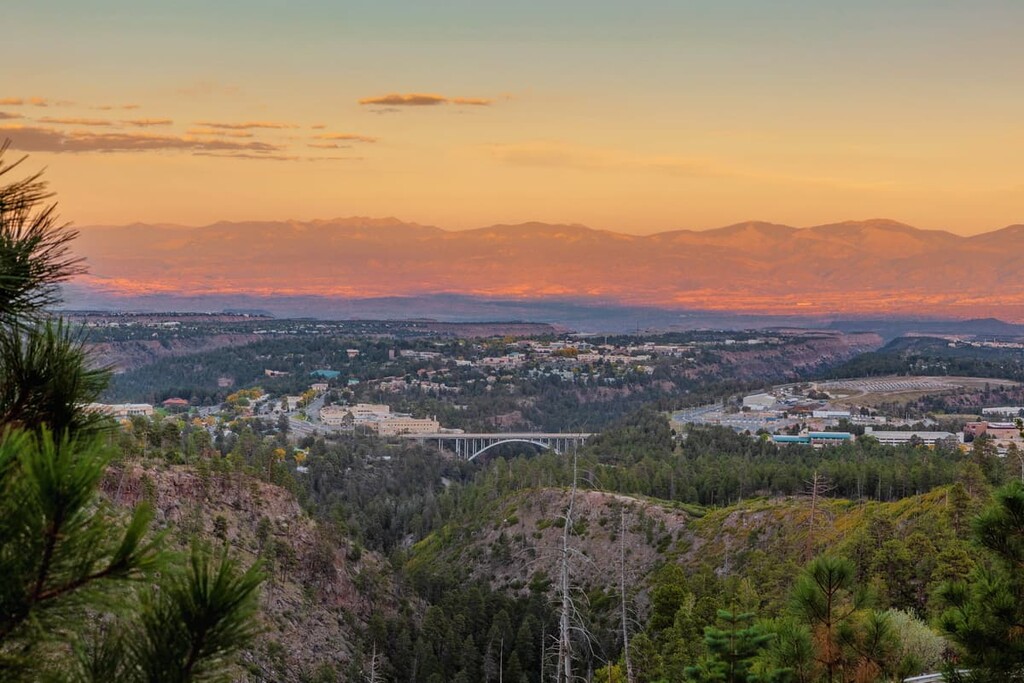
The capital and fourth-largest city in the state of New Mexico, Santa Fe is a community of around 85,000 people located just to the southeast of the Jemez Mountains. It has long been considered one of the country’s foremost art cities, thanks to its superb collection of galleries.
Santa Fe is a bustling metropolitan area with plenty of cultural sites, restaurants, museums, and other attractions to check out. The city is also just a short drive from some of New Mexico’s top outdoor recreation destinations, so it’s a must-visit for all tourists in the region.
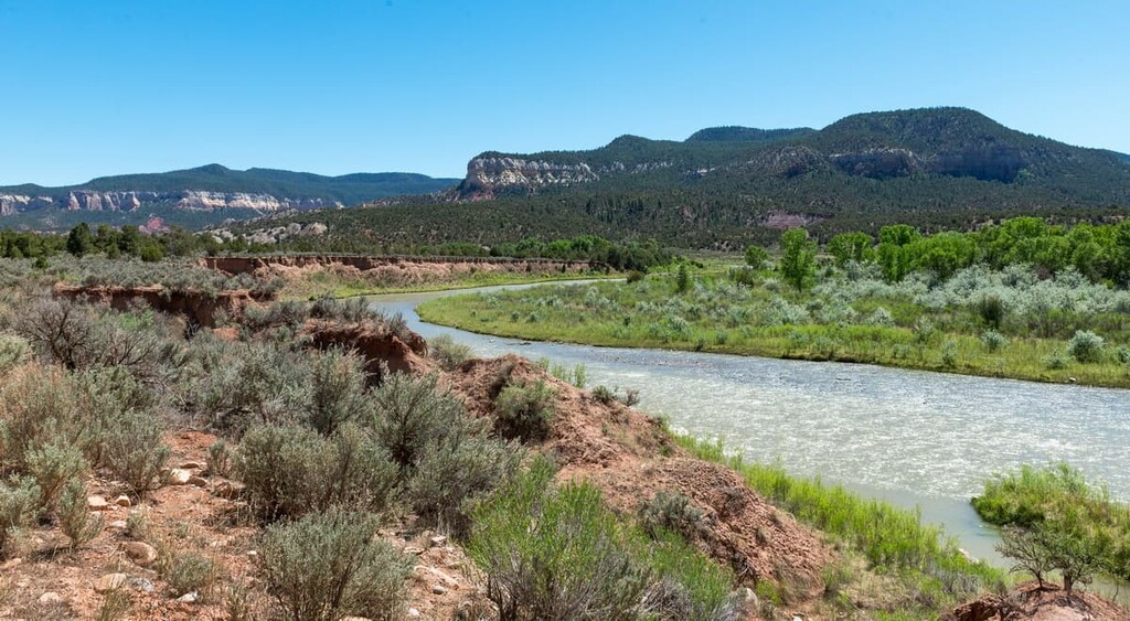
Española is a city of some 10,000 people located to the northeast of the Jemez Mountains in Rio Arriba County. It was actually the first capital for the Kingdom of Santa Fe de Nuevo México during the period of Spanish colonial rule.
The city is now a popular tourist destination due to its many annual festivals. There are also a number of interesting architectural pieces in the city, including a near-replica of a fountain that’s found at the Alhambra in the province of Granada in the autonomous community of Andalusia in Spain.
Situated to the northeast of the Jemez Mountains, Los Alamos is a town of approximately 13,000 residents that’s located on the Pajarito Plateau. The city is arguably best known for being the site of the Manhattan Project during World War II.
Los Alamos is home to the Los Alamos National Laboratory, which remains one of the region’s largest employers. It is also located just outside Valles Caldera National Preserve, so it’s a good place to start ventures into the eastern part of the range.
One of New Mexico’s most beloved mountain towns, Jemez Springs is a community of about 300 people that’s located in the heart of the Jemez Mountains. The town’s beautiful mountain scenery has made it a popular place for spiritual retreats.
Aptly named, Jemez Springs is home to a number of hot springs. It also contains a handful of historic sites and it offers unparalleled access to the recreation areas of the Jemez Mountains.
Home to approximately 230 residents, Abiquiú is a small community located in the northern stretches of the Jemez Mountains. The community is famous for having been the home of artist Georgia O'Keeffe for much of her life. It is still home to the Georgia O'Keeffe Home and Studio, which can normally be visited on a guided tour with advanced reservation.
Although Abiquiú is a small community, it does contain a number of hotels, cafés, restaurants, and shops. It’s also just 1 hour by car from Santa Fe, so it’s the perfect escape from the city if you’re looking to get out and enjoy the wonderful natural landscape of the Jemez Mountains.