Scan the QR code and open PeakVisor on your phone
The Colin Neblett State Wildlife Area is a small protected area located in the northern region of the US state of New Mexico. The rugged and mountainous landscape in the wildlife area is home to 6 named peaks. The tallest peak in the wildlife area is Touch-Me-Not Mountain at 12,044 ft (3,671 m) in elevation and the most prominent peak is Bunkhouse Bare Point with 2,927 ft (892 m) of prominence.
The Colin Neblett State Wildlife Area is located in northern New Mexico. The peaks in the wildlife area are part of the Cimarron Range, a subrange of the Sangre de Cristo Mountains. The wildlife area contains 33,116 acres (13,401 ha) of land and encompasses Cimarron Canyon State Park.
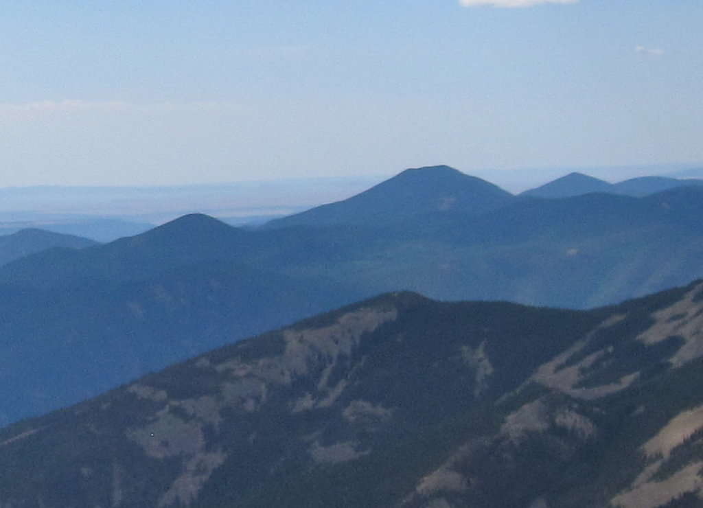
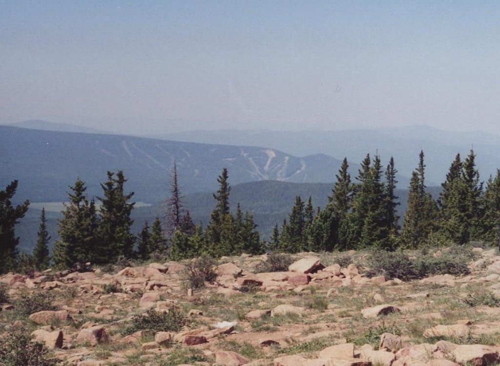
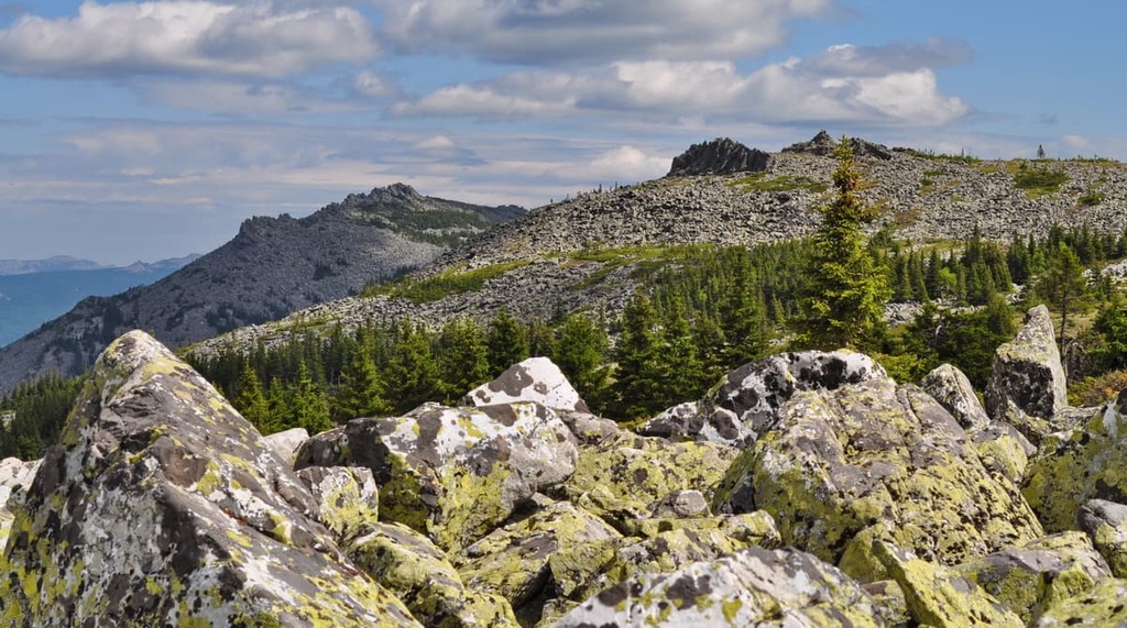
As it is located in the Southern Rocky Mountains, the landscape of the wildlife area is full of steep canyons and rugged forested hills. The high elevation peaks in the wildlife area tower above its narrow canyons while various streams run throughout the region. The most prominent body of water in the wildlife area is the Cimarron River, which is also known as La Flecha.
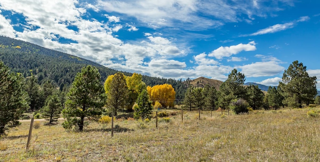
These dramatic changes in elevation have created numerous waterfalls within the park’s scenic landscape. Vast meadows can be found throughout the region and many of them are home to small ponds.
Dense patches of forest cover many of the hillsides in the region while some of the taller peaks and ridgelines in the wildlife area are free of trees. Moreno Valley marks the western border of the wildlife area. Meanwhile, the main massif of the Sangre de Cristo Mountains is located directly to the west.
Other nearby areas of protected land around the Colin Neblett State Wildlife Area include Carson National Forest to the north, south, and west as well as the Wheeler Peak Wilderness, Latir Peak Wilderness, and Columbine-Hondo Wilderness to the west. Philmont Scout Ranch lies directly to the east and south of the wildlife area while Eagle Nest Lake State Park is situated to the west.
The peaks within the Colin Neblett State Wildlife Area are part of the Cimarron Range, a subrange of the Sangre de Cristo Mountains. The Sangre de Cristos are, in turn, the southernmost subrange of the Southern Rocky Mountains.
The Sangre de Cristo Mountains began forming during the Laramide orogeny in the Cenozoic. Widespread uplifts throughout the region slowly formed the peaks within the wildlife area.
That said, the Sangre de Cristo Mountains are one of the youngest ranges in the region, having been uplifted around 20 million years ago. The range is bounded by the Rio Grande rift to the west and a series of reverse and thrust faults to the east.
Gneiss rocks dating back to the Precambrian are some of the oldest rocks found in the region. The peaks in the wildlife area consist primarily of limestones, sandstones, and dolomites.
The region was heavily glaciated throughout the last glacial maximum. These glaciers carved out the landscape, leaving behind the narrow valleys, sweeping meadows, and steep hillsides found throughout the region to this day.
Major peaks within the Colin Neblett State Wildlife Area include Touch-Me-Not Mountain, Bunkhouse Bare Point, Tolby Peak and Comanche Peak.
Since Colin Neblett State Wildlife Area is surrounded by other protected areas, a variety of flora and fauna are able to thrive in the region.
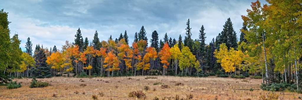
A forested landscape covers much of the wildlife area between the Cimarron River and the region’s rugged ridgelines. Lower elevations in the region are dominated by ponderosa pine and pinyon pine trees.
The mid-elevations in the wildlife area are populated by aspens and conifers while the highest elevation forests are often home to spruce and fir trees. A few of the tallest peaks in the area are free of trees and feature low growing grasses.
Throughout the year, the Colin Neblett State Wildlife Area is home to wildlife such as mule deer, elk, mountain lion, and black bear. Wild turkeys are also common in the region along with a variety of other bird species.
The Cimarron River runs through the region and is a popular fishing destination. Both rainbow and brown trout are stocked in the river and the nearby lake.
Humans have inhabited this region for nearly 11,000 years. The surrounding land marks the traditional territory and homelands of numerous Indigenous tribal nations.
Some of the many Indigneous peoples who consider this region to be part of their ancestral homelands include the Puebloans (particularly the Taos Pueblo), the Jicarilla Apache Nation, and the Ute (Núu-agha-tʉvʉ-pʉ̱). The Pueblo of the Four Corners region migrated to the area around 1,000 years ago.
To the west of the wildlife area, lies the Taos Pueblo. This community is home to one of the oldest continuously inhabited dwellings in all of North America. The surrounding land also marks the historical hunting grounds for the nomadic Ute, Kiowa, and Apache peoples.
During the sixteenth century, Spanish settlers arrived in the region, using the land for livestock grazing and the growing of crops. These settlers acquired the land by forcibly taking it from local tribal nations. Despite tribal resistance, the settlers continued to encroach on their territory.
Following the Mexican War of Independence in 1821, the region was placed under the rule of Mexico. A few decades later in 1848, the region was ceded to the United States as part of the Treaty of Guadalupe Hidalgo.
The Santa Fe Trail passed through this rugged landscape during the mid-1800s. Reaching this portion of trail signified that travelers had just around a week left before they reached Santa Fe.
The land was heavily mined during the late 1800s and early 1900s. A gold rush led even more people to begin settling throughout the region. Today the vast network of protected areas allows for year round outdoor recreation in and around the Colin Neblett State Wildlife Area.
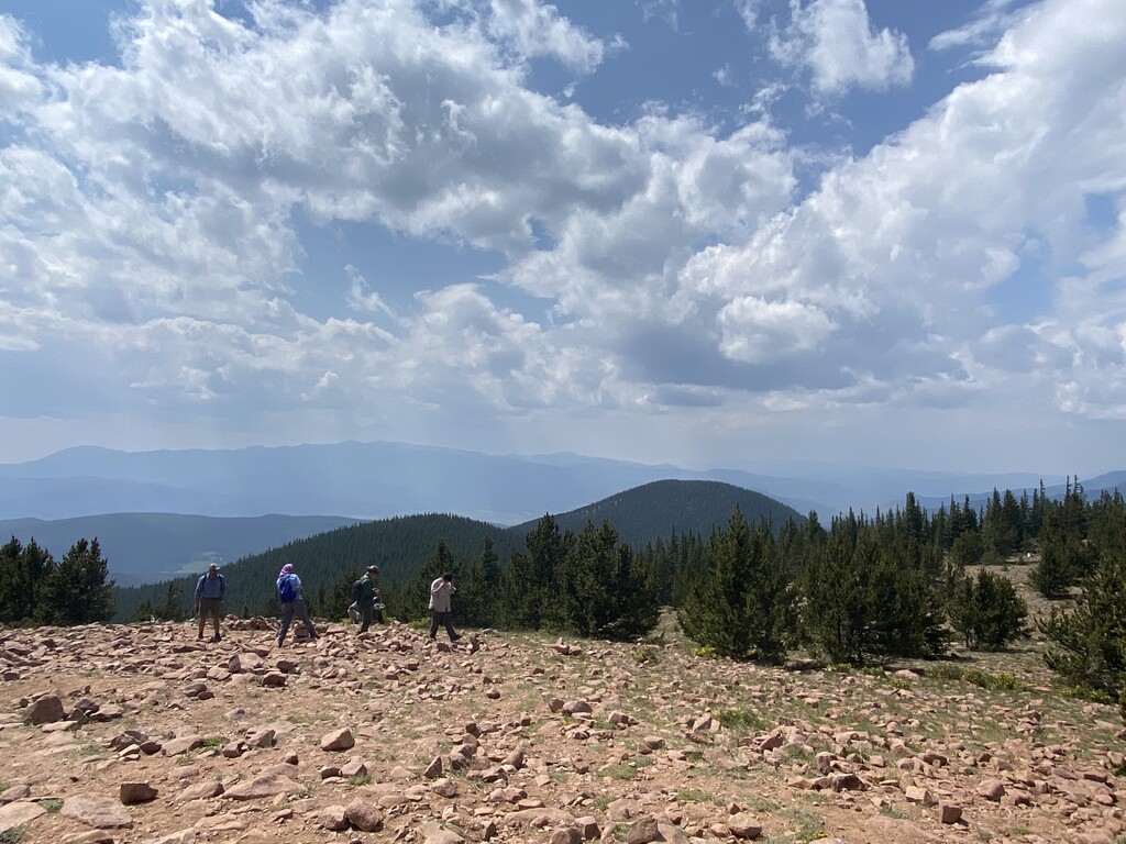
There are numerous day hikes for visitors to enjoy throughout the wildlife area. A majority of the land is only accessible by off-trail exploring. Those entering the region should be able to navigate without a designated trail. Here are some of the most popular hiking areas in the region:
The Clear Creek Trail is the most popular and well-established trail in the region. This out-and-back route is 4.1 miles (6.6 km) long and features 1,043 feet (318 m) of elevation gain.
Thos trail follows along Clear Creek as it winds its way through the forested landscape. Along this route, hikers can also see a number of small waterfalls. At higher elevations, the trees begin to thin, offering views of surrounding forested hillsides.
The Tolby Creek Trail to Mount Phillips begins near Eagle Nest Lake before traveling south into the wildlife area. The route is 18 miles (29 km) long with 4,081 ft (1,244 m) of elevation gain. This trail can be completed over the course of one day or it can be used for backpacking.
After climbing through the forested landscape and passing through sweeping meadows, hikers are rewarded with panoramic views of the region at the summit of Mount Phillips. To the northwest of Mount Phillips lies Eagle Nest Lake and the Moreno Valley.
Looking for a place to stay near Colin Neblett State Wildlife Area? Here are some of the best cities and villages to check out in the region:
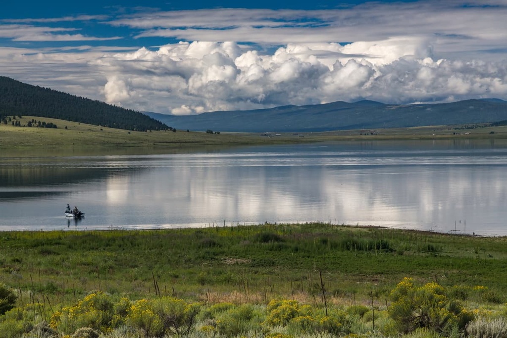
Eagle Nest lies directly to the west of the wildlife area. It is surrounded by Carson National Forest and the Philmont Scout Ranch. The town is home to around 300 residents, and it is located in a quaint setting surrounded by rugged wilderness. The Eagle Nest Lake State Park lies on the southern edge of the town and is known for its pristine fishing.
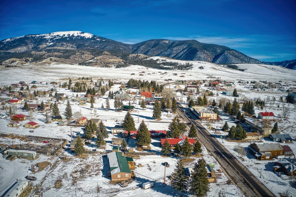
Eagle Nest is located near Angel Fire, Red River, and the Taos ski areas. Some of the trails in the region can also be used for snowshoeing. The small downtown area of Eagle Nest is lined with a few local shops and restaurants. Each year, the town hosts a wildlife preservation event that’s known as the Bear Benefit.
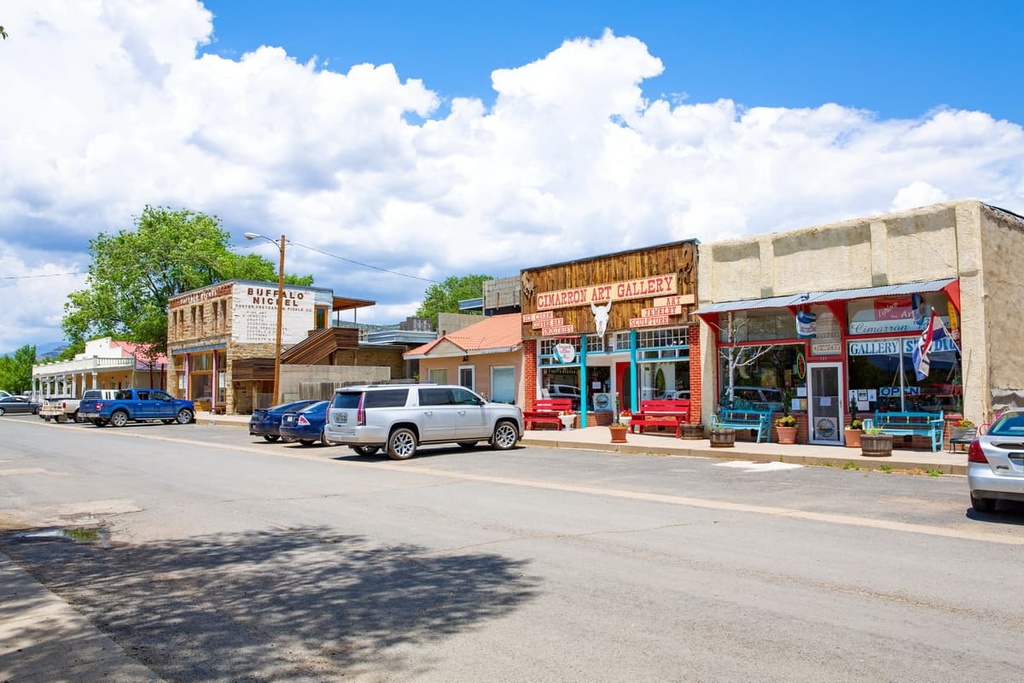
Cimarorn is a town that lies to the east of the wildlife area in the eastern foothills of the Sangre de Cristo Mountains. The town has a population of around 1,000 residents and is situated along the Cimarron River. Numerous ranches surround this historic town whose motto is “where the west is still wild.”
There are a number of historic buildings that can be found throughout Cimarron. A walking tour of the city showcases the Kit Carson Museum, Historic Chase Ranch, and the Old Mill Museum. While the mountains lie directly to the west of the Cimarron, to the east, you’ll find the vast prairie lands of northern New Mexico.
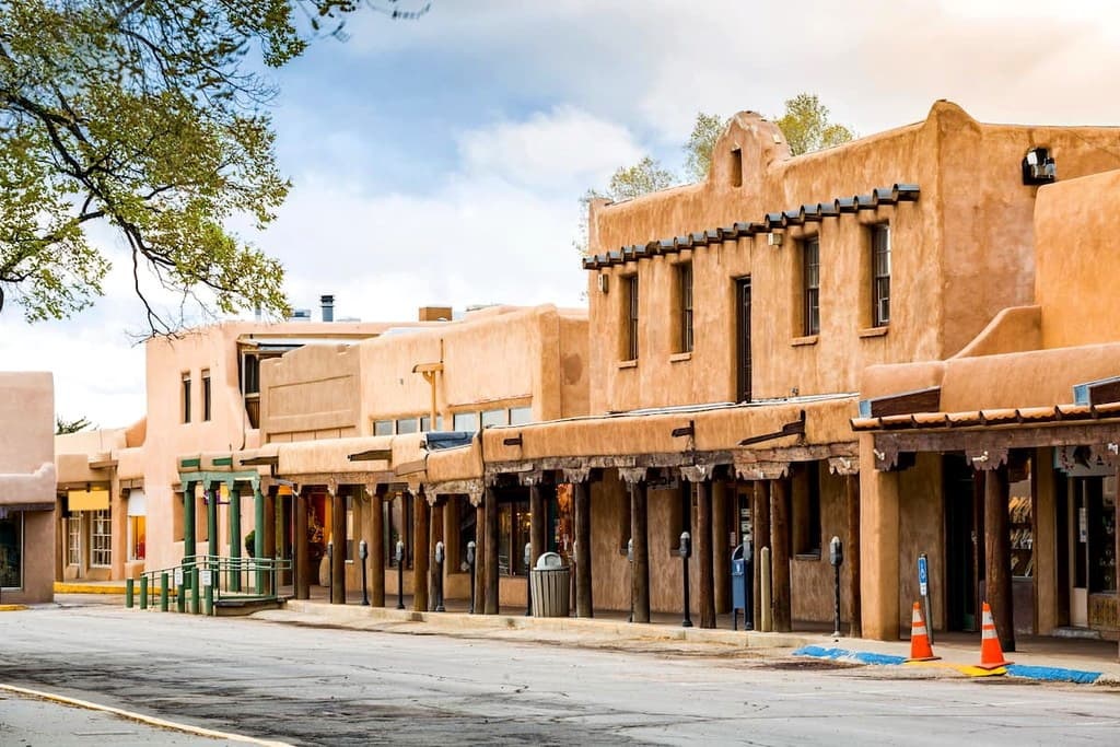
Taos lies in the western foothills of the Sangre de Cristo Mountains, just to the west of the wildlife area. The town has a population of around 6,000 people, and it is located close to the Taos Ski Valley.
Just a short drive from Taos lies the Taos Pueblo World Heritage Site. This site marks one of the oldest continuously inhabited communities in the present-day United States and it is a testament to the extensive human history of the region.
Taos also features multiple historic buildings as well as numerous cultural heritage sites. In the town center lies the iconic St. Francisco de Asis church. As the most populated town in the region, Taos is also a hub for exploring northern New Mexico.