Scan the QR code and open PeakVisor on your phone
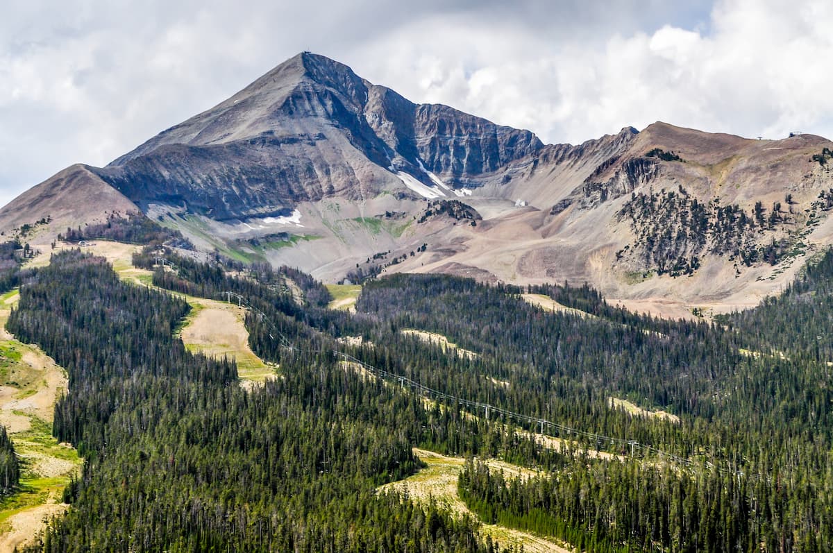
Known for its sprawling alpine terrain, rugged peaks, and diverse ecosystems, Custer-Gallatin National Forest is a federally managed outdoor recreation area located in the south-central and southeastern parts of the US state of Montana and the extreme northwestern part of the state of South Dakota. The forest contains 172 named mountains, the highest and most prominent of which is Crazy Peak (11,211 ft/3,417 m)—the most prominent peak in the state.

Custer-Gallatin National Forest is primarily situated in the south-central part of the US state of Montana. However, portions of the Custer National Forest are located in the southeastern part of Montana and the extreme northwestern part of South Dakota.
The two forests have been administratively joined since 2014 and they are headquartered in the city of Bozeman. A sizable portion of the forests are located along Montana’s border with Wyoming while other parts of the forests border Idaho and South Dakota.
Due to the fact that the Custer-Gallatin National Forest consists of a number of non-contiguous units, the forest is located in a large number of counties. This includes parts of Meagher, Carbon, Madison, Sweet Grass, Park, Powder River, Stillwater, Carter, Rosebud, and Gallatin counties in Montana and Harding in South Dakota.
Gallatin National Forest encompasses a total of 1.8 million acres (728,400 ha) of land, making it just slightly smaller than San Juan and Coconino national forests in Colorado and Arizona, respectively.
Meanwhile, Custer National Forest contains 1.2 million acres (485,600 ha) of land, which makes it just slightly smaller than the Black Hills and Plumas national forests in South Dakota/Wyoming, and California, respectively.
The Custer-Gallatin National Forest contains parts of two federal wilderness areas: the massive Absaroka-Beartooth Wilderness and the Lee Metcalf Wilderness.
Furthermore, the Gallatin National Forest is located close to a number of other areas of public land. This includes the Beaverhead-Deerlodge National Forest to the west and both the Helena and Lewis and Clark national forests to the north. Custer National Forest is also located in close proximity to the Bighorn Canyon National Recreation Area, the Bighorn National Forest, and the Black Hills National Forest.
To the south of both the Custer and Gallatin National Forests is Yellowstone National Park in Wyoming. Also located to the south is the North Absaroka Wilderness, which is part of the Shoshone National Forest, and the rest of the Absaroka-Beartooth Wilderness.
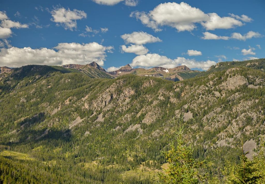
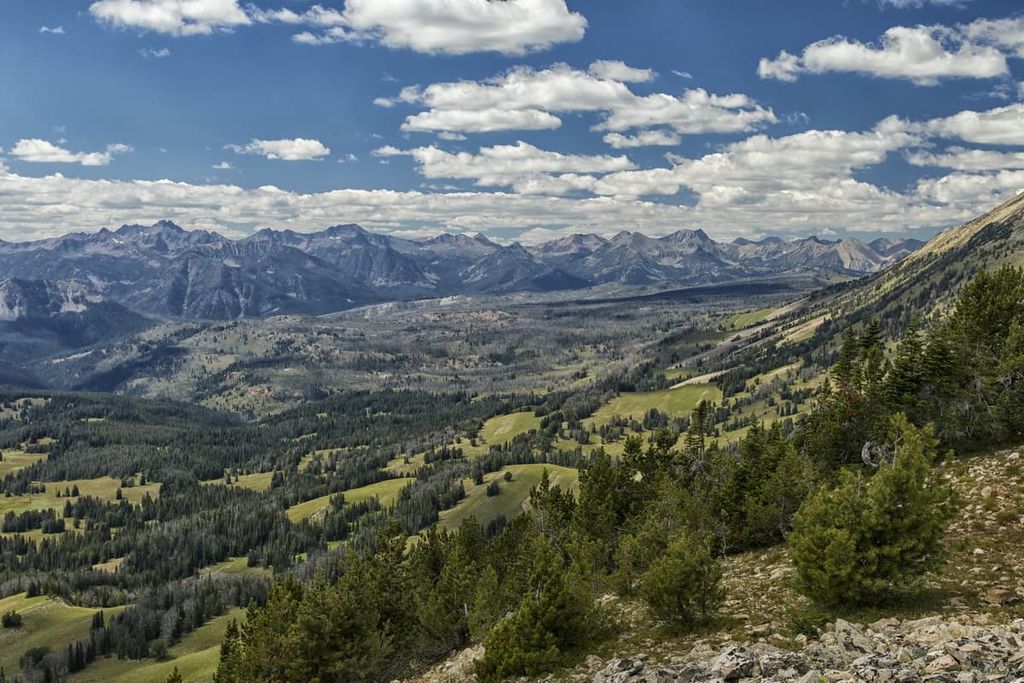
The geology of Custer-Gallatin National Forest is varied and complex. Indeed, the peaks within the forests are part of the Central Montana Rocky Mountains and the Greater Yellowstone Rockies, which are two major ranges within the greater Rocky Mountains that stretch from New Mexico to the province of British Columbia in Canada.
Within the Central Montana Rocky Mountains and the Greater Yellowstone Rockies, there are dozens of named subranges. The primary subranges found within the Custer-Gallatin National Forest are:
Although there are unique geological aspects to all of these subranges, the Rocky Mountains themselves primarily started to form during the Laramide orogeny.
The Laramide orogeny was a major mountain building event that took place between about 80 to 55 million years ago as a result of the subduction of a number of smaller plates under the North American plate. This coincided both geographically and temporally with the Sevier orogeny, though the Sevier orogeny was predominantly responsible for creating mountain ranges toward the western edge of North America.
Furthermore, the rocks within the Custer-Gallatin National Forest vary widely with respect to their age, origin, and composition.
Some subranges within the forest, such as the Crazy Mountains, contain a massive igneous intrusion that consists mostly of diorite, gabbro, and quartz. Other subranges, such as the Gallatin Range, contain a core of ancient gneisses that date back more than 2.7 billion years, that is overlain by layers of sandstones, shales, and limestones.
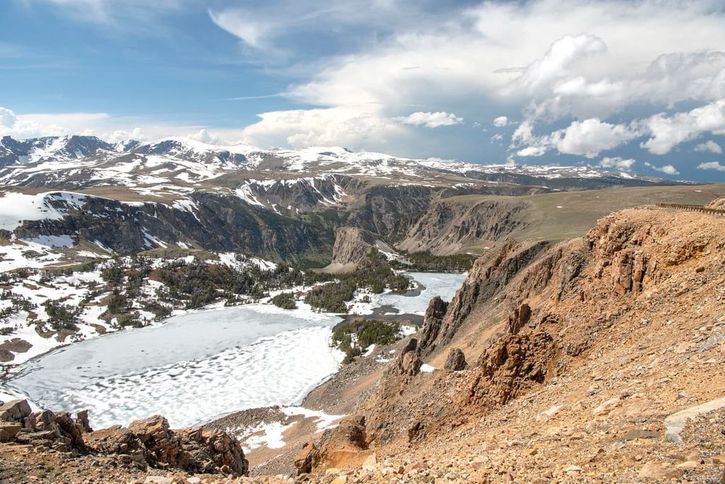
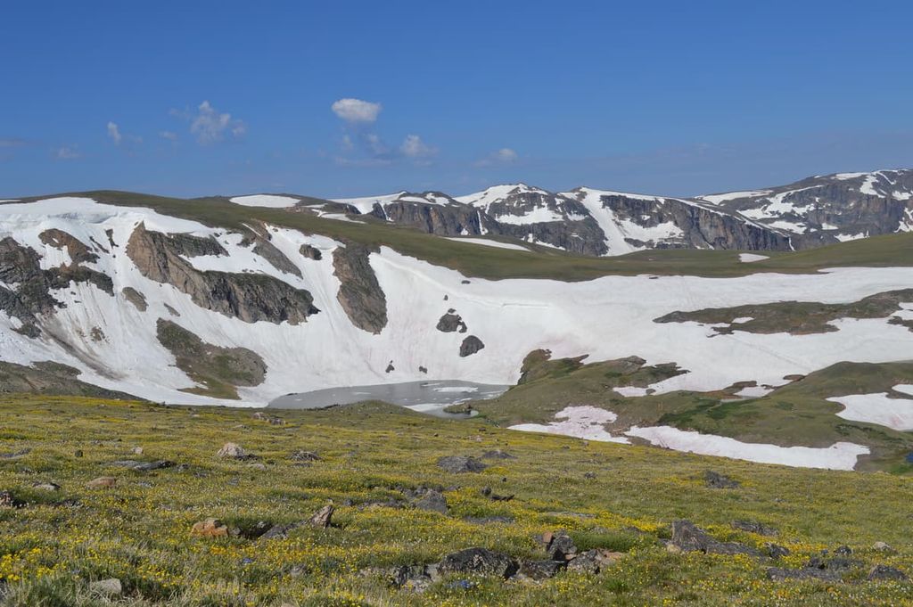
Furthermore, parts of the Custer-Gallatin National Forest are covered by glacial ice. There are approximately 400 glaciers within the Beartooth and Absaroka ranges, alone, and some additional glaciers and snowfields in the Crazy Mountains and the Madison Range.
These glaciers and snowfields are remnants of a much larger ice sheet that once covered much of northern North America. As it retreated, this ice sheet carved out many of the landforms that we see in the range to this day.
Major peaks in the forest include Crazy Peak, Lone Mountain, Emigrant Peak, Sacagawea Peak, Sheep Mountain, and Sage Peak.
Thanks to its vast territory and diversity of landscapes, Custer-Gallatin National Forest is home to a great assortment of different flora and fauna.
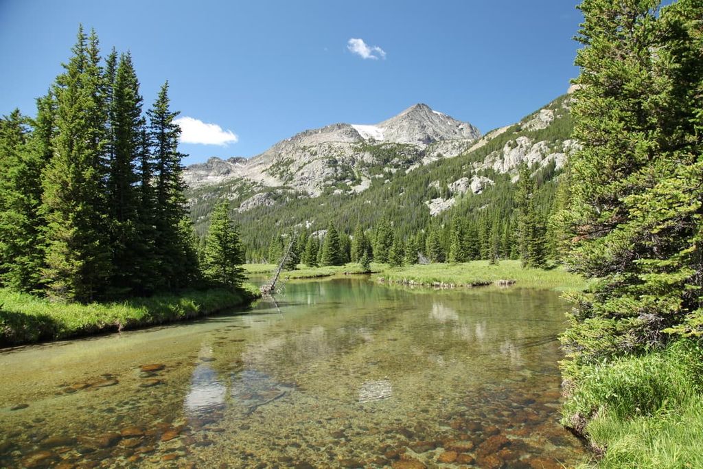
Much of the Gallatin National Forest is actually part of the Greater Yellowstone Ecosystem, which is one of the most biodiverse areas in the Rockies. In the Gallatin National Forest, the lowest elevations are usually dominated by sagebrushes and grasses that transition into forests of Douglas fir, aspen, cottonwood, and spruce.
Meanwhile, in the Custer National Forest, the ecology of the region varies widely depending on precisely where you are in the forest itself. Toward the western part of the forest, the land is home to dense stands of fir, spruce, and pine trees. The eastern part of the forest gradually gives way to the grasslands that dominate the Great Plains.
Wildlife in the Custer-Gallatin National Forest is also abundant. There are hundreds of animal species that call the forest home, including bison, bobcat, moose, elk, mule deer, pronghorn, bighorn sheep, mountain goats, mountain lions, and grey wolves. There are also both black bears and grizzly bears in the forest. Prominent bird species in the region include the peregrine falcon, bald eagle, and merlin.
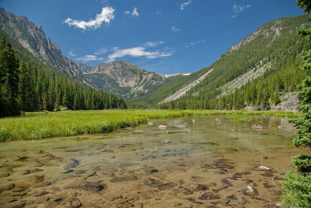
Furthermore, the waters of the Custer-Gallatin National Forest are particularly popular amongst anglers. Some of the many fish found in the forests’ rivers and lakes include book, rainbow, and cutthroat trout.
Humans have lived in the land that is now called Custer-Gallatin National Forest since time immemorial. Some of the many tribal nations that consider the region to be part of their ancestral homelands include the Blackfeet Nation, Crow Tribe (Apsaalooké), Confederated Salish and Kootenai Tribes, Nez Perce Tribe, Northern Cheyenne Tribe, Očhéthi Šakówiŋ (Sioux), and the Mandan, Hidatsa, and Arikara Nation.
The first peoples of European descent to have traveled through what is now Custer-Gallatin National Forest were likely French and French-Canadian fur traders. Furthermore, the Lewis and Clark Expedition of 1803 to 1805 passed through the region on their return journey. Technically, it was just Clark’s team that ventured through the southern part of what is now Montana as Lewis’ group decided to venture further down the Marias River.
The region around what is now Custer-Gallatin National Forest became particularly popular among Americans of European descent in the late 1800s. Around this time, John Bozeman started encouraging people to take a spur trail off the Oregon Trail that led to the mining activity at Virginia City.
By 1864, Bozeman had established the town of Bozeman, which soon became a hub for cattle ranching. The town grew rapidly after the arrival of the Northern Pacific Railway in 1883, bringing even more people to the area. The establishment of Montana State University in 1893 also made nearby Bozeman a hub for the region.
However, as a result of this influx of residents, the land around the town of Bozeman became heavily farmed. After the formation of Yellowstone National Park in the late nineteenth century, US Congress also passed the Forest Reserve Act. This allowed the president to set aside forest reserves, such as the Yellowstone Park Timberland Reserve, to promote conservation and sustainable forest management.
Gallatin National Forest was actually first designated in 1899, making it one of the oldest national forests in the country. It was named for Albert Gallatin, a Swiss-born politician and linguist who was also the US Secretary of the Treasury.
Custer National Forest is the slightly younger of the two, having been first designated in 1907 as Otter National Forest. It then became Custer National Forest in 1908. In 1920, Custer National Forest acquired the lands in Sioux National Forest. Later, in 1932, it also acquired the lands of the Beartooth National Forest.
Finally, in 2014, the two forests were administratively merged to create the Custer-Gallatin National Forest. Together, the two forests contain some of the most popular hiking and recreation areas in all of Montana.
There are thousands of miles of hiking trails to enjoy in the Custer-Gallatin National Forest. Here are some of the best hikes to check out during your next trip:
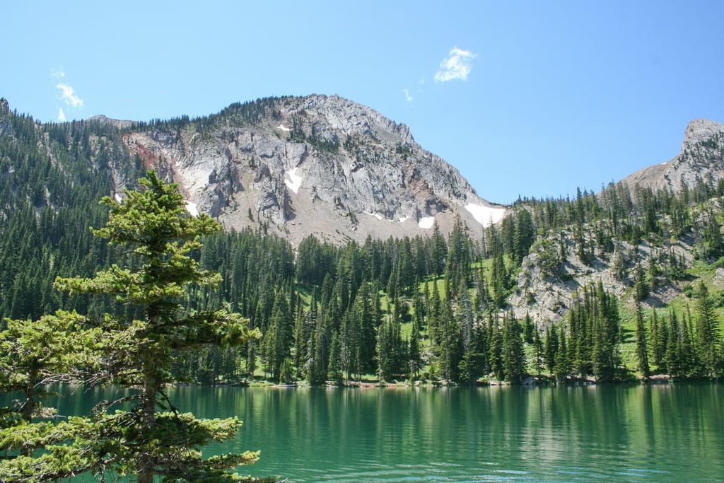
The Lava Lake Trail is one of the most popular hikes in the Bozeman area. This 6 mile (9.7 km) round-trip hike starts at the Lava Lake Trailhead and then climbs up to a beautiful alpine lake in the Lee Metcalf Wilderness.
The trail itself is fairly gradual, though it steadily gains elevation as it makes its way into the alpine. At the lake, you can sit back and relax as you take in the views of the surrounding mountainscape. Alternatively, the anglers among us can enjoy some of the best fly fishing in the area.
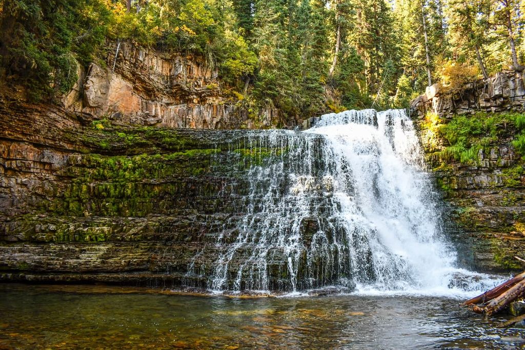
The Ousel Falls Park Trail is a 1.6 mile (2.6 km) round-trip hike that brings visitors to see the stunning Ousel Falls. Located in the heart of Big Sky, the trail wanders its way along the Gallatin River before reaching the falls.
The bulk of the trail is relatively moderate as it gains a modest amount of elevation to the falls. Additionally, the Ousel Falls Park Trail makes for a nice walk on hot summer days because the dense forest cover helps keep conditions cool along the path. At the same time, it’s also a popular winter hike, so long as you bring either snowshoes or microspikes.
The trail to Storm Castle Peak is approximately 5 miles (8 km) long. It starts at a trailhead that’s just 30 minutes outside of Bozeman and it offers superb views of the surrounding region.
Starting off from the trailhead, this trail immediately starts heading up switchbacks as it makes its way up to a series of limestone bluffs. Eventually, you’ll be treated to views of the entire Gallatin Range and the Gallatin Valley. Most people find that they can complete this hike in about 3 to 5 hours, so it’s the perfect short day trip into the Custer-Gallatin National Forest.
Sacagawea Peak is one of the most notable summits in Custer-Gallatin National Forest. Summiting the peak is a popular adventure for keen hikers as it requires just a 4.2 mile (6.6 km) out-and-back trail.
This hike follows the Sacagawea Pass Trail (#518) through the forest until it reaches the Bridger Divide. From here, you’ll take the Corbly Gulch Trail (#544) or the Bridger Ridge Trail (#513). If you want more mileage for the day, try the Corbly Gulch Trail, otherwise stick to the Bridger Ridge Trail for a more direct route to the summit.
Once you’re at the summit of Sacagawea Peak, you’ll get some of the best views of the Tobacco Root Mountains. If you’re lucky, you may also see some mountain goats, which are known to frequent this part of the Forest.
Another fan-favorite, the hike to Baldy Mountain is a great option for anyone looking for a longer day hike in the Custer-Gallatin National Forest. This 10.9 mile (17.5 km) hike to the summit of Baldy Mountain involves almost 4,000 feet (1,219 m) of climbing from the floor of Gallatin Valley, so it’s not for the faint of heart.
There are a number of ways to summit Baldy Mountain, though many people take the College M Trail (#511) until it connects with the Bridger Ridge Trail (#513). This trail will take you to the summit of Baldy Mountain where you can take in the views of the Gallatin Range.
Looking for a place to stay near Custer-Gallatin National Forest? Here are some of the best cities to check out in the region:
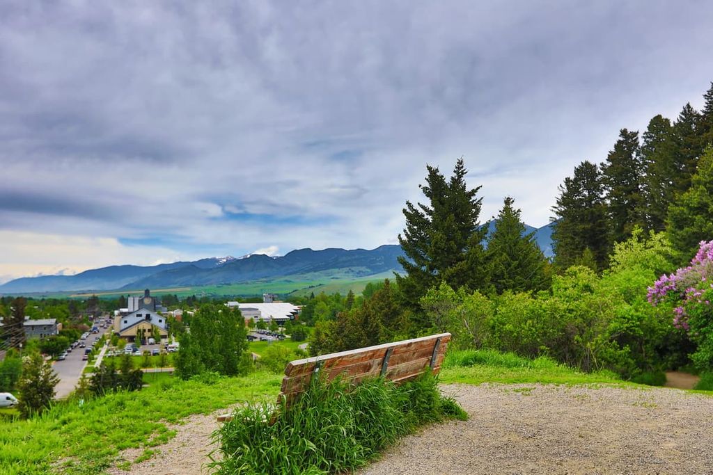
The city of Bozeman is located just outside the westernmost boundary of Custer-Gallatin National Forest. It is the fourth-largest city in the state of Montana with a population of about 53,000 people. However, it is one of the fastest growing cities in the region, so it may soon become one of Montana’s largest metropolitan areas.
Either way, Bozeman is a haven for outdoor recreation due to its close proximity to a number of major areas of public land. The city is within driving distance of Yellowstone National Park and it offers superb skiing opportunities in the winter months.
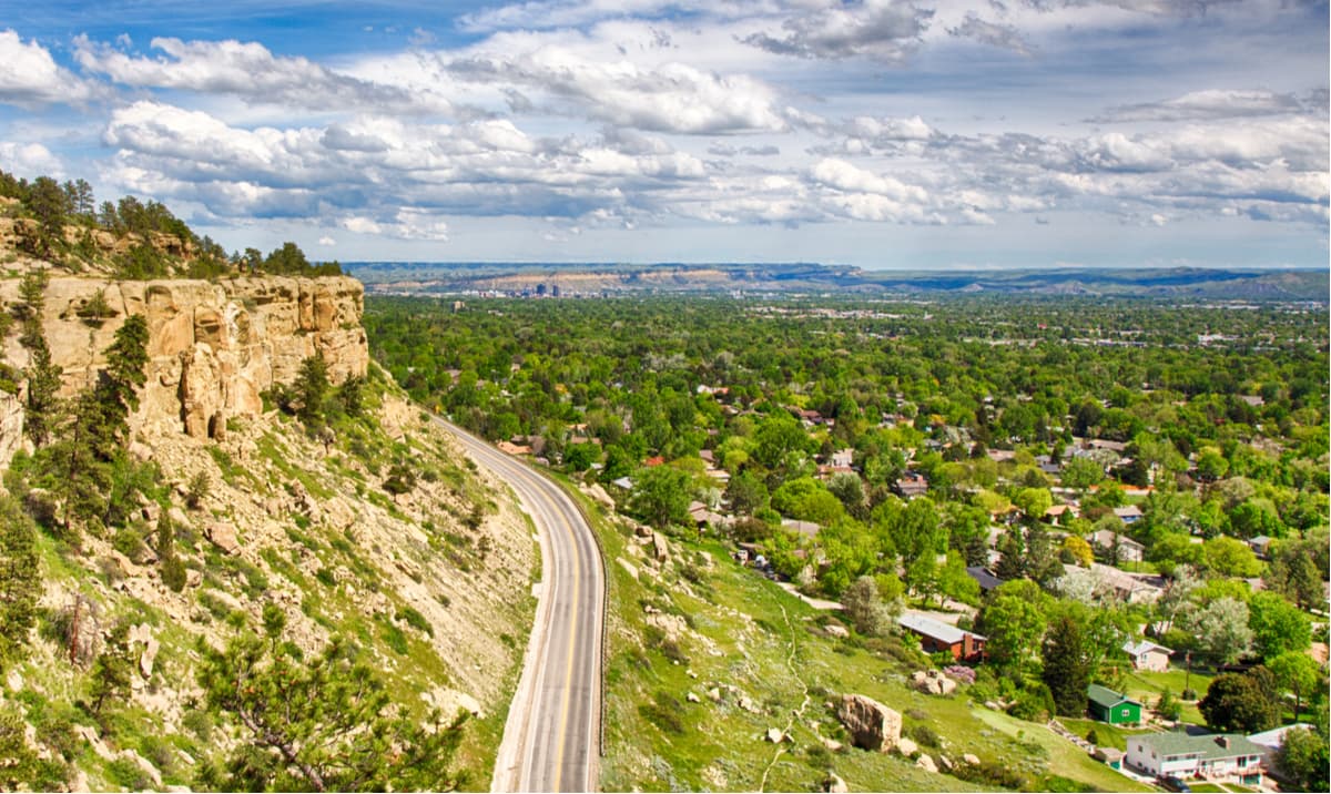
The largest city in Montana, Billings is situated to the north and east of Custer-Gallatin National Forest along Interstate 90. It is home to around 120,000 residents and its strong economy is poised to see even more population growth in the coming years.
Billings is also home to Montana State University Billings as well as an assortment of great cultural and recreation sites. There are a number of museums within the city and it is just a short drive from the Bighorn Canyon National Recreation Area.
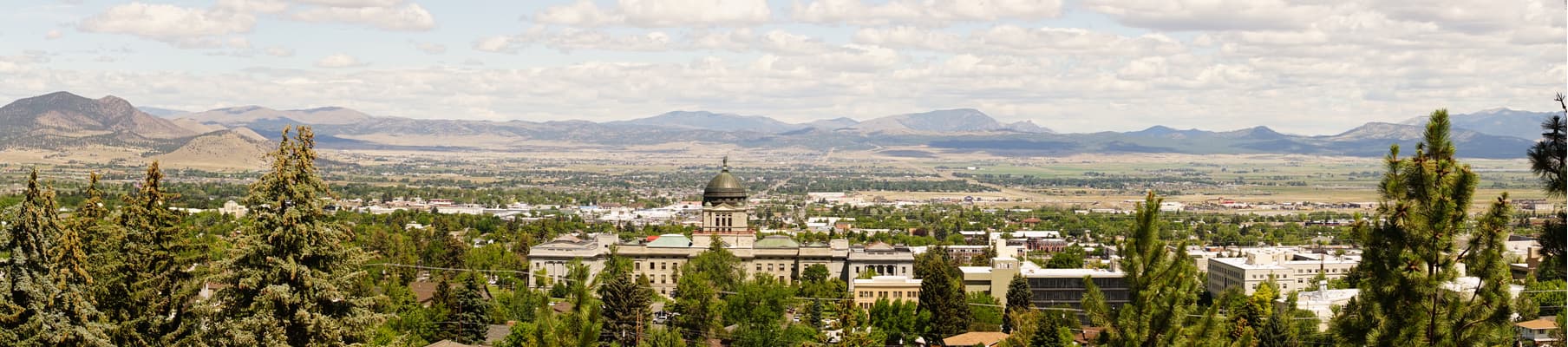
Helena is the capital and sixth most populous city in Montana. Interestingly, with only 32,000 residents, Helena is one of the least populous capital cities in the US, alongside Monteplier in Vermont, Pierre in South Dakota, Augusta in Maine, Frankfort in Kentucky, and Juneau in Alaska.
Nowadays, Helena is a great place to stop if you’re traveling around Montana. Its location on Interstate 15 makes it easy to get to from many of the most popular hiking areas in western Montana and it is within a reasonable drive of other major cities, like Great Falls, Butte, and MIssoula.