Scan the QR code and open PeakVisor on your phone
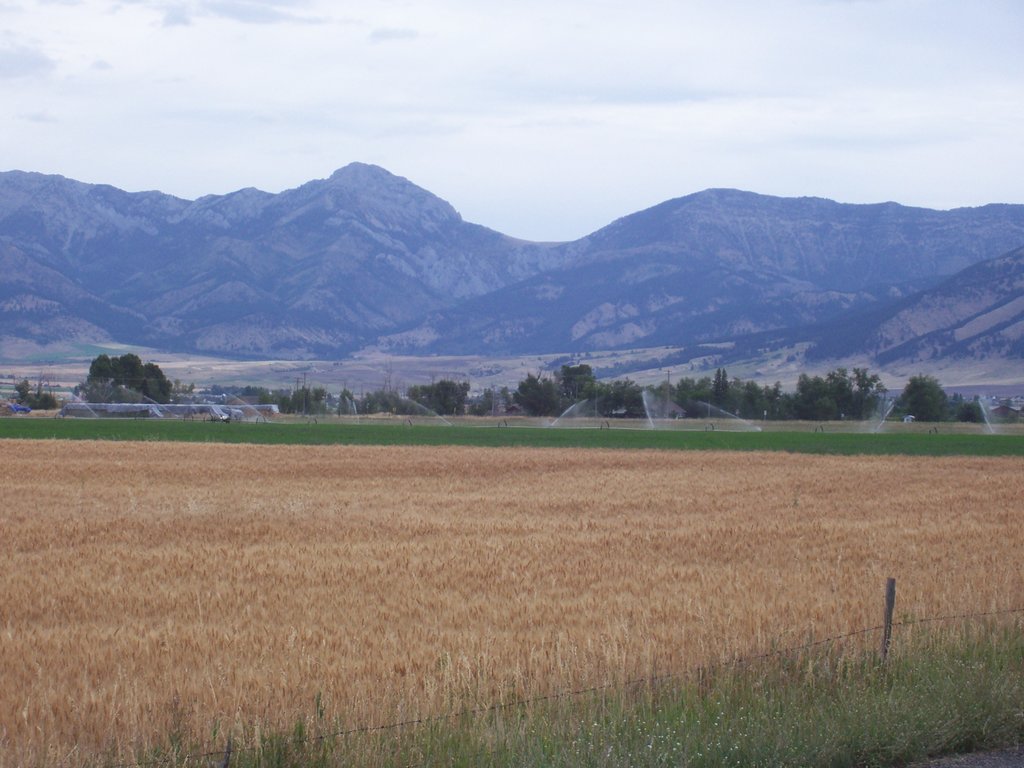
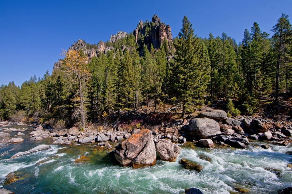
Located in the southwestern part of the US state of Montana, Gallatin County features a scenic and diverse landscape with many notable summits to pursue. The county is home to the Gallatin Range, Bridger Range, and the Spanish Peaks of the Madison Range. There are 121 named mountains in Gallatin County, the highest of which is Wilson Peak (10,696 ft/3,260 m) and the most prominent of which is Sacagawea Peak (9,596 ft/2,925 m).
Gallatin County contains 2,632 sq. mi (6,820 sq. km) of beautiful river valleys and rocky canyons framed by rugged mountain ranges in the southwestern part of the US state of Montana. The sprawling Gallatin Valley is flanked by the Bridger Range to the northeast and the Gallatin Range to the southwest.
Custer Gallatin National Forest is easily accessible from Gallatin County and is a prized area for recreational activities such as hiking, biking, hunting, horseback riding, off-roading, backcountry skiing, mountaineering, rock climbing, and more. The forest spans over 3.1 million acres (1.3 million ha) and includes parts of the Absaroka-Beartooth Wilderness and Lee Metcalf Wilderness.
Adding to the immense number of outdoor activities, Custer Gallatin National Forest is also home to Bridger Bowl Ski Area, and it borders much of Big Sky Resort in the Madison Range.
One of the most geologically unique spots in this region is the headwaters of the Missouri River, which is the United States’ longest river at 2,341 mi (3,768 km) in length. The mighty Missouri features a number of tributaries, including the Jefferson, Madison, and Gallatin rivers, all of which converge at the town of Three Forks.
The Yellowstone River is a major tributary of the Missouri and flows only 50 mi (80 km) from the river’s headwaters. Although close in distance, the two rivers are separated by mountains and the Yellowstone does not converge with Missouri for another 600 mi (965 km).
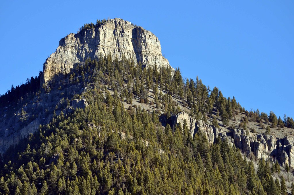
The geology in Gallatin County is quite similar across the Gallatin Range, Bridger Range, and the Spanish Peaks of the Madison Range. At their center, the massive peaks of the Gallatin Range are made up of Archean-aged gneisses that date back 3.8 to 2.7 billion years. Meanwhile, the range’s outer layer is primarily crumbling limestones, shales, and sandstones.
Within the county, the primary rock formations include everything from Archean (more than 2.5 billion years old) metamorphic rocks to Proterozoic conglomerates (approximately 1.4 billion years old). The youngest Paleozoic sedimentary rocks in the county were deposited in the shallow seas that once covered this area approximately 540 to 100 million years ago.
The formation of the Rocky Mountains was caused by the Laramide orogeny, which was a series of mountain-building events in the western part of the US and Canada. The events occurred in the Late Cretaceous, between 80 to 55 million years ago during a period of subduction between the North American tectonic plate and other smaller plates in the region.
Not far from Gallatin County is the concentration of nearly half of the world’s active geysers. This geothermal area is one of the most protected places on earth and mostly exists within the boundaries of Yellowstone National Park.
Gallatin County is well-known for its ecological diversity. It is part of the Greater Yellowstone Ecosystem (GYE), which is noted as the largest intact temperate-zone ecosystem in the world. The vast reaches of the GYE are teeming with wildlife, vegetation, hydrothermal features, lakes and some of America’s most pristine rivers.
The GYE is roughly 22 million acres (8.9 million ha) in size. Although ever-changing, this vast space gives the region’s abundant wildlife population an opportunity to thrive.
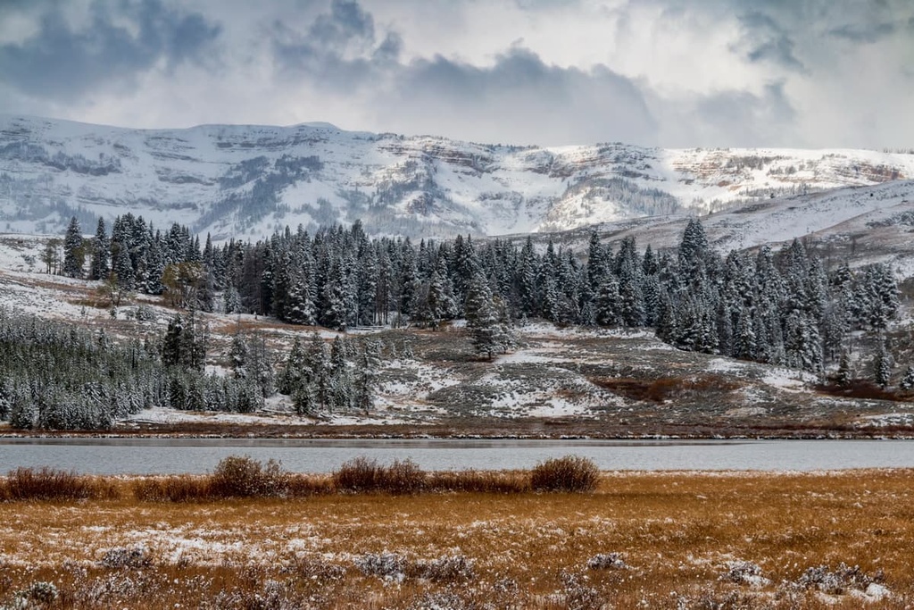
The lower elevations in Gallatin Country are predominantly grasslands that feature sagebrush and a mixture of cottonwood and willow along the rivers. When hiking along the sprawling foothills of the mountains, Douglas fir and aspen forests become more prevalent.
Thick forests of Engelmann spruce, subalpine fir, limber pine, lodgepole pine, and the struggling whitebark pine typically line the entry to alpine zones in Gallatin County. While the alpine landscape maintains a surprisingly diverse assortment of graminoid turf, cushion plants, and snowbank vegetation.
The exceptional amount of flora in the region contributes to an area with dense wildlife populations in the county. Gallatin county is home to grizzly bears, black bears, coyotes, red foxes, mountain lions, bobcats, lynx, wolverines, wolves, elk, moose, white-tail and mule deer, pronghorn antelope, bighorn sheep, and mountain goats.
The first known humans in the area that is now called Montana are thought to be people of the Clovis culture, who entered this area approximately 12,000 years ago before moving through North America in an endless search for game and plants to survive on.
The Gallatin Valley and the surrounding mountain ranges were not historically a particularly popular permanent abode for Indigneous peoples. That said, Gallatin County is the primarily the traditional territory of the Blackfeet Nation, but it has also been home to the Shoshone, Nez Perce, Flathead, Crow, and Bannock tribes.
Many tribal nations historically traveled through what is now Gallatin County en route to the bountiful hunting grounds of Yellowstone or the trapping grounds of the Snake River Plains.
The first Europeans most likely entered the Gallatin Valley, called “The Valley Of Flowers” by many local tribes, in the early eighteenth century to harvest fur-bearing animals. William Clark was one of the first White men to visit and write of the valley during the famous 1804–1806 Lewis and Clark Expedition.
The area wasn’t a popular destination for US settlers until the mid-nineteenth century when gold was discovered 60 miles (96 km) to the west near present day Virginia City, Montana. This fueled the need for an established trail, a project that was spearheaded by John Bozeman.
A procession of people followed the trail in search of gold, but many, disappointed by the reality that gold mining is not easy, decided to settle in the Gallatin Valley to farm or take up other ventures. This was the start of the major city that’s now called Bozeman.
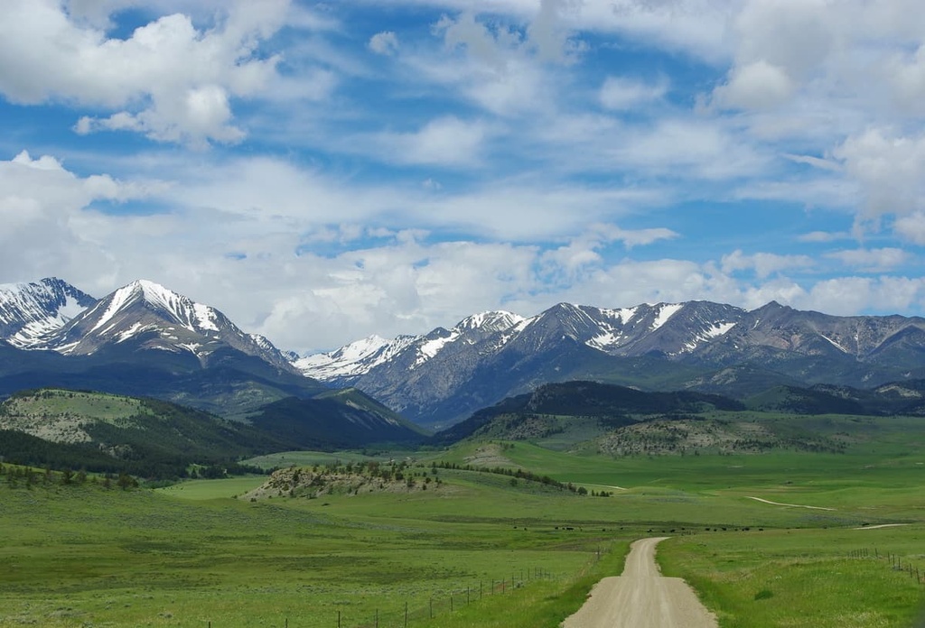
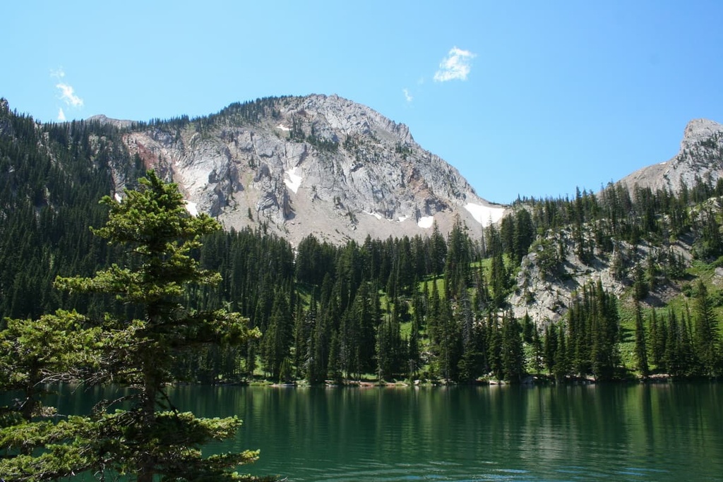
The hiking opportunities in and around Gallatin County could be considered some of the best in the country due to the extensive and seemingly endless amount of public land in the region. Some of the best trails in the county are located within the Custer Gallatin National Forest.
For trails that are more secluded and remote, the Lee Metcalf Wilderness or the Hyalite-Porcupine-Buffalo Horn Wilderness Study Area make for a perfect destination. Here are some specific trails to consider:
Gallatin County is also home to a number of ski resorts. Here are two of the best ski areas to check out in the county.
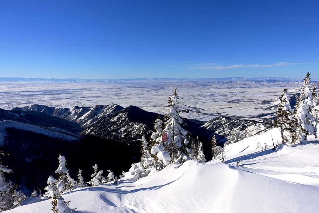
Located within a one-hour scenic drive from Bozeman, Montana, skiers and riders can experience the epic terrain at Big Sky Resort. With 5,850 acres (2,370 ha) of skiable terrain, it’s no wonder why Big Sky Resort is called “The Biggest Skiing in America.”
Located just over the border of Gallatin County in the Madison Range, Big Sky Resort has ample terrain for all experience levels and 39 lifts to choose from in peak season. It’s easy to spend full days exploring the mountain with 300 named runs—one of which spans an impressive 6 miles (9.7 km).
Bozeman’s backyard has a local gem, and it’s Bridger Bowl. Located just 20 miles from downtown through Bridger Canyon, this local ski area boasts 2,000 acres of skiable terrain and over 75 runs. In addition to its legendary powder days, Bridger Bowl is a venue for many of the community’s favorite winter events including the Annual Torchlight Parade and the Dirt Bag Ball.
Towns in Montana aren’t known for their sprawling metropolises, and that’s part of the charm. The towns in Gallatin County take pride in having friendly and inviting communities, outdoor recreation opportunities, and beautiful landscapes. These are some of the best cities and towns to visit in the county.
When exploring Gallatin County, Bozeman is the perfect basecamp for your outdoor adventures. The population of Bozeman is around 53,000 people, so the city is home to a sizable percentage of the 122,000 people that live in Gallatin County.
The bustling Bozeman Yellowstone International Airport makes getting to Bozeman a breeze, too, as it offers direct flights to many major cities. There are a variety of transportation options in town that range from high-class professional limo services to the free public bus system for you to use while you’re in Bozeman.
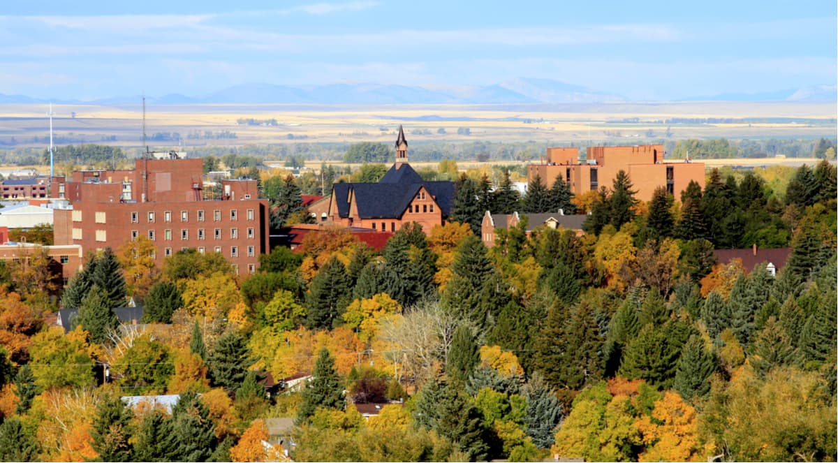
The lodging options in the area are equally as diverse. Choose from cozy rental cabins, luxury hotels, mountain lodges, or camping close by. Bozeman is a major jumping off point for people looking to experience the wonders of nearby Yellowstone National Park.
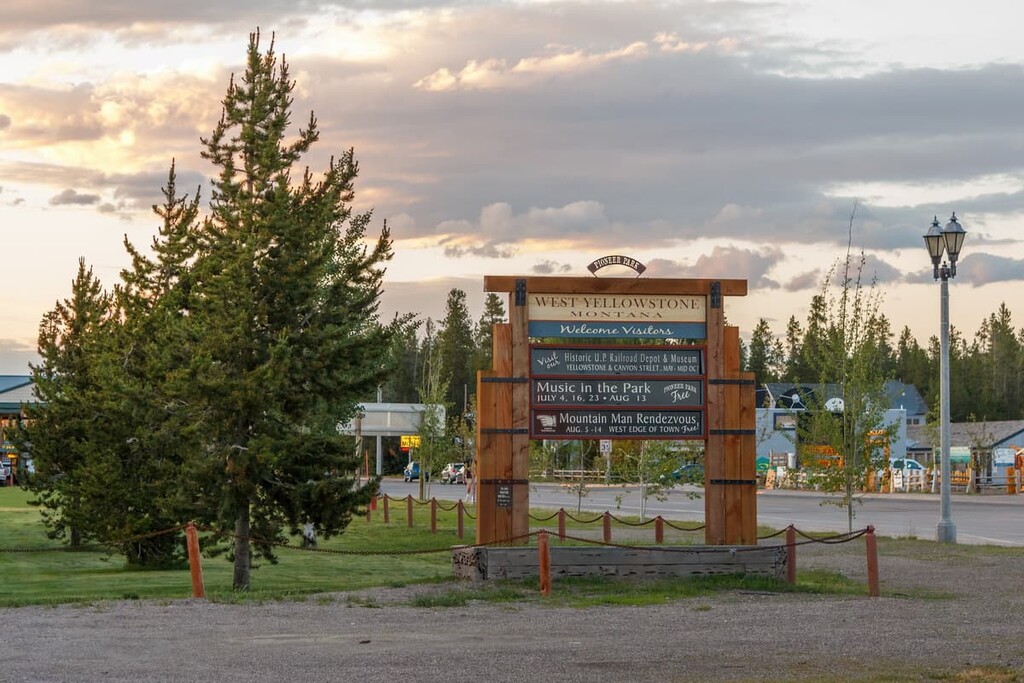
Situated right on the border of Yellowstone National Park, West Yellowstone is a perfect destination for a day trip from Bozeman or a seasonal basecamp for outdoor adventure. Many travel to West Yellowstone in the summer to hike in the US’ first national park. However, many snow seekers come to visit in the wintertime for the region’s world-famous snowmobiling terrain.
Much of the population in this park town is seasonal and peaks during the summer when the West Entrance of Yellowstone is open to private vehicle traffic. The full-time resident population is estimated at 936 and makes up a small portion of the recorded population of Gallatin County.
Known by locals under the self-proclaimed title “Montana’s Favorite Small Town,” Three Forks is just a short drive away from all the amenities and conveniences of Bozeman, though it still maintains a rural feel. The Three Forks population reached nearly 1,800 full-time residents in 2020.
For anyone who enjoys fly fishing, hiking, or horseback riding under the big sky, Three Forks is a perfect place to visit in Gallatin County. While here, fish on the Missouri River and explore the trails in Missouri Headwaters State Park—the town’s premier area for outdoor recreation and Lewis and Clark history.