Scan the QR code and open PeakVisor on your phone
The Great Sand Dunes National Park is a mountainous region located just east of the Great Sand Dunes National Park in the south-central region of the US state of Colorado. The preserve contains 11 named mountains. The tallest peak is Tijeras Peak at 13,612 feet (4,149 m) tall with Mount Zwischen being the most prominent with 732 feet (223 m) of prominence.
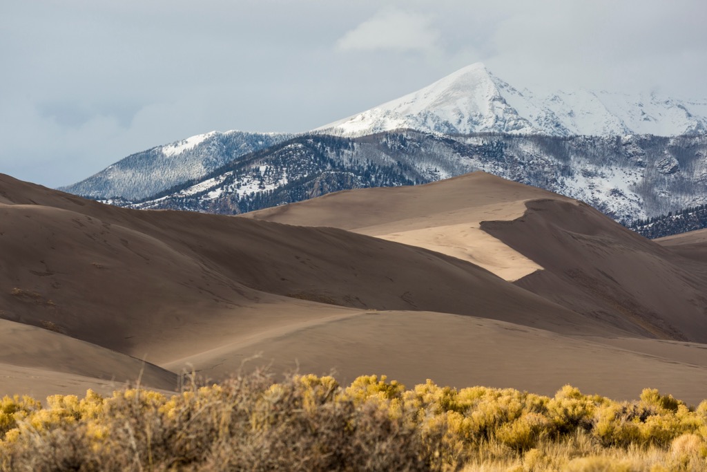
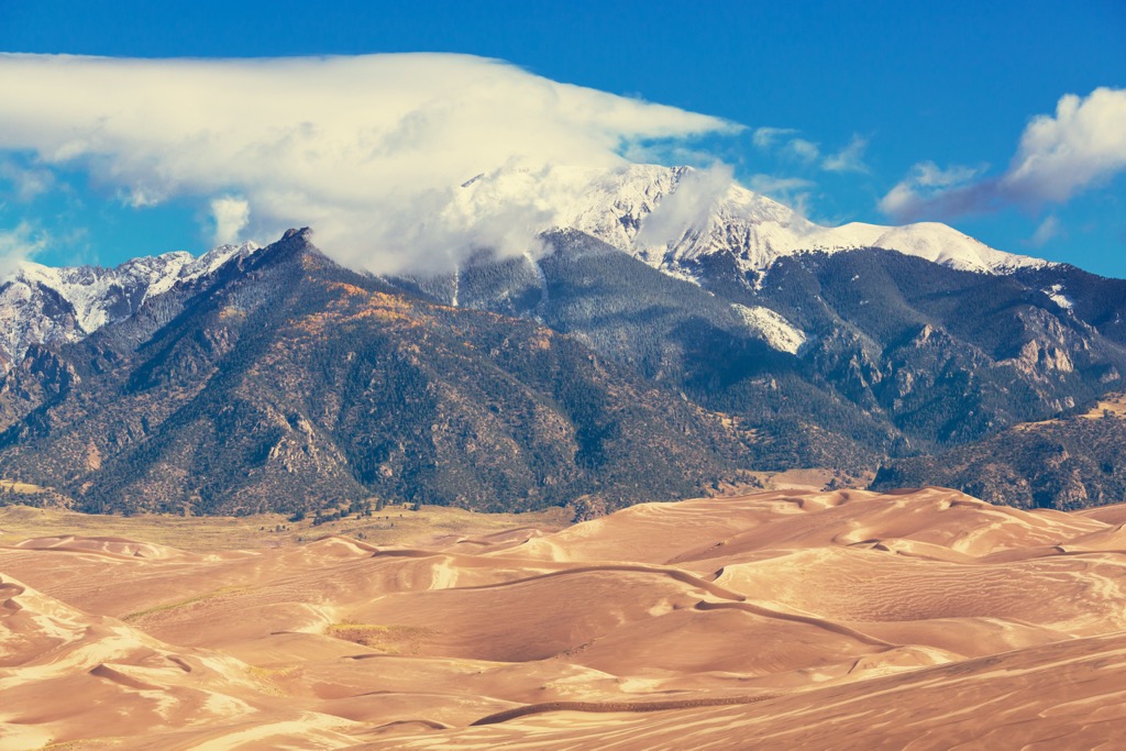
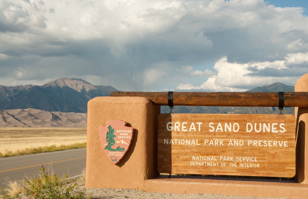
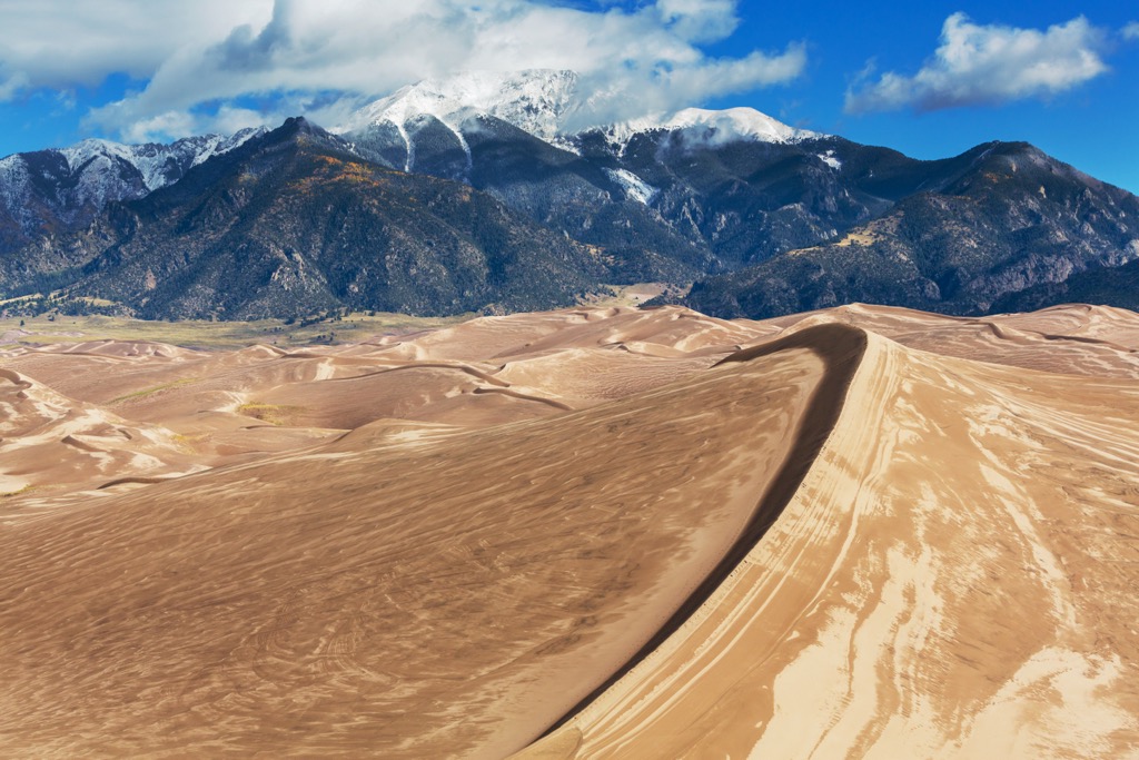
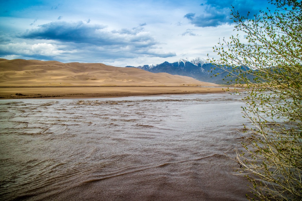
The Great Sand Dunes National Preserve is located in south-central Colorado, north of the Great Sand Dunes National Park. While the national park is marked by the tallest sand dunes in the country, the preserve encompasses some of the surrounding mountainous terrain.
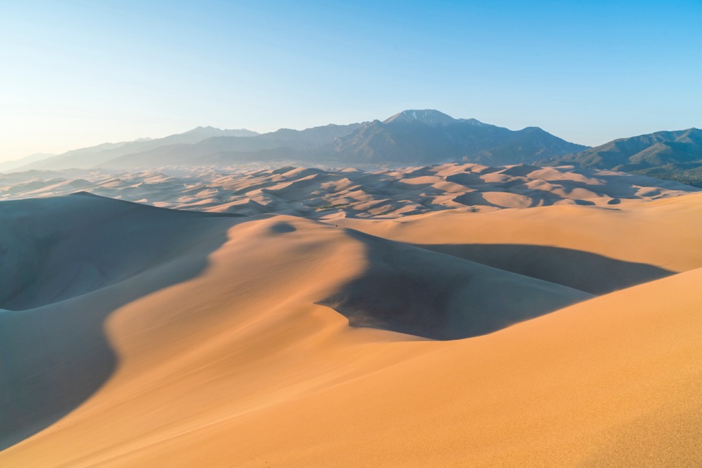
The preserve lies within a portion of the Sangre de Cristo Range. The entire preserve is located within Saguache County covering 41,686 acres (16,870 ha). The San Luis Valley, which contains the Great Sand Dunes, extends west of the preserve.
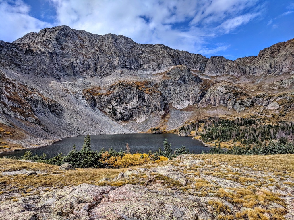
This protected terrain runs along the spine of the Sangre de Cristo Range, roughly extending in a north to south direction. Amidst the rugged terrain lie numerous small lakes and ponds, including the Lower Sand Creek Lake and Upper Sand Creek Lake. Other prominent water features include Deadman Lakes, South Colony Lakes, and Bench Lake, along with various creeks and streams.
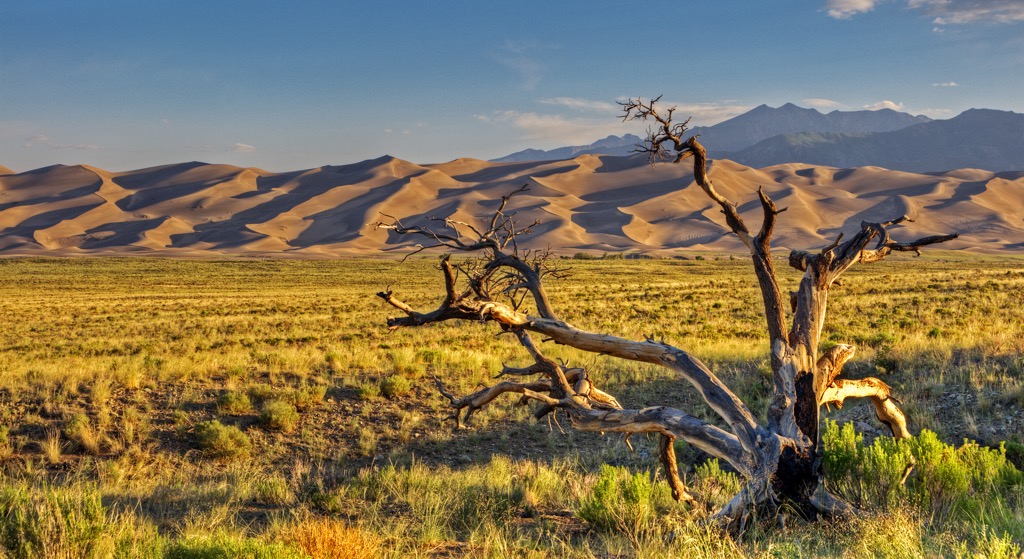
Though the nearby national park is dominated by towering and expansive sand dunes, the national preserve features a vastly different landscape. The surrounding foothills feature densely forested hillsides, quickly giving way to sweeping basins and alpine terrain.
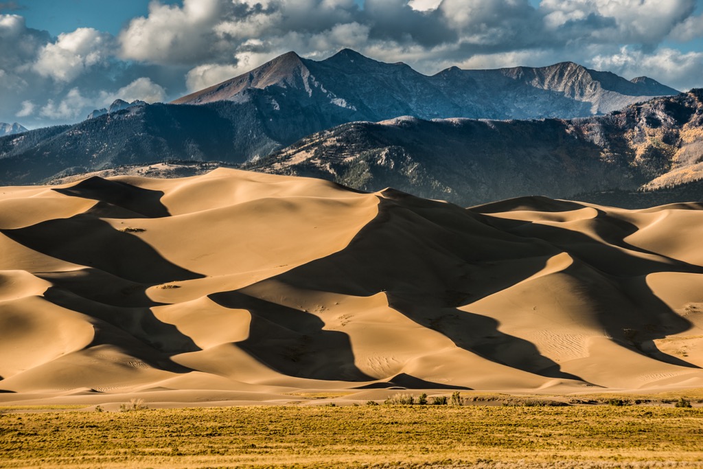
Much of the preserve lies above the treeline, with sheer cliffs, scree fields, and rocky ridgelines towering above. Many of the tallest peaks are free of flora, instead featuring narrow deep chutes and small alpine lakes.
The Great Sand Dunes National Preserve is surrounded by other areas for outdoor recreation. Sangre de Cristo Wilderness Area surrounds much of the preserve while Great Sand Dunes National Park is located to the west. A small portion of Rio Grande National Forest is located to the northwest while the San Isabel National Forest extends to the north and east.
The peaks within the Great Sand Dunes National Preserve are part of the Sangre de Cristo Mountains, which mark a subrange of the Southern Rocky Mountains.
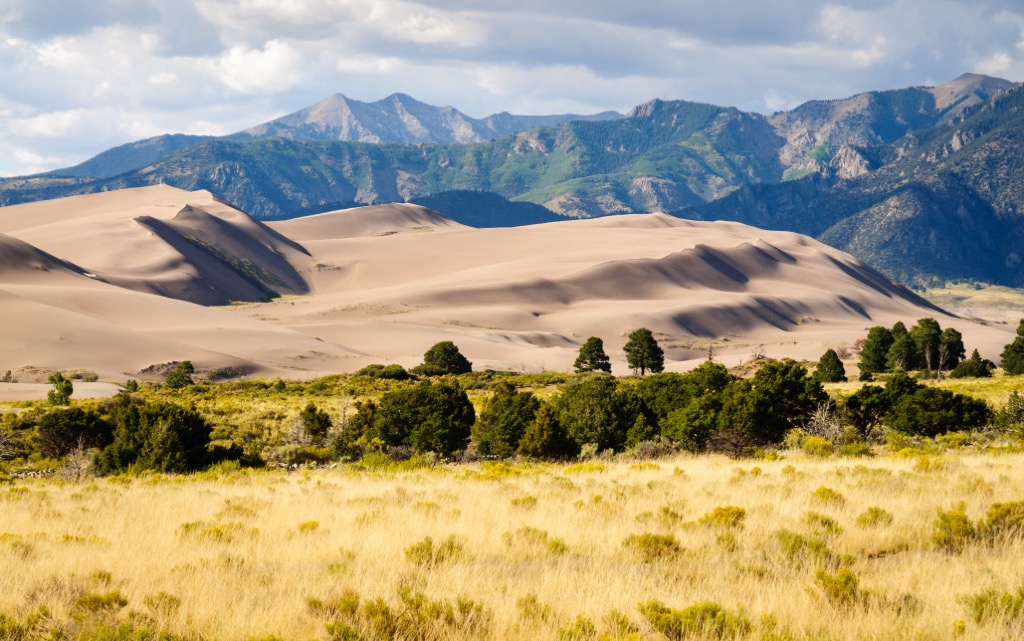
The geological history of the preserve varies from the nearby Great Sand Dunes National Park. The Sangre de Cristo Mountains were slowly thrust upwards during the Laramide orogeny. The Rio Grande Rift is located along the western edge of the surrounding range while numerous thrust faults lie beneath the eastern slopes.
Millions of years of activity along the thrust faults slowly forced the range upwards and eastwards to its current location. Both Precambrian basement rock and sedimentary strata have collided with sections of igneous rocks.
These peaks were further uplifted by widespread volcanic activity that occurred throughout present-day southern Colorado. The nearby San Juan Mountains provide visitors with opportunities to spot plutons, showcasing the volcanic history of the region.
During the last glacial maximum, this range was heavily glaciated. Glacial retreating further carved out the landscape, leaving behind the cirques, canyons, ridgelines, and rugged peaks visible today. Changes in elevation tend to be more dramatic along the eastern side of the range.
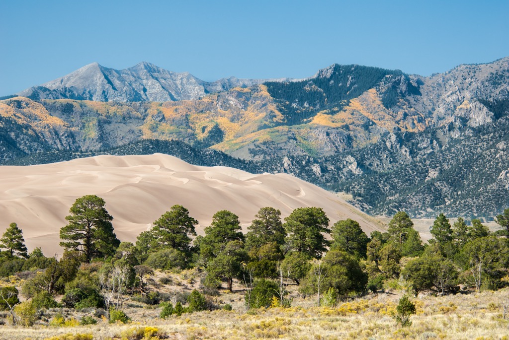
Major peaks located within the Great Sand Dunes National Preserve include Tijeras Peak, Mount Zwischen, Mount Herard, and Marble Mountain.
Lower elevations in the preserve, and the foothills just outside the preserve, are populated by ponderosa pine, dry oakbrush, and pinyon-juniper. As elevations increase the terrain transitions to stands of fir, aspen, and spruce.
A majority of the preserve is located within the alpine terrain, featuring minimal amounts of flora. Amidst the craggy peaks lie various low growing grasses, wildflowers, and lichen.
Some of the larger animals found in the preserve include bighorn sheep, elk, mule deer, cougar, and black bear. Various small birds, insects, and mammals can be spotted during the summer months throughout the surrounding region.
The land in and surrounding the Great Sand Dunes National Preserve has been inhabited by humans for thousands of years, long before the arrival of European colonizers. This region marks part of the ancestral homelands of many Indigenous peoples; particularly the Cheyenne, and Ute people.
The Apache tribes primarily inhabited land that is now Texas, though their territory did extend into present-day southern Colorado. During the nineteenth century the Cheyenne moved westward into Colorado.
The Ute traditionally lived throughout present-day southwestern Colorado. They referred to the nearby sand dunes as “Saa waap maa nache” or “sand that moves. The Jicarilla Apache, who traditionally lived in northern New Mexico, called the dunes “Sei-anyedi”, which translates to “it goes up and down”.
The first recorded Europeans to explore the San Luis Valley and the surrounding ranges arrived in 1694, with Spanish settlers from Santa Fe hunting bison throughout the region. During the eighteenth century, nearby populations began to grow as more fur trappers and traders arrived.
The city of Pueblo, which lies northeast of the preserve, steadily grew throughout the mid-nineteenth century. During the Charles Baker Expedition in 1860, gold was discovered in the nearby San Juan Mountains, leading to the Colorado gold rush.
The Fort Pueblo Massacre occurred in 1854 as the Indigenous Ute and Jicarilla Apaches fought against the settlers in the region. The increased settler population also led to the arrival of infectious diseases such as smallpox and measles, decimating the Indigenous communities who had no natural immunity to these illnesses.
Despite their continual efforts, the Indigenous were eventually forcibly removed from their native homelands by the US government and placed on reservations. Today, descendants of these tribes are part of the Cheyenne and Arapaho Tribes and the Southern Ute Indian Tribe.
The surrounding San Isabel National Forest was originally established in 1902 as a forest reserve, eventually becoming a national forest in 1907. Efforts were made to protect the unique sand dunes as many feared they would be destroyed by gold mining or concrete manufacturing. The dunes were officially designated as a national monument in 1932 and later expanded to form a national park and preserve in 2004.
The Great Sand Dunes National Preserve has numerous hiking trails, many which connect to trails in the surrounding national forests and wilderness areas. Below are a few hikes to check out on your next visit to the region:
This out and back route begins along the east side of the preserve. The route climbs steeply up over a mountain pass before dipping into the Lower Sand Creek Lake. The beginning of the route is located within the forested landscape, before reaching the alpine terrain. Rocky ridgelines rise steeply from the sides of the lake with Tijeras Peak located to the southwest. This trail is 6.8 miles (11 km) long and features 1,706 feet (520 m) of elevation gain.
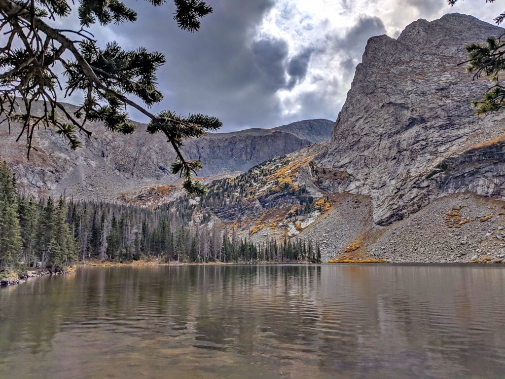
This hiking route begins the same as the Lower Sand Creek Lake Trail, climbing through the forested landscape before dropping slightly in elevation. Rather than turning off the trail to reach Lower Sand Creek Lake, the trail continues climbing steadily before reaching the upper lake. The alpine terrain surrounds the lake along with Music Mountain and Milwaukee Peak. The out and back route is 7.4 miles (12 km) and features 1,965 feet (599 m) of elevation gain.
This hiking route is located in the southeastern portion of the preserve. The route climbs through the forested foothills before opening up into the alpine terrain. A majority of the route follows along Medano Creek, eventually reaching Medano Lake with Mount Herard towering above. This out and back path is 7.9 miles (12.7 km) long and features 2,290 feet (698 m) of elevation gain.
Looking for a place to stay near the Great Sand Dunes National Preserve? Here are some of the best cities and villages to check out in the region.
The city of Alamosa lies southwest of the national preserve and national park. Situated in the San Luis Valley, Alamosa is home to 9,800 residents, making it a commercial hub for the surrounding region.
Surrounded by the largest alpine desert valley in the world, the city is the ideal spot for those wishing to explore the Great Sand Dunes. Besides the desert terrain, visitors can also enjoy hundreds of miles of trails in the surrounding mountains.
The remote nature of the city makes it an ideal spot for stargazing due to the limited amounts of light pollution. Other popular activities in the region include rock climbing, trail running, mountain biking, fishing, and hunting.
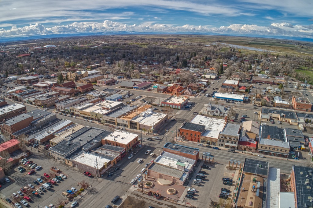
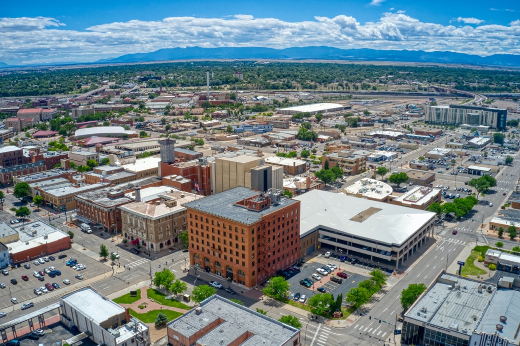
The city of Pueblo lies northeast of the preserve, providing easier access to trails along the eastern edge of the preserve. Home to roughly 111,000 residents, Pueblos boasts over 300 days of sunshine annually. Situated along the Arkansas River, the city is home to a mild climate allowing for year round outdoor recreation.
Besides hiking, other common outdoor activities in the region include trail running, mountain biking, rock climbing, and fly fishing. During the warmer months, visitors can enjoy exploring the Arkansas River or cool off in the nearby Lake Pueblo State Park.
Downtown Pueblo is home to multiple museums and historical sites including the Pueblo Heritage Museum, Rosemount Museum, El Pueblo History Museum, and Steelworks Museum. The city is also home to a plethora of local restaurants, breweries, and pubs.