
Scan the QR code and open PeakVisor on your phone
Saguache County is home to 138 named mountains, including 5 fourteeners. The highest is Crestone Peak at 4,361 m.
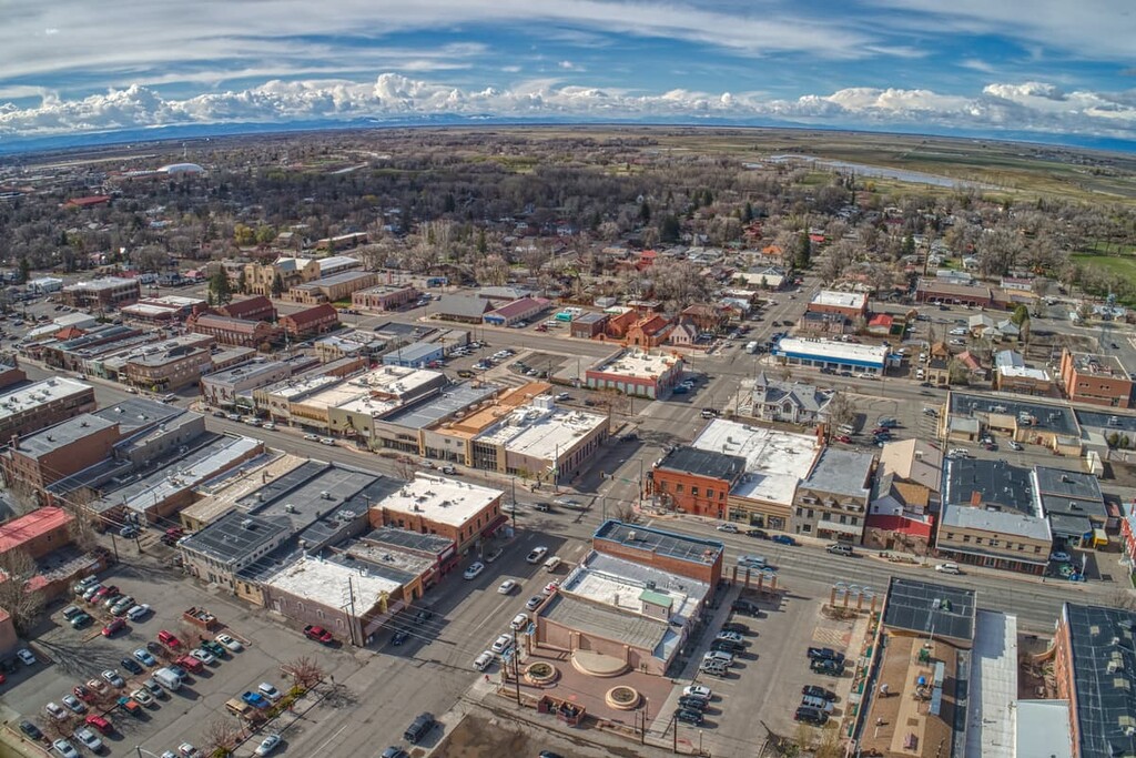
Now this is a county that most people don’t even know exists. And then there is the question of how its name is pronounced. Saguache comes from the Ute Tribe’s word apparently meaning “sand dune” (although there are other opinions). Since the Utes did not have an alphabet, the immigrants to the valley named it as they heard it – thus the spelling. The most common, and presumably correct, pronunciation is “suh-WATCH”, but I’m sure that visitors come up with all kinds of variations. Be that as it may, this little-known county actually has lots to offer visitors, not least of which is some awesome mountains to climb. The county has a population of only 6,824 inhabitants as of the 2019 estimate. With an area of 3,170 square miles, that means the population density is a whopping 1.9 people per square mile. Wow, you would have to look hard to see anyone. The county seat is the town of the same name (and same pronunciation – I think), while the largest town is called Center (population 2,264), apparently so named because it is in the center of the San Luis Valley. No highway goes through that town although State Highway-112 passes by its outskirts. Though I have driven past it many times on US-285 a couple miles to the west, I never realized that there is a “large” town there. The town appears to be totally oriented toward agriculture.
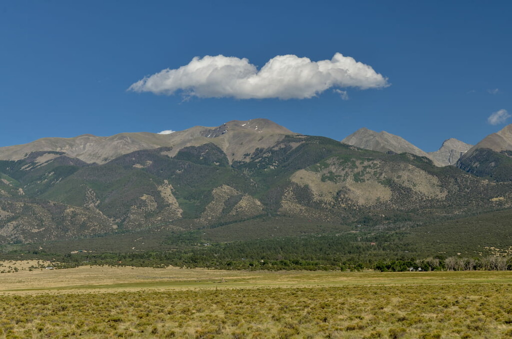
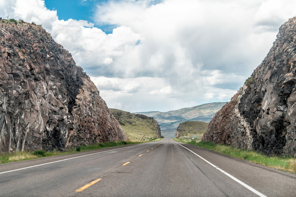
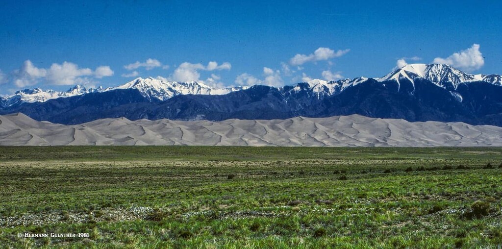
Saguache County shares borders with nine other counties. Along its entire eastern side, the crest of the towering Sangre de Cristo Range defines the boundary with three other counties (Fremont, Custer and Huerfano), where the highest elevations in the county occur. The southeastern part of the county is mostly agricultural, but also includes the largest segment of the Great Sand Dunes National Park and Preserve. The western half of the county is essentially uninhabited and comprises the southern part of the Sawatch Range and the eastern, but not the most spectacular, part of the San Juan Mountains. There are four major highways in the county – US-285, which crosses the county from north to south – and three state highways – SH-17, SH-114 and SH-112.
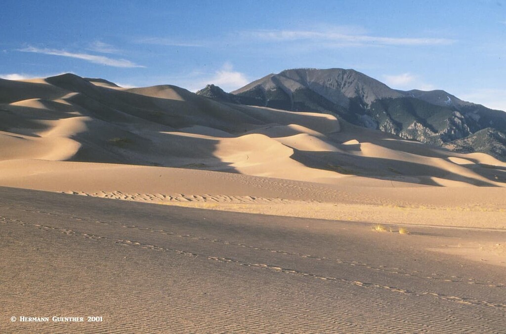
With its stunning location between mountain ranges, as well as some of the most unusual terrain in the country, it comes as no surprise that Saguache County has much of its area under national protection. There are two national forests (Gunnison NF and Rio Grande NF), three wilderness areas (La Garita, Sangre de Cristo and Great Sand Dunes) and one National Park (Great Sand Dunes NP and Preserve), all of which are shared with adjacent counties. Also, this county encompasses a significant proportion of the immense San Luis Valley, which, in addition to and partly because of its agricultural character, figures prominently in a magnificent natural phenomenon.
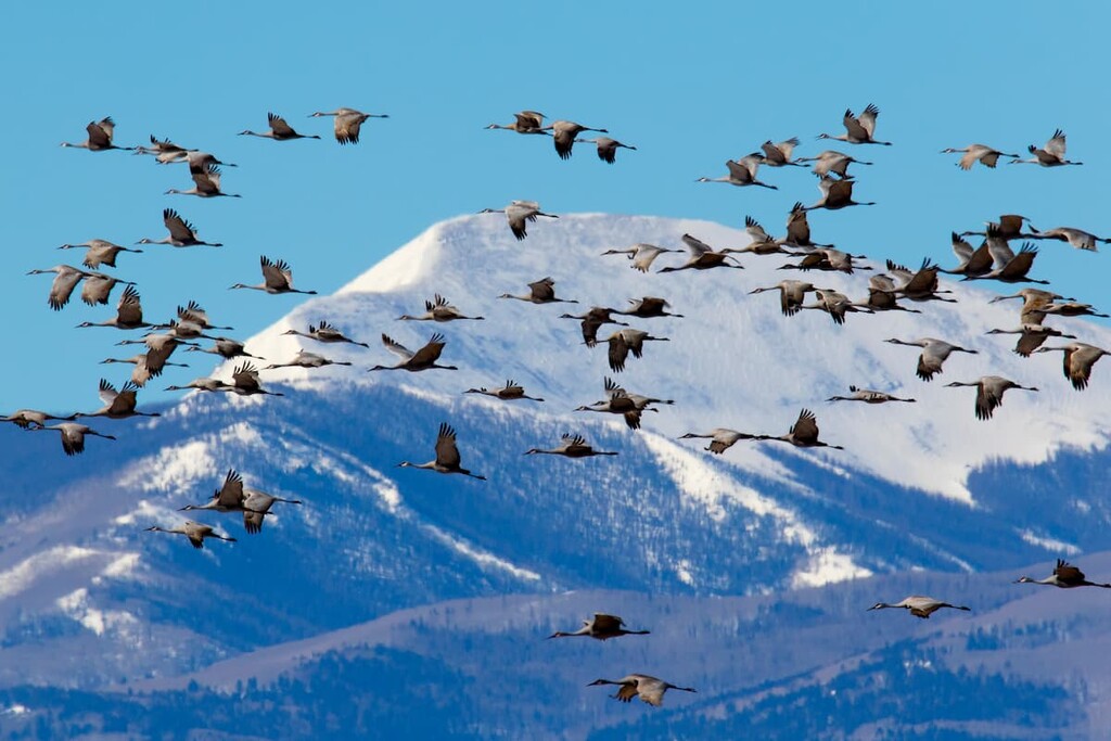
This is one of the flyover routes of the annual spring and fall migration of the Sandhill Cranes. These large and majestic birds spend their winters in New Mexico and their summers in the northern United States and Canada. Over 20,000 of these cranes spend part of their spring and fall in this valley. It is the agricultural fields and nearby wetlands that attract them to this area, where they will spend four to six weeks during each migration. You might look at this as their refueling station on their long migration. The fields in this valley are mostly barley and the millions of grains that fall to the ground are what attract these birds (the barley that is harvested goes to making beer). This spectacle, which is part of a much larger mid-western migration involving from 400,000 to 600,000 birds (one of the great animal migrations on the planet), needless to say attracts visitors from all over during these times of year. There is another such refueling station in western Nebraska where the greatest percentages of cranes make their stopover. Overall, this migration represents 80% of the world’s population of cranes.
Perhaps the biggest tourist attraction in Saguache County is the Great Sand Dunes National Park and Preserve. Granted, it is really only accessible from Alamosa County to the south, yet most of it resides in Saguache County. But that is irrelevant, since most visitors to the park are likely to arrive by driving almost entirely across the county from the north. As you cross Poncha Pass from Chaffee County, you will gradually descend into the San Luis Valley as you head south. Here you will be greeted by dramatic views of the Sangre de Cristo Mountains on your left, and what an incredible view that is! On a clear day you will be able to see the sand dunes at a great distance; in fact, the dunes can be seen from almost any point in the valley. You will surely want to visit this magical place.
The little town of Saguache has an interesting history since it played an important role in the development of the San Luis Valley. It has been known for centuries to the Native Americans who made the valley their home in the winter months when they came down from their summer homes in the mountains. The Spanish moved into the area in the 1600’s followed later by other settlers and miners. The town has a small museum that is worth visiting and has won acclaim from visitors from all over the United States and even abroad. Of particular interest is that it provides information about Alferd Packer, the infamous Colorado cannibal, who was held for a time in the Saguache County Jail here before he escaped (see this article https://peakvisor.com/adm/hinsdale-county.html for more information about this bizarre story).
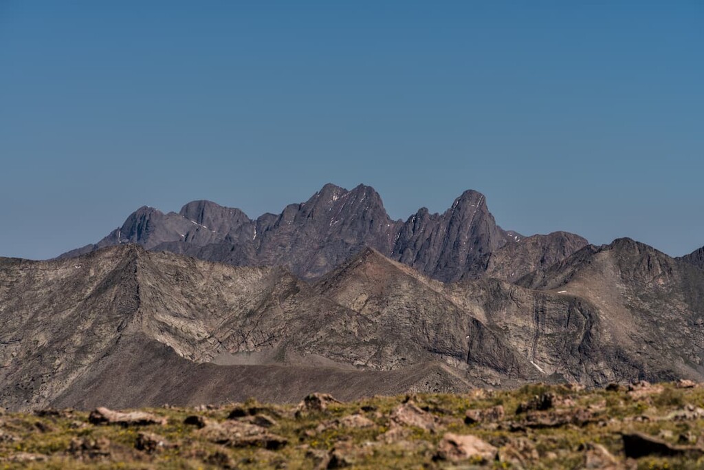
But while you are playing in the Great Sand Dunes, and if you are a hiker or mountaineer, you cannot help but be enticed to climb into that formidable barrier known as the Sangre de Cristos. There are a few, but not many, trailheads from which you can explore these impressive mountains. Also within the county, at its northernmost reaches, is the very southerly end of the long Sawatch Range (same pronunciation as the county – so why is the spelling different???). As for the western half of the county, most of it is occupied by the San Juan Mountains, although the most famous ones in this range are to the west of Saguache County. With the exception of SH-114 that connects the town of Saguache with Gunnison to the northwest, this is a mostly a remote area, although there are of course a number of county and forest roads, most likely all of them gravel and some of them impassible for passenger cars, especially during the winter. There are a few campgrounds in this area, which is crossed by the Colorado Trail. This area, especially the extreme southwestern part of the county, has one fourteener (San Luis Peak) and several other high summits, but accessibility from within the county boundaries is somewhat limited.
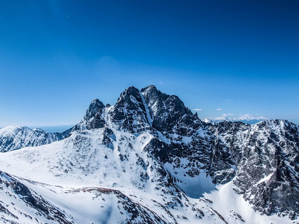
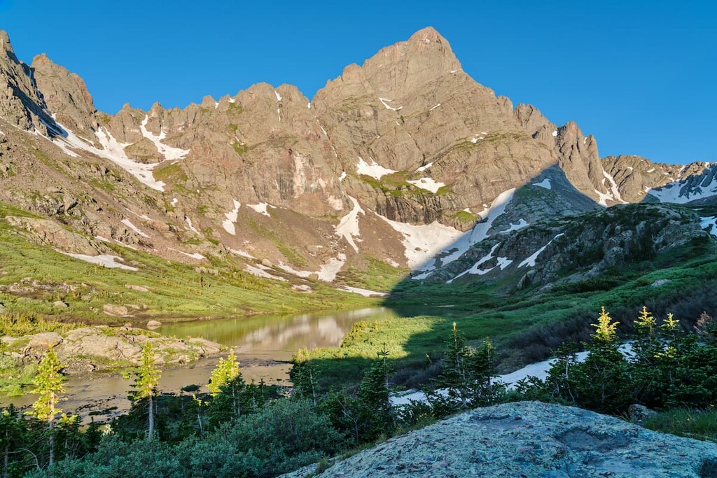
There are 131 named mountains in Saguache County, of which Crestone Peak is the highest and most prominent. Among these mountains are five fourteeners. While much of Saguache County is mountainous, most of it does not attract hordes of hikers and climbers – except the eastern fringe of the county. Yes, the central part of the Sangre de Cristo Range, just to the north of the Great Sand Dunes National Park, is a hot destination for hikers and especially climbers. That is because there are four fourteeners in this part of the county and they are among the most popular, most difficult and most dangerous of them all. Known as the Crestone Group, these peaks are for real climbers, not casual hikers.
But there are a couple of other areas in the north and west of the county that see some hiking and climbing activity. Though not nearly on the scale of the Crestones, these are also worthy of note, especially for people who would like to be a little further from the action. We’ll touch on all of them here.
When driving through the San Luis Valley in southern Colorado, one cannot help but be impressed by the high wall of mountains directly to the east of State Highway 17. These mountains have no foothills and rise straight up from the valley floor. For a mountain lover, let alone a dedicated mountaineer, these high and rugged peaks are sure to get the adrenaline flowing. In the middle part of the range, above the small town of Crestone, is a cluster of high mountains called the Crestones. These four fourteeners (Challenger Point, Kit Carson Peak, Crestone Peak and Crestone Needle) and their sub-peaks afford some of the best climbing in Colorado. The two "Crestones" are clearly the most challenging, so that experience, condition as well as caution are prerequisites for anyone attempting to climb them. A fifth fourteener, Humboldt Peak, is east of the main group in adjacent Custer County and is generally climbed independently of the others and mostly from the east side.
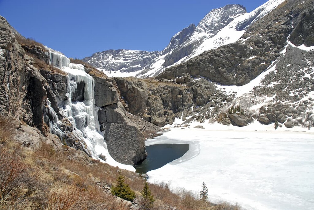
There are several trailheads on the west side of the range within Saguache County that can be used to access these mighty monsters. Some of these trailheads are on private property and are not well-used due to this issue as well as the fact that they involve very long hikes with considerable elevation gains, trails that can be difficult to follow. The Willow Creek Trailhead is the most common one used to reach Kit Carson Mountain and Challenger Point. It is located less than two miles outside the village of Crestone, though the last mile may not be suitable for all passenger cars. To climb the peaks from here is not a casual hike, since to reach both peaks still requires a 12-mile round trip hike with 6,300 feet of total elevation gain. Backpacking to Willow Lake and spending one or two nights there is surely the best way to climb these two summits if you have the time. For non-climbers, the lake itself would make a fine day hike of ten miles and only 2,800 feet of elevation gain. You can extend this hike another mile (plus another 800 feet elevation gain) by continuing to the smaller Willow Creek Lake. Either way, this is a spectacular place.
If you plan to climb the Crestones from the west side, you will be looking at an arduous approach but well worth the effort, for the trail along Cottonwood Creek will take you to the beautiful Cottonwood Lake at 12,300 feet. If you have the energy, this is a wonderful alternative to the far more crowded approach from the east side via the Colony Lakes. While a day hike to Cottonwood Lake for non-climbers is a viable outing, it still involves a round-trip hike of nine miles and an elevation gain of 3,900 feet. Tough, but doable for well-conditioned hikers. Both Crestone Needle and Crestone Peak can be climbed from this lake, but that becomes a major undertaking only for highly experienced climbers. That goes far beyond just ordinary hiking. I have a close friend who grew up in South America and has climbed extensively in the Andes. He climbed these two a couple of years ago and told me that they are complex mountains that require 100% concentration at all times. Sure-footedness is essential and anyone with acrophobia should stay away.
For those hikers who have no intention of climbing the high peaks in the Sangre de Cristo Range, a very pleasant trail can be found just a few miles outside of the town of Crestone. The North Crestone Creek Trailhead is about three miles north of the town right near the North Crestone Campground. This is said to be one of the most beautiful hikes in the Sangres. A 12-mile round-trip hike to North Crestone Lake, with an elevation gain of 3,230 feet, makes a fine day hike or overnight backpack trip. At about the halfway point to the lake, the trail passes through a beautiful stand of aspen trees that will make you appreciate why Colorado is such an awesome autumn destination. In the summer, hikers on this trail provide a feast for mosquitoes – they are there in swarms so that any hiker without plenty of insect repellant will have a bad time. But the fishing at the lake is reported to be awesome. If you do this hike, be sure not to leave any food in your car. Bears have been reported to break into cars to get at anything that smells good to them. An easier and shorter hike is to South Crestone Lake. The trail starts at the Willow Creek Trailhead described above and is nine miles round-trip and just under 3,000 feet of elevation gain. This trail is lightly used yet leads to one of the most beautiful mountain lakes in the Sangre de Cristo Range.
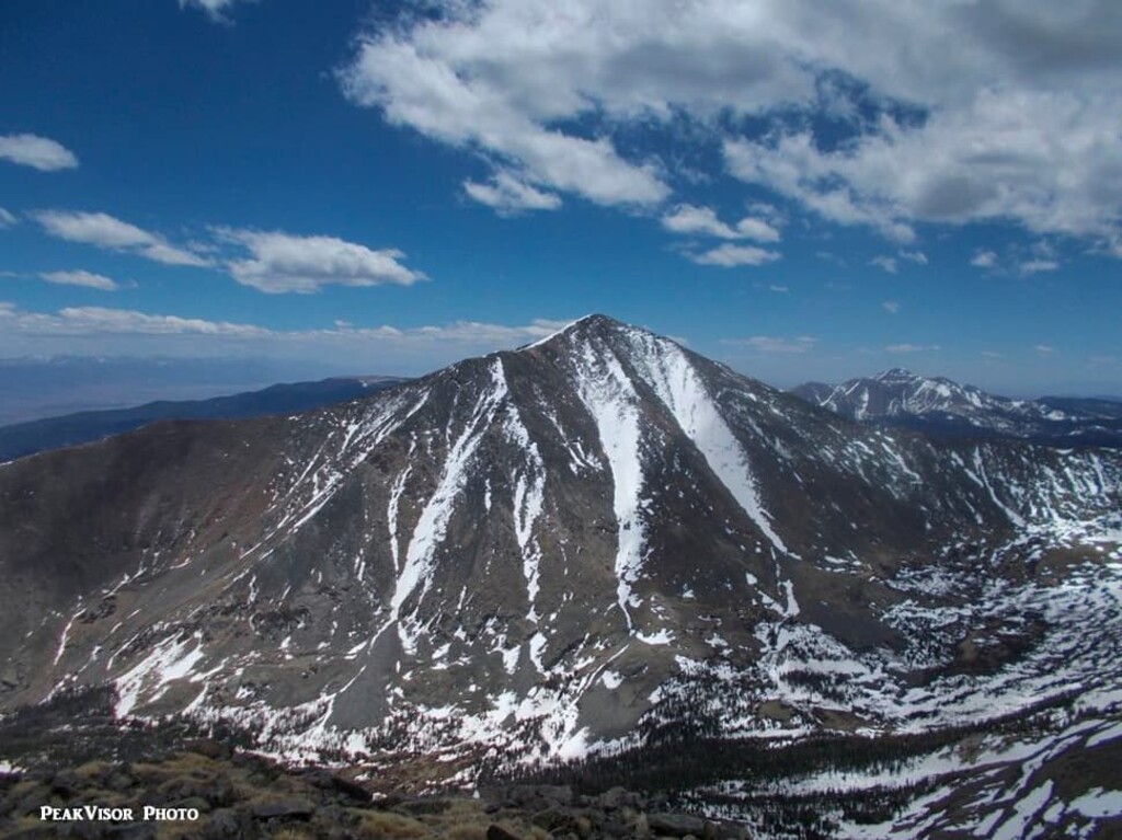
We know that the long Sawatch Range crosses several counties in central Colorado and contains 15 fourteeners including the two highest in Colorado and indeed in all of the Rocky Mountains of North America. The southern end of the range extends well into Saguache County, as far south as the town of Saguache in fact, although these southernmost mountains of the range do not figure prominently in the hiking world. But there are a few peaks in this area that are worthy candidates for climbing, the most important one perhaps being Mount Ouray. At 13,961 feet, it is almost, but not quite, a fourteener and this is the reason it is not frequently climbed. But being the third most prominent mountain in the county, it deserves some respect. Not only that, it is also the most prominent mountain in Chaffee County since it sits squarely on the boundary between these adjacent counties. It is most commonly climbed from the Marshall Pass Trailhead where the route follows the Continental Divide to a ridge, which is then followed east to the summit, from where some of the best views in south-central Colorado can be enjoyed. The round-trip hike is about seven miles and has an elevation gain of 3,200 feet. The road to the trailhead can be driven in a regular passenger car.
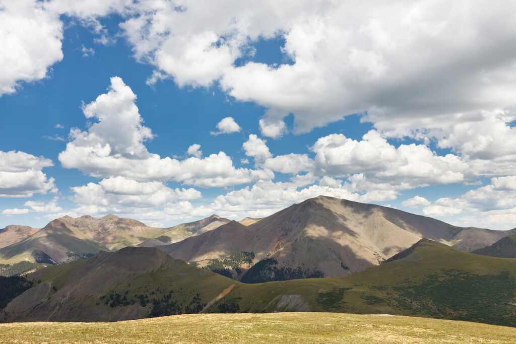
We mountain lovers are well acquainted with the mighty San Juan Mountains, often called the finest mountain range in Colorado. I would not dispute that. Unlike other ranges in Colorado, which are generally linear, long and narrow, the San Juans comprise a vast mountainous area in southwest Colorado that covers over 4,000 square miles. That means it encroaches on a number of counties, including Saguache County. Unfortunately, the best hiking areas in the San Juans are in other counties, while those mountains worthy of climbing in this county are often remote and difficult to find. As earlier mentioned, there is only one fourteener here, San Luis Peak, which is likely the only San Juan mountain in the county that attracts any significant attention. It is possibly the least climbed fourteener, far from anywhere, perched in the middle of the La Garita Wilderness. It offers little technical challenge and you are likely to see more elk there than people. That may make it a highly attractive alternative to other fourteeners. Finding the trailheads is a challenge, involving miles of driving on forest roads that are likely impassible in winter.
Not likely in Saguache County! You would be lucky to find any accommodations in this remote county, although there are a few small places to stay the night, mainly in the towns of Saguache and Crestone. You are likely to have better luck finding a campsite than a motel room here, since there are a number of Forest Service campgrounds scattered around the county. For less rustic and more comfortable accommodations, you will have to look in the major towns in adjacent counties, which are all within reasonable driving distance from the major attractions of the county. Let’s have a look at a few.
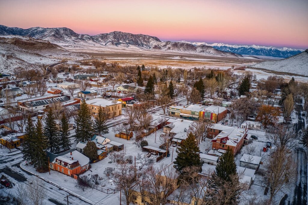
This tiny town of about 500 inhabitants was founded in 1867 and became a major supply town and trading post in support of the mining boom that took place in the late 1800s, after which the town’s population declined significantly. It is not likely to be your first choice for accommodations although it does have a guest house, a bunk house and a small motel. The Big Valley Motel in town has been around since 1954 in the same family and appears to have good reviews and probably very affordable prices. It is continually undergoing renovations. Dining options are minimal in this town, although there is a pub and a liquor store if you are desperate for a brew and don’t happen to have one in a cooler in your car. If you really want a quiet place to stay, this may be a good option, but since US-285 goes right through the center of town there may be very occasional traffic noise from trucks passing through - this is a national highway.
A tiny village of less than 200 souls, Crestone is nestled near the foot of some of the highest peaks of the Sangre de Cristos. It is known as a spiritual center representing a number of major religions, only about a 40-minute drive from the town of Saguache. For some who want a quiet experience in a beautiful setting, there are several bed and breakfast facilities here although other amenities are not abundant. For that you would have to drive about an hour to the nearest major town, Alamosa. This town is very handy to both the Willow Creek and North Crestone Creek Trailheads.
In the middle of the immense San Luis Valley, which lies between the Sangre de Cristo and San Juan Ranges in Colorado, sits the city of Alamosa. Though it is not in Saguache County, this is an ideal town from which to explore what the county has to offer in terms of recreation. With a population of less than 9,000, this is by far the largest town anywhere close to the mountains surrounding the valley. Yet the town offers almost any amenity that a visitor would require for an extended stay to explore these mountains - accommodations, restaurants, hospital, golf course, shopping and even an airport with regional scheduled service including to Denver and Albuquerque, New Mexico. This is the place to stay if convenient hiking access to the western approaches to the Sangre de Cristos is desired. Visitors to the Great Sand Dunes National Park are very likely to base themselves in Alamosa for a multi-day visit.
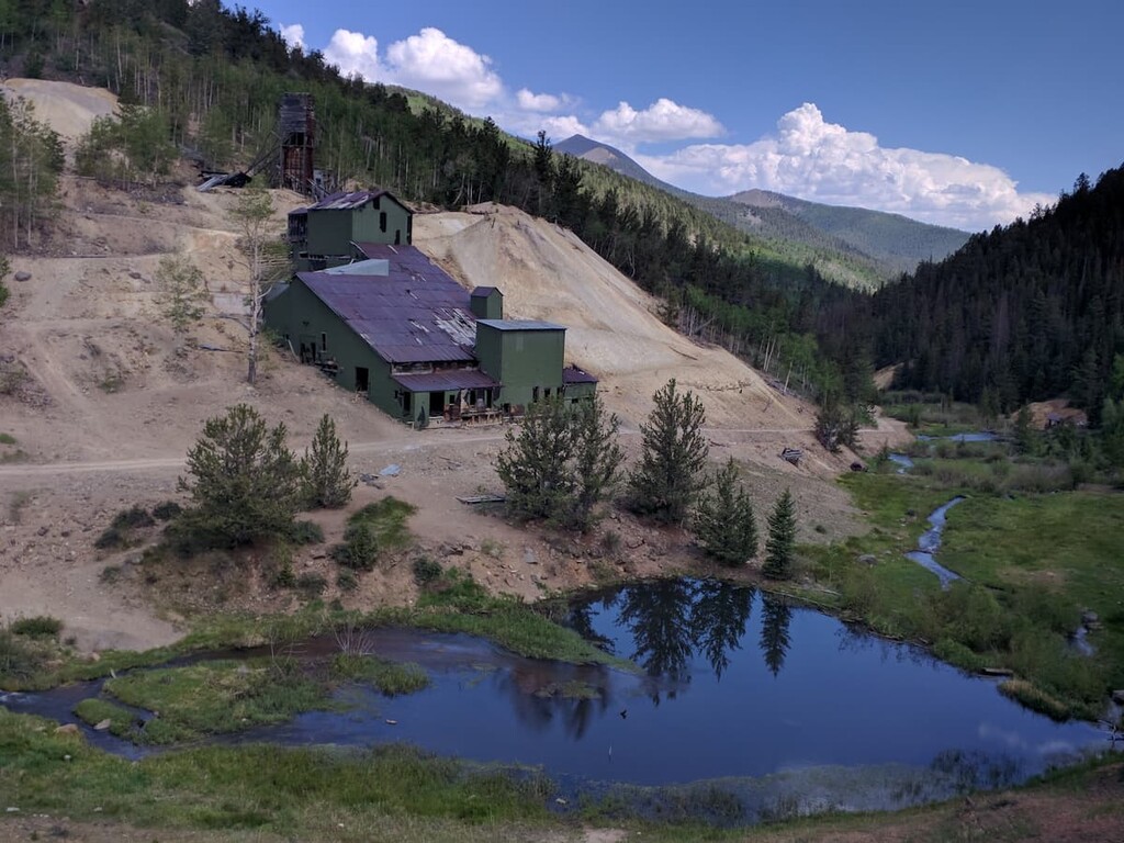
We present to you this tiny town not because it is a likely place to find accommodations (unless you personally know one of the 19 residents of the town), but because it has an interesting history, as have so many towns throughout Colorado’s west. Bonanza is an almost abandoned former silver mining town, though some mining relics remain. The name of the town has Spanish origins meaning “prosperity”. In 1880, Tom Cooke of Salida, Colorado, found ore deposits while searching for his horses. In its first two years, the town’s population boomed to between 1,000 and 1,500. Back in those days, the population of mining towns was determined not by a census taker but by the number of saloons and dance halls (and most likely brothels as well). At that time, Bonanza had 36 saloons and seven dance halls. The town is located near the northern end of Saguache County at an elevation of 9,500 feet and it may or may not be shown on roadmaps. Only one town in Colorado has less inhabitants than Bonanza.


Yes. Saguache County has 138 named mountains. The highest is Crestone Peak at 4,361 m.
The highest mountain in Saguache County is Crestone Peak, at 4,361 m.
Saguache County has 138 named mountains.
Saguache County has 5 fourteeners — peaks above 14,000 ft (4,267 m).


