
Scan the QR code and open PeakVisor on your phone
The San Luis Valley Field Office of the Bureau of Land Management (BLM) manages 500,000 acres (202,300 ha) of public land in the south-central part of the US state of Colorado. There are 25 named peaks in the area, the highest of which is Sheep Mountain (10,485 ft/3,199 m) and the most prominent of which is Flat Top (9,213 ft/2,800 m).
The San Luis Valley Field Office is a regional administrative unit of the Bureau of Land Management (BLM) located in the south-central part of the US state of Colorado. Its borders extend from the northern tip of the San Luis Valley south toward the state’s border with New Mexico.
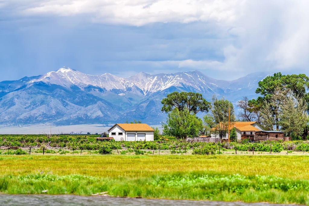
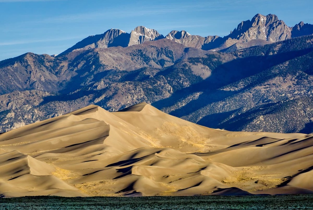
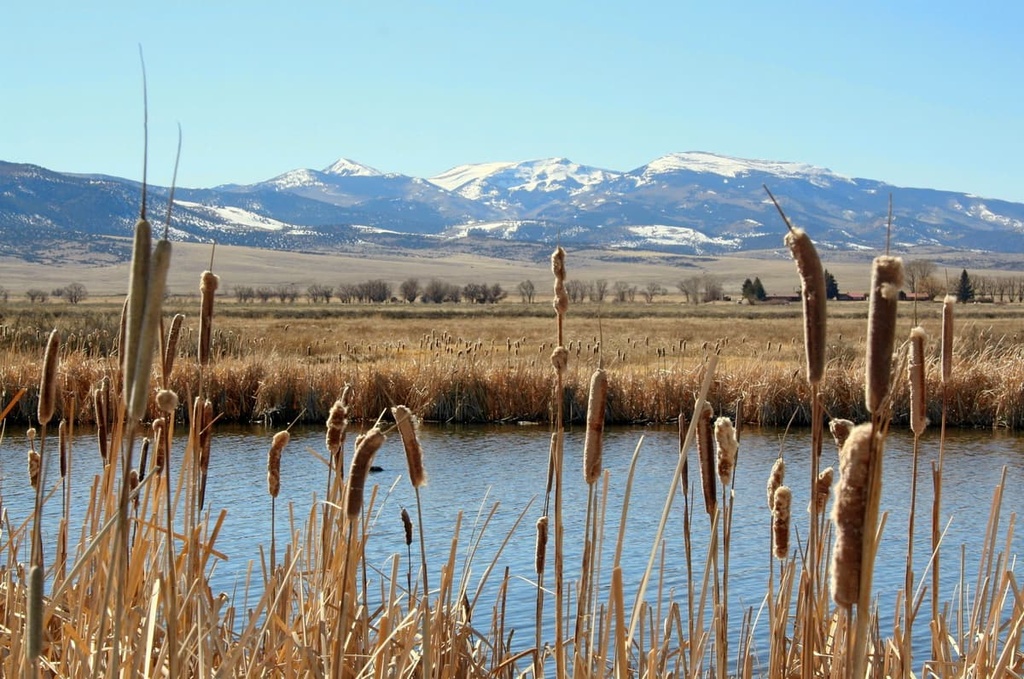
Bordered by the Sangre de Cristo Range and Great Sand Dunes National Park to the east, the San Juan Mountains to the west, and the Sawatch Range (also known as the Saguache Range) to the north, the San Luis Valley stretches roughly 100 mi (161 km) from north to south and is 60 mi (97 km) wide. The valley floor sits at approximately 7,500 ft (2,286 m) elevation and some peaks in the area reach elevations of up to 10,500 ft (3,200 m).
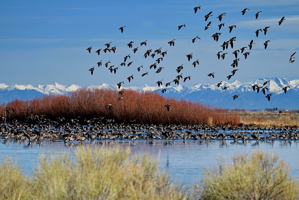
The San Luis Valley Field Office operates four special recreation areas and over 400 mi (644 km) of trails that span low mountains, mesas, canyons, wetlands, prairie, and alpine habitats. It is part of the Rio Grande Basin and encompasses eight areas of critical environmental concern including the Blanca Wetlands and San Luis Hills.
The BLM land abuts the Sangre de Cristo Wilderness Area, La Garita Wilderness Area, and Rio Grande National Forest.
The San Luis Valley formed during the same tectonic uplift that raised the Rocky Mountains roughly 80 to 35 million years ago. Subsequent volcanic activity and magma surging from deep within the Earth created rich mineral deposits in the region.
For the most part, the main deposits of precious metals in the region fall slightly to the west of the valley. However, prospectors in the valley discovered gold and silver near the headwaters of the Conejos River and along the western side of the Sangre de Cristo Range near the small town of Crestone. Turquoise, onyx, opal, and agate deposits are all found throughout the valley.
Approximately 26 million years ago, the Miocene-Pliocene Uplift caused the Earth’s crust to pull apart along the fault line that runs through the San Luis Valley, creating the Rio Grande Rift. This coincided with a period of volcanic activity that formed the San Juan Mountains, the San Luis Hills, and La Garita Caldera, among other notable landmarks in the region.
Although it’s classified as a high elevation desert and it receives less than 10 in (25 cm) of precipitation a year, the San Luis Valley contains parts of two major aquifers that support wetlands and agricultural activity in the region.
Runoff from the surrounding mountain ranges feeds the valley floor with surface water and helps replenish the region’s underground aquifer. The convergence of distinct ecoregions in the field office means that a wide range of flora and fauna can exist in relatively close proximity to one another in this region.
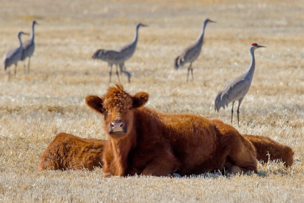
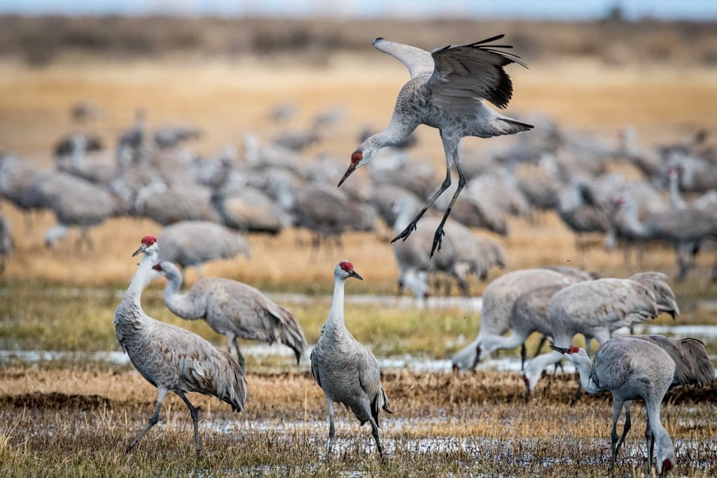
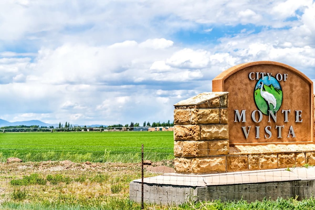
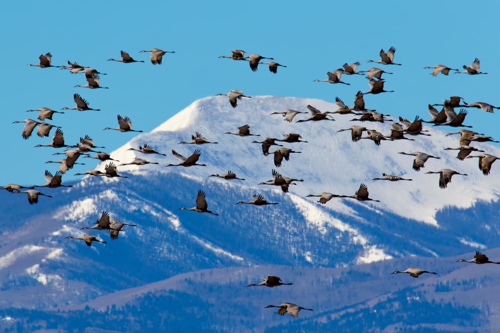
The Monte Vista, Alamosa, and Baca national wildlife refuges and the Blanca Wetlands provide important habitats and food sources for numerous migratory birds and wildlife in the region, which includes everything from porcupines and elk to black bears. The valley also serves as a major resting point for sandhill cranes each spring and fall during their seasonal migration.
Ring muhly and winterfat are common plants found along the mountain bases in the San Luis Valley Field Office. Meanwhile, juniper, piñon and ponderosa pine, and aspen dominate the montane forests in the region.
Both the valley floor and the mountains in the field office boast abundant wildflowers during the summer months. Rabbitbrush and greasewood proliferate in sections of the valley that have historically experienced heavy pressure from livestock grazing.
Evidence of human habitation in the region that is now the San Luis Valley Field Office dates back nearly 10,000 years.
Some of the main archeological evidence that has been uncovered in the region includes projectile points that are believed to be from people of the Folsom culture. Archaeological sites in the region indicate that Indigenous people hunted big game, such as bison, in the valley for thousands of years.
Beginning around 1300 CE, the San Luis Valley served as a corridor for multiple Tribes as they moved from camp to camp throughout the year. This historically included three bands of Ute—Tabeguache, Muache, and Capote—who frequented the valley for countless generations.
Other Tribes with ancestral ties to the region include the Pueblo, Navajo, Comanche, Kiowa, Arapaho, and Cheyenne, all of which sporadically passed through the valley to hunt game, gather food, and collect valuable resources, such as feathers and turquoise.
Spanish missionaries and military members were the first people of European descent to travel to the San Luis Valley. It’s believed that the first Spaniards arrived in the region around the year 1600.
During the 1830s and 1840s, Mexico issued land grants to settlers in the region. The valley became US territory after the US annexed Texas in 1845 and with the establishment of new international borders after the signing of the Treaty of Guadalupe Hidalgo in 1848. Mining, ranching, and agriculture drew settlers to the valley around this time. To this day, agriculture remains a key economic activity in the area.
The tallest and most prominent peaks covered by the San Luis Valley Field Office are located along the northern and western sides of the valley in the Sawatch Range and the San Juan Mountains. Recreating in this area means traversing a diversity of landscapes from grasslands and montane woodlands to alpine forests.
The two tallest peaks in the field office, Sheep Mountain (10,485 ft/3,199 m) and Trickle Mountain (10,138 ft/3,090 m), are both located in the Sawatch Range. As these two mountains are shorter than some of the neighboring peaks that fall outside the field office, they aren’t as popular among hikers. However, on these mountains, one can find two plants endemic to Colorado—Weber’s catseye and rock-loving aletes.
The San Luis Valley Field Office also manages four distinct recreation areas that are great places to check out if you’re looking for good hiking opportunities. These include:
Most towns in the San Luis Valley are remote and sparsely populated. The San Luis Regional Airport and Gunnison/Crested Butte Regional Airport are located in Alamosa and to the north of the valley in Gunnison, respectively.
That said, there are many smaller towns in the region that offer accommodation options and restaurants. These towns also serve as good jumping-off points for accessing many of the trails, campsites, and protected areas within the region. Here are some of the best cities and towns to check out during your next trip to the San Luis Valley Field Office.
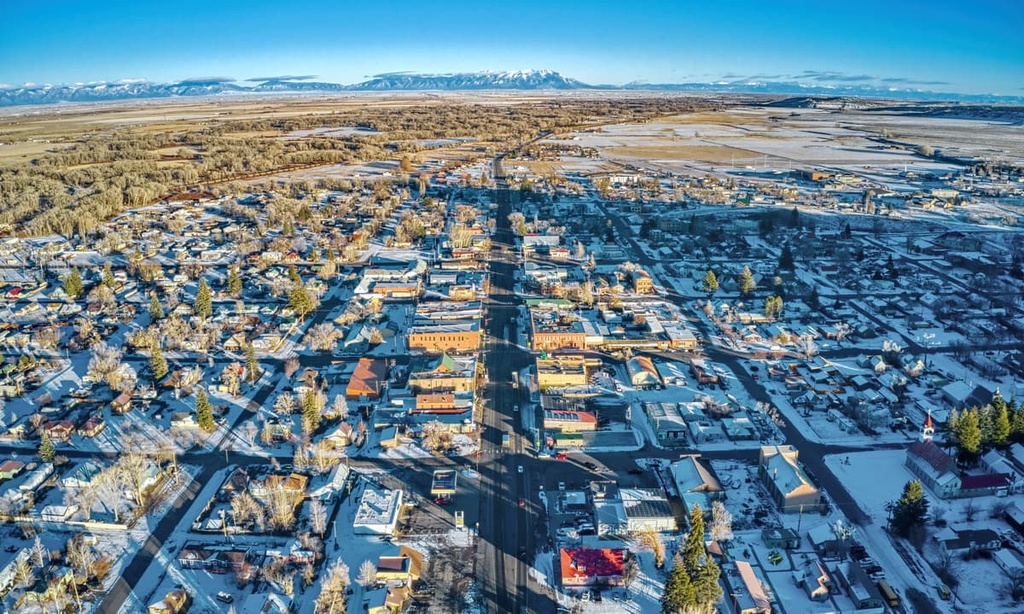
Del Norte has a population just shy of 2,000 people, and it sits at the base of the San Juan Mountains. The city’s quaint downtown area has a handful of boutiques, restaurants, and accommodation options that range from historic to modern and quirky.
Two good accommodation options that are located in town are the Windsor Hotel—originally built in 1874 and a good option for those looking for a bit more comfort—and The Mermaid House, a B&B with a slightly psychedelic ambiance, built with sustainable materials and modeled as a tiny home.
Del Norte is located only 20 minutes away from South Fork, and both towns offer lodging in the winter for visitors to Wolf Creek Ski Area. In the summer, Del Norte is a prime stopover point for accessing Rio Grande National Forest, La Garita Caldera, and a wide array of outdoor activities including fishing, climbing, and hiking.
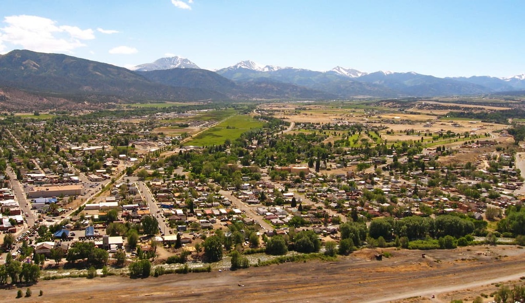
The Arkansas River runs along downtown Salida, a charming town located to the north of the San Luis Valley. The permanent population of Salida hovers at around 6,000 people, but the town draws many visitors to the region with its many whitewater rafting and hiking opportunities.
San Isabel National Forest and Arkansas Headwaters State Park are both located just a short drive from downtown Salida. Both have camping options available, and the first designated campsite in the state park is only 10 minutes from town. There are also areas for dispersed car camping in the national forest as one drives north up Monarch Pass.
Located just across the state border from Colorado in New Mexico, Taos is home to a regional airport, a vibrant art scene, and the Rio Grande Gorge.
For a cultural experience in Taos, one can easily spend a day visiting local artists’ galleries or one of the small art museums that capture the essence of the American southwest.
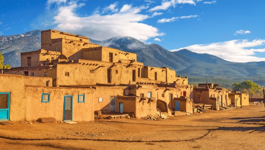
Meanwhile, the Taos Pueblo is a living museum that’s been home to the Taos Pueblo tribe for over a thousand years. Visitors to the pueblo can accompany a local tour guide for the chance to stroll among adobe buildings and learn about the Indigenous community that has called the land home for countless generations.
Another good attraction to check out in Taos is the Rio Grande Gorge Bridge, which is located just 10 miles (16 km) from town. The Rio Grande Gorge Bridge crosses about 650 ft (198 m) above the Rio Grande River, making it the fifth-highest bridge in the US.
There are numerous opportunities for rafting, fishing, and hiking in Taos, too. You can also ski at Tao Ski Valley in the winter months for a bit of snow-filled outdoor adventure.
Accommodation options in the town range from luxury to rustic. For a more luxurious experience, check out El Monte Sagrado, a resort that’s located minutes from downtown. Or, if you’re okay with roughing it, there are many campsites in the nearby Wild Rivers Recreation Area and Carson National Forest.
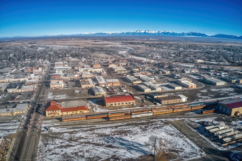
Alamosa is a small university town and the largest commercial center in the San Luis Valley. It features a modest variety of accommodation and shops. For those passing through the region, it’s a great spot to check out if you want to restock on supplies for a trip, get refreshments at a local brewery, or catch occasional live music in the park during summer.
From Alamosa, you can also make the short trip from town to reach Alamosa National Wildlife Refuge and Blanca Wetlands. You can drive to the northeast of Alamosa and reach the popular Great Sand Dunes National Park and Preserve in about half an hour.
Or, if you’re interested in life beyond Earth, you can drive 22 miles (35 km) to the north from Alamosa to see the UFO Watchtower. Alien encounters have long been rumored in the valley. While no UFO sightings are guaranteed, the 10 ft (3 m) raised platform does consistently provide visitors with a stunning view of the surrounding Sangre de Cristo Range and the San Juan Mountains.


