Scan the QR code and open PeakVisor on your phone
Taos Pueblo is an ancient pueblo located in the US state of New Mexico. The pueblo marks one of the oldest continuously inhabited communities in the entire country. The highest peak in the region is Old Mike Peak at 13,094 feet (3991 m) tall while the most prominent is Capulin Peak with 1,250 feet (381 m) of prominence.
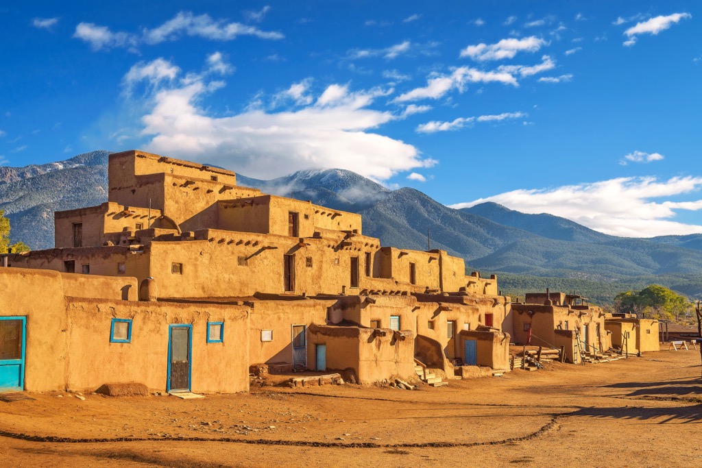
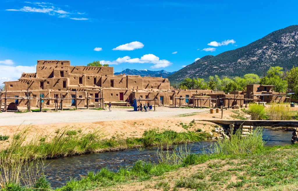
Taos Pueblo is an ancient pueblo situated in the northern stretches of the US state of New Mexico. The pueblo belongs to the Taos Native American tribe, more specifically the Tiwa people.
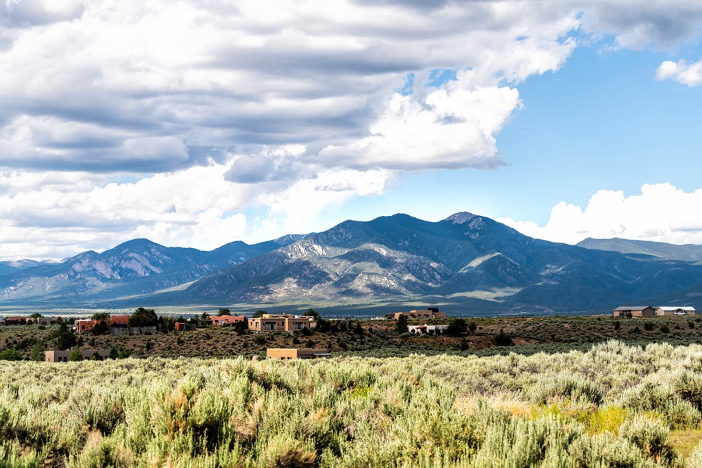
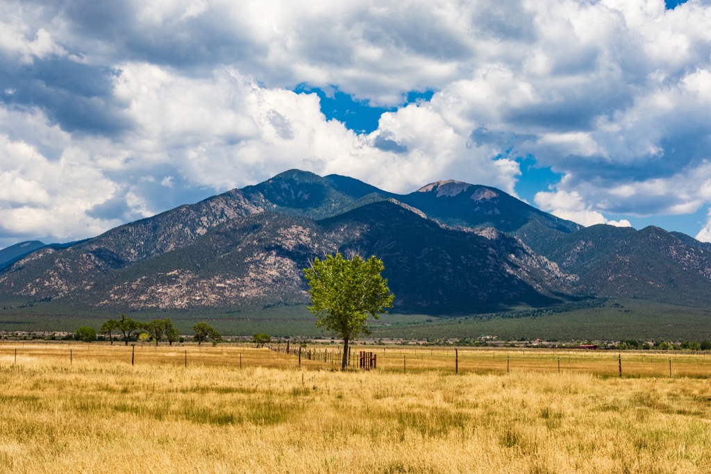
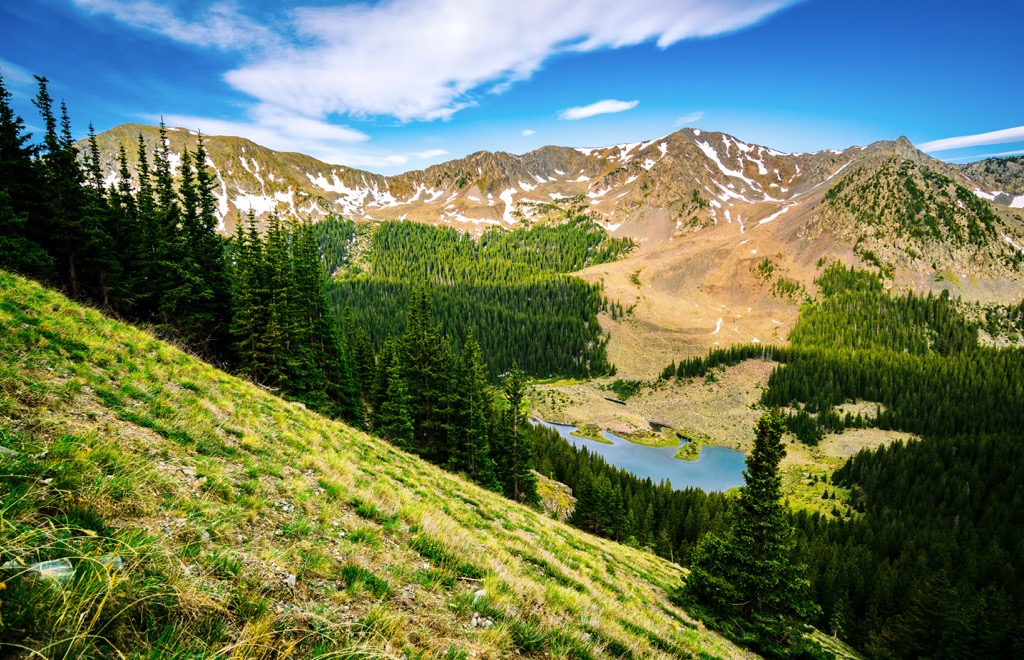
The protected terrain spans across the Sangre de Cristo Mountains in northern New Mexico near the state’s border with Colorado. The pueblo is situated in the western foothills of the mountain range, just a mile north of the city of Taos.
Peaks in the region are part of the Taos Mountains, a subrange of the Sangre de Cristo Mountains. The Río Pueblo de Taos, also known as the Red Willow Creek and Rio Pueblo, cuts through the center of the pueblo.
Within the protected region lies Blue Lake (Ba Whyea) which marks a sacred place for the Indigenous peoples in the region. This lake also marks the headwaters for the Rio Pueblo de Taos.
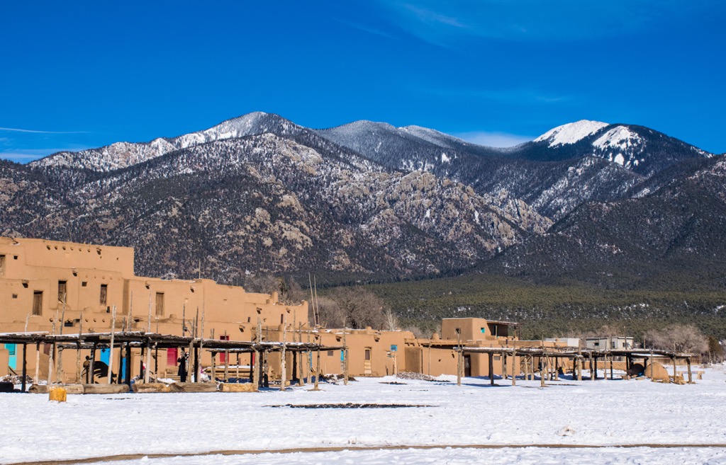
Forested hillsides rise steeply around the pueblo, giving way to portions of Carson National Forest. The Rio Grande lies west of the pueblo, flowing in a north to south direction. Besides the stunning landscape that surrounds the region, the main feature of the pueblo is a multi-storied complex that is still inhabited to this day.
Taos Pueblo is designated as both a National Historic Landmark and a UNESCO Heritage Site. The pueblo and surrounding tribal land spans 95,000 acres (38,000 ha).
Additionally, the Taos Pueblo is located near numerous areas for outdoor recreation. Sections of Carson National Forest extend to the north and south. East of the pueblo lies Eagle Nest Lake State Park and Philmont Scout Ranch. Further west of the pueblo, across the valley, lies portions of Carson National Forest as well as the Rio Grande del Norte National Monument.
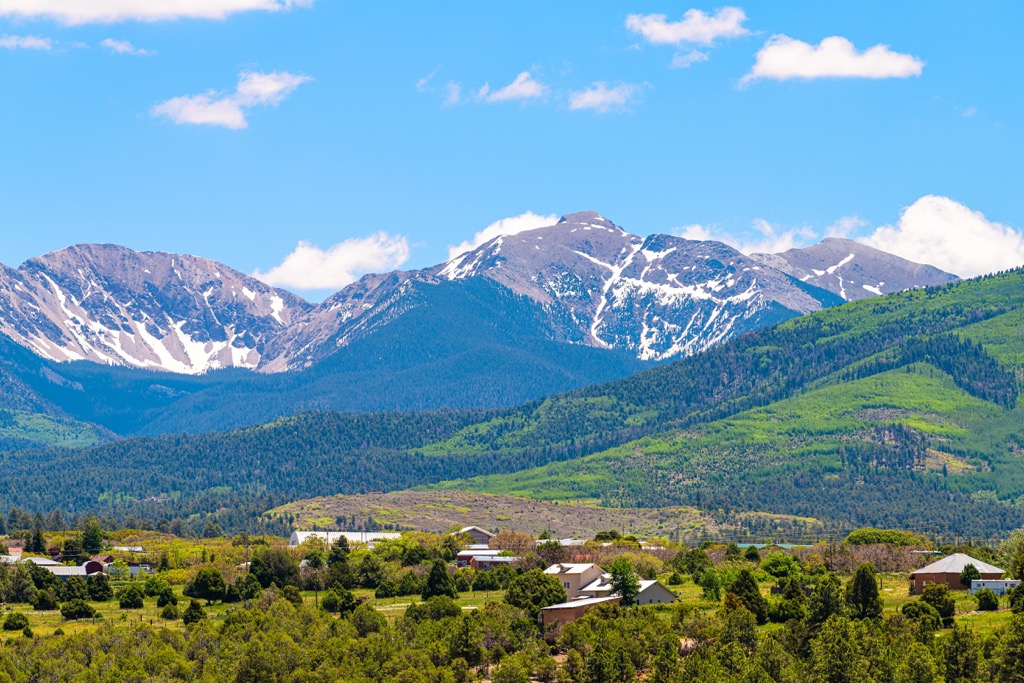
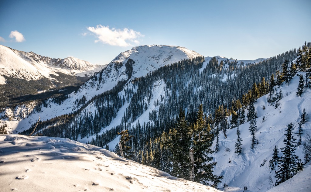
The peaks within and surrounding Taos Pueblo are part of the Taos Mountains, a subrange of the Sangre de Cristo Mountains. The Sangre de Cristo Mountains are one of the southernmost subranges of the Southern Rocky Mountains.
These peaks, along with the surrounding terrain, began forming during the Laramide orogeny. Widespread uplift in the region, led to folding and compacting of the Earth’s crust. Following this continual folding, the region was uplifted 20 million years ago, giving formation to these rugged peaks.
The Sangre de Cristo Mountains mark one of the youngest ranges in the region. Following this major uplift, the range was further folded, giving way to the narrow valleys and steep hillsides of the region.
Gneiss rock found in the region dates back to the Precambrian period. Common rocks found throughout the range include limestones, sandstones, and dolomites.
Despite being some of the southernmost peaks of the Rocky Mountains, peaks in the region were heavily glaciated during the last glacial maximum. Glacial retreating further carved out the landscape, leaving behind sweeping valleys and dramatic changes in elevation.
Major peaks that are located within the area include Old Mike Peak, Capulin Peak, Pueblo Peak, and Vallecito Mountain.
The dramatic changes in elevation in the region allow a variety of both flora and fauna to thrive. Various types of grasses grow in the mountainous terrain that surrounds the pueblo.
As elevations increase, these grasses quickly give way to densely forested hillsides. Ponderosa pine and pinyon pine dominate the lower elevations with aspens and conifers populated mid-elevations. Some of the highest named peaks within the protected region, feature spruce and fir trees.
Fauna in the Sangre de Cristo Mountains is similar to that found throughout the Southern Rocky Mountains. Larger mammals include black bear, mule deer, elk, and mountain lion. Nearby alpine terrain provides the ideal habitat for bighorn sheep, pica, and marmot.
Human history in the region dates back over 10,000 years through the Indigenous peoples of the area. This region is part of the traditional territory for multiple Indigenous groups including the Puebloans (particularly the Taos Pueblo), the Jicarilla Apache Nation, and the Ute (Núu-agha-tʉvʉ-pʉ̱).
The Taos people, along with other Pueblo Indigenous people, are thought to have migrated to the area from the Four Corners region, which lies to the northwest. The buildings found in the pueblo today are estimated to have been constructed between 1000 and 1450 CE, made entirely of adobe.
Many Indigenous groups inhabited land surrounding the Rio Grande, with Taos Pueblo marking a central point for trade between the groups. Every fall season the pueblo would host a trade fair for the surrounding region.
The first people of European descent to arrive in the region were members of the Francisco Vásquez de Coronado expedition in 1540. Spanish presence increased in 1620 when Jesuits built a Catholic Church in the pueblo.
This forced imposition of the Catholic religion was met with frustration and resistance from the Taos people. By the 1660s the Taos people had killed the priest and destroyed the Catholic Church. Tensions continued to grow as the Spanish retaliated.
In 1680, the Taos Pueblo, along with other pueblos in the region, led the Pueblo Revolt which resulted in killing the present priest and yet again destroying the Catholic Church. This resulted in the Spanish retreating to present-day El Paso until 1692.
The Spanish people returned to the Taos region at the end of the seventeenth century. Both the Taos Pueblo and the Spanish were continually raided by the Comanche and Kiowa peoples over the following decades. To help combat these raids, the Spanish and Taos Pueblo worked together.
In 1846, during the Mexican-American war, the two groups joined forces to resist the advances and brutality brought on by the US Army.
After being designated as part of the US, President Theodore Roosevelt took 48,000 acres (19,000 ha) of land from the Taos Pueblo, and designated it as part of Carson National Forest. In 1970, this land, including the land surrounding Blue Lake, was returned to the Taos Pueblo.
In 1966 the region was designated as a US Historic Place, and later a UNESCO World Heritage Site in 1992. The Taos Pueblo lies within roughly 95,000 acres (38,445 ha) of tribal land. Today the Taos Pueblo is open to visitors during designated hours with roughly 150 people living in the pueblo fulltime.
There are numerous hiking areas surrounding Taos Pueblo. Those visiting the pueblo must do so during the designated hours and follow the guidelines provided by the pueblo. Here a few spots to check out on your next visit to the region:

The trail leading to the summit of Devisadero Peak lies just south of Taos Pueblo, directly east of the city of Taos. This route climbs steadily through the forested landscape, with sections of both technical and smooth trail.
The loop trail offers stunning views of the sweeping valley below while the Sangre de Cristo Mountains extend to the east. Hikers have unobstructed views from the summit of the peak of the city of Taos down below. This loop route is 5.6 miles (9 km) in length and features 1,335 feet (407 m) of elevation gain.
This hiking trail lies north of the pueblo, within the Columbine-Hondo Wilderness of Carson National Forest. The trail climbs steadily for the first four miles (6.4 km) before flattening out near the summit of Lobo Peak.
After climbing through the forested landscape and passing along multiple creeks, the trail opens up. From the summit, hikers have panoramic views of the Southern Rocky Mountains which extend to the north and south. The out and back route is 11.6 miles (18.7 km) with 3,772 feet (1,150 m) of elevation gain.
Williams Lake Trail marks one of the most popular hiking routes in Carson National Forest. A majority of the trail climbs through the forested landscape before a short descent to Williams Lake.
The lake lies at the base of a basin with steep forested hills rising to the east, south, and west. The out and back trail is 4.2 miles (6.8 km) with 1,030 feet (314 m) of elevation gain. Hikers can also extend this route to reach the summit of Wheeler Peak.
Looking for a place to stay near the Taos Pueblo? Here are some of the best cities and villages to check out in the region.
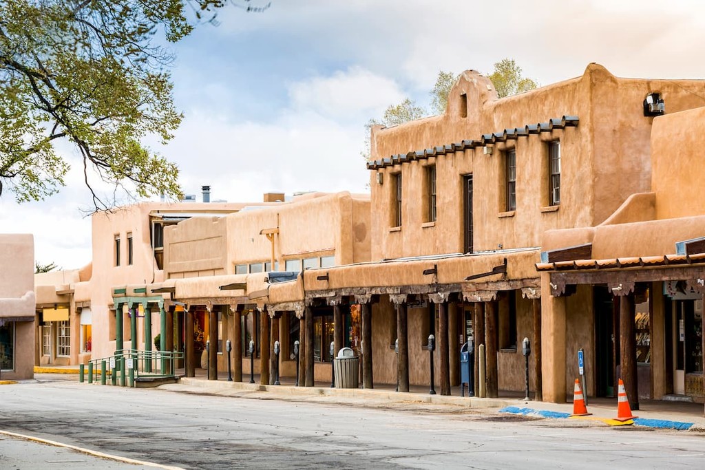
Taos is a small town situated one mile south of the Taos Pueblo. Situated in the foothills of the Sangre de Cristo Mountains, Taos is home to around 6,000 people. This small mountain town lies near the Taos Ski Valley, situated to the northeast.
Taos is home to numerous galleries and museums, showcasing the artistic history of the region. Besides being surrounded by opportunities for outdoor recreation, the town of Taos is also home to numerous local shops and restaurants. Visitors can also check out the Harwood Museum of Art and the Taos Art Museum.
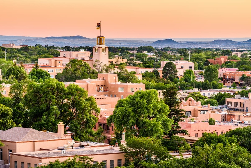
The city of Santa Fe lies an hour and a half drive south of the Taos Pueblo. Home to around 88,000 residents, Santa Fe marks the fourth largest city in the state. The city was founded in 1610 as a Spanish colony and is situated on either side of the Santa Fe River.
Known for its Pueblo-style architecture, the city features a historic district with numerous landmarks. The warm climate has helped establish Santa Fe as a tourist destination throughout the year. Popular sites and museums include the New Mexico Museum of Art, Museum of Contemporary Native Arts, and New Mexico History Museum.