Scan the QR code and open PeakVisor on your phone
The Bull Gulch Wilderness Study Area is a potential protected area situated in the western part of the state of Colorado in the US. The tallest peak in the wilderness study area is Black Mountain at 8,645 ft (2,635 m) in elevation. The most prominent peak in the region is Big Red Hill with 384 ft (117 m) of prominence.
The Bull Gulch Wilderness Study Area is a small potential protected area that’s part of the White River Plateau and the Southern Rocky Mountains of western Colorado.
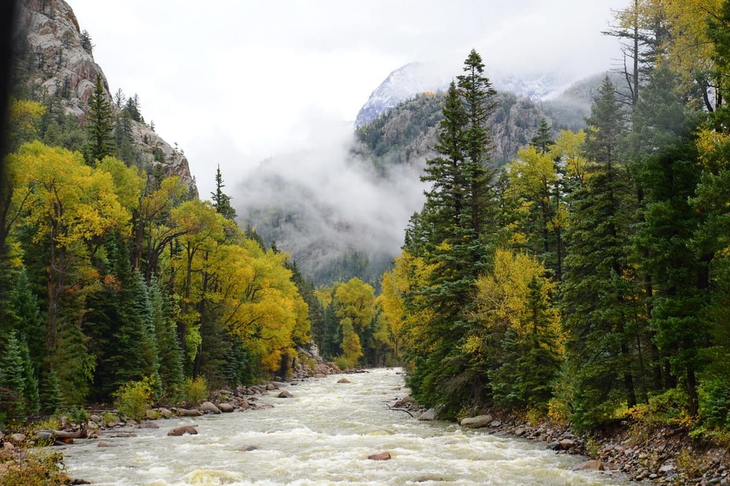
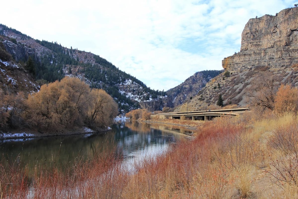
The wilderness study area includes 15,200 acres (6,151 ha) of rugged, mountainous, and forested landscape. The Colorado River runs along the western edge of the study area as it travels southwest into Utah.
The western portion of the study area is marked by steep cliffs and gulches that lead into the Colorado River. A redrock forested landscape can be seen throughout, as the mountainous landscape of western Colorado transitions into canyon-filled desert.
The Bull Gulch, for which the wilderness is named, cuts a deep canyon through formations of red rock. Deep and narrow twisting corridors are found near the entrance of the gulch. Here, large sweeping bowls have also been carved into the delicate sandstone near the Colorado River.
The forested portions of the study area begin to thin as the elevation increases, allowing for views of the nearby Flat Tops from many of the region’s summits.
The Bull Gulch Wilderness Study Area is situated near numerous other protected areas. These spaces include the Castle Peak Wilderness, Flat Tops Wilderness, Eagles Nest Wilderness, and Sarvis Creek Wilderness.
The peaks within Bull Gulch Wilderness Study Area are part of the White River Plateau within the western stretches of the Southern Rocky Mountains. The greater Rocky Mountains extend from southern Wyoming to central New Mexico.
The plateau, which is also known as the White River Uplift, is a broad plateau that formed during the Eocene epoch. This occurred during the later period of the Laramide orogeny that took place between about 70 million to 35 million years ago.
The uplift of the plateau originally created a flatter landscape than the one that’s visible today. Over the course of millions of years, erosion carved out the rock to form the landscape that we now see in the region.
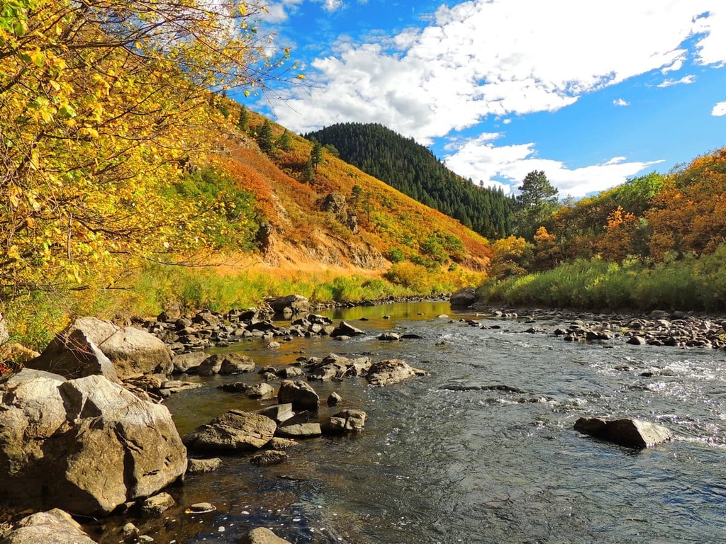
The Colorado River, and its tributaries, have eroded much of the softer sedimentary rock in what is now the Bull Gulch Wilderness Study Area, leaving behind the region’s distinctive red rock sandstone.
Due to the brittle nature of sandstone, there are many dramatic cliffs, gulches, and canyons within the study area. The rock has also been smoothed out in many places, leaving behind sweeping bowls and other rock formations.
Major peaks within Bull Gulch Wilderness Study Area include Black Mountain, Big Red Hill, and Jack Flats.
The Bull Gulch Wilderness Study Area receives minimal rain and snowfall compared to other areas in the region.
Lower elevations in the wilderness are characterized by subalpine and conifer forests, though some of the taller peaks are free of plant life.
These forested sections often consist of aspen, Douglas fir, ponderosa pine, and blue spruce. Low growing grasses and shrubs, such as sagebrush, can be found throughout the wilderness, too.
There are relatively few animal species that inhabit the wilderness study area due to the harshness of the terrain. However, there are many species that live in the nearby Flat Tops Wilderness Area, which is located to the northwest. Common animals found in the Bull Gulch Wilderness include mule deer, marmots, various species of songbirds, and black bears.
The land surrounding the Bull Gulch Wilderness has a long and rich human history that dates back thousands of years.
This region is part of the ancestral homelands of the Ute people who have lived throughout what is now western Colorado and eastern Utah since time immemorial.
The Ute traditionally lived as hunters and gatherers, often establishing a home base and traveling into the mountains in order to find food and materials. The Parianuche band of Ute traditionally used this region to forage for food. Many tribal nations also traditionally used the natural hot springs that are found to the southwest of the wilderness.
Settlers of European descent began arriving in the region in the 1820s. Many of these settlers were fur trappers.
But during the 1860s, the Charles Baker Expedition discovered gold in western Colorado. This led to a massive influx of settlers. Populations continued to grow in the region with the construction of the railroad.
Disputes often broke out between Indigenous tribes and the settlers. Many of the settlers in the region disregarded the Ute peoples’ claim to their ancestral homelands.
In 1868 a treaty was signed by the Tabeguache Ute Chief Ouray which ensured that the Ute people could use present-day Glenwood Springs as their hunting ground. Despite the treaty, the Ute people were continually harassed, displaced, murdered, and forcibly moved onto reservations.
The construction of the railroad led to the establishment of the city of Glenwood Springs. The city later became one of the first in the nation to have electric lights in 1897.
As a wilderness study area, Bull Gulch isn’t currently protected by the provisions of the Wilderness Act. However, Bull Gulch is managed by the Bureau of Land Management (BLM) and it was designated as a wilderness study area in 1980.
It is protected by the BLM due to its wilderness characteristics in case Congress decides to formally designate it as a wilderness in the future. Until then, Bull Gulch will be managed in the same way as a formal wilderness area but without an official designation.
Bull Gulch Wilderness Study Area is home to relatively few hiking trails. That said, here are some of the most popular hiking areas in the region:
The Colorado River Road Trail follows along the Colorado River marking the western boundary of the wilderness. The trail can be used for hiking, mountain biking, or driving. This point to point route is 34.5 miles (56 km) long with 2,506 ft (764 m) of elevation gain.
Many visitors will drive the road as it provides access to many unmaintained trails leading into the Bull Gulch Wilderness. Many of these unmarked trails travel eastward into the wilderness, taking hikers up to some of the named peaks.
Dozens of unmarked trails are scattered throughout the wilderness. Hikers wishing to explore the area should be equipped with maps, GPS devices, and quality navigation skills due to the remote nature of the landscape.
Looking for a place to stay near Bull Gulch Wilderness Study Area? Here are some of the best cities and villages to check out in the region:
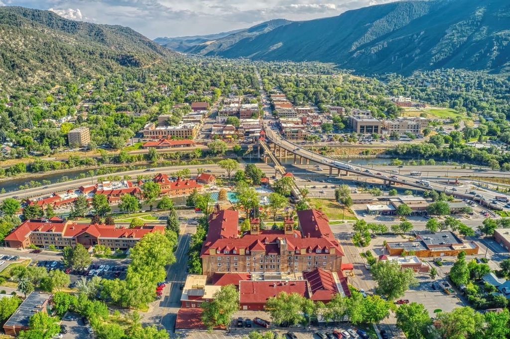
Glenwood Springs lies just to the southwest of the wilderness, and it is home to around 10,000 people. The city is a hub for year-round outdoor recreation and is known for its world-famous hot springs. Hundreds of miles of trails around the city provide the perfect setting for hiking, trail running, and mountain biking during the summer months.
Winter months in Glenwood are also full of outdoor activities, including skiing, snowmobiling, snowshoeing, and Nordic skiing. Tourists and locals alike can enjoy relaxing in the natural hot springs throughout the year.
Despite its small size, Glenwood is home to multiple local restaurants, breweries, and artisanal shops. Atop a nearby mountain lies the Glenwood Canyon Adventure Park, an amusement park accessible by cable car.
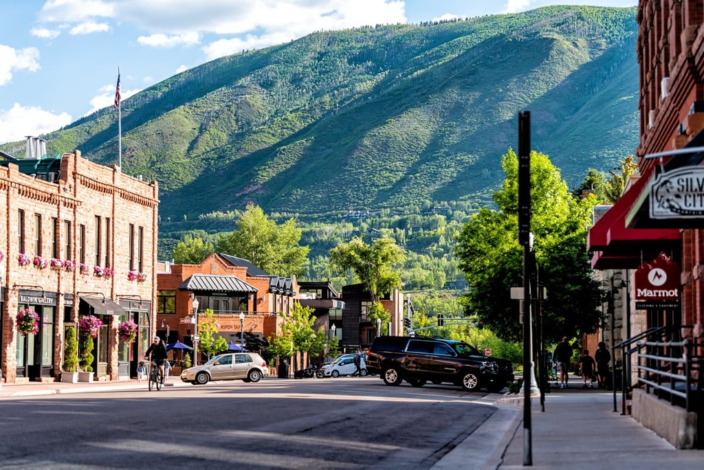
Aspen, Colorado lies to the south of the wilderness. It is situated in the heart of the White River National Forest. Surrounded by the Rocky Mountains, Aspen is known for its world-class skiing and fine dining.
Four major ski resorts make up the Aspen Snowmass region, making it one of the largest ski areas in the country. Other popular winter activities include snowshoeing and cross-country skiing. The restaurant scene in Aspen is comparable to that of larger cities, too.
Though the stunning mountain town is known for its winter activities, summertime in Aspen is equally as beautiful. Hundreds of miles of trails in the region can be used for hiking, biking, and horseback riding. Sites for rock climbing, fishing, and paragliding are all a short drive or walk away from downtown.