Scan the QR code and open PeakVisor on your phone
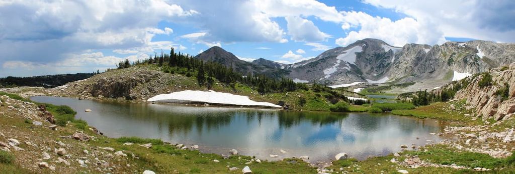
Medicine Bow National Forest is a massive area of federally managed land situated in the southeastern part of the US state of Wyoming. The forest contains everything from expansive grasslands to the jagged peaks of the Southern Rocky Mountains. There are 140 named mountains in the forest, the highest of which is Medicine Bow Peak (12,021 ft/3,664 m) and the most prominent of which is Laramie Peak (10,256 ft/3,126 m).
Medicine Bow National Forest is situated in the southeastern region of the US state of Wyoming. The forest consists of multiple non-contiguous units that are located in Platte, Natrona, Carbon, Converse, and Albany counties.
Technically, while Medicine Bow National Forest is its own forest unit, it is managed alongside Routt National Forest and Thunder Basin National Grassland as a single administrative unit. As a whole, the two forests and the one grassland have a combined area of more than 2.2 million acres (890,000 ha).
Routt National Forest is located in Garfield, Routt, Jackson, Grand, Rio Blanco, and Moffat counties in northern Colorado. Meanwhile, Thunder Basin Grassland is situated in the northeastern part of Wyoming near the state’s borders with South Dakota and Montana in Converse, Weston, Campbell, Crook, and Niobrara counties.
Medicine Bow National Forest is slightly smaller than Routt National Forest with approximately 1,096,891 acres (443,896 ha) of land to Routt’s 1,125,438 acres (455,448 ha) of land. This makes Medicine Bow National Forest approximately the same size as Bighorn, Pike, Lincoln, and Mount Hood national forests in Wyoming, Colorado, New Mexico, and Oregon, respectively.
As is the case with Routt National Forest, Medicine Bow National Forest is highly mountainous. The alpine regions of the national forests stand in stark contrast to the lower-lying grasslands below.
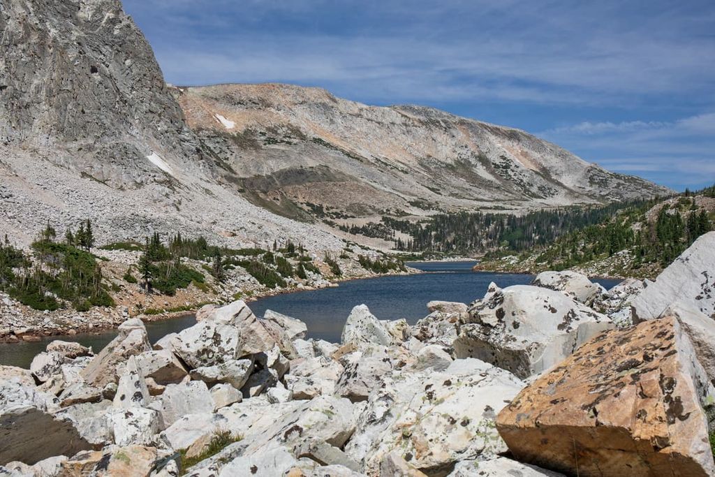
However, one of the most famous parts of Medicine Bow National Forest is an area called Vedauwoo (pronounced Vidau-voo). Vedauwoo is an area of large rock outcroppings located near Interstate 80 between Cheyenne and Laramie. It is one of the most popular rock climbing areas in the region due to its fantastic off-width climbing opportunities.
Other notable features of Medicine Bow National Forest include the many wilderness areas within its borders. These wilderness areas include:
Medicine Bow National Forest is also located within driving distance of many other areas of public land. This includes the nearby Routt National Forest as well as Arapaho National Forest, Roosevelt National Forest, Arapaho National Wildlife Refuge, and Pawnee National Grassland.
Medicine Bow National Forest encompasses some of the easternmost peaks in the Southern Rocky Mountains. The Rocky Mountains are one of the major mountain ranges in North America. They stretch from the northern part of the US state of New Mexico all the way to the northern part of the province of British Columbia in Canada.
Within Medicine Bow National Forest, there are two primary subranges: the Laramie Mountains and the Medicine Bow Mountains, the latter of which also includes the Snowy Mountain sub-subrange.
The Laramie Mountains are the northernmost extent of the Front Range of the Southern Rocky Mountains. They stretch for about the northern border of Colorado all the way to about the city of Casper. The Laramie River cuts through the center of the range and then meets up with the North Platte River in Colorado.
As is the case with the rest of the Rockies, the Laramie Mountains formed primarily during the Laramide orogeny, a major mountain building event that took place about 70 million years ago. In fact, the Laramide orogeny gets its name from the Laramie Mountains and the Laramie River.
Within the Laramie Mountains, the rock is primarily Precambrian granite. The range is dominated by geologic structures known as monadnocks, which are isolated rocky knobs that rise out above an otherwise flat plain.
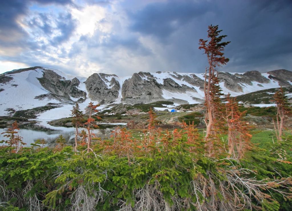
The Medicine Bow Mountains are situated just to the west of the Laramie Mountains. They run for about 100 miles (!60 km) from the northern part of Colorado into Wyoming. Technically, the range starts at the terminus of the Never Summer Mountains in the northern part of Rocky Mountain National Park. They end just to the south of Interstate 80 in Wyoming.
Geologically, the Medicine Bow Mountains also formed during the Laramide orogeny alongside the Laramie Mountains and the rest of the Rockies.
As with the Laramie Mountains, the Medicine Bow Mountains contain some very old rock including Precambrian granite. Some of the most notable rock in the Medicine Bow Mountains includes Medicine Peak quartzite, which is believed to date back about 2.4 to 2 billion years.
Furthermore, a decent portion of the Cheyenne belt is exposed within the range. The Cheyenne belt is a large tectonic suture zone that formed during the Paleoproterozoic Medicine Bow orogeny.
This mountain building event occurred about 1.7 billion years ago and it is a natural barrier between the 2.5 billion to 1.6 billion year old Yavapai province to the south and the 4 to 2.5 billion year old Wyoming craton to the north.
Medicine Bow National Forest is home to a great diversity of flora and fauna. In general, Medicine Bow and Routt national forests share similar ecological characteristics. However, the land in Medicine Bow tends to be lower and drier than the land in Routt. As such, the plants and animals in Medicine Bow are often more drought-tolerant.
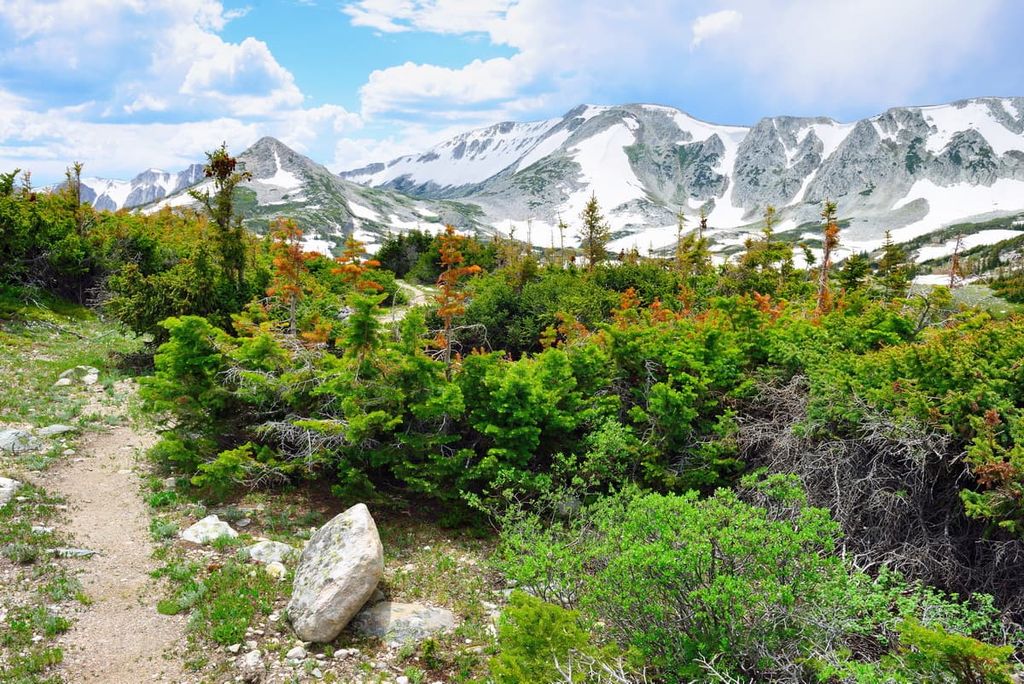
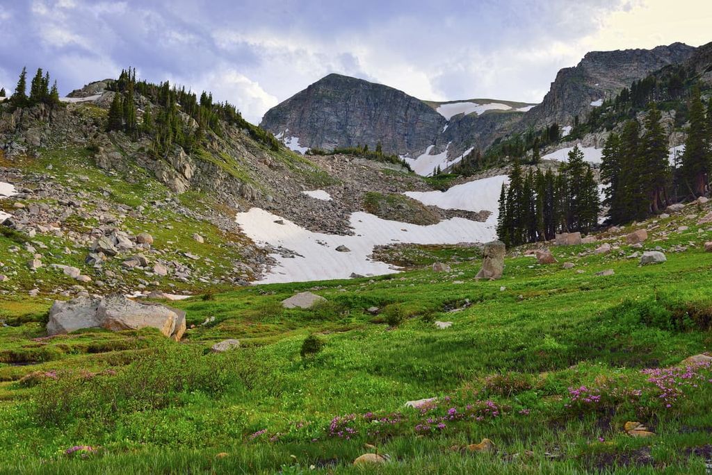
There are four primary ecological zones in the forest: sagebrush steppe, montane forest, riparian forest, and alpine.
The lowest elevation regions of the forest are dominated by sagebrush steppe, which is common throughout the non-mountainous regions of Wyoming. These plants are highly drought-tolerant and they have adapted to live in very hot climates.
At mid elevations, the landscape is heavily forested. The primary tree type is lodgepole pine, though other species in the region include ponderosa pine, Douglas fir, subalpine fir, engelmann spruce, Colorado blue spruce, gambel oak, and aspen.
Furthermore, many of the areas in the forest around major rivers and streams have riparian vegetation. This includes trees like the narrow leaf cottonwood and various species of willow.
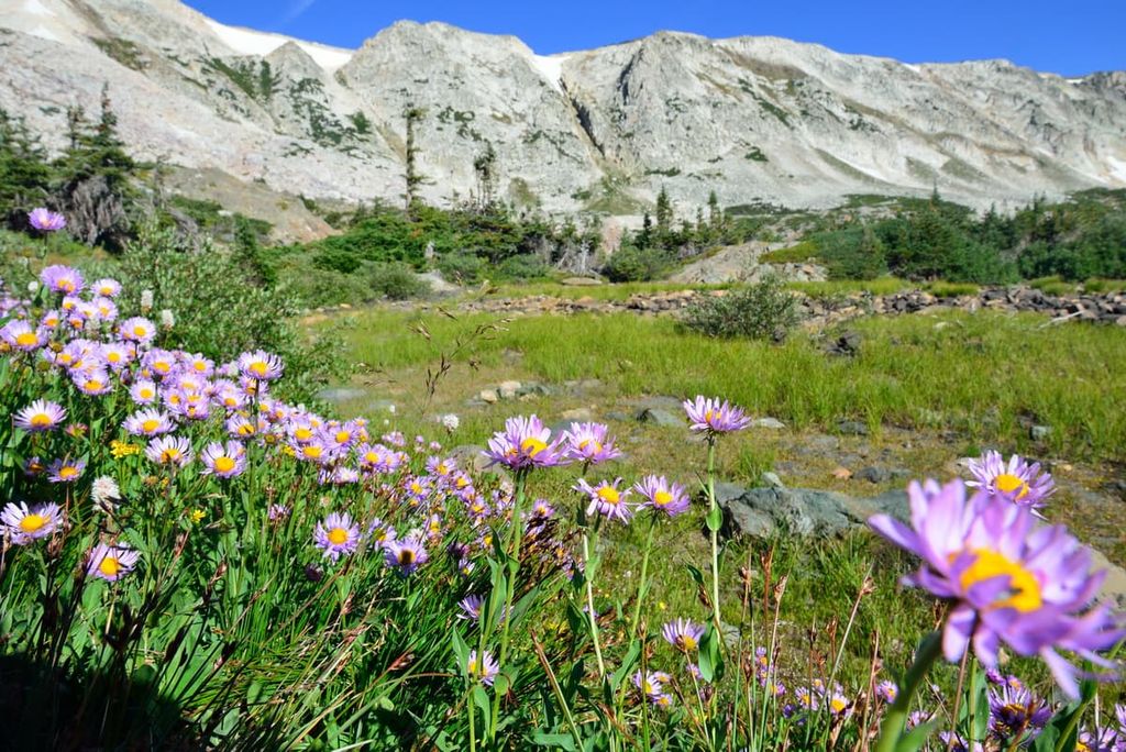
Finally, at the summits of the highest peaks in the forest, the landscape transitions into an alpine zone. Here, only the heartiest of grasses and shrubs can survive. Alpine meadows in the region also feature stunning wildflowers in the summer months.
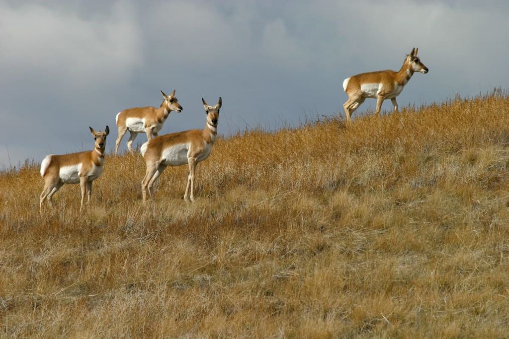
Wildlife in the national forest is just as varied as the plantlife. Some of the many species that call the forest home include pronghorn, elk, mule deer, moose, and white-tailed deer. There are also Canada lynx, red fox, coyotes, bobcats, and mountain lions. Black bears also call the region home, though grizzly bears have since been extirpated from the forest.
Humans have lived in what is now Medicine Bow National Forest since time immemorial. The region is the ancestral homelands of many Indigenous peoples, including the Eastern Shoshone Tribe, the Cheyenne & Arapaho Tribes, the many tribal nations of the Očhéthi Šakówiŋ (Great Sioux Nation), and the Crow Tribe (Apsaalooké), among others.
The first peoples of European descent to visit the region were likely French and French-Canadian fur trappers who came to the area during the eighteenth and nineteenth centuries.
One of the more famous of these fur trappers was Jacques La Rameé, a French-Canadian trader that worked for the North West Company and the American Fur Company. La Rameé visited the region around what is now Laramie in the 1820s and disappeared in what is now called the Laramie Mountains. Both the city and the range are named after him.
The arrival of the Union Pacific railway brought more peoples of European descent and European-Americans to the region in the mid-1800s. This precipitated the forced removal of Indigenous peoples from their homelands in what is now southeastern Wyoming and northern Colorado, particularly after the establishment of Wyoming Territory in 1868 and the creation of the state of Wyoming in 1890.

What is now Medicine Bow National Forest was initially established as Medicine Bow Forest Reserve in 1902 by President Theodore Roosevelt. The forest was later expanded after the addition of the former Hayden National Forest in 1929.
In 1959, the forest also acquired a parcel of land that’s known as the Pole Mountain Unit from the War Department (now the Department of Defense). Military activity ceased in the region in 1961, and the land has since been used for recreational purposes.
Although Medicine Bow National Forest is a separate unit from that of Routt National Forest and Thunder Basin National Grassland, the three areas have been administratively combined since 1995.
The forest’s name, “Medicine Bow,” is said to come from the fact that many tribal nations in the area traditionally used what is now called the Medicine Bow Mountains to harvest mountain mahogany. The quality wood from mountain mahogany was then used to create bows at large ceremonial powwows that were held in the range.
Medicine Bow National Forest is home to hundreds of miles of hiking trails. Here are some of the best hikes to consider during your next trip to the forest:
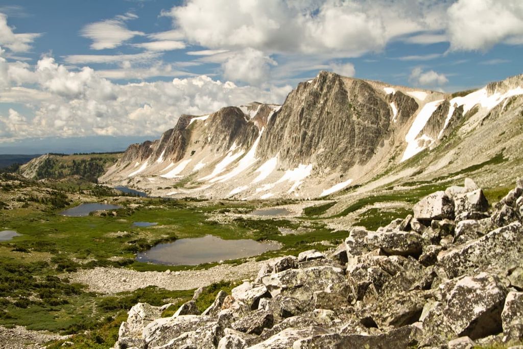
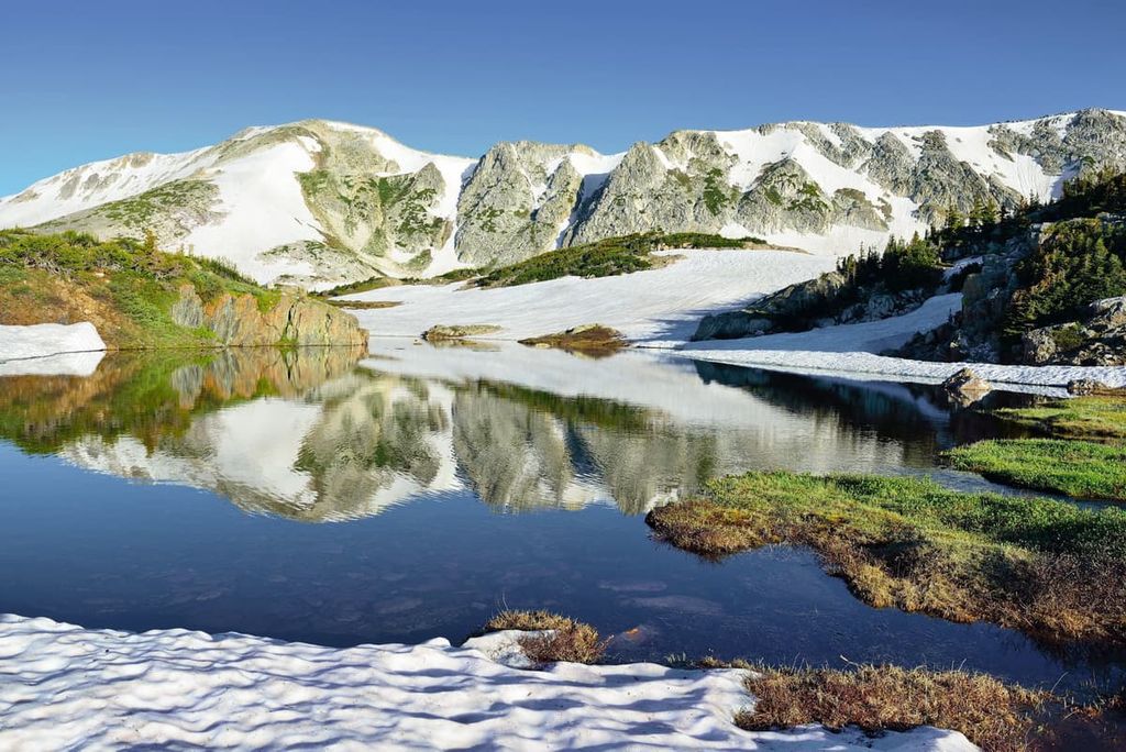
The 7.6 mi (12.2 km) Medicine Bow Peak Loop is a popular trail among people looking to get spectacular views of the Medicine Bow Mountains. There are multiple starting points for this hike, though many people begin from the Mirror Lakes Trailhead.
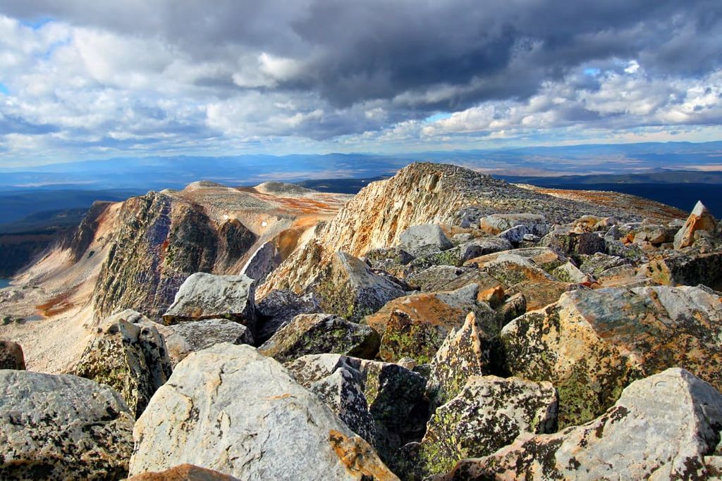
From there, you’ll begin navigating your way uphill, gaining elevation as you make your way up switchbacks to the summit of Medicine Bow Peak. At the summit, you can enjoy the expansive views from the top of one of the most prominent peaks in the region.
After reaching the summit, you’ll continue down the backside of the peak and onto a large ridge. This eventually leads you to an overlook above Lake Marie and then back to the trailhead after a fun day of adventure.
Also note that you may see some wreckage on this hike from the crash of United Airlines Flight 409, which crashed into Medicine Bow Peak in 1955. There were no survivors from the crash and you can see some debris from the plane as you hike. A memorial plaque was erected on the mountain in 2001 and visitors are asked to respect both the memorial and the crash site.
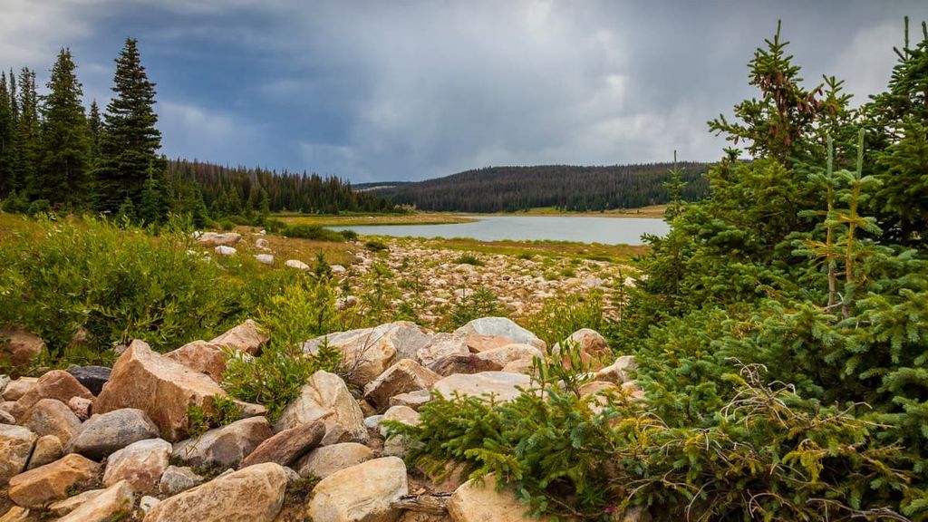
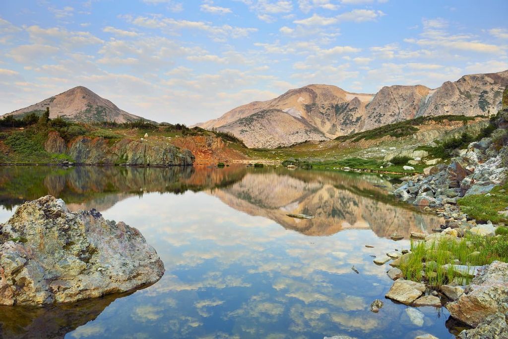
The Alpine Lakes Loop is a popular 11.8 mi (19 km) hike that brings you to some of the most stunning mountain lakes in Medicine Bow National Forest.
This hike begins at the Brooklyn Lake Trailhead. To begin, you’ll take the Sheep Lake Trail (#389) and then the Gap Lakes Trail (#108) before merging onto the Lost Lake Trail (#395). Throughout the adventure, there are also opportunities to take small side trails to see other beautiful alpine lakes.

During the Alpine Lakes Loop, you’ll circumnavigate Browns Peak and get to see some gorgeous wildflower meadows. However, even though this hike is fairly long, it has a reasonable amount of elevation gain, making it a nice choice for a cruisy, scenic day hike.
One of the more difficult hikes in Medicine Bow National Forest, the Tour de Snowy Mountains is a 32.3 mi (52 km) backpacking adventure into the northern part of the Medicine Bow Mountains.
This hike begins at the North Fork Campground on North Fork Trail (#390). It then ventures all the way to Medicine Bow Peak and then makes a loop around the peak on the Medicine Bow Peak Loop trail. After, it heads back toward the trailhead and follows the Alpine Lakes Loop around Browns Peak before heading back to the trailhead.
Effectively, this is an out-and-back trip that has two of the most popular loop hikes in the forest built-in. This makes it a great choice for people who want to see as much of the region as possible on one adventure.
The Twin Lakes Trail is a casual 3.3 mi (5.3 km) out-and-back hike that starts at the Brooklyn Lake Campground. It is technically a section of the Alpine Lakes Loop, but its relatively short distance and minimal elevation gain make it a nice choice for families and newer hikers.
Do note that there are a number of small stream crossings on the trail, especially if you’re hiking in the early summer. However, the stunning views of the surrounding mountainscapes make this one of the best short day hikes in the forest.
Another popular day hike, the Tipple Trail (#293) is a 4.4 mi (7.1 km) out-and-back trek to an old miner’s cabin. This trek begins at the Lake Marie Trailhead and ventures through both dense woodlands and alpine meadows.
Along the way, the trail crosses French Creek a number of times before traversing a small boulder field. Eventually, the trail arrives at an old miner’s cabin, which was once used to house miners working at the nearby Red Mask Mine.
In addition to being one of the best hiking destinations in southeastern Wyoming, Medicine Bow National Forest is also home to a world-famous climbing area: Vedauwoo.
The Vedauwoo (pronounced Vidau-voo) climbing area is located just off of I-80 in the national forest. It is a collection of dozens of crags, most of which are within a short drive of the city of Laramie. The climbing area is fairly hard to miss while driving on I-80 because the many rocky knobs and cliffs that define Vedauwoo can be seen right from the highway off of Exit 329.
With hundreds of climbs to choose from, there’s plenty of adventure to be had on the 1.4 billion year old Sherman Granite towers that are scattered around the area. Most of the climbing is trad climbing, though there’s a mixture of slab and crack routes, some of which are bolted.
However, Vedauwoo has made a name for itself thanks to its plethora of fantastic off-width climbs. The area is home to a range of routes with a solid assortment of moderate and challenging climbs.
Note that there is an entrance fee if you want to climb at Lower Blair and the Central Area, but all other parking areas are free. Additionally, as of May 2018, dispersed camping in the area is limited to designated sites on Forest Road 700. The sites are free, but you must stay at a designated area.
Finally, if you want more information about the climbing routes and opportunities in the area, there are a few excellent guidebooks to check out. These include:
Note that some of the guidebooks for the area are out of print, so finding a copy can be challenging. Mountain Project and Vedauwoo.org both have good information about climbing in the region.
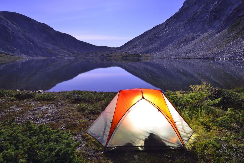
Medicine Bow National Forest offers a whole slew of accommodation options for people looking to spend more time in the wilderness. From designated campgrounds to dispersed camping and cabin rentals, here are some of the best places to spend the night in the forest:
There are dozens of campgrounds in Medicine Bow National Forest. Some are available on a first come, first served basis while others can be reserved online through Recreation.gov. If you are planning to visit a reservable campground during the summer months, booking in advance is highly recommended on the weekend.
Each campground in the forest is slightly different, so research any amenities at a given campground before leaving home. However, keep in mind that none of the forest’s campgrounds offer electricity and water hookups for RV campers.
Also note that most campgrounds are only open seasonally. So, late spring snow and early fall snow can disrupt the opening and closing schedules of a campground.
Finally, you cannot camp for more than 14 days in a 30 day period in a campground in the national forest. If you wish to camp for longer, you need to acquire a permit.
The campgrounds in the Sierra Madre, Pole Mountain, and Laramie Peak areas of Medicine Bow National Forest include:
Additionally, the campgrounds in the forest’s Snowy Range area include:
As a general rule, dispersed camping, which is camping away from a developed campground, is allowed in national forests. Medicine Bow National Forest is no exception.
You can more or less set up your tent wherever you’d like in the national forest unless otherwise designated. However, note that you must generally be at least 200 feet (60 m) from waterways and trails when camping in the backcountry. If camping along a road, you generally can’t drive your vehicle more than 300 feet (91 m) off the road.
There are a few exceptions to this rule. For example, in the Pole Mountain Corridor along Vedauwoo Road, dispersed camping is only allowed in one of the 73 designated sites. This is a very popular rock climbing area, and most of the campsites have a fire ring for visitor use.
Additionally, all dispersed campers in Medicine Bow National Forest are limited to no more than 16 days of dispersed camping in a 30 day period. If you would like to camp for longer, you need to get a permit.
When dispersed camping in the national forest, all of the principles of Leave No Trace should serve as guidelines for visiting the area. Be sure to pack out any trash that you produce in the forest. Store your food with bear safety in mind and always follow fire regulations when camping in the forest.
Medicine Bow National Forest also contains a number of cabins that are available for rent during your adventures. Many of these cabins are open year-round, too, for hiking or skiing trips.
Note that reservations are required for cabin rentals and should be made well in advance on Recreation.gov. This is particularly true on the weekend and during summer holidays.
Some cabins offer amenities like water and even electricity, but others are much more rustic. Be sure to do your research and determine what you need to bring with you before you book a stay in a national forest cabin.
The cabins located in Medicine Bow National Forest include:
Looking for a place to stay near Medicine Bow National Forest? Here are some of the best nearby cities to check out:
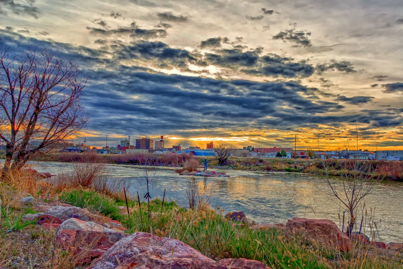
The city of Laramie, Wyoming is situated just to the east of Medicine Bow National Forest. It is home to approximately 32,000 residents, so it’s the third-largest city in the state.
Home to the University of Wyoming, Laramie is a bustling college town that’s also a popular outdoor recreation destination. The city is home to a number of museums and it offers superb access to a number of Rocky Mountain subranges, such as the Laramie Range and the Snowy Range, for hiking, nordic skiing, and mountain biking.
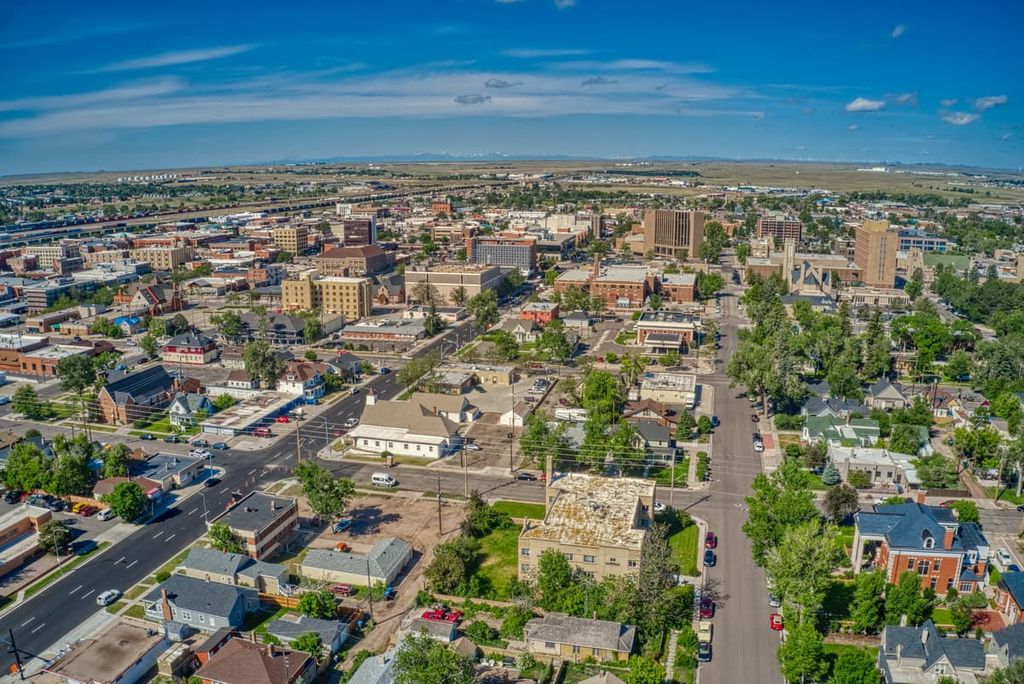
Cheyenne is the largest city in the state of Wyoming with a population of approximately 65,000 residents. It’s also the state capital and a major economic center for Wyoming.
Although the Rocky Mountains extend much further north than Cheyenne to the province of British Columbia in Canada, the city is the northern terminus for a region known as the Southern Rocky Mountain Front. This megalopolis includes a number of major cities in the southern and eastern part of the Rockies, such as Denver and Santa Fe.
Cheyenne is a worthy destination in its own right. The city has a beautiful botanical garden and it has an extensive parks system with dozens of miles of trails. It’s also just over an hour from Denver, so it’s an easy place to get to if you’re traveling to the area from further afield.
With approximately 58,000 residents, Casper is the second-largest city in Wyoming. It is located just outside the northern section of Medicine Bow National Forest along Interstate 25.
Although Casper is a sizable distance from the other major cities in Wyoming (Cheyenne and Laramie), it is an important economic and cultural center for central Wyoming. It is home to the state’s second busiest airport by enplanements after Jackson Hole, and it offers great road access to the western part of the state.
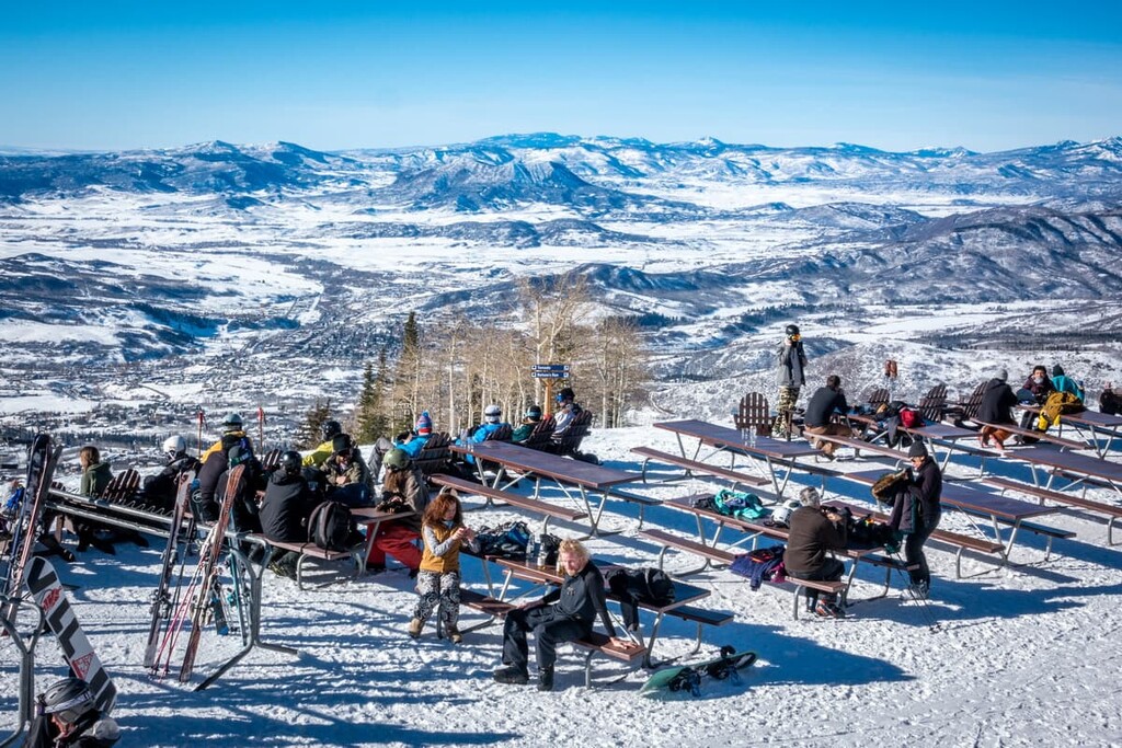
The self-proclaimed Ski Town USA, the city of Steamboat Springs is located to the south of Medicine Bow National Forest, just outside of Routt National Forest. It is home to approximately 13,000 people and it is a world-famous ski destination.
In addition to being a great place to head to in the winter, Steamboat also offers great hiking and rafting opportunities in the summer. Plus, Steamboat has a regional airport (Yampa Valley) that offers excellent connections to major cities around the US, especially during the winter months.
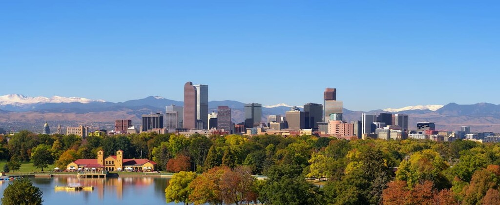
Although it’s a bit of a drive from Medicine Bow National Forest, Denver is by far the largest city in the region. With a population of over 715,000 people, Denver is actually the nineteenth largest city in the US and the second largest state capital by population.
Denver is located just to the east of the Rockies, so it offers unparalleled access to some of the world’s best hiking, climbing, skiing, and mountain biking. It’s just a few hours by car to Steamboat Springs and a short drive to Cheyenne and Laramie. So, Denver is a great place to fly into before you start your adventures in Medicine Bow National Forest.