
Scan the QR code and open PeakVisor on your phone
Just 62 miles east of the US city of Portland, Oregon, the Mount Hood National Forest is a block of land protecting just over 1 million acres (4,300 km2) of land. The forest protects lake, streams, mountains, and woodlands from the Columbia River Gorge all the way to the Olallie Scenic Area under the slopes of Mount Jefferson.
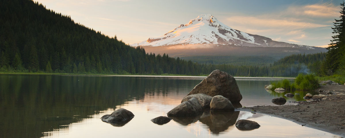
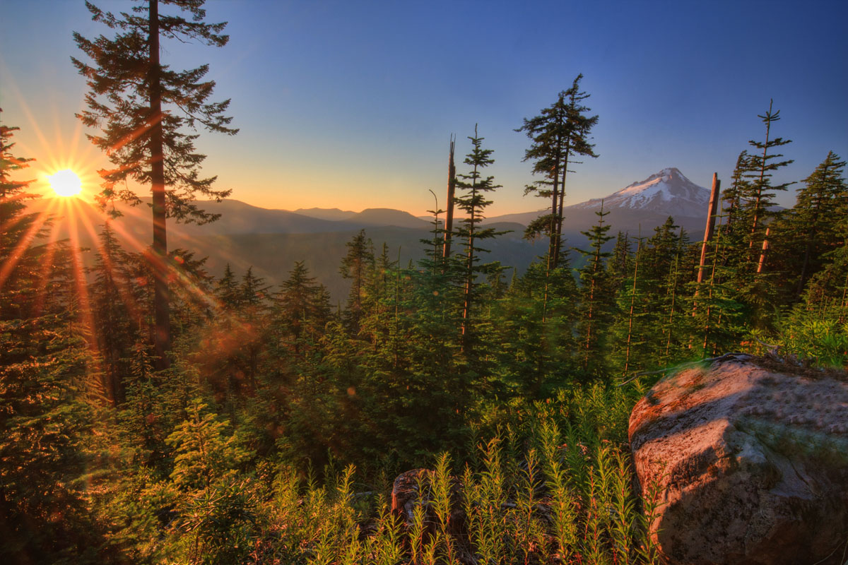
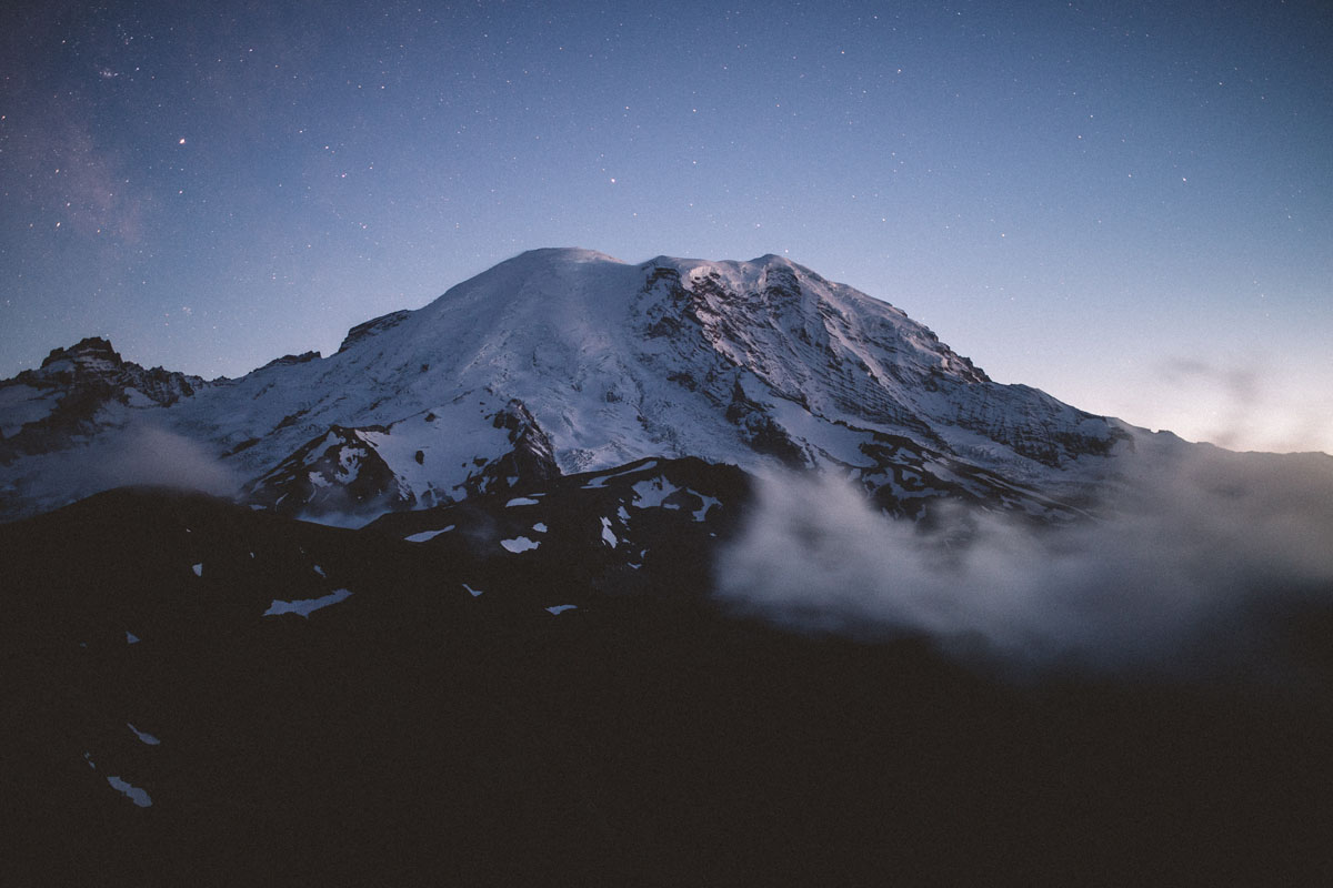
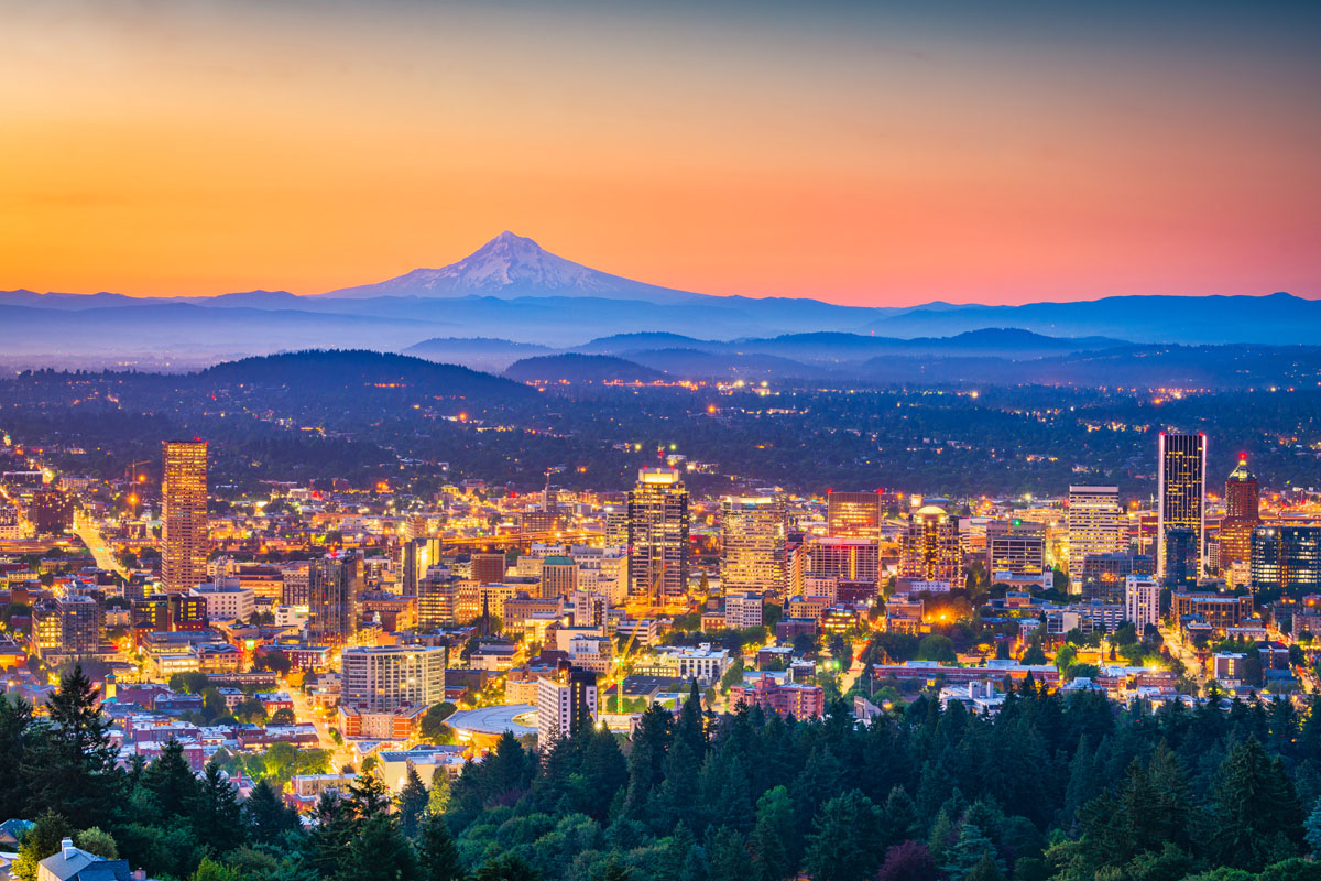
The forest’s namesake, Mount Hood (11,240ft/3426), is one of just 168 mountains contained within its boundaries. A major stratovolcano, Mount Hood is the highest and most prominent peak in the forest, covered with 11 active glaciers. It is a major summit of the southern Cascade Rangein the state of Oregon.
Mt. Hood is understandably the area’s most admired natural treasure. The dormant volcano is an iconic backdrop to Portland and features a half-dozen ski areas and miles of hiking trails. Over 10,000 climbers attempt the summit every year, making it one of the most-climbed glaciated peaks in the world.
In addition to Mount Hood, the forest is home to impressive summits like Crater Rock, Schreiner Peak, Lookout Mountain, Pulpit Rock, Mount Lowe.
Before the region became a national forest, the area was home to the Molalas, Kalapuyans, Chinookan Clackamas, Shinookan Wascos, Northern Paiute, Sahaptin, and Multnomah people who all consider the land to be their ancestral home.
The Multnomah people’s original name for Mount Hood, Wy’east comes from a version of a legend in which the Great Spirit Sahale’s sons, Wy’east and Pahto, burned forests and villages in a fight over Loowit, a beautiful maiden. In his anger, Sahale smote both of his sons and Loowit, creating a mountain for each of them where they died. Loowit was the original name for Mount St. Helens, while Pahto was the original name for Mount Adams.
With the arrival of European and white American settlers in the region, most of the indigenous people of the area were forced off their land and sent to reservations. Eventually, President Benjamin Harrison designated the land “Bull Run Timberland Reserve” in 1892, though land was soon added to this parcel and the name was changed to the Cascade Range Forest Reserve in 1893.
This large forest reserve was broken up into smaller forests in 1908, thereby establishing the Oregon National Forest under the jurisdiction of the National Forest Service. In 1924 the forest was renamed, yet again, and called the Mount Hood National Forest.
By that time the land was quite popular among outdoor recreationalists, thanks, in no small part, to the role of the automobile, which allowed people to easily get to the forest’s picnic grounds and campsites. During the Great Depression, the Civilian Conservation Corps (CCC) built a number of new campgrounds and recreation sites int eh National Forest, including Timberline Lodge.
As World War II rolled around, however, the focus of Mount Hood National Forest was no longer recreation but timber and mineral extraction to aid in the war effort. After the war, visitor numbers skyrocketed, reaching an average of 4 million tourists per year in the forest’s 100 developed campgrounds, 5 ski areas, and 812 miles of trails.
Mount Hood is one of the most visited and beloved National Forests in the country and receives over four million visitors each year. To protect the Forest from deforestation and logging, several campaigns have been created to encourage legislators to designate the Forest and nearby Columbia River Gorge as a National Park. National Park designation has the potential to expand public access and recreation opportunities in the forest.
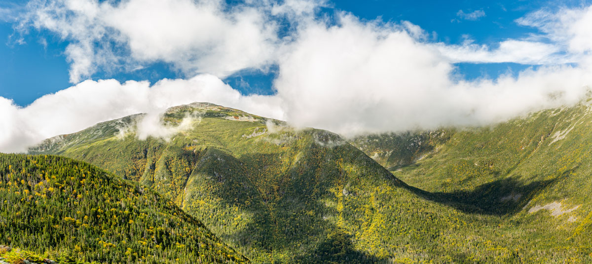
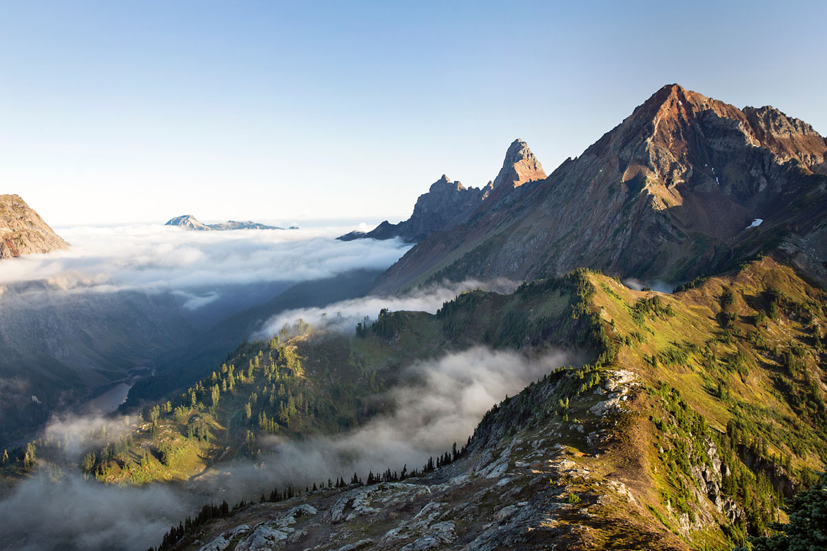
Eight Wilderness areas can be found in the Mount Hood National Forest – Badger Creek, Bull of the Woods, Clackamas, Lower White River, Mark O. Hatfield, Mount Hood, Roaring River, and the Salmon-Huckleberry Wilderness. Each wilderness area provides ample outdoor recreation opportunities including fishing, camping, hiking, biking, boating, skiing, and even berry picking.
Here are some of the top trails in Mount Hood National Forest:
Located near the base of Mount Hood, this 2.1 mile trail takes you through beautiful old growth forest along the Salmon River as you make your way past gigantic cedars and small sandy beaches. A perfect year-round activity!
This beautiful trail from Timberline Lodge takes you directly into the alpine with fantastic views of Mt. Jefferson and the 700 foot deep Zigzag canyon. Perfect for late summer and early fall, this 4.4 mile roundtrip hike is a great half-day activity.
If you don’t have time to tackle the entire Timberland Trail, the McNeil trail is an excellent alternative. This trek is one of the best in the Mt. Baker area and features stunning mountain views, lush meadows, and plenty of babbling brooks. The hike is approximately 10.5 miles roundtrip and gains 2,200 feet of elevation. The trail begins at Top Spur Trailhead and follows part of the Pacific Crest and Timberline Trail.
The Timberline trail is a classic Pacific Northwest trail that circumnavigates Mt. Hood. This footpath features incredible alpine vistas, scenic waterfalls, stunning alpine meadows, and of course, plenty of majestic views of Mt. Hood. The trail is a 40-mile loop and gains a total of 9,000 feet in elevation. Though the hike isn’t technically challenging, there are a few big climbs and most hikers will allocate 4 days to complete the trip.
This trail takes you as high as you can go on Mount Hood by hiking as it climbs switchbacks for 3.9 miles up to Tie-In-Rock, the traditional starting point of many technical climbs. Once you reach this spot, you can get great views of Mount Rainier and the Three Sisters on the horizon. Looking for a more moderate hike? You can head on a 1.3 mile walk around Cooper Spur to an old stone shelter with a nice view of Eliot Glacier instead.
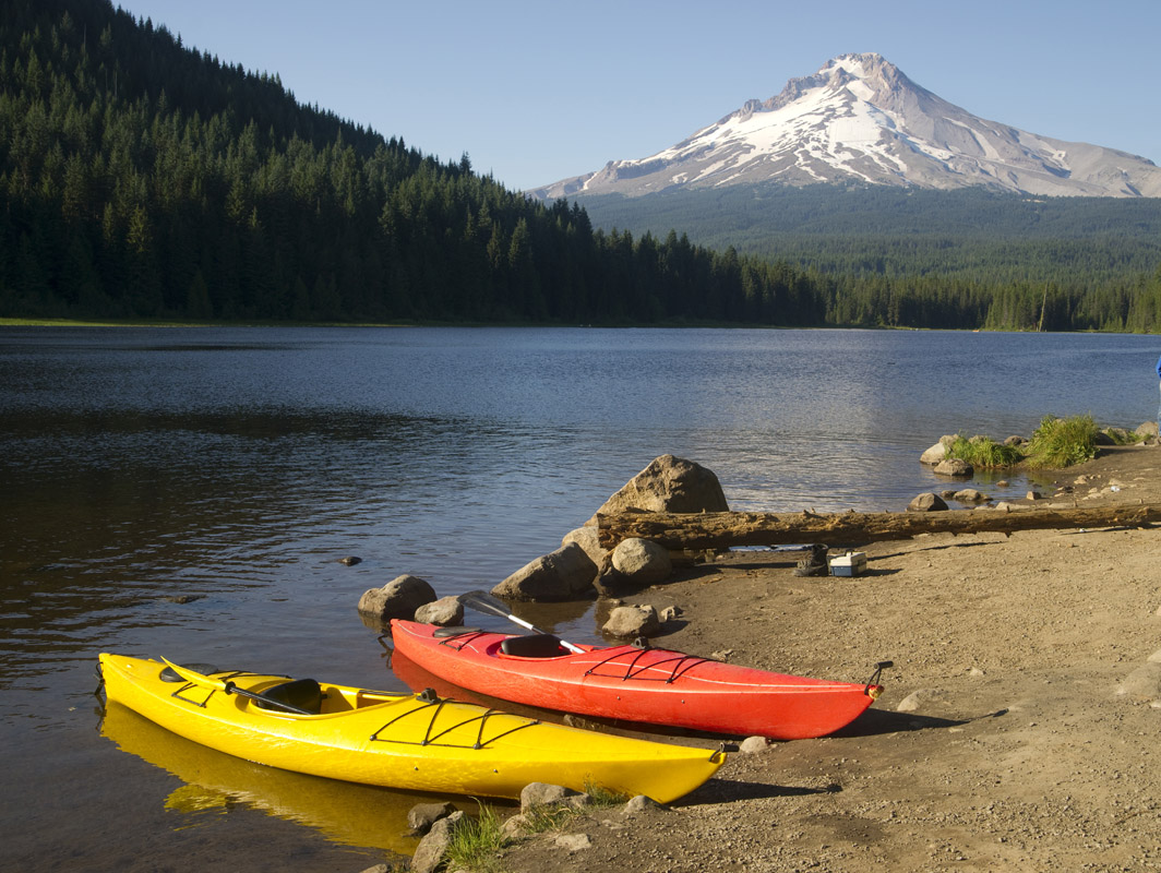
For picture-perfect views of Mt. Hood, most visitors will make the trip to Trillium Lake. In the winter, roads around the lake are groomed for cross-country skiing and snowshoeing. In the summer, visitors travel to the lake to walk the 1.9-mile Trillium Lake Loop, pitch a tent at the Trillium Lake Campground, or cast a line in the lake’s pristine waters.
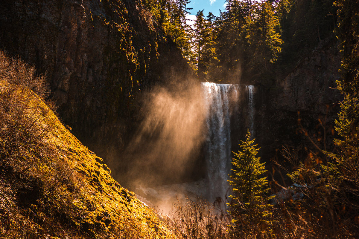
Thundering over a 150-foot lava cliff near the eastern base of Mount Hood, Tamanawas Falls is a popular destination for travelers to Portland and the Mt. Hood National Forest. The hike begins at the Sherwood Trailhead and continues for 3.6 miles (RT). Gaining just 700 feet in elevation, this trip is rated as easy and is suitable for families and novice hikers.
Mt. Hood has six ski areas - Cooper Spur, Mount Hood Meadows, Ski Bowl, Snow Bunny, Summit, and Timberline Ski Area. Timberline offers the only year-round ski resort operation in America and the most vertical feet of skiing in the Pacific Northwest.
The Timberline Lodge, which was built in 1937, is a particularly popular destination for skiers and snowboarders. In addition to offering premium access to the mountain, the lodge features high-end accommodations and dining.
Whispering Woods is located just a mile off Highway 26 and sits adjacent to Mt. Hood National Forest. Since 1981, Whispering Woods has evolved into a premium Mt. Hood vacation destination. The resort offers a variety of accommodations ranging from private rentals to luxurious condominiums. While staying at the resort, visitors can take advantage of hiking trails, fishing, winter sports, and scenic destinations nearby.
Portland is the largest city in Oregon and lies on top of an extinct volcanic field.The city is characteristically quirky and is best-known for its offbeat culture. In the city, you’ll find a variety of bike paths, coffee shops, and a laid-back environment. It is a bustling city with an international airport and some of the world’s finest cuisine. Portland is a popular city for tourists that are looking to visit the Columbia River Gorge, the largest national scenic area in the United States with the greatest concentration of waterfalls in North America. Most travelers start their Oregon adventure by flying into Portland and driving a few hours to their final destination.
An hour and a half’s drive south from Mount Hood National Forest, Bend is a great city on the banks of the Deschutes River that’s become a hipster outdoor enthusiast’s paradise in recent years. With a decently sized airport and all the amenities you can think of, Bend is a great place to start your trip to Mount Hood National Forest.


ultra
glacier
volcano
oregon-9000ers
cascade-range-9000ers
chemeketan-18-nw
cascade-volcanoes-pin
mazamas-guardian-award
mazamas-cascades-award
mazamas-16-nw-award
fred-beckey-great-peaks
oregon-ultras
ultra
glacier
volcano
oregon-9000ers
cascade-range-9000ers
chemeketan-18-nw
cascade-volcanoes-pin
mazamas-guardian-award
mazamas-cascades-award
mazamas-16-nw-award
fred-beckey-great-peaks
oregon-ultras


