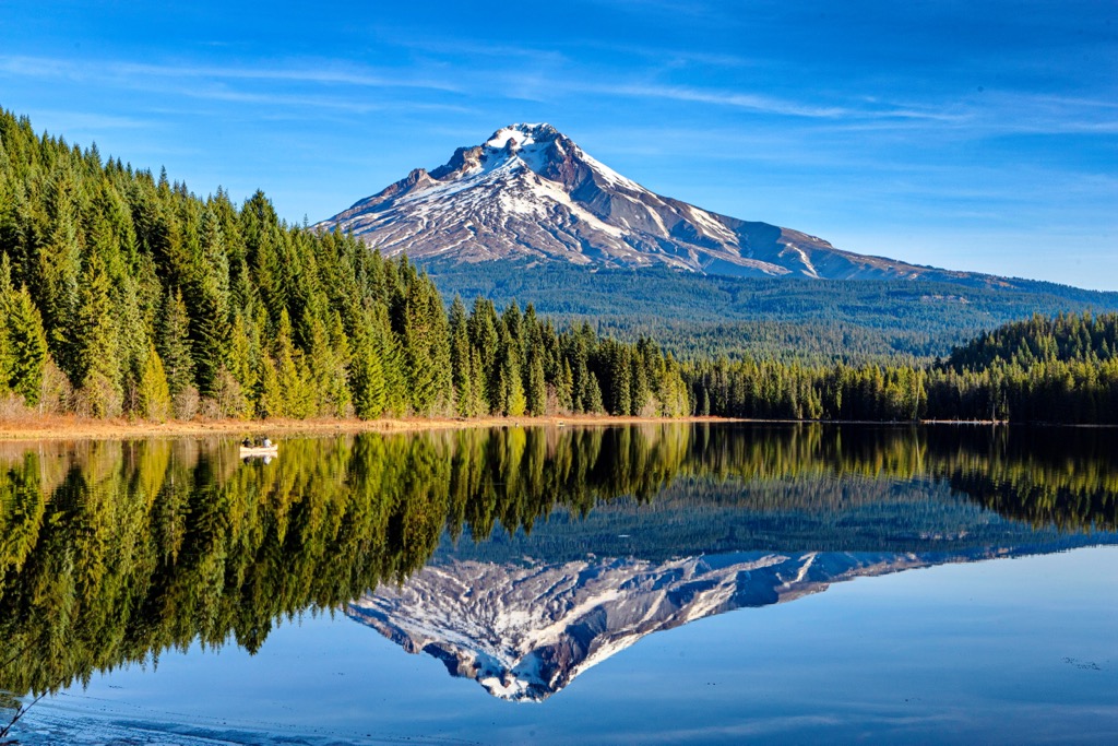
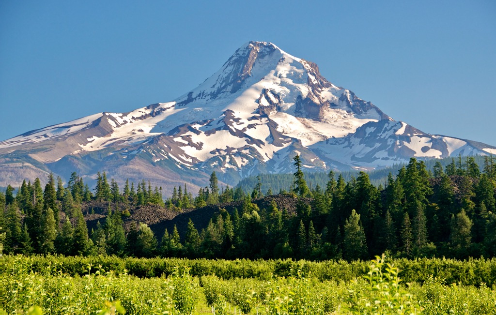
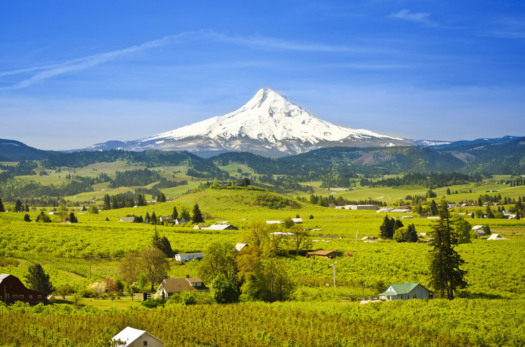
Mount Hood is an iconic mountain in the state of Oregon, located in the Cascade Mountain Range. It is the highest peak in Oregon at 11,249 ft (3,429 m) and is a popular destination for hikers, climbers and skiers. Mount Hood is also one of the most popular destinations for skiing, snowboarding, cross-country trails, and tubing. Mount Hood is the only active volcano in the state and is part of the Cascade Volcanic Arc, which is made up of more than 20 major volcanoes.
The mountain is part of the Mount Hood National Forest and is home to many species of wildlife, including the northern spotted owls, cougars, elk and, recently rumored, wolves. Mount Hood is also home to several glaciers the largest being Eliot and Coe on the north flank. The mountain is a popular destination for climbers, hikers and skiers, and is home to the Timberline Lodge, a National Historic Landmark.
Mount Hood is a popular subject in Oregon folklore and has been featured in many books, films and television shows. The mountain has also been featured in the popular film "Twilight" and the popular television show "Portlandia".
Mount Hood in Oregon is a premier ski destination, boasting some of the best ski resorts in the Pacific Northwest. With its stunning mountain views, excellent snow conditions, and world-class ski resorts, Mount Hood is the perfect place to hit the slopes.
<a href="https://peakvisor.com/ski-resort/mtbaldyresort.html">The Mount Hood Ski Bowl</a> is the largest night ski area in the United States with 36 lighted runs and 69 day runs. With over 1000 acres of terrain, the <a href="https://peakvisor.com/ski-resort/mtbaldyresort.html">Ski Bowl</a> offers a variety of terrain for all levels of skiers and snowboarders. It has a full-service lodge, a tubing hill, and a terrain park.
<a href="https://peakvisor.com/ski-resort/timberlinelodge.html">Timberline Lodge</a> is the only ski resort on Mount Hood that is open year-round. With its stunning views and excellent snow conditions, <a href="https://peakvisor.com/ski-resort/timberlinelodge.html">Timberline Lodge</a> is a favorite among skiers and snowboarders alike. It offers over 1,685 acres of terrain, including a variety of trails for all levels of skiers and snowboarders.
<a href="https://peakvisor.com/ski-resort/skihood.html">Mt. Hood Meadows</a> is the largest ski resort on Mount Hood and is home to some of the best skiing and snowboarding in the state. With over 2,150 acres of terrain, , 11 lifts, and 87 trails. <a href="https://peakvisor.com/ski-resort/skihood.html">Mt. Hood Meadows</a> offers a variety of trails for all levels of skiers and snowboarders. It has a full-service lodge, a terrain park, a tubing hill, and a variety of restaurants and cafes.
No matter what your skill level, Mount Hood has something for everyone. With its stunning mountain views, excellent snow conditions, and world-class ski resorts, Mount Hood is the perfect place to hit the slopes.
By elevation Mount Hood is
# 29 out of 4345 in the Cascade Range # 1 out of 213 in Mount Hood National Forest # 1 out of 4749 in Oregon # 1 out of 136 in Clackamas County # 1 out of 73 in Hood River County # 1 out of 31 in Mount Hood Wilderness # 1 out of 4 in Richard L. Kohnstamm Memorial Area
By prominence Mount Hood is
# 5 out of 4345 in the Cascade Range # 1 out of 213 in Mount Hood National Forest # 30 out of 91437 in USA # 1 out of 4749 in Oregon # 1 out of 136 in Clackamas County # 1 out of 73 in Hood River County # 1 out of 31 in Mount Hood Wilderness # 1 out of 4 in Richard L. Kohnstamm Memorial Area
We use GPS information embedded into the photo when it is available.
3D mountains overlay
Adjust mountain panorama to perfectly match your photos because recorded by camera photo position might be imprecise.
Move tool
Rotate tool
Zoom
More customization
Choose which peak labels should make into the final photo and what photo title should be.
Next
Photo Location
Satellitte
Flat map
Relief map
Latitude
Longitude
Altitude
OR
Latitude
°'''
Longitude
°'''
Apply
Register Peak
Peak Name
Latitude
Longitude
Altitude
Register
Teleport
PeakVisor
This 3D model of Sagarmatha National Park in Nepal was made using the PeakVisor app topographic data. The mobile app features higher precision models worldwide, more topographic details, and works offline. Download PeakVisor maps today.
Download OBJ model
PeakVisor
The download should start shortly. If you find it useful please consider supporting the PeakVisor app.
PeakVisor for iOS and Android
Be a superhero of outdoor navigation with state-of-the-art 3D maps and mountain identification in the palm of your hand!


.jpg)


