
Scan the QR code and open PeakVisor on your phone
Clackamas County is home to 136 named mountains. The highest is Mount Hood at 3,429 m.
Clackamas County is a county located in northern Oregon, just east of Portland. The county has a population of 418,000, making it the third most populated county within the state. The name Clackamas, comes from the Clackamas Indians who are part of the Chinookan people. The region was originally called Clackamas District back in 1843 with the Columbia River as its northern boundary. During this time, the district covered land in four current US states, along with a Canadian province. Oregon City, located within the county, was once the only federal court on the west coasts, besides one in San Francisco.
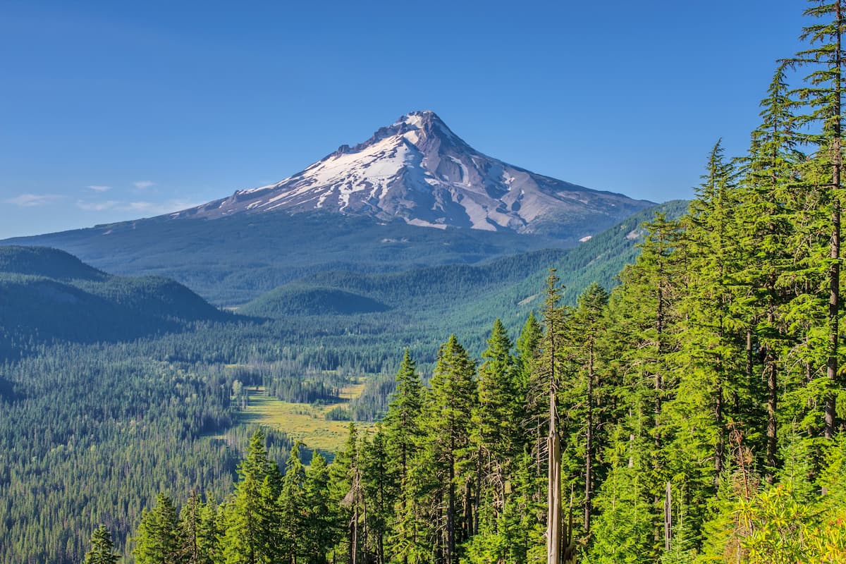
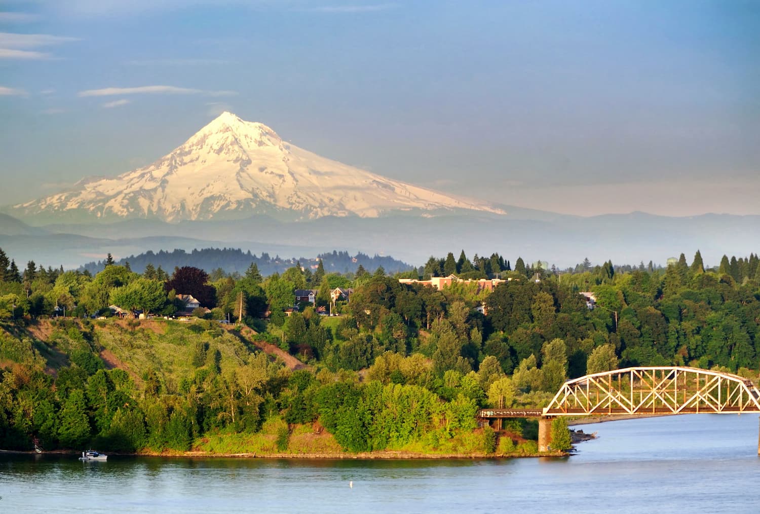
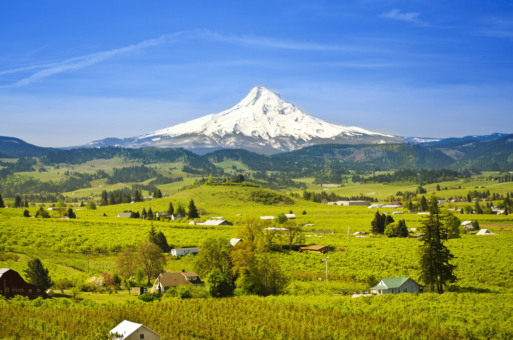
Today the northern boundary of the county is marked by the Columbia River that separates Washington and Oregon. Clackamas County covers 1,883 square miles of land across northern Oregon and is part of the Portland-Vancouver metro area. Nearby Multnomah county is known for being extremely liberal, while Clackamas County tends to lean conservative on many issues. There are 114 named mountains in Clackamas County. The highest and the most prominent mountain is Mount Hood at 11,161 feet. Mount Hood is also the highest point in all of Oregon and is one of the five major volcanoes within the Cascade Range. The western regions of the county are residential with rolling hills while the eastern side of the county stretches into the Cascade Mountains, encompassing Mount Hood.
Mount Hood National Forest: The most popular region for hiking in the county is the Mount Hood National Forest. The forest spans 4.4 million acres across central Oregon, reaching all the way to the Columbia River in the north. The forest is named after Mount Hood which can be seen from Portland, Oregon. The forest was first established back in 1892. Today there are roughly 1,000 miles of trails throughout Mount Hood National Forest. Many popular hikes within the forest include Lost Lake, Trillium Lake, Timothy Lake, Rock Creek Reservoir, Pacific Crest Trail, and summiting Mount Hood.
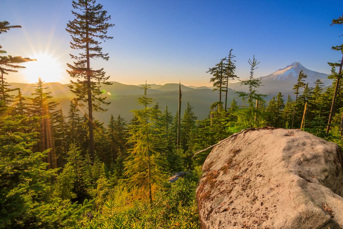
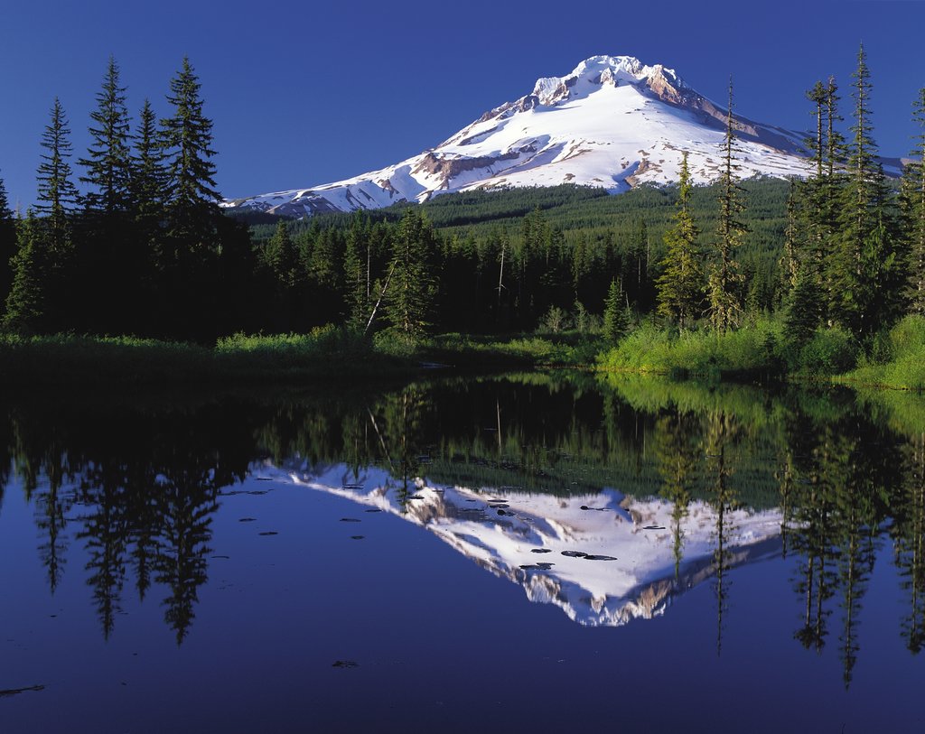
Mount Hood Wilderness: Within Mount Hood National Forest lies Mount Hood Wilderness, spanning 67,320 acres. Mount Hood lies within this wilderness along with the rainforests at lower elevations. A popular hike within the wilderness includes summiting Mount Hood, with more than 10,000 people doing so each year. Other hikes include one of the numerous trails that circle the mountain; Lolo Pass, Cloud Cap, Elk Cove, and the well-known Timberline Trail which is 41 miles around the entire mountain.

Salmon Huckleberry Wilderness: Located on the southern side of Mount Hood lies the Salmon-Huckleberry Wilderness. The wilderness covers 62,061 acres of land. The region is characterized by dense rain forests, and rugged peaks. The most iconic trail in the wilderness is the Salmon River National Recreation Trail which totals 70 miles, following along the Salmon River.
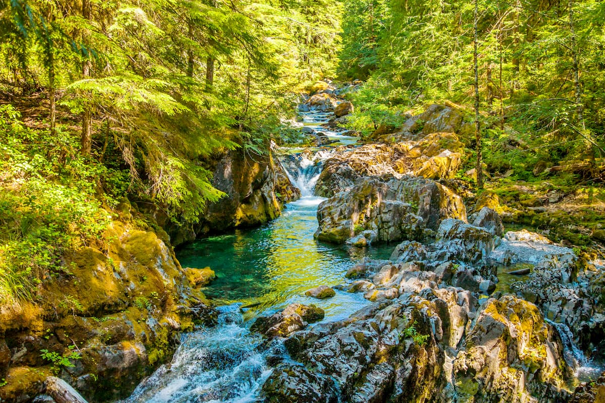
Opal Creek Wilderness: Located in the Willamette National Forest, bordered by the Mount Hood National Forest, lies the Opal Creek Wilderness. Established in 1996, this wilderness covers 20,746 acres of land. The wilderness contains 50 waterfalls and five lakes with 36 miles of hiking trails. The old-growth forest is known for having numerous 500- to 1,000-year-old trees throughout it.
Located on the western border of Clackamas County, lies the city of Portland. With a population of over 600,000 people, Portland is the largest city within the state of Oregon. Known for its vast food scene, many people often forget that Portland is also a hiker’s paradise. The city is home to Forest Park, 5,200 acres of trails within the city, it is just two hours away from both Mount Adams and Mount Hood, and an hour from Tillamook National Forest. Portland is also known for its hipster and liberal vibes and is rated as one of the best cities for biking.
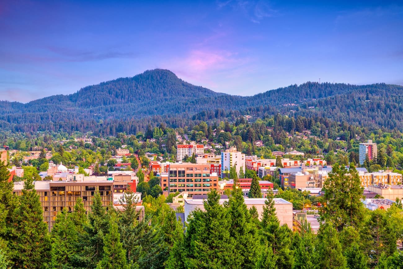
Two hours south of Portland lies the city of Eugene. Known as “Track Town, USA”, Eugene is a runner’s paradise. With a population of nearly 200,000, the city is the largest within central Oregon. The city is located two hours south of Portland, and just one hour south of Salem, Oregon’s state capitol. The town is known for its focus on environmentalism and abundance of recreation activities including biking, hiking, rafting, and of course, running. Eugene is also where the Nike corporation began. Be sure to check out the Lane County Farmers’ Market or grab a bite to eat at one of the many local restaurants.


ultra
glacier
volcano
oregon-9000ers
cascade-range-9000ers
chemeketan-18-nw
cascade-volcanoes-pin
mazamas-guardian-award
mazamas-cascades-award
mazamas-16-nw-award
fred-beckey-great-peaks
oregon-ultras
ultra
glacier
volcano
oregon-9000ers
cascade-range-9000ers
chemeketan-18-nw
cascade-volcanoes-pin
mazamas-guardian-award
mazamas-cascades-award
mazamas-16-nw-award
fred-beckey-great-peaks
oregon-ultras
Yes. Clackamas County has 136 named mountains. The highest is Mount Hood at 3,429 m.
The highest mountain in Clackamas County is Mount Hood, at 3,429 m.
Clackamas County has 136 named mountains.


