
Scan the QR code and open PeakVisor on your phone
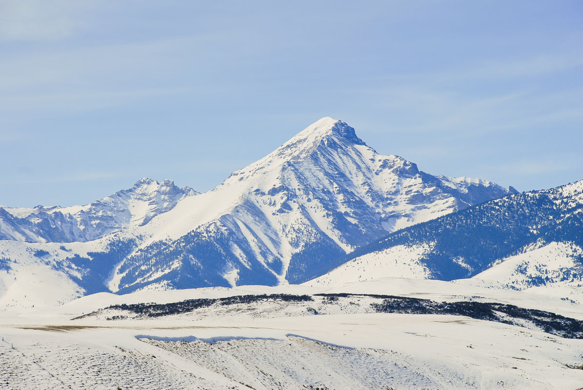
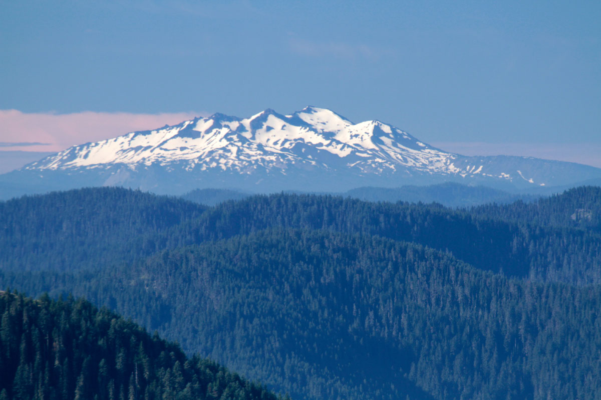
Stretching for over 100 miles along the western slope of the Cascades lies the Willamette National Forest, a 1.6-million-acre unspoiled wilderness area. The forest contains 272 named mountains and seven major Cascade summits – Mount Jefferson, Mount Washington, Three Fingered Jack, Diamond Peak, North, Middle, and South Sisters. The elevation of the forest ranges from 1,500 feet above sea level on the western edge to almost 10,500 feet at the top of Mount Jefferson.
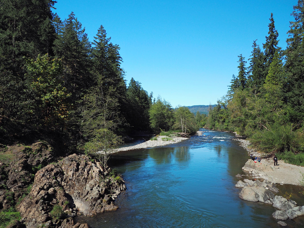
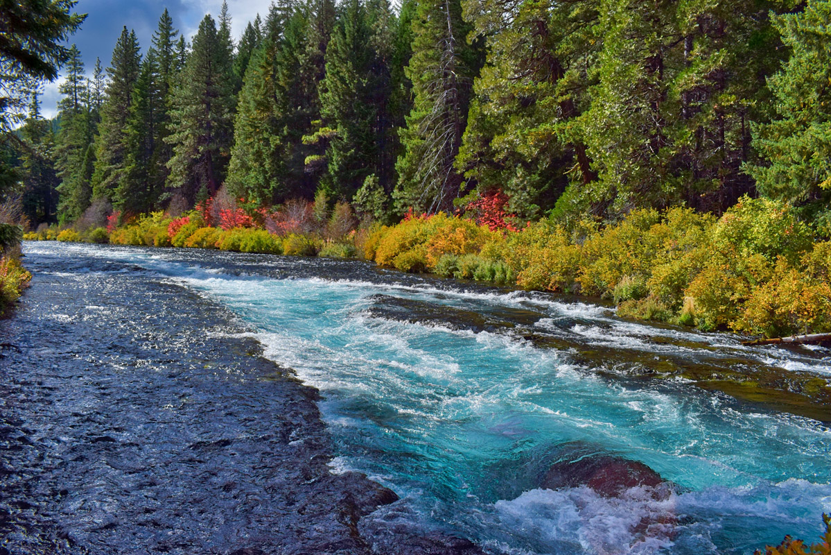
Willamette National Forest also houses over 1,500 miles of rivers and streams, several designated National Wild and Scenic Rivers, and over 375 alpine lakes. More than 1,700 miles of trail, several of which are easily accessible, are available to explore. In fact, five scenic, low-elevation trails have been designated as National Recreation Trails - The Falls Creek, Mckenzie River, Lava River, Middle Fork Willamette, and South Breitenbush Gorge National Scenic Trails.
In 1893, before receiving National Forest designation, Willamette was part of the Cascade Range Forest Reserve. In 1933, it received National Forest Designation. Over the years, the Forest has been the center of controversy between the logging industry and environmentalists. Beginning in 1994, the Forest has been governed by the Northwest Forest Plan, which restricts logging in potential spotted owl habitat.
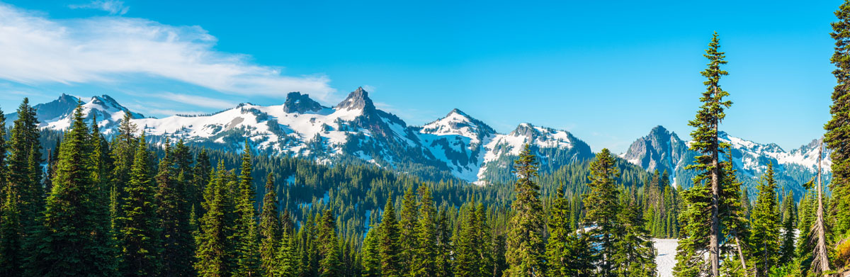
Willamette remains a popular destination for hiking, backpacking, mountain biking, boating, swimming, and climbing. The varied climate and terrain allow for a broad range of outdoor recreation opportunities. 380,000 acres of the forest are designated as wilderness areas – Diamond Peak, Middle Santiam, Menagerie, Mount Jefferson, Mount Washington, Three Sisters, Waldo Lake, and Opal Creek.
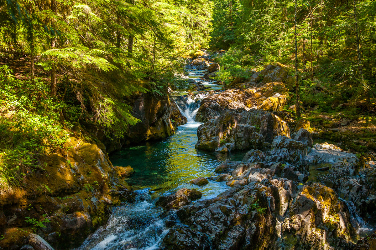
The Opal Creek Wilderness encompasses over 20,000 acres of steep and rugged hillsides and stunning waterways. Two peaks, in particular, dominate the western section of the wilderness – Whetstone and Henline. Hiking trails lead to old bridges, scenic waterfalls, and large spans of 700-year-old Douglas Fir. For those seeking solitude, Opal Creek is both easy to reach and receives far less visitors than some of the other wilderness areas in Willamette. Popular Hikes and attractions in this area include: Opal Creek Trailhead, Three Pools, and Sawmill Falls.
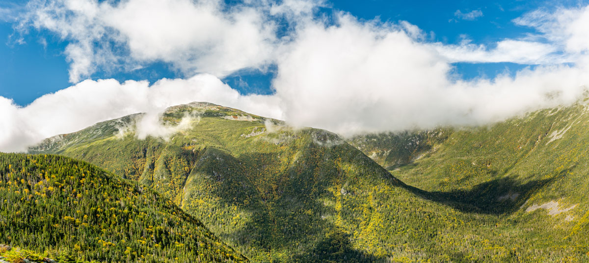
Mt. Jefferson and Three Fingered Jack are the dominating feature in this area. Steep slopes, rocky outcrops, alpine meadows, and hundreds of alpine lakes draw visitors to the Mount Jefferson Wilderness. The Wilderness covers over 100,000 acres and contains 163 miles of trail, including 40 miles of the Pacific Crest Trail. Popular trails in this area include: The Three Finger Jack Loop, Firecamp Lakes, Marion Lake, and Canyon Creek Meadows.
Located near Mt. Washington, Middle Santiam is characterized by high-altitude summits, steep slopes, and rugged ridges. Recognizable features include Chimney Peak, Donaca Lake, and the Middle Santiam River. A large part of Middle Santiam is heavily forested in old-growth Douglas-fir, western red cedar and western hemlock. The most popular trails include – McQuade Creek Trail and Swamp Peak Trail.
The Menagerie Wilderness is located near Mount Washington in the central Oregon Cascades. This area is a particularly popular destination for rock climbing. A series of unique rock pinnacles can be found scattered throughout the landscape. There are very few designated trails in Menagerie and visiting impressive pinnacles may require hiking over steep, rugged terrain. The best-known and most popular pinnacle is Rooster Rock, which can be accessed via the Trout Creek Trail and Rooster Rock Trail.
The Mount Washington Wilderness is a rugged retreat centered around the illustrious Mt. Washington visited mostly by hunters, hikers, and mountain climbers. The Wilderness spans 54,278 acres and encompasses Belknap Crater, a 6,821-foot cinder and ash volcanic cone, 28 lakes, and portions of the Pacific Crest National Scenic Trail. Although the Mt. Washington Wilderness sits near the Willamette Valley, this area is not visited nearly as often as other wilderness areas. Tenas Lake and Benson Lake are popular destinations in this region, as well as Patjens Lake. All three lakes are accessible via short hiking trails.
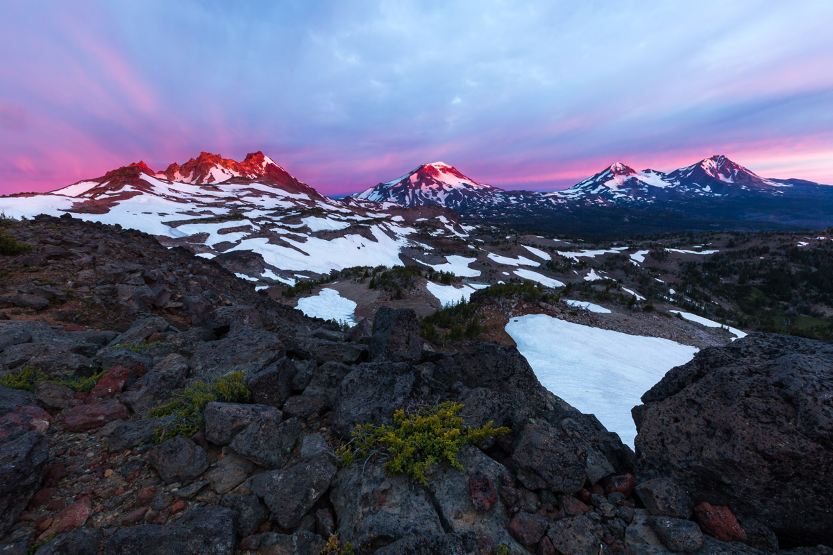
Just as its name implies, the Three Sisters Wilderness is centered around the North, Middle, and South Sisters, all of which exceed 10,000 feet in elevation. Collier Glacier, the largest glacier in Oregon, can also be found on the western slope of North Sister in the Three Sisters Wilderness. Other impressive features in this region include Rock Mesa, Collier Cone, and Yapoah Crater. There are 260 miles of trails to explore in the Three Sisters Wilderness, making it a popular destination for hikers, climbers, backpackers, and general outdoor enthusiasts. Popular trails include McKenzie Pass, Black Crater, Obsidian, Chambers Lake, and Broken Top Lake.
An impressive array of alpine lakes can be found scattered throughout the 36,572-acre Waldo Lake Wilderness. Located just outside the eastern boundary of the wilderness is Waldo Lake, a 10-square-mile, sparkling lake that was carved out by ancient glaciers. There are approximately 84 miles of trails, many of which lead to various lakes and through lush meadows. This region is mostly forested and is characterized by steep to moderate slopes and rocky outcrops. Popular hikes in the area include the Fuji Mountain trail and nearby Waldo Lake trail.
The Diamond Peak Wilderness spans 52,611 acres and contains lakes reaching an impressive 28 acres in size. The area’s namesake summit, Diamond Peak, is a shield volcano that formed as the Cascade Range was undergoing volcanic activity. Approximately 125 miles of trails cross the wilderness, including 14 miles of the Pacific Crest Trail. Marie Lake, Divide Lake, and Rockpile Lake are popular destinations for hopeful hikers looking to climb Diamond Peak.
The Wayfarer Resort sits just outside of the Willamette National Forest along the McKenzie River. In addition to offering several quaint river cabins and vacation homes, Wayfarer is within close proximity to gorgeous hiking trails, several scenic waterfalls, and miles of both technical and non-technical mountain biking trails.
The Lodge at Detroit Lake is located in Detroit, Oregon, in the heart of the Willamette National Forest. The lodge is within close proximity to the Hot Springs at Breitenbush, a 154-wildlife sanctuary, the Hoodoo Ski Resort, hundreds of scenic trails in the Willamette National Forest, and all rooms are fully equipped with modern amenities.
Cold Springs Resort is where outdoor enthusiasts go for a quiet retreat in the woods. The resort, which is only steps from the spring-fed Metolius River, offers a variety of hiking, biking, and world-class fly-fishing opportunities. Cold Springs is within close proximity to the Hoodoo Ski Area, Smith Rock State Park, and sits just outside of both Three Fingered Jack and Mt. Washington.
The tiny town of Oakridge has a lofty reputation as being the mountain-biking capital of the Pacific Northwest. This thickly forested destination sits at the western edge of the Cascades and features hundreds of miles of trails. Oakridge is known as the perfect basecamp for exploring the Willamette National Forest, but also offers a local eateries and a handful of accomodations.


ultra
glacier
volcano
oregon-9000ers
cascade-range-9000ers
chemeketan-18-nw
cascade-volcanoes-pin
mazamas-cascades-award
mazamas-16-nw-award
oregon-ultras
ultra
glacier
volcano
oregon-9000ers
cascade-range-9000ers
western-state-climbers
western-state-climbers-star
chemeketan-18-nw
cascade-volcanoes-pin
mazamas-cascades-award
mazamas-16-nw-award
oregon-ultras
volcano
oregon-9000ers
cascade-range-9000ers
western-state-climbers
western-state-climbers-star
chemeketan-18-nw
cascade-volcanoes-pin
mazamas-cascades-award
mazamas-16-nw-award
glacier
volcano
oregon-9000ers
cascade-range-9000ers
western-state-climbers
western-state-climbers-emblem
chemeketan-18-nw
cascade-volcanoes-pin
mazamas-cascades-award
mazamas-16-nw-award
chemeketan-18-nw
cascade-volcanoes-pin
mazamas-cascades-award
mazamas-16-nw-award
volcano
western-state-climbers
western-state-climbers-star
chemeketan-18-nw
cascade-volcanoes-pin
mazamas-cascades-award
mazamas-16-nw-award
ultra
glacier
volcano
oregon-9000ers
cascade-range-9000ers
chemeketan-18-nw
cascade-volcanoes-pin
mazamas-cascades-award
mazamas-16-nw-award
oregon-ultras
ultra
glacier
volcano
oregon-9000ers
cascade-range-9000ers
western-state-climbers
western-state-climbers-star
chemeketan-18-nw
cascade-volcanoes-pin
mazamas-cascades-award
mazamas-16-nw-award
oregon-ultras
volcano
oregon-9000ers
cascade-range-9000ers
western-state-climbers
western-state-climbers-star
chemeketan-18-nw
cascade-volcanoes-pin
mazamas-cascades-award
mazamas-16-nw-award
volcano
western-state-climbers
western-state-climbers-star
chemeketan-18-nw
cascade-volcanoes-pin
mazamas-cascades-award
mazamas-16-nw-award
chemeketan-18-nw
cascade-volcanoes-pin
mazamas-cascades-award
mazamas-16-nw-award


