Scan the QR code and open PeakVisor on your phone
The Opal Creek Wilderness is located in the central portion of the US state of Oregon. The rugged and forested landscape features the largest intact stand of old-growth forest in the Cascade Range. The tallest and most prominent mountain is Battle Ax Mountain at 5,554 feet (1,693 m) tall with 1,004 feet (306 m) of prominence.
The Opal Creek Wilderness is located in central Oregon, within the Willamette National Forest. Terrain is marked by steep and rugged forested hills, ridgelines, and mountains. Within the wilderness lies the largest uncut watershed in the state.
The wilderness spans 20,454 acres (8,277 ha) of land across Marion and Clackamas counties. The Opal Creek Valley forms the largest intact section of old-growth forest in the entire Cascade Range. Some trees in the region date back between 500 to 1,000 years old.
Terrain is often broken into two main sections; east and west. The landscape in the western section is dominated by two major peaks, Henline and Whetstone. The eastern portion contains the headwaters for Battle Axe Creek and Opal Creek. These two creeks eventually flow into the Little North Santiam River.
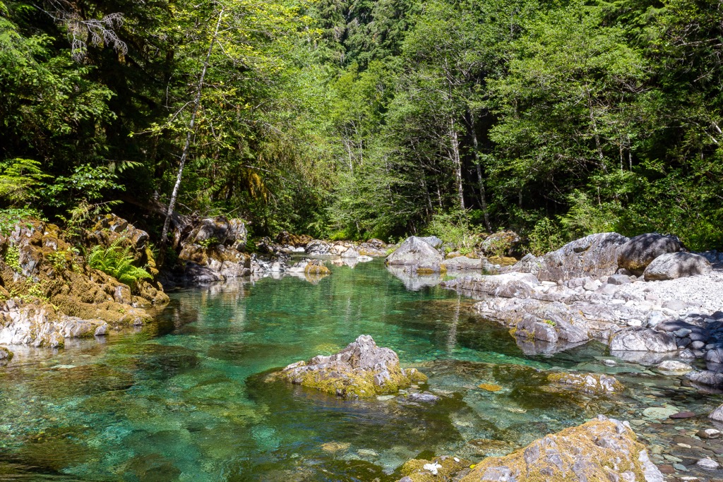
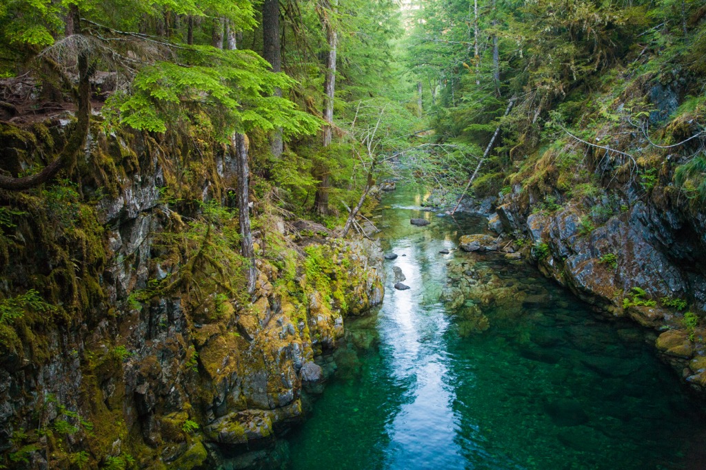
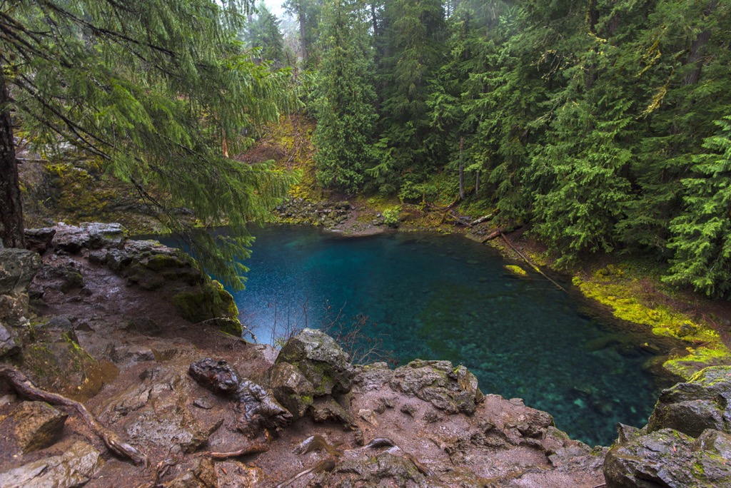
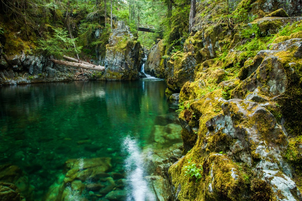
Amidst the stands of old-growth forest in the Opal Creek Valley, lie numerous lakes and dozens of waterfalls. Steep ridgelines and hillsides and met with narrow and deep river canyons with lush vegetation throughout. The densely forested wilderness features a few old fire towers that act as viewpoints for the surrounding forested landscape.
Additionally, the Opal Creek Wilderness is surrounded by various areas for outdoor recreation. Directly north of the wilderness lies the Mount Hood National Forest and the Bull of the Woods Wilderness. The Santiam State Forest extends to the south along with the Willamette National Forest. Silver Falls State Park is situated to the west while the Table Rock Wilderness is to the northwest.
The ridgelines and named peaks within the wilderness are part of the Cascade Range, a major mountain range that extends throughout British Columbia, Washington, Oregon, and Northern California. This range contains both non-volcanic and volcanic peaks.
The entire range began forming roughly 90 million years ago. Shifting tectonic plates led to the subduction of the Juan de Fuca Plate beneath the North American Plate. This subduction caused immense pressure and led to the formation of the range.
Today the base of the range consists of various short lived volcanoes and volcanic debris. Major peaks that rise above the surrounding landscape include Mount Hood, Mount Adams, Mount St. Helens, Mount Rainier, and Mount Baker.
The oceanic slab continues to be subducted beneath the North American plate, contributing to the region being known for its frequent earthquakes. Millions of years of erosion, coupled with glacial retreating, further carved out the landscape, leaving behind the dramatic changes in elevation visible today.
Major peaks within the wilderness include Battle Ax Mountain, Whetstone Mountain, Burnt Mountain, Mount Beachie, and Henline Mountain.
The high amounts of rainfall in the region have allowed for a variety of both flora and fauna to flourish. Common tree species include western hemlock, Douglas fir, and the Pacific silver fir.
Lower elevations are often populated by Pacific yew and western red cedar, while mountain hemlock and Engelmann spruce are common along the higher ridgelines. Other common trees include red alder and big leaf maple.
Common low growing vegetation includes rhododendron, huckleberry, and vine maple. The densely forested landscape is populated by a variety of bird species along with some larger mammals including cougar, elk, deer, and black bear.
Humans have inhabited land within and surrounding the wilderness for thousands of years. Long before the arrival of Europeans, this land marked part of the ancestral lands of numerous Indigenous peoples.
Some of the most prominent groups in the region included the Molalla, Confederated Tribes of Grand Ronde, Confederated Tribes of Siletz Indians, and the Confederated Tribes of the Umatilla Indian Reservation.
The various tribes of the region lived rather harmoniously with each other and the land. Fishing, hunting, and gathering were all integrated into their culture, as well as trading with other tribes.
Completion of railroads in present-day Oregon, coupled with westward expansion, brought more people to the region. This increased population ultimately led to continual harassing, attacking, killing, and displacing of the Indigenous peoples of the region.
As communities began to grow, various treaties were signed between the Indigenous peoples and the US government. Between 1853 and 1855, these treaties led to the forced removal of the Indigenous peoples.
In 1856 the federal government forced various tribes in the region onto a reservation located within Oregon’s coast range. This “trail of tears” forced the Indigenous peoples to make this treacherous journey during winter, with many people dying en route to the reservation.
Populations of Americans of European descent continued to steadily grow in the region. The Mount Hood National Forest was originally established in 1892 as the Bull Run Forest Reserve, eventually becoming a national forest in 1908.
In 1980 the Opal Creek Valley was set to be clear cut, with advocacy efforts putting a stop to logging in the region. In 1996 the Opal Creek Wilderness was designated, named after Opal Elliot who was the wife of a forest ranger in the region.
In 2020 the region was closed following the Beachie Creek and Lionshead wildfire. The region is set to reopen in 2023 but could be closed longer due to the amount of damage throughout the forest.
There are 36 miles (58 km) of maintained trails within the wilderness area. Those visiting should check if the trails have been reopened following the wildfires in the region. Here are some of the top hiking areas to visit to the wilderness:
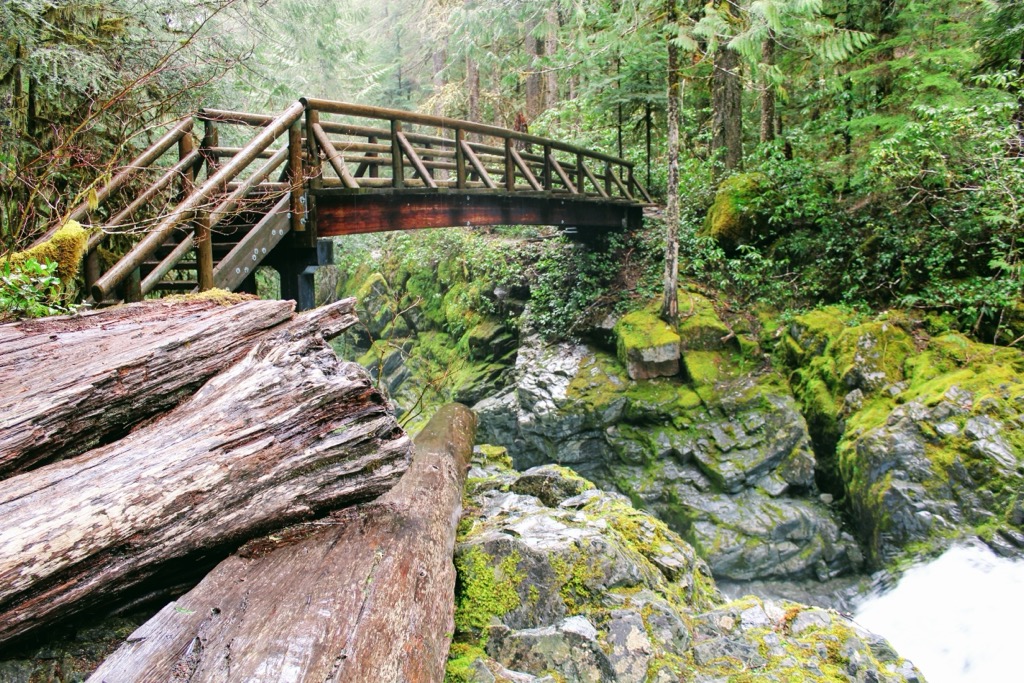
Opal Creek Trail lies near the center of the protected wilderness area. This popular hiking route follows along Opal Creek while winding through the old-growth forested landscape. Hikers pass over a bridge with views of Opal Pool and the crystal clear waters of the creek.
The route also loops past Jawbone Flats which is a historic town in the region. The old mining operation has been abandoned for over a century, slowly being overtaken by the forest. This out and back route is 7 miles (11.3 km) in length and features 652 feet (199 km) of elevation gain.
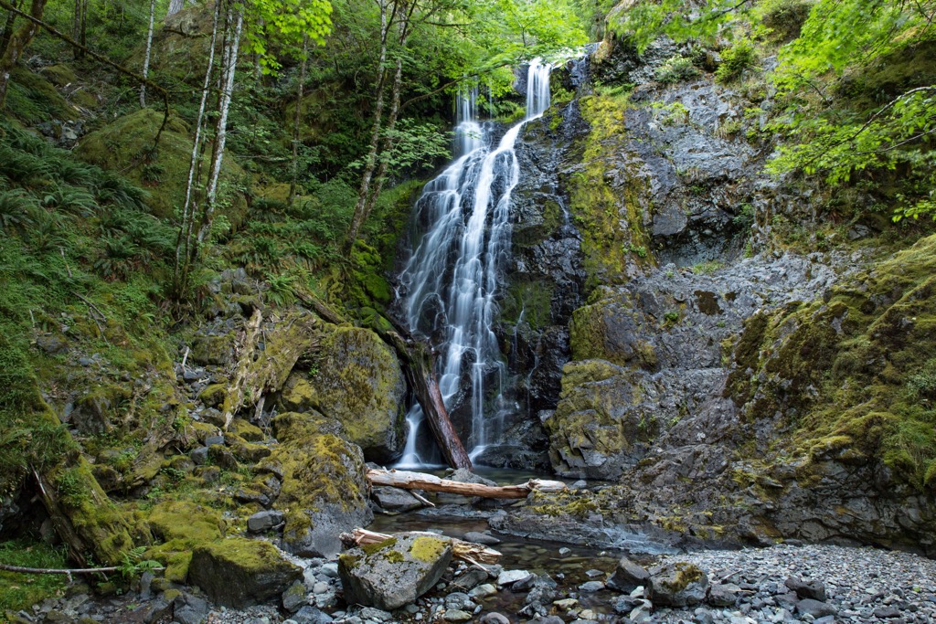
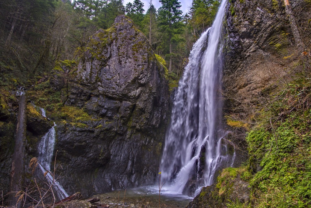
True to its name, this short out and back trail winds through the Douglas fir and hemlock forest before reaching Henline Falls. The falls cascade down the sheer cliff, featuring a small pool at its base.
Along this route also lie remnants of the mining operations in the region. Hikers can also follow the Ogle Mountain Trail at the base of the falls in order to climb up to the top of Henline Falls. This out and back trail is 1.8 miles (2.9 km) long and features 249 feet (76 m) of elevation gain.
Henline Mountain marks one of the tallest peaks in the wilderness and offers stunning views of the surrounding landscape from its summit. The route steadily climbs through the forested hillsides before finally opening up near the summit.
Hikers are rewarded with sweeping views of the surrounding mountains, ridgelines, and forested hillsides that define the Cascade Range. This out and back route is 6.5 miles (10.4 km) long and features 2,821 feet (860 m) of elevation gain.
Looking for a place to stay near the Opal Creek Wilderness? Here are some of the best cities and villages to check out in the region:
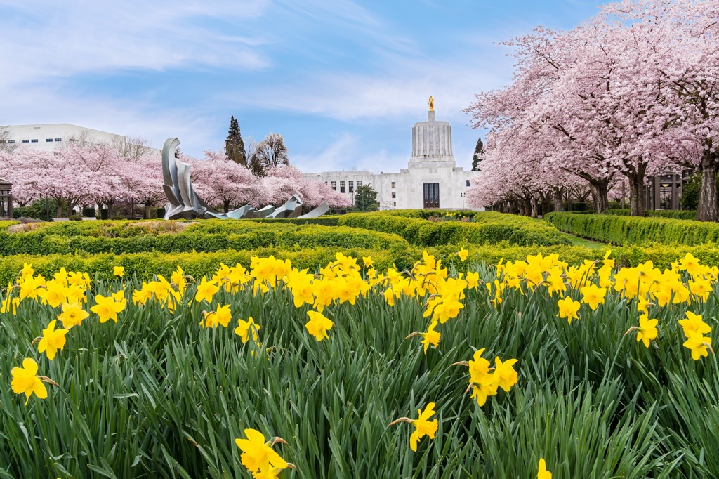
Salem, the capital city of Oregon, lies west of the wilderness, situated in the heart of the Willamette Valley. Home to 175,000 residents, Salem marks the third most populous city in the state following Portland and Eugene.
Besides being surrounded by lush forests, rolling hills, and the Cascade Range, Salem is also known for being the garden capital of Oregon. Visitors to the region can explore Silver Falls State Park, Salem Gardens, Oregon Garden, Enchanted Forest, and numerous local wineries.
The downtown streets are filled with local shops, art studios, restaurants, breweries, and cider houses. The historic downtown offers a small town feel and a quaint way to relax after a day exploring the outdoors.
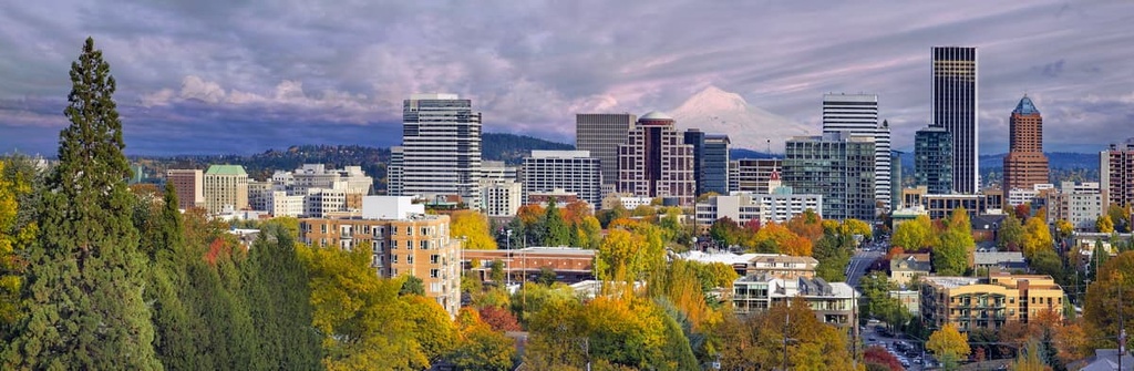
The city of Portland lies northwest of the wilderness, roughly an hour's drive north of Salem. Situated at the confluence of the Willamette and Columbia Rivers, Portland is home to over 650,000 residents, making it the most populous city in the state.
The city lies along the northern edge of Oregon, near the state’s border with Washington. With a metropolitan area of 2.5 million, Portland marks the second largest metropolitan area in the Pacific Northwest after Seattle.
The city is known for its various parks, close proximity to Mount Hood, craft breweries, coffee shops, and eco-friendly living. Rated one of the most bike-friendly cities in the US, Portland is a hub for counterculture and is home to a thriving arts scene. Local restaurants have helped set Portland on the map for food enthusiasts across the country.