
Scan the QR code and open PeakVisor on your phone
Mount Washington Wilderness has 8 named peaks. The highest is Mount Washington at 2,367 m. Other notable peaks include Belknap Crater, Little Belknap and Scott Mountain.
The Mount Washington Wilderness is a region surrounding Mount Washington in the Cascade Mountain Range located in central Oregon. The wilderness spans 54,278 acres and lies within both the Willamette National Forest and the Deschutes National Forest. There are 7 named mountains in Mount Washington Wilderness.
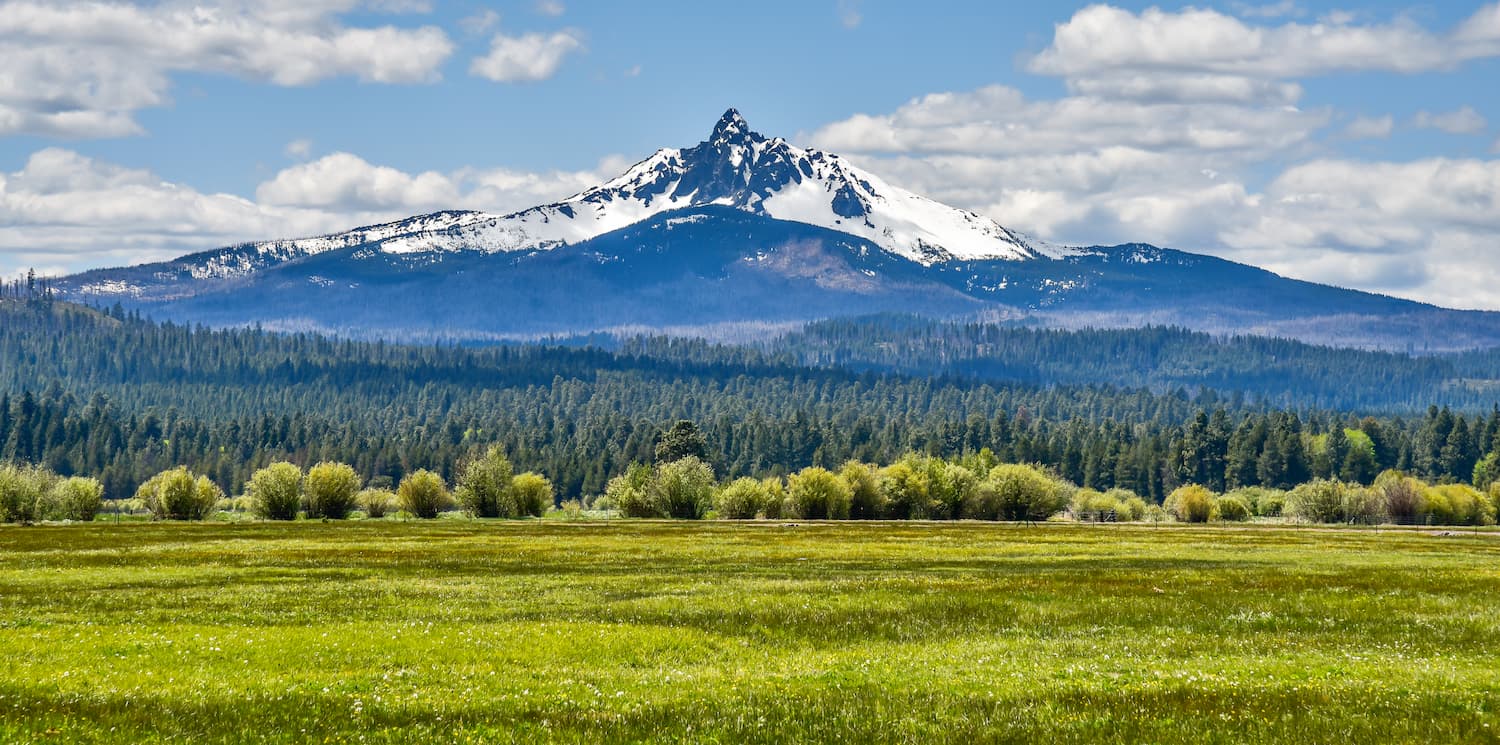
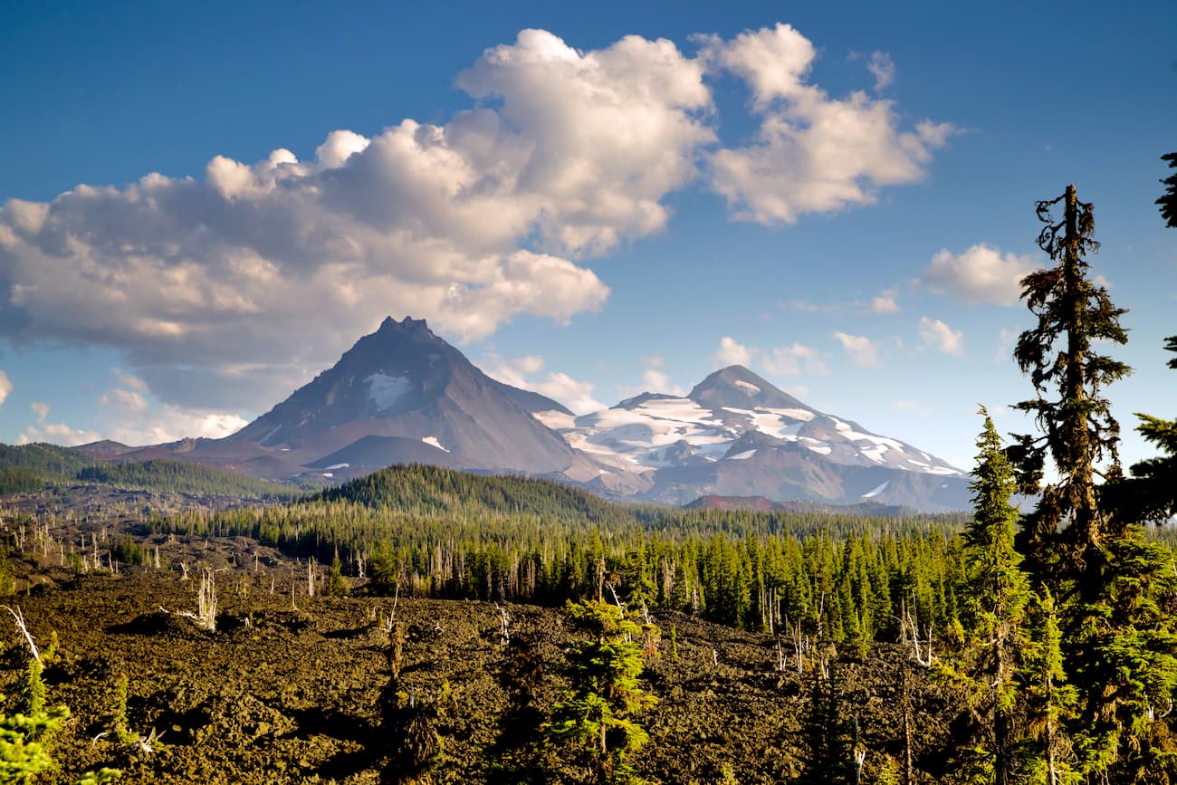
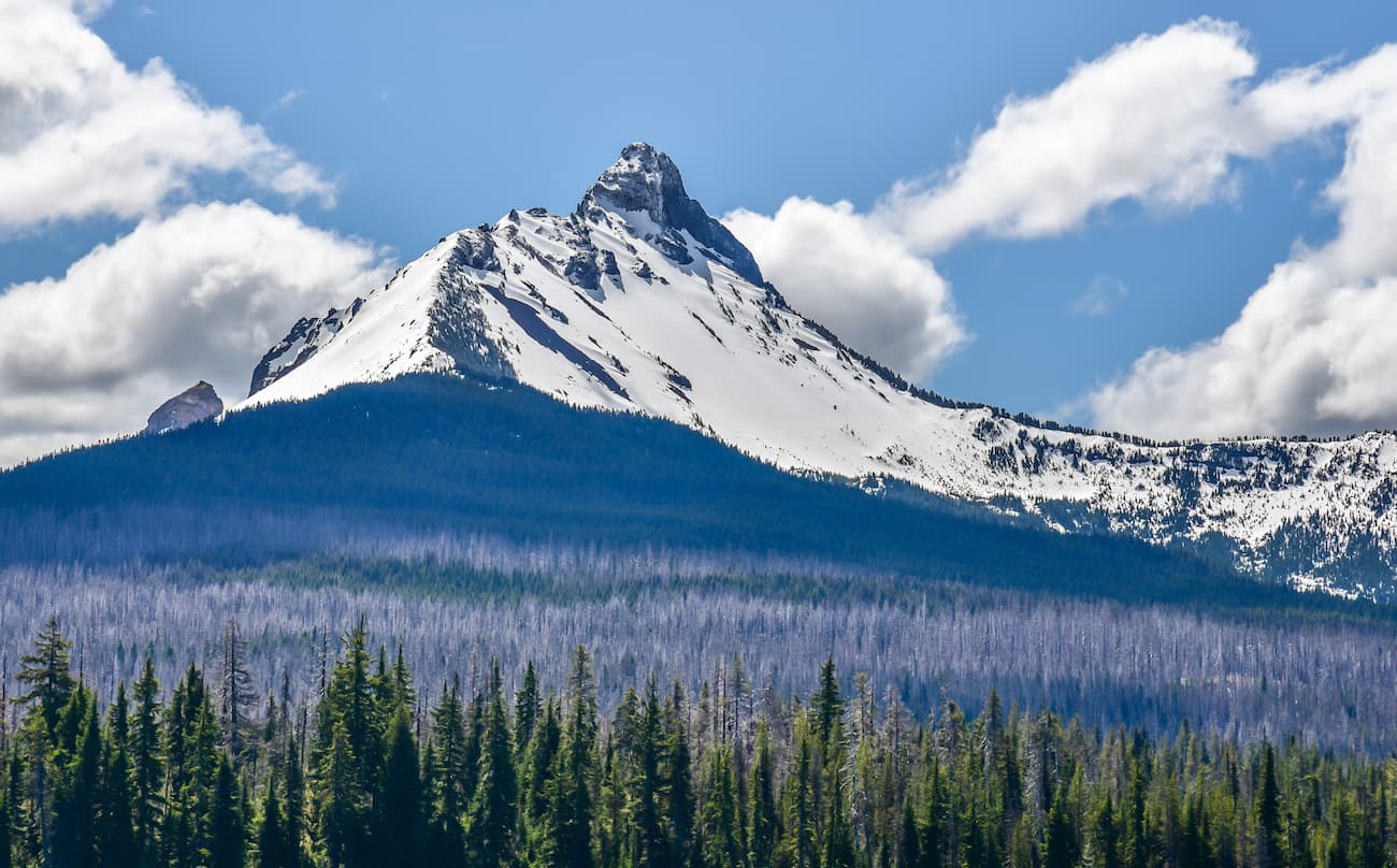
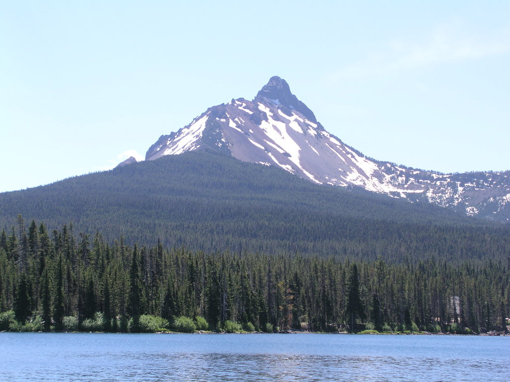
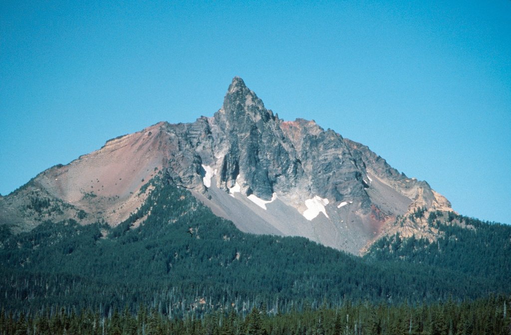
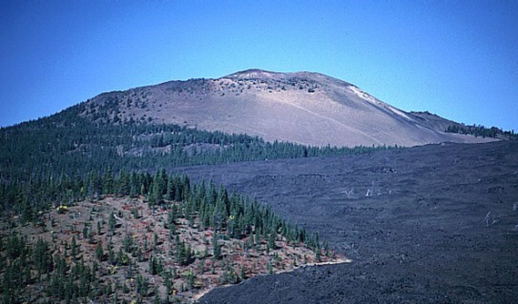
The highest and the most prominent mountain is Mount Washington. The mountain sits at 7,769 feet tall making it one of the tallest peaks within the state of Oregon. Mount Washington is classified as a shield volcano, rising above 75 square miles of lava plains. A majority of the wilderness is characterized by the lodgepole pine and mountain hemlocks. The Pacific Crest Trail passes through the wilderness for 16.6 miles. Within the wilderness there are 28 lakes amongst the forest and lava fields. Belknap Crater, a 6,872-foot cinder and ash cone, sits within the wilderness. The previous eruption created one of the largest sheets of lava in the United States.
The wilderness is located near the Willamette Valley in Oregon which is a highly populated area. Despite the proximity to this area, the Mount Washington Wilderness is often less busy than surrounding forests and parks.
This 16.6 mile point to point hike starts at McKenzie Pass in the south before traveling north to meet U.S. 20. The route takes you through some of the most scenic sections of the wilderness. Start by crossing a section of the lava flow, walk past Belknap Crater, climb along the western slopes of Mount Washington, and see alpine lakes before reaching the highway.
The hike up to the summit of Mount Washington starts along the Pacific Crest Trail. The out and back trail is 10.3-miles long with 3,087 feet of elevation gain. The trail follows a steep climb up the north ridge of the mountain to the final summit section. The climb requires knowledge of mountaineering and rock climbing and should only be completed if you have a strong base of knowledge. Once at the summit, enjoy the views of Three Fingered Jack and Jefferson to the north, and Sisters and Broken Top to the south.
Perhaps the most popular hike within the wilderness, Clear Lake Trail is great for all skill levels. Just off of scenic McKenzie Highway, this 4.6-mile hike has only 226 feet of elevation gain. The lake is referred to as “lake born of fire” since it was formed over 3,000 years ago when the lava from Sand mountain reached the McKenzie river and backed it up to form a lake. The lake is extremely cold which makes it often too cold for swimming. The hike around the lake offers amazing views of the dense forest and crystal clear waters.
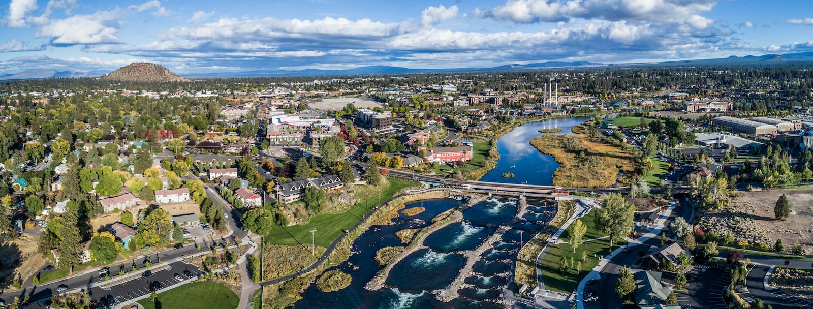
Bend is the largest city located in eastern Oregon with a population of nearly 100,000. The city is located on the Deschutes River and is known for being an outdoor paradise. To the west lies the lake and peaks of the Cascade Mountains, along with Mount Bachelor Ski Resort, while a trail in the city leads to the top of Pilot Butte. To the south lies the High Desert Museum and Newberry National Volcanic Monument. Just north of town is one of the state’s most iconic rock-climbing locations, Smith Rock State Park. As a whole, the city is a mecca for trail running, skiing, mountain biking, hiking, rock climbing, and even surfing in the river. Besides the abundance of outdoor activities, Bend is known for its numerous breweries and restaurants.
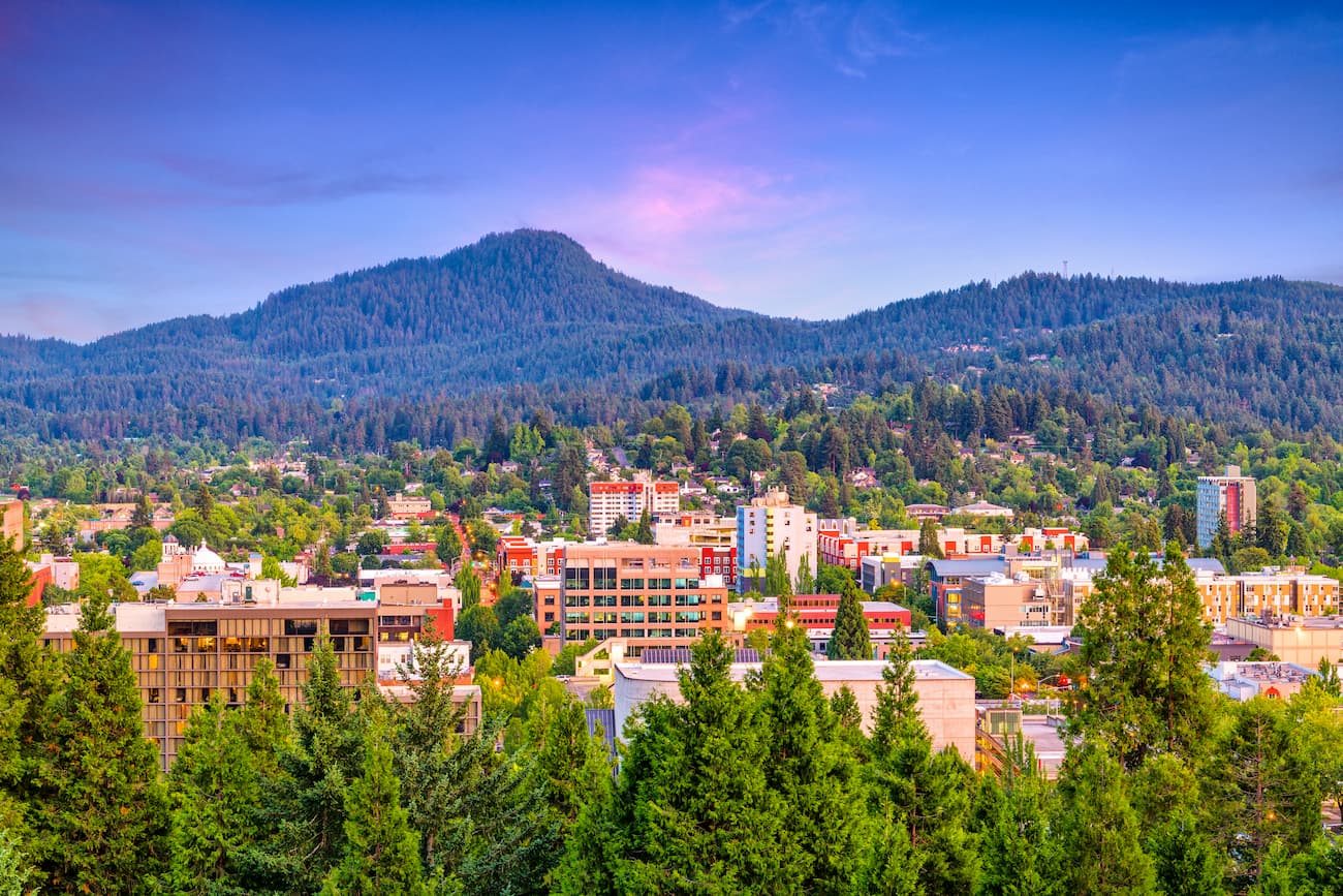
Eugene sits about 80 minutes west of Mount Washington Wilderness. Known as “Track Town, USA”, Eugene is a runner’s paradise. With a population of nearly 200,000, the city is the largest within central Oregon. The city is located two hours south of Portland, and just one hour south of Salem, Oregon’s state capitol. The town is known for its focus on environmentalism and abundance of recreation activities including biking, hiking, rafting, and of course, running. Eugene is also where the Nike corporation began. Be sure to check out the Lane County Farmers’ Market or grab a bite to eat at one of the many local restaurants.


volcano
western-state-climbers
western-state-climbers-star
chemeketan-18-nw
cascade-volcanoes-pin
mazamas-cascades-award
mazamas-16-nw-award
volcano
western-state-climbers
western-state-climbers-star
chemeketan-18-nw
cascade-volcanoes-pin
mazamas-cascades-award
mazamas-16-nw-award
The highest peak in Mount Washington Wilderness is Mount Washington, at 2,367 m.
Notable peaks in Mount Washington Wilderness include Mount Washington, Belknap Crater, Little Belknap, Scott Mountain and Dugout Butte.


