
Scan the QR code and open PeakVisor on your phone
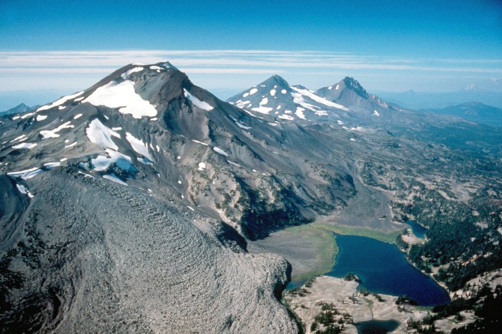
The Deschutes National Forest is located in Oregon in the United States. The area spans 1.8 million acres just east of the Cascade Mountain Range. There are over 1,200 miles of trails throughout the entire forest. The forest has 209 named mountains. The highest and the most prominent mountain is South Sister at 10,363 feet. The forest has Mount Thielsen Wilderness located at the southern tip and Mount Jefferson Wilderness at the northern tip. The Newberry National Volcanic Monument is located within the forest. This monument has over 54,000 acres of lakes, lava flows, and lava tubes.
Deschutes National Forest is home to a variety of wildlife and has sections that geological classify as high desert, a stark contrast from western Oregon. The ski resort on Mount Bachelor is a popular destination for both winter and summer. There are nearly 350,000 acres of old growth forest located within Deschutes National Forest. The region is also home to five distinct wilderness areas: Diamond Peak Wilderness, Mount Jefferson Wilderness, Mount Thielsen Wilderness, Mount Washington Wilderness, and Three Sisters Wilderness.

The expansive forest is full of activities year-round. The summer months are perfect for hiking, camping, backpacking at alpine lakes, and mountain biking. In the winter be sure to discover the hundreds of miles of snow-shoeing and cross-country skiing trails, or hit the slopes on Mount Bachelor.
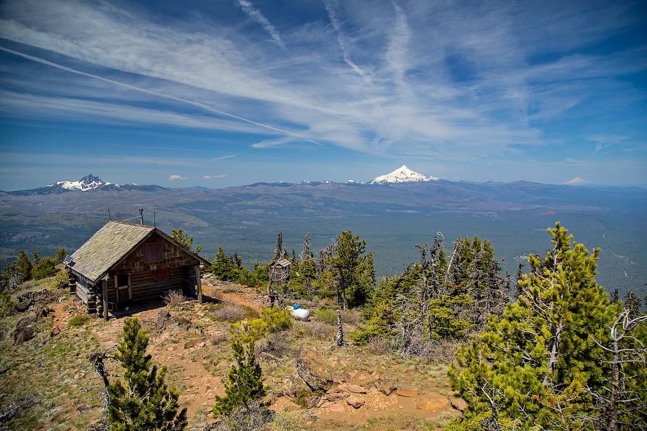
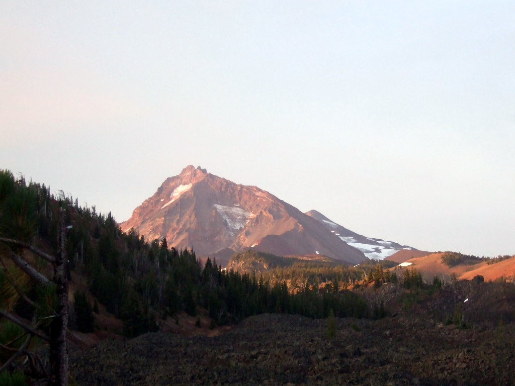
One of the most trafficked trails in the forest, this 4-mile out and back hike is worth the steep climb. The trail climbs steeply for the first two miles before the trees begin to thin. Once you reach the top, you’ll be greeted with unobstructed views of the forest below and many of the surrounding mountains and peaks.
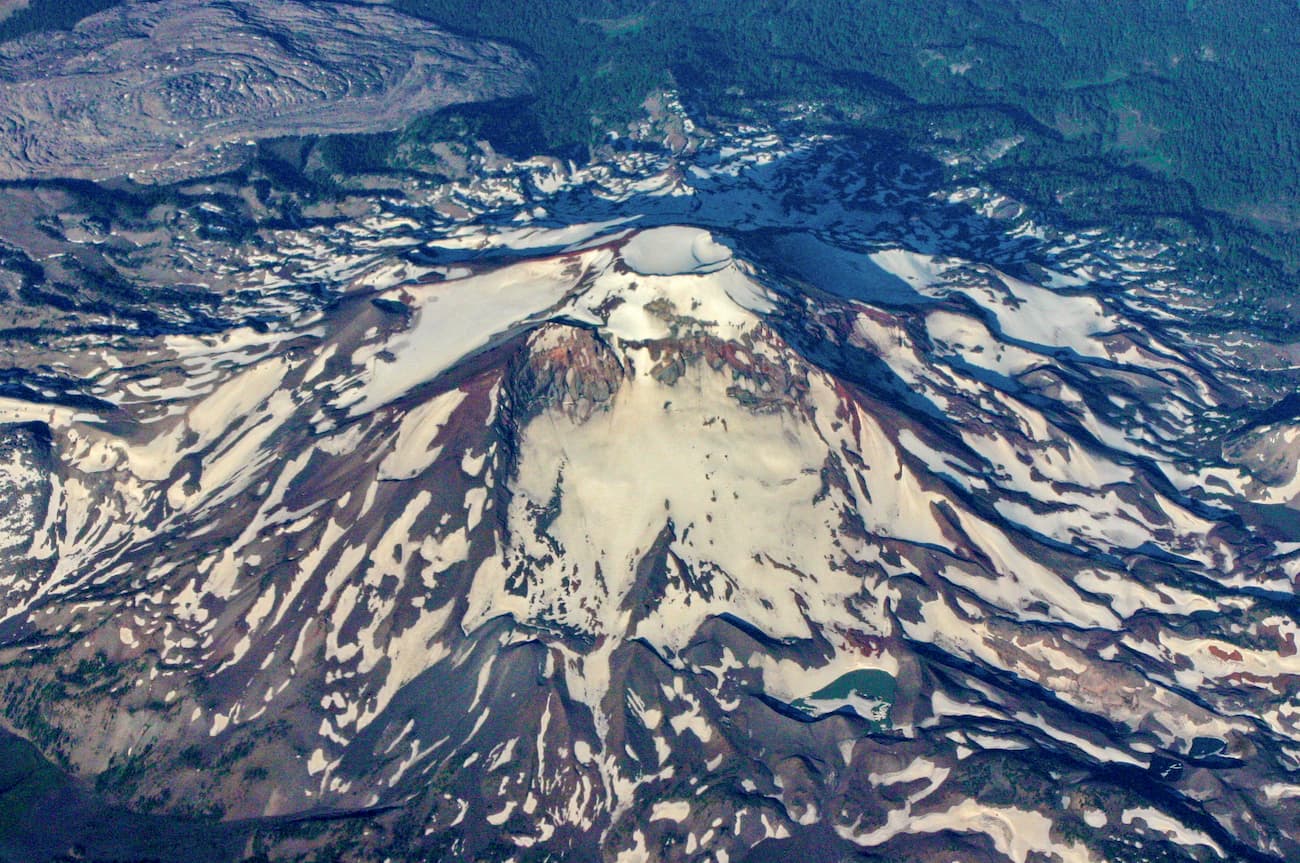
At 10,363 feet, South Sister is the third tallest peak within the state of Oregon, and there is a trail to the very top. Easily one of the most difficult hikes within the forest, this 12-mile hike climbs nearly 5,000 feet. The hike itself is extremely steep and rugged though no technical climbing gear is required to reach the summit during the summer months. Once you reach the summit, you’ll see a small lake inside the crater, Teardrop Lake. On a clear day, hikers can see over 100 miles into the distance to the surrounding peaks and forests. It is recommended to avoid heading to the summit if you see even a small cloud sitting there. The summit is known for being dangerous and hikers are prone to getting stuck in blizzards and white out zones.

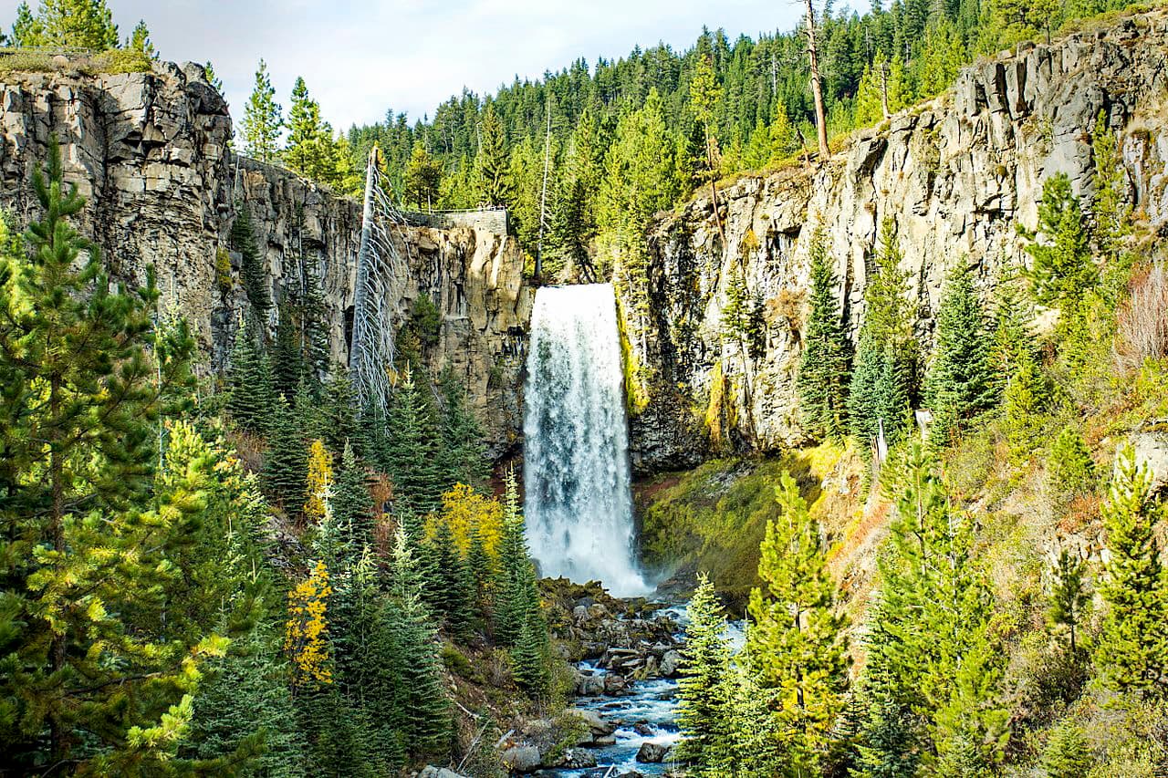
While Tumalo Falls is the tallest waterfall on the Tumalo Creek, it is only a half-mile round trip from the parking lot. The Tumalo Falls Loop takes you past this falls on a 7.4-mile hike where you can witness many other gorgeous waterfalls. The trail connects North Fork Trail, Swampy Lakes Trail, and the Bridge Creek Trail. The entire loop totals just over 1,000 feet of elevation gain but the extra effort is worth seeing countless other falls.
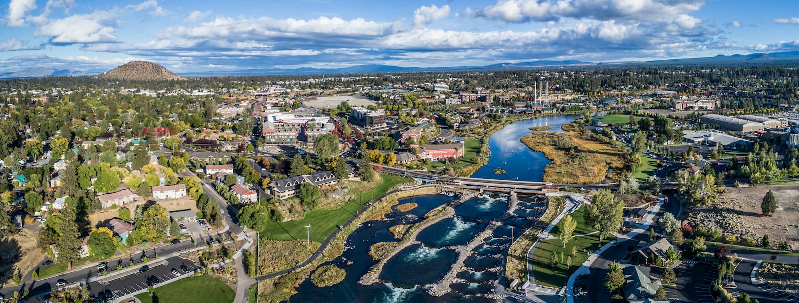
Bend is the largest city located in eastern Oregon with a population of nearly 100,000. The city is located on the Deschutes River and is known for being an outdoor paradise. To the west lies the lake and peaks of the Cascade Mountains, along with Mount Bachelor Ski Resort, while a trail in the city leads to the top of Pilot Butte. To the south lies the High Desert Museum and Newberry National Volcanic Monument. Just north of town is one of the state’s most iconic rock-climbing locations, Smith Rock State Park. As a whole, the city is a mecca for trail running, skiing, mountain biking, hiking, rock climbing, and even surfing in the river. Besides the abundance of outdoor activities, Bend is known for its numerous breweries and restaurants.


ultra
glacier
volcano
oregon-9000ers
cascade-range-9000ers
western-state-climbers
western-state-climbers-star
chemeketan-18-nw
cascade-volcanoes-pin
mazamas-cascades-award
mazamas-16-nw-award
oregon-ultras
volcano
oregon-9000ers
cascade-range-9000ers
western-state-climbers
western-state-climbers-star
chemeketan-18-nw
cascade-volcanoes-pin
mazamas-cascades-award
mazamas-16-nw-award
glacier
volcano
oregon-9000ers
cascade-range-9000ers
western-state-climbers
western-state-climbers-emblem
chemeketan-18-nw
cascade-volcanoes-pin
mazamas-cascades-award
mazamas-16-nw-award
glacier
volcano
oregon-9000ers
cascade-range-9000ers
chemeketan-18-nw
cascade-volcanoes-pin
volcano
oregon-9000ers
cascade-range-9000ers
cascade-volcanoes-pin
ultra
glacier
volcano
oregon-9000ers
cascade-range-9000ers
western-state-climbers
western-state-climbers-star
chemeketan-18-nw
cascade-volcanoes-pin
mazamas-cascades-award
mazamas-16-nw-award
oregon-ultras
volcano
oregon-9000ers
cascade-range-9000ers
western-state-climbers
western-state-climbers-star
chemeketan-18-nw
cascade-volcanoes-pin
mazamas-cascades-award
mazamas-16-nw-award
volcano
oregon-9000ers
cascade-range-9000ers
cascade-volcanoes-pin
volcano
western-state-climbers
western-state-climbers-star
chemeketan-18-nw
cascade-volcanoes-pin
mazamas-cascades-award
mazamas-16-nw-award
chemeketan-18-nw
cascade-volcanoes-pin
mazamas-cascades-award
mazamas-16-nw-award


.jpg)