
Scan the QR code and open PeakVisor on your phone
The Newberry National Volcanic Monument is located within the Deschutes National Forest in the state of Oregon. Newberry is also considered an active volcano. The monument protects the land surrounding Newberry Volcano. This region covers 54,822 acres which feature lakes, lava flows, and other geologic features in central Oregon. The area that is now the monument was used to help train astronauts during the years of 1964-1966.
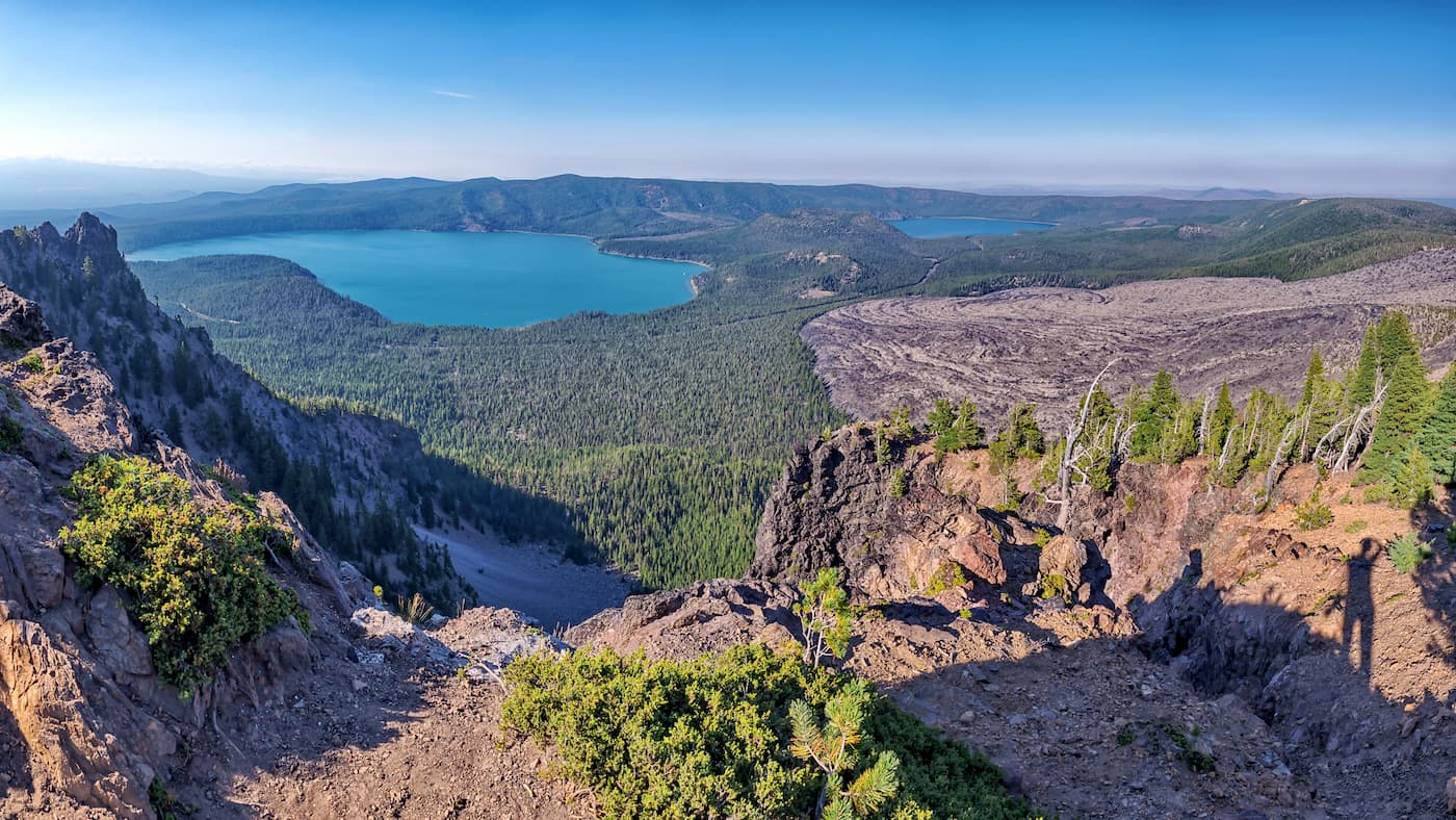
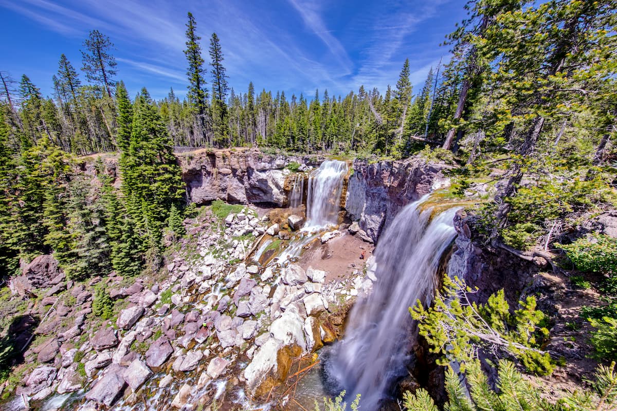
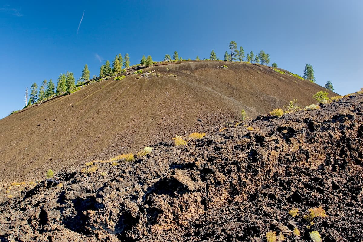
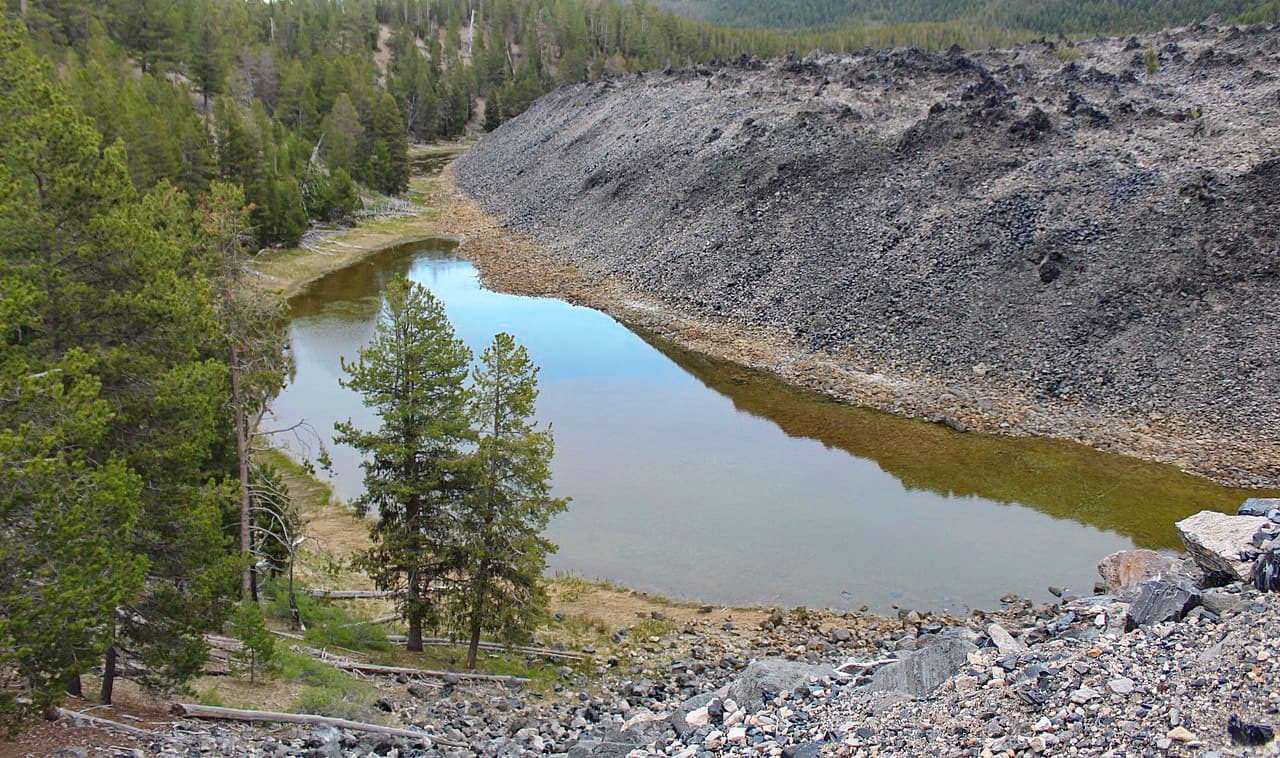
There are 14 named mountains in Newberry National Volcanic Monument. The highest and the most prominent mountain is Paulina Peak at 7,985 feet. There are four main regions to the Newbery National Monument; Lava Butte, Lava River Cave, Lava Cast Forest, and Newberry Caldera. The Big Obsidian Flow, which happened 1,300 years ago, spans an area of 700 acres. The Lava Flow Forest is located south of the city of bend and contains 6,000-year-old molds of ancient trees that were formed by lava flows. Lava River Cave, located within the monument, is the largest uncollapsed lava tube in the state of Oregon and can be explored by using headlamps and flashlights. Newberry Caldera is the primary hiking area within the monument offering a variety of activities, trails, and panoramic view of the region.
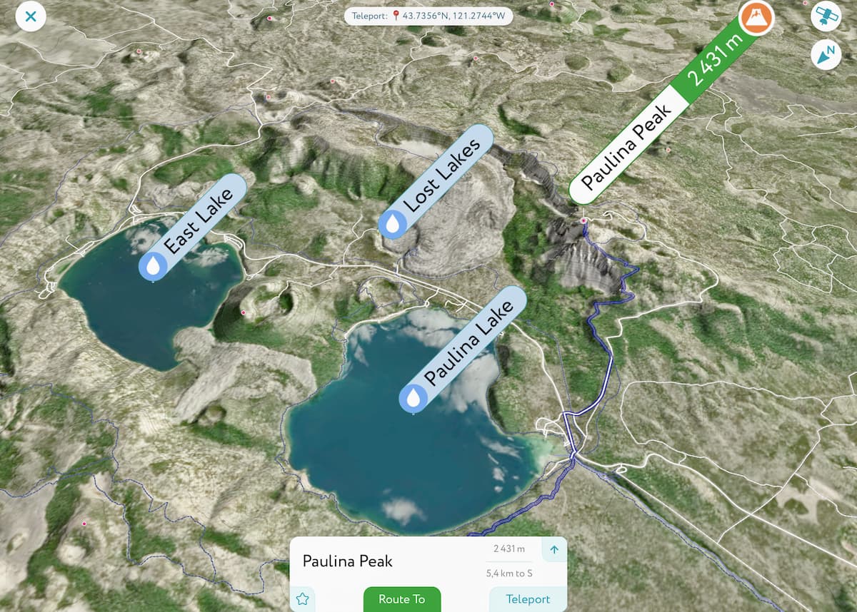
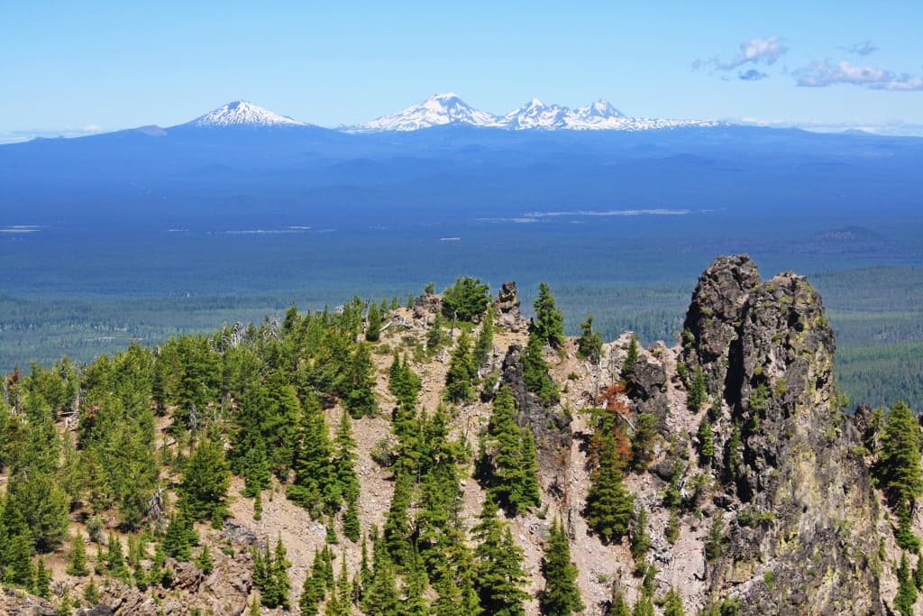
The trail takes you to the tallest peak within the monument, Paulina Peak. The hike is an out and back totaling 6.2 miles with 1,610 feet of elevation gain. The trail starts at Paulina Lake Trailhead and climbs the Newbery Caldera rim until you reach the summit. Once you reach the peak, you will have views on the Cascade Range stretching from Mount Adams in Washington state, down to Mount Shasta in California. The trail starts at the lake among the surrounding trees before climbing to the peak offering unobstructed views. Look below to see both Cags and Paulina Lake within the crater.
As the name shows, this hike takes you on a loop of the entire rim of the crater. The total loop is 19.5 miles with 2,874 feet of total elevation gain. This trail also starts at Paulina Lake Trailhead before taking you around the entire crater. The trail is used frequently by both hikers and bikers due to the breathtaking views it offers. Hikers should note that the lowest elevation on the hike is at around 6,000 feet so be prepared for the difficulty that comes with increased elevation. There are limited spots to fill up water so be sure you carry a lot with you when hiking. There are spots to camp along the trail so the hike can be completed in two days if desired.
While this is a short hike within the region, there is a reason it is so popular. This 0.8-mile lollipop loop only has 200 feet of elevation gain. The hike is known for taking you out on the one-square-mile Big Obsidian Flow. This lava flow occurred 1,300 years ago making it the youngest within the state of Oregon. The lava flow has left behind an iconic landscape unlike anything in the surrounding area. This short hike will offer you views of the Obsidian Flow as well as Paulina Peak and the surrounding wilderness.
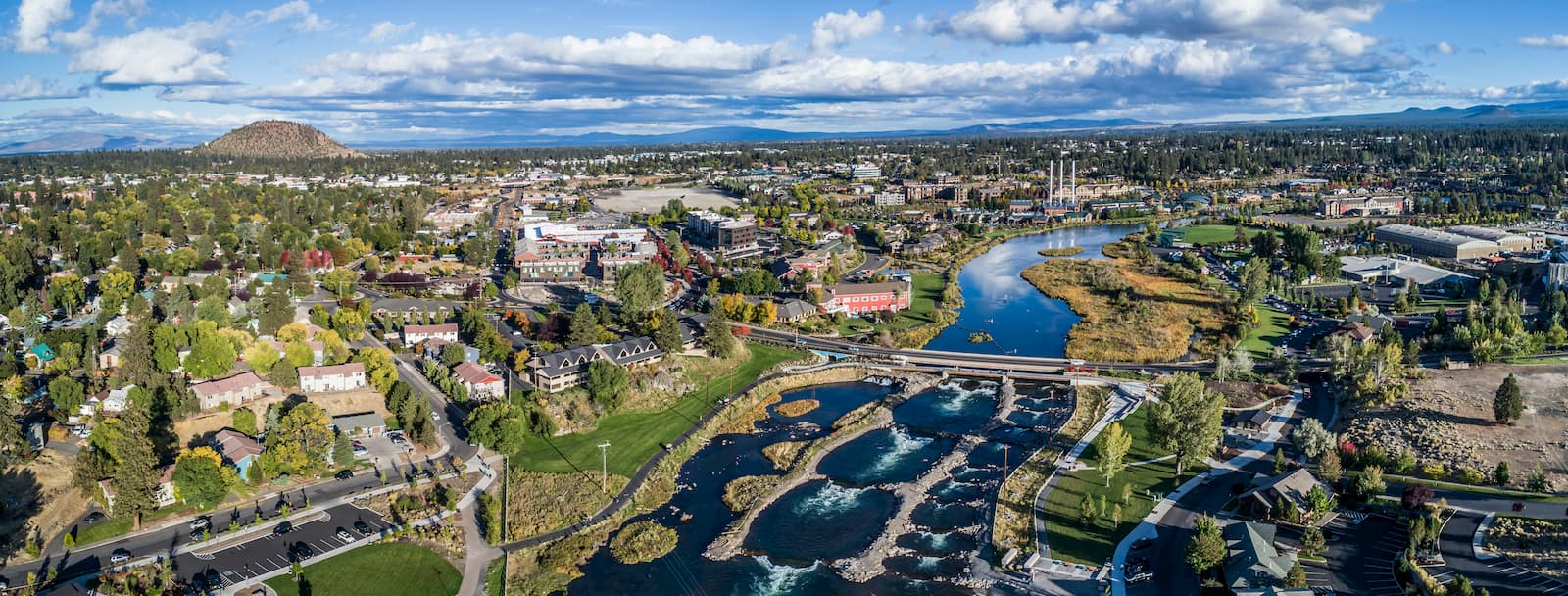
Bend is the largest city located in eastern Oregon with a population of nearly 100,000. The city is located on the Deschutes River and is known for being an outdoor paradise. To the west lies the lake and peaks of the Cascade Mountains, along with Mount Bachelor Ski Resort, while a trail in the city leads to the top of Pilot Butte. To the south lies the High Desert Museum and Newberry National Volcanic Monument. Just north of town is one of the state’s most iconic rock-climbing locations, Smith Rock State Park. As a whole, the city is a mecca for trail running, skiing, mountain biking, hiking, rock climbing, and even surfing in the river. Besides the abundance of outdoor activities, Bend is known for its numerous breweries and restaurants.


