Scan the QR code and open PeakVisor on your phone
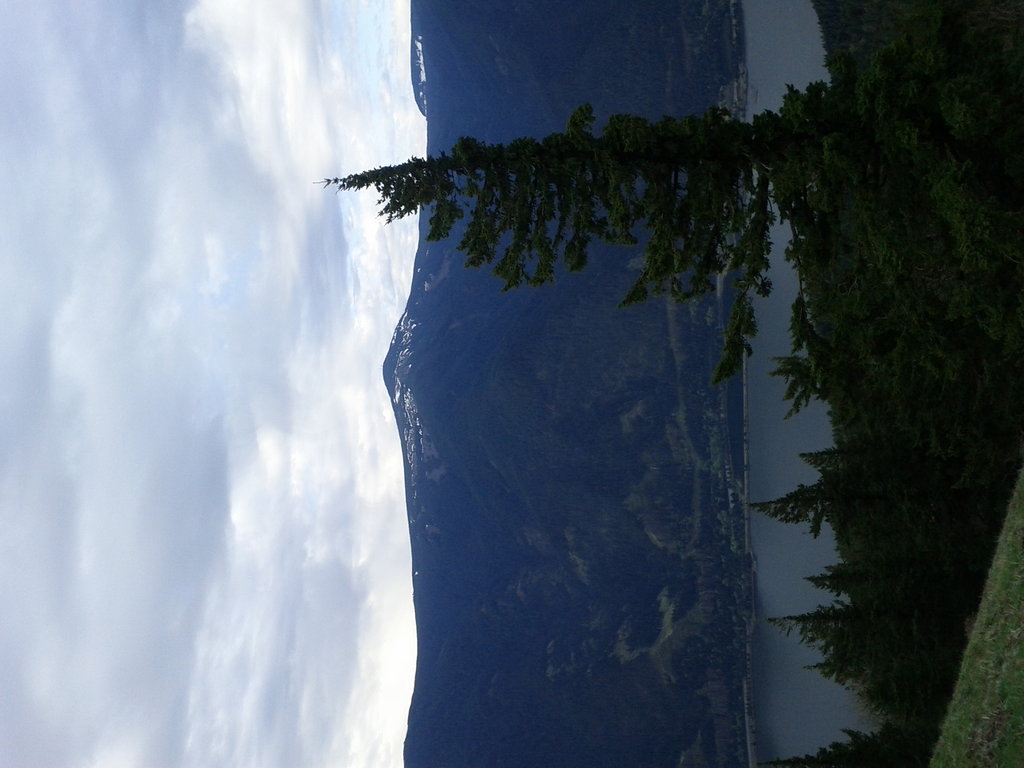
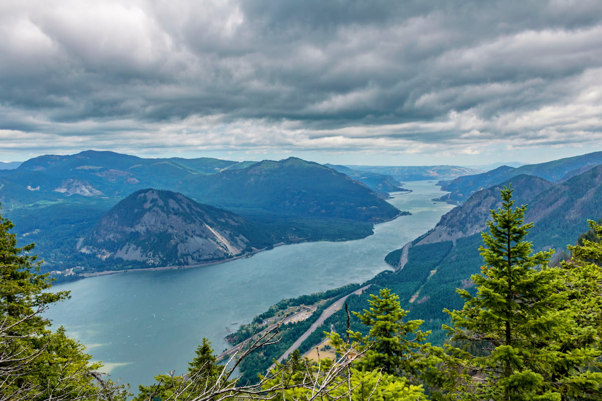
The Mark O. Hatfield Wilderness is located on the north side of Mount Hood within the Mt. Hood National Forest and the Columbia River Gorge National Scenic Area. There are 15 named mountains in Mark O. Hatfield Wilderness and it encompasses 65,822 acres. The highest and the most prominent mountain is Mount Defiance at 4,954 feet. The northern part of the wilderness is characterized by a landscape similar to that in the gorge; basalt cliffs and numerous waterfalls that feed into the river below. As the wilderness stretches towards Mount Hood, the plateaus give way to panoramic views of the Cascade Range and the Columbia River Gorge below. Elevations within the Wilderness range from 100 feet down at the river, up to the summit of Mount Defiance.
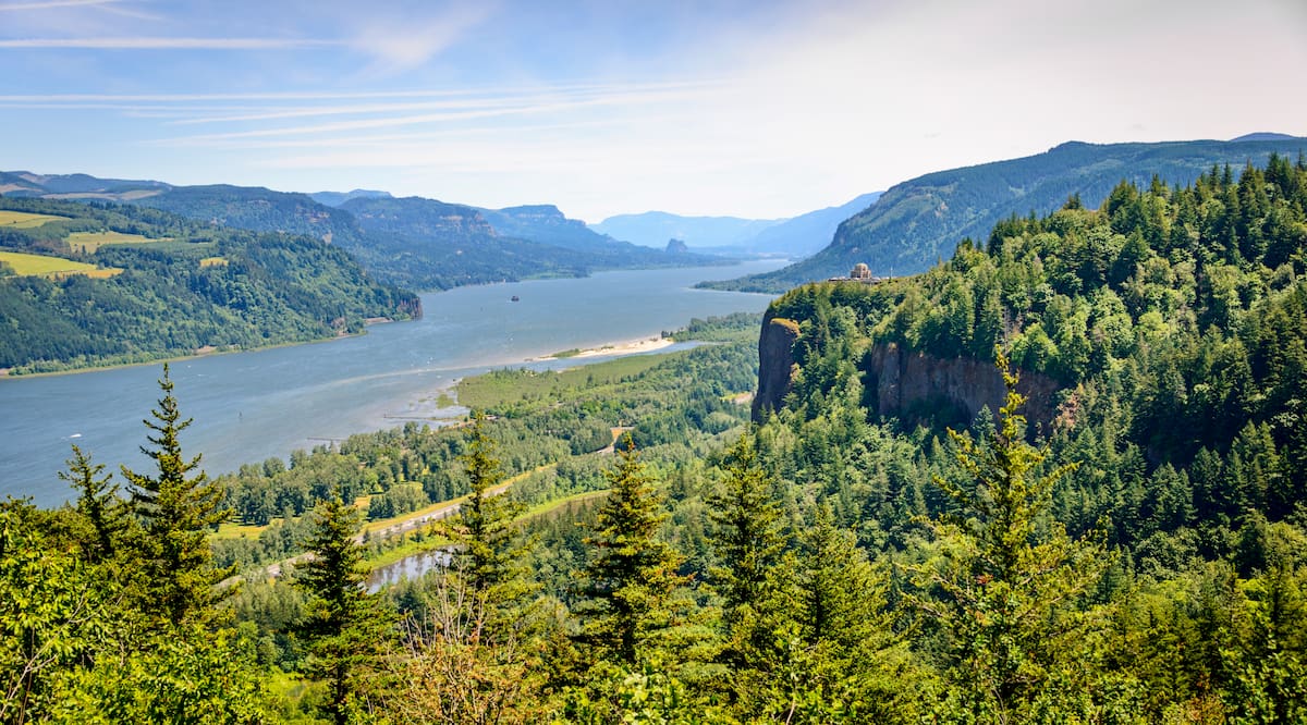
In 2009 the Mark O. Hatfield Wilderness was expanded to include the Gorge Face and Larch Mountain. This region now includes cliffs, deep canyons and waterfalls stretching from Oneonta Creek west to Viento Creek located near Hood River. The southwestern border of the Wilderness is the Bull Run Watershed which provides water for nearby Portland and the surrounding metropolitan area. Within the Wilderness there are over 200 miles of trails, many of them following waterways and up steep cliffs. The Pacific Crest Trail passes through the Wilderness before crossing the Columbia River along the Bridge of the Gods into Washington State.
The main waterways within the Wilderness are Herman Creek, Eagle Creek, and Tanner Creek. The region closer to the Columbia River is defined by old growth Douglas-fir, hemlock, and cedar trees. In the higher elevations forested plateaus, subalpine lakes, and panoramic views take over.
Mount Defiance Trail: The loop trail leading to the summit of Mount Defiance, the tallest peak in the Wilderness, is 12.4 miles long with 5,072 feet of elevation gain. The peak is also the highest point within the Columbia River Gorge, allowing it to offer unparalleled views of the area. From the summit hikers have views of nearby Mt. Hood, Mt. St Helens, and Mt. Adams. The trail is considered to be one of the hardest hikes within the state due to its steep incline.
Indian Point via Herman Creek, Nick Eaton, and Gorton Creek Loop: As one of the most popular hikes in the Wilderness is this 7.3-mile loop trail with 3,185 feet of elevation gain. The trail climbs through the dense forest crossing through patches of the remnants of a wildfire. Eventually, after much climbing, hikers follow ridgelines with expansive views of the Columbia River and Washington State below. A well-rounded route that offers hikers a plethora of viewpoints.
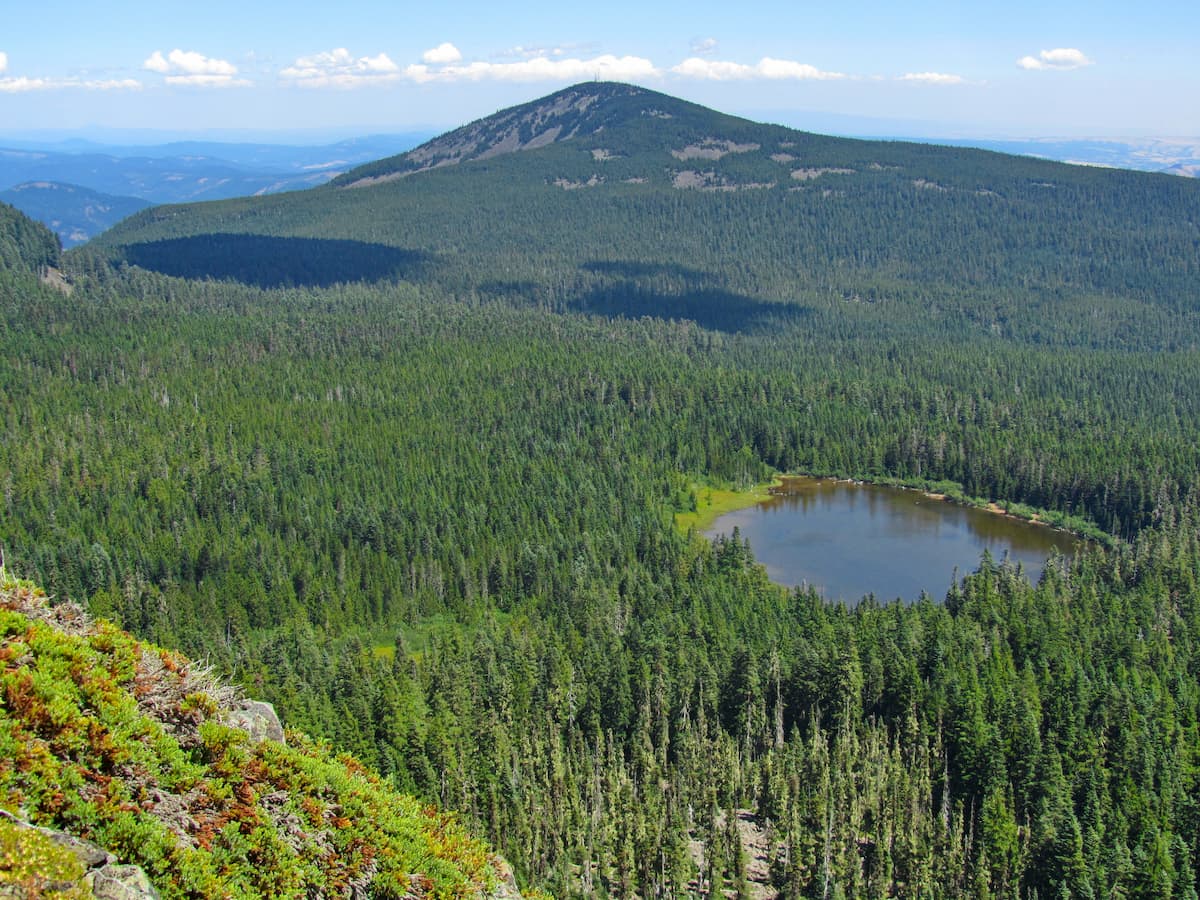
Chinidere Mountain: Tucked into the heart of the Mark O. Hatfield Wilderness lies this 4-mile hike with just over 1,000 feet of elevation gain. The old forest road leads hikers right to the trailhead. From there the trail follows the south side of Wahtum Lake before climbing up to the summit of Chinidere Mountain. The trail then descends around the north side of the lake with sections of the trail following along the Pacific Crest Trail. To make this a longer route, hikers have the option of continuing onward to Tomlike Mountain after summiting Chinidere Mountain. Though a slightly lower elevation, this peak provides views of the rolling Cascade Mountains stretching to the south.
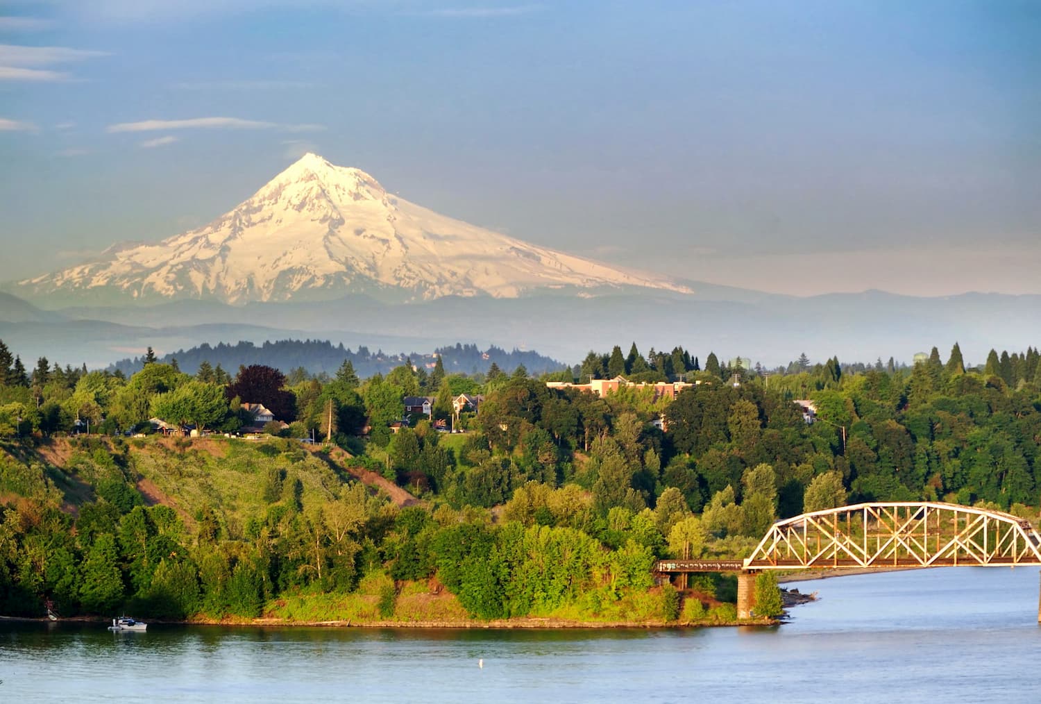
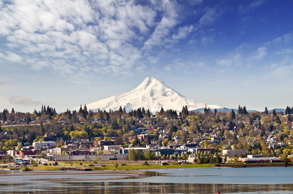
Just 20 minutes east lies the city of Hood River, Oregon. Located on the Columbia River, Hood River is a port city with a population of just under 8,000. The city is located at the confluence of the Hood River and the Columbia River, being one of the largest cities within the Columbia River Gorge. Surrounded by the foothills of the Cascade Mountains, the city is just 30 miles from Mount Hood, Oregon’s tallest peak. The close proximity to nature means an abundance of hiking, biking, skiing, and world class windsurfing on the Columbia River. The town is also full of numerous local restaurants, breweries, and wineries.
Located just an hour west of Mark O. Hatfield Wilderness Area, lies the city of Portland. With a population of over 600,000 people, Portland is the largest city within the state of Oregon. Known for its vast food scene, many people often forget that Portland is also a hiker’s paradise. The city is home to Forest Park, 5,200 acres of trails within the city, it is just two hours away from both Mount Adams and Mount Hood, and an hour from Tillamook National Forest.