Scan the QR code and open PeakVisor on your phone
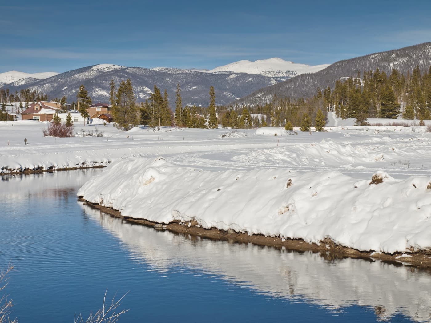
One of 64 counties in Colorado, Grand County is located in the north-central part of the state. With an area of 1,870 square miles and a 2019 population estimated at 15,734, it is one of the less densely populated counties in the state – only eight persons per square mile. The county is mostly rural in character and has no cities, though it has six towns with the best known perhaps being the resort town of Winter Park. The county seat is Hot Sulphur Springs and the largest town is Granby. The county is named after Grand Lake and the Grand River, which has its headwaters at La Poudre Pass and is better known today as the Colorado River.
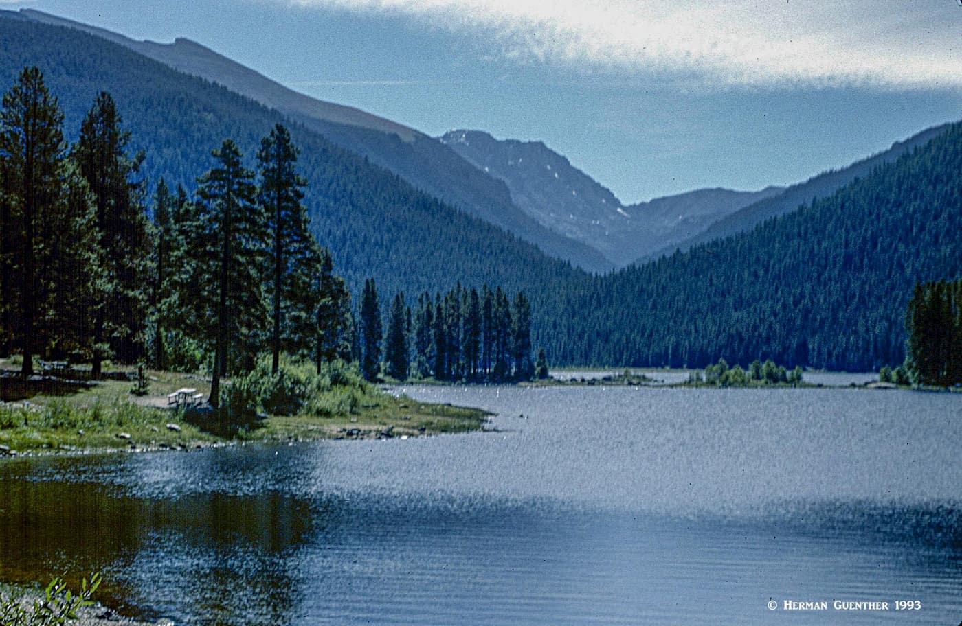
Grand County has common boundaries with eight other counties and occupies parts of two national forests, six wilderness areas, Rocky Mountain National Park, Arapaho National Recreation Area and several well-known hiking and biking trails. Not only does the Colorado River flow across the entire county, most of this stretch is rated as Gold Medal Waters, which means it is designated as quality waters that can produce large trout. Then there are many magnificent lakes, several of which are man-made including Williams Fork Reservoir, Lake Granby, Shadow Mountain Reservoir, Meadow Creek Reservoir, and Monarch Lake among others, and one, Grand Lake, is the largest and deepest natural lake in Colorado. Together, they provide ample opportunities for recreation while serving the water supply and power-generation needs of a large part of the state.
On top of this natural and man-made recreation infrastructure, there are the mountains, high mountains, which practically surround most of Grand County, as well as filling its interior. In fact, there are 157 named mountains in the county, the highest of which is Pettingell Peak and the most prominent is Mount Richthofen. The Continental Divide forms the entire eastern and northern boundary of the county. Most of the highest peaks are located directly on the Continental Divide, but only on the eastern segment which includes the Never Summer Mountains sub-range of Colorado's Front Range. Consequently, those mountains are shared with other counties and administrative entities, including Rocky Mountain National Park. Many of the mountains in the central and western parts are much lower and are of little significance in the context of hiking or other recreation.
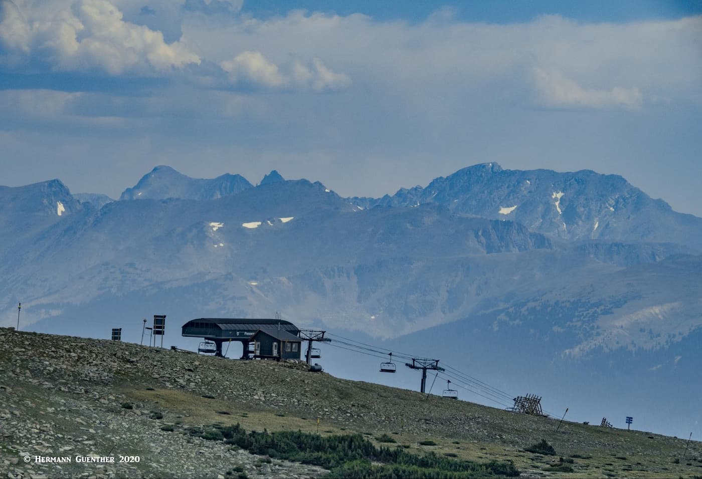
From the standpoint of foreign or out-of-state visitors to Grand County, perhaps the prime recreation venue is the Winter Park Ski Area. This is Colorado's longest continually operated ski resort. It consists of two interconnected areas, each accessed from different approaches. The main area is in the town of Winter Park itself, while the slightly more remote area, known as Mary Jane, can be reached from a spur roadway off the main highway (US-40). I have always found it more convenient to park at Mary Jane rather than driving into town. Also, I much favored Mary Jane due to its higher and more challenging terrain. It is possible to ski the entire complex no matter where you park – you just have to plan accordingly so that you don't get stranded in the wrong place when the lifts close at the end of the day. Mary Jane now boasts the highest six-person chairlift in the world – the Panoramic Express which has its top terminal at 12,060 feet. It serves mainly advanced terrain.
But aside from alpine skiing, the Fraser Valley offers several Nordic skiing centers including the Devil's Thumb Ranch and the Snow Mountain Ranch/YMCA of the Rockies. A little further north is the Grand Lake Nordic Center. Collectively, these resorts offer hundreds of miles of cross-country and snowshoe trails. Snowmobiling is also popular in Grand County, with Grand Lake known as the “Snowmobiling Capital of Colorado”, about 35 miles north of Winter Park.
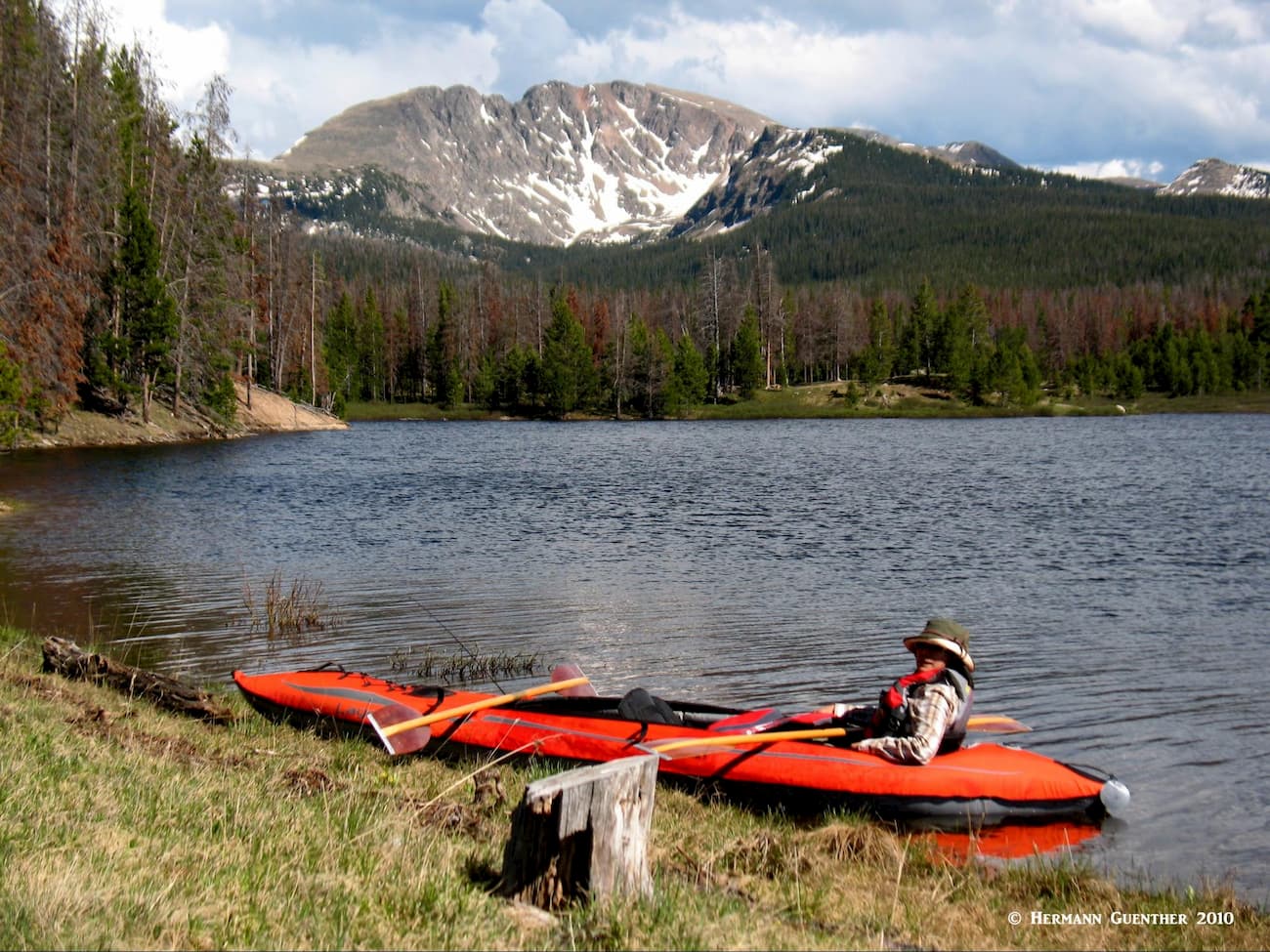
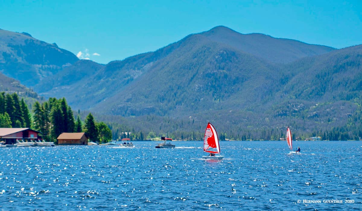
If water sports are your passion, you will not be disappointed in Grand County. As mentioned, the Colorado River, as it crosses the county from the northeast to the southwest, offers one of the many fine Gold Medal fishing venues. If boating is your preference, the aforementioned lakes and reservoirs offer many opportunities. And then there is the Arapaho National Recreation Area, 35,000 acres of scenic water wonderland, which includes parts of these lakes’ shorelines. The slightly smaller Monarch Lake and Meadow Creek Reservoir are also within this amazing landscape that also provides lots of camping, boating, kayaking, fishing, horseback riding, hiking. You will be sure to see plenty of wildlife here. It is necessary to pay a fee to enter these areas, but it is very reasonable and well worth paying to experience this magnificent area.
When it comes to hiking in Grand County, it is impossible to cover all of the many trails that can be accessed from here. Certainly, many backpackers making one-way trips may start within the county and exit over the mountains to another destination. Overnight trips across some of the high passes over the Continental Divide are popular as are hikes to destinations within the county but which may start in an adjacent county. An example would be the highest mountain in the county - Pettingell Peak – which is most easily climbed from the Herman Gulch Trailhead – in Clear Creek County. So just follow me as I tell you about some of the best hiking to be found in this varied county, based mostly on my own experience over the past 40 years.
Ptarmigan Peak Trail – While Ptarmigan Peak (12,500 feet) is technically in Grand County, it lies on its boundary with Summit County, and is the namesake mountain of the small Ptarmigan Peak Wilderness. There is only one real trail to the mountain's summit, in fact, the only trail in the entire wilderness. This trail starts right within the city limits of Silverthorne, just a stone's throw from I-70. The five-mile trail to the top generally follows a southwest facing ridge. This is a moderately-used trail but somewhat strenuous due to more than 3,600 feet of elevation gain. While the top part of the trail is above tree line, even the lower segments open up to some fine views. Autumn can be very nice here, with amazing views south across Dillon Reservoir toward the Tenmile Range. Please note that there are two Ptarmigan Peaks in Grand County – the other one is about 700 feet lower and does not appear to have any official trails to its summit.
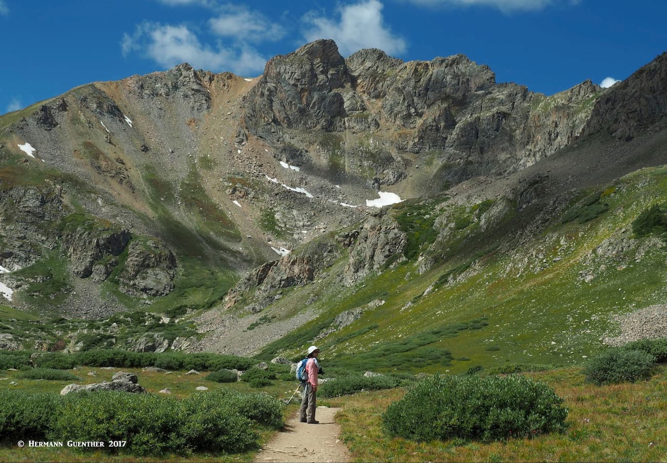
Herman Gulch Trailhead – This is an incredibly popular trailhead mainly because it affords a relatively easy seven-mile round trip hike to the small Herman Lake, which sits in a beautiful alpine basin with stunning views in all directions. You will not be alone here, partly because this trailhead can be reached from the western suburbs of Denver in 45 minutes or less. Even on a weekday in mid-summer, you need to get here early in order to find a parking spot, especially if you plan to climb Pettingell Peak, the highest mountain in Grand County. As you drive west on I-70, you can get the best view of the mountain shortly before the highway exit. As you look straight up Herman Gulch, it sits right in the middle of the valley to the right of the pyramid-shaped Mount Bethel.
Once you arrive at Herman Lake, there will be no trail and you have to find your own way to the top. And you will no longer have to deal with other hikers. The times that I have climbed Pettingell, I never saw anyone else up there. But that was a number of years ago and things have undoubtedly changed. Once on top, you are on the Continental Divide and your views will be incredible. While this is a strenuous hike, if you have more energy reserves, you can hike along the Divide, scrambling across the impressive Citadel to Hagar Mountain, from which you return to the Citadel and then back down into Herman Gulch. That would make an impressive hike indeed.
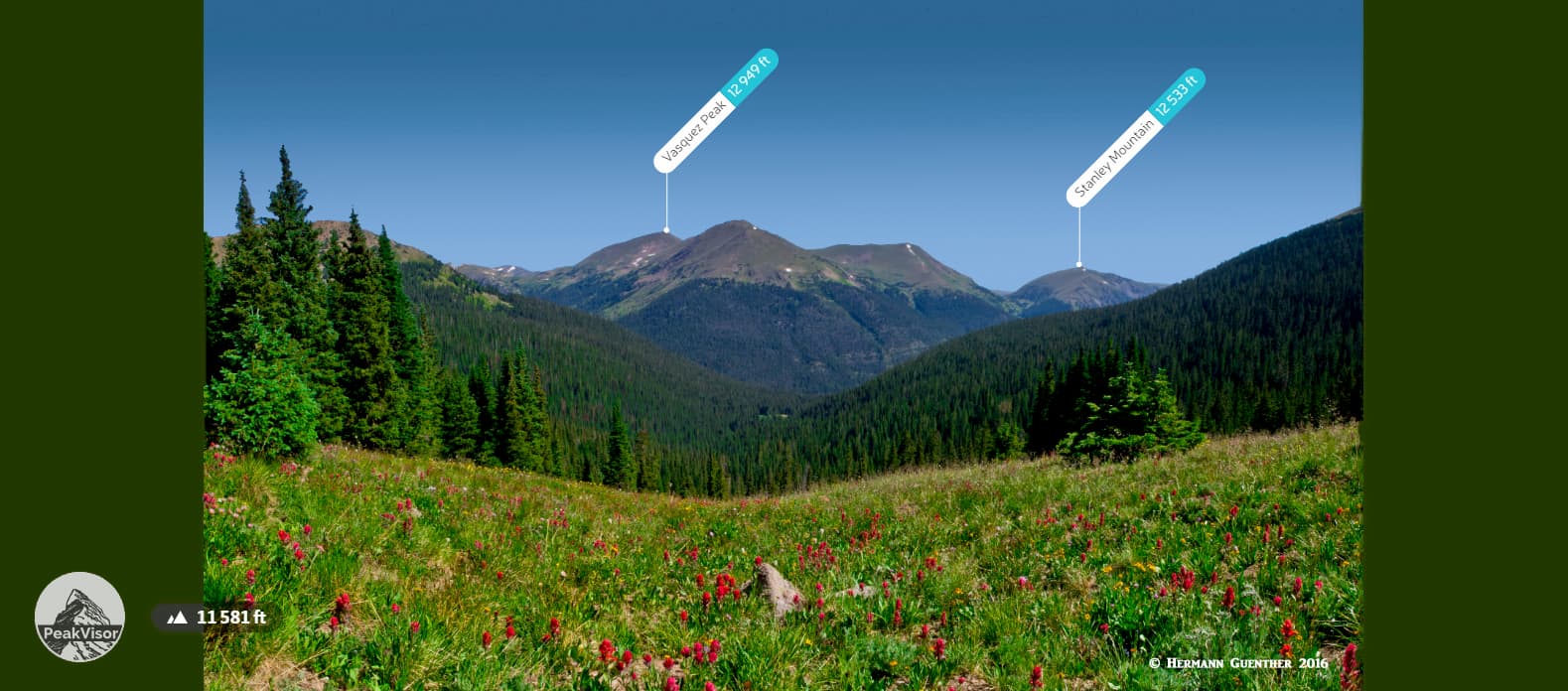
Berthoud Pass Trailhead - The summit of Berthoud Pass offers a number of hiking options, as this is where the Continental Divide crosses Highway 40. Here it is possible to follow the Continental Divide National Scenic Trail (CDNST) for miles in both directions. The pass is at the boundary of Clear Creek and Grand Counties. To the northeast the route will take you over various summits of the James Peak Wilderness, which lies entirely on the eastern side of the Divide. On the western side of the pass, the trail will take you to the Vasquez Peak Wilderness which it follows for seven miles, taking you over Stanley Mountain and Vasquez Peak. This is entirely above the tree line so you must be aware of exposure to the weather.
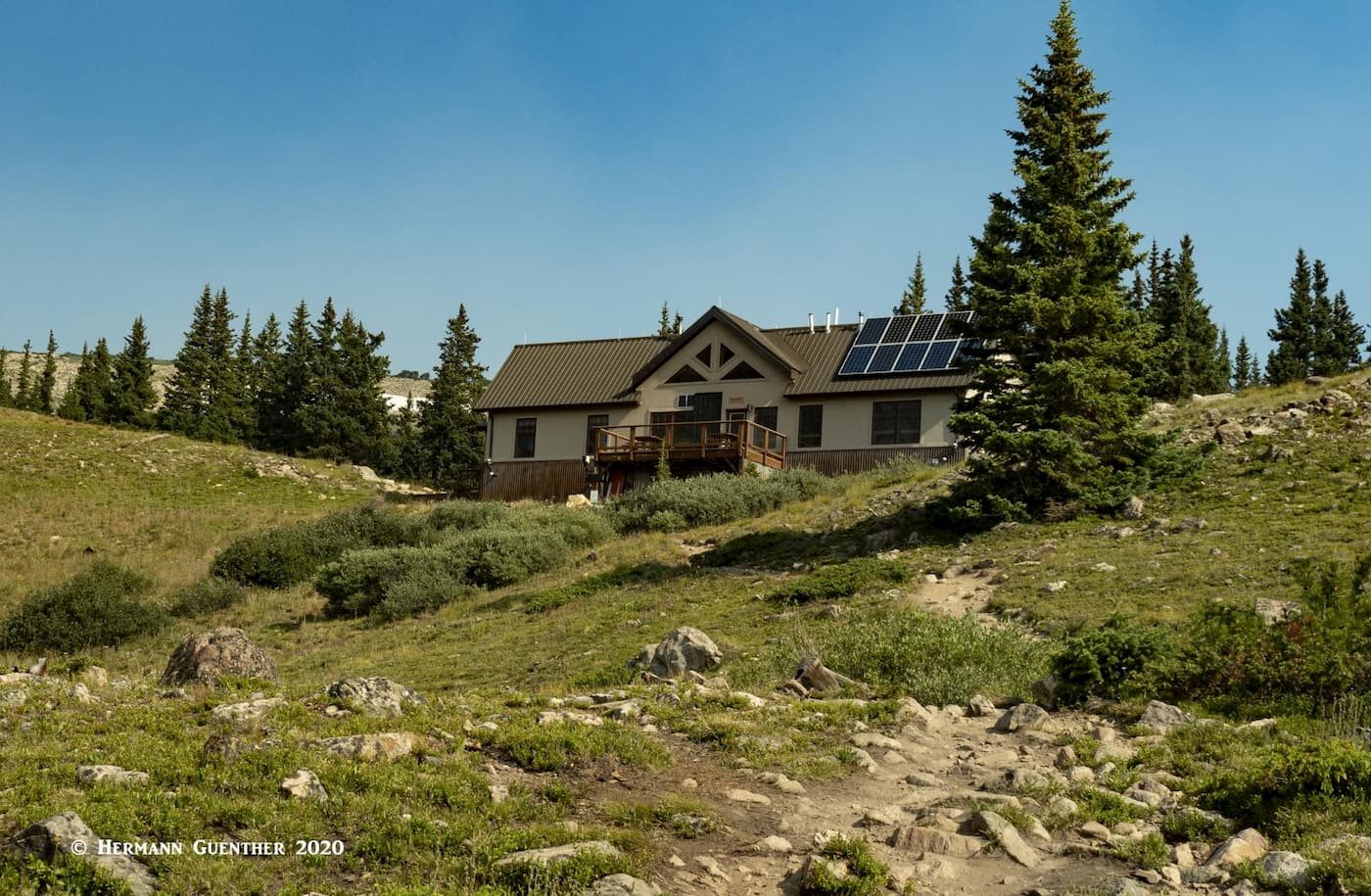
Second Creek Trailhead – Approximately three miles north of Berthoud Pass, heading down toward Winter Park, is the Second Creek Trailhead. By a big bend in the road, there is a parking area on the left side for about 30 cars. This is where the Second Creek Trail begins – and it will take you to some fascinating terrain in the Vasquez Peak Wilderness. A little more than one mile of moderately steep hiking will take you to the Broome Hut, part of the 10th Mountain Division Hut System. It sits at the edge of a stunning alpine basin that is one of the finest high altitude skiing and hiking locales in Colorado. You will be tempted to simply stop here and absorb the magic of this place. But you must continue – there is more to this hike.
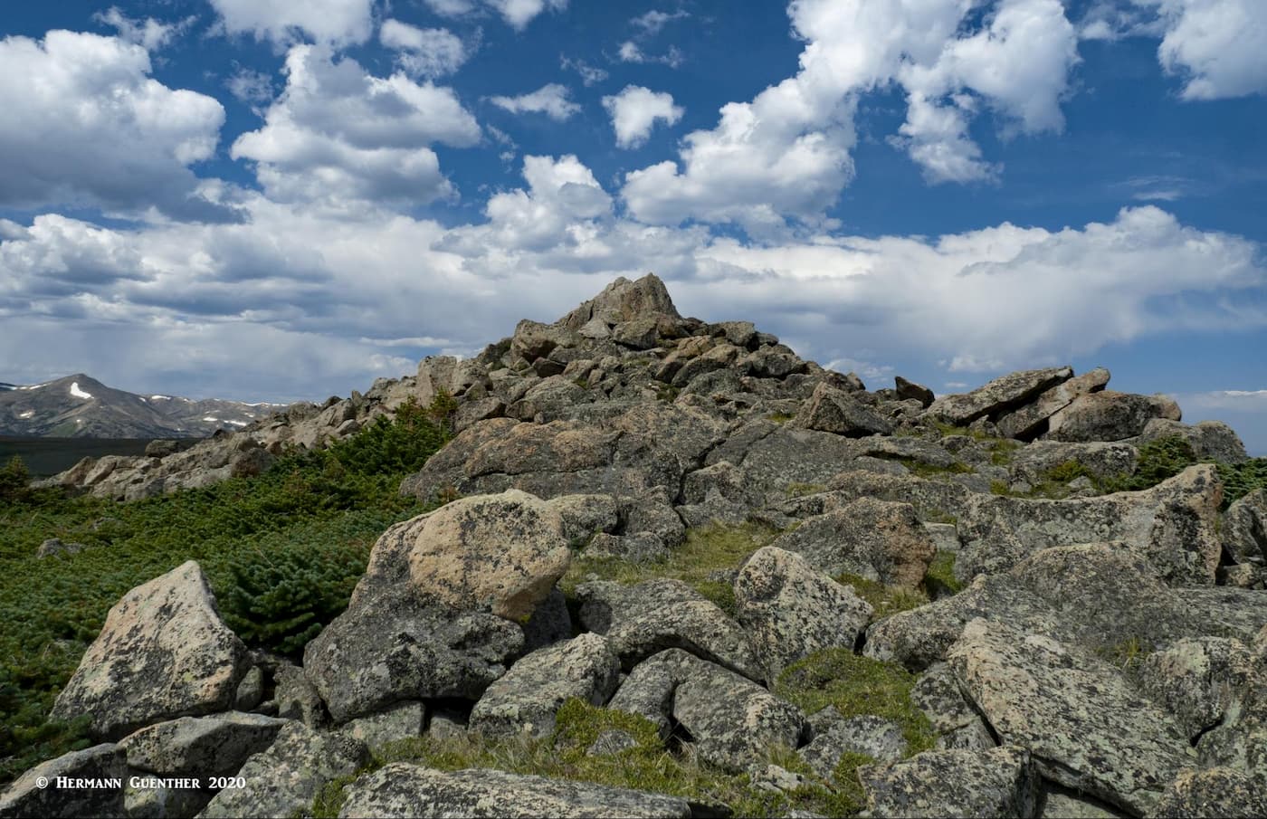
The trail continues over open terrain until it tops out on a high plateau right at 12,000 feet elevation. When we did this hike for the first time in the summer of 2020, we were astounded at what we saw up here - a huge expanse of open tundra with distant mountain views in all directions. Just to the north of this spot were two slightly elevated summits known as the Twin Cones, both at an elevation of 12,057 feet, and about a half mile apart. These strange formations are something I had never experienced in Colorado before. The North Cone summit is just a few feet above the summit station of the Panoramic Express – the highest six-person chairlift at the Mary Jane ski area (see above). The views toward the high peaks of the Continental Divide are amazing – all the mountains of the James Peak Wilderness and the Indian Peaks Wilderness can be seen from here, as can the higher peaks of Rocky Mountain National Park, including Longs Peak.
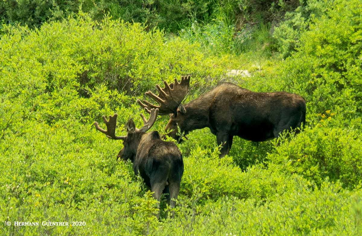
After “summiting” both cones, it is best to return the way you came, unless you are equipped for a long-distance expedition. We only saw four to six other people up here. You need to check you GPS to be sure you don't miss the point where you have to descend from this wonderful plateau. On the way back down to the hut, after stopping for lunch, we saw two moose just off the trail, and both were bulls with huge antlers. We have of course seen these creatures before, but never two males foraging in the willows together. A rare treat, but one must be careful not to approach them – though they are in the deer family, they are mean and can be extremely dangerous. Fortunately, their ears were perked up - a clear sign that they were not bothered by us, although they kept watching us.
Junco Lake Trailhead – If you are going to be camping at Meadow Creek Reservoir, you might want to consider making a very fine day hike to one of two nice destinations. For either one, which will take you into the beautiful Indian Peaks Wilderness, you will hike the first two miles on the Caribou Pass Trail to a junction at which point you will have to make a decision – go to Caribou Pass or to Columbine Lake. A tough choice. I solved that dilemma by making a three-day backpack trip, camping two nights at Columbine Lake, the total distance to which is 3.7 miles. When you arrive at the lake the first day, set up camp and enjoy the scenery around the lake, maybe even try to catch a few fish in this pristine setting.
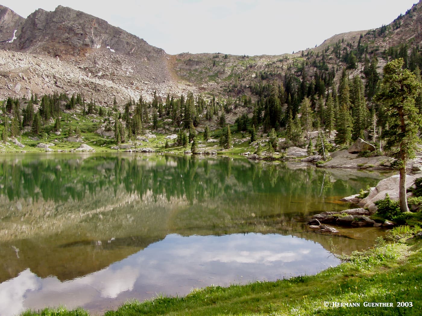
The next morning take a day hike (no heavy pack needed for this) to Caribou Pass. Just go back to the trail junction you passed the previous day and then take the Caribou Pass Trail to the actual pass. Here you will get a spectacular view across a basin, which contains Caribou Lake, toward the massive South Arapaho Peak. Off to the right, the trail continues across a steep slope to Arapaho Pass. This short segment of trail has some exposure that may intimidate some hikers, and certainly should be avoided if there is snow here. But it is adequate to just enjoy this stunning spot and then return to your campsite. The next morning, you can just take the short hike back to your car and drive home. This is a fairly easy hike, even for backpacking, since the elevation gain to Columbine Lake is only 1,100 feet.
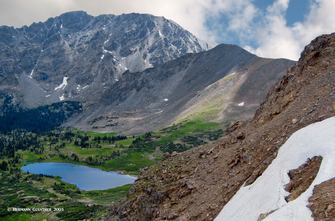
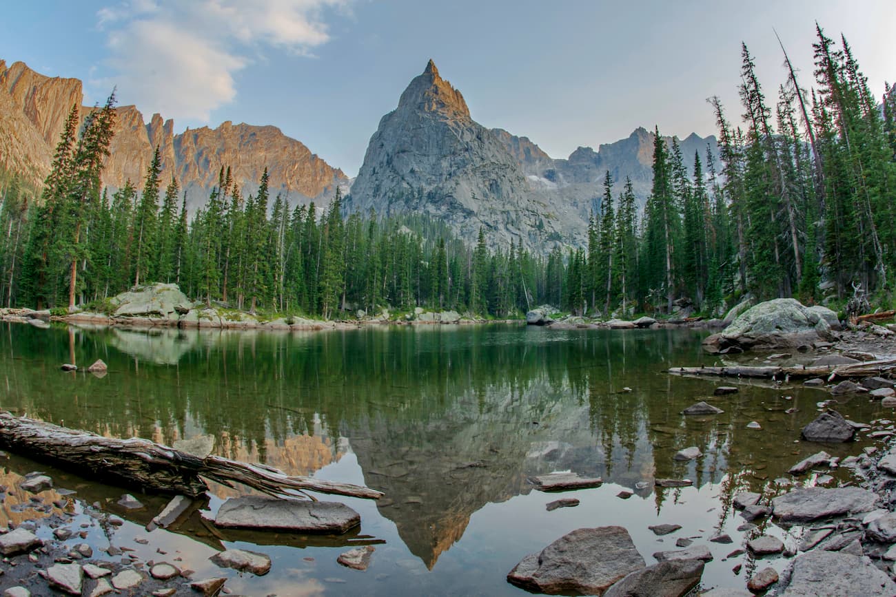
Monarch Lake Trailhead – This trailhead is less than six miles north of the Junco Lake Trailhead as the crow flies, although it is 40 miles by road. The small Monarch Lake is less than a mile from the eastern end of Lake Granby and the trailhead provides access to a number of long hikes into the Indian Peaks Wilderness. There is a short four-mile loop around the lake which is more of a leisurely walk than a hike. But perhaps the best hike here is the 16-mile round trip hike to Crater Lake (how many of those in Colorado alone!) at the foot of Lone Eagle Peak. That is a long day hike - which is why I turned that one into a four-day backpack trip. There is so much to explore here that a day, or even two, is simply not enough. The Cascade Creek Trail is very popular and you will likely not be alone here during peak summer periods. It is the most heavily used trail on the west side of the Continental Divide in Grand County. It feeds several other trails which go even farther into the wilderness. About one mile before Crater Lake, this trail splits into two – one is Crater Lake Spur and the other the Pawnee Pass Trail. Just before the spur trail reaches the lake, it passes a small tarn called Mirror Lake that lures photographers who want to snap that perfect reflection of the pointed spire of Lone Eagle Peak.
Meanwhile, the Pawnee Pass Trail continues on its own path deeper into the wilderness, passing the spectacular Pawnee Lake, which sits in a deep glacial cirque that will open your eyes to a remarkable landscape. You definitely want to stop here for some photography, and you had better come prepared with a camera that has a wide-angle lens, for that is what you will need to capture the scenery in a way that truly conveys the grandeur of this place. After the lake, the trail rapidly ascends (well, the trail does – you won't, at least not rapidly) 1,660 feet to Pawnee Pass in about 1.5 miles. The last half mile to the summit is a series of steep switchbacks built on terrain that must surely approach the limit of trail construction. It has to be experienced to be believed. Horses are not permitted on this trail, which, after the pass descends more gently from the Divide down to its eastern terminus at the Brainard Lake Recreation Area. From Crater Lake to the pass and back to camp was a strenuous all-day hike for me. I clocked 32 miles on that four-day hike, half of it with a 50-pound pack.
This 100,000 acre roadless complex, which also includes the Vasquez Peak Wilderness, does not have a plethora of trails, and those it has are hard to find. But I did manage to find them by following a series of Forest Service roads not very far from Winter Park. There are occasional access limitations into this area, so it is wise to inquire locally before going there.
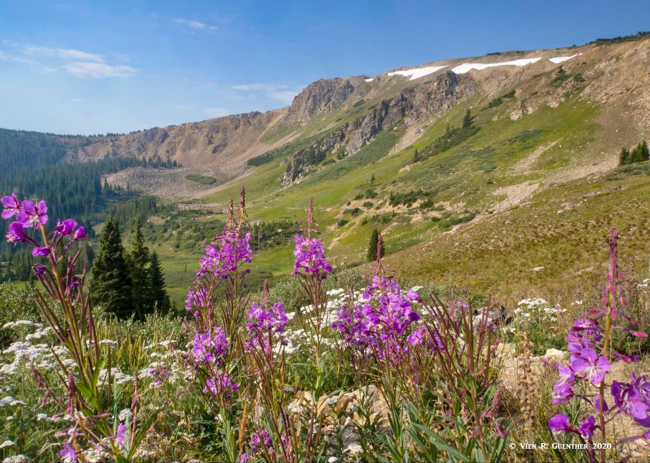
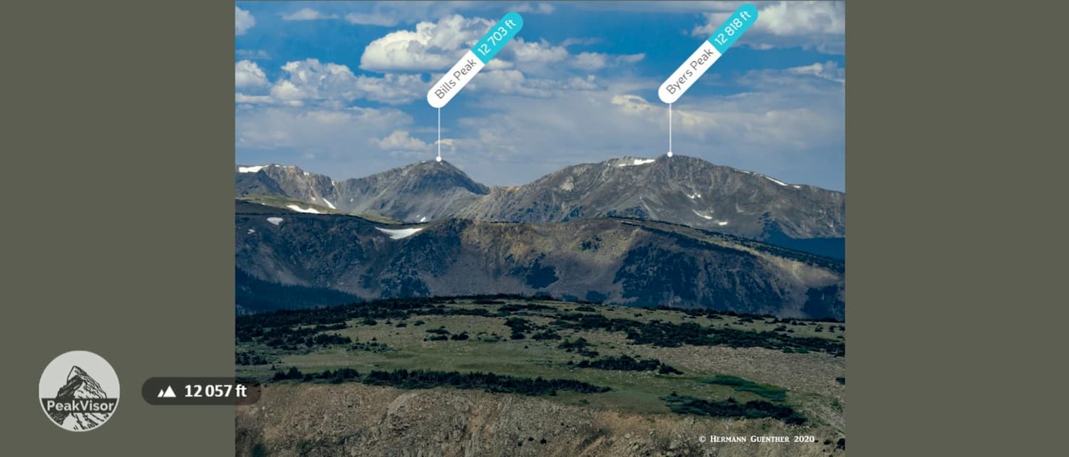
Byers Peak Trail - This popular trail begins about 15 miles west of the resort of Winter Park – it takes driving a short distance on US-40 and then on several Forest Service Roads to get there. This fine hike is in the Byers Peak Wilderness, the smallest mountain wilderness in Colorado. About one half of Byers Peak consists of alpine tundra and therein lies the great attraction of the area. Though the summit elevation is only 12,818 feet, not all that high by Colorado standards, there is an elevation gain of 2,988 feet in the 4.5 miles to the top. But that distance includes about two miles of old road that is closed to vehicles. Only at the end of this road does the serious climbing begin. Because of this it is rated as difficult, although I did not think that it was all that hard when I did it 25 years ago. The segment above the tree line has amazing wildflowers at the right time of summer. The trail actually continues beyond the peak for some of the finest alpine ridge hiking in Colorado. Since Byers Peak is the highest peak in the wilderness, and one of the most prominent in the Arapaho National Forest, it is wise to be mindful of the afternoon thunderstorms that are common here.
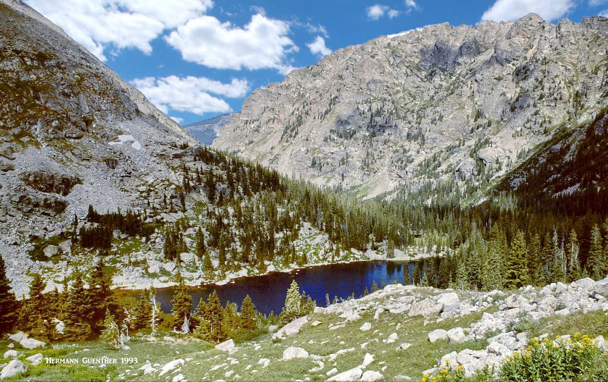
Saint Louis Lake Trailhead – Saint Louis Lake is a beautiful alpine lake tucked in between Byers Peak and Saint Louis Peak, deep in the Fraser Experimental Forest. It sits in a lovely glacial basin at an elevation of around 11,550 feet just barely above tree line. I did this hike back in 1995 when it was possible to drive to the trailhead, from which it was a seven-mile round trip hike. Now, there is a permanently closed gate on the St. Louis Creek Road from which that hiking distance has become more than 11 miles, much of which you will have to walk along the road that I was able to drive back then. But the upside of that is that far fewer people will want to do that hike. But it is well worth doing if you have the will to walk that far.
This town is best known as a major ski resort, located in the Fraser Valley on the western side of the Continental Divide. A world-class resort, Winter Park is ideally situated for staging expeditions, or simply day hikes, into the high mountains of several wilderness areas, including the Indian Peaks and James Peak Wildernesses. The town is easily reached in little over an hour from Denver via U.S. Highway 40, which crosses the Continental Divide at Berthoud Pass, elevation 11,307 feet. Winter Park is also handy to the Byers Peak Wilderness area, which has two peaks over 12,500 feet elevation - Byers Peak and Bills Peak, as well as the Vasquez Peak Wilderness Area. One distinction that other resorts in Colorado don't share is that Winter Park is served by Amtrak's California Zephyr train on a daily basis, thus providing an alternative method of getting there from Denver. There is no shortage of accommodations and restaurants in this mountain getaway.
Grand Lake is the northernmost town in Grand County. It is a very small town with a permanent population of less than 500. But lest the visitor be fooled by such small numbers, it is known that this charming town can handle its share of visitors, although on a much smaller scale than other resorts in Colorado. For those who want to settle down in a more low-key locale, Grand Lake just might be the place, even though it is the western gateway to Rocky Mountain National Park, which receives most of its visitors from the east side. This town offers year-round recreation, and, especially in the winter, it is known as the "Snowmobiling Capital of Colorado".
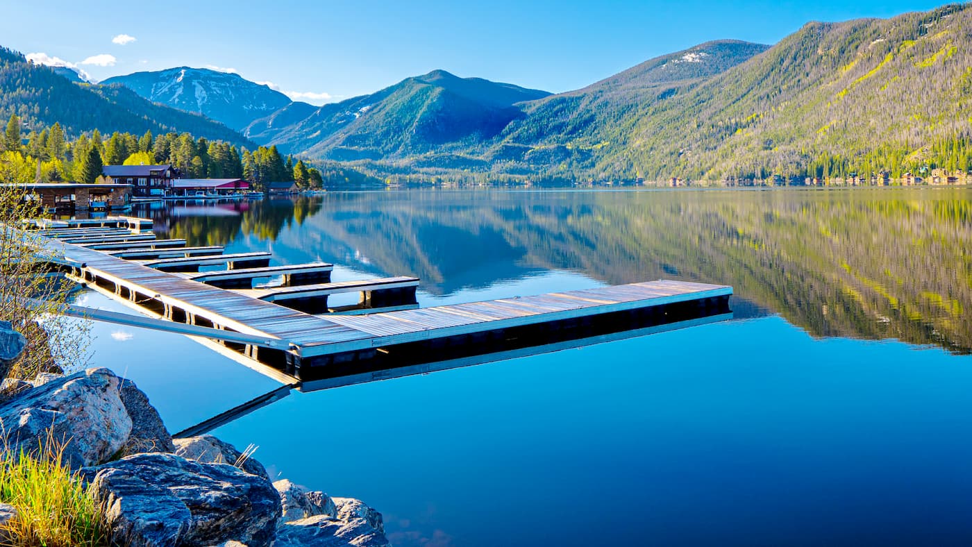
Grand Lake has an assortment of accommodations, restaurants, bars, shops and galleries. Nearby lodgings can be found that are more rustic in nature, which may be just what many visitors might be looking for when they choose to stay here. For those who are into alpine skiing, the resort of Winter Park is only 35 miles to the south. If you find Grand Lake (the lake) is not big enough for boating and fishing, there are two much larger lakes right next door - Shadow Mountain Lake and the even larger Lake Granby. The views across these lakes to the high peaks on the other side are simply amazing.
Hot Sulphur Springs (estimated population of 733), the seat of Grand County, is aptly named due to its geothermal hot springs. It was originally a winter camping ground for Native Americans who used the springs for medicinal purposes. It is the oldest town in Grand County having been established in 1860. It was originally called Saratoga West (perhaps named after Saratoga Springs in upstate New York?), and was occasionally called Warm Springs (for obvious reasons). The town has a less-than-stellar history, the town site having been bought in a backroom deal in violation of a treaty which had named the Ute tribe as the rightful owners. But the new owner, William Byers (who had various geographic features in Colorado named after him), prevailed, after which he surveyed and laid out the town as it exists today. The first pool house at the springs was built around 1900, with the first lodgings following in 1926. The present-day Hot Sulphur Springs Resort and Spa lies just outside town limits on the north bank of the Colorado River.
Located at the junction of highways U.S. 40 and U.S. 34 in the Fraser Valley, 20 miles north of Winter Park, Granby may not be a large town but it is perhaps the most convenient place to stage excursions to various parts of Grand County. Though the town only has a population of 1,916 (2016 estimate), it is the largest town in the county and offers an adequate selection of accommodations and restaurants, with nearby camping and RV facilities, probably at prices far more affordable than you would find in Winter Park. For those inclined to try their luck at fishing, the nearby rivers and lakes will keep most anglers happy for days. There are also plenty of cross-country ski trails nearby.