Scan the QR code and open PeakVisor on your phone
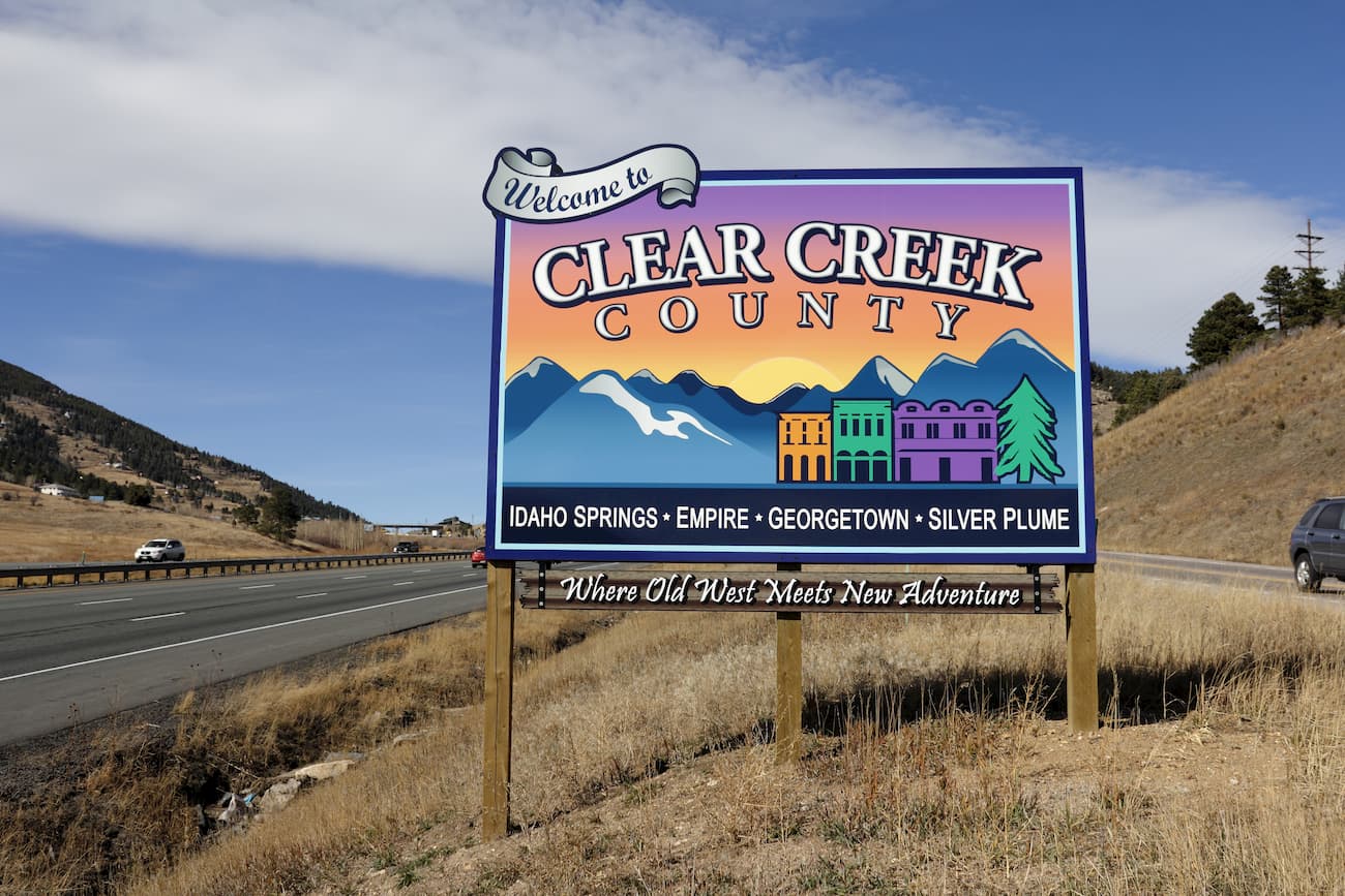
Clear Creek County, one of 64 in the state of Colorado, is centrally located in the state, extending from the western border of Jefferson County up to the Continental Divide. It is one of the original 17 counties created by the state legislature in 1861, and remains as one of only two counties (along with Gilpin County) to have retained their original boundaries. Most other early counties encompassed much larger areas that were subsequently subdivided into more and smaller counties. The estimated 2019 population is around 9,700 inhabitants. Being mostly a rural county, it has a population density of only 24 people per square mile, though it is part of the Denver-Aurora-Lakewood metropolitan statistical area. The county seat is Georgetown, while the only city is Idaho Springs.
The entire county encompasses mountainous terrain ranging in elevation from about 6,900 feet at the point where Clear Creek crosses into Jefferson County to 14,278 feet at the summit of Grays Peak, the highest and most prominent mountain in the county as well as the highest on the entire Continental Divide of North America. It is one of 91 named mountains in the county. Two major tributaries of the South Platte River system cross the county – beginning at the Continental Divide is Clear Creek, the county’s namesake. Bear Creek has its origin on the eastern slopes of Mount Evans. Parts of Arapaho and Pike National Forests occupy parts of the count as do parts of two wilderness areas – James Peak Wilderness and Mount Evans Wilderness.
When it comes to recreation, Clear Creek County is well positioned to offer some of the best. While ski areas in the county are limited to Loveland Basin/Valley and Echo Mountain (all others are west of the Continental Divide), there is plenty of fine hiking and climbing to be found here. For water sports enthusiasts, Clear Creek offers some fine whitewater rafting and kayaking, while there is some fine fly fishing to be found on the many creeks and alpine lakes in the high country as well as in parts of the foothills.
But it is the presence of many fine venues for hiking that may well be what attracts visitors and locals alike to Clear Creek County. It helps that the only east-west freeway (I-70) in Colorado crosses the county – it provides easy access to many of these areas. At its highest point, I-70 passes under the Continental Divide through the 1.7-mile Eisenhower Tunnel. These twin bores are the highest vehicular tunnels (11,158 feet above sea level) on the planet, thus giving bragging rights to Clear Creek County as well as the adjacent Summit County.
Having lived in the Denver area for 40 years, I have had plenty of opportunities to find and explore most, if not all, of the fine areas to go hiking in Clear Creek County. Most of these are easily reached in an hour from the western suburbs of Denver and most are in what I call the high country (foothills hiking is more prevalent in Jefferson County to the east). This means that the best hiking in the county is confined by the calendar – late spring through mid-autumn – except for those adventurers who are equipped and trained for winter hiking and climbing. The proximity of these places to such a large population center means that they are highly popular and often overcrowded, especially on weekends and holidays. Add to that the fact that there are four fourteeners in the county, and you will be assured of not being alone when you go hiking. Having been retired for a number of years, my wife and I get around this dilemma by only going hiking on weekdays when there should be less people. But even that has changed over the years, such that some areas see more hikers on weekdays now than they used to see on weekends 20 or 30 years ago.
I have climbed all of the fourteeners in the county – three under my own power and the fourth under mechanical horsepower. Yes, even I have driven to the summit of Mount Evans a couple of times, but only when I had to impress family or friends from faraway places who have never stood at such high elevations. The other three fourteeners (Mount Bierstadt, Grays Peak and Torreys Peak) are among the most popular in the state. On a fine day, you will see hordes of people climbing them – they are after all not difficult by fourteener standards.
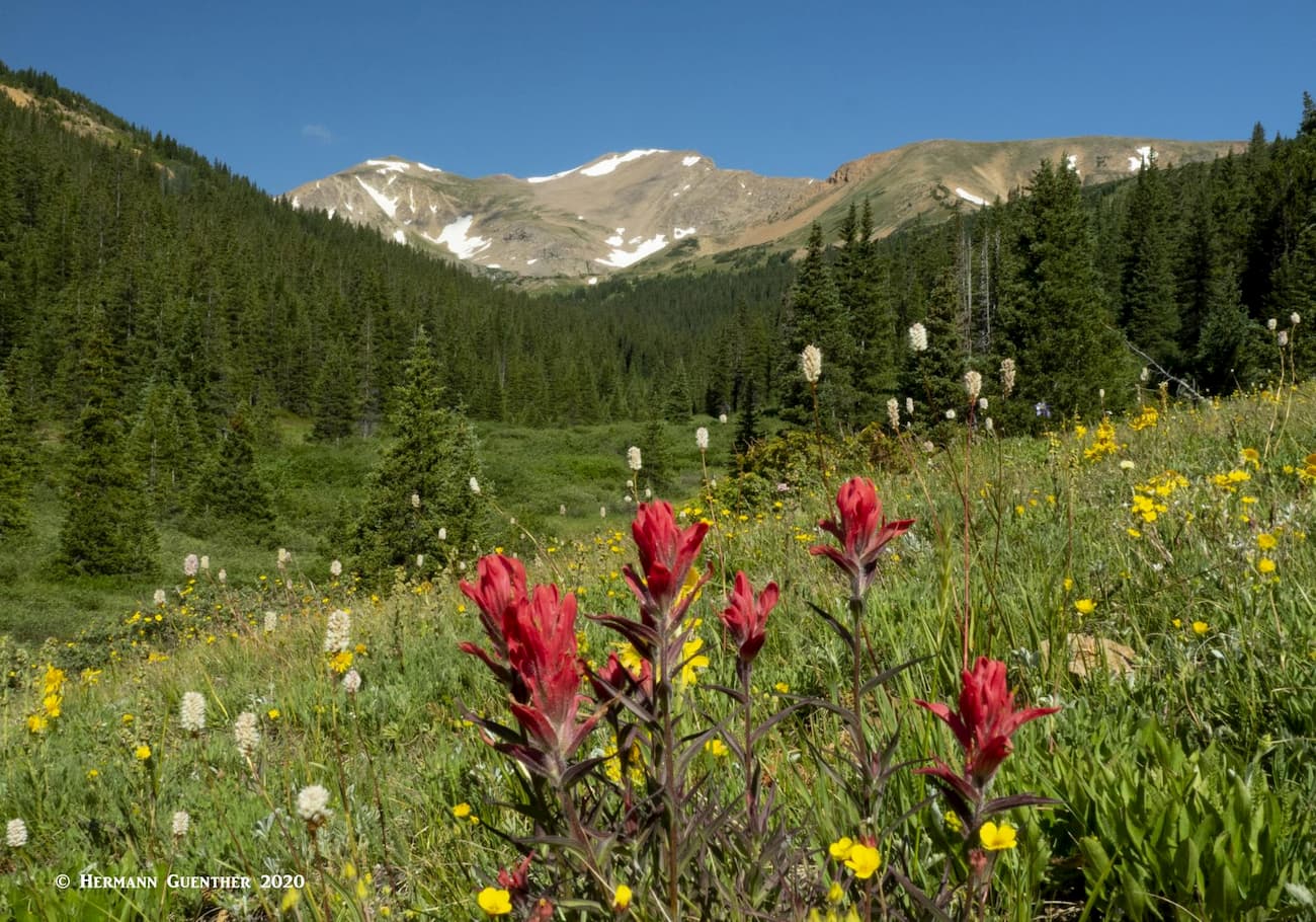
But there are many other hikes near and amongst these behemoths that are simply amazing and fall under some of the favorite hikes my wife and I have done in Colorado. Some of these are easy and some are very strenuous – all are scenic and some have interesting historic attributes that are well worth exploring, over and over again. Follow me as I walk you through some fine mountain scenery in Clear Creek County.
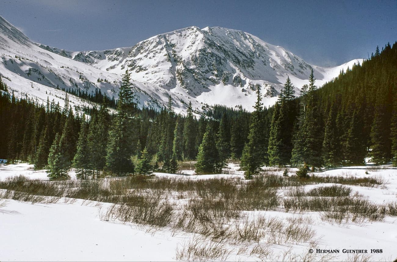
While Idaho Springs is the jumping-off point where you leave I-70 to drive the Mount Evans Road, you also get off the highway here to do one of my favorite hikes close to home. You start by taking the road toward Mount Evans, but only drive as far as Echo Lake, which is where the Summit Road begins. Behind the lake is the Chicago Lakes Trailhead. This five-mile (one way) trail first descends for one mile to meet a gravel road that goes to the Idaho Springs Reservoir. After this point, the road becomes a trail as it enters the Mount Evans Wilderness area. Here it gets serious – lots of elevation gain to the two Chicago Lakes. The higher you go, the better the scenery becomes.
At about four miles in, you arrive at a point above the Lower Chicago Lake. Some people turn around here. They don’t know what they are missing if they do that. While the lower lake sits in a wonderful basin with high cliffs on the opposite side, the lake is surrounded by almost impenetrable willows and marshy ground. With one exception, I have always avoided going down to that lake since it is better to look at it from above. It is the Upper Chicago Lake that is the real attraction on this hike, and that’s why we go hiking there.
The trail continues along the lower lake without descending to it, but after bypassing it, takes a sudden dive into some rough terrain before it ascends very steeply to the upper lake. While not a long way, you will definitely make several stops to catch your breath, but when you arrive at the upper lake you will be amply rewarded. The view toward and across the Upper Chicago Lake is epic. The massive cliffs towering over the lake at its far end are a sight to behold. Having just done this hike a couple of weeks ago (this is autumn 2020), I can assure you that this fantastic view will knock your eyes out. There are no trees up here, just lots of willows surrounding the lake. You can walk around the lake, as we did, but you need to carefully find your way around the willows. It is not fun trying to fight your way through them. While up there, take a look back down to the lower lake before you start your return to the trailhead. And try not to think of the last mile back which takes you uphill to the parking lot – this last part will be in the afternoon sun and can be brutal on a summer day.
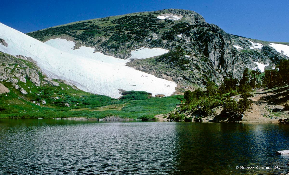
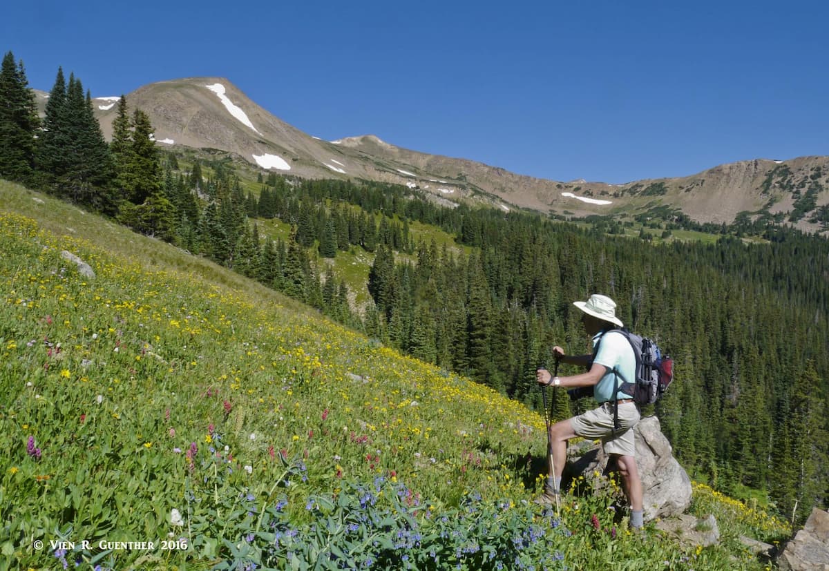
Just west of Idaho Springs on I-70 is Saint Mary’s Glacier and the residential settlement of Alice. After ten miles of uphill driving you will arrive at a large parking area. This is where you need to park your car – and make sure you pay the parking fee. You might be tempted to just park along one of the residential streets when the lot is full, which it is likely to be at certain times. Don’t. The hike to Saint Mary’s Lake is short – only one mile each way, but very scenic. The glacier is not a glacier, but a semi-permanent snowfield. It is definitely advisable to hike beyond the lake for better views. I have only done this hike a couple of times since it can be so crowded. But for more adventure, you can climb James Peak from here, which is what I did my first time. That is an 8-mile round trip with about 3,000 feet of elevation gain.
If you exit I-70 at Georgetown, it is only between 10 and 12 miles up the scenic Guanella Pass Road, depending on which trail you want to hike. It is from this road that you can climb one of the four fourteeners in Clear Creek County. But you don’t have to climb a fourteener in order to experience some wonderful high country hiking in this area. Let’s take a look at the options one at a time.
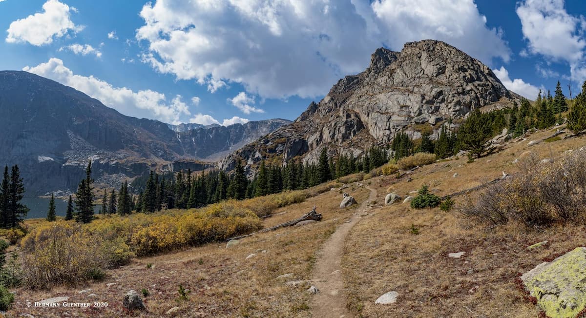
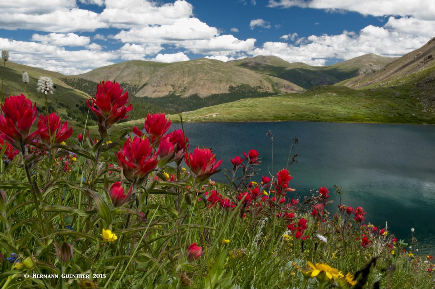
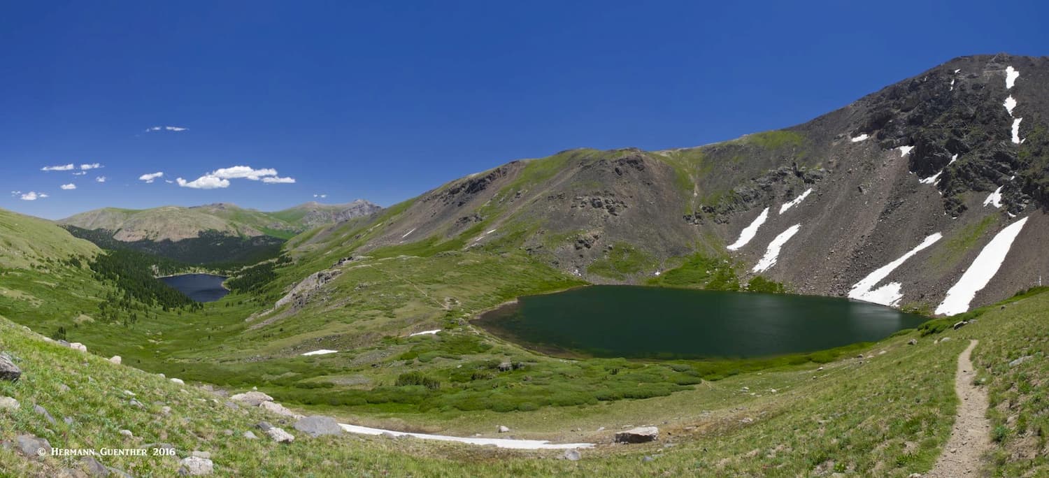
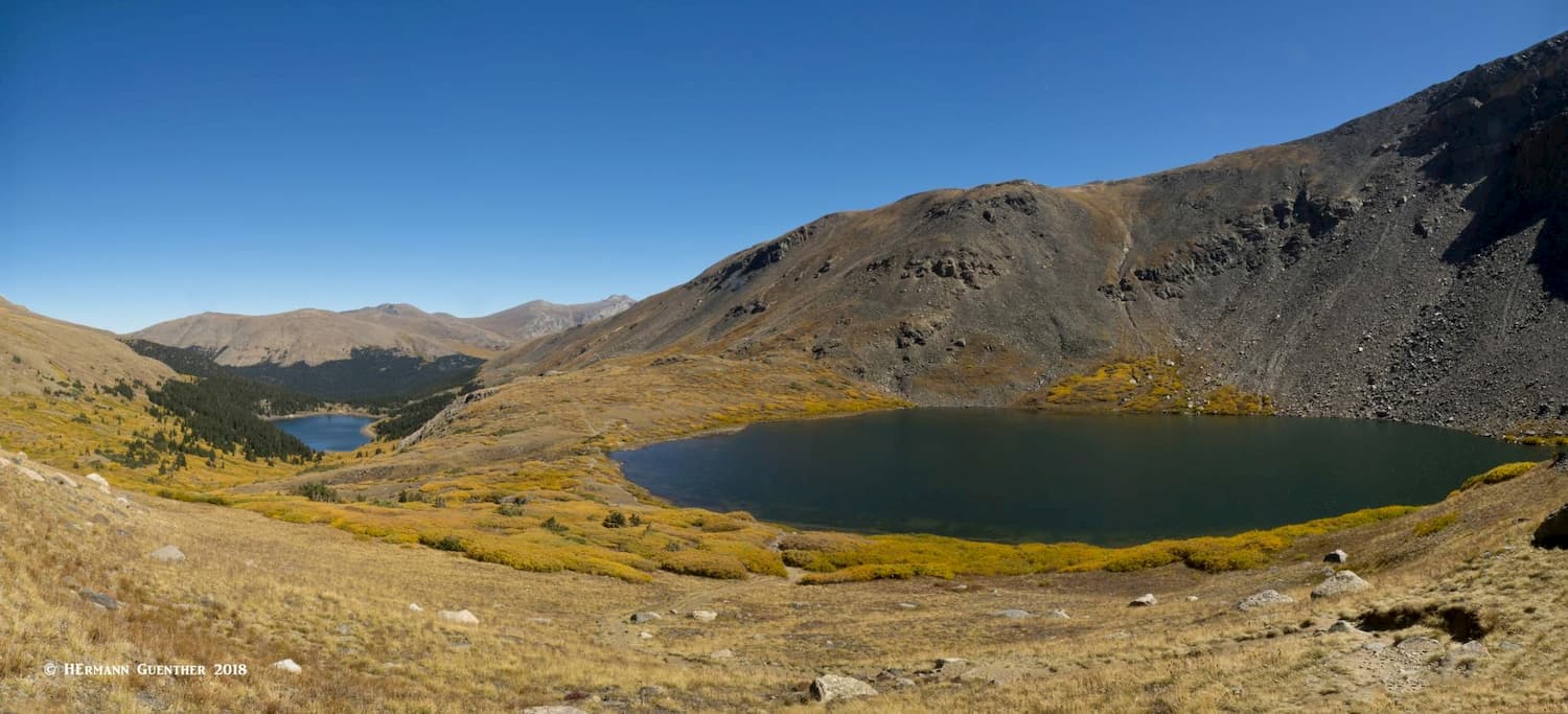
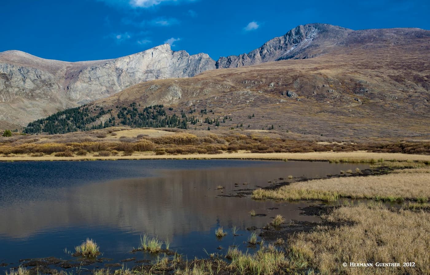
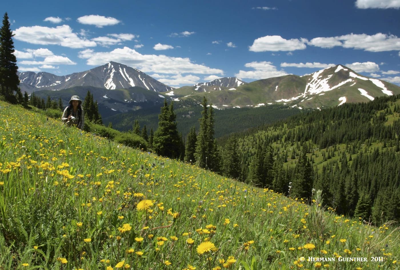
Ten miles from the I-70 exit at Georgetown you will arrive at the lower trailhead for Silver Dollar Lake. The first 0.6 mile is along the steep and sometimes very rough Naylor Lake Road to the official trailhead. If you don’t want to drive up to that trailhead, there is ample parking for those who don’t want to risk it. On our last hike there, we noticed that the road had been graded so that even most passenger cars could make it up, but that may not be the case at all times. We always park at the bottom. The very enjoyable hike can vary in length from five to seven miles, depending on where you start and how far you go. Many people just go to Silver Dollar Lake, which is nice enough. Most of the hike is above tree line so that great open views are to be seen most of the way. The first lake you will see is Naylor Lake, which is private – the trail bypasses this one, but you get great views of it for much of the hike as you start to climb above it. And then, unexpectedly, you arrive at Silver Dollar Lake. At the right time of summer, the slopes above it will be studded with wildflowers.
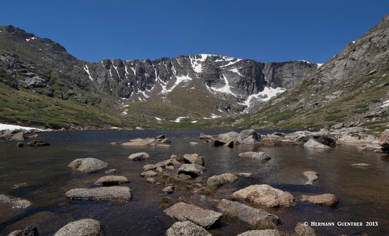
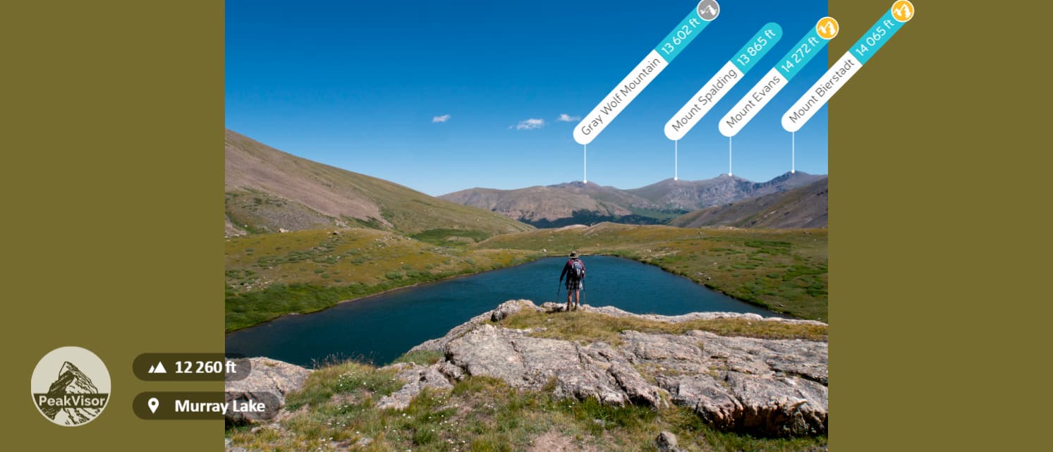
When you get to Silver Dollar Lake (its almost complete circular shape is the reason for its name), you will be impressed by the steep slopes of Square Top Mountain looming above the lake. Here is a fine place to stop for a snack and take a few photos, while you contemplate extending your hike further. You will see an obvious trail rising steeply to the northwest and may wonder where it goes. Believe me, you want to go there. Because not far up that steep slope is another world and another lake – Murray Lake. Not only is it a beautiful lake, but look back and the views become more spectacular as you look down to Naylor Lake and Silver Dollar Lake. Summer or autumn, this wide and far-reaching view is hard to beat, especially under a blue Colorado sky.
When you reach the crest of the hill, Murray Lake lies a half mile away and slightly lower than where you are, at the foot of Argentine Peak. You might even be tempted to walk to and around the lake, but might be intimidated by the high rock face that drops right into the water. So, if you are determined to go around, you will need to be a little adventurous, but with determination you can find a way over and around that cliff. If you do this,you will be rewarded with what I think is the best view on this hike - a view across Murray Lake with Mount Evans and Mount Bierstadt dominating the horizon. Just beware of one thing – at certain times of year you will have to cross a snow slide path that is very steep and can be treacherous. Use your judgment.
Only two miles further up the road from the Silver Dollar Lake Trailhead is the summit of Guanella Pass (11,669 feet). Here you will find two trailheads on opposite sides of the road, each with its dedicated parking lot. You may see hundreds of cars parked along that road since the lots don’t have nearly enough capacity. This place is popular to say the least. The trailhead on the east side of the road is the starting point for climbing Mount Bierstadt. Until late summer 2019, this was the most climbed fourteener in the state, which is why this trailhead is so popular. The view of this fine mountain from this spot is sure to make you want to climb it. I have climbed it twice and my wife has conquered it as her only fourteener. It is a moderate 7-mile round trip hike, and thousands do it every year. Ambitious climbers combine it with Mount Evans by scrambling across the Sawtooth Ridge. Don’t try that unless you are an experienced mountaineer, and certainly not when it is wet. This hike is entirely within the Mount Evans Wilderness Area.
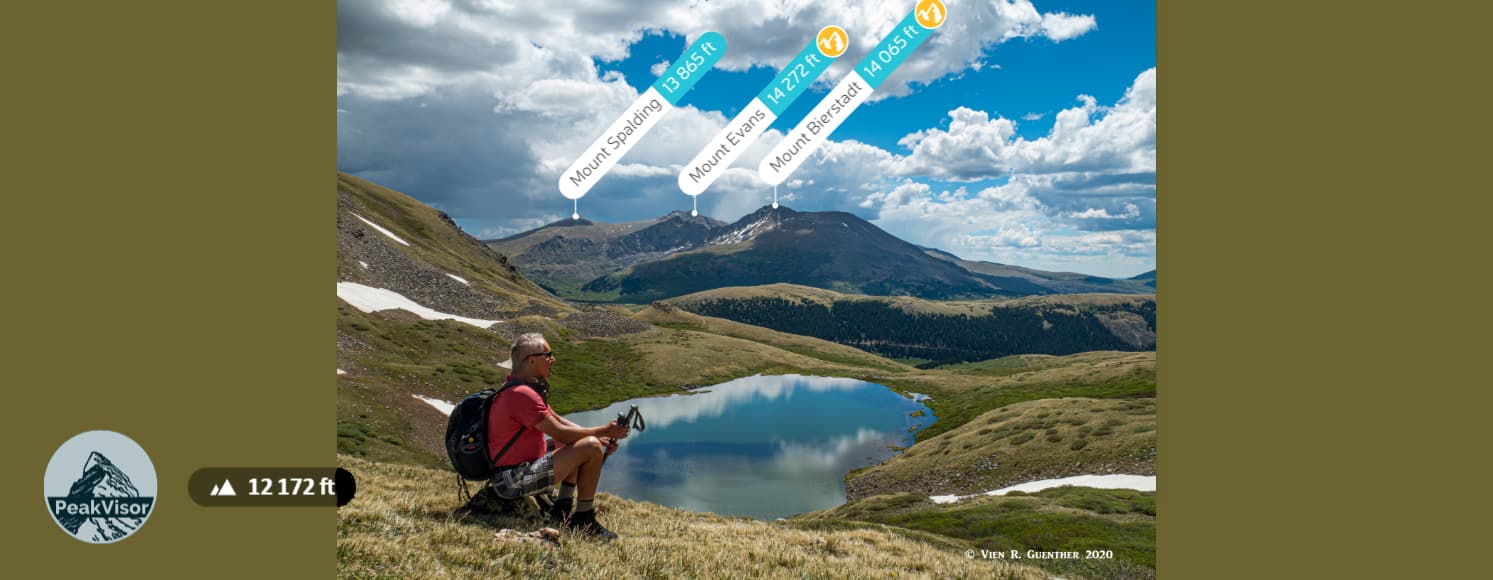
Across the road from the Bierstadt Trailhead is another parking lot for the Square Top Lakes Trailhead. The easy five-mile round trip hike to these two fine alpine lakes is truly a pleasure when the weather is fine. The weather is an important factor since you will be exposed for the entire hike, always at elevations above 11,550 feet without the shelter of trees. You will be exposed to high winds and lightning up here if conditions turn for the worse, so be aware before you start out. When we made this hike, we had conditions that were just about perfect. When you undertake this hike, you will first go downhill for a half mile before the trail starts its climb to the lakes. Remember that you will have to regain this 100-foot elevation loss on your return, but it is not difficult. The views along this entire hike, especially across to Mounts Evans and Bierstadt, are stunning, and if you have extra energy, you might even want to climb Square Top Mountain.
About seven miles west of Georgetown on I-70 is Bakerville – this may be a place name, but there is no town here. As you exit the highway and head for Stevens Gulch Road, you will have a full-on view of Torreys Peak (Grays Peak is hidden behind it in this view). From the exit, you have to drive three miles up Steven Gulch on a very rough and popular road to the famous trailhead for Grays and Torreys Peaks. Expect to find lots of people here, In fact, expect cars parked along the road to as far as a mile before the trailhead. But what is an extra mile each way when you get to climb two of the finest fourteeners in the state.
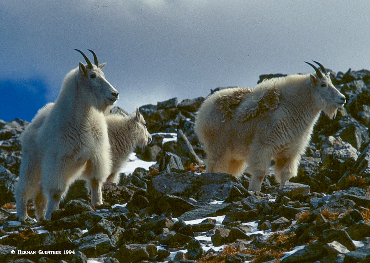
The two peaks are usually climbed together since they are separated by a short ridge and are reached via a well-constructed trail – total hiking distance of about eight miles. While a strenuous hike, these mountains are not difficult, although you could opt to take the northeast ridge (also called the Kelso Ridge) to Torreys. A class 3 scramble, this would be a climb, not a hike. On the way up to Grays Peak, you will have a good chance to encounter mountain goats, which here seem to have no fear of humans.
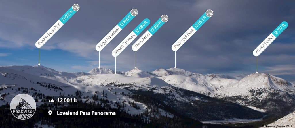
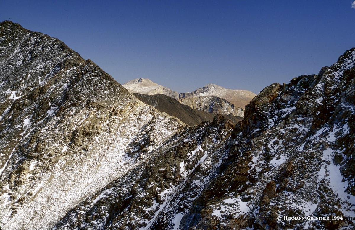
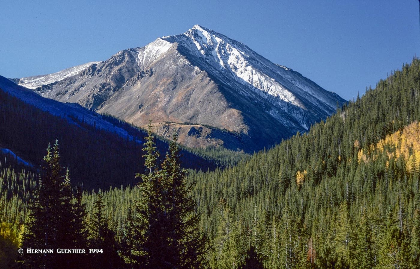
About three miles west of Bakerville, you will find an unnamed exit from I-70 – this is the Herman Lake Trailhead. It has become extremely popular over recent years, so an early arrival here is mandatory, even on weekdays in the summer. Most people come here to do the seven-mile round trip hike to Herman Lake. It certainly is a beautiful trail, especially in mid-summer when the wildflowers are in full bloom. The lake sits in a spectacular basin at the foot of Pettingell Peak, which you can climb from here. I have done it a few times and can assure you that the extra 1,600 feet of elevation gain will turn this into a respectable hike. There is no trail and few people do it.
There are other hikes to do from this trailhead where you are likely to find few, if any, other people. Just a few hundred yards from the trailhead, a branching trail leaves the main trail and takes you into Watrous Gulch. You don’t need to have a specific destination in mind here – just go anywhere as far as you want and enjoy the wildflowers and the view – you really can’t get lost in here.
But there are some serious climbing options to consider. As you ascend into the gulch, looming above you on the right (east) is the mighty Mount Parnassus (no, not the one in Greece), which you can climb by its south shoulder. Trust me, it’s a lung-buster. Once on top, you can continue along a horseshoe-shaped ridge over Woods Mountain and Mount Machebeuf, from where you can descend back down into Watrous Gulch. Or you can continue from Machebeuf in a westerly direction to Herman Lake. That’s what I did a couple of times. Now that’s a hike of major proportions. Don’t do this unless you are in top condition and don’t do what I did – don’t go alone. I never met anyone else up there, so you would be on your own. Best to go with somebody else.
When driving west on I-70, about halfway between Idaho Springs and Georgetwon is the exit to Empire and Winter Park. This is U.S Highway 40 which goes over 11,307-foot Berthoud Pass. Just before you reach the first switchback, an exit on the left to a county road will take you to two trailheads. One will take you to the Continental Divide National Scenic Trail from which you will have the chance to climb either Vasquez Peak or Stanley Mountain.
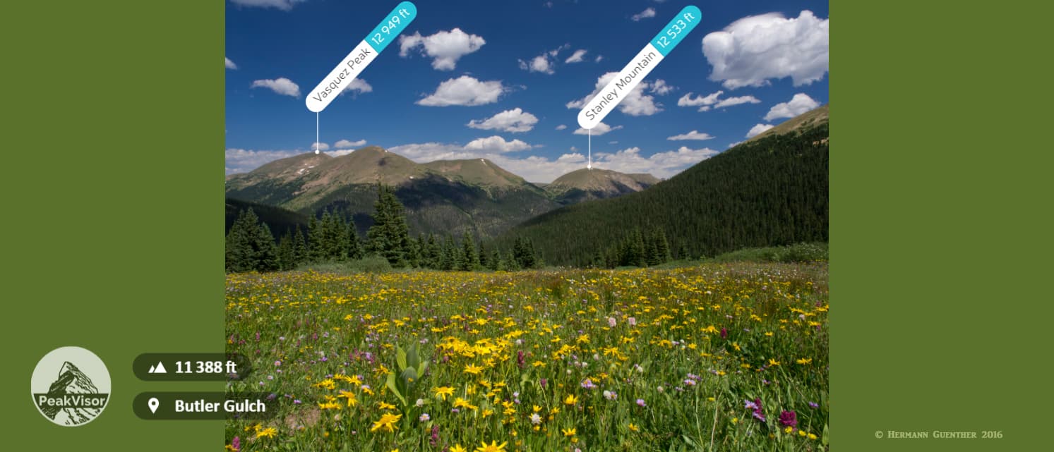
The other trailhead is for Butler Gulch. While I haven’t done the former, my wife and I have been to Butler Gulch several times. While only a six-mile hike, this steep trail takes you to an interesting basin that has lots of wonderful wildflowers and features some old mining relics at about 12,000 feet elevation. This is a great place to stop for lunch and contemplate what it must have been like during the mining days of the late 19th century. I always wonder about how they ever got that massive equipment up there. I’m sure that they didn’t care too much about the environment back then.
Although Clear Creek County is immediately west of the greater Denver metropolitan area, it has much more of a rural character due to its mountainous geography and early mining history. Its relatively small population belies the fact that busiest highway crossing Colorado from east to west passes directly through the county. At certain times during peak tourist season there could well be more visitors present in the county than those who live there. This is primarily due to the great expanse of mountain worlds that are crawling with hikers and climbers. Many of them will be from the metropolitan area, and a good number of those will just drive to their place of recreation from their homes and at the end of the day simply return home. They are not likely to stop and visit the two major towns in the county. But for visitors from other places, these towns offer attractions that most Coloradans either take for granted or have visited once or twice and have no further interest in. I must admit to being one of them. The mountains attract me more than do museums.
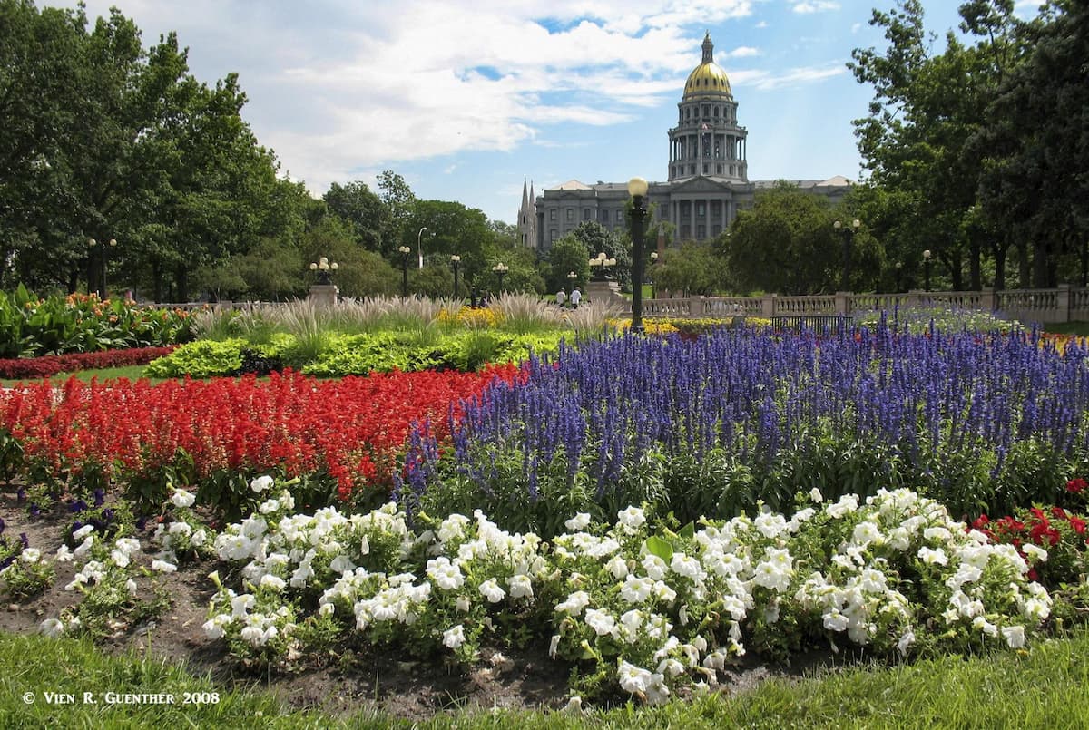
Visitors from afar are likely to arrive in Denver before they venture out into the mountains for recreation. Well, Denver is a fine city of world-class status offering world-class amenities for just about any tastes and budgets. If you are not a local, do take time to visit the many attractions that Denver has to offer. If lying in, start by checking out the airport, which is an architectural marvel unlike any you will have ever seen. In the area of Civic Center Park in downtown is the Colorado State Capitol building, the historic Denver City Hall (also called City and County Building) as well as the United States Mint, which has been striking coins since 1906. It is the single largest producer of coins in the world. Free tours are normally available, except that they were temporarily halted in early 2020.
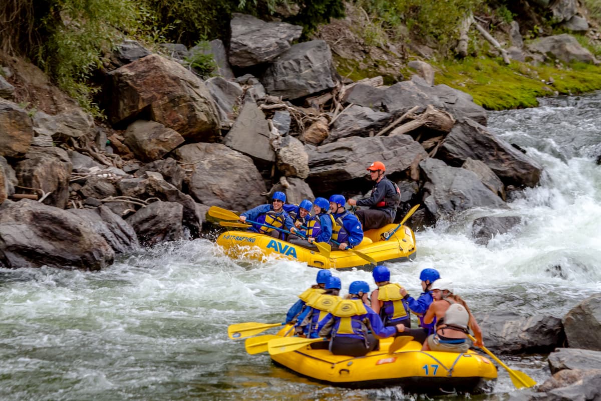
This historic mining town of 1,800 residents dominates the narrow Clear Creek Valley and is the first significant town a traveler encounters when driving west along I-70. Most drivers will "fly" past the town on their way to higher and farther destinations. But those in the know will get off at the main exit and head up into the Mount Evansarea. It is only 28 miles and about one hour from here to the very summit of this 14,271-foot fourteener. Of course the Echo Lake Park area is only 14 miles and 23 minutes away. Idaho Springs does offer a limited selection of accommodations, and a number of restaurants and breweries. There are also several attractions for visitors interested in mining history. The Argo Gold Mine and Tunnel is a tourist favorite as is the Indian Hot Springs. River rafting and tubing on Clear Creek is a hot-ticket item in the summer months.
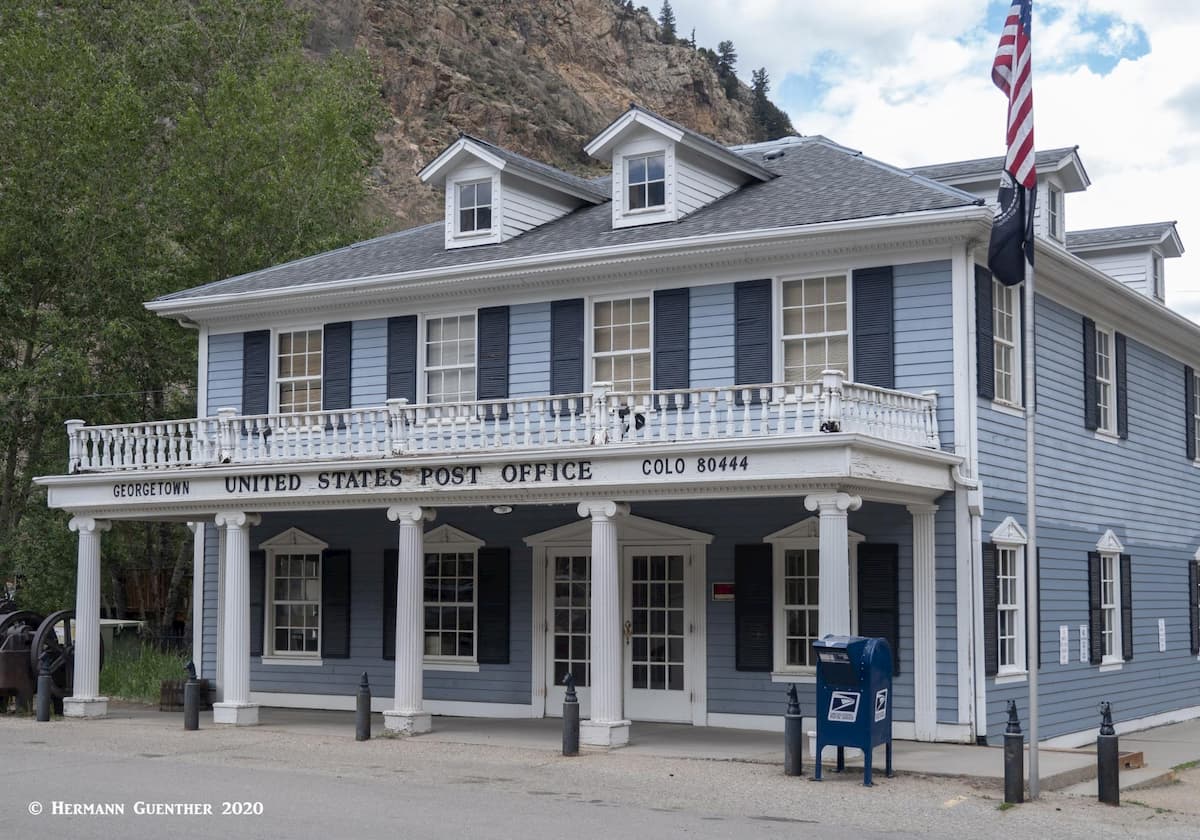
This charming Victorian town just a few miles west of Idaho Springs is a must-see stop along the way into the mountains. If nothing else, the Victorian architecture alone is worth a stop off the highway, with a collection of historic houses and museums, as well as a fine choice of restaurants, shops and boutiques. The famous Georgetown Loop Railroad is a reconstruction of a historic mountain train line that is extremely popular with families in the summer months. But Georgetown is also a major gateway into the Mount Evans Wilderness area, specifically the most popular trailhead at the top of Guanella Pass. It is only 12 miles from the highway exit to the pass along an extremely scenic road that takes only about a half hour. Being a small town of only about 1,100 residents, Georgetown does not offer a wide choice of accommodations or restaurants, but what it does offer is adequate for those visitors who chose to make this charming town a base for exploring the surrounding attractions.