Scan the QR code and open PeakVisor on your phone
There are 64 counties in Colorado of which Summit County is one. It certainly is not the highest county in the state in terms of average or mean elevation (it ranks No. 5), nor does it have the highest mountain in the state (Mount Elbert, in Lake County). But it is certainly elevated, having an average elevation of 10,365 feet, varying from a low of 7,569 feet where the Blue River crosses the county line into Grand County in the north, to a high of 14,278 at the summit of Grays Peak. So why was it named Summit County? Simply because it has so many high peaks, that's why.
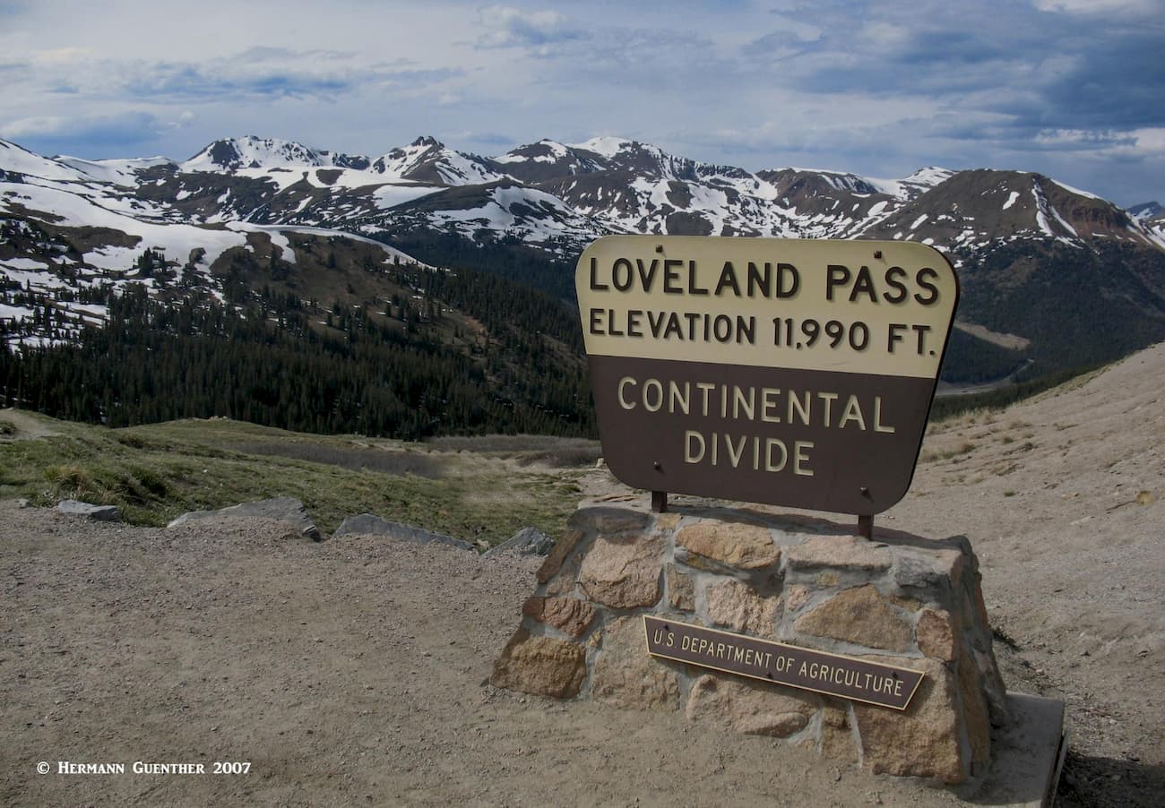
It was one of the 17 original Colorado counties organized by the First Territorial Legislature on November 1, 1861. So my opinion is that they had no scientific way to determine highest elevations, let alone average elevations, back in those days. So we live with the name and we don't worry about its origin – we just enjoy it for what it has to offer. All highways entering the county, with the exception of SH-9 north of Green Mountain Reservoir, have to climb to between 11,000 and 12,000 feet before finding themselves in Summit County, U.S. Highway 6 over Loveland Pass being the highest.
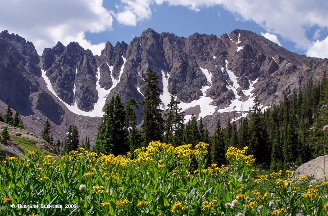
There are 103 named mountains in Summit County of which Grays Peak is the highest, as well as the highest summit on the entire Continental Divide of North America. The most prominent mountain is Mount Powell in the Gore Range. Some of these mountains, especially those whose summits are perched directly on the Divide, are shared with several adjacent counties such as Clear Creek, Eagle, Lake and Park Counties. The entirety of Summit County lies west of the Continental Divide, meaning that it lies in the Pacific Watershed.
Another interesting fact about Summit County is that in 2014, it had a life expectancy from birth of 87 years, the longest of any county in the United States (Pitkin and Eagle Counties, also in Colorado, ranked two and three in the country). There are several reasons for this remarkable statistic including high income, good medical care and a high level of education. So, since PeakVisor is all about mountains, we support hiking not only for pleasure but for the fact that hiking promotes good health. How can you go wrong?
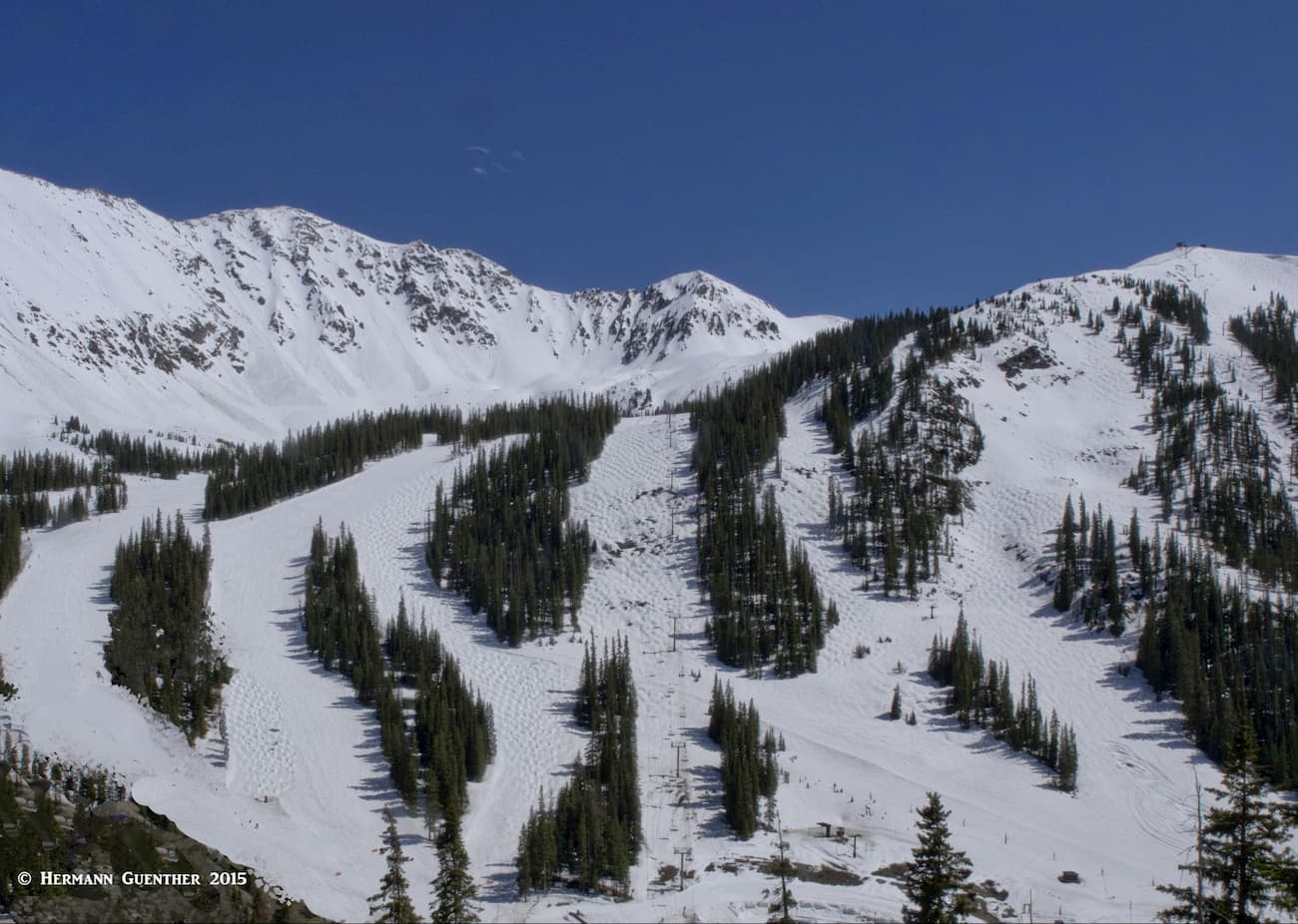
At the risk of presenting you with too many facts, I will give you some reasons why Summit County is such a huge and popular recreation center. It is centrally located in Colorado and only a one-hour drive from much of the greater Denver area via Interstate Highway 70 to the town of Silverthorne, at which all the major highways converge. This makes recreation easy for those who just want to go for a day – whether it is for hiking, skiing, boating fishing or any of the other activities that are available. Four Major ski areas (Arapahoe Basin, Keystone, Breckenridge and Copper Mountain) ensure that this place is always busy with visitors, including those from out of state and even overseas.
Then there are parts or all of two wilderness areas (Ptarmigan and Eagles Nest) in the White River National Forest. Numerous hiking and biking trails and byways originate in or cross the county, several of them extending long distances even to Canada and Mexico. Here they are:
The last two combine for a wonderful bike ride starting in East Vail and climbing the steep path to the summit of Vail Pass. At the top of the pass are stunning views toward the Gore Range in one direction and toward the Ten Mile Range in the other. It's a great place to take a breather after that long climb before you make the thrilling descent to Copper Mountain Resort. At this point, the ride continues on the Ten Mile Recreation Path to the town of Frisco, through which it passes as the Temple Trail. It then becomes the Blue River Bikeway as it continues to Breckenridge. This 30-mile ride is almost entirely on a dedicated paved path which passes through some delightful scenery, and though it closely follows the main highways (I-70 and SH-9), it is always separated from highway traffic and only encounters a few road crossings along the way. I have done this ride in my younger days – it is a workout, especially if you have to ride back to your starting point.
There are also two large lakes (Lake Dillon and Green Mountain Reservoir) that provide incredible recreation in the form of water sports – fishing, sailing, paddle-boarding, etc. If fly fishing is your passion, try the Blue River – the entire length from the Dillon Dam to its confluence with the Colorado River is designated Gold Medal Water. There is one thing Summit County does not have – an airport. That just might be because there are too many mountains around. Now, since we are first and foremost interested in hiking and climbing, let's have a look at some of the wonderful places to enjoy these activities in Summit County. Much of this will be based on my personal experience over many years.
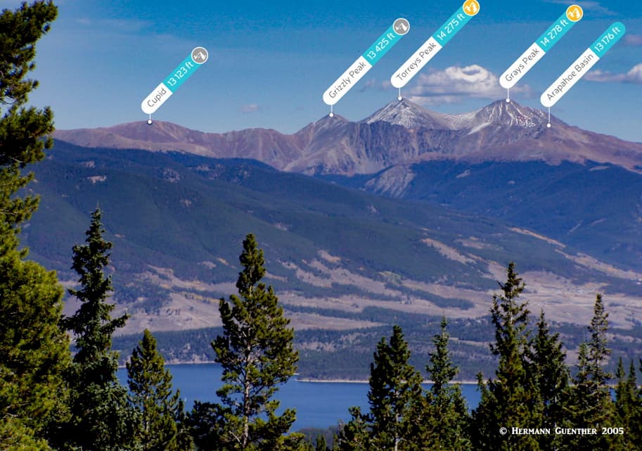
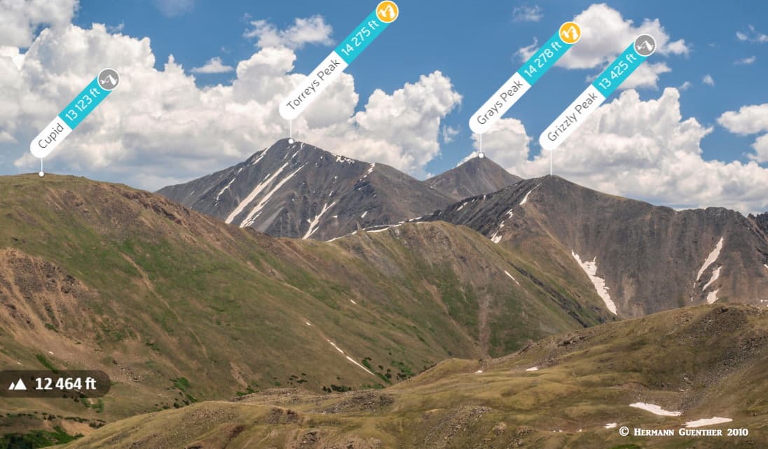
Though Grays and Torreys Peaks are shared with adjacent Clear Creek County, they are clearly major hiking destinations in Summit County as well. They are typically climbed from the popular trailhead in Stevens Gulch near Bakerville on I-70. But they can also be climbed from the top of Loveland Pass, though this is a much more difficult approach to these two highest peaks on the entire Continental Divide of North America. It entails following the Divide over Grizzly Peak before arriving at Torreys and then Grays. Hikers that would do this are likely to descend from Grays down to the Stevens Gulch Trailhead. A car shuttle is required for this route – returning back to Loveland Pass over Torreys and Grizzly Peaks would substantially increase the level of difficulty.
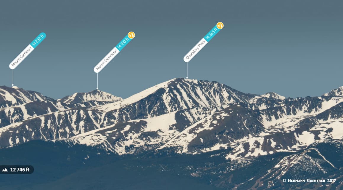
The only other fourteener in Summit County is Quandary Peak in the Mosquito Range, since late summer of 2019 having gained the distinction of being the most climbed of all fourteeners in the state. It is usually climbed from the trailhead just off State Highway 9 about eight miles south of central Breckenridge, on McCullough Gulch Road. You can't miss it – there will be so many cars parked here, in a large lot and along several roads, that you may be discouraged to do this hike. It was not like that when I climbed it – back in 1983. But there still might be days in off-seasons when it would not be so crowded. It certainly is a wonderful climb and not very difficult if you just follow the east ridge all the way to the top. This mountain is a very celebrated winter climb, and people often ski its gentle east slopes. There are of course several technical routes for those wanting the challenge and having the experience.
The wonderful Gore Range has its southern terminus at Wheeler Junction, the location of the Copper Mountain Resort. The ridgeline of the range serves as the boundary between Summit County and Eagle County to the west. It is home to the spectacular Eagles Nest Wilderness, which straddles the county line and can be entered from both sides. We will talk about the fine hikes that are possible from the eastern side of the range, starting at the south end.
Gore Range Trail - This long trail provides excellent, but in many cases lengthy, access to some spectacular areas of the range. From the southern trailhead at Wheeler Junction, just off Interstate Highway 70, the trail rises rapidly into the high terrain of the south central part of the mountains, reaching elevations of almost 12,000 feet. However, it does not stay at very high elevations for its entire length, and always stays on the Summit County side. At about its midpoint, this trail descends toward the east from where it meanders at elevations between 8,700 and 10,000 feet for the rest of its length to the northern terminus, which is on a county road just southwest of the little village of Heeney - 45 miles from the southern terminus. Heeney sits on the western shore of Green Mountain Reservoir which is near the northern end of the county.
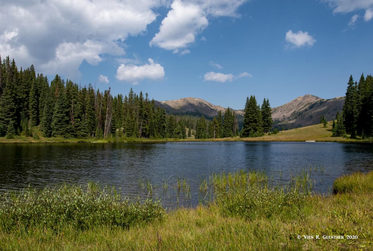
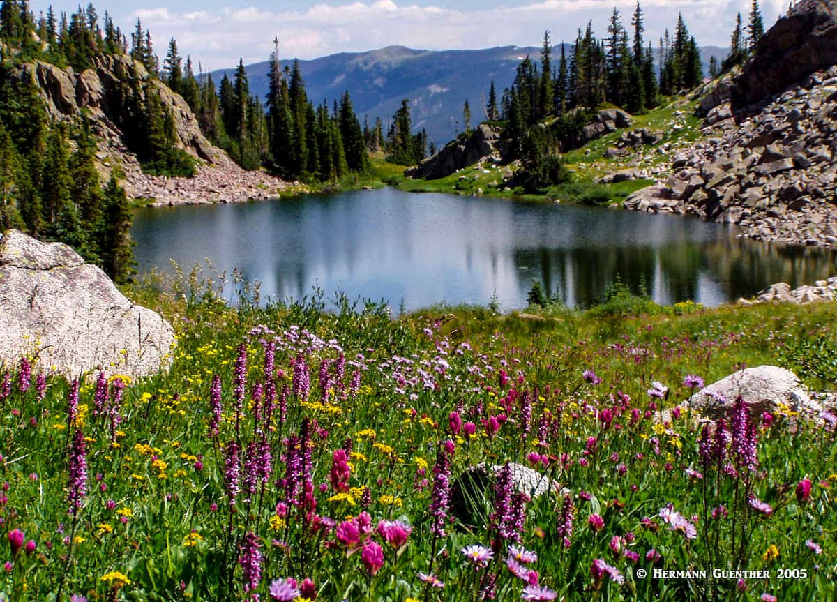
South Gore Range Trailhead- Servicing the long-distance Gore Range Trail, this convenient trailhead is located on the north side of I-70 with ample parking spaces. Most users of this trailhead typically start here to make the pleasant hike to the two Wheeler Lakes or for those with a bit more energy, a continuation to Lost Lake (one of many so-named lakes in Colorado) or even Uneva Pass. The trailhead is accessible for westbound traffic only along I-70, although eastbound traffic can continue east about two miles to the exit at Officer's Gulch where they can turn around and head back west to the parking lot. Although access to this trail is so easy, we find it difficult to comprehend why we have encountered so relatively few other hikers on this trail. My wife and I have hiked this trail to the pristine Wheeler Lakes several times and are always surprised to see so few people. What sets the Wheeler Lakes apart from so many high alpine lakes is their setting. Though sitting at over 11,000 feet elevation, they are not surrounded by steep, rocky cliffs – instead the terrain is gently sloping forested hillsides with amazing views to higher mountains.
North Tenmile Trailhead - This convenient trailhead is right at the end of the north interchange ramps serving the town of Frisco. This trail has no specific destination but basically ends at the Gore Range Trail. Since the trail follows North Tenmile Creek for its entire length of about four miles, it is not steep and is therefore popular for cross-country skiing.
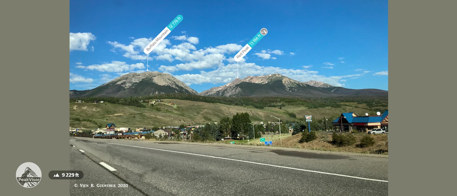
Meadow Creek/Lily Pad Lake Trailhead - Just a short distance off the north side of the Breckenridge/Frisco interchange on I-70 is a parking area for the Meadow Creek Trail. This fine trail penetrates deep into the Eagles Nest Wilderness and ends at the Gore Range Trail at an elevation of about 11,400 feet. This trail, in conjunction with the Lily Pad Trail (which branches off from it) and the Gore Range Trail, makes up part of a wonderful 14-mile loop hike around Buffalo Mountain. A long ridge walk to the summit of Buffalo Mountain is possible from Eccles Pass, the highest point on the Gore Range Trail, although a shorter alternative is available.
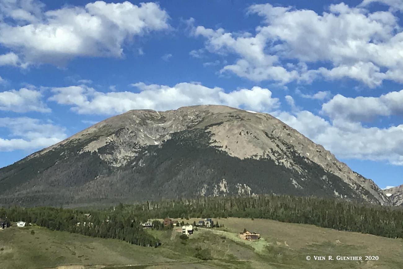
Buffalo Mountain Trailhead - You can't miss Buffalo Mountain when you drive west on I-70 - as you go down the long hill from the Eisenhower Tunnel just before Silverthorne, the rounded dome of this mountain is right in front of you. This major trailhead is located at the top of the Wildernest subdivision, about four miles from the I-70/Silverthorne interchange. For those wanting to climb Buffalo Mountain without doing the long loop around it (see above), this is the logical starting point as the total round trip distance is only about six miles. But this is also perhaps the best starting point for doing the Buffalo Mountain Loop hike since this would eliminate one extra mile of having to hike the entire Meadow Creek Trail. From this trailhead it is also possible to connect to the Mesa Cortina Trail, which is popular for cross-country skiing and which has its trailhead nearby in the same subdivision.
Willowbrook Trailhead - A short drive north on State Highway 9 from the I-70/Silverthorne interchange is Willowbrook Road which leads to the trailhead which is less than three miles from the interchange. This trailhead provides the shortest route to the beautiful Willow Lakes and Salmon Lake via the Gore Range Trail which is only just over a mile from the trailhead. It is also possible to access the Mesa Cortina Trail from here. The jagged ridge above the Willow Lakes basin is epic, and demonstrates why ridge scrambling is popular in the Gore Range.
Rock Creek Trailhead - This trailhead is about 11 miles from the I-70/Silverthorne interchange via State Highway 9 and County Road 1350. From the trailhead (which may not be suitable for low-clearance vehicles at all times) it is less than a half mile to its intersection with the Gore Range Trail. The trail continues past the intersection to an old mining area, but otherwise does not lead to any noteworthy destination. However, the trail provides an alternative route to Boulder Lake which can be reached from the intersection in a little over two miles by going north on the Gore Range Trail. There are some fine views across the lake toward the high peaks of the Gore Range. Using this trailhead to reach the lovely Willow Lakes and Salmon Lake is possible, but results in a round-trip hike of 18 miles - a tough day indeed. A three-day backpack trip for these lakes is a good alternative to trying to do in one day. I have done it both ways.
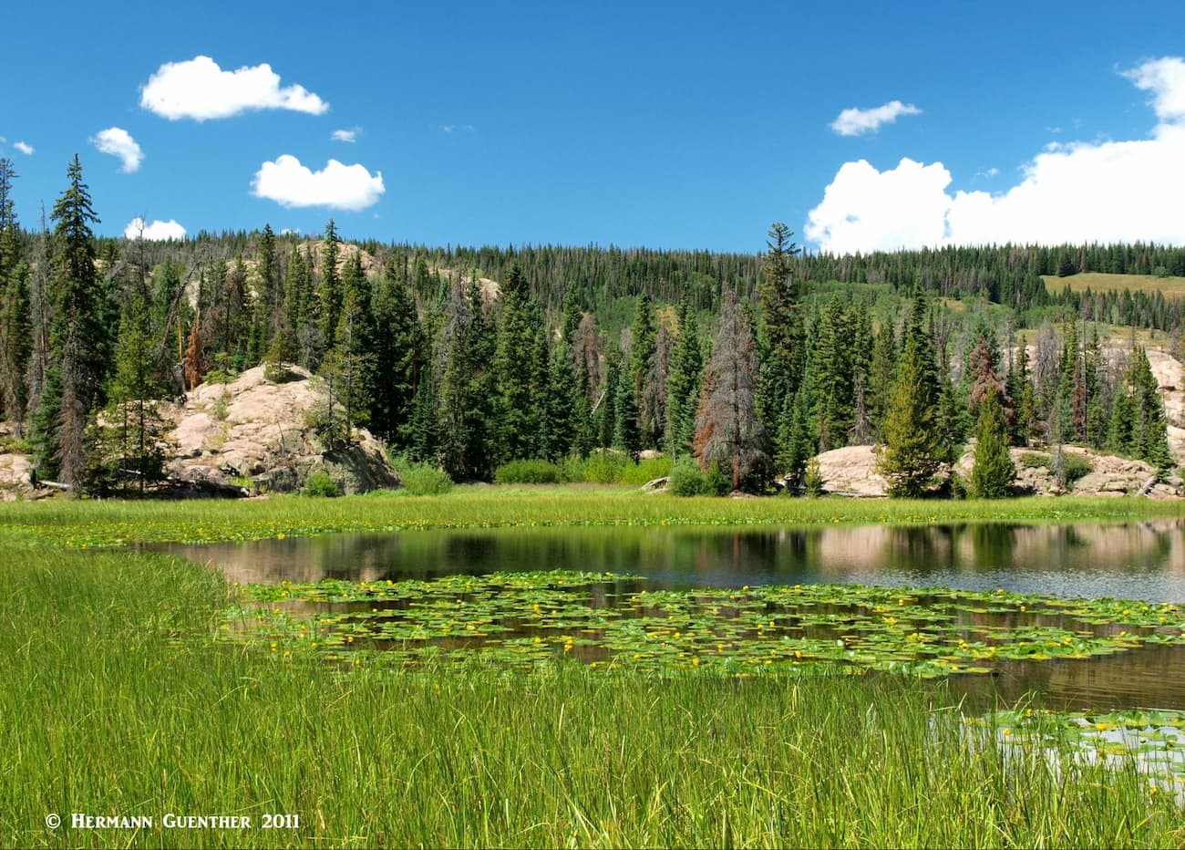
About 20 miles north of the I-70/Silverthorne interchange along State Highway 9 is the Green Mountain Reservoir, a 5-mile long man-made lake sourced by the waters of the Blue River. Just before reaching the lake is a turnoff to Heeney Road which, as one would expect, leads to the small settlement of Heeney. A couple of miles south of the town is County Road 1725 which in about three miles reaches Lower Cataract Lake. This gem of a lake is a worthy destination on its own, but just before the lake are several parking areas which serve, in addition to the lake, two important trailheads. There is a 2.5-mile trail around the lake itself, but the two trailheads provide access deep into the wilderness.
Surprise Trailhead - Not surprisingly, this trail leads to Surprise Lake, which lies about 2.6 miles from the trailhead, near where the Surprise Lake Trail ends at its intersection with the Gore Range Trail (there's that trail again!). A nice stopping point for a breather or a snack. But that's not all there is to this place. A short distance to the west along the latter trail is a branch, the Upper Cataract Trail, that leads to, as one would expect, Upper Cataract Lake, and a mile or so further, to Mirror Lake. These are fine backpacking destinations and are reasonably close to the two highest mountains in the Gore Range - Eagles Nest and Mount Powell – the latter being the most prominent mountain in Summit County. Continuing from this junction, the Gore Range Trail will pass the south shore of Tipperary Lake and continue on to the junction with the Eaglesmere Lakes Trail and then to the two Eaglesmere Lakes. From here, the trail meanders another two miles to its northern terminus.
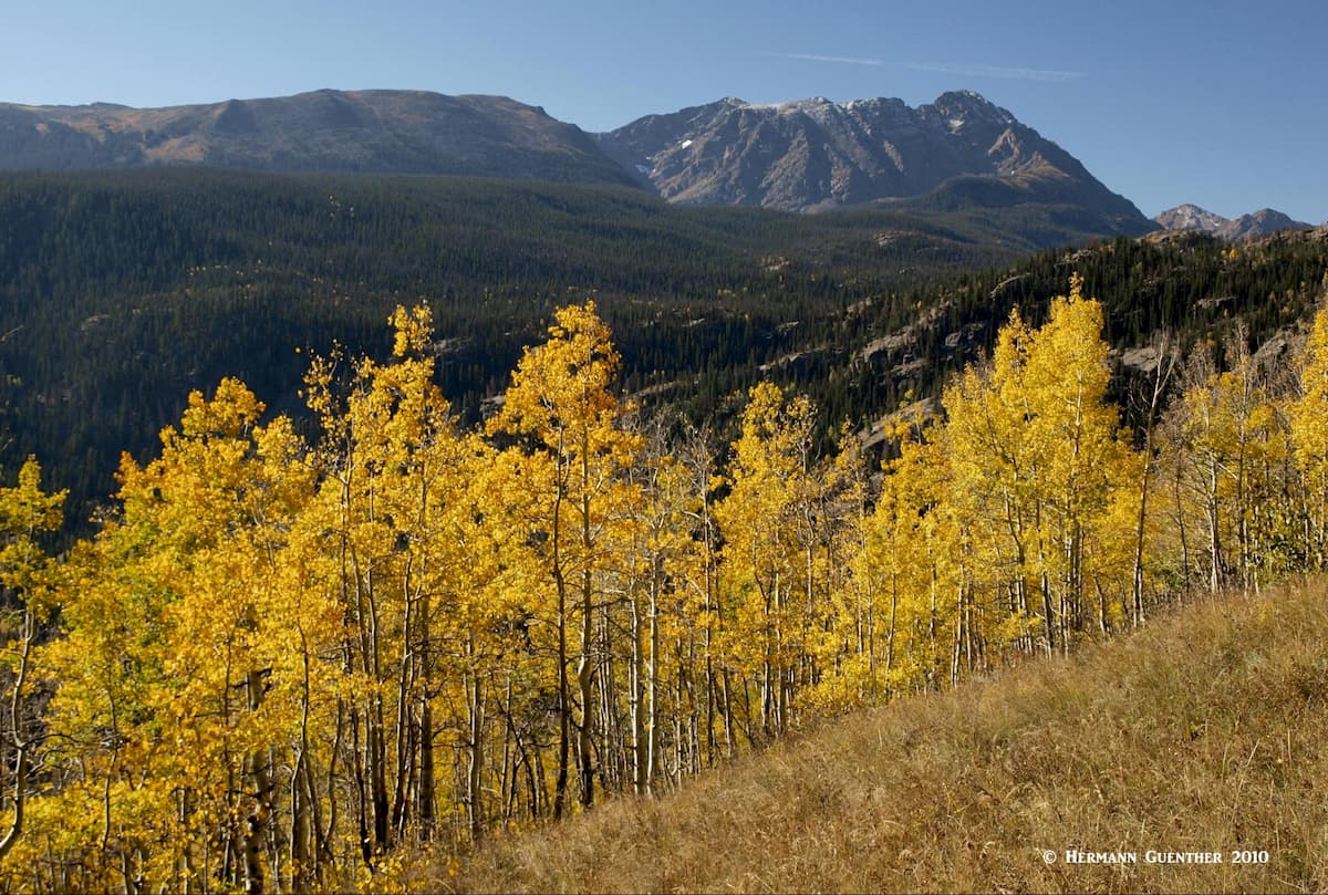
Eaglesmere Lakes Trailhead - This trailhead is very close to the Surprise Trailhead and, in conjunction with that, affords a rather lengthy loop hike. Of course, some might only want to do the much shorter hike to the Eaglesmere Lakes. That in itself is a worthy hike if only for the great views towards the south across the Cataract Creek valley. Eagles Nest (elev. 13,420), the second highest summit in the Gore Range, dominates this impressive view, although the higher Mount Powell is not visible from here. Autumn, when the aspen trees change colors, is a fine time to make this hike.
One of my favorite ski resorts in Colorado is the wonderful Victorian town of Breckenridge. True, the ultra-modern and gigantic ski development is not Victorian, but the historic town is such a pleasure to explore – any time of year. Since the resort occupies a large bit of land to the east of the precipitous Ten Mile Range (as sub-range of the Mosquito Range), it does without saying that there must be lots of hiking opportunities right in the town. Well, there are, and many trails penetrate these mountains, some simply designated as routes. We have already introduced Quandary Peak, which lies just south of the town (see above). But there are many other places in and near Breck (as the locals call it) that offer hiking venues for the entire family. Or super challenges for the serious climbers. But I would like to introduce you to two trails that are particularly fine and in some ways unique, but not too difficult.
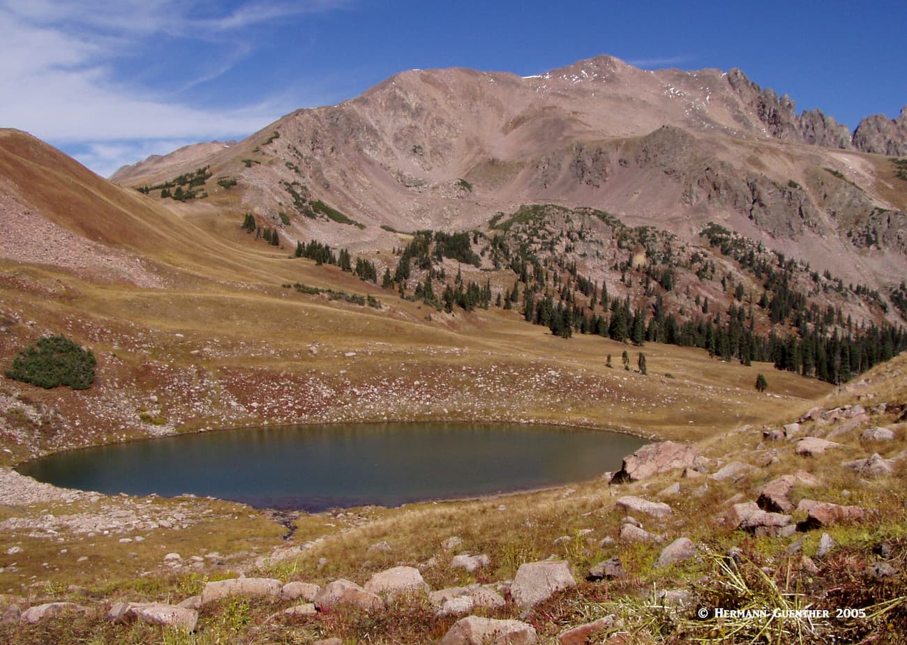
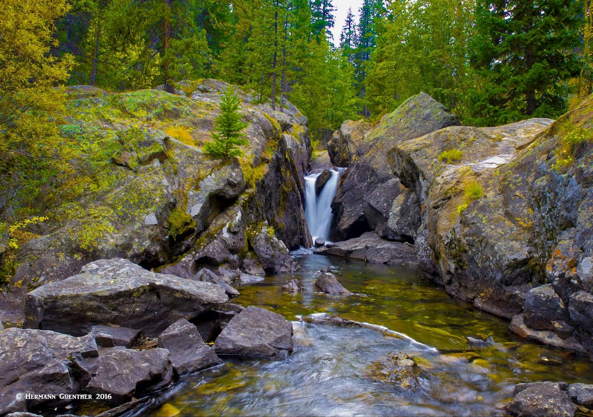
Mohawk Lakes Trailhead - About 2.5 miles south of Breckenridge along Highway 9 is Spruce Creek Road which provides access to the Mohawk Lakes (also called Spruce Creek) Trailhead. This is a popular access point into the Mosquito Range. The trail passes a number of lakes and waterfalls, including the beautiful Continental Falls, on the way to lower and upper Mohawk Lakes, which is where most hikers will turn around. The more adventurous can continue walking up the basin another mile or more to several other ponds and tarns. Eventually, you will reach a point where you can see the mighty Pacific Peak (at 13,957 one of the highest thirteeners in Colorado), which, along with Crystal Peak, can be climbed from this trailhead. These two peaks are best left for more experienced climbers.

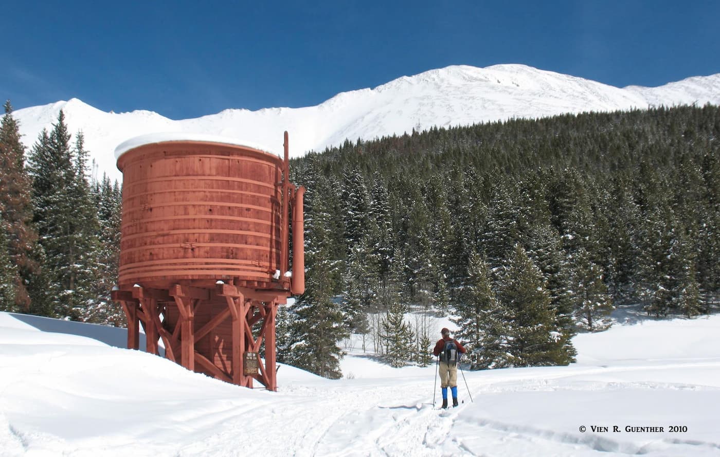
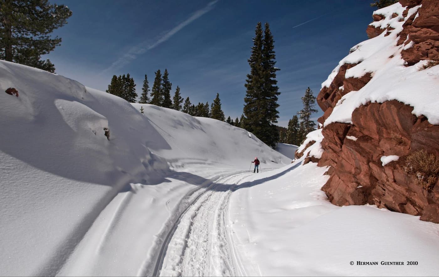
Boreas Pass Road. This trail, as its name implies, is actually a road that connects Breckenridge with the small town of Como in Park County. In summer, you can drive over the pass in your family car. But in winter, it is an entirely different story. The road follows an old railroad line, so it is never steep. But that makes this a great place for Nordic skiing. Most people will go as far as Baker's Tank, an old water tank that was used to replenish the steam locomotives with their lifeblood. In summer, a regular hiking trail to the tank can also be accessed at this same trailhead. That hike is especially nice in the autumn when the colors of the aspen trees change to their typical Colorado Gold.
The views across the Blue River Valley toward the Mosquito Range are especially fine during winter. Skiers that have extra energy can ski all the way to the top of Boreas Pass which will double the distance to 12 miles roundtrip. At certain times that is not desirable, since the high elevation at the pass (11,490 feet) is prone to high winds which turn the snow into a compacted crust. I have done this once and found the snow conditions to be less than desirable. However, there is a historic cabin called Section House at the pass (which is the Continental Divide) that is part of the Summit Huts Association. It was built in 1882 and is open during the winter months for skiers and sleeps up to 10 people. Needless to say, you must bring your own sleeping bags, but the hut has a wood-burning stove for heat and cooking, as well as cooking and eating utensils. Just bring your food. If the snow conditions are right, there is a wonderland of finebackcountry ski terrain, some of it very challenging.
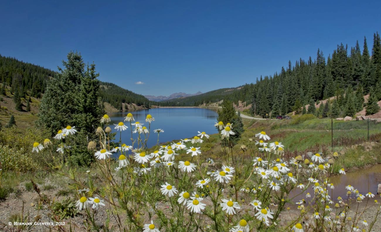
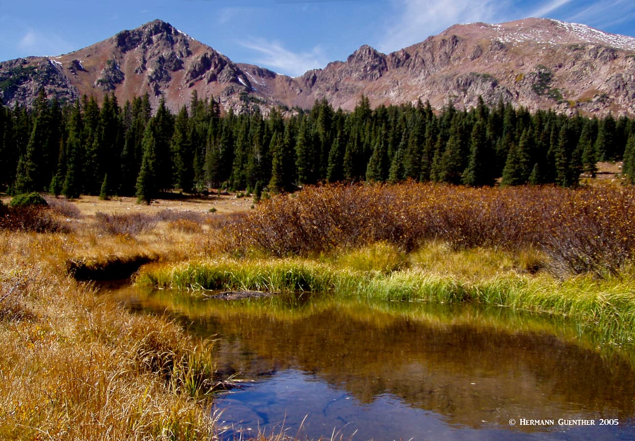
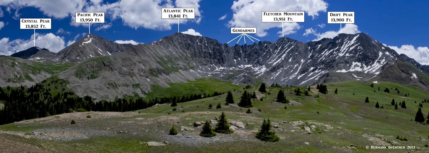
On the west side of the Ten Mile Range, almost directly opposite Quandary Peak is an amazing high valley known as Mayflower Gulch. This easy hike is one of our favorites because it affords some stunning mountain scenery and displays some of the best wildflowers around in late July and early August. Some years we do this hike several times. Since the trailhead is at 11,000 feet,you don’t have to climb very much to get into fascinating terrain. You will also be rewarded with some history - this was an active mining area during the late 19th century and some of the old buildings and mining equipment are still there for you to marvel at. Some of these were placed in seemingly impossible places, terrain so steep that I would not want to hike on it. As the trail emerges from the trees just a short distance from the trailhead, you will surely be impressed with the stunning view of two of the highest peaks in the Ten Mile Range - Atlantic Peak and Fletcher Mountain (second highest only after Quandary Peak). These two are truly right “in your face”. The five jagged pinnacles between them are called the “Gendarmes” - policemen.
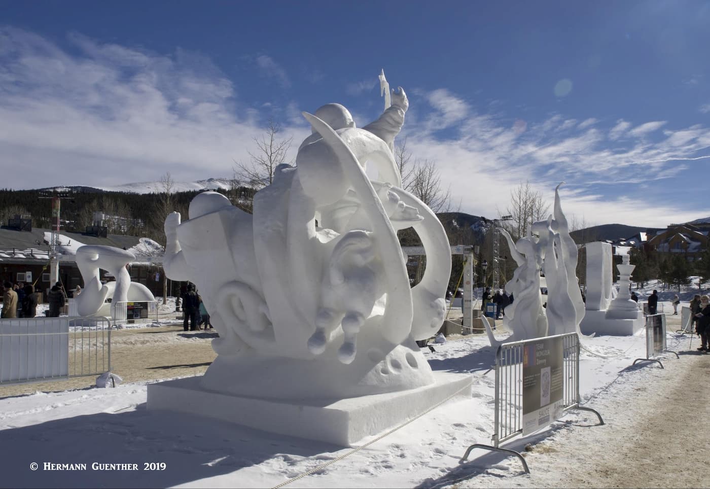
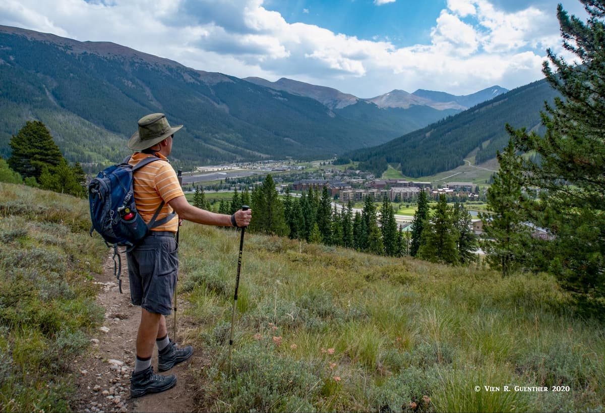
The largest town and the seat of Summit County is Breckenridge. A combination of a major ski resort and charming restored Victorian town, this is a place to spend some time enjoying the great restaurants, galleries and boutiques. Lodging opportunities abound here, offering a wide range of inns, hotels and condominiums. It is an excellent base for exploring the southern part of the county and taking in all of the fine recreational activities available here year-round. It is an easy 10-mile drive from Interstate Highway 70 which provides high-speed access from Denver and its international airport. In winter, the town hosts the International Snow Sculpture Championships, which is a free event open to the public. Teams come from around the world, including places as far away as Mongolia.
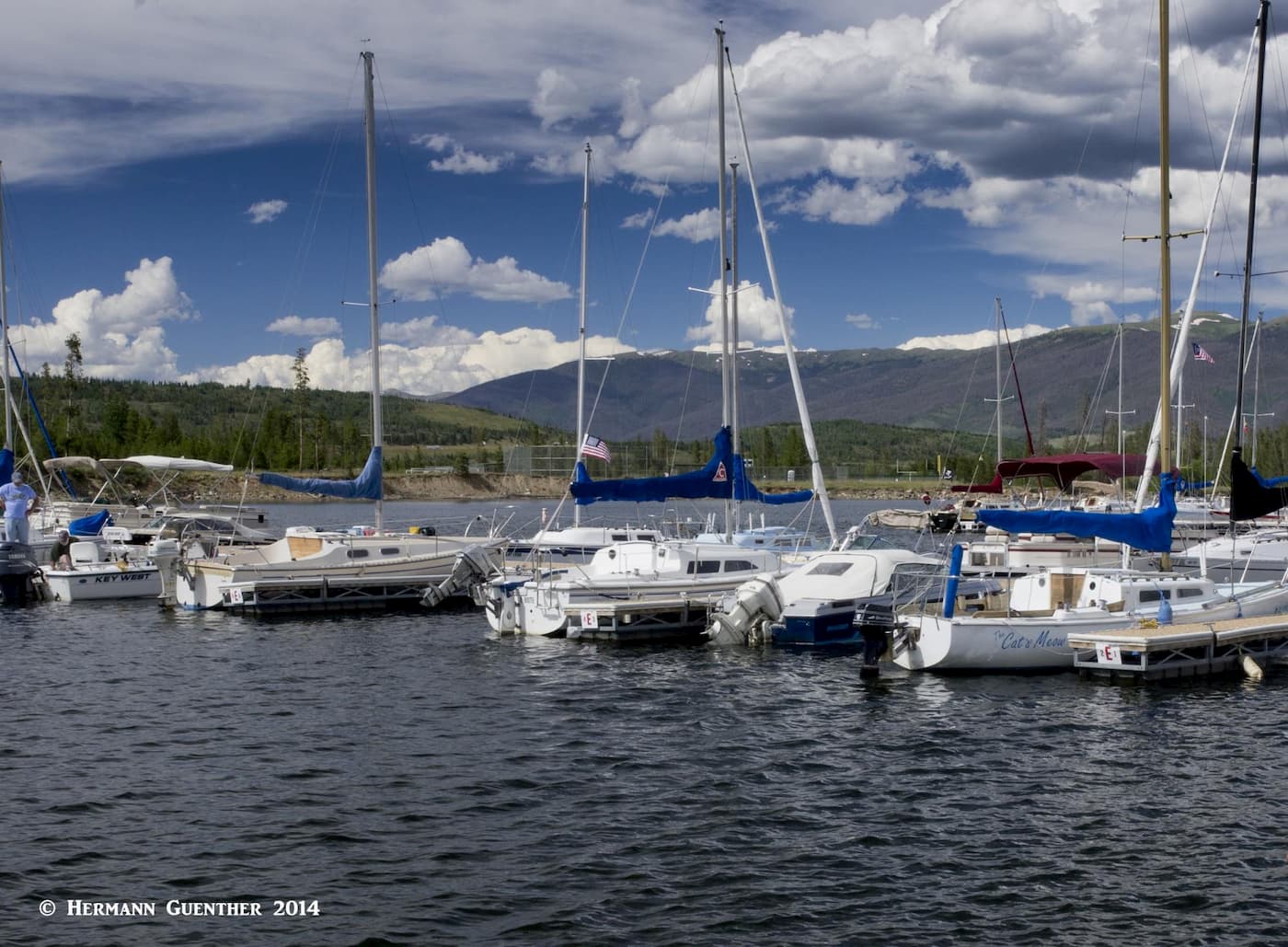
Just off Interstate 70 north of Breckenridge is the charming town of Frisco located on the shores of Lake Dillon, the main water supply source for Denver, 70 miles away. It is centrally located in the heart of Summit County with easy access to the county’s four major ski areas - Breckenridge, Copper Mountain, Keystone and Arapahoe Basin. Even the famous resort of Vail is only 30 minutes away. In addition to skiing, there are unlimited recreational opportunities available the rest of the year here including camping, hiking, biking, fishing, rafting and boating. In summer, Lake Dillon can be seen studded with countless sailboats, many of them based at the Frisco Marina. The Frisco Nordic Center is just a few minutes outside of town and offers 16 miles of ski trails and 6 miles of snowshoe trails. There is no shortage of accommodations and restaurants in this beautiful spot in the Rockies.
Copper Mountain is not so much a town as it is a self-contained resort, mostly geared toward skiing. It is located at the junction of I-70 and State Highway 91 at the eastern foot of Vail Pass. This is also known as Wheeler Junction. It was opened as a ski resort in 1972. As it is strictly a resort village, Copper's accommodations tend to be mostly condominiums or vacation rentals. There is a selection of restaurants. There are plenty of recreational activities available here, including golf, biking, fishing and hiking. For anyone staying here, the south end of the Gore Range Trail is within walking distance of their accommodations.
Silverthorne is conveniently located at a significant crossroads in the heart of Summit County that has benefited significantly from the tourist trade. Situated on I-70 just eight miles west of the Eisenhower-Johnson Tunnel and the Continental Divide (and about 2,000 feet lower), there is no shortage of restaurants and lodging, shopping and easy access to the four major ski areas in the county. Together with the nearby towns of Dillon and Frisco, visitors would do well to consider this as a base from which to explore much of the northern part of the county, specifically in the Gore Range. State Highway 9 goes right through the center of town and provides easy access to the entire eastern fringe of the range. For those interested in climbing Ptarmigan Peak and who live in or are staying in this town, they can just about walk to the two trailheads which will give them access into the Ptarmigan Peak Wilderness. Meanwhile, U.S. Highway 6 goes from here, past the beautiful Lake Dillon, as it climbs over Loveland Pass before it joins I-70 east of the tunnel.