Scan the QR code and open PeakVisor on your phone
Lake County, in almost the exact geographical center of the state, is one of the 64 counties in Colorado. It has a long history of being carved out of the 17 original counties created by the Colorado legislature on November 1, 1861, until it emerged in its present geographical configuration on February 8, 1879. It is now the fourth-smallest county in the state by area – only 377 square miles, of which 7 is water. The county seat of Leadville is the only municipality in Lake County, which was named after the unincorporated settlement of Twin Lakes, which in turn was named for the two side-by-side lakes (Twin Lakes Reservoir) to the south of Leadville. Adjacent counties are Eagle (north), Summit (northeast), Park (east), Chaffee (south) and Pitkin (west). The entire western boundary is defined by the Continental Divide while the eastern one runs along the crest of the Mosquito Range.
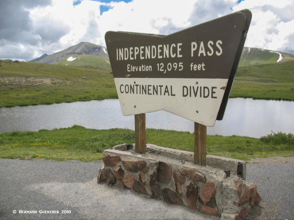
The county is served by three highways – US-24 which crosses it from north to south, State Highway 91 crossing over the Continental Divide at Fremont Pass from the northeast, and State Highway 82 which also crosses the Continental Divide at Independence Pass from Aspen in the west. The latter two terminate at their respective intersections with US-24. Independence Pass is usually closed by deep snow from mid-October through late-May (with variations depending on the amount of snowpack), leaving only three approaches into the county during the winter. Lake County Airport outside of Leadville at an elevation of 9,934 feet is the highest in North America and had commercial airline service until 2008, when it was re-designated as a general aviation facility. It is used for high-altitude performance testing, especially for helicopters.
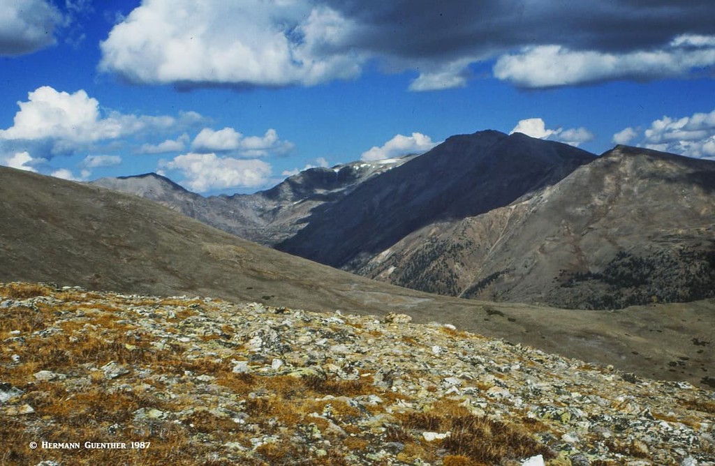
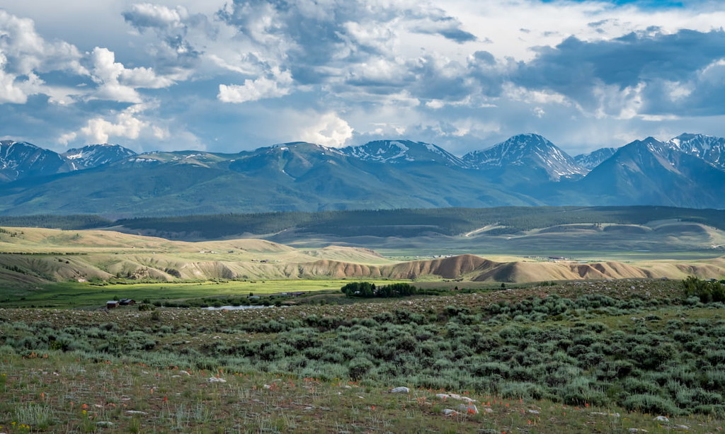
Topographically, Lake County is the third highest in the state in terms of mean elevation at 10,790 feet, after San Juan and Hinsdale Counties. While mountainous on both sides, the county is split from south to north by the Arkansas River Valley. There are 66 named mountains in the county, four of which are fourteeners. The highest is Mount Elbert, which also has these statistics: highest in Colorado, highest in the entire Rocky Mountains of North America, highest in the entire Mississippi River drainage basin, and the second-highest in the contiguous United States (“lower 48”) after Mount Whitney in California. Mount Massive, the second highest, is just to the north of Elbert and shares the same respective statistics.
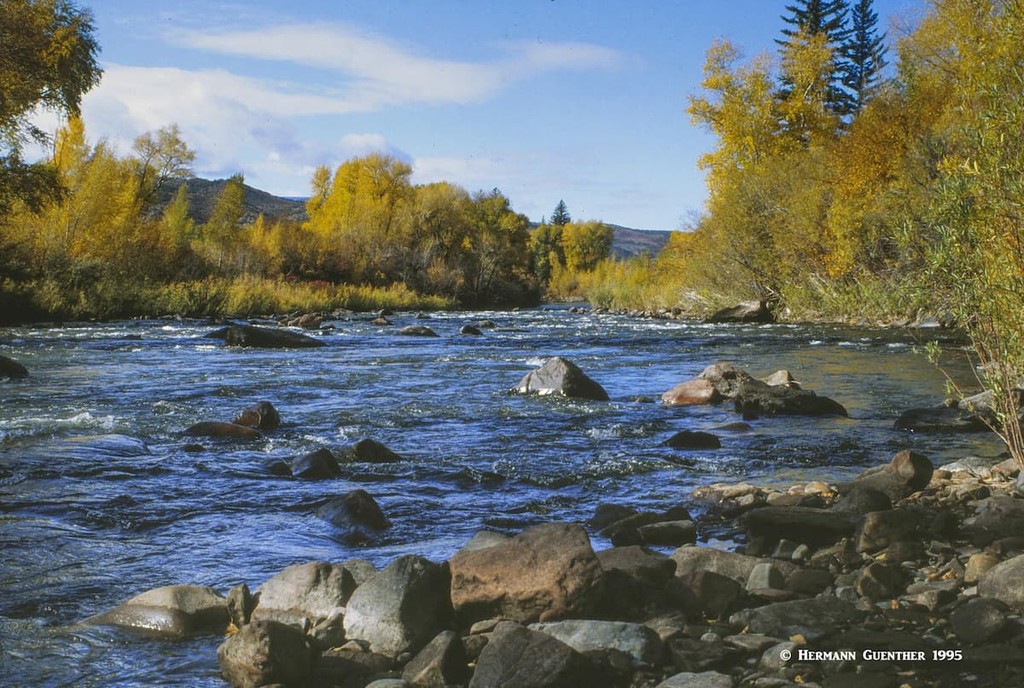
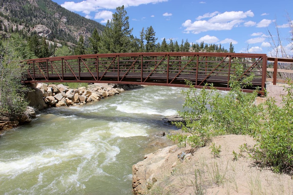
Lake County might be small in area but it sure is big when it comes to mountains, lakes and rivers, which make it a big destination for recreation. First, there is the Arkansas Headwaters Recreation Area, one of the country’s most popular whitewater rafting and kayaking areas. Then there is amazing trout fishing – almost the entire length of the Arkansas River within county boundaries is designated as Gold Medal trout waters, ensuring anglers a prime opportunity of catching trophy-sized fish. There are bicycle trails, nature trails, hiking trails – all in or near the San Isabel National Forest, parts of which are located in the county.
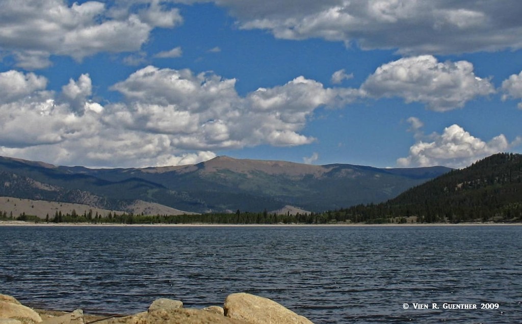
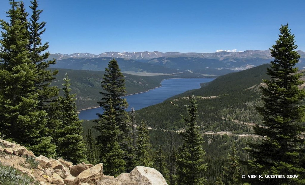
Just outside of Leadville, deep in the forest, lies the beautiful Turquoise Lake which gets its name from the Turquoise mines that produced the semi precious stone in Leadville’s not so distant past. It is a spot prized for fishing, camping and hiking, and offers some of the finest views in the county. A scenic drive (County Road 9) goes all the way around the lake, which hosts numerous campgrounds, boat-launching ramps, scenic overlooks and trailheads. This is needless to say a very popular recreation area and is heavily visited, especially in the summer. Several of the Tenth Mountain Division Huts are accessible from trailheads here via the Continental Divide National Scenic Trail (CDNST). On the south side of the lake, a gravel road diverts from the main road – this is the road over Hagerman Pass (elevation 11,925 feet); high-clearance vehicles only with 4WD preferred, and summers only. I have driven this road several times and found that I did not have to engage the 4WD but the high clearance was mandatory. The views from the road back to the lake are stunning. As the road crosses the pass into Pitkin County, the views don’t disappoint either.
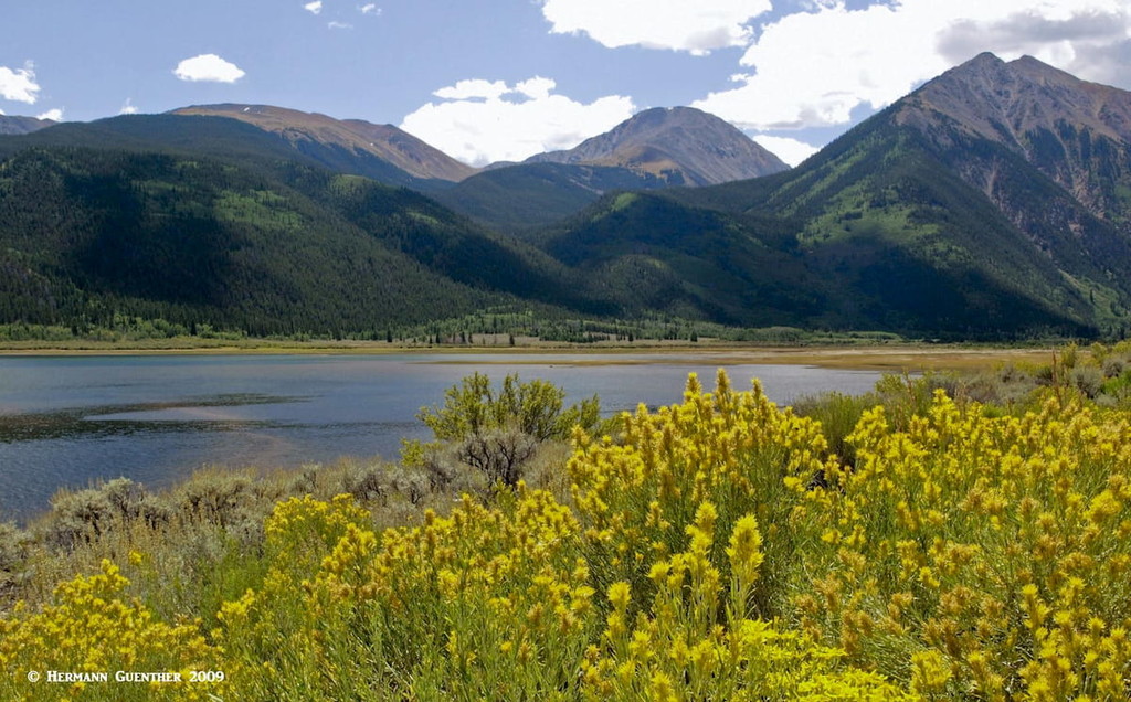
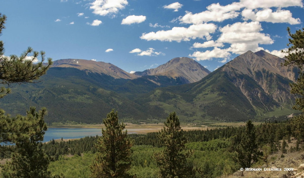
Near the southern boundary of the county, at the location where SH-82 departs from US-24 and heads toward Independence Pass, is the popular Twin Lakes Reservoir. Yes, this is one reservoir consisting of two lakes connected by a small channel across a narrow isthmus separating the two lakes. These lakes offer some great fishing, with a real chance to catch trophy Lake Trout. Winter ice fishing is extremely popular here. Most activity centers are found along the north shore right beside the highway, and include two campgrounds, two boat-launch ramps and a number of fine fishing spots. The CDNST meanders around most of the reservoir and the views across the lakes are just as spectacular as those at Turquoise Lake. On the north shore is a hydroelectric power plant with a visitor center. There is also a third campground (the Lakeview Campground) off a minor road just a short distance north of and uphill from the lakes. If you get the right spot, the view from your campsite will be memorable (see photo below).
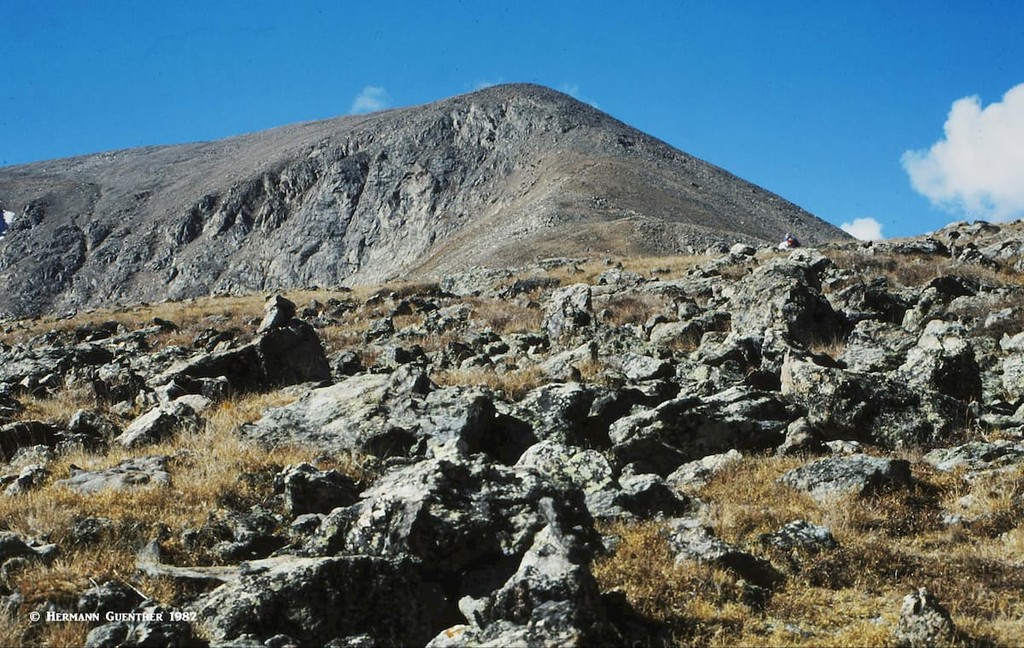
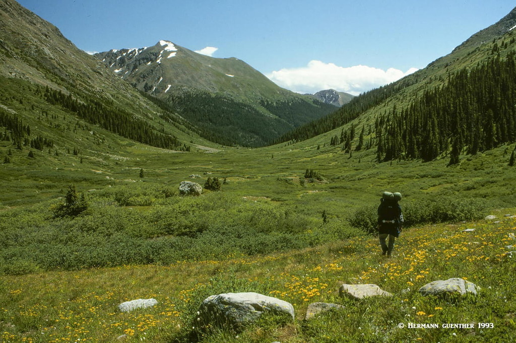
Four wilderness areas can be found within Lake County – Mount Massive, Buffalo Peaks, Holy Cross and Collegiate Peaks – although only the Mount Massive Wilderness is entirely in the county. The other three are mostly located in adjacent counties. Major hiking trails include the American Discovery Trail, the Colorado Trail and the CDNST. In addition to Mounts Elbert and Massive, which are entirely within county boundaries, two other fourteeners – Mount Democrat and Mount Sherman – straddle the boundary with adjacent Park County. Then there are also 18 high thirteeners scattered around the fringes of the county. This abundance of high mountains presents some formidable hiking and climbing challenges for such a seemingly insignificant county. But those who know the county know it is very significant in many respects.
It may be speculative, but it is very likely that the most popular hiking area is in or very near the Mount Massive Wilderness. After all, here are the two highest mountains in the entire Rocky Mountains of North America, not to mention in Colorado. To add to the popularity, these mountains are relatively easy – nothing more than Class 2 ascents. No wonder they are often called “gentle giants”. The main routes start from the Halfmoon Road, which has three trailheads only about 11 miles from the center of Leadville. Most of the road has a good gravel surface and can be driven with a passenger car, though the last and highest trailhead requires a 4WD vehicle for the final half mile. Following are the trailheads. Alternatively, there are several trailheads near or just a few miles off SH-82 in the vicinity of Twin Lakes Reservoir and Town (see below). The latter are used for climbing only Mount Elbert. Let’s take a look at some of these.
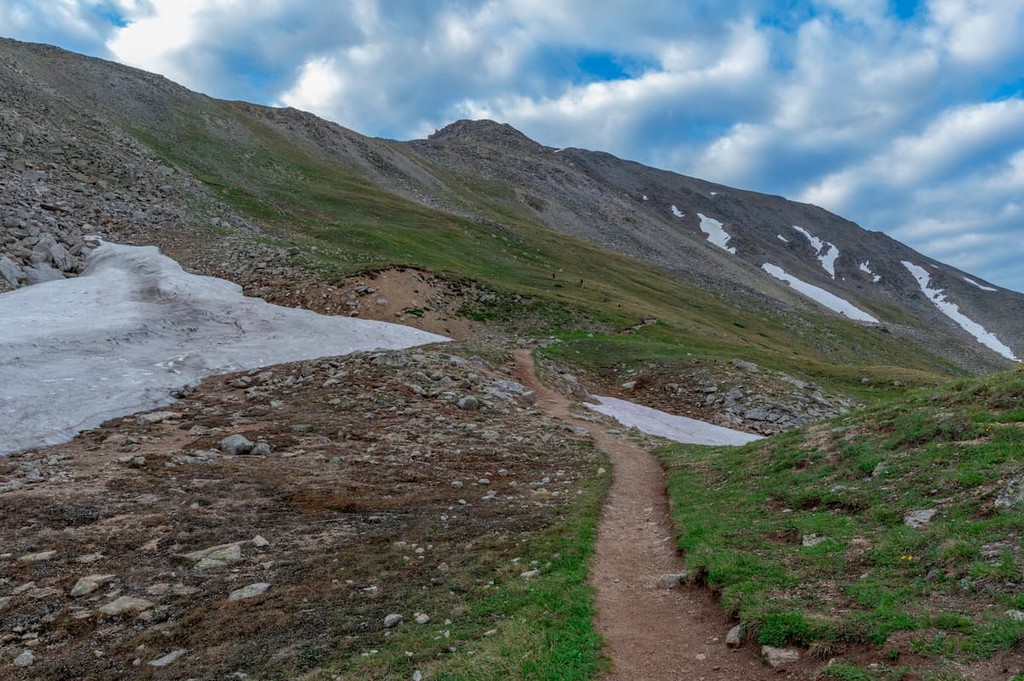
Mount Elbert Trailhead – This popular trailhead is directly across the road from the Elbert Creek Campground. This is where I camped and also from where I made my ascent of Mount Elbert via the northeast ridge. This is the most popular route up Elbert and is rated as Class 1. The route follows the Colorado Trail for the first mile or so on gentle terrain. Then it just follows the North Mount Elbert Trail the rest of the way to the summit at a mainly constant grade, gaining a total of 4,400 feet in elevation. The round-trip hike is about ten miles. Needless to say, the views get progressively better the higher you go. Though I made this climb in late summer when the weather is usually most favorable, when I reached the summit, a thunderstorm blew in so suddenly that I could spend no more than a few minutes at the top. I made it back down to the treeline in record time.
Mount Massive Trailhead – This trailhead, a half mile beyond the Mount Elbert Trailhead is where the easiest route up the second-highest mountain in the Rockies begins. We say easy, though it is a 13.4-mile round-trip hike with an elevation gain of 4,400 feet. As with Mount Elbert, this hike requires following the Colorado Trail north for 3.2 miles before the Mount Massive Trail is encountered at an elevation of 11,250 feet. That trail then ascends the vast east slopes of Mount Massive reaching a saddle between South Massive and the main summit at 13,900 feet. From there, a climber’s trail heading north will take you to the immense summit. Though long, this hike is rated at no more than Class 2. This mountain has three summits over 14,000 feet on a three-mile-long ridge. If this mountain were truncated at that elevation, the resulting plateau would be a half square mile in area.
North Halfmoon Trailhead – For a much steeper and shorter hike to Mount Massive, you can start here, 2.5 miles further up the Halfmoon Road and about 500 feet higher than the main trailhead. Keep in mind that you will need a 4WD vehicle to get here. This approach will take you to the large southwest slopes of Massive from which you can choose your route to the saddle between Massive and South Massive. From here you will follow the last stretch as in the previous description. The relentless steepness of the terrain here is amply rewarded by fields of wildflowers above the treeline. This is a hike of less than seven miles. If you want to forgo bagging this summit, yet make a pleasant day hike here, you can do the 5.5-mile (round-trip) hike to the North Halfmoon Lakes – only 1,560 feet of elevation gain.
Twin Lakes Trailhead – This trailhead is reached by following County Road 24 which departs from SH-82 on the north side of the larger of the two Twin Lakes, almost across the road from the hydroelectric plant. About 3.5 miles will take you to the trailhead, from which you can make the ascent of Mount Elbert via its east ridge. This is the easiest route up the mountain on a good trail, yet it is not as popular as the Northeast Ridge route (above).
La Plata Gulch Trailhead – This trailhead is about eight miles west of the town of Twin Lakes along SH-82 on the south side of the road. Though this trailhead is in Lake County, the destinations it serves are not. Yet it is important enough to mention here, as the trail that starts here leads to the fifth-highest mountain in Colorado (and therefore in all of the Rockies) – La Plata Peak. In fact, it is the most popular route up the mountain, but not the easiest. La Plata is in the Collegiate Peaks Wilderness and in Chaffee County just south of the Lake County line. The trail provides access to the north and west sides of the mountain. There are two routes to climb this mountain from here, and route-finding is a bit of a challenge for both routes. The northwest ridge route is a Class 2 hike involving 4,300 feet of elevation gain. But it is the second route that is of serious interest to experienced mountaineers - the Ellingwood Ridge. Elevation difference from base to summit is the same as via the northwest ridge, but the elevation gain is an additional 700 feet - at least. This jagged ridge with countless ups and downs should not be underestimated, and certainly not be undertaken by even moderately experienced hikers. This is serious business and can get any less than well-seasoned climber into trouble. Stamina and route selection ability along the ridge are essential.
Willis Gulch Trailhead – Follow SH-82 for two miles west of the Village of Twin Lakes and find the trailhead on the south side of the road. Again, this trailhead is in Lake County but the destinations are not. There are two good day hikes you can make from this trailhead. One is the 11-mile round trip to Willis Lake involving about 3,000 feet of elevation gain. Probably not to be recommended in winter since there are some really steep slopes dropping down from Twin Peaks directly above the trail suggesting avalanche potential. An alternative hike here is to take the trail to Hope Pass – less than ten miles out and back with 3,250 feet of elevation gain. It is part of the CDNST. The pass (elevation 12,530 feet) is located between Mount Hope (13,941 feet) and Quail Mountain (13,469 feet). The views are impressive in both directions from the pass.
North Fork Lake Creek Trailhead – If you continue driving west on SH-82 you will eventually reach the summit of Independence Pass. As you start your climb up the pass, at the first switchback you will come to the trailhead from where you can hike far into the Mount Massive Wilderness and the headwaters of Lake Creek. If you hike here you will be in a beautiful basin that sits right below the Continental Divide. I once did an overnight backpack trip into this secluded spot and saw no other people the entire weekend (except for the companion I was hiking with). My friend lived not far away and was very familiar with this area – I would never have thought of hiking here without his knowledge. Within the basin are fields of wildflowers and a very scenic alpine lake perched just below the Continental Divide at 12,500 feet. Blue Lake it is called – one of many so-named lakes in Colorado. We saw no other people there all weekend.
Other Hiking Areas – I mentioned earlier in this article that the entire eastern boundary of Lake County follows the crest of the Mosquito Range. This would imply some great hiking there – and there is. Unfortunately, all the fine trails into those mountains are on the east side of the range in Park County. There are no important trailheads in Lake County from where you can reasonably expect to hike in those mountains. But if you are based in the county – say Leadville, for example – your best option would be to drive across this range via the Weston Pass Road (variously known as County Road 7 and County Road 22). This is a rough gravel road, especially on the Lake County side of the pass, such that 4WD and high clearance vehicles are definitely advisable. This road can be found by driving US-24 about 8 miles south of Leadville. There are some minor trails right at the pass, but the main reason I would drive here from Leadville would be to hike in the pristine Buffalo Peaks Wilderness – six miles east of the pass is the Rich Creek Trailhead from which the delightful Buffalo Meadows Loop can be accessed. See the link above for more information about that.
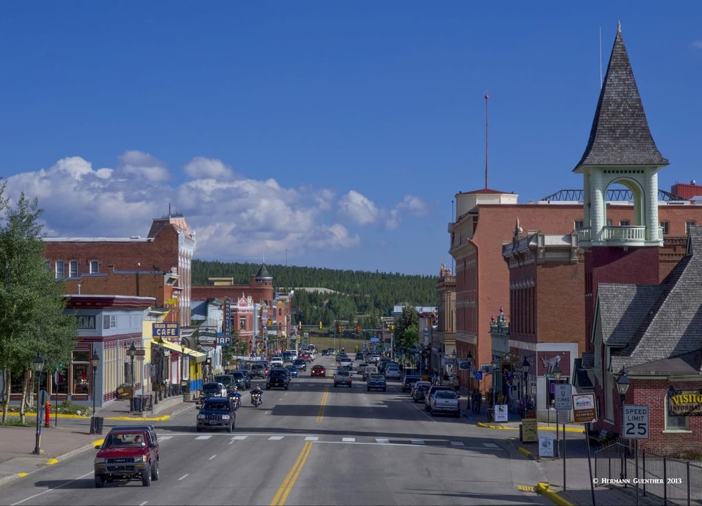
Given that Lake County has only one town, your options for accommodations are somewhat limited. But Leadville does have a decent selection of hotels and motels, as well as a good selection of restaurants, considering that its population (2019 estimate) is only 2,868 inhabitants. For an expanded selection, I would recommend also looking into staying in Buena Vista about 35 miles to the south. Leadville is situated at an elevation of 10,152 feet, making it the highest incorporated town (it is actually designated a city) in the United States. It also has the highest airport, the highest golf course (imagine how far you can drive a ball off the tee in this thin air!), the highest hospital, the highest college, etc. You get the idea. And from many parts of town, you get great views of the two highest mountains in the entire Rocky Mountain of North America. Denver may be called the “Mile High City”, but Leadville likes to call itself the “Two Mile High City”. Well, not quite two miles, but Leadville suffers from a slightly inflated altitude ego. It only missed the mark by 408 feet.
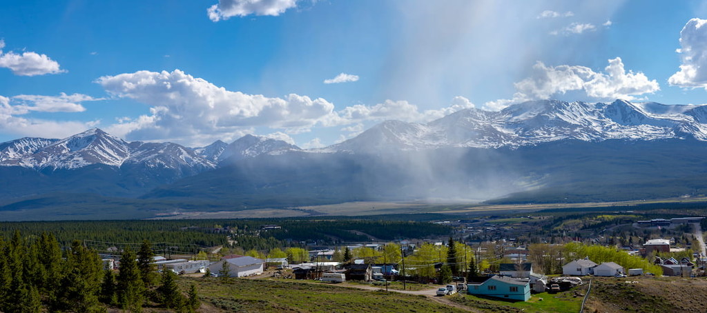
Historically, Leadville was a major silver mining center and in the late 1890's was second in population to only Denver. Today, it retains its historic charm and contains many historic buildings and sites. The summit of Elbert is only 12 miles away and that of Massive is even closer. Needless to say, at this elevation Leadville is a cold place, but that does not deter visitors from enjoying the many recreational activities available here. At the head of the Arkansas River Valley, Leadville is tucked between two major mountain ranges - the Sawatch Range and the Mosquito Range - which makes the town a handy base for mountaineering nearby. For those who want to recreate in the Holy Cross Wilderness up north, Leadville makes a very convenient base to call home for a few days as well.
This tiny unincorporated town sitting at the southern foot of Mount Elbert has a population of only 171 souls. Since it is unincorporated, Lake County is its government. A town couldn’t ask for a more spectacular setting – adjacent to the two lakes and surrounded by dramatic mountains. State Highway 82 goes right through the town – don’t blink or you’ll miss it – on its way to Independence Pass and Aspen. In winter, when the pass is closed, not much traffic passes by here. The two lakes are the largest glacially-formed lakes in Colorado. If you want to stay in this cute little village, you will have few choices, but they are nice and rustic. You have a choice of bed & breakfast, lodges, cabins and inns. And there are a few places to eat. You just need to want to stay in beautiful surroundings with ample recreation venues nearby. You can even walk to the lakes or climb Mount Elbert right from your doorstep. OK, it will be quite a hike, but you can do it.