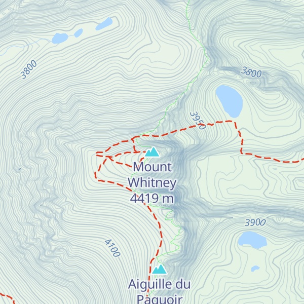
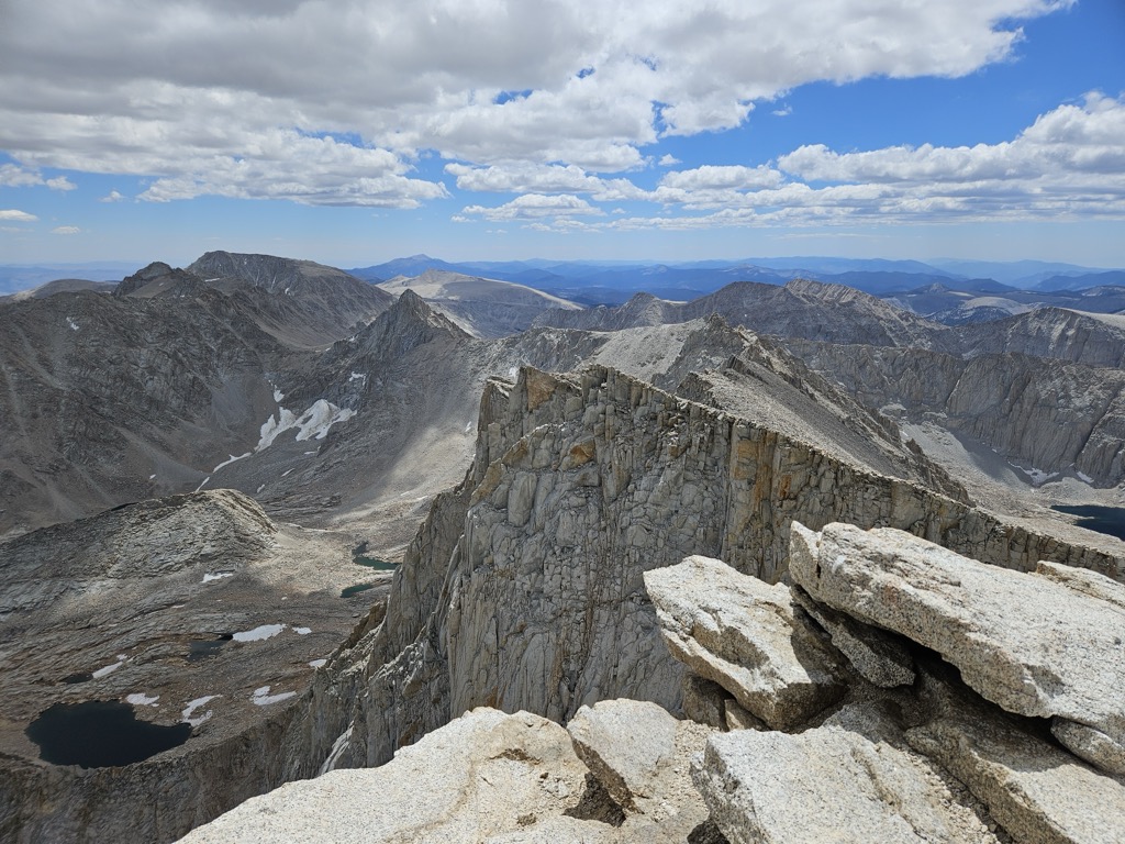
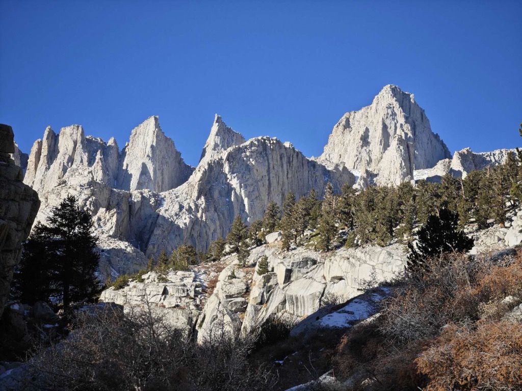
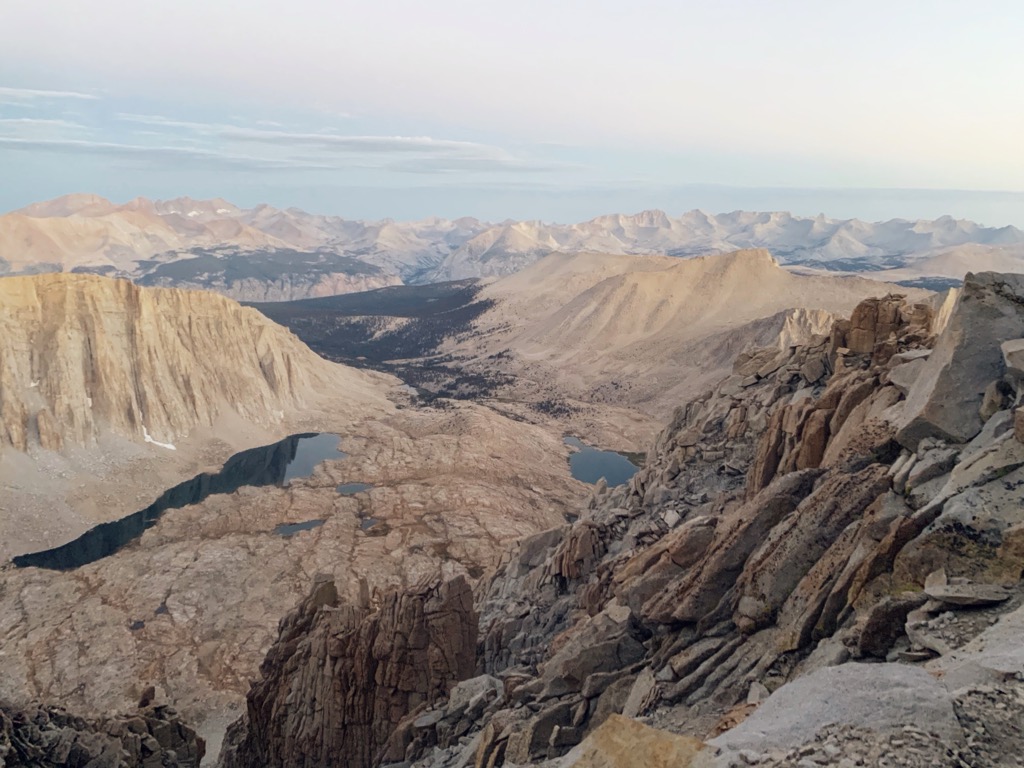
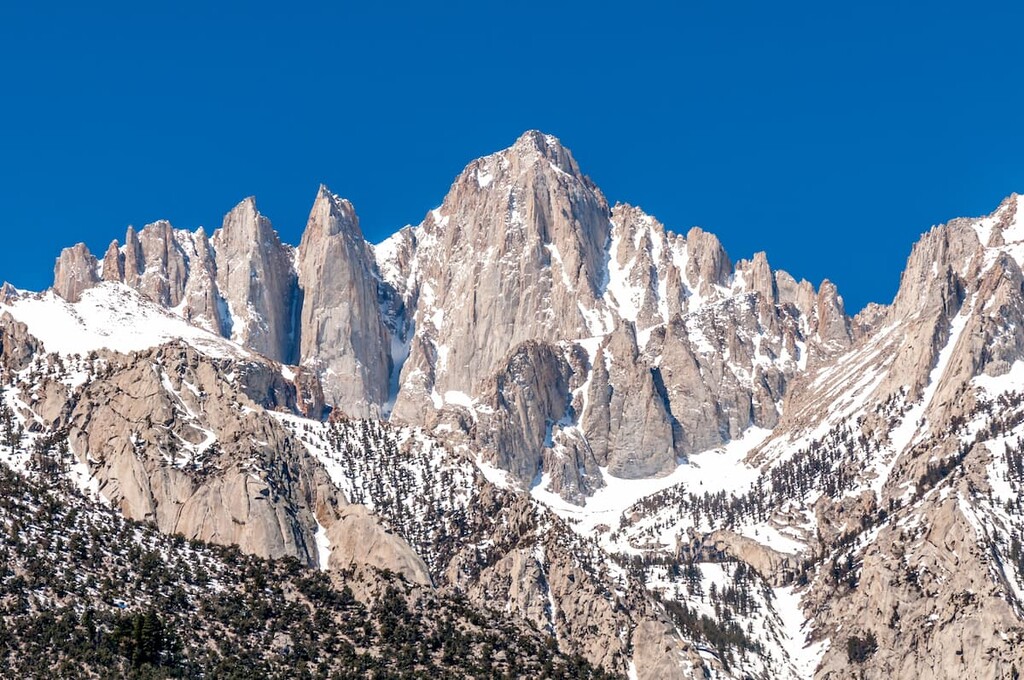
Mount Whitney, located in the Sierra Nevada mountain range, has an elevation of 14,505 feet (4,421 m) and is located in the Sequoia National Park. It is the centerpiece of the John Muir Wilderness and is a popular destination for hikers and outdoor enthusiasts.
On August 18, 1873, Charles Begole, A. H. Johnson, and John Lucas, all from nearby Lone Pine, became the first to reach the contiguous United States' highest summit. The peak was named after Josiah Whitney, the State Geologist of California.
The trail to the summit of Mount Whitney is considered one of the most challenging and rewarding hikes in the United States. It is 11 miles long with an elevation gain of 6,100 feet.
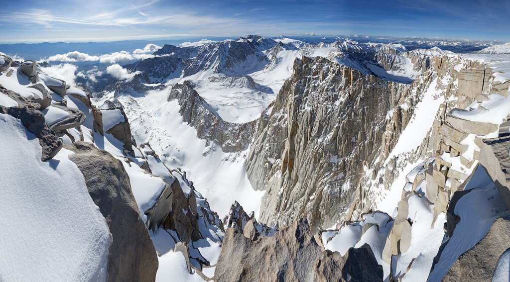
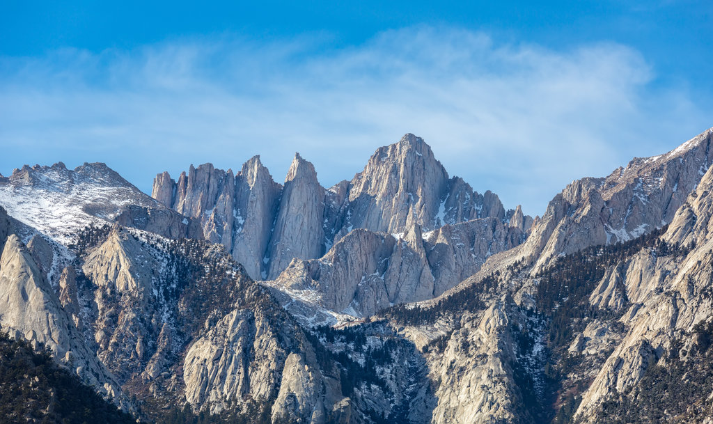
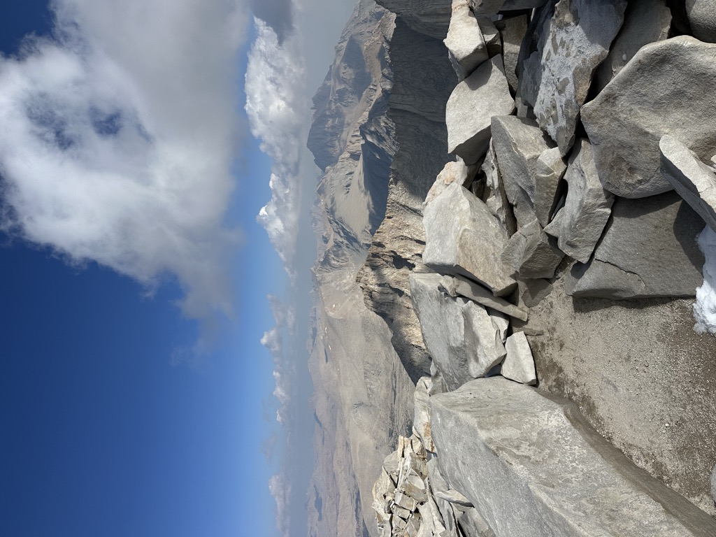
The summit of Mount Whitney offers stunning views of the surrounding Sierra Nevada Mountains. It is also home to a variety of wildlife, including pikas, yellow-bellied marmots, black bears, and golden-mantled ground squirrels. There is also a wide variety of flora, including the giant sequoia trees.
Mount Whitney is a popular destination for hikers and outdoor enthusiasts from all over the world. It is a beautiful and majestic mountain that offers breathtaking views and an unforgettable experience.
There's a hiking trail (T1) called John Muir Trail leading to the summit. Mount Whitney is one of the 5 peaks along the multi-day John Muir Trail.
By elevation Mount Whitney is
# 25 out of 91437 in USA # 1 out of 7926 in California # 1 out of 120 in Sequoia National Park # 1 out of 349 in Tulare County # 1 out of 258 in Inyo County # 1 out of 205 in John Muir Wilderness # 1 out of 2492 in the Sierra Nevada
By prominence Mount Whitney is
# 9 out of 91437 in USA # 1 out of 7926 in California # 1 out of 120 in Sequoia National Park # 1 out of 349 in Tulare County # 1 out of 258 in Inyo County # 1 out of 205 in John Muir Wilderness # 1 out of 2492 in the Sierra Nevada
We use GPS information embedded into the photo when it is available.
3D mountains overlay
Adjust mountain panorama to perfectly match your photos because recorded by camera photo position might be imprecise.
Move tool
Rotate tool
Zoom
More customization
Choose which peak labels should make into the final photo and what photo title should be.
Next
Photo Location
Satellitte
Flat map
Relief map
Latitude
Longitude
Altitude
OR
Latitude
°'''
Longitude
°'''
Apply
Register Peak
Peak Name
Latitude
Longitude
Altitude
Register
Teleport
PeakVisor
This 3D model of Sagarmatha National Park in Nepal was made using the PeakVisor app topographic data. The mobile app features higher precision models worldwide, more topographic details, and works offline. Download PeakVisor maps today.
Download OBJ model
PeakVisor
The download should start shortly. If you find it useful please consider supporting the PeakVisor app.
PeakVisor for iOS and Android
Be a superhero of outdoor navigation with state-of-the-art 3D maps and mountain identification in the palm of your hand!


.jpg)
.jpg)
.jpg)
.jpg)